Saltar al contenido principal

Pilares

Submitted by brandcode_deweloper on
Id
3965997
Descripción
Breve descripción
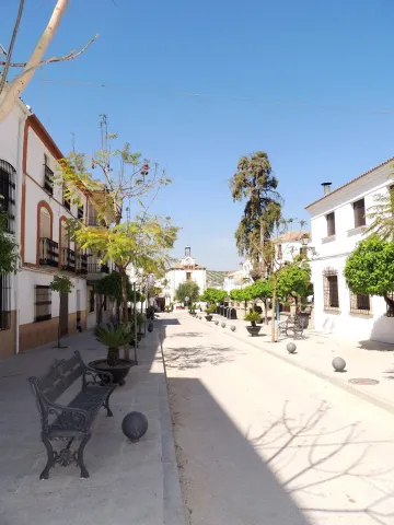
Farmhands and their mules would refresh themselves after a tiring day's work in the crystal-clear waters of the round trough, recovering the strength worn down by exhaustion. Meanwhile, amid popular songs and circles of hard-working women swinging tales, crisp white sheets were bleached in the troughs, their icy water roughening their hands.
Telecomunicaciones
Sitio web
www.villatorres.es/patrimonio-historico/
Ubicación
Código Postal
23630
Latitud
37.94005
Longitud
-3.72986
Dirección
Villatorres, Jaén
Municipio
Ubicación en el mapa
POINT (-3.72986 37.94005)
Imágenes carrusel
imagen
Image
pilares.jpg
Imagen principal
Desactivado
Imágenes cabecera
imagen
Image
pilar2.jpg
Imagen principal
Activado
Loading map
Preparing points of interest and routes...

Iglesia de San Francisco de Paula

Submitted by brandcode_deweloper on
Id
3966027
Descripción
Breve descripción
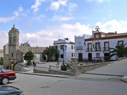
The parish church of Torrequebradilla stands out as the most significant cultural asset in the town centre. It has a nave with a gabled roof covered in Arabic tiles; a slightly pronounced transept, in keeping with its Latin-cross floor plan, marked by a dome covered externally with a hipped roof; and a bell gable that marks the church's highest point.
Telecomunicaciones
Sitio web
www.villatorres.es/patrimonio-historico/
Ubicación
Código Postal
23638
Latitud
37.91060
Longitud
-3.66297
Dirección
Plaza Mayor, 5
Municipio
Ubicación en el mapa
POINT (-3.66297 37.9106)
Imágenes carrusel
imagen
Image
francisco%20de%20paula.jpg
Imagen principal
Desactivado
Imágenes cabecera
imagen
Image
2053553j9.jpg
Imagen principal
Activado
Loading map
Preparing points of interest and routes...

Casas Señoriales

Submitted by brandcode_deweloper on
Id
4897406
Descripción
Breve descripción
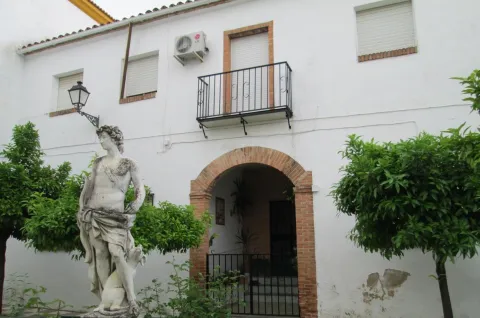
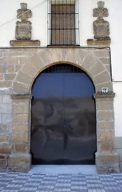
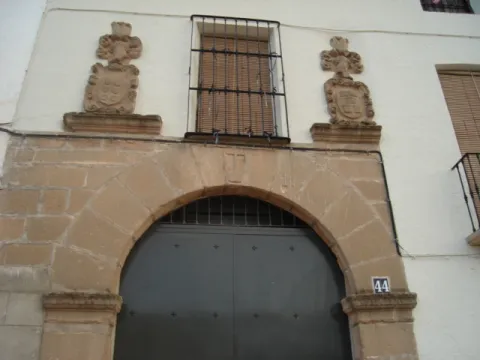
The oldest building within the town centre, built with rendered masonry, is a traditional Andalusian noble house, three storeys high and of large dimensions. The ground-floor windows have wrought-iron grilles with lead ornamentation, and the five balconies on the upper floor rest on corbels, with iron parapets and trapezoidal moulding. Engraved on the lintel of one of the windows is the date 1714. The entrance door, framed with a jamb, is off-centre. Next to this house is another, with a doorway featuring a semicircular arch resting on impost blocks and a cross at the keystone. The original ashlar stonework has disappeared, but above the arch a barred window survives, flanked by 17th-century Baroque-style stone coats of arms.
Telecomunicaciones
Sitio web
www.torreblascopedro.es
Teléfono de contacto
953626001
Correo electrónico
torreblascopedro@jaen.com
Ubicación
Código Postal
23510
Latitud
37.99658
Longitud
-3.63589
Dirección
C/ Constitución nº 42
Municipio
Ubicación en el mapa
POINT (-3.63589 37.99658)
Imágenes carrusel
imagen
Image
Torreblascopedro.jpg
Imagen principal
Desactivado
Imágenes cabecera
imagen
Image
Portada_de_la_Casa_Se%C3%B1orial.jpg
Imagen principal
Activado
Loading map
Preparing points of interest and routes...
El Pósito

Submitted by brandcode_deweloper on
Id
4554066
Descripción
Breve descripción
The Pósito of Santiago de Calatrava is a distinguished, historic building constructed in the 18th century. It was originally a prison, later used as a pósito (a granary for storing grain), and also as a health centre. Located on Calle La Corte, it is now home to the Adult Education School.
Telecomunicaciones
Sitio web
www.santiagodecalatrava.es/el-municipio/patrimonio-historico.html
Correo electrónico
scalatrava@promojaen.es
Ubicación
Código Postal
23612
Latitud
37.75311
Longitud
-4.16946
Dirección
C/ La Corte
Distrito
Ubicación en el mapa
POINT (-4.16946 37.75311)
Imágenes carrusel
imagen
Image
Posito_1s.%20calatrava.jpg
Imagen principal
Desactivado
Imágenes cabecera
imagen
Image
Posito_1s.%20calatrava%20%202.JPG
Imagen principal
Activado
Loading map
Preparing points of interest and routes...
Ayuntamiento Santiago de Calatrava

Submitted by brandcode_deweloper on
Id
4554115
Descripción
Descripción larga
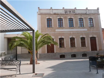
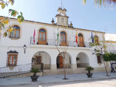
It is a three-storey building topped by a brick section housing a clock and bell, which emphasises the building's vertical line. On the eastern side of the same Plaza de la Constitución, further up from the parish church, stands the new Town Hall. Also a regionalist-style building with an elongated layout, its ground floor opens onto a portico of three semicircular arches through which it is accessed, and its main façade is topped by a stone bell gable bearing the municipality's coat of arms.
Breve descripción
On the Plaza de la Constitución, opposite the church, stands what was once the town's old Town Hall, built in 1917 in regionalist style.
Telecomunicaciones
Sitio web
www.santiagodecalatrava.es
Teléfono de contacto
953 52 81 13
Correo electrónico
scalatrava@promojaen.es
Ubicación
Código Postal
23612
Latitud
37.75309
Longitud
-4.16947
Dirección
Plaza Constitucion, 3
Distrito
Ubicación en el mapa
POINT (-4.16947 37.75309)
Imágenes carrusel
imagen
Image
Ayuntamiento%20Santiago%20de%20Calatrava.jpg
Imagen principal
Desactivado
Imágenes cabecera
imagen
Image
AYNT%20S.%20CALATRAVA.JPG
Imagen principal
Activado
Loading map
Preparing points of interest and routes...
Antiguo Ayuntamiento Santiago de Calatrava

Submitted by brandcode_deweloper on
Id
4554004
Descripción
Descripción larga
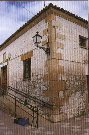
It consists of a ground floor and two upper sections, with lintelled openings — those on the upper floors being balconies — arranged along a central axis and set between attached pillars. The ensemble is topped by a clock section, crowned by a bell that emphasises its vertical line.
Breve descripción
Near the Church of the Virgen de la Estrella stands the Old Town Hall, later the Agricultural Chamber and now home to the "San Isidro" Pensioners' Centre.
Telecomunicaciones
Sitio web
www.santiagodecalatrava.es
Teléfono de contacto
953 52 81 13
Correo electrónico
scalatrava@promojaen.es
Ubicación
Código Postal
23612
Latitud
37.75310
Longitud
-4.16946
Dirección
Plaza Constitución
Distrito
Ubicación en el mapa
POINT (-4.16946 37.7531)
Imágenes carrusel
imagen
Image
ANT%20AYN%20S%20CALATRAVA.jpg
Imagen principal
Desactivado
imagen
Image
ANT%20AYNT%20S.%20CALATRAVA%202.JPG
Imagen principal
Desactivado
Imágenes cabecera
imagen
Image
Antiguo%20Ayuntamiento%20Santiago%20de%20Calatrava.jpg
Imagen principal
Activado
Loading map
Preparing points of interest and routes...
Casa del Párroco

Submitted by brandcode_deweloper on
Id
4650308
Descripción
Breve descripción
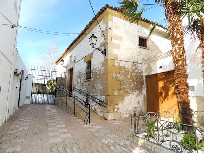
Attached to the church on the side opposite the square, the Priest's House is representative of 17th-century popular Baroque style. It shows a distinctive structure of recesses and projections, creating optical and perspective effects through its broken, angular forms. Notable is the asymmetrical arrangement and variety of its openings, ranging from the lintelled door and the rectangular windows and balcony to the small segmental-arched windows of the attic storey, along with the circular window in between.
Telecomunicaciones
Sitio web
www.higueradecalatrava.es/el-municipio/patrimonio-historico.html
Teléfono de contacto
953 529107
Ubicación
Código Postal
23611
Latitud
37.79849
Longitud
-4.15767
Dirección
C/ Huerta, 1
Distrito
Ubicación en el mapa
POINT (-4.15767 37.79849)
Imágenes carrusel
imagen
Image
casa%20del%20parroco%202.jpg
Imagen principal
Desactivado
Imágenes cabecera
imagen
Image
1.jpg
Imagen principal
Activado
Loading map
Preparing points of interest and routes...

Ayuntamiento de Fuerte del Rey

Submitted by brandcode_deweloper on
Id
4518252
Descripción
Descripción larga
Opposite the church entrance, on higher ground, in the most representative space of the municipality, the Plaza de la Constitución, stands the Town Hall — a simple, functional building with an elongated layout, recently refurbished, dominated by exposed brick across its two sections, with an irregular, asymmetrical arrangement of openings, a stone coat of arms of the town featuring the imperial double-headed eagle as its heraldic emblem, and topped by a small pediment with a clock and bell, on whose iron structure the date 1933 appears.
Telecomunicaciones
Teléfono de contacto
953 37 60 11
Correo electrónico
ayuntamiento@fuertedelrey.es
Ubicación
Código Postal
23180
Latitud
37.87408
Longitud
-3.88461
Dirección
Plaza de la Constitución 1
Distrito
Municipio
Ubicación en el mapa
POINT (-3.88461 37.87408)
Imágenes carrusel
imagen
Image
fuerte%20del%20rey.jpg
Imagen principal
Desactivado
Imágenes cabecera
imagen
Image
fuerte%20del%20rey%202.jpg
Imagen principal
Activado
Loading map
Preparing points of interest and routes...
Vieja fábrica de harina

Submitted by brandcode_deweloper on
Id
4517777
Descripción
Descripción larga
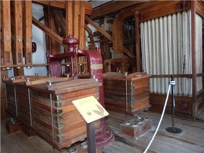
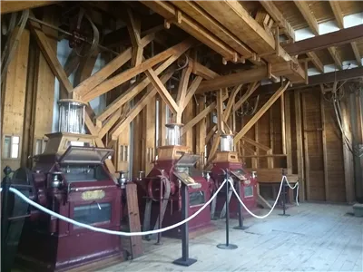
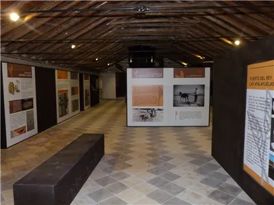
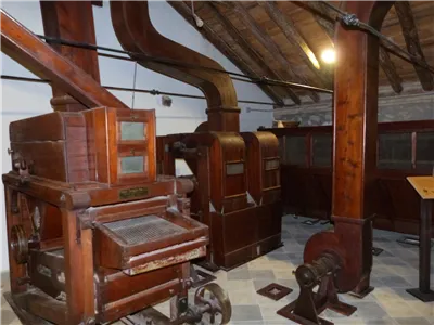
Dating from the first half of the 20th century, it is one of the oldest flour mills in the province. It was a key facility for the municipality's economy during the post-war years. In 2004, it was listed in the General Catalogue of Andalusian Historical Heritage as a site of ethnological interest.
Telecomunicaciones
Sitio web
www.fuertedelrey.es
Teléfono de contacto
953 37 60 11 - 953 37 61 17
Ubicación
Código Postal
23180
Latitud
37.87464
Longitud
-3.88427
Dirección
Av. de Jaén, 68
Distrito
Municipio
Ubicación en el mapa
POINT (-3.88427 37.87464)
Imágenes carrusel
imagen
Image
thb_g_P1300402.jpg
Imagen principal
Desactivado
imagen
Image
Fabrica%20Harinas%20Nuestra%20Se%C3%B1ora%20del%20Rosario%20Fuerte%20del%20Rey%20%28Ja%C3%A9n%29%20fachada.jpg
Imagen principal
Desactivado
imagen
Image
thb_g_IMG_20190827_103314228.jpg
Imagen principal
Desactivado
imagen
Image
thb_g_P1300413.jpg
Imagen principal
Desactivado
imagen
Image
thb_g_P1300420.jpg
Imagen principal
Desactivado
Imágenes cabecera
imagen
Image
thb_g_P1300371.jpg
Imagen principal
Activado
Loading map
Preparing points of interest and routes...
Hacienda del Pilar

Submitted by brandcode_deweloper on
Id
4523531
Descripción
Descripción larga
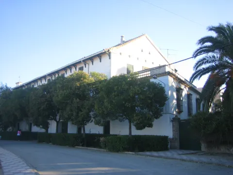
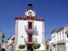
The Hacienda del Pilar, which takes its name from the image of the Virgin under this title placed on its façade, was built from 1904 onwards as a working farm estate and later remodelled into a private noble residence for receiving dignitaries. Owned by José del Prado y Palacio, former Minister of Public Instruction and Marquis of Rincón de San Ildefonso, it hosted Alfonso XIII during his visit to Jaén in 1916. It was approached through carefully tended English-style gardens with a monumental fountain at their centre and another, in Seville style, to one side. The façade, with two columned galleries — one of them glazed — featured wooden columns and finely worked ironwork, all in a markedly eclectic style. Inside, this eclecticism continued with an element of special interest: a Renaissance courtyard belonging to a palace in Andújar, demolished in the second decade of the century and acquired and transferred to El Pilar by its owner. Nine slender columns, eight arches with cushioned coffering, spandrels, medallions and noble coats of arms were removed from their original building and brought here, along with a fountain with a wide basin, four shells and two bowls, decorated with caryatids. The building also had spacious rooms, a small theatre and a hall with fine furnishings.
Breve descripción
Closed and very difficult to visit. Built from 1904 onwards as a working farm estate and later remodelled into a private noble residence for receiving dignitaries. Its owner was the Marquis of Rincón de San Ildefonso, Don José del Prado y Palacio, Minister of Public Instruction under King Alfonso XIII and one of the great landowners of the area. It is approached through English-style gardens with fountains. It incorporates a Renaissance courtyard taken from a demolished palace in Andújar — that of the Marquis of Puente de la Virgen, formerly located in Andújar's Plaza de España, today Plaza de la Constitución. The building included a small theatre and a hall furnished with walnut furniture.
Telecomunicaciones
Sitio web
www.espeluy.es/el-municipio/patrimonio-historico.html
Correo electrónico
espeluy@promojaen.es
Ubicación
Código Postal
23628
Latitud
38.03192
Longitud
-3.86257
Distrito
Municipio
Ubicación en el mapa
POINT (-3.86257 38.03192)
Imágenes carrusel
imagen
Image
hacienda%20del%20pilar.jpg
Imagen principal
Desactivado
Imágenes cabecera
imagen
Image
hacienda_El_pilar%20%281%29.jpg
Imagen principal
Activado
Loading map
Preparing points of interest and routes...