Saltar al contenido principal

Olivo de Santiago de Calatrava

Submitted by brandcode_deweloper on
Id
8132962
Descripción
Descripción larga
A century-old, single-trunk olive tree enclosed within a square plot bordered by four mouldings bearing the cross of the Order of Calatrava.
Breve descripción
A century-old, single-trunk olive tree (Olea europaea) of great size. Recently planted in front of the Rural Agricultural Chamber.
Telecomunicaciones
Teléfono de contacto
953 52 81 13
Correo electrónico
scalatrava@promojaen.es
Ubicación
Código Postal
23612
Latitud
37.75323
Longitud
-4.16977
Dirección
Plaza de la Constitución
Distrito
Ubicación en el mapa
POINT (-4.16977 37.75323)
Tipos de punto de interés
Imágenes carrusel
imagen
Image
Olivo%20de%20Santiago%20de%20Calatrava2.jpg
Imagen principal
Desactivado
imagen
Image
Olivo%20de%20Santiago%20de%20Calatrava3.jpg
Imagen principal
Desactivado
Imágenes cabecera
imagen
Image
Olivo%20de%20Santiago%20de%20Calatrava.jpg
Imagen principal
Activado
Loading map
Preparing points of interest and routes...
Arroyo Salado de Arjona

Submitted by brandcode_deweloper on
Id
8126032
Descripción
Descripción larga
The Salado de Arjona rises in the municipal district of Los Villares and flows through the Campiña region of Jaén in a roughly north–south direction over some 48 km, before flowing into the Guadalquivir river near the town of Marmolejo. The main towns within its basin are Martos and Lopera. It flows into the Guadalquivir within the municipal district of Marmolejo.
Breve descripción
The Salado de Arjona is a river or stream in southern Spain, part of the Guadalquivir river basin, running entirely through the province of Jaén.
Telecomunicaciones
Teléfono de contacto
953 53 00 14
Correo electrónico
lahiguera@promojaen.es
Ubicación
Código Postal
23746
Latitud
38.01654
Longitud
-4.12168
Dirección
Lahigera
Distrito
Municipio
Ubicación en el mapa
POINT (-4.12168 38.01654)
Tipos de punto de interés
Loading map
Preparing points of interest and routes...
Parque Municipal de Fuerte del Rey

Submitted by brandcode_deweloper on
Id
8113746
Descripción
Descripción larga
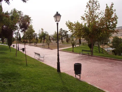
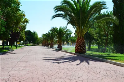
The great appeal of this park lies in its views and the large number of benches for resting, along with its function as an eco-park, allowing visitors to exercise on its outdoor gym equipment, although access to these is over uneven ground. The park has a children's play area that is not accessible, as it has a step of around 12 cm.
Breve descripción
A park located in the highest part of Fuerte del Rey, from where almost the entire town can be seen. At the main entrance there is a slight side incline that makes access more difficult.
Telecomunicaciones
Teléfono de contacto
953 37 60 11 / 953 37 61 17
Correo electrónico
ayuntamiento@fuertedelrey.es
Ubicación
Código Postal
23180
Latitud
37.87573
Longitud
-3.88143
Dirección
C/ Antonio Machado, nº 20
Distrito
Municipio
Ubicación en el mapa
POINT (-3.88143 37.87573)
Tipos de punto de interés
Imágenes carrusel
imagen
Image
Parque%20Municipal%20Fuerte%20del%20Rey2.jpg
Imagen principal
Desactivado
Imágenes cabecera
imagen
Image
Parque%20Municipal%20Fuerte%20del%20Rey.jpg
Imagen principal
Activado
Loading map
Preparing points of interest and routes...

Embalse de Giribaile

Submitted by brandcode_deweloper on
Id
3985611
Descripción
Descripción larga
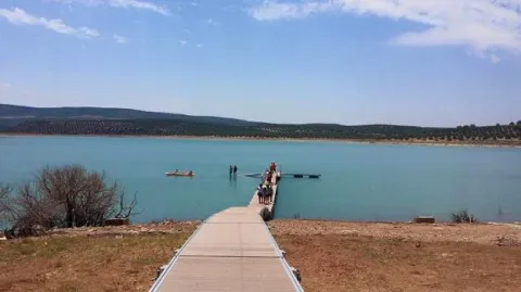
Recently built between 1993 and 1997, its dam wall stands on the slopes of the Lambra area, and its waters submerge parts of the municipal districts of Ibros, Vilches, Rus, Canena, Úbeda, Navas de San Juan and Sabiote. It holds an immense artificial lake formed by the impounded waters of the river, known as the "sea of La Loma", the second largest reservoir in Jaén and the third largest in the Guadalquivir basin, with a capacity of 475 hm³. Beneath its waters lies the submerged monumental 16th-century Puente Ariza bridge, designed by the architect Andrés de Vandelvira. Three homes were also flooded, and 12 residents had to be relocated. It is used for irrigation, fishing, swimming and electricity generation, and has a tourist jetty.
Breve descripción
The Giribaile reservoir is a dam located on the Guadalimar river, within the Guadalquivir basin, between the regions of La Loma de Úbeda and El Condado.
Ubicación
Distrito
Municipio
Imágenes carrusel
imagen
Image
2%20%282%29.jpg
Imagen principal
Desactivado
imagen
Image
3%20%281%29.jpg
Imagen principal
Desactivado
Imágenes cabecera
imagen
Image
1%20%281%29.jpg
Imagen principal
Activado