Fuente Palacios
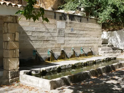
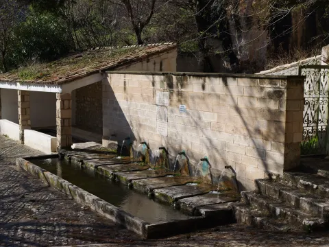
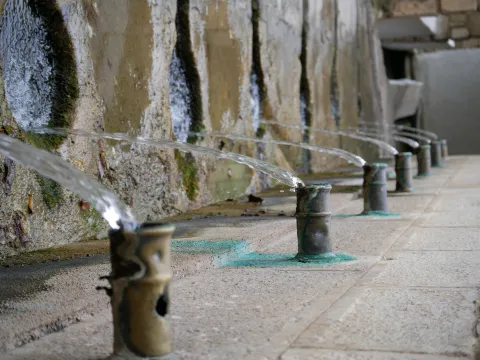
The Fuente de los Siete Caños is a water spring located about 500 metres south of the town of Albanchez de Mágina. This is a clear example of rural architecture, one that combined aesthetics with functionality to pleasing effect. In this case, little explanation is needed, as it is plain to see how the water was put to use for the trough, the washing place, and the irrigation of nearby market gardens and olive groves.
The fountain's construction features a finely finished stone ashlar front. It has seven water spouts, in bronze pipes, which give it a pleasing appearance. It carries a fairly abundant flow, which has never dried up, although in times of drought it tends to reduce somewhat.
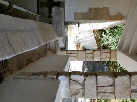
The water flow collects in a trough of modest depth, which until recently was used to quench the thirst of the "beasts" that worked the land. Each spout carries a variable flow, with the last one carrying the greatest. Attached to it is a public washing place, featuring two rows for washing clothes and an iron fitting. The water from the washing place flows from the trough through a small stone channel, fitted with a grille to protect anyone passing over it.
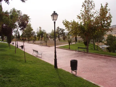
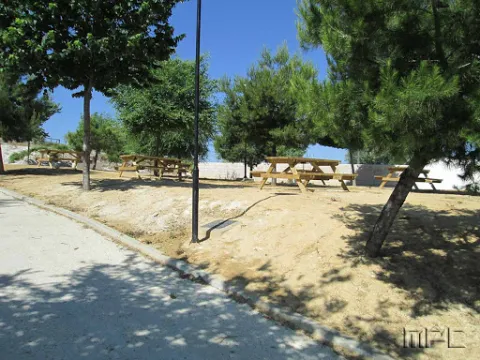
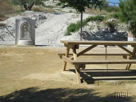
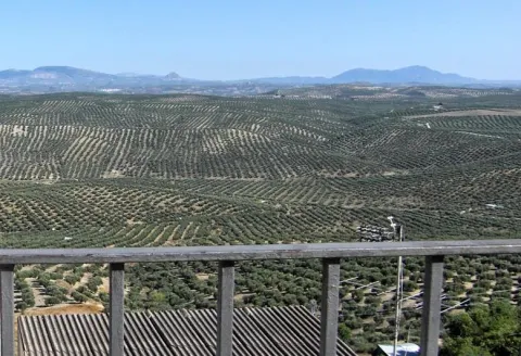
The rest area also has street furniture for sitting and enjoying impressive views of the Albanchez river, El Torcal and Bedmar.
This spot also lies along the Route to the Caldera del Tío Lobo, so if you enjoy hiking, don't hesitate to walk it. And once you've completed it, stop, rest and enjoy the surroundings.
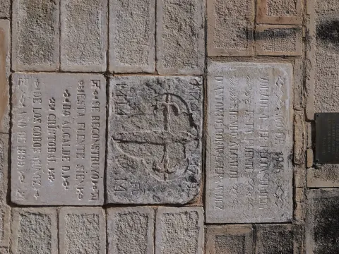
Fountain with seven water spouts, which give it its name. It has a stone-fronted trough and a public washing place, an example of traditional rural architecture linked to the use of water for drinking and for irrigating market gardens, dating back to the 16th century.
Open 24 hours.
30S x=458954 y=4182409
Arjona is included in the Route of the Castles and Battles, an itinerary running through the province of Jaén and part of the provinces of Ciudad Real and Granada. Arjona once had one of the most complex fortification systems in Al-Ándalus, with a triple line of defensive walls which, combined with Arjona's own strategic position, made it an impregnable stronghold. The origin of its wall system is set within the protohistory of the Iberian Peninsula, having been used by the successive cultures that passed through it, all of which left their mark on its structure. Today, part of this vast defensive system survives, along with an Almohad-period cistern located at the heart of the Alcazaba. The Archaeology Room of the Arjona Museum holds remains of weapons used in the Islamic medieval period, notably including arrowheads of a type matching those used at the Battle of Las Navas de Tolosa; also of note, inside the Sanctuary of the Sacred Relics, is a collection of drawings and plans based on the manuscripts of the 17th-century historian Martín Ximena Jurado, showing what Arjona's defensive system looked like at that time.
The visit ticket includes a guide and admission to all monuments, museums and churches, except the Sanctuary of the Sacred Relics; admission to the Sanctuary costs €1, payable at its entrance.
Ruta de los castillos y batallas
All year round
30S x=407265 y=4199295
Facial cleansing and toning set, consisting of a MICELLAR MOUSSE enriched with hyaluronic acid, chamomile, olive, mandarin and aloe vera; and a FACIAL TONER made with rose water and organic olive extract.
Next to the castle you will find the ruins of the Church of Sto. Silos Sunday. The legend tells that it was built on the place where the Arabs held captive Christians in prison and there was Santo Domingo doing his job. In the building there are traces of the disciples of Vandelvira. It's a must-see for any lover of history.
The Iruela was part of Cazorla until 1370, when Archbishop D. Gome Manrique gave it independence, power and shield. His political and territorial position has allowed him to preserve an important heritage: the Conistory House - a proud building in the Mudejar style of Toledan - and the Church of the Immaculate Conception are part of this legacy.
The population has a core worth visiting. The streets are steep and narrow, with crouched houses and flowers on the balconies. In the center there is a beautiful fountain from which several roads arise to surround the village. From here you can go up to Temple Street on a beautiful stone road accompanied by fig trees and cypresses.
We suggest:
The road that goes up to the saw from Cazorla borders this small, but amazing population. Its best known profile is due to the castle, a legendary fortress that became owned by the Templars and dominates the Guadalquivir Valley. The need to defend itself has given rise to this fortification which, because of its most abrupt aspect, is inexortable. But the Iruela is more attractive.
The track runs on the northwest face of Mount Bucentaina. When we have been walking for about 20 minutes we will reach the source of the Noguerón, from which there is plenty of water. In this place, the path PR-A 175 is separated by a path to the left. We're still on the main road.
At first we will see the mountains and olive groves around Siles, and then enter the forest. It is one of the best pineapples of carrasco pine the Natural Park. Just as the village of Puentehonda appears before us, we see on the left, on the same road, two gigantic and venerable specimens of carrasco pine, which are included in the Inventory of Singular Trees of Andalusia with the names of Pino de los Barrilos de Puentehonda and Pino del Cerro Bucentaina and respectively. The latter is 32 m high and 4.5 m in diameter at its base.
We will also find in our way an indication to go up a narrow and steep path to the remains of the castle of Puentehonda, whose ruins, corresponding to two towers, are half hidden in the thickness of the forest.
The village of Puentehonda, at the foot of the Peñalta, has a small recreational area with a fountain in which it is worth resting. The way back and forth, doing so quietly, will take about four hours.
This route, of just under 5 km, runs along a narrow forest track that we recommend to walk. Its main attraction is the carrasco pine forest that crosses, under which grows a closed forest of oak, madroños and doves. The first kilometer is quite steep, but the rest is barely at a level. To reach the village of Puentehonda it is enough to follow the track, without taking any detour, until it ends up in another of greater width. The other side of the village is the village.
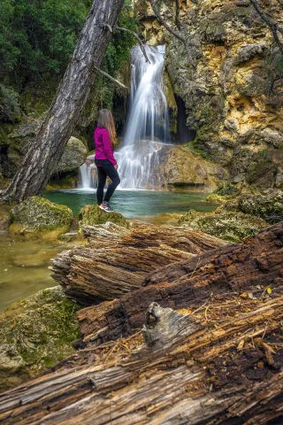
The Guadalquivir made this canyon narrow and deep, leaving some streams - like that of Linarej- hanging on the heights. When this stream is at the throat it forms the spectacular Cascade of Linarejos, which after standing in some pozas joins the Guadalquivir to descend to the valley.
The path is 1.6 km and on its circular route it surrounds the "Peñón del Lanchón" to return to the road in a pleasant walk of about 45 minutes.
In the final part of the road - just before returning to the asphalt - you reach a pine-resinero or black forest (Pinus pinaster) that was used to obtain the resin with which the water used to be made. In these trees you will see the furrows that the resineros opened to allow the exit of this sap.
We suggest:
The site known as Cerrada del Utroo-Linarejos is an amazing natural work sculpted by the Guadalquivir in the limestone that surrounds it. The path is on foot, and it will allow you to appreciate the sharp rocks and objades created by water over hundreds of thousands of years. It is a charming walk where the labiérnago, the cornicabra, and the willow accompany you to one of the most photographed places in the Park: the "horse tail" or Cascada de Linarejos.
We deviate from the road, in order to see, upstream, a spectacular leap of water, with a large poza in its base, whose waters look an emerald green by the reflection of the lush vegetation surrounding it. Let us take our way back, to reach a small hill, with a very particular silhouette. It is the Paso del Aguartedo, place of impressive views towards the countryside.
The path is conditioned and low, with a serpentating route, on a steep and rocky slope. On our left we found a striking oquity - an ashtray - where the shepherds used to keep their cattle. Below we reach a small lookout, where the path is fork. We follow the one on the right, until we get back to the channel to contemplate the majestic cascade of the Osera, perhaps one of the highest and beautiful waterfalls of Andalusia.
We continue along the path marked, by the narrow and steep ravine, enjoying the multiple pozas of the channel, to a walkway that crosses the river and back the path to the Odera lookout. If at this point we continue along the road that goes parallel to the channel, we will reach the explanade of La Osera, place where the vehicles are left when it is accessed from Mogón.
For these wonderful places it is very easy to observe the flight of the leonate vulture. The real eagle is also present and, if we look well, we can even see the little perdicular eagle.
We suggest:
The most recommended option is to make the path down. From the reservoir of Aguascebas, the walk is 4.5 km, from the km 18.8 of the road JH-7155 (Transversal de las Villas). At this point, to our left are the houses of the reservoir and, right behind it, we can observe an old quarry, where the path starts.
This path will allow you to discover one of the most charming environments in the Las Villas mountains. It runs along the natural channel of the river Aguascebas Chico, where we will discover unusual and unexpected corners. Following him, on our right, we found fenced land of ancient crops and a small cortijo half-melting. This place is known as "Las Ramblillas." In the deep valley you can see the river Aguascebas Chico.