Saltar al contenido principal
icon-intereses-turismo-low-cost

Hillside / Ridge of los Castellones

Submitted by brandcode_deweloper on
Id
4485791
Descripción
Descripción larga

Location: To the south of the town, in the natural park of Cazorla, Segura and Las Villas.

Distance: 19 km

Medium: In vehicle tourism and on foot.

Access route: On the road A-319 towards La Iruela; at this point, after going 13 km, we will take the Chorro road, then turn away by a horseshoe road leading to the Port of Tejo.

Breve descripción

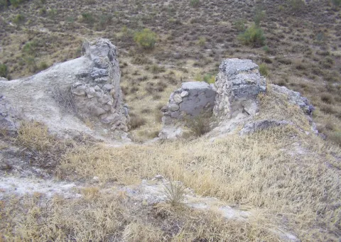
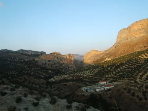
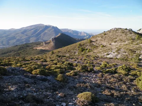
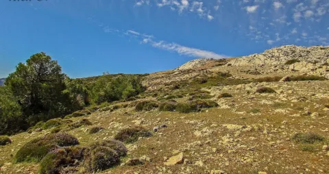
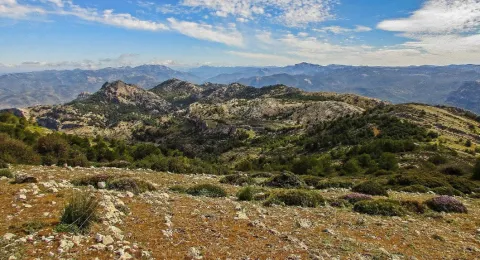
From this abrupt enclave we can see the impressive rocky cliffs and eroded stone blocks that rise in their surroundings. The landscape is unique.

Ubicación
Código Postal
23470
Latitud
37.883210
Longitud
-2.976650
Municipio
Ubicación en el mapa
POINT (-2.97665 37.88321)
Tipos de punto de interés
Imágenes carrusel
imagen
Image
lomacastellones2.png
Imagen principal
Desactivado
Imágenes cabecera
imagen
Image
lomacastellones.png
Imagen principal
Activado
Loading map
Preparing points of interest and routes...

Hillside / Ridge of Cagasebo

Submitted by brandcode_deweloper on
Id
877485
Descripción
Descripción larga

The complex formed by the union of these two cavities is located in the Loma de Cagasebo, at an altitude of about 1890 m.; within the Natural Park of Cazorla. The discovery of this cavity takes place during the exploration campaigns that the Montaña de Valencia University Club has been conducting in this area since 1987.

A succession of wells interspersed with some narrow steps, whose explorers had previously to unblock, give way to a rosary of new vertical, accompanied by a small course of water.

Breve descripción

Cagasebo's loin

Ubicación
Latitud
37.842982
Longitud
-3.066921
Municipio
Ubicación en el mapa
POINT (-3.066921 37.842982)
Tipos de punto de interés
Imágenes carrusel
imagen
Image
4499132Master.jpg
Imagen principal
Desactivado
imagen
Image
19376807%20%281%29.jpg
Imagen principal
Desactivado
Imágenes cabecera
imagen
Image
5543589Master.jpg
Imagen principal
Activado
Loading map
Preparing points of interest and routes...

Plains of Palomares-Cárcheles

Submitted by brandcode_deweloper on
Id
5849330
Descripción
Breve descripción

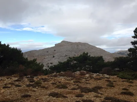
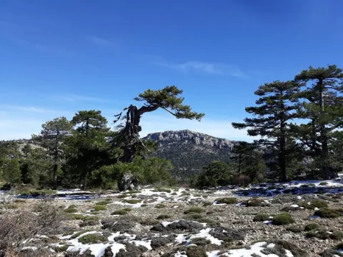
Altiplanicie in height, surrounded by mountains. Border space between the municipal terms of Los Cárcheles and Jaén. It is ideal for all-terrain bike and hiking and is accessible, by unasphalted slopes, from the Monte de la Sierra peri-urban park (Jaén) and from Carchelejo (Cárcheles).

Ubicación
Latitud
37.636740
Longitud
-3.639830
Distrito
Municipio
Ubicación en el mapa
POINT (-3.63983 37.63674)
Tipos de punto de interés
Imágenes carrusel
imagen
Image
Llanos%20de%20Palomares-C%C3%A1rcheles.jpg
Imagen principal
Desactivado
Imágenes cabecera
imagen
Image
Llanos%20de%20Palomares-C%C3%A1rcheles1.jpg
Imagen principal
Activado
Microsite al que pertenece
Loading map
Preparing points of interest and routes...
Alharilla Plain

Submitted by brandcode_deweloper on
Id
4861638
Descripción
Breve descripción

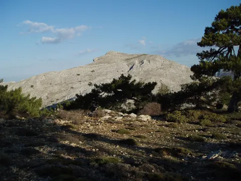
A place that has a large tree and is ideal for a day of field, as it has a magnificent road. There is the hermitage of the Virgin of Alharilla, in whose honor a rosemary is organized every year.

Ubicación
Código Postal
23790
Latitud
37.870860
Longitud
-4.183340
Distrito
Municipio
Ubicación en el mapa
POINT (-4.18334 37.87086)
Tipos de punto de interés
Imágenes carrusel
imagen
Image
Alharilla-humilladero28720180501-696x464.jpg
Imagen principal
Desactivado
Imágenes cabecera
imagen
Image
llano.jpg
Imagen principal
Activado
Microsite al que pertenece
Loading map
Preparing points of interest and routes...
Iberian Lynx

Submitted by brandcode_deweloper on
Id
1914733
Descripción
Descripción larga

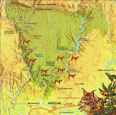
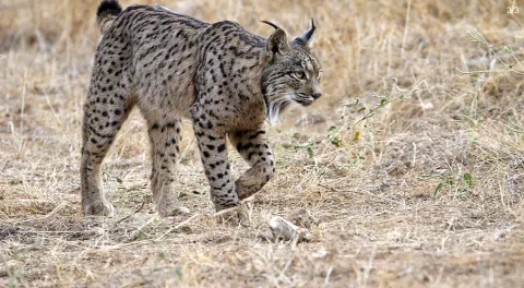
Although Iberian lince has been a protected species since 1966, this wonderful feline is in danger of extinction. At present, only two populations are viable and consolidated for the development and proliferation of this species: the one in Doñana and the one in the natural spaces Sierra de Cardeña and Montoro Natural Park and Sierra de Andújar Natural Park, where the most important population of the nail cat is located.

To see a lince in Andújar

To try to locate and observe an Iberian lince we must look for a good observatory from which we see a lot of saw, many slopes, rosquets, bushes and above all, many clear pasture. Among the best areas for an observation day are:

Road of the boat on its last stretch.

Road and recreational area of the Encinarejo.

Embalse of the Encinarejo from the north bank.

All the viewpoints in the south of the park.

Jabali Path.

Recreative area of the line in New Place.

Located at the observatory, it is essential to be always very attentive and silent, so, even in plain sight, we can distinguish a lineage moving if it is not too far away. We will also start a sweep of the area by means of binoculars. With them we will be looking at the clear and the exits of the land; so we can discover some cat placed on a rock. The telescope should be left for the last search, to go looking further and to go looking very slowly or even to look at the animal once we have discovered it.?

As with almost all predators, the corvids are also very aggressive with the Iberian lince (perhaps this is the animal with which they are most rattled), so we have to be very long-awaited of the movements and demands of the urracas. 50% of the success of observing a lince can come from being able to interpret the corvids.

For the sake of the species and the future visitors who seek to see the great cat, we must respect all the rules of public use, be respectful of the environment, always remain silent and do not in any way disturb animals. Nor should we enter privately owned farms without authorization or deviate from established paths.

Breve descripción

The largest number of the nail cat population

Ubicación
Latitud
38.039236
Longitud
-4.050560
Distrito
Municipio
Ubicación en el mapa
POINT (-4.05056 38.039236)
Imágenes carrusel
imagen
Image
Anotaci%C3%B3n%202020-04-16%20083233.jpg
Imagen principal
Desactivado
imagen
Image
Anotaci%C3%B3n%202020-04-16%20083330.jpg
Imagen principal
Desactivado
Imágenes cabecera
imagen
Image
Anotaci%C3%B3n%202020-04-16%20083259.jpg
Imagen principal
Activado
Microsite al que pertenece
Loading map
Preparing points of interest and routes...
The Moors' Tiles

Submitted by brandcode_deweloper on
Id
8211317
Descripción
Descripción larga

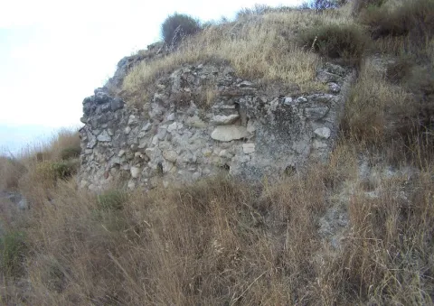
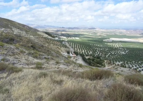
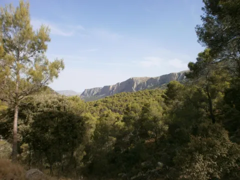
It is possibly the Muslim castle referred to in the 1243 delimitation between the episcopal headquarters of Baeza and the Archbishop of Toledo. Known as Ullurauam. In a territory between the Jandulilla River and the Guadiana Minor River, which would be identified as Larva. It is located near the current population of Larva, on a well-ridden hill, with a polygonal plant and two enclosures. Its construction is of tapial alternating with masonry. It keeps its perimeter walled and several towers. Then, because of the border situation and the demographic vacuum, this castle would run the same destination as that of Cabra, abandoned in a neutral area. Roman remains have also been found as a tegola.

Breve descripción

Since the 13th century Larva was integrated into the Spanish-Nazi border, playing an important role in the villages of the minor Guadiana, in 1243 there were conflicts in the delimitations between the episcopal headquarters of Baeza and the archbishopric of Toledo.

Telecomunicaciones
Correo electrónico
ayuntamiento@larva.es
Ubicación
Código Postal
23591
Latitud
37.760080
Longitud
-3.202320
Distrito
Municipio
Ubicación en el mapa
POINT (-3.20232 37.76008)
Imágenes carrusel
imagen
Image
Tejar%20de%20los%20Moros2.jpg
Imagen principal
Desactivado
imagen
Image
El%20Tejar%20de%20los%20moros.jpg
Imagen principal
Desactivado
Imágenes cabecera
imagen
Image
Tejar%20de%20los%20Moros3.jpg
Imagen principal
Activado
Microsite al que pertenece
Loading map
Preparing points of interest and routes...
Las Cimbras

Submitted by brandcode_deweloper on
Id
5846924
Descripción
Breve descripción

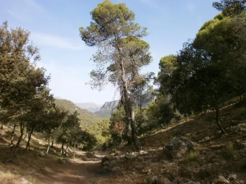
Great beauty rocky scarves that are attached in the urban case of Torres, next to the municipal pool. For its accessibility, climbing routes have been installed, for which it is necessary to be a federated sportsman or to hire the services of an authorized service company.

Ubicación
Latitud
37.689185
Longitud
-3.821449
Distrito
Municipio
Ubicación en el mapa
POINT (-3.821449 37.689185)
Tipos de punto de interés
Imágenes carrusel
imagen
Image
4781171%20%282%29.jpg
Imagen principal
Desactivado
Imágenes cabecera
imagen
Image
1934914Master%20%282%29.jpg
Imagen principal
Activado
Microsite al que pertenece
Loading map
Preparing points of interest and routes...
Las Cabritas

Submitted by brandcode_deweloper on
Id
5845992
Descripción
Breve descripción

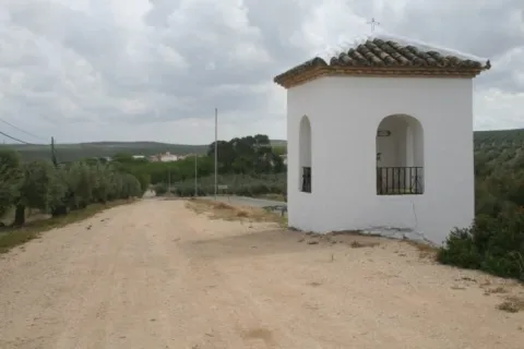
Area of old gardens and mills belonging to the municipality of Huelma. Until well into the 20th century it was one of the most fruitful gardens in the province of Jaén. It cultivated multiple varieties of fruit and vegetables. Some of these varieties were inherited from ancient crops of the Middle Ages.

Ubicación
Latitud
37.695120
Longitud
-3.432440
Distrito
Municipio
Ubicación en el mapa
POINT (-3.43244 37.69512)
Tipos de punto de interés
Imágenes carrusel
imagen
Image
Las_Cabritas_%28Huelma%29.jpg
Imagen principal
Desactivado
Imágenes cabecera
imagen
Image
Las_Cabritas.jpg
Imagen principal
Activado
Microsite al que pertenece
Loading map
Preparing points of interest and routes...
Lapiaz of Torcal Llano

Submitted by brandcode_deweloper on
Id
876760
Descripción
Descripción larga

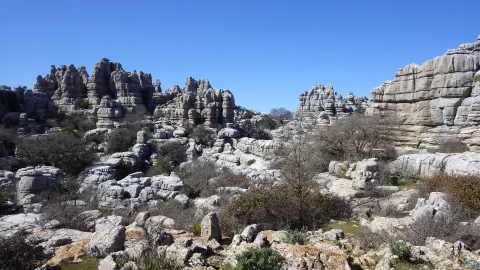
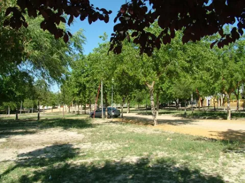
It is a very developed lapiaz with very good exposure, carved on limestone of the upper Jurassic. Stratification has a small dipping, and topography in this sector adapts to the stratification surface, generating a landscape of great beauty.

Source: Inventory of Georresources of Andalusia. Environmental Council. Junta de Andalusia.

Breve descripción

Lapiaz del Torcal Llano

Ubicación
Latitud
37.842982
Longitud
-3.066921
Municipio
Ubicación en el mapa
POINT (-3.066921 37.842982)
Tipos de punto de interés
Imágenes carrusel
imagen
Image
9310925.jpg
Imagen principal
Desactivado
Imágenes cabecera
imagen
Image
0d8a2ca0342a33999d22197e6c2b21c2o.jpg
Imagen principal
Activado
Loading map
Preparing points of interest and routes...
Lagoon Honda

Submitted by brandcode_deweloper on
Id
7009935
Descripción
Descripción larga

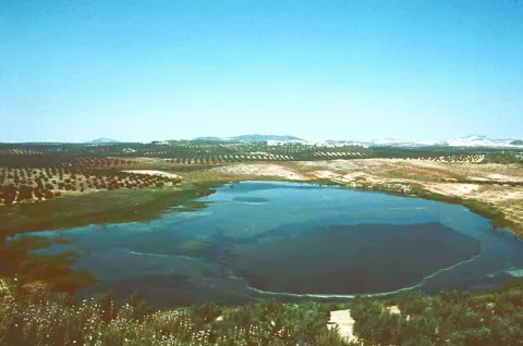
It has an area of 65 hectares, as well as an additional protection area around it of 220 hectares.

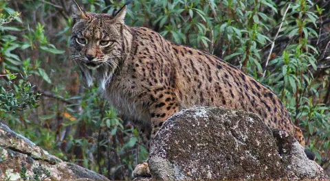
Laguna Honda is a humid, endemic area that is flooded with the first rains of autumn and remains as such until spring, with a small river mass, making it a seasonal lagoon although a small stream, which comes from the Sierra de Orbes, provides water flow.

This lagoon has a high saline content, caused by the materials of the substrate as well as the washing of adjacent land.

Vegetation

The area is surrounded by agricultural land of rainforest olive trees, highlighting its perilagunar palustre vegetation of eneas (typha dominguensis), carrizos (phragmites australis) and juncos. One of the primitive and still preserved plant varieties in this reserve is tarage.

Fauna

The main species that are located in Laguna Honda are vertebrates, always with a temporary or seasonal character, highlighting the aquatics, such as the hens (gallinula chloropus), easily recognizable because it emits a strong graznada, the common focal (fulica atra), which has the white peak and black plumage or the real anade (anas platyrhnchos), which has a yellow peak and is known as a common duck.

Breve descripción

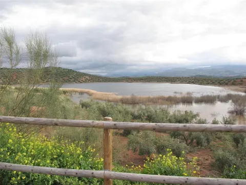
This Nature Reserve is located to the south-west of the province of Jaén, in the area of Tumbalagraja, very close to the Casariche cortijo, passing very close to the line of the old railway Linares- Puente Genil, today Via Verde del Eil, between the Sierra Orbes, the Cambrón and the Desgarradero, and limiting with the province of Córdoba.

Ubicación
Latitud
37.600710
Longitud
-4.143600
Distrito
Municipio
Ubicación en el mapa
POINT (-4.1436 37.60071)
Tipos de punto de interés
Imágenes carrusel
imagen
Image
lagunaonda%20%281%29.jpg
Imagen principal
Desactivado
imagen
Image
ondalaguna.jpeg
Imagen principal
Desactivado
Imágenes cabecera
imagen
Image
1.jpg
Imagen principal
Activado
Loading map
Preparing points of interest and routes...