Saltar al contenido principal
icon-intereses-turismo-low-cost

Hermitage of the Calvario

Submitted by brandcode_deweloper on
Id
8108554
Descripción
Descripción larga

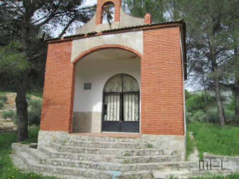
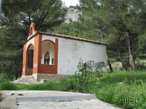
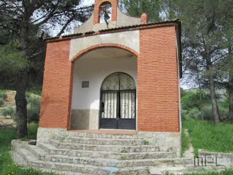
Inside there is a figure of a Crucified Christ as well as a Cross Way that was donated by the marriage Mr José Martínez García and Mr María Velasco Czech in 1989. It was rebuilt in 1984.

Breve descripción

It is a small hermitage located on the way of the Dehesa which is reached after a road of stone crosses. It is accessed through a portico with a reduced arch and a swordsman by cutting the whole.

Telecomunicaciones
Sitio web
www.jamilena.es
Teléfono de contacto
953 566 001
Correo electrónico
ayuntamientojamilena@gmail.com
Ubicación
Código Postal
23003
Latitud
37.744390
Longitud
-3.904840
Dirección
Camino de las Cruces
Distrito
Municipio
Ubicación en el mapa
POINT (-3.90484 37.74439)
Tipos de punto de interés
Imágenes carrusel
imagen
Imagen
Ermita%20del%20Calvario.jpg
Imagen principal
Desactivado
imagen
Imagen
Ermita%20del%20Calvario2.jpg
Imagen principal
Desactivado
Imágenes cabecera
imagen
Imagen
Ermita%20del%20Calvario.jpg
Imagen principal
Activado
Loading map
Preparing points of interest and routes...
Hermitage of San Juan Bautista

Submitted by brandcode_deweloper on
Id
8090814
Descripción
Descripción larga

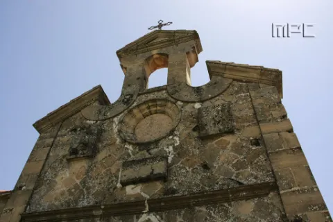
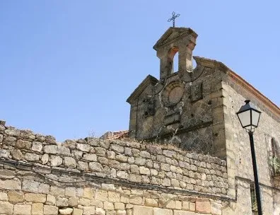
Behind the Palace is a house that was once a hermitage of St. John the Baptist: it retains the structure of the 17th's conventual gates, a small swordsman and, of course, remarkable paving as the tradition of Jabalfifth commands.

Breve descripción

Built by order of the Marquise Dona Catalina de Rojas and Sandoval, the first stone was placed in 1635. The stone wall, about three meters high, was later built around 1820, using the stones from the old castle and melting. It is currently decacralized and conditioned as a housing; though not inhabited and in a ruinous state.

Telecomunicaciones
Sitio web
www.jabalquinto.es/el-municipio/patrimonio-historico.html
Teléfono de contacto
953 617 056 / 953 617 373
Ubicación
Código Postal
23712
Latitud
38.019170
Longitud
-3.724520
Distrito
Municipio
Ubicación en el mapa
POINT (-3.72452 38.01917)
Tipos de punto de interés
Imágenes carrusel
imagen
Imagen
ermita%20de%20San%20Juan%20Bautista2.jpg
Imagen principal
Desactivado
Imágenes cabecera
imagen
Imagen
ermita%20de%20San%20Juan%20Bautista%20%282%29.jpg
Imagen principal
Activado
Loading map
Preparing points of interest and routes...
Holm Oak and Juniper Forests

Submitted by brandcode_deweloper on
Id
920671
Descripción
Descripción larga

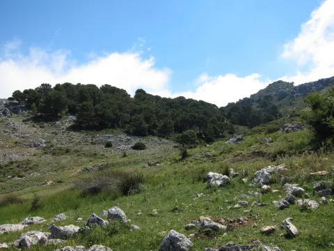
They are found on the stony and slope slopes, forming clear forests in which they coexist with some pine of several species (Pinus nigra salzmannii, Pinus pinaster and Pinus halepensis), according to the altitude and orientation of the slope, as well as cornicabra (Pistacia terebinthus), ruscos (Ruscus aculeatus) and a herbaceous entourage such as charts, rompesacos and cerveres (Poa bulbosa, Cynosurus echinatus, Aegilops, and the acrachacellus (Arrachacus), and the acellus (Arrachatus), and the other (Arrachus).

From the Recreative Area of Linarejos, we walk along the track that goes up the hill. We will go through a quarry and a barrier, these are two indicators that confirm that we are on the right track. At 3 km from the Recreative Area we will see a detour to our left, a track that enters us into a rock maze. It is a torque, in which this formation of oaks and juniper is extended. Two leads are coming out to our left, one after the other, and they both get us into this torcal. If we do not want to go too far, because it is a difficult ground to go through, from the main track we see this plant formation in the same way.

Breve descripción

The Navillas, Peña Gallinera

The oak (Quercus ilex ballota) and juniperus oxicedrus (Juniperus oxicedrus) are a unique feature of these limestone saws. It is difficult to see a formation of these pure characteristics, since it is normal to see them intermingled in enclosures, pine trees and in slices of Mediterranean forests, but in a few places, like this, we can see them with their characteristic elements.

Ubicación
Latitud
37.912893
Longitud
-3.003887
Municipio
Ubicación en el mapa
POINT (-3.003887 37.912893)
Imágenes carrusel
imagen
Imagen
encinares_enebrales.png
Imagen principal
Desactivado
imagen
Imagen
ales%20%281%29.jpg
Imagen principal
Desactivado
Imágenes cabecera
imagen
Imagen
4eladera%20del%20espinar%2C%20barranco%20de%20la%20pinada%2C%20barranco%20de%20las%20esparragueras%2C%20barranco%20de%20las%20liebres.jpg
Imagen principal
Activado
Loading map
Preparing points of interest and routes...

Holm Oak Forest

Submitted by brandcode_deweloper on
Id
880004
Descripción
Descripción larga

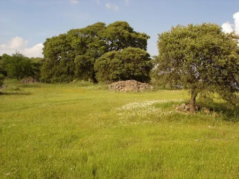
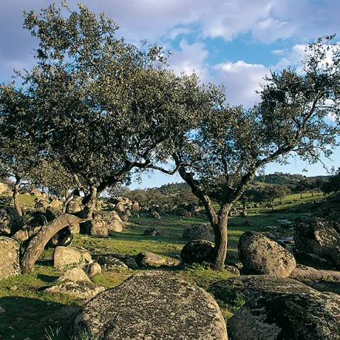
Our goal is to see one of the most spectacular oak trees in the Park, where we will see large, very large oak trees and a forest of tale. Give the place where we left the car, we continue on foot on the track about 6 km. The rise is easy and uncomplicated.

We'll get to a crossroads, we'll follow right. A little higher, a source is intuited under an oak. For that place, to the right of the track and above the source we will find large copies of oak, although in reality we have been walking through a magnificent oak for a long time. The crossing of the track is where the old forest house of the Fountain del Roble was. This is where the burning reaches all its magnificence.

In this forest dominated by the oak we find some other complaint (Quercus faginea), serbals (Sorbus domestica), pespejones (Sorbus torinlis), majuelos (Crataegus monogina), skirmishes (Rosa spp.), laureolas (Daphne laureola), thorns (Berberis vulgaris australis), torvizcos (Daphne gidium), peonies or mountain roses (Paeonia broteroi), orchids (Orchis, the dominant, Chiphiphipis, and the contiguera (Ophanacteria), and the domineas.

In our saws we can see many oak forests. For example, on the rise to Santiago de la Sword from Tobos, on the Esperilla, before Fuente Steel, or on the access track to the Pegueras. The name of engraving has meant Mediterranean forest, but the matter is not so simple.

Rather, we should say that burning is a phase of the Mediterranean forest. The lauroid forest, which we discussed elsewhere, is also Mediterranean forest. In any case, the engraving does exist as such, in addition to the fact that its main component, the encin (Quercus ilex ballota), is in almost all the plant formations of the Park, with the exception of the summits and the cold deciduous forests, of the high mountain.

LOCATION

From Coto Ríos we take the road A-319 towards the Tranco and less than a kilometer away to the right towards the campsite of the Llanos de Arance. We overcome it and follow it (the road becomes a forest track), until it reaches the control of Aguamula. As we pass it we follow the track to the left, discarding another one to the right, from here we will travel the right margin of the Tranco reservoir. We take the first detour to be presented to our right at 2.1 km from the above control. It is a great crossing where the track is widened and where we must turn to our right making a closed curve that places us almost 180º to the sense of our march. This is the track that goes up to Majalalto, passing through the Fountain del Roble. In that place we left the vehicle, as the track is closed to traffic with a chain.

Breve descripción

Our goal is to see one of the most spectacular oak trees in the Park, where we will see large, very large oak trees and a forest of tale. Give the place where we left the car, we continue on foot on the track about 6 km. The rise is easy and uncomplicated.

We'll get to a crossroads, we'll follow right. A little higher, a source is intuited under an oak. For that place, to the right of the track and above the source we will find large copies of oak, although in reality we have been walking through a magnificent oak for a long time. The crossing of the track is where the old forest house of the Fountain del Roble was. This is where the burning reaches all its magnificence.

In this forest dominated by the oak we find some other complaint (Quercus faginea), serbals (Sorbus domestica), pespejones (Sorbus torinlis), majuelos (Crataegus monogina), skirmishes (Rosa spp.), laureolas (Daphne laureola), thorns (Berberis vulgaris australis), torvizcos (Daphne gidium), peonies or mountain roses (Paeonia broteroi), orchids (Orchis, the dominant, Chiphiphipis, and the contiguera (Ophanacteria), and the domineas.

In our saws we can see many oak forests. For example, on the rise to Santiago de la Sword from Tobos, on the Esperilla, before Fuente Steel, or on the access track to the Pegueras. The name of engraving has meant Mediterranean forest, but the matter is not so simple.

Rather, we should say that burning is a phase of the Mediterranean forest. The lauroid forest, which we discussed elsewhere, is also Mediterranean forest. In any case, the engraving does exist as such, in addition to the fact that its main component, the encin (Quercus ilex ballota), is in almost all the plant formations of the Park, with the exception of the summits and the cold deciduous forests, of the high mountain.

LOCATION

From Coto Ríos we take the road A-319 towards the Tranco and less than a kilometer away to the right towards the campsite of the Llanos de Arance. We overcome it and follow it (the road becomes a forest track), until it reaches the control of Aguamula. As we pass it we follow the track to the left, discarding another one to the right, from here we will travel the right margin of the Tranco reservoir. We take the first detour to be presented to our right at 2.1 km from the above control. It is a great crossing where the track is widened and where we must turn to our right making a closed curve that places us almost 180º to the sense of our march. This is the track that goes up to Majalalto, passing through the Fountain del Roble. In that place we left the vehicle, as the track is closed to traffic with a chain.

Ubicación
Latitud
37.912893
Longitud
-3.003887
Municipio
Ubicación en el mapa
POINT (-3.003887 37.912893)
Tipos de punto de interés
Imágenes carrusel
imagen
Imagen
Natu021.jpg
Imagen principal
Desactivado
imagen
Imagen
IMG_0815._Encinar.jpg
Imagen principal
Desactivado
Imágenes cabecera
imagen
Imagen
encinar.png
Imagen principal
Activado
Loading map
Preparing points of interest and routes...

Beautiful Holm Oak

Submitted by brandcode_deweloper on
Id
8091775
Descripción
Descripción larga

It is an elongated plateau in the north-south-west sense that presents in all directions abrupt slopes. It has dimensions of 500 meters on its longest axis, about 270 meters on the narrowest side and an area of about 10 hectares.

Archaeologists especially highlight their landscape values with an indigenous vegetation of oak and other species of the Mediterranean mountain.

The site has been the subject of some limited archaeological interventions and the general lines of a Master Plan to address the comprehensive treatment of the site from research and protection to dissemination and value, even though only progress was made in this regard.

The realization in Cabeza Baja of an emergency excavation in 1986, motivated by the increase and extension of the archaeological expolio, offered a series of key archaeological data to define the entity of the site. The data obtained in the excavation indicate that the oppidum of Cabeza Baja de Encina Hermosa is founded between the end of the third century BC and the mid-second century and develops a population that must follow the typical Iberian urbanism of the Alto Guadalquivir.

The first continued occupation of Cabeza Baja (early S.II and final of the S.III BC) was probably by contingents of tubular origin arrived from Obulco, although no other nuclei such as Iponoba, Tucci or even the Iberian nuclei of Alcalá la Real should be excluded. The excavations pointed to the existence of various structures; the existence of an Iberian wall around the plateau was demonstrated. The thickness of the wall can be estimated at 3 meters.

The finding of a level of fire was identified as a possible cause of the abandonment of these units.

Breve descripción

The lower head of Encina Hermosa is an archaeological settlement known from the ascentral times. It is located in the municipality of Castillo de Locubín. In a straight line of about 7 km. of the population of Alcaudete, northwestern, and 5.5 km. of Castillo de Locubín, in a southeast sense. From the city of Jaén, you can access the N-432 road to the village of Ventes del Carrizal, and from here, following the way of the Bath Cortijo to the hill.

Telecomunicaciones
Sitio web
www.aytocastillodelocubin.org/?page_id=1284
Teléfono de contacto
953 591 364
Ubicación
Nombre
Castillo de Locubín
Código Postal
23670
Latitud
37.527956
Longitud
-3.942249
Distrito
Ubicación en el mapa
POINT (-3.942249 37.527956)
Tipos de punto de interés
Imágenes carrusel
imagen
Imagen
Encina%20Hermosa%20%281%29.jpg
Imagen principal
Desactivado
Imágenes cabecera
imagen
Imagen
Encina%20Hermosa2.jpg
Imagen principal
Activado
Loading map
Preparing points of interest and routes...
Víboras Reservoir

Submitted by brandcode_deweloper on
Id
6115159
Descripción
Breve descripción

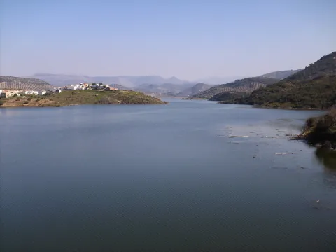
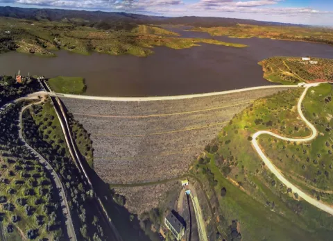
The Víboras, is one of the most requested swamps by the sports fishing clubs of the province, even by club of other provinces, reaching a few weekends up to four competitions on its shores, with seven areas enabled for the freshwater competitions, thanks to the collaboration of the municipal team of Las Casillas de Martos.

Ubicación
Código Postal
23614
Latitud
37.638034
Longitud
-3.999677
Distrito
Municipio
Ubicación en el mapa
POINT (-3.999677 37.638034)
Imágenes carrusel
imagen
Imagen
Embalse%20del%20V%C3%ADboras.jpg
Imagen principal
Desactivado
Imágenes cabecera
imagen
Imagen
DSCF6882.JPG
Imagen principal
Activado
Loading map
Preparing points of interest and routes...
Rumblar Reservoir

Submitted by brandcode_deweloper on
Id
6115043
Descripción
Breve descripción

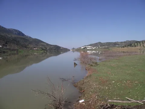
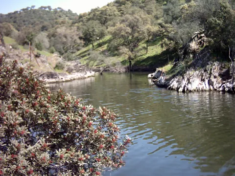
The tent, barbo and Black Bass are present, although the big fish are very rare. The average size is small or at most medium, so it's a perfect place with polo and it can end with a lot.

Ubicación
Código Postal
23711
Latitud
38.191160
Longitud
-3.785430
Distrito
Ubicación en el mapa
POINT (-3.78543 38.19116)
Imágenes carrusel
imagen
Imagen
Playa-el-tamujoso-embalse-del-rumblar-e1435315737961.jpg
Imagen principal
Desactivado
imagen
Imagen
Natu159.jpg
Imagen principal
Desactivado
Imágenes cabecera
imagen
Imagen
Natu103.jpg
Imagen principal
Activado
Microsite al que pertenece
Loading map
Preparing points of interest and routes...
Tranco Reservoir

Submitted by brandcode_deweloper on
Id
912713
Descripción
Descripción larga

The reservoir is mainly nourished by the waters of the Guadalquivir, it has almost 500 cubic meters of capacity and 1500 hectares of surface. Much of it was previously occupied by the beautiful Vega de Hornos and the Guadalquivir valley.

We suggest...

The Tranco road is usually quite busy on dates of greater tourist influx, so, if you really want to enjoy the landscape, do not agree to look at it from the car and stop for a while at the dam or at some viewpoint, as usual. Our advice is: walk. On the right bank, you have several forest tracks, as well as the circular signposted path PR-A 149, which begins very close to the village of Fuente la Higuera. On the left, there are two signposted paths: the PR-A 193, which starts 1.1 km from the Tranco dam to the north, and a stretch of the GR-144, which is taken halfway between the Hornos de Segura and Cañada Morales, in a pronounced curve. In addition, in the environment of the reservoir you will not find many earrings.

Breve descripción

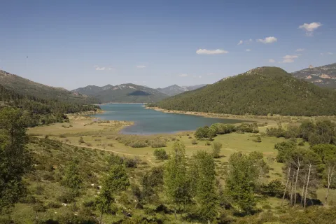
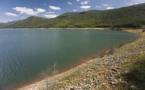
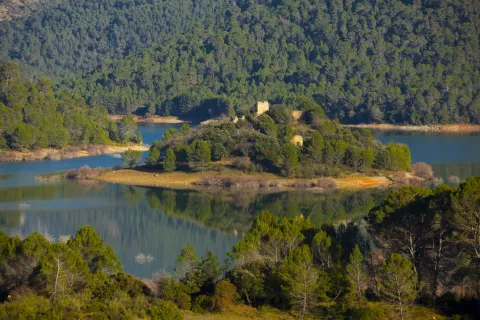
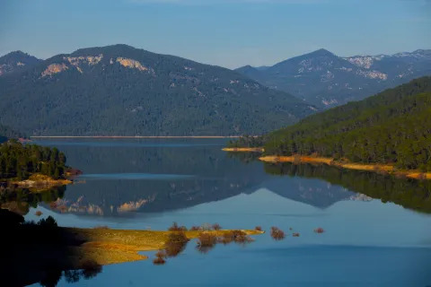
It is one of the largest reservoirs in Spain and is a first-class landscape resource in the Natural Park, so its entire environment is especially protected as the Bujaraiza Reserve Area. The left bank is on the A-319 road, and has various viewpoints, recreational areas, signposted trails and accommodation and restoration services, as well as water sports facilities. The right margin is mostly passed through forest tracks and roads. In its beginning (southern part) has several views of the Félix Rodríguez de la Fuente route.

Ubicación
Latitud
37.772886
Longitud
-3.788329
Distrito
Municipio
Ubicación en el mapa
POINT (-3.788329 37.772886)
Imágenes carrusel
imagen
Imagen
_mg_3284-jpg
Imagen principal
Desactivado
imagen
Imagen
_mg_0792-jpg
Imagen principal
Desactivado
imagen
Imagen
_mg_3280-jpg
Imagen principal
Desactivado
imagen
Imagen
img_0526-copia-jpg
Imagen principal
Desactivado
imagen
Imagen
img_0528-copia-jpg
Imagen principal
Desactivado
Imágenes cabecera
imagen
Imagen
_mg_0793-jpg
Imagen principal
Activado
Loading map
Preparing points of interest and routes...
Yeguas Reservoir

Submitted by brandcode_deweloper on
Id
6115426
Descripción
Breve descripción

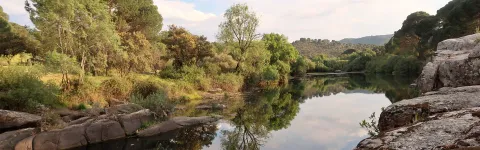
An English stage, ideal for facing tents and barbs above the kilo.It therefore requires a reel and a certain distance to deceive its untrustworthy fish, which usually enter into fine, half-water, and with continuous barley of spice. A very sophisticated plug is also used, with elastic to the third, fourth or fifth tranche, or the bologna in case this technique is dominated.

Ubicación
Código Postal
23770
Latitud
38.079566
Longitud
-4.164839
Distrito
Municipio
Ubicación en el mapa
POINT (-4.164839 38.079566)
Imágenes carrusel
imagen
Imagen
embalse_yeguas.png
Imagen principal
Desactivado
Imágenes cabecera
imagen
Imagen
Yeguas_Ferro.jpg
Imagen principal
Activado
Microsite al que pertenece
Loading map
Preparing points of interest and routes...
Jándula Reservoir

Submitted by brandcode_deweloper on
Id
5861609
Descripción
Breve descripción

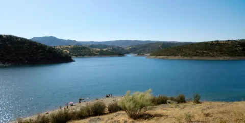
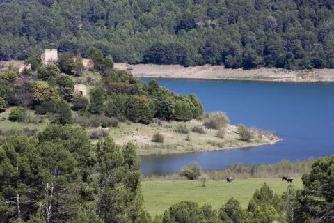
From this viewpoint you can see a beautiful landscape, in which rounded lomas occur with adhesitated extensions around the Jandula reservoir. The effect of the soil reflections on the packaged waters provides a beautiful picture. It is curious to see the clear line that borders the banks of the loins, which suggests how far the water level reaches in rainy times. The reservoir contains species such as black-bass, tent and barb. And next to them, a fish that is only found in these waters and tributaries of the Jandula, called Bogardilla. An ideal time to visit this viewpoint is the autumn, when deer will give us the sound show of the berrea. And with a little luck, we can contemplate the struggle of the males, horn against horn, on their arduous path to reproduction.

Telecomunicaciones
Teléfono de contacto
953 549 030
Ubicación
Código Postal
23740
Latitud
38.258730
Longitud
-3.934320
Distrito
Municipio
Ubicación en el mapa
POINT (-3.93432 38.25873)
Imágenes carrusel
imagen
Imagen
Natu054.jpg
Imagen principal
Desactivado
imagen
Imagen
rio-jandula.jpg
Imagen principal
Desactivado
imagen
Imagen
Natu073.jpg
Imagen principal
Desactivado
imagen
Imagen
Natu419.jpg
Imagen principal
Desactivado
imagen
Imagen
Natu425.jpg
Imagen principal
Desactivado
imagen
Imagen
Natu388.jpg
Imagen principal
Desactivado
imagen
Imagen
Natu384.jpg
Imagen principal
Desactivado
imagen
Imagen
Natu118%20%281%29.jpg
Imagen principal
Desactivado
imagen
Imagen
Natu185.jpg
Imagen principal
Desactivado
Imágenes cabecera
imagen
Imagen
Natu071.jpg
Imagen principal
Activado
Microsite al que pertenece
Loading map
Preparing points of interest and routes...