Saltar al contenido principal
icon-intereses-turismo-low-cost

Fountain of the Espino

Submitted by brandcode_deweloper on
Id
1869147
Descripción
Descripción larga

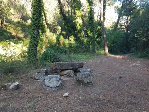
Location: To the south of the city centre, on the road to the mountains.

Distance: 4 hours.

Medium: On foot.

Access route: By mountain sidewalk.

Breve descripción

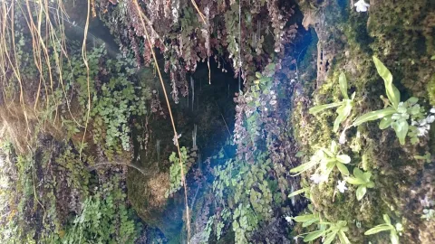
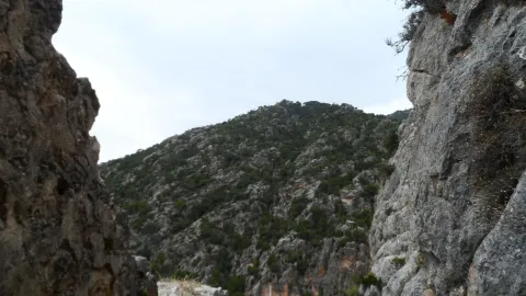
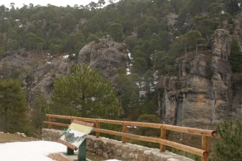
It is a water birth located in the middle of the Mediterranean mountain, with geological and vegetable formations of high natural value.

Ubicación
Latitud
37.740100
Longitud
-3.461470
Distrito
Ubicación en el mapa
POINT (-3.46147 37.7401)
Tipos de punto de interés
Imágenes carrusel
imagen
Imagen
Fuente%20del%20Espino%202.jpg
Imagen principal
Desactivado
Imágenes cabecera
imagen
Imagen
Espino1.png
Imagen principal
Activado
Microsite al que pertenece
Loading map
Preparing points of interest and routes...
Fountain of the Escribano

Submitted by brandcode_deweloper on
Id
4970637
Descripción
Descripción larga

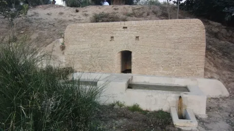
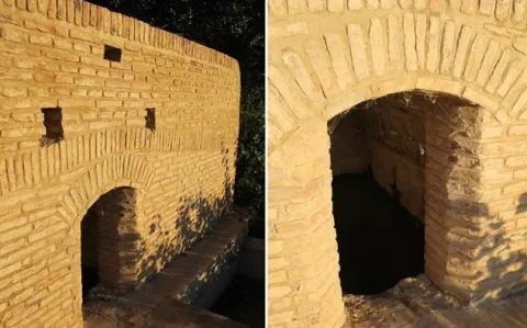
The source of the scribe has a very low flow rate, approximately between 0-1 l / s, although it is rarely exhausted. The use of water from this spring is now rural and livestock. Today the water of the spring is used very little, but in the past century, it was a source very frequented by the arjonilleros, using a part of it as a forklift for the cavalry and the rest of cattle, and another part for human supply. At the source the arjonilleros collected water, in pitchers and flyers, which they used for their domestic use, to refresh in the agricultural work...

There is no doubt that the picture presented by the source of the scribe earlier, according to the testimonies that come to us from the mouth of the older, must be bewildered. Men and women with the pitcher at their expense, or donkeys and carrying animals that were carrying in the serons the pitchers and flyers.

Breve descripción

It has traditionally been a watershed for animals and pour its water into the stream of the Fountain of the scribe. This old source was rebuilt in 1947 and 2015.

Telecomunicaciones
Sitio web
www.arjonillapatrimoniohistorico.blogspot.com/2017/09/la-fuente-del-escribano.html
Ubicación
Código Postal
23750
Latitud
37.967830
Longitud
-4.126910
Distrito
Municipio
Ubicación en el mapa
POINT (-4.12691 37.96783)
Tipos de punto de interés
Imágenes carrusel
imagen
Imagen
Fuente%20del%20Escribano.jpg
Imagen principal
Desactivado
imagen
Imagen
Fuente%20del%20Escribano%202.jpg
Imagen principal
Desactivado
Imágenes cabecera
imagen
Imagen
fuente-escribano.jpg
Imagen principal
Activado
Loading map
Preparing points of interest and routes...

Fountain of the Comendador

Submitted by brandcode_deweloper on
Id
4861505
Descripción
Descripción larga

With double deck and pool. Next to the modern source is another very old one of possible Ibero-Roman origin.

Breve descripción

It is a beautiful area, easily accessible, with a natural water spring.

Telecomunicaciones
Sitio web
www.porcuna.jaenescondido.es/fuente-del-comendador.html
Correo electrónico
contacto@jaenescondido.es
Ubicación
Latitud
37.871140
Longitud
-4.183990
Distrito
Municipio
Ubicación en el mapa
POINT (-4.18399 37.87114)
Tipos de punto de interés
Imágenes carrusel
imagen
Imagen
Fuente%20del%20Comendador.jpg
Imagen principal
Desactivado
imagen
Imagen
Fuente%20del%20Comendador%202.jpg
Imagen principal
Desactivado
Imágenes cabecera
imagen
Imagen
fuente.jpg
Imagen principal
Activado
Loading map
Preparing points of interest and routes...

Fountain of the Reja

Submitted by brandcode_deweloper on
Id
4658611
Descripción
Descripción larga

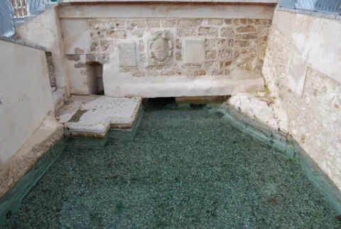
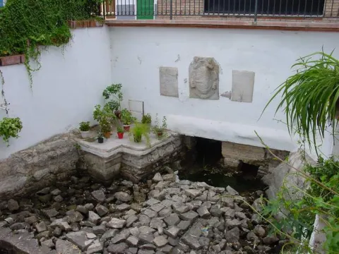
In the Fuente de la Reja we find a commemorative canvas decorated with heraldic elements, the weapons of Philip III and those of the villa itself. which reads as follows:

"King D. Philip III reigned in Spain. He ordered to do this work the village of Pegalajar year 1605.?

The lack of water in recent years has led to the implementation in 2007 of the aquifer extraction plan to recover the spring and to take measures to value it as a resource for local development.

The set composed of the Fuente de la Reja, la Charca and la Huerta de Pegalajar is an essential part of the historical-cultural-economic heritage of Pegalajar, as recognized by its declaration as a place of ethnic interest made by the Council of Culture of the Junta de Andalucía.

Telecomunicaciones
Sitio web
www.pegalajar.org/articulos/la_fuente_de_la_reja.htm
Teléfono de contacto
953 360 003
Correo electrónico
pegalajar@promojaen.es
Ubicación
Código Postal
23110
Latitud
37.741540
Longitud
-3.646940
Dirección
C/ Fuente la Reja
Distrito
Municipio
Ubicación en el mapa
POINT (-3.64694 37.74154)
Tipos de punto de interés
Imágenes carrusel
imagen
Imagen
fuente%20de%20la%20reja.jpg
Imagen principal
Desactivado
imagen
Imagen
fuente%20de%20la%20reja%202.jpg
Imagen principal
Desactivado
Imágenes cabecera
imagen
Imagen
fuentelareja2001.jpg
Imagen principal
Activado
Microsite al que pertenece
Loading map
Preparing points of interest and routes...

Fountain of the Corregidora

Submitted by brandcode_deweloper on
Id
4696970
Descripción
Descripción larga

The fountain of La Corregidora is less than 1 km from the urban centre of Sabiote, in the
place known as the Corridor. To access it, you have to go down by an unusual cut through those areas of La Loma, and it gradually opens up by discovering a beautiful view in which you can see the entire province, passing through Villacarillo and Iznatoraf (or Torafe as they call it through those areas and the Sierra de Segura). It is a dark and very humid area, as the sun never comes. It has a 4-year-old fountain, which in the past and now serves to give the cattle and the people to drink. The stream that forms, called the corridor, as its source, flows into the Guadalimar basin. In the surroundings there are only heras, olive trees and fruit crops, such as cherry and almonds.

Breve descripción

One of the most important natural sites we own in the region of the Loma and the Villas, is this stream that forms a waterfall in the vicinity of Sabiote, a place that for its freshness and for having around it the stone that has made great the monuments of this villa.

Telecomunicaciones
Sitio web
www.sabiote.com
Teléfono de contacto
953 773 002
Ubicación
Código Postal
23410
Latitud
38.068423
Longitud
-3.291115
Municipio
Ubicación en el mapa
POINT (-3.291115 38.068423)
Tipos de punto de interés
Imágenes carrusel
imagen
Imagen
Fuente%20de%20la%20Corregidora.jpg
Imagen principal
Desactivado
Imágenes cabecera
imagen
Imagen
img_0227.jpg
Imagen principal
Activado
Loading map
Preparing points of interest and routes...

Fountain of the Almoteja

Submitted by brandcode_deweloper on
Id
880909
Descripción
Descripción larga

In the fountain we can see the catacamosque (Pinguicola vallisneriifolia), small carnivora plant endemic to the Park, which feeds on insects. In this place a signposted path of 1 '5 km is started, which ascends on a hillside from which you can see very good panorama of the Bucentaina and the Stone of the Hole.

SITUATION

In the km 2.2 of the Siles to Las Azeas road (JF-7012), it starts a forest track that leads to the Area after 1.5 km.

Breve descripción

This Recreative Area is in a cool and pleasant place next to the Arroyo del Barranco de los Tejos and has tables and fountain. Although it has a small parking lot, we recommend walking to enjoy the river vegetation of the stream, with abundant willows.

Ubicación
Latitud
38.359810
Longitud
-2.569110
Dirección
km 2,2 de la carretera de Siles a Las Acebeas
Distrito
Municipio
Ubicación en el mapa
POINT (-2.56911 38.35981)
Tipos de punto de interés
Imágenes carrusel
imagen
Imagen
Fuente%20Almoteja.jpg
Imagen principal
Desactivado
Imágenes cabecera
imagen
Imagen
fuente-almoteja.jpg
Imagen principal
Activado
Loading map
Preparing points of interest and routes...

Fuenmayor

Submitted by brandcode_deweloper on
Id
5846796
Descripción
Breve descripción

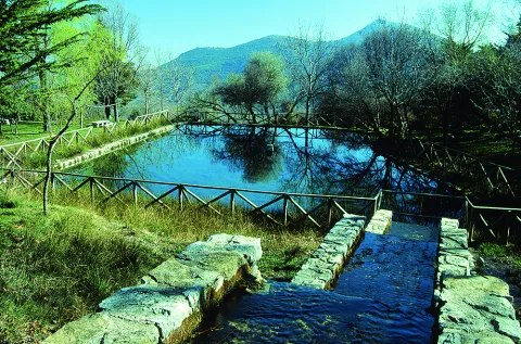
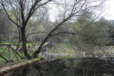
Traditional meringero area around a high-flow source that feeds a pond, around which the furniture of the picnic area is distributed. It is the starting place of several hiking routes.

Ubicación
Latitud
37.785140
Longitud
-3.509250
Distrito
Municipio
Ubicación en el mapa
POINT (-3.50925 37.78514)
Tipos de punto de interés
Imágenes carrusel
imagen
Imagen
Natu438.jpg
Imagen principal
Desactivado
Imágenes cabecera
imagen
Imagen
Fuenmayor.jpg
Imagen principal
Activado
Microsite al que pertenece
Loading map
Preparing points of interest and routes...

Fault of Tíscar

Submitted by brandcode_deweloper on
Id
876119
Descripción
Descripción larga

The Tiscar Falla is a sinistra tear fracture that borders the Quesada saw by the E, running always close to the Quesada- well Alcón road. The fracture plane is almost vertical. The failure has cut the southern end of the Sierra de Cazorla, moving the southern fragment to the NW about 8 km.

At the proposed point the failure plane can be observed, with associated failure rocks, as well as some horizontal strands that show the movement of this fracture.

Source: Inventory of Georresources of Andalusia. Environmental Council. Junta de Andalusia.

Breve descripción

Tiscar failure

Ubicación
Latitud
37.912893
Longitud
-3.003887
Municipio
Ubicación en el mapa
POINT (-3.003887 37.912893)
Tipos de punto de interés
Imágenes carrusel
imagen
Imagen
falla-tiscar.jpg
Imagen principal
Desactivado
imagen
Imagen
piedras.jpg
Imagen principal
Desactivado
imagen
Imagen
Natu215.jpg
Imagen principal
Desactivado
Imágenes cabecera
imagen
Imagen
tiscar.jpg
Imagen principal
Activado
Loading map
Preparing points of interest and routes...

Los Perales Strait

Submitted by brandcode_deweloper on
Id
913048
Descripción
Descripción larga

There are two places to enjoy the Strait of Perals:

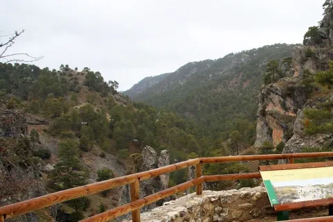
  • Undoubtedly a good place to observe the beauty of this Strait is the lookout that appears on the left side of the Navas road. It's not signposted, so you have to pay attention, though it has no loss.
  • In the valley of Valdetrillos in the ascending direction there is a track that can be seen from the lookout. To get to it you have to turn back on the runway of the Navas and take the road cut by a chain that goes to the right. We have to cross the bridge over the Rambla stream. After a period of half an hour walking we view the basin of the Valdetrillos stream from where the Strait of the Perals and the lookout that has been referred to above are observed.

In Cazorla take the Sierra road (A-319) until the crossing known as the Empalme del Valle. Turn right on the JF-7092 road and after passing the bridge over the Guadalquivir River (4 km from the Empalme) follow the left track (JF-7091). Between the km 27 and 28 of the road signs is the lookout with views of the Strait of the Perales.

Breve descripción

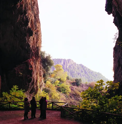
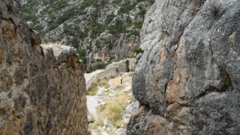
Singular throat that stands out for the aesthetics of its curious rock formations. At the bottom the stream of Valdetrillos breaks into fast joys that put the sound note. In this area it is easy to see how the agile muflons, the montane males, and even the majestic flight of the royal eagle, the leonate vulture or the drifted eagle climb through vertical walls. At the end of the valley the Calarillas provides perspectives of the highest mountains of this natural space.

Ubicación
Latitud
37.912893
Longitud
-3.003887
Municipio
Ubicación en el mapa
POINT (-3.003887 37.912893)
Tipos de punto de interés
Imágenes carrusel
imagen
Imagen
perales.jpg
Imagen principal
Desactivado
Imágenes cabecera
imagen
Imagen
1515_MI_01.jpg
Imagen principal
Activado
Loading map
Preparing points of interest and routes...
Estaca Grande

Submitted by brandcode_deweloper on
Id
7461237
Descripción
Descripción larga
  • Your access is made on foot field through.
  • The person who best knows and has studied the centenary olive trees in Martos is Mr. Ciriaco Castro Toro, retired technician of the City Council.
Breve descripción

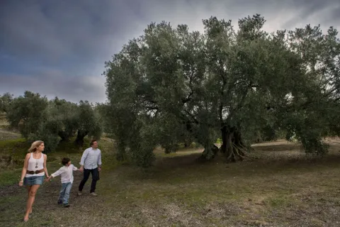
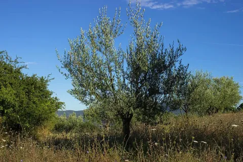
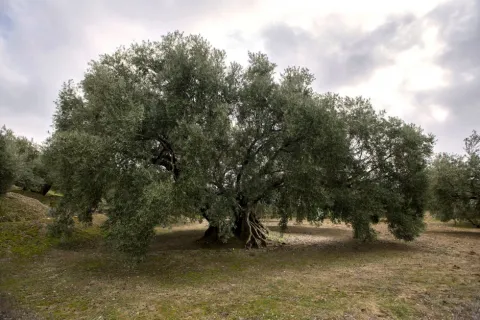
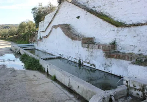
La Estaca Grande is a unique olive tree, about 300 years old, located about 450 metres from the Via Verde del Oil, right in the area called Cañada del Abandado, in the municipal term of Martos. In Jaén the olive trees are also known as stacas, in reference to their primary phase and to one of the planting methods.

Telecomunicaciones
Sitio web
https://www.martos.es/
Teléfono de contacto
953 704 005
Correo electrónico
concejal.jerena@martos.es
Ubicación
Nombre
Cañada del Abandonado
Código Postal
23600
Latitud
37.735290
Longitud
-3.970170
Distrito
Municipio
Ubicación en el mapa
POINT (-3.97017 37.73529)
Tipos de punto de interés
Imágenes carrusel
imagen
Imagen
estca-grande-2.jpg
Imagen principal
Desactivado
imagen
Imagen
olivo-estaca.jpg
Imagen principal
Desactivado
Imágenes cabecera
imagen
Imagen
estaca-grande-1.jpg
Imagen principal
Activado
Microsite al que pertenece
Loading map
Preparing points of interest and routes...