Saltar al contenido principal
icon-intereses-turismo-low-cost

Hútar

Submitted by brandcode_deweloper on
Id
5848201
Descripción
Breve descripción

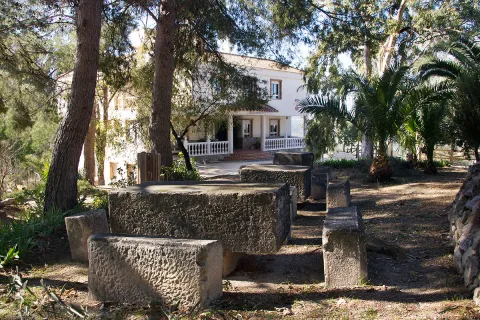
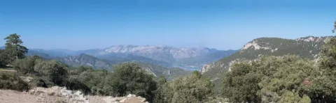
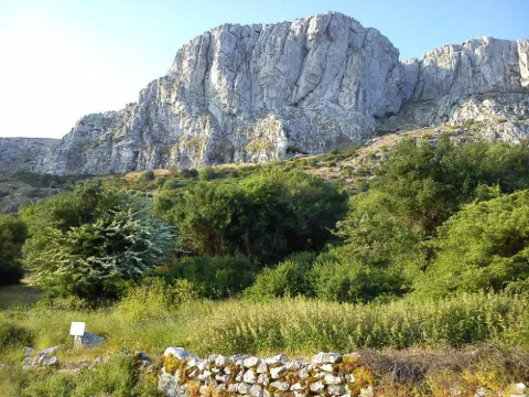
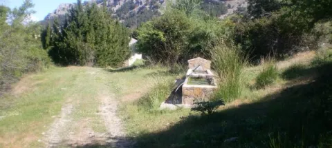
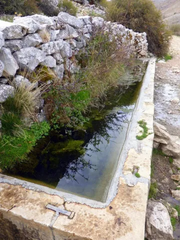
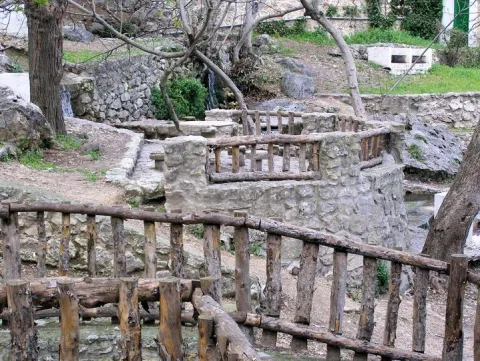
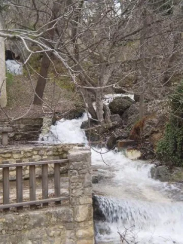
Water spring located in the municipal term of Albanchez de Magina, just where the Hútar stream is born. It is a traditional area of meringeros, with barbecues, swimming pool and games for children among other facilities..

Ubicación
Latitud
37.792170
Longitud
-3.466120
Distrito
Ubicación en el mapa
POINT (-3.46612 37.79217)
Tipos de punto de interés
Imágenes carrusel
imagen
Imagen
hutar.jpeg
Imagen principal
Desactivado
Imágenes cabecera
imagen
Imagen
Hutar.jpg
Imagen principal
Activado
Microsite al que pertenece
Loading map
Preparing points of interest and routes...
Cora Botanical Garden

Submitted by brandcode_deweloper on
Id
5713992
Descripción
Descripción larga

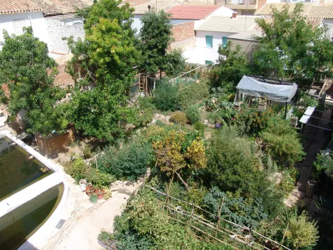
Since 2013 the Association of the Cultural Garden of the Cora, has had the institutional recognition and the transfer of the land by unanimous agreement of all the political groups of the City of Jódar.

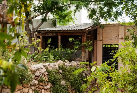
Everything in the Garden of Cora has a why, a story that goes unnoticed in the eyes of the visitor. It is necessary to decipher the meaning of each component or inhabitant of this space in order to understand the true value of what the walls of this old school, which despite not being occupied by children's laughter and games, remain synonymous with life and the future.

Thanks to the work of the members of the Echo Cultural Association of the Garden of Cora, here is a real laboratory activity; the recovery and conservation of local seeds - or other sources - at risk of extinction as well as the cultivation of specimens from other areas of the planet that are considered especially interesting based on the climatic conditions of the area.

Breve descripción

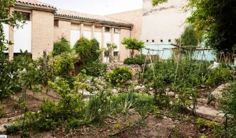
Located in the municipality of Jódar, in an old school that was occupied in the early 1990s, the Garden of Cora is a reality built thanks to the solidarity and selfless work of the people who are members of the association that manages it.
In its banks it houses a complex amalgam of promising species and plant varieties of high agroecological value, extremely unique and many of them almost unknown or at risk of disappearance, a fact that has attracted visits by experts and scholars from countless points on the planet. To date, the garden maintains a quota of about 400 different varieties - either in direct cultivation through its seed bank.

Telecomunicaciones
Sitio web
https://huertodelacora.es.tl/
Teléfono de contacto
622 345 626
Ubicación
Código Postal
23500
Latitud
37.838500
Longitud
-3.354360
Dirección
C/ Sevilla, 29
Distrito
Municipio
Ubicación en el mapa
POINT (-3.35436 37.8385)
Tipos de punto de interés
Imágenes carrusel
imagen
Imagen
7.jpg
Imagen principal
Desactivado
imagen
Imagen
6.jpg
Imagen principal
Desactivado
imagen
Imagen
5.jpg
Imagen principal
Desactivado
Imágenes cabecera
imagen
Imagen
8.jpg
Imagen principal
Activado
Microsite al que pertenece
Loading map
Preparing points of interest and routes...
Huerta Vieja (Camping Area ontrolada)

Submitted by brandcode_deweloper on
Id
880967
Descripción
Descripción larga

Tranco road A-319, in the surroundings of the Tranco reservoir.

Breve descripción

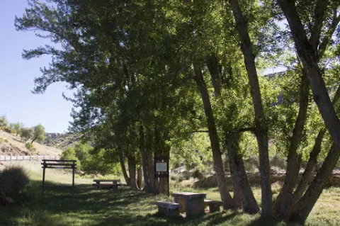
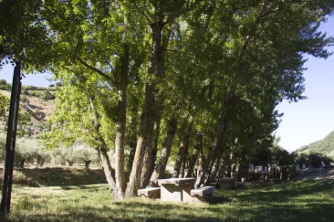
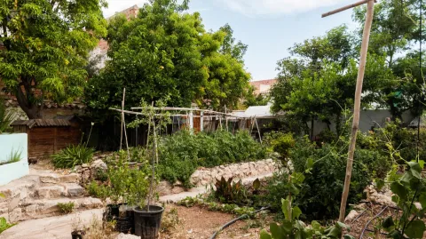
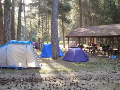
Large area surrounded by lush vegetation, with fountain and wooden dining area, crossed by a stream. When you are not occupied by a camp, it is an excellent place to eat and rest. Very close is also the delicious place where the village of Bujaraiza was, abandoned since the construction of the Tranco reservoir.

Ubicación
Latitud
38.117830
Longitud
-2.806540
Dirección
Carretera del Tranco A-319
Distrito
Municipio
Ubicación en el mapa
POINT (-2.80654 38.11783)
Imágenes carrusel
imagen
Imagen
Huerta%20Vieja%202.jpg
Imagen principal
Desactivado
imagen
Imagen
Huerta%20Vieja%201.jpg
Imagen principal
Desactivado
Imágenes cabecera
imagen
Imagen
huerta-vieja.jpg
Imagen principal
Activado
Loading map
Preparing points of interest and routes...

Orchard of the Sordo o Huerta de San Lázaro

Submitted by brandcode_deweloper on
Id
6616170
Descripción
Descripción larga

That historic day will play an important role, as the heat attached to the scarcity of the liquid element for the French troops would be a key factor in defeating the Galo army, which in the last moments of the struggle would despair to reach the desired place where to satisfy the unbearable thirst. The popular tradition tells us that many of these soldiers will be thrown into the river of the San Lazaro Garden, the only place near with water, with the following phrase "To die here and resurrect in Paris."

Breve descripción

The Orerta de San Lazaro, or commonly known as the Orerta del Sordo, is a prominent symbol of the battle of 1808, where both armies converge during the Battle of Bailen of 1808. Declared as Good of Cultural Interest with a category of "Historic Site," it retains within it the old line that acted as a dividing line between the French and Spanish army during the battle.

Ubicación
Latitud
38.092970
Longitud
-3.786950
Distrito
Municipio
Ubicación en el mapa
POINT (-3.78695 38.09297)
Tipos de punto de interés
Imágenes carrusel
imagen
Imagen
unnamed%20%281%29.jpg
Imagen principal
Desactivado
Imágenes cabecera
imagen
Imagen
huerta-san-lazaro-scaled-jpg
Imagen principal
Activado
Microsite al que pertenece
Loading map
Preparing points of interest and routes...
Sierra Mágina Farm School and Summer Camp

Submitted by brandcode_deweloper on
Id
5416060
Descripción
Descripción larga

Our long history in the field of education allows us to make available to users all our years of experience; the results are manifested in the confidence that many educational centres, teachers and families that year after year support our project are placed in us. Granja Escuela Sierra Mágina has specialized in the programming of activities aimed at a student aged 3 to 16 mainly. On the other hand, every year, we face new challenges to adapt to new needs by always focusing on quality education as a pillar of our project.

Breve descripción

Since our beginning, in 2000, our mission has been the same, bringing nature, respect for the environment and animals closer to all the groups with which we work year after year. Since then, we have made progress to the most appropriate facilities for children to enjoy a unique experience in their lives.

Telecomunicaciones
Sitio web
www.granjaescuelamagina.com
Teléfono de contacto
622 383 031
Correo electrónico
info@granjaescuelamagina.com
Ubicación
Código Postal
23537
Latitud
37.816680
Longitud
-3.416830
Dirección
Carretera de Bedmar a Albanchez de Mágina, s/n
Distrito
Municipio
Ubicación en el mapa
POINT (-3.41683 37.81668)
Tipos de punto de interés
Imágenes carrusel
imagen
Imagen
gallinas-jpg
Imagen principal
Desactivado
imagen
Imagen
mg_7869-jpg
Imagen principal
Desactivado
imagen
Imagen
cabras-jpg
Imagen principal
Desactivado
imagen
Imagen
dormitorio-2-1-jpg
Imagen principal
Desactivado
Imágenes cabecera
imagen
Imagen
fachada-hd-jpg
Imagen principal
Activado
Horario
Monday to Friday: 09: 00 - 19: 00.
Microsite al que pertenece
Loading map
Preparing points of interest and routes...
Granites of La Puerta de Segura

Submitted by brandcode_deweloper on
Id
876209
Descripción
Descripción larga

Aflation of paleozoic granite surrounded by prebetic (triasic) materials with which it has a relationship of inconformity. Part of the village is built on the granite, which force a meandro in the Guadalimar River.

These are pink-coloured granules in afloor, in which large quartz and feldspar crystals are distinguished, in general unmeteorized. They are part of a recently exhumed paleorelieve after the erosion of the triastic clays and herring that cover them regionally. This is the granitic outcrop of the Central Iberian Zone of the southernmost Iberian Massif and further into the Betic Externs.

Source: Inventory of Georresources of Andalusia. Environmental Council. Junta de Andalusia.

Breve descripción

Granites of The Safe Gate

Ubicación
Latitud
38.079566
Longitud
-4.164839
Distrito
Municipio
Ubicación en el mapa
POINT (-4.164839 38.079566)
Tipos de punto de interés
Imágenes carrusel
imagen
Imagen
puerta-segura%20%281%29.jpg
Imagen principal
Desactivado
Imágenes cabecera
imagen
Imagen
la_puerta_segura_1.jpg
Imagen principal
Activado
Loading map
Preparing points of interest and routes...

Gorge of Hornos

Submitted by brandcode_deweloper on
Id
913080
Descripción
Descripción larga

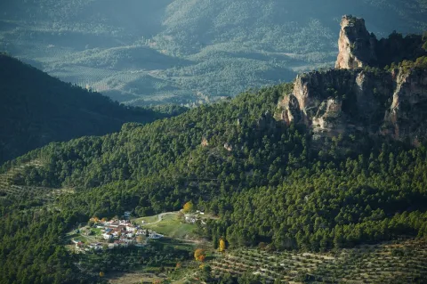
Half a mile from Hornos, on the right, you will find the look at Las Celadillas. Later on, do not stop visiting the charming village of La Capellanía, whose crossing is well marked to the left. From there you can walk along the signposted path PR-A 150, which is close to the steep slopes of the Yelmo Chico and allows you to contemplate a wide range of views. The A-317a road itself lends itself to the walk, as it has very little traffic since the new A-317 road was built from Hornos to Santiago de la Espada.

Breve descripción

It is a long and deep valley all along the winding road A-317a, which rises at first between olive groves and then between closed pine trees, which are of carrasco pine in the lower area, black pine in the middle altitude strip and larix pine in the higher parts. Mixed with them, the oak trees and other species of the Mediterranean forest abound, forming a landscape of remarkable longitude.

Ubicación
Latitud
38.210827
Longitud
-2.685734
Distrito
Municipio
Ubicación en el mapa
POINT (-2.685734 38.210827)
Tipos de punto de interés
Imágenes carrusel
imagen
Imagen
Aldea%20de%20La%20Capellan%C3%ADa%20y%20valle%20de%20La%20Garganta%20-%20copia.jpg
Imagen principal
Desactivado
Imágenes cabecera
imagen
Imagen
hornos1.jpg
Imagen principal
Activado
Loading map
Preparing points of interest and routes...

Fountain Taza de Pozo Alcón

Submitted by brandcode_deweloper on
Id
8109717
Descripción
Descripción larga

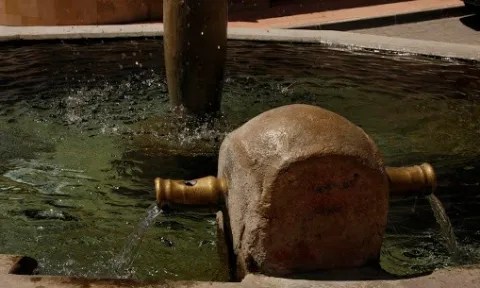
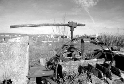
Located on a side of the Church of the Incarnation. Decorative source of vertical pipe type cup that spills to an octagonal pillar. It has two side pipes on the perimeter of the pillar that they used to serve to fill the cantars.

Breve descripción

Dodecagonal source with a single pipe on one side

Telecomunicaciones
Teléfono de contacto
953 738 041
Correo electrónico
ayuntamiento@pozoalcon.es
Ubicación
Código Postal
23485
Latitud
37.705600
Longitud
-2.933550
Dirección
C/ Monje, 2. Pozo Alcón
Municipio
Ubicación en el mapa
POINT (-2.93355 37.7056)
Tipos de punto de interés
Imágenes carrusel
imagen
Imagen
Fuente%20Taza2%20%281%29.jpg
Imagen principal
Desactivado
imagen
Imagen
Fuente%20Taza3%20%281%29.jpg
Imagen principal
Desactivado
Imágenes cabecera
imagen
Imagen
Fuente%20Taza%20%281%29.jpg
Imagen principal
Activado
Loading map
Preparing points of interest and routes...
Fountain of the Raso

Submitted by brandcode_deweloper on
Id
8091917
Descripción
Breve descripción

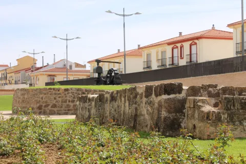
Enable as a recreational area. It is located 5 km north of Fries by the road towards Valdepeñas de Jaén. In the middle of Sierra Martina. Serrano landscape that stands out for the presence of typical plant species of the Mediterranean forest.

Telecomunicaciones
Sitio web
www.frailes.es/fuente-del-raso-frailes
Teléfono de contacto
953 599 541
Ubicación
Código Postal
23690
Latitud
37.509919
Longitud
-3.831940
Distrito
Municipio
Ubicación en el mapa
POINT (-3.83194 37.509919)
Tipos de punto de interés
Imágenes carrusel
imagen
Imagen
Fuente%20del%20raso3.jpg
Imagen principal
Desactivado
Imágenes cabecera
imagen
Imagen
Fuente%20del%20raso.jpg
Imagen principal
Activado
Loading map
Preparing points of interest and routes...
Fountain of the Gargantón

Submitted by brandcode_deweloper on
Id
5845859
Descripción
Breve descripción

Caudalosa fountain fed by the Garganton River, one of the most important watercourses on the southern side of the Sierra Magina mountains. In summer the park and the bar next to the fountain are places to stop.

Ubicación
Latitud
37.723720
Longitud
-3.382640
Distrito
Ubicación en el mapa
POINT (-3.38264 37.72372)
Tipos de punto de interés
Imágenes carrusel
imagen
Imagen
1465030943_456942_1465032471_album_normal%20%281%29.jpg
Imagen principal
Desactivado
imagen
Imagen
fuente%20%282%29.jpg
Imagen principal
Desactivado
Imágenes cabecera
imagen
Imagen
13641265.jpg
Imagen principal
Activado
Microsite al que pertenece
Loading map
Preparing points of interest and routes...