Saltar al contenido principal
icon-intereses-turismo-low-cost

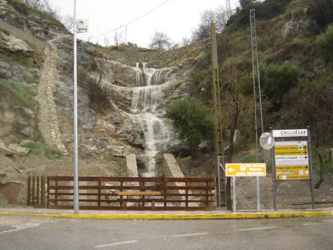
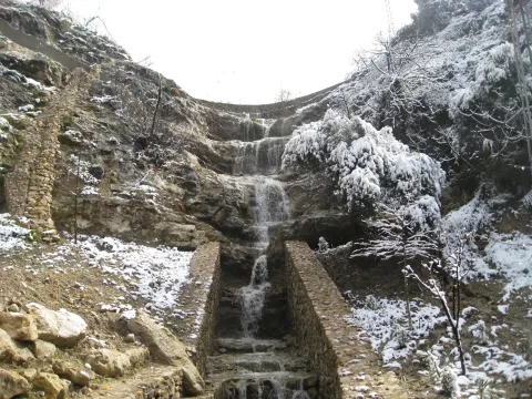
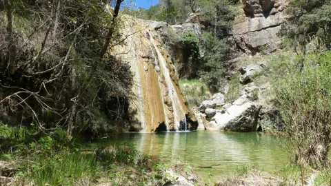
Waterfall Bridge Nevada

Submitted by brandcode_deweloper on
Id
8088114
Descripción
Descripción larga

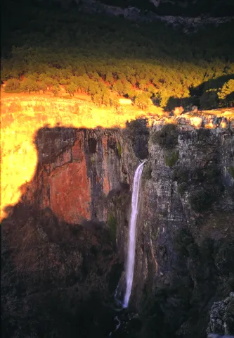
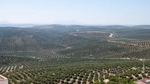
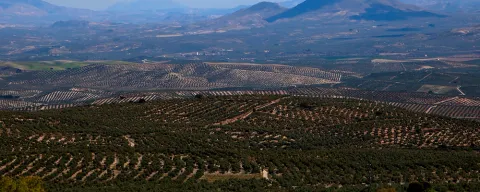
Like the other municipalities of the region, it is located between the mountain and the Guadalquivir valley. Its fundamental economy is the olive tree, although it has an incipient tourist development

Breve descripción

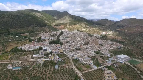
Chilluevar is a municipality in the province of Jaén, in Andalusia, Spain. It belongs to the Sierra de Cazorla region. This town is located at 738 meters of altitude and is located in one of the least known parts of the Natural Park, the Sierra de las Villas.

Telecomunicaciones
Sitio web
www.promojaen.es/pit/fmt.asp?i=&m=28&op=1
Teléfono de contacto
953 717 300
Ubicación
Código Postal
23477
Latitud
38.001440
Longitud
-3.031300
Municipio
Ubicación en el mapa
POINT (-3.0313 38.00144)
Imágenes carrusel
imagen
Imagen
cascada%20Chillu%C3%A9var2%20%281%29.jpg
Imagen principal
Desactivado
Imágenes cabecera
imagen
Imagen
cascada%20Chillu%C3%A9var%20%281%29.jpg
Imagen principal
Activado
Loading map
Preparing points of interest and routes...

Waterfall la Escaruela

Submitted by brandcode_deweloper on
Id
912020
Descripción
Descripción larga

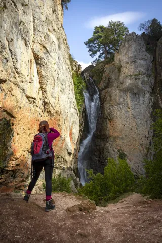
The waterfall is located next to the Falcones (1448 m), mountain always visible from any street of Cazorla, and a natural stone wall "Los Castellones" (1,820 m), elevation as a fortress from where it is named. To appreciate the water leaps it will be necessary to climb up a narrow path that runs next to the slope of the stream where you will be accompanied by the cornicabra (Pistacia terebinthus), a very abundant species on this path. By moving along the path you will appreciate the impressive fall of water as soon as the limestone walls serve as slides.

We suggest:

  • Next to the bridge from where the waterfall is seen, a right-hand road leads us to the control of Riogazas. It is a pleasant walk in which you will find a fountain called "The River" and another beautiful waterfall, that of the Magdalena. From here goes down a road to Cazorla.

In the Iruela you have to reach the square of the City Hall from where the road ascends towards the hotel Riogazas. 5 km from the Iruela and after two lookouts with meringeros there is a bridge. To the left we can see the Cascade of the Escaleruela.

Breve descripción

When you look at the waterfall you discover a stream covered in vegetation that barely lets the water see. Your look continues to ascend among limestone walls to discover how a stream with numerous water leaps is unraveling, only visible in periods of abundant rain and ice. Although we are very close to the localities of Cazorla and the Iruela wild nature begins to manifest in this spectacular leap of water, premonition of what we will find later.

Ubicación
Latitud
37.912893
Longitud
-3.003887
Municipio
Ubicación en el mapa
POINT (-3.003887 37.912893)
Tipos de punto de interés
Imágenes carrusel
imagen
Imagen
escaruela.jpg
Imagen principal
Desactivado
Imágenes cabecera
imagen
Imagen
unnamed%20%283%29.jpg
Imagen principal
Activado
Loading map
Preparing points of interest and routes...

Waterfall El Saltador

Submitted by brandcode_deweloper on
Id
5929475
Descripción
Descripción larga

Information and Observations

  • We will have to leave the vehicle at the entrance of the lane because there is a barrier to avoid the passage of vehicles.
  • The property through which the lane passes is private so it is not allowed to enter the lane with vehicle.
Breve descripción

The Saltador is a natural waterfall in the Arroyo del Tejuelo; this stream receives the waters of the Arroyo de Andrés and the Sierra del Agua, then joins the Arroyo de la Fuente del Tejo and forms the flow of the Tu River.

Ubicación
Latitud
38.388680
Longitud
-2.581360
Distrito
Municipio
Ubicación en el mapa
POINT (-2.58136 38.38868)
Imágenes carrusel
imagen
Imagen
Natu150.jpg
Imagen principal
Desactivado
Imágenes cabecera
imagen
Imagen
5.jpg
Imagen principal
Activado
Loading map
Preparing points of interest and routes...

Waterfall of Chorro Gil

Submitted by brandcode_deweloper on
Id
878082
Descripción
Descripción larga

The upper part of the Borosa River, has a scalated profile for the development of pozas and waterfalls in which travertine terraces are formed with spectacular botroidal calcite morphologies that were precipitated during the most humid and warm periods of the Quaternary.

Although travertine appear throughout the river, the highest concentration is located in the sector between the organ jump and the electric power plant. Its formation is due to the precipitation of calcite caused by the tear-up of the river waters produced by the turbulent regime of the water leaps in the areas with the greatest slope. This precipitation occurs in areas of dense vegetation receding elements of plants and producing subvertical sheets known as cascade facies.

Breve descripción

Travertines and cascade of Chorro Gil

Ubicación
Latitud
37.912893
Longitud
-3.003887
Dirección
Cascada de Chorro Gil
Municipio
Ubicación en el mapa
POINT (-3.003887 37.912893)
Tipos de punto de interés
Imágenes carrusel
imagen
Imagen
salto-de-los-organos-jpg
Imagen principal
Desactivado
Imágenes cabecera
imagen
Imagen
Natu069%20%281%29.jpg
Imagen principal
Activado
Loading map
Preparing points of interest and routes...

Casas-cueva de Pegalajar

Submitted by brandcode_deweloper on
Id
5848815
Descripción
Breve descripción

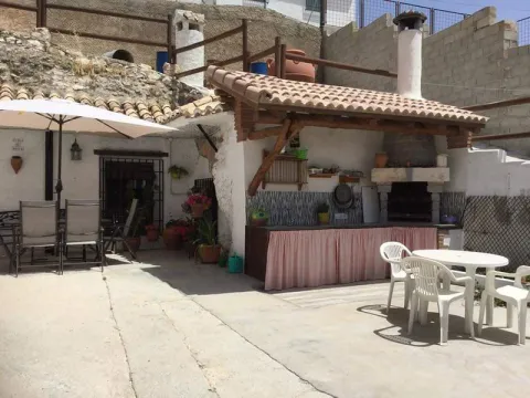
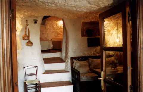
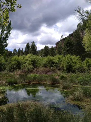
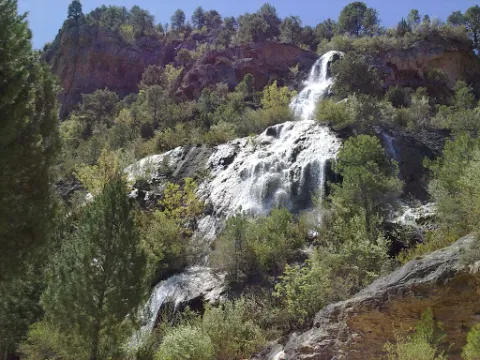
Set of troglodite houses rehabilitated as second residences and holiday tourist houses. They now make up a picturesque neighborhood, on horseback between the Serrezuela and the city centre. Very memorable.

Ubicación
Latitud
37.740061
Longitud
-3.645026
Distrito
Municipio
Ubicación en el mapa
POINT (-3.645026 37.740061)
Tipos de punto de interés
Imágenes carrusel
imagen
Imagen
01387888.jpg
Imagen principal
Desactivado
imagen
Imagen
68.jpg
Imagen principal
Desactivado
Imágenes cabecera
imagen
Imagen
cuevapelagar%20%281%29.jpg
Imagen principal
Activado
Microsite al que pertenece
Loading map
Preparing points of interest and routes...
Count of La Quintería House

Submitted by brandcode_deweloper on
Id
8090970
Descripción
Descripción larga

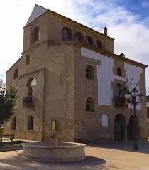
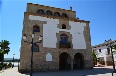
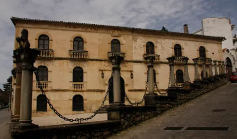
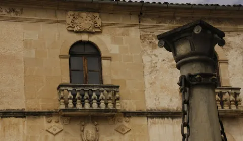
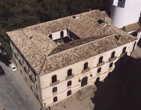
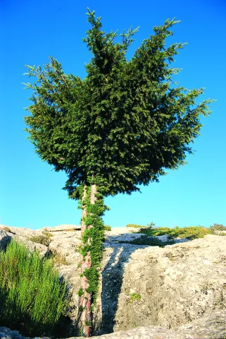
The infant Charles III, son of Philip V, in one of his travels, stayed in this palace on October 27, 1731, then the infant Charles III, King of Spain from 1759.
He stayed in this palace to avoid an outbreak of smallpox plaguing Andújar.
In the afternoon he was distracted by hunting from his window and at nightfall he witnessed from the windows of his room the artefacts that were prepared for such an occasion in Andújar.

Breve descripción

In 1705, King Philip V awarded the title of Count of the Quinteria to Eugene José de Miranda and Gamboa of the local nobility, and was issued in the name of Manuel Francisco de Cárdenas and Palomino, his son-in-law, the first Count of the Quinteria.

Telecomunicaciones
Sitio web
www.vreina.com
Teléfono de contacto
953 537 110
Ubicación
Código Postal
23730
Latitud
38.016530
Longitud
-3.951620
Distrito
Ubicación en el mapa
POINT (-3.95162 38.01653)
Tipos de punto de interés
Imágenes carrusel
imagen
Imagen
Casa%20del%20Conde%20de%20La%20Quinter%C3%ADa2.jpg
Imagen principal
Desactivado
imagen
Imagen
Casa%20del%20Conde%20de%20La%20Quinter%C3%ADa3.jpg
Imagen principal
Desactivado
Imágenes cabecera
imagen
Imagen
Casa%20del%20Conde%20de%20La%20Quinter%C3%ADa.jpg
Imagen principal
Activado
Microsite al que pertenece
Loading map
Preparing points of interest and routes...
House of the Chains

Submitted by brandcode_deweloper on
Id
656022
Descripción
Descripción larga

In Beas de Segura we find different examples of this type on Feria Street. In Orcera we find some interesting houses on San José Street or in Genaro de la Parra. In the Gate of Segura and in Siles there are also examples of this architecture called generally regionalist, but what they are looking for at the bottom is to incorporate elements from other times in the design of the houses.

Elements of Muslim architecture will give rise to the ne- mudejar and so during different times as the rebirth or the baroque. Its owners intended to legitimize their situation of being able to recover elements of the medieval or Renaissance past, as an element that would serve to connect with the nobility and thus justify their situation of power. To talk about this type of construction, is to make it from the 19th century, a century of great transformations, a time in which the saws that make up the Natural Park know the province of Jaén and the establishment of mechanism and forms of government totally different from those that exist with the advance of Cazorla and the envination of Segura. It is the century in which great fortunes are formed and at the same time the number of poor families is growing exponentially, all of which are framed in a constitutional regime that is completely unknown to most of the inhabitants.

The House of the Chains is a three-storey construction that offers a compact and solid image highlighting Renaissance elements such as the half-point arches. A large entrance arch contains the shield of the Godoy family, the first owners to be recorded.

Breve descripción

The House of the Cadenas stands on the floor that occupied the house of the Marquis of Camarasa and still retains a stone plate belonging to the old building. This construction serves to understand all that architecture present in our villages and which is made up of large master houses that have little to do with the rest. During the 19th century there are a number of large owners who become owners of large areas of land from the disamortization and sale of public property.

Ubicación
Latitud
37.913400
Longitud
-3.002850
Dirección
C/ Cantarranas, 8
Municipio
Ubicación en el mapa
POINT (-3.00285 37.9134)
Imágenes carrusel
imagen
Imagen
Casa%20de%20las%20Cadenas1.png
Imagen principal
Desactivado
imagen
Imagen
casa-cadenas-2.jpg
Imagen principal
Desactivado
Imágenes cabecera
imagen
Imagen
casa-cadenas.jpeg
Imagen principal
Activado
Loading map
Preparing points of interest and routes...

A-316 Road, Torreperogil-Villacarrillo-Villanueva del Arzobispo Section

Submitted by brandcode_deweloper on
Id
7468197
Descripción
Descripción larga

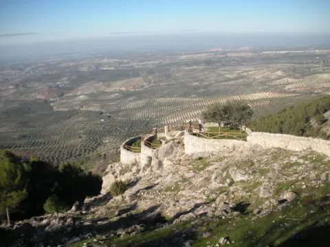
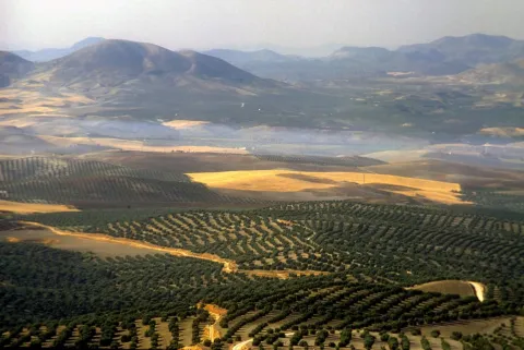
In particular this stretch of road runs almost air in the interflude of the valleys of the Guadalimar and the Guadalquivir. From this area you can see thousands of hectares of olive trees in a single look, framed by the horizons of Sierra Morena on one side, and Sierra de Segura and Sierra de Las Villas on the other.

Breve descripción

It is just an example of the great olive groves that can be seen when travelling through the province of Jaén.

Ubicación
Latitud
37.772886
Longitud
-3.788329
Municipio
Ubicación en el mapa
POINT (-3.788329 37.772886)
Tipos de punto de interés
Imágenes carrusel
imagen
Imagen
272ca59b7f36e64b14d2565ff1caba3a.jpg
Imagen principal
Desactivado
imagen
Imagen
olivos%20%281%29.jpg
Imagen principal
Desactivado
Imágenes cabecera
imagen
Imagen
miradores.png
Imagen principal
Activado
Loading map
Preparing points of interest and routes...

Road a Cabra de Sto. Cristo

Submitted by brandcode_deweloper on
Id
5845675
Descripción
Breve descripción

The best place to enjoy the last foothills, to the east, of Sierra Magina and also of the valley of the River Guardana Minor, characterized by its subaridity. The floral elements are numerous because they have to colonize different bioclimatic floors on different types of soils: saline, plaster, margous, limestone, etc. What is most striking are their carcabas and badlands formations.

Ubicación
Latitud
37.704030
Longitud
-3.286750
Distrito
Ubicación en el mapa
POINT (-3.28675 37.70403)
Tipos de punto de interés
Imágenes carrusel
imagen
Imagen
Carretera%20a%20Cabra%20de%20Sto.%20Cristo.jpg
Imagen principal
Desactivado
Imágenes cabecera
imagen
Imagen
106616866_3694094363937974_2481093797201150654_o.jpg
Imagen principal
Activado
Microsite al que pertenece
Loading map
Preparing points of interest and routes...
Carbonates of the Sector de Cabañas

Submitted by brandcode_deweloper on
Id
874642
Descripción
Descripción larga

The stratigraphic section of Cabañas is a mandatory reference of the Jurassic to Cretaceous transit in the Prebetic Zone. The materials that apflorate are essentially carbonates, in which the tidal levels stand out with marked cyclicity and magnificent examples of surfaces with drying cracks.

Reef faces, levels of accumulation of ferruginous oils, and limestones with spectacular sedimentary structures caused by traction currents are also observed. In addition to the section itself, the panorama contains an example of angular discord between the Jurassic materials and various Cretaceous terms of high paleogeographic interest.

Source: Inventory of Georresources of Andalusia. Environmental Council. Junta de Andalusia.

Breve descripción

Carbonates of the Cabins sector

Ubicación
Latitud
37.842982
Longitud
-3.066921
Municipio
Ubicación en el mapa
POINT (-3.066921 37.842982)
Tipos de punto de interés
Imágenes carrusel
imagen
Imagen
IMG_7746.JPG
Imagen principal
Desactivado
imagen
Imagen
100_3241.jpg
Imagen principal
Desactivado
Imágenes cabecera
imagen
Imagen
Natu004%20%281%29.png
Imagen principal
Activado
Loading map
Preparing points of interest and routes...