Saltar al contenido principal
icon-intereses-turismo-low-cost

Trail Cruz de la Chimba

Submitted by brandcode_deweloper on
Id
6488877
Descripción larga

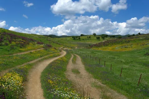
The path begins at the same source of the Cañada de las Azadillas, before a small round where the asphalt road ends. To the right of the fountain and to the empty, we go up perpendicularly from the road about 80 m. We make a turn of something more than 90 ° to the left where a horseshoe path is born that passes on the hillside of the fountain. Once on the road there is no loss as it is very marked, only some fallen trees cross the road, but these do not have difficulty avoiding them.

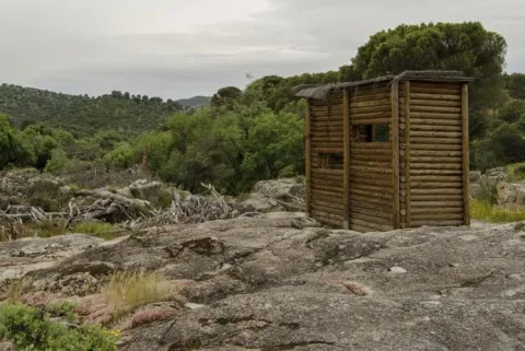
This first stretch is a constant rise and the good route of the path facilitates progression. As you gain height, the cups of the bushes adjacent to the path partially occupy some areas of the path, but in no case makes the footprint difficult or hidden. Already at the top the slope is softer and soon in a clear area we find the remains of a low-marked lane that lead to an explanade where forest cars turn, and start of the track. This point is the place of access and to which we must return, if we want to visit the forest shed Cruz de la Chimba at about 200 meters, hidden by the thickness of the pines. There is no path marked as such, so it is easy to get confused even though the distance is short. The best option is to walk on the track about 20 m from where the vehicle pass begins and is marked, perpendicularly to the lane and to the right of the track (west direction, direction 247th) we enter the pine in an area of path little defined, but with traces of the passage of the people, and that goes slightly up to reach a meadow where the shed is.

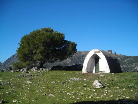
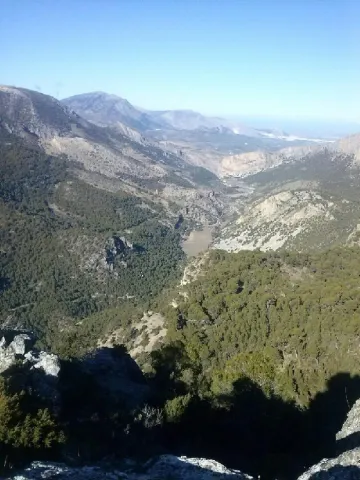
The Chimba Cross. It's the star point of the excursion. It has one of the best panoramic views of the Sierra de Jaén. Behind the shed is La Pandera, below the valley of the Quiebrajano River, and towards the north, the Castle of Otiñar and to the bottom of Jaén. It is in a semi-exclusive state thanks to the respectful care of its visitors. Caution should be exercised if we are accompanied by children or have vertigo, as the shed is in the vicinity of a steep area without any protection.

For return to the track the same route is used in the one way. Again on the forest track you have to continue to the right, the land is flat. This area is known as the Llanos de Navalopos. The track has no confusion. At its step and on the left it passes close to a plain and later borders a second plain up to a hill. At this point, the track goes down continuously until it returns to the Azadillas Canyon. But first we will find a chain that cuts the way to the cars and just beyond there is a crossing with the track that links the Azadillas Canyon with the Llanos de Palomares and the Pueblo de Carchelejo. We continue on the left descending, direction to the Cañada de las Azadillas. At the entrance to the Hall of Nature we will have finished the tour.

Breve descripción

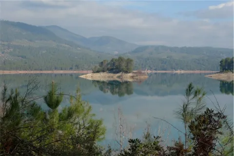
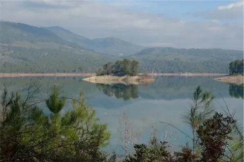
It is located in the area of the Cañada de las Azadillas, inside the Jaén Periurban Park, at 18.5 Km. Its forest and abrupt orography are of a great beauty and landscape wealth that deserves to visit it. Their isolation because it is not a place of passage, has helped to remain practically intact. There is a recreational area, known and visited by the Jiennenses and people of neighbouring villages on weekends to make picnic hiking, etc. There is also a Nature Hall dedicated to environmental education. The previous approach is made from Jaén, from the Alcantarilla district, by regional road JA-3210 to the Sierra Bridge. From there, follow to the right, the road towards the Quebrajano Pantano, Otinar and Cañada de las Azadillas. In the Km 14 of the road, under the Castle of Otiñar, we take the left road across the bridge and about 3 km away we will reach the Cañada.
Latitud
37.654095
Longitud
-3.728805
Ubicación en el mapa
POINT (-3.728805 37.654095)
imagen
Image
1226012Master.jpg
Imagen principal
Activado
imagen
Image
Sendero%20Cruz%20de%20la%20Chimba%20%282%29.jpg
Imagen principal
Desactivado
2 h

Nature

icon-intereses-naturaleza

Friends

icon-intereses-amigos

Adventure

icon-intereses-aventura

Culture

icon-intereses-cultura

Sport

icon-intereses-deporte

Eco-friendly

icon-intereses-eco-friendly

For couples

icon-intereses-en-pareja

Family

icon-intereses-familia

Gastronomy

icon-intereses-gastronomia

Municipality

icon-intereses-municipio

Low-cost tourism

icon-intereses-turismo-low-cost

Solo travel

icon-intereses-viajar-solo
Medium
1114 m
Sendero Cruz de la Chimba
6,9 km
283m
283m
On foot
All year round
Desactivado

Recreational area of the Cañada de las Azadillas
Source of the Cañada de las Azadillas (non-drinking water) at the beginning of the path

It is located at 18.5 km. of the city of Jaén, in the area of the Cañada de las Azadillas well known for the recreational area of the same name. A vehicle is currently needed to access the start of the path quickly. Take the JA-3210 communal road leading to the Sierra Bridge. From there, we take to the right the road towards the Quebrajano Pantano, Otinar and Cañada de las Azadillas.

In the Km. 14 of the road, under the castle of Otiñar, we take the left road crossing the bridge over the river until we reach the canyon. The path begins at the source of the Cañada de las Azadillas, before a small round don ends the asphalt road.
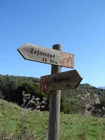
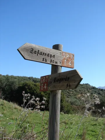
Coordenadas / Huso 30S
UTM coordinates: x = 435713 and = 4167687

GR-7

Submitted by brandcode_deweloper on
Id
6485714
Descripción larga

The explanations offered here are very brief, and do not go from being a presentation of this great itinerary, with the aim of locating its different stages as it passes through our province. The most important localities and reference steps are mentioned, but the explanation does not stop to inform about each and every detail of the road, actually formed by different types of roads, landscapes and conditions.
The entire route in the province of Jaén will take a week to ten days of long walks, with the most recommended support of one or two vehicles for the transport of material. Its passage through villages makes its division possible and allows it to make stages of less journey, depending on the interest of the group of hiking people. The GR-7 was marked and beheaded by the Andalusian Mountain Federation and the Tourism, Trade and Sport Council. Years later, some of the milestones have been lost, but by using traditional roads, their realization remains possible.
The path crosses the provincial border Cordoba-Jaén in Pilas de Fuente Soto, reaches Alcalá la Real and continues, in the direction of the village of Santa Ana, coinciding with a Royal Canyon adorned with stone crosses that crosses a moor with the Castle of La Mota on the horizon. It passes through Santa Ana, takes us to Fries and then to Los Rosales, from where it follows a paved road and then to rural roads.
It traverses several ports among which is that of Los Alamillos, goes down to the river Valdearazo and comes up again by seeping the Stone of the Palo, between Camillo de Arenas and Carchelejo, giving view to the Embalse of Quiebrajano. The road continues to ascend to a few plains before the town of Carchelejo, which is accessed by a steep road, by the upper part of the town, by the deposits.
The road leaves the Sierra Sur and leaves Carchelejo following a path that descends in search of the old road N-323, passing through a rock needle to which they refer by "The Old Tooth." In the N-323 it continues to the highway, the cross below and goes back the river line between orchards and choperas to access Cambil next to the debugger of the population. From here we go in the direction of the Corrijada of Matabejid, in the direction of Huelma, to enter the Natural Park of Sierra Magina, with the highest summits of the province of Jaén. We pass through Matabejid and follow a track towards the Port of La Mata, passing through the area of the Castillejo, a magnificent landscape characterized by the ruins of a castle of the ancient medieval border. This mountain of oaks and complaints is kept by one of the most emblematic mountains of the province, La Peña de Jaén. This landscape has the particularity of being the dehesa of complaints on a limestone mountain, higher in Spain. Crossing the Port the road runs between pine trees in the direction of Torres, where we can refresh with the water of the Fuenmayor, and already in the village in the Pila Pellenda, at the entrance to the village, before continuing to Albánchez de Magina by means of pecuaria roads, used as pedestrian roads between populations, accompanied by almonds and cherry trees characteristic of this area, which offers an image of whitened valley during its flowering.
Once again, we pass through Fuente de la Fresneda and through the recreational area of Cuadros until we reach Bedmar, from where we will suddenly go up to El Portillo by one of the most pronounced ramps of the GR to go down to Jódar through the Serrezuela. We left Jódar for the Jódara-Quesada railway station, we crossed the Minor Guadiana looking for Peal Furnaces, then Toya, and continued on the Vega to Quesada.
We are already in the Natural Park of the Serras de Cazorla, Segura and the Villas. As we leave Quesada we will pass under the site known as El Chorro, in search of the Monastery of Monte Zion, and from here to the hermitage of San Isicio, near Cazorla. We will leave Cazorla on one of the most beautiful roads of the whole route, we will see the hermitage of the Virgin of the Cabeza, on a road between pine trees we will pass by the Fountain of the Bear in search of the village of Vadillo Castril, then the village of Loma de Mª Ángeles, later on, through the Natural Park of the Sierra de Cazorla, Segura and Las Villas, Catorrios, and through the avenue of the Guadalquivir, passing near the Aguamulas River, we will go to the Fountain to Segura to reach Pontones. From Pontones we continue to Poyotello, we go down next to the channel of the young Rio Zumeta to the village of the Ruices, Santiago de la Espada, and finally we cross the provincial limit towards the Puebla de D. Fadrique, in Granada.

Breve descripción

The path GR-7 is just over 300 km. of the province of Jaéngoing throughthree of the most important Sierras in the province:Sierra Sur, Sierra Magina and Sierras de Cazorla, Segura and Las Villas. This is a stretch of this great road that runs through the European continent. It begins in Tarifa (Cadiz, Spain) and through Brussels (Belgium), it ends in Athens (Greece). As you pass through the province of Jaén, you will find a network of local, no less interesting, small tour trails.

Latitud
37.4614
Longitud
-3.9222
Distrito
Municipio
Ubicación en el mapa
POINT (-3.9222 37.4614)
imagen
Image
gr7malaga1.jpeg
Imagen principal
Activado
imagen
Image
gr7malaga1-1-jpeg
Imagen principal
Desactivado
Unas 100 h de andadura a una media de 3 km/h

Friends

icon-intereses-amigos

Nature

icon-intereses-naturaleza

Solo travel

icon-intereses-viajar-solo

Gastronomy

icon-intereses-gastronomia

For couples

icon-intereses-en-pareja

Family

icon-intereses-familia

Adventure

icon-intereses-aventura

Culture

icon-intereses-cultura

Sport

icon-intereses-deporte

Municipality

icon-intereses-municipio

Low-cost tourism

icon-intereses-turismo-low-cost

Eco-friendly

icon-intereses-eco-friendly
GR-7
150 km
11000m
11000m
Desactivado
Tramo de asfalto o cemento
 
Tramo de pista o camino forestal
 
Tramo de vía pecuaria
 
Tramo de senda
 

Signposted Trail - El Encinarejo

Submitted by brandcode_deweloper on
Id
6474525
Breve descripción

It is a path designed around the Jandula River. Through a pleasant walk, you can enjoy the contrast between the riverside ecosystems and those of a typical dehesa of the Sierra de Andújar Natural Park.

It starts at the Iron Bridge that crosses the Jandula River and is also the main entrance to the natural park. A recreational area with barbecues and tables continues in parallel to the right bank of the river. In this section of the path we can observe the characteristic vegetation of the park's riverside forests: strawberries, alyses, sardines, tarayes, etc., which serve as a refuge to the representative fauna of this humid area: royal herons, zampullin, water cocks and if we are lucky you can see some otter. It is interesting, too, the presence of small sides of rabies or mohyes that often approach visitors waiting for food.

On this same stretch and on our left, in what constitutes the Solana del Coscojar, we can see, on the hillside, that the vegetation changes markedly, with the appearance of oak, pine pines, lentils and grasses.

Following the river bank we arrive at the foot of the dam of the Encinarejo swamp. It is a small swamp, more like a lake, and the purpose of which is the use of electrical energy. Under the dam and through a bridge you cross the other shore, after a small climb you reach the village of Encinarejo, built to house the employees who built the dam.

The rabbit is of great importance inside the park. In addition to traditional cynegetic use in the area, it provides support for species of great interest such as the lince, the imperial eagle or the meloncillo. The deer is the species of major hunting par excellence in the natural park, the traditional form of hunting is the montaria, its tradition in this

Latitud
38.0704
Longitud
-4.0303
Distrito
Municipio
Ubicación en el mapa
POINT (-4.0303 38.0704)
imagen
Image
1190_SS_02%20%281%29.jpg
Imagen principal
Activado
imagen
Image
Sendero%20se%C3%B1alizado%20-%20El%20Encinarejo.jpg
Imagen principal
Desactivado
1 h

Nature

icon-intereses-naturaleza

Friends

icon-intereses-amigos

Adventure

icon-intereses-aventura

Culture

icon-intereses-cultura

Sport

icon-intereses-deporte

Eco-friendly

icon-intereses-eco-friendly

For couples

icon-intereses-en-pareja

Family

icon-intereses-familia

Gastronomy

icon-intereses-gastronomia

Municipality

icon-intereses-municipio

Low-cost tourism

icon-intereses-turismo-low-cost

Solo travel

icon-intereses-viajar-solo
Baja
Sendero señaliado - El Encinarejo
2,7 km
On foot
All year round
Desactivado
  • In front of COVID19, keep the safety distance and carry a mask, avoid agglomerations and contact with surfaces, wash your hands frequently, use hydroalcoholic gel and consult the available digital materials. Take care of your health and others.
  • It works to prevent fires. Do not throw cigarettes or any other object that produces combustion.
  • By consuming local products and having companies in the area you will contribute to rural development.
  • He lives with the local people and other users. It respects private property and property.
  • Unwind in a sustainable way: public transport, bike, walk, shared vehicle...
  • Noise is another form of pollution. In silence you will enjoy your experience more.
  • It facilitates the use of people with special needs.
  • The trash doesn't come back alone. Take her with you to the nearest container. Reduce, reuse, recycle.
  • Don't leave a mark on your way through nature.
  • It practices a responsible and committed tourism with the environment. Be a real ecotourist!
  • Respect the facilities at your disposal. We all pay for your maintenance.
  • Check the weather forecast before starting your activity.
  • Avoid going out alone. If you do, it communicates tour and time of return to other people.
  • Extreme caution under adverse conditions and with the occasional presence of animals or motor vehicles.
  • Please provide prior information on the possible existence of cynegetic activity.
  • It has water, sun protection, proper clothes and shoes.
  • It carries a mobile with enough battery in case of emergency (112), but remember that there is not always coverage.
  • Don't even bother animals. You would negatively alter his behavior.
  • For your safety and the safety of the environment, don't get out of the signposted road or take shortcuts.
  • Remember that the capture of animals, light fire, fish and collect plants or minerals is prohibited.
  • If you bring a dog, take him with his strap and make sure he doesn't bother other animals or people.
  • Your safety is our concern, but it's your responsibility.
  • Thank you for your cooperation!
Tramo de asfalto o cemento
 
Tramo de pista o camino forestal
 
Tramo de vía pecuaria
 
Tramo de senda
 

Signposted Trail Camino Viejo: Sections Los Cerrillos-San Ginés

Submitted by brandcode_deweloper on
Id
6474117
Descripción larga

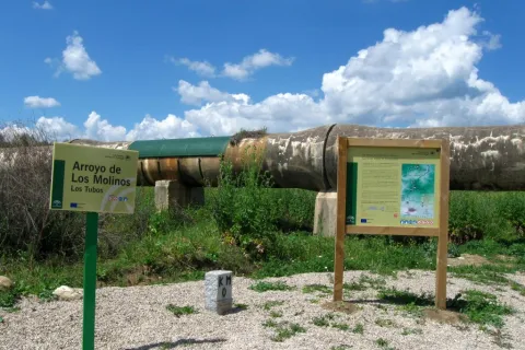
To take this path we will have to go to the northern part of the urban town of Andújar and from the cemetery take the Old Way or the San Amasio Way. The road is a track of land with good firm, up to the kilometer 1.9 where is the area known as Los Tubos, where the track is crossed by a huge tube of the Rumblar Canal.

In the area known as the "Tubos" is located the zero km of the route Camino Viejo - Cordel de los Molinos. From this point on the track through which we travel, it has worse firm, but it is passable by all-terrain vehicles for 900 meters more, until it reaches a rest area for the pilgrims and the sign of the beginning of the path. The starting signal is located next to a metal door that we will have to close to us to start the path on foot, on horse or by bicycle.

Breve descripción

IMPORTANT AVISO

As a preventive measure to prevent the contagion of COVID19, this path must be carried in the sense indicated in the starting sign.

The trail Los Cerrillos is part of the Old Way, used by the pilgrims to climb from Andújar to the Sanctuary of the Virgin of the Head. Part of the site known as Los Cerrillo and reaches the Hermitage of San Ginés, a traditional meeting point for pilgrims.

The path gently ascends from the countryside, crosses through areas of livestock pastures and goes into the Sierra, crossing mountains covered with oak trees, cantuesos and jaras. During the flowering season, in April and May, the landscape becomes especially attractive.

It is worth walking this path in order to see an interesting panorama of Andújar and the countryside of the Guadalquivir valley and to go through the intertwined paths excavated on the slate rocks by the continued passage of thousands of pilgrims: walkers, cyclists and riders

Latitud
38.0902
Longitud
-4.0101
Distrito
Municipio
Ubicación en el mapa
POINT (-4.0101 38.0902)
imagen
Image
1636_SS_03.jpg
Imagen principal
Activado
imagen
Image
1636_SS_04.jpg
Imagen principal
Desactivado
imagen
Image
1636_SS_01.jpg
Imagen principal
Desactivado
2 h

Nature

icon-intereses-naturaleza

Friends

icon-intereses-amigos

Adventure

icon-intereses-aventura

Culture

icon-intereses-cultura

Sport

icon-intereses-deporte

Eco-friendly

icon-intereses-eco-friendly

For couples

icon-intereses-en-pareja

Family

icon-intereses-familia

Gastronomy

icon-intereses-gastronomia

Municipality

icon-intereses-municipio

Low-cost tourism

icon-intereses-turismo-low-cost

Solo travel

icon-intereses-viajar-solo
Sendero Señalizado Camino Viejo: Tramos Los Cerrillos-San Ginés
5,5 km
On foot
All year round
Desactivado
  • In front of COVID19, keep the safety distance and carry a mask, avoid agglomerations and contact with surfaces, wash your hands frequently, use hydroalcoholic gel and consult the available digital materials. Take care of your health and others.
  • It works to prevent fires. Do not throw cigarettes or any other object that produces combustion.
  • By consuming local products and having companies in the area you will contribute to rural development.
  • He lives with the local people and other users. It respects private property and property.
  • Unwind in a sustainable way: public transport, bike, walk, shared vehicle...
  • Noise is another form of pollution. In silence you will enjoy your experience more.
  • It facilitates the use of people with special needs.
  • The trash doesn't come back alone. Take her with you to the nearest container. Reduce, reuse, recycle.
  • Don't leave a mark on your way through nature.
  • It practices a responsible and committed tourism with the environment. Be a real ecotourist!
  • Respect the facilities at your disposal. We all pay for your maintenance.
  • Check the weather forecast before starting your activity.
  • Avoid going out alone. If you do, it communicates tour and time of return to other people.
  • Extreme caution under adverse conditions and with the occasional presence of animals or motor vehicles.
  • Please provide prior information on the possible existence of cynegetic activity.
  • It has water, sun protection, proper clothes and shoes.
  • It carries a mobile with enough battery in case of emergency (112), but remember that there is not always coverage.
  • Don't even bother animals. You would negatively alter his behavior.
  • For your safety and the safety of the environment, don't get out of the signposted road or take shortcuts.
  • Remember that the capture of animals, light fire, fish and collect plants or minerals is prohibited.
  • If you bring a dog, take him with his strap and make sure he doesn't bother other animals or people.
  • Your safety is our concern, but it's your responsibility.
  • Thank you for your cooperation!

Route Source of Segura

Submitted by brandcode_deweloper on
Id
5974145
Breve descripción

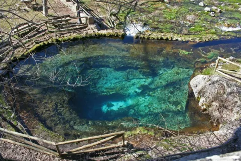
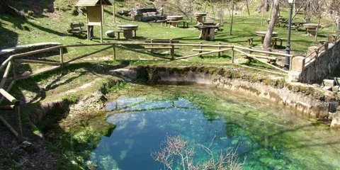
This circular route, which coincides in its first half with the GR-7 and the Safe Source Path (perfectly marked by the Environmental Council of the Junta de Andalucía), runs through the valley between the slopes of the Mariasnal and the rocky soils of Los Corralejos, passing through the villages of Fuente Segura and the birth of the Segura River, a spectacular crystalline poza of about 7 m diameter by 6 m depth, whose state is very variable according to the weather of the year.

The water runs through the mouth of a poza that forms part of the underground system that collects the precipitation that falls into the nearby altiplanicie of the fields of Hernán Perea.

Latitud
38.0947
Longitud
-2.6583
Distrito
Municipio
Ubicación en el mapa
POINT (-2.6583 38.0947)
imagen
Image
1.jpeg
Imagen principal
Activado
imagen
Image
nacimiento-del-rio-segura.jpg
Imagen principal
Desactivado
1 h 15 min

Nature

icon-intereses-naturaleza

Friends

icon-intereses-amigos

Adventure

icon-intereses-aventura

Culture

icon-intereses-cultura

Sport

icon-intereses-deporte

Eco-friendly

icon-intereses-eco-friendly

For couples

icon-intereses-en-pareja

Family

icon-intereses-familia

Gastronomy

icon-intereses-gastronomia

Municipality

icon-intereses-municipio

Low-cost tourism

icon-intereses-turismo-low-cost

Solo travel

icon-intereses-viajar-solo
Baja
Ruta Nacimiento del Segura
9,6 km
99m
All year round
Desactivado

Pontones has various services and at the birth of the Segura there is a recreational area, with a fountain and chiringuito (open from Easter to autumn).

Recommended epoch spring and especially autumn.

We leave Pontones in the direction of Santiago de la Espada and at 200 m to the right there is a manganche where we can leave the car, next to a park adapted with a fountain.

On the A-317 road to Pontones (The Lower Ponton).

Tramo de asfalto o cemento
 
Tramo de pista o camino forestal
 
Tramo de vía pecuaria
 
Tramo de senda
 

Circular Route Peña del Olivar

Submitted by brandcode_deweloper on
Id
5973466
Breve descripción

Northern area of the Natural Park, municipality of Siles.

Latitud
38.3883
Longitud
-2.5817
Distrito
Municipio
Ubicación en el mapa
POINT (-2.5817 38.3883)
imagen
Image
1.jpg
Imagen principal
Activado
imagen
Image
Ruta%20Circular%20Pe%C3%B1a%20del%20Olivar.jpg
Imagen principal
Desactivado

Nature

icon-intereses-naturaleza

Friends

icon-intereses-amigos

Adventure

icon-intereses-aventura

Culture

icon-intereses-cultura

Sport

icon-intereses-deporte

Eco-friendly

icon-intereses-eco-friendly

For couples

icon-intereses-en-pareja

Family

icon-intereses-familia

Gastronomy

icon-intereses-gastronomia

Municipality

icon-intereses-municipio

Low-cost tourism

icon-intereses-turismo-low-cost

Solo travel

icon-intereses-viajar-solo
Medium
Document
Document
Ruta Circular Peña del Olivar
1,3 km
4480m
All year round
Desactivado

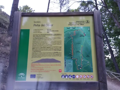
In the recreational area of La Peña del Olivardis it puts the fountain, tables, bathing area and a kiosk that usually opens during the holiday period. There is also water in the Nogueron Fountain (Km 1),

From Siles: on the JF-7012 road, marked "The Way of the Azeas."

Recreative area of the Peña del Olivar, in the Km 2 of the said road, next to the ceramic panel.

Circular Route Navalespino

Submitted by brandcode_deweloper on
Id
5972751
Descripción larga

From Segura de la Sierra we take the Sierra road (JV-7032), and at 8.3 km we find a crossing called La Era del Fustal, where we turn right, towards Santiago de la Sword. About 400? m later we took to the left a long forest track that flows into the Albaceteña village of Parolís. It is a wide track and in good condition, at the beginning of which there are signs of speed and weight limitation.

From Siles we take the road called the Road of the Azebeas (JF-7012). At 14 Km we arrive at the crossing that goes to Segura de la Sierra on the right (The Era del Fustal). We ignore it and continue to face it by finding about 400? m to the left the forest track mentioned above.

Latitud
38.276424
Longitud
-2.543725
Distrito
Municipio
Ubicación en el mapa
POINT (-2.543725 38.276424)
imagen
Image
2.jpg
Imagen principal
Activado
imagen
Image
turismoActivo9.jpg
Imagen principal
Desactivado
2 h 30 min

Nature

icon-intereses-naturaleza

Friends

icon-intereses-amigos

Adventure

icon-intereses-aventura

Culture

icon-intereses-cultura

Sport

icon-intereses-deporte

Eco-friendly

icon-intereses-eco-friendly

For couples

icon-intereses-en-pareja

Family

icon-intereses-familia

Gastronomy

icon-intereses-gastronomia

Municipality

icon-intereses-municipio

Low-cost tourism

icon-intereses-turismo-low-cost

Solo travel

icon-intereses-viajar-solo
Medium
Ruta Circular Navalespino
7,7 km
250m
All year round
Desactivado

The only point of water is the Fountain of the Hoya del Trigo at 2,2? Km from the beginning. It can dry in summer.

Type of Signals:Beacons with white arrows and mojones. From the km 1.3 and to the top we will also find white and yellow signs of international signage such as the Path of Small Tour (PR) of the PR-A 178.

At 6.9 Km from the start of the track, and as we go down to the stream of the Fountain of the Tejo, just before reaching it, a track to the stream of the Fountain of the Tejo, just before reaching it, a track to the right, which in 1.6 Km will place us next to the front of the path. There are wooden rails that delimit the parking area.

Coordenadas / Huso 30S
539909 mE / 4236584 mN
Tramo de asfalto o cemento
 
Tramo de pista o camino forestal
 
Tramo de vía pecuaria
 
Tramo de senda
 

Route Source of the River Segura – Viewpoint Juan León

Submitted by brandcode_deweloper on
Id
5971858
Descripción larga

Attention to snow in winter and contrast of temperatures between day and night in summer.

Breve descripción

After contemplating at the beginning the great poza where the Segura river is born, the route ascends between pinars, pastures, small vaguadas and very broken hills by the karmic action.

The route ends in an impressive cut from which we discover the most panoramic. To the left, the rope of the Banderillas and the Sierra de Cazorla. To the right stands the summit of the Yelmo and the Alcaraz Albaceteña saw.

The most immediate thing is the abandoned village of Los Centenares. After that, the summit curtain of the Sierra de Mirabuenos and the Sierra de las Villas, among which the Guadalquivir valley and the Tranco reservoir are hidden. Beyond, the view is lost in the plains of Castilla-La Mancha. The area is continuously overflown by leonate vultures and the muflon is very abundant.

Latitud
38.0001
Longitud
-2.7503
Distrito
Municipio
Ubicación en el mapa
POINT (-2.7503 38.0001)
imagen
Image
2.jpg
Imagen principal
Activado
imagen
Image
Ruta%20Nacimiento%20del%20R%C3%ADo%20Segura%20%E2%80%93%20Mirador%20de%20Juan%20Le%C3%B3n.jpg
Imagen principal
Desactivado
1 h 45 min (solo ida)

Nature

icon-intereses-naturaleza

Friends

icon-intereses-amigos

Adventure

icon-intereses-aventura

Culture

icon-intereses-cultura

Sport

icon-intereses-deporte

Eco-friendly

icon-intereses-eco-friendly

For couples

icon-intereses-en-pareja

Family

icon-intereses-familia

Gastronomy

icon-intereses-gastronomia

Municipality

icon-intereses-municipio

Low-cost tourism

icon-intereses-turismo-low-cost

Solo travel

icon-intereses-viajar-solo
Medium
Ruta Nacimiento del Río Segura – Mirador de Juan León
5,6 km (solo ida)
317m
All year round
Desactivado

Pontones has various services and at the birth of the Segura there is a recreational area with banks and tables. There are no sources on the tour.

Recreative area of the Birth of the Segura, located at the end of the above mentioned road, which is 4.7 km long

On the road JF-7047, which leaves 0.5 km from Pontones (Pontón Bajo) towards Santiago de la Sword, to the right, with the indication "Fuente Segura."

Recreative area of the Birth of the Segura, located at the end of the above mentioned road, which is 4.7 km long.

Circular Route el Yelmo Chico

Submitted by brandcode_deweloper on
Id
5970388
Breve descripción

Between the Garganta de Hornos and the El Yelmo peak, near the village of La Capellanía in the municipality of Hornos de Segura.

In the village of the Capellania, right at the entrance, as the first building is passed to our right, the path starts. There is an indicative arrow and the corresponding start panel.

Latitud
38.212083
Longitud
-2.686295
Distrito
Municipio
Ubicación en el mapa
POINT (-2.686295 38.212083)
imagen
Image
1.jpg
Imagen principal
Activado
imagen
Image
Ruta%20Circular%20el%20Yelmo%20Chico%20%281%29.jpg
Imagen principal
Desactivado
4 h

Nature

icon-intereses-naturaleza

Friends

icon-intereses-amigos

Adventure

icon-intereses-aventura

Culture

icon-intereses-cultura

Sport

icon-intereses-deporte

Eco-friendly

icon-intereses-eco-friendly

For couples

icon-intereses-en-pareja

Family

icon-intereses-familia

Gastronomy

icon-intereses-gastronomia

Municipality

icon-intereses-municipio

Low-cost tourism

icon-intereses-turismo-low-cost

Solo travel

icon-intereses-viajar-solo
Medium
Document
Document
Ruta Circular el Yelmo Chico
14,8 km
580m
All year round
Desactivado

Along the route we will find several places suitable for refreshment and rest, two of them, on foot of the route, are corresponding to cattle forks. But we recommend to visit the area of La Fuente de los Ganados just 5 minutes from our route, a very suitable place for the rest where we will find an old forest house.

To reach this path you have to go to the village of the Capellanía, which is accessed by a short signposted detour from the road of Hornos de Segura to Rio Madera A-317, old road to Pontones.

Coordenadas / Huso 30S
527463 mE / 4229393Nm
Tramo de asfalto o cemento
 
Tramo de pista o camino forestal
 
Tramo de vía pecuaria
 
Tramo de senda
 

Circular Route Alto del Montero

Submitted by brandcode_deweloper on
Id
5969785
Descripción larga

In Hornos de Segura we take the road A-317 towards Pontones and take a right turn, at the height of the village of Hornos el Viejo, towards La Plantera. We passed a few meters from this village and reached another crossing, where the asphalt is finished, we turned left, in the direction of the Fountain de la Higuera. The beginning of the path is 3.5 km (approx.) from this crossing. This forest track borders the Embalse del Tranco, we will leave to the right a recreational area, called Fountain de la Higuera and just 200 meters to the right begins our route, initially by a forest track with a little use.

A very good path for the observation of fauna, especially the boar and deer. It is recommended to go in silence and very attentive. Animals usually go down to drink, and sometimes they are surprised very close to the itinerary. In addition, the semi-abandoned olive groves in the area of Arroyo Montero are exceptional areas of grass. This path can also be realized from the area of Coto Ríos, entering the forest track of Llanos de Arance and following it to the end, where we would find the Arroyo Montero, by being circular, we could also do it from there in its entirety.

Breve descripción

Proximities of the Embalse del Tranco, near the Hornos de Segura (approx. 10 km).

Latitud
38.2804
Longitud
-2.6402
Distrito
Municipio
Ubicación en el mapa
POINT (-2.6402 38.2804)
imagen
Image
6%20%281%29.jpg
Imagen principal
Activado
imagen
Image
Ruta%20Circular%20Alto%20del%20Montero%20%281%29.jpg
Imagen principal
Desactivado
4 h 30 min

Nature

icon-intereses-naturaleza

Friends

icon-intereses-amigos

Adventure

icon-intereses-aventura

Culture

icon-intereses-cultura

Sport

icon-intereses-deporte

Eco-friendly

icon-intereses-eco-friendly

For couples

icon-intereses-en-pareja

Family

icon-intereses-familia

Gastronomy

icon-intereses-gastronomia

Municipality

icon-intereses-municipio

Low-cost tourism

icon-intereses-turismo-low-cost

Solo travel

icon-intereses-viajar-solo
Alta
Document
Document
Ruta Circular Alto del Montero
18,9 km
342m
All year round
Desactivado
Image
a3ec287d-faae-f015-1436-6b812ece7703?t=1607022723091

In the middle of the tour, we will find the Montero stream, which we will have to cross on two occasions. It is a very appropriate place to make a stop and rest.

Past Higuera Source, the forest track seems to leave the reservoir to start climbing. Right at that point, to the right, it starts this path, on a small forest track.