Saltar al contenido principal
icon-intereses-viajar-solo

Scenic Drive carretera de La Cumbre

Submitted by brandcode_deweloper on
Id
5712445
Breve descripción

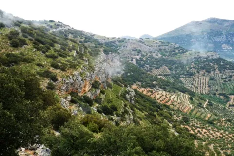
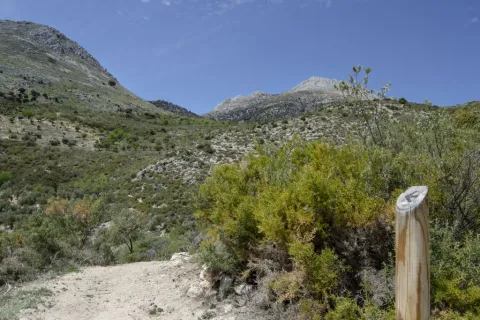
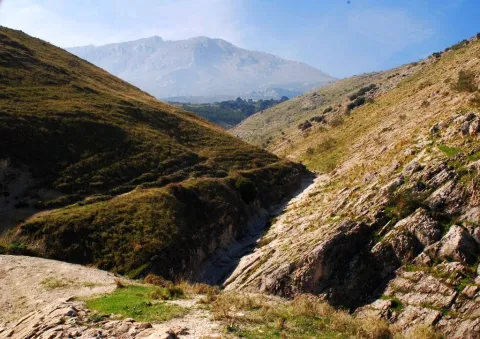
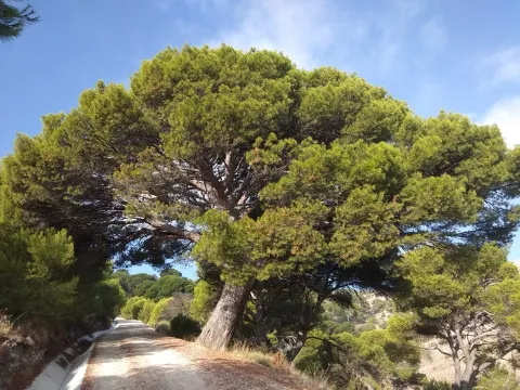
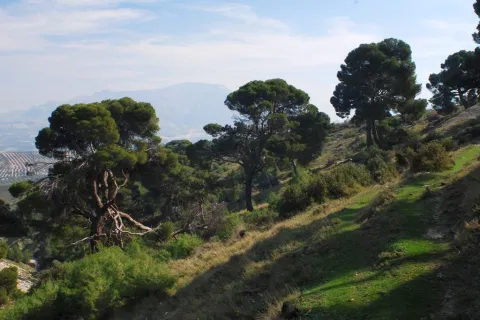
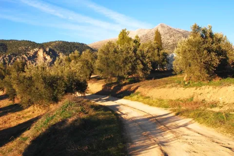
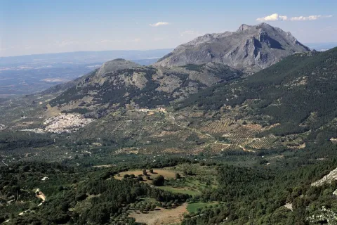
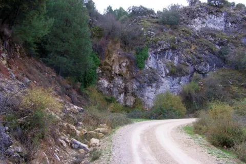
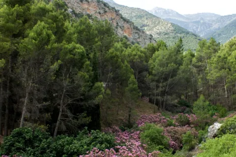
This area is not what suggests its name, but a long and wide range of water between the basins of Guadalquivir and Segura. It is surrounded by the quiet road A-317a, through which you can enjoy a very wooded landscape dominated by larix pine pines, with some points from which a memorable panorama is dominated to the Tranco reservoir, the Las Villas saw and the Banderillas mountain range.

You can take advantage of this stretch of road to close a car circuit with the Miradores Route and the Hornos Grain road. If you want to walk, we recommend the public road that goes east in the direction of the village of Cabeza Gorda passing through the old forest house of the Fuente del Chorro, which passes through dense pine forests.

Latitud
37.9002
Longitud
-2.9701
Distrito
Municipio
Ubicación en el mapa
POINT (-2.9701 37.9002)
imagen
Image
499_img.png
Imagen principal
Activado
imagen
Image
Ruta%20en%20coche%20carretera%20de%20La%20Cumbre.jpg
Imagen principal
Desactivado

Nature

icon-intereses-naturaleza

Friends

icon-intereses-amigos

Adventure

icon-intereses-aventura

Culture

icon-intereses-cultura

Sport

icon-intereses-deporte

Eco-friendly

icon-intereses-eco-friendly

For couples

icon-intereses-en-pareja

Family

icon-intereses-familia

Gastronomy

icon-intereses-gastronomia

Municipality

icon-intereses-municipio

Low-cost tourism

icon-intereses-turismo-low-cost

Solo travel

icon-intereses-viajar-solo
Ruta en coche carretera de La Cumbre
By car, on foot
All year round
Desactivado

Trail Veredón-Mojón Blanco

Submitted by brandcode_deweloper on
Id
4982563
Descripción larga

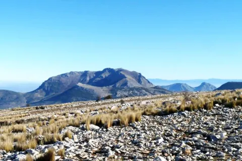
The path from the Veredón to Mojón Blanco runs along the Pecuaria route Colada Fuente de la Teja, in Pegalajar. It allows us to climb to the peak in which the municipal terms of Pegalajar, Mancha Real and Torres are joined, and from which are seen spectacular views of the Bercho umbria, one of the most steep and wild areas of the municipal term Pegalajar. We can also enjoy amazing views of the Sierra de Jaén.

It is a relatively short path that we can complete with a visit to the beautiful village of Pegalajar and its famous pond, which in the years of abundant rains appears as a huge pond within the urban centre.

This path can be linked to those who come from the Royal Mancha, as well as other pecuary ways, or even, to the Pico Almadén.

Breve descripción

The path from the Veredón to Mojón Blanco runs along the Pecuaria route Colada Fuente de la Teja, in Pegalajar. It allows us to climb to the peak in which the municipal terms of Pegalajar, Mancha Real and Torres are joined, and from which are seen spectacular views of the Bercho umbria, one of the most steep and wild areas of the municipal term Pegalajar. We can also enjoy amazing views of the Sierra de Jaén.

It is a relatively short path that we can complete with a visit to the beautiful village of Pegalajar and its famous pond, which in the years of abundant rains appears as a huge pond within the urban centre.

This path can be linked to those who come from the Royal Mancha, as well as other pecuary ways, or even, to the Pico Almadén.

Latitud
37.7861
Longitud
-3.6286
Distrito
Municipio
Ubicación en el mapa
POINT (-3.6286 37.7861)
imagen
Image
1561_SS_05.jpg
Imagen principal
Activado
imagen
Image
Sendero%20Vered%C3%B3n-Moj%C3%B3n%20Blanco.jpg
Imagen principal
Desactivado
imagen
Image
1561_SS_04.jpg
Imagen principal
Desactivado
imagen
Image
1561_SS_02.jpg
Imagen principal
Desactivado
1 h 30 min

Nature

icon-intereses-naturaleza

Friends

icon-intereses-amigos

Adventure

icon-intereses-aventura

Culture

icon-intereses-cultura

Sport

icon-intereses-deporte

Eco-friendly

icon-intereses-eco-friendly

For couples

icon-intereses-en-pareja

Family

icon-intereses-familia

Gastronomy

icon-intereses-gastronomia

Municipality

icon-intereses-municipio

Low-cost tourism

icon-intereses-turismo-low-cost

Solo travel

icon-intereses-viajar-solo
Medium
Sendero Veredón-Mojón Blanco
2,9 km
On foot
All year round
Desactivado
  • In front of COVID19, keep the safety distance and carry a mask, avoid agglomerations and contact with surfaces, wash your hands frequently, use hydroalcoholic gel and consult the available digital materials. Take care of your health and others.
  • It works to prevent fires. Do not throw cigarettes or any other object that produces combustion.
  • By consuming local products and having companies in the area you will contribute to rural development.
  • He lives with the local people and other users. It respects private property and property.
  • Unwind in a sustainable way: public transport, bike, walk, shared vehicle...
  • Noise is another form of pollution. In silence you will enjoy your experience more.
  • It facilitates the use of people with special needs.
  • The trash doesn't come back alone. Take her with you to the nearest container. Reduce, reuse, recycle.
  • Don't leave a mark on your way through nature.
  • It practices a responsible and committed tourism with the environment. Be a real ecotourist!
  • Respect the facilities at your disposal. We all pay for your maintenance.
  • Check the weather forecast before starting your activity.
  • Avoid going out alone. If you do, it communicates tour and time of return to other people.
  • Extreme caution under adverse conditions and with the occasional presence of animals or motor vehicles.
  • Please provide prior information on the possible existence of cynegetic activity.
  • It has water, sun protection, proper clothes and shoes.
  • It carries a mobile with enough battery in case of emergency (112), but remember that there is not always coverage.
  • Don't even bother animals. You would negatively alter his behavior.
  • For your safety and the safety of the environment, don't get out of the signposted road or take shortcuts.
  • Remember that the capture of animals, light fire, fish and collect plants or minerals is prohibited.
  • If you bring a dog, take him with his strap and make sure he doesn't bother other animals or people.
  • Your safety is our concern, but it's your responsibility.

Thank you for your cooperation!

From the city centre of Pegalajar itself, go along the Vereda Real Ubeda-Granada, along the track leading to Mount Bercho. The path begins about 5 km from the village.

Tramo de asfalto o cemento
 
Tramo de pista o camino forestal
 
Tramo de vía pecuaria
 
Tramo de senda
 

Trail Ascent to Hoando de la Laguna

Submitted by brandcode_deweloper on
Id
4982394
Descripción larga

We begin our itinerary on the way to Los Orchertos, between olive groves and orchards irrigated by the waters of the Garganton River that are transported through the existing waterfalls. Then we link with the pecuaria track, which ascends between aulagas and rosemary by this path used for transhumanism. In our tour we will see the Torre del Lucero, a relatively well-preserved atalaya, which during the Reconquest (XIII-XV) was part of the defensive system of the kingdom of Granada.

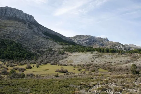
From the Collado del Lucero we see the castles of Bélmez and Solera and we enter into an encore mixed with some maple. We walk through a Kárstico modeling landscape, a limestone that culminates with a dolina known as the Hoyo de la Laguna, the largest of this protected space.

From the end of the path you can link with the signposted path Caño del Aguadero, with beginning in the recreational area Cuadros.

Breve descripción

This beautiful path has its beginning next to the park of the Birth, located in the urban town of Bélmez de la Moraleda, entering into the heart of the Sierra Magina Natural Park by the Cordel de la Laguna. In this area we can see the agricultural, livestock and forestry uses of the area, various defensive constructions and the Arctic modeling of Sierra Magina.

Latitud
38.1104
Longitud
-2.5903
Distrito
Ubicación en el mapa
POINT (-2.5903 38.1104)
imagen
Image
1552_SS_05.jpg
Imagen principal
Activado
imagen
Image
Sendero%20Subida%20al%20Hoyo%20de%20la%20Laguna2.jpg
Imagen principal
Desactivado
imagen
Image
1552_SS_04.jpg
Imagen principal
Desactivado
imagen
Image
1552_SS_01.jpg
Imagen principal
Desactivado
2 h 30 min

Nature

icon-intereses-naturaleza

Friends

icon-intereses-amigos

Adventure

icon-intereses-aventura

Culture

icon-intereses-cultura

Sport

icon-intereses-deporte

Eco-friendly

icon-intereses-eco-friendly

For couples

icon-intereses-en-pareja

Family

icon-intereses-familia

Gastronomy

icon-intereses-gastronomia

Municipality

icon-intereses-municipio

Low-cost tourism

icon-intereses-turismo-low-cost

Solo travel

icon-intereses-viajar-solo
Medium
Sendero Subida al Hoyo de la Laguna
5,5 km
On foot
All year round
Desactivado
  • In front of COVID19, keep the safety distance and carry a mask, avoid agglomerations and contact with surfaces, wash your hands frequently, use hydroalcoholic gel and consult the available digital materials. Take care of your health and others.
  • It works to prevent fires. Do not throw cigarettes or any other object that produces combustion.
  • By consuming local products and having companies in the area you will contribute to rural development.
  • He lives with the local people and other users. It respects private property and property.
  • Unwind in a sustainable way: public transport, bike, walk, shared vehicle...
  • Noise is another form of pollution. In silence you will enjoy your experience more.
  • It facilitates the use of people with special needs.
  • The trash doesn't come back alone. Take her with you to the nearest container. Reduce, reuse, recycle.
  • Don't leave a mark on your way through nature.
  • It practices a responsible and committed tourism with the environment. Be a real ecotourist!
  • Respect the facilities at your disposal. We all pay for your maintenance.
  • Check the weather forecast before starting your activity.
  • Avoid going out alone. If you do, it communicates tour and time of return to other people.
  • Extreme caution under adverse conditions and with the occasional presence of animals or motor vehicles.
  • Please provide prior information on the possible existence of cynegetic activity.
  • It has water, sun protection, proper clothes and shoes.
  • It carries a mobile with enough battery in case of emergency (112), but remember that there is not always coverage.
  • Don't even bother animals. You would negatively alter his behavior.
  • For your safety and the safety of the environment, don't get out of the signposted road or take shortcuts.
  • Remember that the capture of animals, light fire, fish and collect plants or minerals is prohibited.
  • If you bring a dog, take him with his strap and make sure he doesn't bother other animals or people.
  • Your safety is our concern, but it's your responsibility.

Thank you for your cooperation!

From the A-401 take the region road JA-4201 or the region JA-4202 to reach the municipality Bélmez de la Moraleda. The path begins in the urban core itself, at the end of Sierra Magina Avenue.

Trail Pine Forest of Cánava

Submitted by brandcode_deweloper on
Id
4982102
Descripción larga

We began our path in the hermitage of the Virgin of Cánava, near a beautiful square with a magnificent fountain of several years, and with a thick grove around.

Breve descripción

The singularity of this corner of Sierra Magina is undeniable: a forest anchored in the past that for years has remained unchanged. A rise to a pine forest that has been preserved in a state very close to the natural one and which, therefore, retains an unusual beauty intact.

This pine was declared a Pinar Natural Monument of Canavas by the Junta de Andalucía on November 23, 2001. It belongs to the municipal term of Jimena, and is one of the few centenary forests of carrasco pine that remain in Andalusia, with specimens up to 250 years. It borders the edge of the limestone mountain massif and the countryside of the Jaén olive groves. On the way we will access unforgettable landscape panorama and we will be able to observe a wide variety of flora and fauna associated with the different areas to be crossed.

Latitud
37.8244
Longitud
-3.3956
Distrito
Municipio
Ubicación en el mapa
POINT (-3.3956 37.8244)
imagen
Image
1116_SS_02.jpg
Imagen principal
Activado
imagen
Image
Pinar_de_c%C3%A1nava.jpg
Imagen principal
Desactivado
imagen
Image
1116_SS_10.jpg
Imagen principal
Desactivado
imagen
Image
1116_SS_07.jpg
Imagen principal
Desactivado
1 h

Nature

icon-intereses-naturaleza

Friends

icon-intereses-amigos

Adventure

icon-intereses-aventura

Culture

icon-intereses-cultura

Sport

icon-intereses-deporte

Eco-friendly

icon-intereses-eco-friendly

For couples

icon-intereses-en-pareja

Family

icon-intereses-familia

Gastronomy

icon-intereses-gastronomia

Municipality

icon-intereses-municipio

Low-cost tourism

icon-intereses-turismo-low-cost

Solo travel

icon-intereses-viajar-solo
Baja - Media
Sendero Pinar de Cánava
1,7 km
On foot
All year round
Desactivado
  • In front of COVID19, keep the safety distance and carry a mask, avoid agglomerations and contact with surfaces, wash your hands frequently, use hydroalcoholic gel and consult the available digital materials. Take care of your health and others.
  • It works to prevent fires. Do not throw cigarettes or any other object that produces combustion.
  • By consuming local products and having companies in the area you will contribute to rural development.
  • He lives with the local people and other users. It respects private property and property.
  • Unwind in a sustainable way: public transport, bike, walk, shared vehicle...
  • Noise is another form of pollution. In silence you will enjoy your experience more.
  • It facilitates the use of people with special needs.
  • The trash doesn't come back alone. Take her with you to the nearest container. Reduce, reuse, recycle.
  • Don't leave a mark on your way through nature.
  • It practices a responsible and committed tourism with the environment. Be a real ecotourist!
  • Respect the facilities at your disposal. We all pay for your maintenance.
  • Check the weather forecast before starting your activity.
  • Avoid going out alone. If you do, it communicates tour and time of return to other people.
  • Extreme caution under adverse conditions and with the occasional presence of animals or motor vehicles.
  • Please provide prior information on the possible existence of cynegetic activity.
  • It has water, sun protection, proper clothes and shoes.
  • It carries a mobile with enough battery in case of emergency (112), but remember that there is not always coverage.
  • Don't even bother animals. You would negatively alter his behavior.
  • For your safety and the safety of the environment, don't get out of the signposted road or take shortcuts.
  • Remember that the capture of animals, light fire, fish and collect plants or minerals is prohibited.
  • If you bring a dog, take him with his strap and make sure he doesn't bother other animals or people.
  • Your safety is our concern, but it's your responsibility.

Thank you for your cooperation!

As a surprise and a complement to this path, we can go a little more than 100 meters and reach the Caracoles, an ancient and magical village of quarries that worked the round mill stone, in which we will find some of its unique buildings in dry stone.

Up to Jimena for the A-320 (Real- Bedmar Mancha) connects with the A-316 (Estepa-Ubeda) and the A-401 (Ubeda-Moreda). From there go to the upper part of the village to the hermitage of the Virgin of Canava, where you will find the beginning of the path.

Tramo de asfalto o cemento
 
Tramo de pista o camino forestal

 
Tramo de vía pecuaria
 
Tramo de senda
 

Trail las Viñas

Submitted by brandcode_deweloper on
Id
4981725
Descripción larga

It begins in the recreational area of Cuadros, parallel to the Aldelfal de Cuadros trail, which allows us to enjoy beautiful views of the adelfal and its pink flowers in spring and summer. Little by little we will go up and get to know the main water births of Bedmar (Los Sistillos), always accompanied by the extraordinary views of this unique site.

In our ascent we will find the cornicabra abundantly. This plant acquires tones from yellow to red in the autumn, the best time to appreciate the beauty of these formations.

We will go up to privileged locations from which we will see wide panoramic views of the Sierra Magina Natural Park. A varied vegetation will be offered at our pace, both natural and cultivated. And we will also be able to know something about the history and heritage of these mountains.

If we turn a little bit, we can visit the view-conditioning at the Torreón de Cuadros. This watchtower looks at the steep valley of the Cuadros River and a beautiful landscape of gardens and crops. The contrast of this landscape well deserves that little effort as it deviates.

Breve descripción

This is a circular path of making it difficult to average, in which we will find a great diversity of very interesting elements.

Latitud
37.8244
Longitud
-3.3956
Distrito
Municipio
Ubicación en el mapa
POINT (-3.3956 37.8244)
imagen
Image
724_SS_04.jpg
Imagen principal
Activado
imagen
Image
sendero%20las%20vi%C3%B1as.jpg
Imagen principal
Desactivado
imagen
Image
724_SS_06.jpg
Imagen principal
Desactivado
imagen
Image
724_SS_05.jpg
Imagen principal
Desactivado
3 h

Nature

icon-intereses-naturaleza

Friends

icon-intereses-amigos

Adventure

icon-intereses-aventura

Culture

icon-intereses-cultura

Sport

icon-intereses-deporte

Eco-friendly

icon-intereses-eco-friendly

For couples

icon-intereses-en-pareja

Family

icon-intereses-familia

Gastronomy

icon-intereses-gastronomia

Municipality

icon-intereses-municipio

Low-cost tourism

icon-intereses-turismo-low-cost

Solo travel

icon-intereses-viajar-solo
Medium
Document
Sendero las Viñas
8,7 km
On foot
All year round
Desactivado

Recreative area of squares

  • In front of COVID19, keep the safety distance and carry a mask, avoid agglomerations and contact with surfaces, wash your hands frequently, use hydroalcoholic gel and consult the available digital materials. Take care of your health and others.
  • It works to prevent fires. Do not throw cigarettes or any other object that produces combustion.
  • By consuming local products and having companies in the area you will contribute to rural development.
  • He lives with the local people and other users. It respects private property and property.
  • Unwind in a sustainable way: public transport, bike, walk, shared vehicle...
  • Noise is another form of pollution. In silence you will enjoy your experience more.
  • It facilitates the use of people with special needs.
  • The trash doesn't come back alone. Take her with you to the nearest container. Reduce, reuse, recycle.
  • Don't leave a mark on your way through nature.
  • It practices a responsible and committed tourism with the environment. Be a real ecotourist!
  • Respect the facilities at your disposal. We all pay for your maintenance.
  • Check the weather forecast before starting your activity.
  • Avoid going out alone. If you do, it communicates tour and time of return to other people.
  • Extreme caution under adverse conditions and with the occasional presence of animals or motor vehicles.
  • Please provide prior information on the possible existence of cynegetic activity.
  • It has water, sun protection, proper clothes and shoes.
  • It carries a mobile with enough battery in case of emergency (112), but remember that there is not always coverage.
  • Don't even bother animals. You would negatively alter his behavior.
  • For your safety and the safety of the environment, don't get out of the signposted road or take shortcuts.
  • Remember that the capture of animals, light fire, fish and collect plants or minerals is prohibited.
  • If you bring a dog, take him with his strap and make sure he doesn't bother other animals or people.
  • Your safety is our concern, but it's your responsibility.

Thank you for your cooperation!

From the village of Bedmar we will take the road leading to the Sanctuary of the Virgin of Cuadros, just before crossing the bridge over the river we will deviate on the left track until we reach the recreational area Adelfal de Cuadros, the starting point of this path.

To end the path we will pass by the beautiful hermitage of the Virgin of Cuadros, and next to the impressive Cueva del Agua, ideal to visit in summer and refresh, if we want to walk within the river and discover three caves through which the river runs forming spectacular formations as a result of the water's spread over time. In this case, it is recommended to wear shoes and clothes for water.

Trail la Cave of Graja

Submitted by brandcode_deweloper on
Id
4981374
Breve descripción

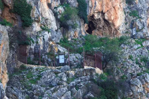
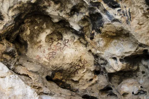
Due to the limestone materials and the action of the water, in the Sierra Magina Natural Park there are oysters. The abundance of hunting and the wild fruits convinced our ancestors of the Neolithic, the first inhabitants of the Guadalquivir, to make it a place of residence. This is a test of the cave, actually a coat, that we visit with this path. National Historical Monument since 1924, and Good of Cultural Interest, in it we can see representations of rites and pastoralism.

Latitud
37.8244
Longitud
-3.3956
Distrito
Municipio
Ubicación en el mapa
POINT (-3.3956 37.8244)
imagen
Image
1%20%282%29.jpg
Imagen principal
Activado
imagen
Image
Sendero%20la%20Cueva%20de%20la%20Graja.jpg
Imagen principal
Desactivado
imagen
Image
721_SS_04.jpg
Imagen principal
Desactivado
imagen
Image
721_SS_03.jpg
Imagen principal
Desactivado
30 min

Nature

icon-intereses-naturaleza

Friends

icon-intereses-amigos

Adventure

icon-intereses-aventura

Culture

icon-intereses-cultura

Sport

icon-intereses-deporte

Eco-friendly

icon-intereses-eco-friendly

For couples

icon-intereses-en-pareja

Family

icon-intereses-familia

Gastronomy

icon-intereses-gastronomia

Municipality

icon-intereses-municipio

Low-cost tourism

icon-intereses-turismo-low-cost

Solo travel

icon-intereses-viajar-solo
Medium
Sendero la Cueva de la Graja
0,6 km
On foot
All year round
Desactivado
  • In front of COVID19, keep the safety distance and carry a mask, avoid agglomerations and contact with surfaces, wash your hands frequently, use hydroalcoholic gel and consult the available digital materials. Take care of your health and others.
  • It works to prevent fires. Do not throw cigarettes or any other object that produces combustion.
  • By consuming local products and having companies in the area you will contribute to rural development.
  • He lives with the local people and other users. It respects private property and property.
  • Unwind in a sustainable way: public transport, bike, walk, shared vehicle...
  • Noise is another form of pollution. In silence you will enjoy your experience more.
  • It facilitates the use of people with special needs.
  • The trash doesn't come back alone. Take her with you to the nearest container. Reduce, reuse, recycle.
  • Don't leave a mark on your way through nature.
  • It practices a responsible and committed tourism with the environment. Be a real ecotourist!
  • Respect the facilities at your disposal. We all pay for your maintenance.
  • Check the weather forecast before starting your activity.
  • Avoid going out alone. If you do, it communicates tour and time of return to other people.
  • Extreme caution under adverse conditions and with the occasional presence of animals or motor vehicles.
  • Please provide prior information on the possible existence of cynegetic activity.
  • It has water, sun protection, proper clothes and shoes.
  • It carries a mobile with enough battery in case of emergency (112), but remember that there is not always coverage.
  • Don't even bother animals. You would negatively alter his behavior.
  • For your safety and the safety of the environment, don't get out of the signposted road or take shortcuts.
  • Remember that the capture of animals, light fire, fish and collect plants or minerals is prohibited.
  • If you bring a dog, take him with his strap and make sure he doesn't bother other animals or people.
  • Your safety is our concern, but it's your responsibility.

Thank you for your cooperation!

The paintings present different tonalities, which can go from chestnut to more or less dark red. These colors were obtained by means of mineral pigments, iron oxide and ferruginous clays, mixed with animal fat. The schematic painting is of difficult and complex interpretation, and is mainly linked to the social structure of the groups in the area and the tasks they performed: collection, hunting and grazing.

The paintings we see inside are quite abstract, with relatively thick strokes. Possibly made with their own fingers, or with a rite crushed like a rustic brush. Several representations appear: zoomorphic and anthropomorphic figures. Some of the human figures are accompanied by ornaments such as feathers, horns, weapons or other objects. The figure of an occulate, with tentacles and surrounded by human figures with arms in hand, is most powerful. Other representative paintings are those of two figures together and of an individual who seems to feed an animal.

To be able to visit these paintings it is necessary to order the key in the City Council of Jimena or in the Hermitage of the Virgin of Canava, next to its beautiful square with a magnificent fountain of several years, and with a thick grove around, located shortly before the beginning of the path.

Even Jimena for the A-320 (Real-Bedmar Mancha) connects with the A-316 (Estepa-Ubeda) and the A-401 (Ubeda-Moreda). From there to the upper part of the village and 100 m from the entrance of the municipal pool, you will find the beginning of the path.

Tramo de asfalto o cemento
 
Tramo de pista o camino forestal
 
Tramo de vía pecuaria
 
Tramo de senda
 

Trail Gibralberca

Submitted by brandcode_deweloper on
Id
4981199
Breve descripción

It is a path of medium length, whose journey is interesting to pass from the southern to the northern slopes in a short space of time, which allows us to contemplate the change of existing vegetation. There are many botanical species that we can observe and which are typical of the Mediterranean forest. We will find coals of considerable bearing, centenary complaints, repopulation pines such as the carrasco or the resinero, maples, skirmishes, cornicabra, majuelos, tojos, omillos...

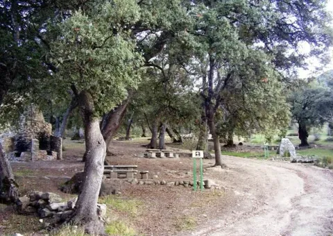
Starting from the peaceful recreational area of Gibralbca, where we will find centenary oaks, we take a path that will take us to a point from which we can contemplate the crest of Magina by its southern face with several peaks of the saw that exceed 2,000 meters in height, such as those of Almadén, Pico Magina and Ponce and the different floors of the vegetation depending on the altitude. On the way down we will reach the Umbria of Cano and on that piece of the path it is not difficult to observe specimens of real eagle.

Latitud
37.6681
Longitud
-3.5742
Distrito
Municipio
Ubicación en el mapa
POINT (-3.5742 37.6681)
imagen
Image
722_SS_05.jpg
Imagen principal
Activado
imagen
Image
Sendero%20Gibralberca.jpg
Imagen principal
Desactivado
imagen
Image
Sendero%20Gibralberca2.jpg
Imagen principal
Desactivado
imagen
Image
722_SS_01%20%281%29.jpg
Imagen principal
Desactivado
imagen
Image
722_SS_06.jpg
Imagen principal
Desactivado
2 h

Nature

icon-intereses-naturaleza

Friends

icon-intereses-amigos

Adventure

icon-intereses-aventura

Culture

icon-intereses-cultura

Sport

icon-intereses-deporte

Eco-friendly

icon-intereses-eco-friendly

For couples

icon-intereses-en-pareja

Family

icon-intereses-familia

Gastronomy

icon-intereses-gastronomia

Municipality

icon-intereses-municipio

Low-cost tourism

icon-intereses-turismo-low-cost

Solo travel

icon-intereses-viajar-solo
Baja - Media
Sendero Gibralberca
5,7 km
On foot
All year round
Desactivado
  • In front of COVID19, keep the safety distance and carry a mask, avoid agglomerations and contact with surfaces, wash your hands frequently, use hydroalcoholic gel and consult the available digital materials. Take care of your health and others.
  • It works to prevent fires. Do not throw cigarettes or any other object that produces combustion.
  • By consuming local products and having companies in the area you will contribute to rural development.
  • He lives with the local people and other users. It respects private property and property.
  • Unwind in a sustainable way: public transport, bike, walk, shared vehicle...
  • Noise is another form of pollution. In silence you will enjoy your experience more.
  • It facilitates the use of people with special needs.
  • The trash doesn't come back alone. Take her with you to the nearest container. Reduce, reuse, recycle.
  • Don't leave a mark on your way through nature.
  • It practices a responsible and committed tourism with the environment. Be a real ecotourist!
  • Respect the facilities at your disposal. We all pay for your maintenance.
  • Check the weather forecast before starting your activity.
  • Avoid going out alone. If you do, it communicates tour and time of return to other people.
  • Extreme caution under adverse conditions and with the occasional presence of animals or motor vehicles.
  • Please provide prior information on the possible existence of cynegetic activity.
  • It has water, sun protection, proper clothes and shoes.
  • It carries a mobile with enough battery in case of emergency (112), but remember that there is not always coverage.
  • Don't even bother animals. You would negatively alter his behavior.
  • For your safety and the safety of the environment, don't get out of the signposted road or take shortcuts.
  • Remember that the capture of animals, light fire, fish and collect plants or minerals is prohibited.
  • If you bring a dog, take him with his strap and make sure he doesn't bother other animals or people.
  • Your safety is our concern, but it's your responsibility.

Thank you for your cooperation!

It has access from the A-324 (Cambil-Huelma) road, located among the towns of Huelma at 9.1 km. and Cambil, at 10.2 km. From here a road leads to the recreational area of Gibralbca.

Trail Fuenmaandor

Submitted by brandcode_deweloper on
Id
4979890
Breve descripción

This is a particularly beautiful path in the flowering season of the cherry tree, where we can enjoy this unique spectacle of nature with a walk, or just reaching its starting point in the Fuenmayor recreational area.

Latitud
37.7917
Longitud
-3.5447
Distrito
Municipio
Ubicación en el mapa
POINT (-3.5447 37.7917)
imagen
Image
723_SS_03.jpg
Imagen principal
Activado
imagen
Image
Sendero%20Fuenmayor.jpg
Imagen principal
Desactivado
imagen
Image
Sendero%20Fuenmayor2.jpg
Imagen principal
Desactivado
imagen
Image
723_SS_05.jpg
Imagen principal
Desactivado
2 h 20 min

Nature

icon-intereses-naturaleza

Friends

icon-intereses-amigos

Adventure

icon-intereses-aventura

Culture

icon-intereses-cultura

Sport

icon-intereses-deporte

Eco-friendly

icon-intereses-eco-friendly

For couples

icon-intereses-en-pareja

Family

icon-intereses-familia

Gastronomy

icon-intereses-gastronomia

Municipality

icon-intereses-municipio

Low-cost tourism

icon-intereses-turismo-low-cost

Solo travel

icon-intereses-viajar-solo
Medium
Sendero Fuenmayor
6,4 km
On foot
All year round
Desactivado

Also in winter this path can be an adventure and allow us to enjoy the snow with the whole family, or be a starting point for lovers of the high mountain.
In summer, it is one of the coolest areas of the natural park, and we can enjoy our picnic in the refreshing Fuenmayor.

  • In front of COVID19, keep the safety distance and carry a mask, avoid agglomerations and contact with surfaces, wash your hands frequently, use hydroalcoholic gel and consult the available digital materials. Take care of your health and others.
  • It works to prevent fires. Do not throw cigarettes or any other object that produces combustion.
  • By consuming local products and having companies in the area you will contribute to rural development.
  • He lives with the local people and other users. It respects private property and property.
  • Unwind in a sustainable way: public transport, bike, walk, shared vehicle...
  • Noise is another form of pollution. In silence you will enjoy your experience more.
  • It facilitates the use of people with special needs.
  • The trash doesn't come back alone. Take her with you to the nearest container. Reduce, reuse, recycle.
  • Don't leave a mark on your way through nature.
  • It practices a responsible and committed tourism with the environment. Be a real ecotourist!
  • Respect the facilities at your disposal. We all pay for your maintenance.
  • Check the weather forecast before starting your activity.
  • Avoid going out alone. If you do, it communicates tour and time of return to other people.
  • Extreme caution under adverse conditions and with the occasional presence of animals or motor vehicles.
  • Please provide prior information on the possible existence of cynegetic activity.
  • It has water, sun protection, proper clothes and shoes.
  • It carries a mobile with enough battery in case of emergency (112), but remember that there is not always coverage.
  • Don't even bother animals. You would negatively alter his behavior.
  • For your safety and the safety of the environment, don't get out of the signposted road or take shortcuts.
  • Remember that the capture of animals, light fire, fish and collect plants or minerals is prohibited.
  • If you bring a dog, take him with his strap and make sure he doesn't bother other animals or people.
  • Your safety is our concern, but it's your responsibility.

Thank you for your cooperation!

The beginning of this path is located in the recreational area of Fuenmayor, which is accessed by the road that is part of the end of the promenade of San Isidoro, in the town of Torres. You have to travel 7 Km from the village to the equipment.

Starting from the Fuenmayor recreational area, we started a rising road that a mile later leads us to the Zurreon waterfall. Later on, this path offers us a beautiful panoramic view of Torres and the landscape of crops that unfolds around this town and ends up introducing us on a narrow road surrounded by cherry, cakis and olive trees.

From this path we can easily link with the end of the path Subida Puerto de la Mata, from which we will enjoy beautiful views of the magnificent dehesa of Mata Bejid, completely different from those that accompanied us.

Tramo de asfalto o cemento
 
Tramo de pista o camino forestal
 
Tramo de vía pecuaria
 
Tramo de senda
 

Trail Castle of Albanchez

Submitted by brandcode_deweloper on
Id
4979788
Breve descripción

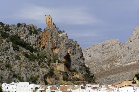
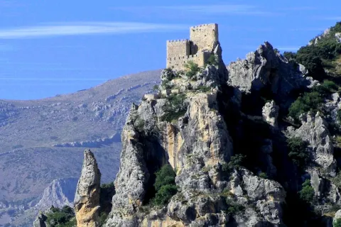
Jaén is the province of most castles per square kilometre in all of Europe, which is explained by its strategic value. The region of Magina was an important border between the kingdoms of Castile and Granada, which led its conquerors throughout history to lift fortifications that would allow the surveillance and defense. That's the case with Albánchez Castle. Of Christian origin but raised on Arab remains, it served to master the steps of Almadén and Magina.

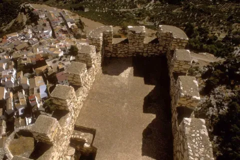
The interest of this short, but intense path is historical and landscape. In addition, once we go up to the viewpoint of the castle of Albanchez de Magina, we will find impressive and extensive views of the territory and its varied landscapes. If we stand among their almenas and let our imagination fly, we can evoke how these lands could be in the time of skirmishes between the Christian and Muslim kingdoms during the Middle Ages; from here, the sentinels, it would be cold or hot, they watched any movement of enemy troops.

Latitud
37.8244
Longitud
-3.3956
Distrito
Ubicación en el mapa
POINT (-3.3956 37.8244)
imagen
Image
3.jpg
Imagen principal
Activado
imagen
Image
Sendero%20Castillo%20de%20Albanchez.jpg
Imagen principal
Desactivado
imagen
Image
728_SS_02.jpg
Imagen principal
Desactivado
imagen
Image
728_SS_05.jpg
Imagen principal
Desactivado
20 min

Nature

icon-intereses-naturaleza

Friends

icon-intereses-amigos

Adventure

icon-intereses-aventura

Culture

icon-intereses-cultura

Sport

icon-intereses-deporte

Eco-friendly

icon-intereses-eco-friendly

For couples

icon-intereses-en-pareja

Family

icon-intereses-familia

Gastronomy

icon-intereses-gastronomia

Municipality

icon-intereses-municipio

Low-cost tourism

icon-intereses-turismo-low-cost

Solo travel

icon-intereses-viajar-solo
Medium
Sendero Castillo de Albanchez
0,2 km
On foot
All year round
Desactivado
  • In front of COVID19, keep the safety distance and carry a mask, avoid agglomerations and contact with surfaces, wash your hands frequently, use hydroalcoholic gel and consult the available digital materials. Take care of your health and others.
  • It works to prevent fires. Do not throw cigarettes or any other object that produces combustion.
  • By consuming local products and having companies in the area you will contribute to rural development.
  • He lives with the local people and other users. It respects private property and property.
  • Unwind in a sustainable way: public transport, bike, walk, shared vehicle...
  • Noise is another form of pollution. In silence you will enjoy your experience more.
  • It facilitates the use of people with special needs.
  • The trash doesn't come back alone. Take her with you to the nearest container. Reduce, reuse, recycle.
  • Don't leave a mark on your way through nature.
  • It practices a responsible and committed tourism with the environment. Be a real ecotourist!
  • Respect the facilities at your disposal. We all pay for your maintenance.
  • Check the weather forecast before starting your activity.
  • Avoid going out alone. If you do, it communicates tour and time of return to other people.
  • Extreme caution under adverse conditions and with the occasional presence of animals or motor vehicles.
  • Please provide prior information on the possible existence of cynegetic activity.
  • It has water, sun protection, proper clothes and shoes.
  • It carries a mobile with enough battery in case of emergency (112), but remember that there is not always coverage.
  • Don't even bother animals. You would negatively alter his behavior.
  • For your safety and the safety of the environment, don't get out of the signposted road or take shortcuts.
  • Remember that the capture of animals, light fire, fish and collect plants or minerals is prohibited.
  • If you bring a dog, take him with his strap and make sure he doesn't bother other animals or people.
  • Your safety is our concern, but it's your responsibility.

Thank you for your cooperation!

Up to Albanchez de Magina by the A-320 (Real-Bedmar Mancha) taking the JA-3105 or JA-1107. From there go to the City Hall Square from where the start point of the path is marked, next to the last houses of the town.

Trail Adelfal de Cuadros

Submitted by brandcode_deweloper on
Id
4979539
Breve descripción

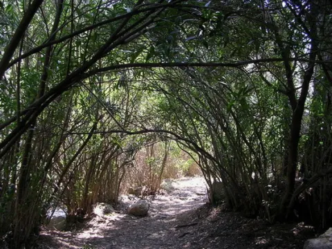
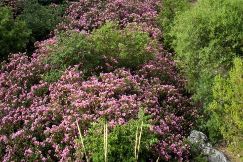
The natural adelfal of the Cuadros River is probably one of the largest in size and importance of the Iberian Peninsula. This plant has a beautiful flowering in spring and summer that colors the beautiful valley of the river Cuadros in pink, intertwined between cutting and vertical folds, with a rich geological diversity. The adelfas, plants that do not resist the frost, are located in the lower parts of the Sierra Magina Natural Park and in areas where there are nearby watercourses. Wept willows, fig trees, and other species of the banks are jalonar the path.

Located in the incomparable area of Cuadros near the town of Bedmar, this path offers the visitor a short but unforgettable tour. It will enter a river that cherishes one of the most important natural masses of thinning on the peninsula. During its passage, we will be able to observe the exuberance of the alderfal formations that develop exceptional tree ports. The sound of water will accompany us during our journey by relaxing our senses, and by surprise us in summer with a fresh and spectacular getaway.

Along the path and intermittently it is possible to have as a reference the tower of Cuadros, a milestone that recalls the past of these lands as the border of the kingdom of Granada.

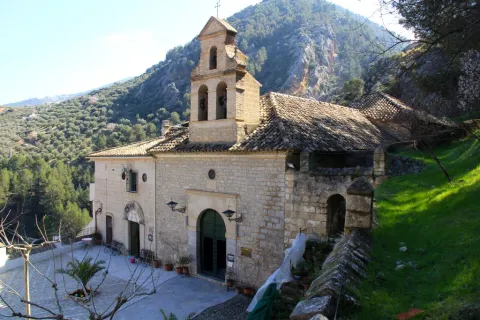
Next to the path, next to the hermitage of the venerated Virgin of Cuadros we find the Cave of Water, a magical place for the summer, if we want to walk within the river and discover three caves by which the river runs forming spectacular formations as a result of the spread of the water over time.

It also links this path with the path of the Viñas, which brings us closer to the view of Torreón de Cuadros with unbeatable views over this unique valley.

Latitud
37.8244
Longitud
-3.3956
Distrito
Municipio
Ubicación en el mapa
POINT (-3.3956 37.8244)
imagen
Image
1.jpg
Imagen principal
Activado
imagen
Image
Sendero%20Adelfal%20de%20Cuadros.JPG
Imagen principal
Desactivado
imagen
Image
727_SS_05.jpg
Imagen principal
Desactivado
imagen
Image
727_SS_03.jpg
Imagen principal
Desactivado
imagen
Image
727_SS_04.jpg
Imagen principal
Desactivado
20 min

Nature

icon-intereses-naturaleza

Friends

icon-intereses-amigos

Adventure

icon-intereses-aventura

Culture

icon-intereses-cultura

Sport

icon-intereses-deporte

Eco-friendly

icon-intereses-eco-friendly

For couples

icon-intereses-en-pareja

Family

icon-intereses-familia

Gastronomy

icon-intereses-gastronomia

Municipality

icon-intereses-municipio

Low-cost tourism

icon-intereses-turismo-low-cost

Solo travel

icon-intereses-viajar-solo
Baja
Sendero Adelfal de Cuadros
0,4 km
On foot
All year round
Desactivado
  • In front of COVID19, keep the safety distance and carry a mask, avoid agglomerations and contact with surfaces, wash your hands frequently, use hydroalcoholic gel and consult the available digital materials. Take care of your health and others.
  • It works to prevent fires. Do not throw cigarettes or any other object that produces combustion.
  • By consuming local products and having companies in the area you will contribute to rural development.
  • He lives with the local people and other users. It respects private property and property.
  • Unwind in a sustainable way: public transport, bike, walk, shared vehicle...
  • Noise is another form of pollution. In silence you will enjoy your experience more.
  • It facilitates the use of people with special needs.
  • The trash doesn't come back alone. Take her with you to the nearest container. Reduce, reuse, recycle.
  • Don't leave a mark on your way through nature.
  • It practices a responsible and committed tourism with the environment. Be a real ecotourist!
  • Respect the facilities at your disposal. We all pay for your maintenance.
  • Check the weather forecast before starting your activity.
  • Avoid going out alone. If you do, it communicates tour and time of return to other people.
  • Extreme caution under adverse conditions and with the occasional presence of animals or motor vehicles.
  • Please provide prior information on the possible existence of cynegetic activity.
  • It has water, sun protection, proper clothes and shoes.
  • It carries a mobile with enough battery in case of emergency (112), but remember that there is not always coverage.
  • Don't even bother animals. You would negatively alter his behavior.
  • For your safety and the safety of the environment, don't get out of the signposted road or take shortcuts.
  • Remember that the capture of animals, light fire, fish and collect plants or minerals is prohibited.
  • If you bring a dog, take him with his strap and make sure he doesn't bother other animals or people.
  • Your safety is our concern, but it's your responsibility.

Thank you for your cooperation!

From the village of Bedmar we will take the road leading to the Sanctuary of the Virgin of Cuadros, just before crossing the bridge over the river we will deviate on the left track until we reach the recreational area Adelfal de Cuadros, the starting point of this path.

Tramo de asfalto o cemento
 
Tramo de pista o camino forestal

 
Tramo de vía pecuaria
 
Tramo de senda