Saltar al contenido principal
icon-intereses-viajar-solo

Jabalquinto Park

Submitted by brandcode_deweloper on
Id
8122790
Descripción
Descripción larga

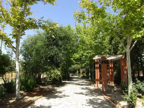
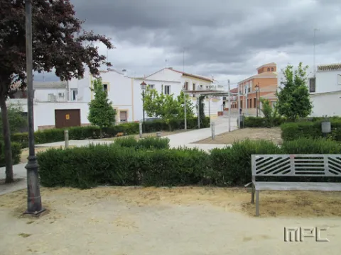
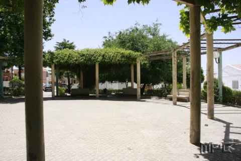
The park is located in a public square in the centre of the city centre, with urban facilities and furniture dating back to the 1980s and which were old and in disuse. "It is a comprehensive project that will remodel this Freedom Park, which is almost 40 years old and has an image of deterioration," he adds. In this first phase, the entire infrastructure of supply, sanitation and public lighting is being changed. This performance will continue in a second phase in which all the urban furniture will be completed, consisting of banks running around the alcorques and the children's playground, as well as the covering of the fountain and the decorative lighting of the whole.

Breve descripción

New park on Avenida de Andalucía. It was designed to build a biosaludable park for outdoor sport with swing area for children.

Telecomunicaciones
Teléfono de contacto
953 617 056
Correo electrónico
jabalquinto@jabalquinto.es
Ubicación
Código Postal
23712
Latitud
38.019340
Longitud
-3.726970
Distrito
Municipio
Ubicación en el mapa
POINT (-3.72697 38.01934)
Tipos de punto de interés
Imágenes carrusel
imagen
Image
parque%20Jabalquinto%20%281%29.jpg
Imagen principal
Desactivado
Imágenes cabecera
imagen
Image
parque%20Jabalquinto2%20%281%29.jpg
Imagen principal
Activado
Loading map
Preparing points of interest and routes...

Pilar de la Dehesa Park

Submitted by brandcode_deweloper on
Id
4445246
Descripción
Descripción larga

Location: In the area of the same name, very close to the city centre.
Distance: 1.4 km
Medium: By vehicle tourism or on foot.
Access route:: A rural road that leaves the town directly

Breve descripción

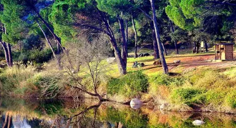
Leisure and rest place with shade areas with barbecues, water sources and table

Ubicación
Código Postal
23628
Latitud
37.983890
Longitud
-3.882950
Distrito
Municipio
Ubicación en el mapa
POINT (-3.88295 37.98389)
Tipos de punto de interés
Imágenes carrusel
imagen
Image
pilardehesa.jpg
Imagen principal
Desactivado
Microsite al que pertenece
Loading map
Preparing points of interest and routes...

Natural Park Sierra de Andújar

Submitted by brandcode_deweloper on
Id
1914790
Descripción
Descripción larga

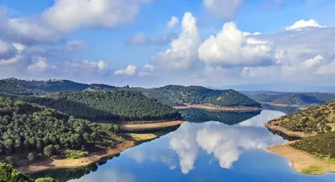
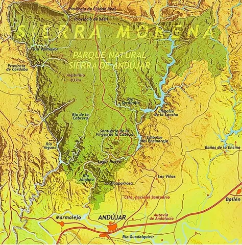
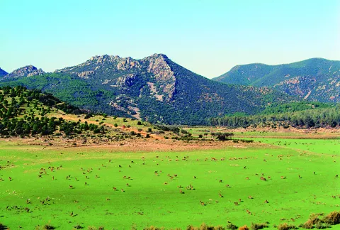
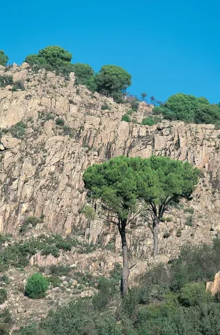
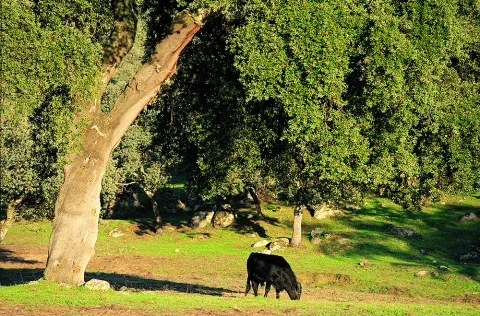
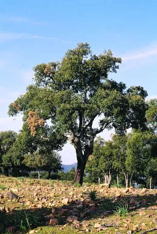
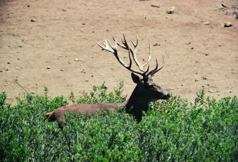
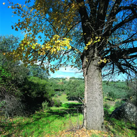
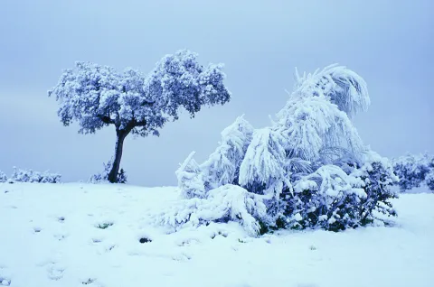
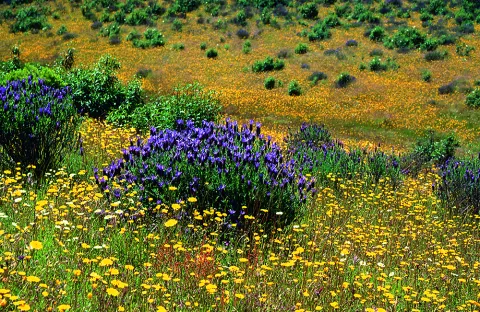
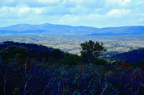
The Sierra de Andújar Natural Park has a varied morphology and altitude. The most extensive natural vegetation spots in Sierra Morena are observed in this environment, with the oaks, the complaints and the alcornoques being the predominant species.

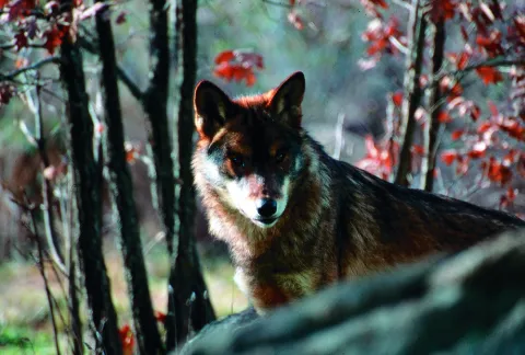
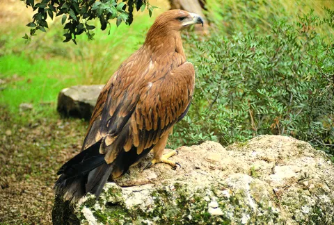
In Sierra Quintana, Atlantic obledals are located. In addition, valuable species of fauna, such as the lince or the royal eagle, find in the Sierras de Andújar one of its few shelters within the Iberian Peninsula.

Livestock is of some importance in the local economy, with extensive dehesas dedicated to the raising of ligia bulls or to the exploitation of deer, gores, lambs, muflons and boars. Thus, hunting sport is a major economic resource in the famous public and private areas of the Park.

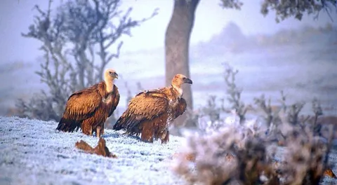
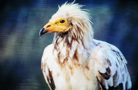
It is not difficult to see in the sky of the Sierra de Andújar Natural Park the spectacular flights of the royal, perdicular and imperial eagles, the last one on the Iberian Peninsula and which has in this area one of its last shelters. Three carrion species can also be observed: the leonate vulture, the black and the alenoche.

Of tourist interest are the Sanctuary of the Virgin of the Head, where each year by May is celebrated the oldest Romeria in Spain, the Jandula and Encinarejo reservoirs, the Cercado del Ciprés Environmental Complex, which has a botanical garden and a Nature Hall, among other facilities, or the Mirador del Peregrino.

BASIC PARTICULARS

Geographical location: To the north-west of the province

Municipalities: Andújar, Baños de la Encina, Villanueva de la Reina and Marmolejo

Coordinates: 38º16 'N; 4º6' W

Date of declaration1989

Area74,774 ha.

Altitude: between 500 and 1,290 m. (Pico Burcio del Pino)

Climate data:
- Average monthly temperatures: Between 9 ° C (January) and 28 ° C (August)
- Average annual accuracy: 570 mm.

Main training:
Mediterranean mountain of cherries and river vegetation

Natural Park Office:
Environmental complex Cercado del Ciprés
The way of the Rubials, s / n. 23740 Andújar
Tel.: + 34 953 539 620
Fax: + 34 953 012 508
Email:pn.andujar.cma @ juntadeandalucia.es

Visitors' Centre:
Peñallana vineyards
Ctra. A-6177 Andújar - Virgin of the Head Sanctuary, Km. 13. 23740 Andújar
Tel.: 953 549 030
Email:cv _ vinasdepenallana @ egmasa.es

Other protection figures:
Area of Special Protection for Birds [ZEPA (2002)]

Other equipment for public use:
- La Recta recreational area
- Recreative area of the Encinarejo
- Recreative area of the Aliseda
- Jabali recreational area
- Mirador de las Mahadillas
- Jandula Viewer
- Viewer of the Old Way
- Cosomal Viewer

More information:
http: / / www.juntadeandalucia.es / environment / site / web /
http: / / www.prodecan.es /

Breve descripción

The Natural Park of Sierra de Andújar is located to the northwest of the province of Jaén, in the heart of Sierra Morena, just a step from the city of Andújar. It has an area of 74,774 hectares, and contains four municipal terms: Andújar, Baños de la Encina, Villanueva de la Reina and Marmolejo.

Ubicación
Latitud
38.289780
Longitud
-4.028650
Distrito
Municipio
Ubicación en el mapa
POINT (-4.02865 38.28978)
Tipos de punto de interés
Imágenes carrusel
imagen
Image
Anotaci%C3%B3n%202020-04-16%20084514.jpg
Imagen principal
Desactivado
imagen
Image
Anotaci%C3%B3n%202020-04-16%20084445.jpg
Imagen principal
Desactivado
imagen
Image
Anotaci%C3%B3n%202020-04-16%20084429.jpg
Imagen principal
Desactivado
imagen
Image
Anotaci%C3%B3n%202020-04-16%200884850.jpg
Imagen principal
Desactivado
imagen
Image
Natu044.jpg
Imagen principal
Desactivado
imagen
Image
Natu422.jpg
Imagen principal
Desactivado
imagen
Image
Natu424.jpg
Imagen principal
Desactivado
imagen
Image
Natu135.jpg
Imagen principal
Desactivado
imagen
Image
Natu161.jpg
Imagen principal
Desactivado
imagen
Image
v-lwu0Cw.jpeg
Imagen principal
Desactivado
imagen
Image
Natu174.jpg
Imagen principal
Desactivado
imagen
Image
Natu267.jpg
Imagen principal
Desactivado
imagen
Image
Natu141.jpg
Imagen principal
Desactivado
imagen
Image
Natu142.jpg
Imagen principal
Desactivado
imagen
Image
Natu139.jpg
Imagen principal
Desactivado
imagen
Image
Natu158.jpg
Imagen principal
Desactivado
imagen
Image
Natu222.jpg
Imagen principal
Desactivado
imagen
Image
Natu245.jpg
Imagen principal
Desactivado
imagen
Image
Natu247.jpg
Imagen principal
Desactivado
imagen
Image
Natu248.jpg
Imagen principal
Desactivado
Imágenes cabecera
imagen
Image
9576153667_3b55af2da2_b.jpg
Imagen principal
Activado
Microsite al que pertenece
Loading map
Preparing points of interest and routes...

Manuel Jurado Park

Submitted by brandcode_deweloper on
Id
8521441
Descripción
Descripción larga

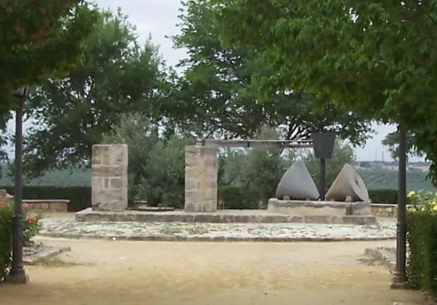
Park to extramuros south of the villa of Sabiote. Just where the south wall is attached to the west wall of the Sabiote wall. Located under the Pasaje de los Torreones and at the beginning of San Januario Street. In it is the Mill of the Manuel Jurado Park.

Breve descripción

For its strategic position, it is a lookout with beautiful views over Sierra Magina, as well as those of Cazorla, Segura and Las Villas. This park was opened in June 2003.

Telecomunicaciones
Teléfono de contacto
953 773 002
Ubicación
Código Postal
23410
Latitud
38.068360
Longitud
-3.305080
Dirección
C/ San Juanario, 6
Municipio
Ubicación en el mapa
POINT (-3.30508 38.06836)
Tipos de punto de interés
Imágenes cabecera
imagen
Image
parque_manuel_jurado.jpg
Imagen principal
Activado
Loading map
Preparing points of interest and routes...

The Verja Park

Submitted by brandcode_deweloper on
Id
8123608
Descripción
Breve descripción

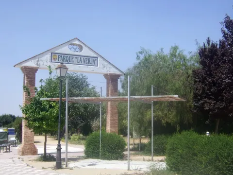
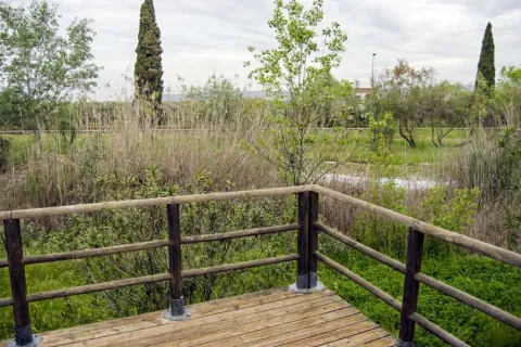
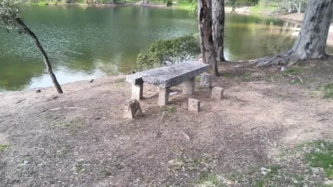
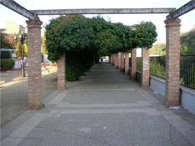
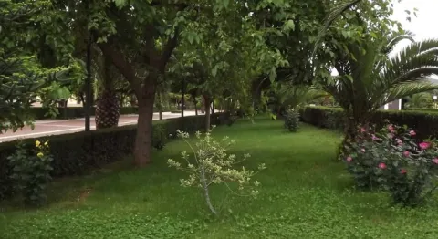
It is a green area full of gardens and vegetation as a walk, very frequented by the inhabitants of Lopera for sports practice.

Telecomunicaciones
Teléfono de contacto
953 516 250
Ubicación
Código Postal
23780
Latitud
37.944700
Longitud
-4.217430
Dirección
C/ Estanque
Distrito
Municipio
Ubicación en el mapa
POINT (-4.21743 37.9447)
Imágenes carrusel
imagen
Image
Parque%20La%20Verja3.jpg
Imagen principal
Desactivado
imagen
Image
Parque%20La%20Verja%20%281%29.jpg
Imagen principal
Desactivado
Imágenes cabecera
imagen
Image
Parque%20La%20Verja2.jpg
Imagen principal
Activado
Loading map
Preparing points of interest and routes...

Cercado del Ciprés Forest Park

Submitted by brandcode_deweloper on
Id
2980366
Descripción
Descripción larga

This peri-urban environmental park occupies 11 hectares of land and has recreational areas, bike lane, trails, viewpoints, wooden buildings, classrooms, aviary, artificial lake and botanical garden. In the Cercado del Ciprés we will enjoy a beautiful courtyard of oranges, which presents a system of irrigation lacquers that reminiscent of the gardens of Muslim design. Here are the offices of the Sierras de Andújar Natural Park as well as a visitor information point. The environmental education activities they organize include the scientific nesting of birds and workshops on beekeeping, fishing and identification of animal prints.

Breve descripción

The Cercado del Ciprés forest park is located on the outskirts of the city of Andújar, next to the Alto Guadalquivir Regional Hospital, on the Rubiales Road and just 250 m from the Andalusian motorway.

Ubicación
Código Postal
23740
Latitud
38.042910
Longitud
-4.026890
Dirección
Camino de los Rubiales, s/n
Distrito
Municipio
Ubicación en el mapa
POINT (-4.02689 38.04291)
Imágenes carrusel
imagen
Image
parqueforestal.jpg
Imagen principal
Desactivado
imagen
Image
area%20recreativa%202.jpg
Imagen principal
Desactivado
Imágenes cabecera
imagen
Image
ZAC7.jpg
Imagen principal
Activado
Loading map
Preparing points of interest and routes...

Guadalquivir Park

Submitted by brandcode_deweloper on
Id
8147398
Descripción
Descripción larga

The different meanders formed by the Guadalquivir in its way through Villanueva de la Reina allow an exuberant vegetation with tree species, among which are willows, alms, chopos, zarzas and eucalyptos. Among the fauna, it is common to find real anades, storks, leper galapagos, real garzas, American red crabs, viperine creams, the fishing martin, beehive or nightingale. We have access for two areas: to the left on Calle la Tercia and, on the right, to the Paseo del Oil. The Park has landscaped recreational areas, a gateway to cross the river to the area of Las Viñas, and the fairground.

Breve descripción

The Guadalquivir Park is a magnificent landscaped area on the banks of the Guadalquivir River, about 500 metres long, divided into two parts: the park itself and the Paseo del Eil; on this walk we can find a real press of ancient oil. Inside the park also runs the bike lane that sepents and crosses the river.

Telecomunicaciones
Teléfono de contacto
953 537 110
Ubicación
Código Postal
23730
Latitud
38.005481
Longitud
-3.914568
Dirección
C/ Santa Potenciana, 14
Distrito
Ubicación en el mapa
POINT (-3.914568 38.005481)
Tipos de punto de interés
Imágenes carrusel
imagen
Image
Parque%20del%20Guadalquivir2.jpg
Imagen principal
Desactivado
imagen
Image
Parque%20del%20Guadalquivir3.jpg
Imagen principal
Desactivado
Imágenes cabecera
imagen
Image
Parque%20del%20Guadalquivir.jpg
Imagen principal
Activado
Microsite al que pertenece
Loading map
Preparing points of interest and routes...

San Francisco de Asís Park

Submitted by brandcode_deweloper on
Id
6615167
Descripción
Breve descripción

The main park has a large walk space surrounded by banks and gardens. Inside we can observe the monument to San Francisco de Assisi and the pond.

Ubicación
Latitud
38.318200
Longitud
-2.899350
Distrito
Municipio
Ubicación en el mapa
POINT (-2.89935 38.3182)
Tipos de punto de interés
Imágenes carrusel
imagen
Image
1369232244.jpg
Imagen principal
Desactivado
imagen
Image
1369232245.jpg
Imagen principal
Desactivado
Imágenes cabecera
imagen
Image
Captura%20de%20pantalla%202020-10-29%20152414.jpg
Imagen principal
Activado
Microsite al que pertenece
Loading map
Preparing points of interest and routes...

Las Quebradas Park

Submitted by brandcode_deweloper on
Id
4884966
Descripción
Descripción larga

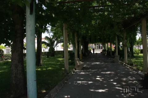
This park has large shade areas, rest banks, a children's recreation area and a delimited picnic area.

Breve descripción

Frondosa grove in the old town of Torredonjimeno where there is an area conditioned for leisure and free time consisting of a children's park and a picnic area.

Ubicación
Nombre
Cortijo de la Muña
Código Postal
23650
Latitud
37.766800
Longitud
-3.960900
Distrito
Municipio
Ubicación en el mapa
POINT (-3.9609 37.7668)
Tipos de punto de interés
Imágenes carrusel
imagen
Image
parquequebradas.jpg
Imagen principal
Desactivado
Imágenes cabecera
imagen
Image
6062256Master.jpg
Imagen principal
Activado
Microsite al que pertenece
Loading map
Preparing points of interest and routes...

Freedom Park

Submitted by brandcode_deweloper on
Id
8122637
Descripción
Descripción larga

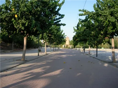
The Freedom Park has a large area for the walk and is the preferred meeting place for the inhabitants of Jabalfifth.

This park stands out for its magnificent shadows, ideal for the summer months and for the great accessibility it enjoys.

It has a children's playground.

Next to Park is the Bus Station.

Breve descripción

Built in 1988, it is a large, grass-filled and wooded complex with countless banks and two sources that invite us to rest.

Telecomunicaciones
Teléfono de contacto
953 617 056
Ubicación
Código Postal
23712
Latitud
38.020360
Longitud
-3.725910
Dirección
Av. Picasso, 32
Distrito
Municipio
Ubicación en el mapa
POINT (-3.72591 38.02036)
Tipos de punto de interés
Imágenes carrusel
imagen
Image
Parque%20de%20la%20libertad2.jpg
Imagen principal
Desactivado
imagen
Image
Parque%20de%20la%20libertad.jpg
Imagen principal
Desactivado
Imágenes cabecera
imagen
Image
Parque%20de%20la%20libertad3.jpg
Imagen principal
Activado
Loading map
Preparing points of interest and routes...