Saltar al contenido principal
icon-intereses-viajar-solo

Drinking Trough Fountain

Submitted by brandcode_deweloper on
Id
910704
Descripción
Descripción larga

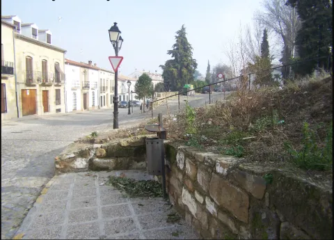
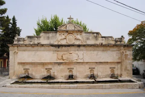
Precisely, to the cloister of the said convent, Mr Gonzalo Messía Carrillo Fonseca, I Marqués de La Guardia, commissioned the execution of an exempt fountain, crowned by the Magdalena and dated 1577, which has been attributed to Francisco del Castillo "El Mozo," currently located in the courtyard of the Excel. Provincial Council of Jaén. Years earlier, and perhaps to commemorate the appointment as I Marqués de La Guardia, Gonzalo Messía ordered to raise a pilar-abrevadero at the entrance of the population, near the Dominican convent, to serve as a water supply to the neighbors and their animals. This beautiful space, threatened with splendid gardens, over time became a plateau made up of the source itself and a nobility house of silery built according to the date of 1814.

The pilar-abrevadero, in a landscape and built of silary stone, is formed by a wall articulated by two bodies and attic. In the first body there are five caños of bronze out of avenerated hornazas that pour abundant waters on a rectangular pillar, in the second a beautiful frame was carved with hanging cloth with the inscription allusive to the comitant and the date of execution: "This work command to do the Iltmo. Mr. Don Gonzalo Mexia Carrillo, my lord. Year 1566." Throughout this second body there is an internment supported at the ends in Ionian striated columns. In the center of the attic two canes, with the garruches of the Messia family, hold an oval shield on the mould with the crown of Marquis and the following inscription "Plaza de Isabel II Reina Constitucional," with which this place has been known since. In its origin the dogs held the shield with the weapons of Don Gonzalo Messia Carrillo; it is overcome with a fronton with a central relief flanked by fins and crowned with a Cross, to the ends and bearing the cross of Santiago have settled two lying lions (all very redone).

Although the tracist of this beautiful pillar is not known, the stylems incorporated in it, columns with alternating sticks, the scroll with cloth (similar to the carved ones in the City Palace of Ubeda), the molding of the inlet and the cut-off hides of the shield held by the canes point to a possible intervention by Andrés de Vandelvira. Professor Galera Andreu expresses himself in this respect: I do not believe that the public source is not at his hand, despite the reforms (...) to be highlighted by the small scale of the columns attached in an application to the reverse of what was done in the chapel of the Benavides in Baeza. The set was restored by the local workshop school in 1991.

Breve descripción

Monument of the Historical-Artistic Set. Declared 06 / 07 / 1983 To the Messies, lords and Marquis of La Guardia, the architectural wealth preserved in this villa is largely due. Thanks to its performance, not without taste, the old Bajomieval fortress adapted to the new palaciegos (typical of the reign of the Catholic Kings) with a beautiful tarootic cover and encouraged the foundation of a convent run by the Dominicans, in which consecrated architects such as Andrés de Vandelvira and Francisco del Castillo "El Mozo" would intervene throughout the 16th century.
Telecomunicaciones
Sitio web
www.laguardiadejaen.com/tu-ciudad/historia/
Teléfono de contacto
953 327 100
Correo electrónico
ayuntamiento@laguardiadejaen.es
Ubicación
Código Postal
23170
Latitud
37.744720
Longitud
-3.693890
Dirección
C/ Escuelas, 11
Distrito
Ubicación en el mapa
POINT (-3.69389 37.74472)
Tipos de punto de interés
Imágenes cabecera
imagen
Image
Pilar%20Abrevadero%20%281%29.jpg
Imagen principal
Activado
Loading map
Preparing points of interest and routes...

"Los deseos" Stone

Submitted by brandcode_deweloper on
Id
1476792
Descripción
Descripción larga

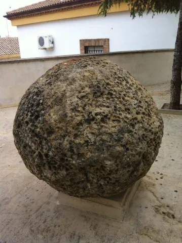
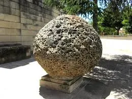
If we look at it from the geological point of view, it is a sphere of sandstone / limestone, which is very eroded by having been buried along with strong water currents, which have contributed to forming an countless number of holes along its entire surface, giving it even more if that character of lunar appearance is there. Leaving aside its geological nature and approaching its symbolic nature, we can say that it is a ritual or sacred stone as we have previously called it, whose name within the archaeological argot is Betilo. This type was used by prehistoric sedentary communities near the Neolithic. Its value was ceremonial or ritual, as they were considered to be divinities associated with the fertility of the land or of the woman. This type of betils were usually placed around the primitive sanctuaries or houses / caves of the community leader and around it were held rituals.

In the case of our "Stone of the Desires," we find that at the top, it has an orifice of deep broth, the purpose of which was to bear the pagan divinities once they take human figure, or later for the Christian communities to place the cross, an unequivocal symbol of Christianity.
This sphere reached Arjona in 1995, a year of terrible drought, in which the fields of Arjona offered a desolate aspect. The same day that the stone arrives in Arjona, a great storm is unleashed that changes the look of these fields, which have been damaged by the terrible drought that has been in this town for months. It is curious how the power of this stone was quickly associated with rituals of Mediterranean cultures that have water as the main rite. That water that makes the earth fertile, that you water the fields and that gives life to the crops, offers us the enigmatic aspect of this stone, whose ancestral function for which it was created, was to symbolize the fertility of the earth, fertility that is achieved only by rain, in this case and thousands of years later the stone exercises that same symbolic power just after reaching its new destination, Arjona.

In the nights of San Juan there are numerous Arjoneros, who come to this stone to practice rituals specific to Mediterranean culture. But this stone not only works on the night of San Juan, from its location in or privileged place of the Plaza de Santa María, is available to the visitor and Arjonero any day of the year. For the visitor's wishes to be fulfilled, in Arjona we have devised a ritual to follow. This ritual consists of placing the 5 fingers of either of the two hands, in holes of similar size, once this ritual has been performed a desire is asked.
From here we want our "Stone of the Desires" to grant you health and happiness.

Breve descripción

This enigmatic sphere, which in Arjona is popularly known as "La Piedra de los Deseos" or "Las Casualidades," was incorporated into the city of Arjona in 1995. Despite these "titles" with which the stone currently counts or is known, it is a bethyl or sacred stone. This type of "Sacred Stone," comes from an excavation that took place in the ancient Gothic Cathedral of Jaén, which reaches Arjona by the hands of our illustrious countryman Juan Eslava Galán.

Telecomunicaciones
Sitio web
www.redjaen.es
Ubicación
Código Postal
23760
Latitud
37.935360
Longitud
-4.054280
Dirección
C/ Santa María, 7
Distrito
Municipio
Ubicación en el mapa
POINT (-4.05428 37.93536)
Tipos de punto de interés
Imágenes carrusel
imagen
Image
Piedra%20de%20Los%20Deseos.jpg
Imagen principal
Desactivado
Imágenes cabecera
imagen
Image
Piedra.jpeg
Imagen principal
Activado
Loading map
Preparing points of interest and routes...

Peaks of the Guadiana

Submitted by brandcode_deweloper on
Id
913424
Descripción
Descripción larga

The Guadiana Menor is a very young river from the geological point of view. Until about 10,000 years ago, its basin was a large salty lake, to which it provided its waters and sediments numerous streams from Sierra Nevada, Filabres and the Macizo de Cazorla and Segura. Its current course arose in an accidental and violent way, perhaps due to the breaking of one of the margins of the lake produced by an earthquake, excavating deep ravines, leaving out the yermas clays, loaded with plaster and salts, rolling edges and marine sands, a means that makes it difficult to survive the living beings that inhabit them.

The depression that bears its name from this river is the most arid area in the province and one of the driest in Europe, recording annual rainfall that very rarely exceeds 250 mm. The consequence is that of a semidesertic, rotational and beautiful landscape, populated by highly specialized Stepparian vegetables to the middle, most herbs and small matas. Its biological uniqueness is enormous, having an endemic character (very small geographical area) more than half of the species present in the area. This proportion is only comparable to the biological exclusivity of the high betic mountain, where we find most of the most well-known endemisms in the Natural Park.

We suggest...

  • Make the Desert Route, described in the Tourist Guide of Hinojares.
  • Visit the Mirador del Lirio, with stunning views of the valley and the desert of the Natural Park. It is accessed (it is signposted) from the village of Fontanar, which is located about 5 Km from Pozo Alcón.
  • Other unique points of this recommended visit are the necropolis ibera de los Castellones de Ceal, next to the village of Ceal, and the Salinilla de Chillar, located very close to Hinojares.

To visit the Picos del Guadiana and to visit the subdesert area of the Natural Park that corresponds to the Valle del Guadiana Menor, we will use the road section of the A-315 that links Bone with Pozo Alcón and Hinojares. The view of the Picos is at the beginning of these, in an enranche of the previous way, about 14 km from Hinojares and 19 km from Pozo Alcón.

Breve descripción

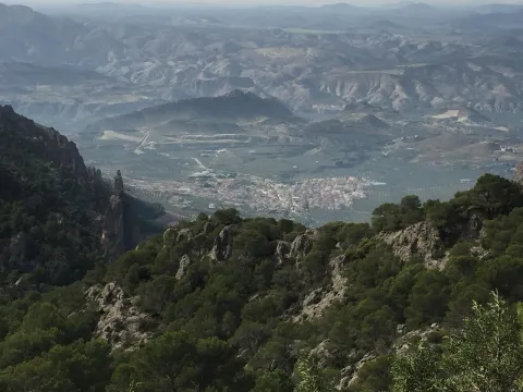
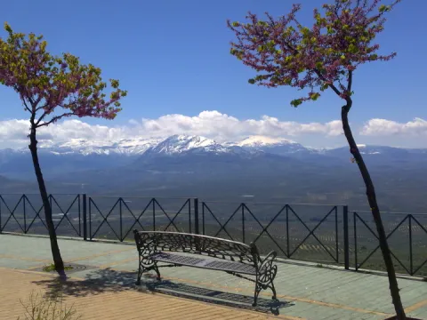
The geoforms of the valley of the Minor Guadiana, originating from the slow and inexorable erosive processes, are extremely striking. An enclave of great geomorphological interest, proposed as a natural monument: the Picos del Guadiana, stands out. It is a limestone crest where the petreous strata, arranged vertically, emerge from a cone of soft clays, forming a rocky alignment that resembles the teeth of a saw. The most imaginative say that it is the fossil of a colossal dinosaur that died by the river, without considering that there was no such channel in the Jurassic and that some of those prehistoric animals were huge, but not so much.

Ubicación
Latitud
37.702695
Longitud
-2.935057
Municipio
Ubicación en el mapa
POINT (-2.935057 37.702695)
Tipos de punto de interés
Imágenes carrusel
imagen
Image
picos.jpg
Imagen principal
Desactivado
Imágenes cabecera
imagen
Image
8040409Master.jpg
Imagen principal
Activado
Loading map
Preparing points of interest and routes...

Peaks of the Guadiana

Submitted by brandcode_deweloper on
Id
2980258
Descripción
Descripción larga

We are located in the subdesert area near the Natural Park Sierras de Cazorla, Segura and Las Villas. The geoforms of the valley of the Minor Guadiana, originating from the slow and inexorable erosive processes, are extremely striking. An enclave of great geomorphological interest, proposed as a natural monument: the Picos del Guadiana, stands out. It is a limestone crest where the petreous strata, arranged vertically, emerge from a cone of soft clays, forming a rocky alignment that resembles the teeth of a saw. The Guadiana Menor is a very young river from the geological point of view. The depression that bears its name is the driest area in the province and one of the driest in Europe, recording annual rainfall that very rarely exceeds 250 mm. Its biological uniqueness is enormous, having an endemic character (very small geographical area) more than half of the species present in the area.

Breve descripción

We can access this peculiar landscape through the A-315 road that links Bone with Pozo Alcón and Hinojares. The view of the Picos del Guadiana is located in a corner of the previous track, about 13 km. from Hinojares and 19 from Pozo Alcón.

Ubicación
Código Postal
23487
Latitud
37.747960
Longitud
-3.099540
Dirección
Carretera A-315
Municipio
Ubicación en el mapa
POINT (-3.09954 37.74796)
Tipos de punto de interés
Imágenes carrusel
imagen
Image
picos_guadiana.jpg
Imagen principal
Desactivado
Imágenes cabecera
imagen
Image
10463723Master.jpg
Imagen principal
Activado
Loading map
Preparing points of interest and routes...

Peak Gilillo

Submitted by brandcode_deweloper on
Id
4486161
Descripción
Descripción larga

Location: To the south of the town, in the natural park of Cazorla, Segura and Las Villas.

Distance: 16 km

Medium: In vehicle tourism and on foot.

Access route: By the A-319 in the direction of La Iruela; at this point, after 13 km, we will take the Chorro road, then diverting by a horseshoe road leading to the Port of Tejo.

When you reach the port of Giillo, you leave the path to turn right and climb to the rocky top of the same name, spectacular atalaya with beautiful views in all directions. The fall is made to the port of Giillo, and we will have to pass through an old, ruined shelter where a path of descent begins, this one passes through the Loma de Los Castellones, with beautiful views of the Calar de Juana and the Cabañas, as well as a spectacular sincerity that remains to our left, soon we arrive to the Laguna de Cazorla, a great dolina where we will take a beautiful horseshoe path that is headed towards the Port of Tejo. From here on, a beautiful fall begins on the path of masonry passing under the Banderín and the Cejo de la Mora, with beautiful views towards Los Castellones and Giillo, until reaching the ruins of the Forest House of Prado Redondo, beautiful corner with a fountain.

Breve descripción
Ubicación
Latitud
37.869750
Longitud
-2.993650
Municipio
Ubicación en el mapa
POINT (-2.99365 37.86975)
Tipos de punto de interés
Imágenes carrusel
imagen
Image
gilillo.jpg
Imagen principal
Desactivado
Imágenes cabecera
imagen
Image
NaturalPicoGilillo.jpg
Imagen principal
Activado
Loading map
Preparing points of interest and routes...

Peña del Olivar

Submitted by brandcode_deweloper on
Id
5924636
Descripción
Descripción larga

Information and Comments:

  • The kiosco-bar is temporarily closed until further notice, by works of improvement in the installation.
  • The barbecues area can only be used when Environment gives the order that there is no danger of fire.
Breve descripción

In this recreational area is the Peña del Olivar botanical collection, which is divided into two areas dedicated to the high and low mountain.

In the high mountain area, the visitor will discover the species of the great heights of the Segura saw such as the Sabina and the juniper or the larice pine. As it descends in altitude, the forest of maples, complaints, and mellows, as well as the forests of stalks, all taking a prominent place along the itinerary.

In the area dedicated to the low mountain you can discover the vegetation of the lauroid forest with, among other species, madroños and doves. The tour is completed by presenting the exclusive species of the place.

This area, which is traditionally appreciated by the neighbors of Siles, is part of a particularly lush and fresh environment in summer, when many people take advantage of bathing in the cold waters of the natural pool built just across the road, in the Barranco de los Tejos stream. The area has a fountain, bar with dining room, banks and tables to eat, barbecues and children's area. There is also a surprising Botanical Collection in a small and pleasant garden, with over a hundred species of natural park plants, some with exceptional ecological value because they are rare endemisms.

Ubicación
Latitud
38.388731
Longitud
-2.589810
Distrito
Municipio
Ubicación en el mapa
POINT (-2.58981 38.388731)
Tipos de punto de interés
Imágenes carrusel
imagen
Image
pe%C3%B1aolivar.jpg
Imagen principal
Desactivado
Imágenes cabecera
imagen
Image
1%20%281%29.jpg
Imagen principal
Activado
Microsite al que pertenece
Loading map
Preparing points of interest and routes...

Mining Heritage

Submitted by brandcode_deweloper on
Id
4383600
Descripción
Descripción larga

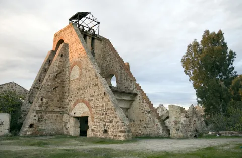
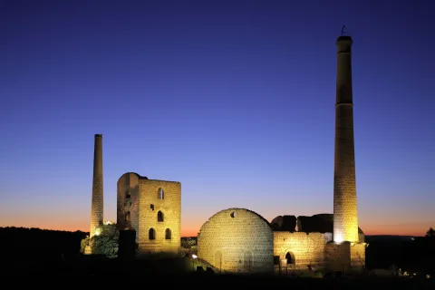
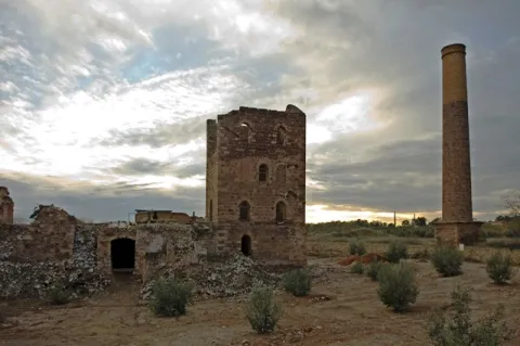
Since then, local associations and municipalities have begun to promote this interesting heritage. In 1999, because of the uniqueness, abundance and quality of this industrial mining landscape, heritage experts described the area in the British press as "the best kept secret in Europe" (Europe's best kept secret).

In the entire mining region, there are remains of high interest industrial archaeology, some unique examples in the world. This scattered set of buildings, railway stations, machine houses, chimneys, cabries and roads explain the history of one of the areas of southern Europe in which the Industrial Revolution took place, where English, Belgian, French and Spanish communities lived together. This combination of history and the use of natural resources is an excellent pretext for visiting the landscape of the chimneys, the landscape that welcomes visitors who arrive in Andalusia from the north.

Breve descripción

The mining activity of the Linares- La Carolina mining district extends over 4,000 years, as shown by archaeological investigations. Its importance was such that in 1869 lead production exceeded that of all England. The operation remained active until 1,991, when it closed the last mine in Linares for lack of profitability.

Telecomunicaciones
Sitio web
www.lacarolina.innovasur.es
Teléfono de contacto
953 660 034
Correo electrónico
info@lacarolina.es
Ubicación
Código Postal
23200
Latitud
38.274220
Longitud
-3.615160
Distrito
Municipio
Ubicación en el mapa
POINT (-3.61516 38.27422)
Tipos de punto de interés
Imágenes carrusel
imagen
Image
mineros.jpg
Imagen principal
Desactivado
imagen
Image
mineros%202.jpg
Imagen principal
Desactivado
Imágenes cabecera
imagen
Image
image_183804.jpeg
Imagen principal
Activado
Loading map
Preparing points of interest and routes...

Walk of the Walls

Submitted by brandcode_deweloper on
Id
3984471
Descripción
Descripción larga
Little by little, Antonio Machado is adapting to the rural environment of Baeza and its dazzling landscape outside the walls. Enjoy peri-urban walks that take you to the Alcázar hill and over the remains of the old wall. One of the spaces most frequented by Antonio Machado, who visits it again and again in his meditation exercises. At one point on said walk, a plaque and a monument to Antonio Machado with a bust of Pablo Serrano commemorate the poet today. This sculpture was made to honor the poet in 1966, although it did not arrive in Baeza until 1983. From the viewpoints along the promenade it dominates the middle valley of the Guadalquivir with its beautiful horizon carpeted with olive trees and outlined by the Cazorla, Mágina mountain ranges and the Aznaitín and Jabalcuz mountains. This image serves as an escape and an impulse for his creative capacity, creating here sublime verses that describe this landscape. PATHS (…) From the Moorish city behind the old walls, I contemplate the silent afternoon, alone with my shadow and my sorrow. The river runs, among gloomy orchards and gray olive groves, through the cheerful fields of Baeza The vines have golden branches on the red vines. Guadalquivir, like a broken cutlass and scattered, shines and mirrors. (…)
Breve descripción
Baeza Paseo de las Murallas and Antonio Machado. It begins in the Plaza de los Leones. Continue along the path of the walls and continue along the Antonio Machado walk. Good views of the Bishop Academy and Jaén olive oil bridge. We continue along the route and see a tribute to D. Antonio Machado. And from here at the end Impressive views of the Guadalquivir valley and at the end views of Úbeda.
Ubicación
Código Postal
23440
Latitud
37.987620
Longitud
-3.471160
Municipio
Ubicación en el mapa
POINT (-3.47116 37.98762)
Tipos de punto de interés
Imágenes carrusel
imagen
Image
muralla_baeza.png
Imagen principal
Desactivado
Imágenes cabecera
imagen
Image
57fd22895f44626a108a9ccbc88957b7_720x560.jpg
Imagen principal
Activado
Microsite al que pertenece
Loading map
Preparing points of interest and routes...

Parish Church of Our Lady of Peace

Submitted by brandcode_deweloper on
Id
4276831
Descripción
Breve descripción

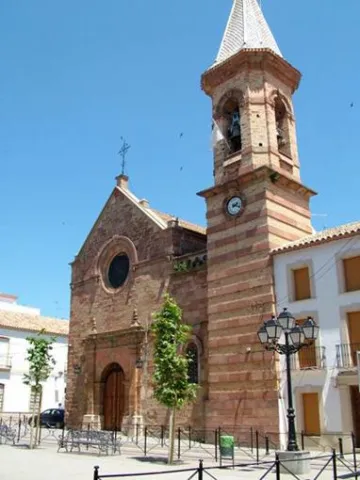
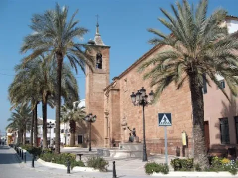
The Parish Church of Our Lady of Peace is located in Marmolejo. The origins of this church date back to the 14th century. This early foundation was added to the cruise in the 15th and 16th centuries and in the 18th the two covers. But the general configuration presented by this church today is the result of the reform carried out at the end of the 19th century by the architect Justino Flórez Llamas, under the historical and eclectic lexicography of the time, and which focused primarily on the west tower and facade.

Telecomunicaciones
Sitio web
www.villademarmolejo.es/urbanismo-y-monumentos/monumentos/iglesialapaz/
Teléfono de contacto
953 540 210
Ubicación
Código Postal
23770
Latitud
38.044960
Longitud
-4.170870
Dirección
Plaza de la Constitución, 3
Distrito
Municipio
Ubicación en el mapa
POINT (-4.17087 38.04496)
Tipos de punto de interés
Imágenes carrusel
imagen
Image
Parroqu%C3%ADa%20de%20Nuestra%20Se%C3%B1ora%20de%20la%20Paz3.jpeg
Imagen principal
Desactivado
imagen
Image
Parroqu%C3%ADa%20de%20Nuestra%20Se%C3%B1ora%20de%20la%20Paz.png
Imagen principal
Desactivado
Imágenes cabecera
imagen
Image
image_105936.jpeg
Imagen principal
Activado
Microsite al que pertenece
Loading map
Preparing points of interest and routes...

Parish of the Natividad de Nuestra Señora

Submitted by brandcode_deweloper on
Id
4523566
Descripción
Breve descripción

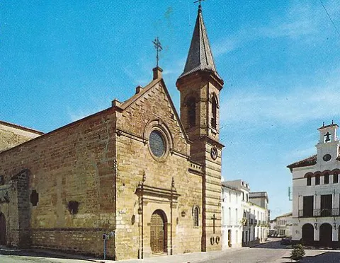
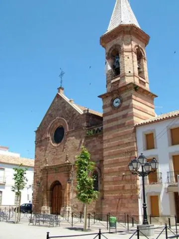
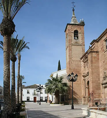
It was built on an earlier medieval temple and was founded in 1604 by Maria Notario de Lara, although its interior denotes Gothic traces. It is important to note its Major Retail of the S. XV). At the foot, it has a square base tower with two floors and a bell tower with half-point arches, which crown a pointed capital. On its northern side is the Chapel of the Rosary, an example of the Andalusian rococo of the first half of the 18th century.

Telecomunicaciones
Sitio web
www.vreina.com
Teléfono de contacto
953 537 127
Ubicación
Código Postal
23730
Latitud
38.005440
Longitud
-3.919940
Dirección
Plaza la Constitución, 9
Distrito
Ubicación en el mapa
POINT (-3.91994 38.00544)
Tipos de punto de interés
Imágenes carrusel
imagen
Image
Parroquia%20de%20la%20Natividad%20de%20Nuestra%20Se%C3%B1ora.jpg
Imagen principal
Desactivado
Imágenes cabecera
imagen
Image
villanuevareina.jpg
Imagen principal
Activado
Microsite al que pertenece
Loading map
Preparing points of interest and routes...