Saltar al contenido principal
icon-intereses-viajar-solo

Natural Monument El Piélago

Submitted by brandcode_deweloper on
Id
2193369
Descripción
Descripción larga

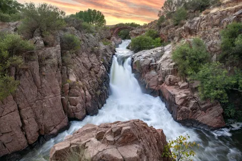
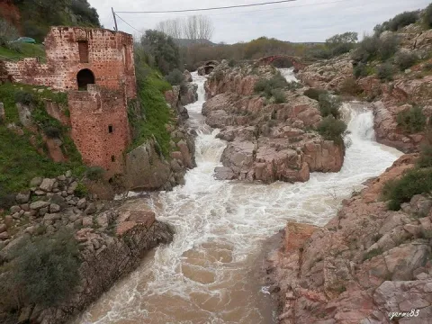
The "Natural Monument the Pat" is located to the north of the municipality of Linares. To get to it you have to follow the A-312 autonomous road towards Arquillos, after the station of Vadollano we find a detour to the left - Vilch- that leads us directly to the site.

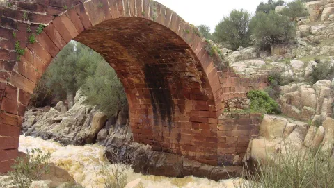
This is an area of special landscape and historical interest, since the beauty of the route of the river Guarrizas is joined by the existence of the Roman bridge of Vadollano, which is part of the route of the Via Augusta.

Just below the Roman bridge, we found the ruins of what was a chocolate factory, which used the driving force of the river water to generate energy.

Breve descripción

Area: 67,149 m ²

A place of special landscape interest whose uniqueness lies in the presence of a riverbank forest, a rich fauna and elements of enormous geological value, as well as the remains of a bridge and a Roman-era road.
Ubicación
Latitud
37.890735
Longitud
-3.565822
Distrito
Municipio
Ubicación en el mapa
POINT (-3.565822 37.890735)
Tipos de punto de interés
Imágenes carrusel
imagen
Image
el-pielago-jpg
Imagen principal
Desactivado
imagen
Image
linares3.jpg
Imagen principal
Desactivado
Imágenes cabecera
imagen
Image
1200px-El_Pi%C3%A9lago.jpg
Imagen principal
Activado
Microsite al que pertenece
Loading map
Preparing points of interest and routes...

Natural Monument El olivo de Fuentebuena

Submitted by brandcode_deweloper on
Id
6726352
Descripción
Descripción larga

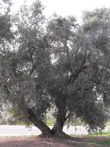
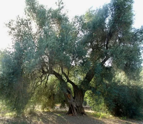
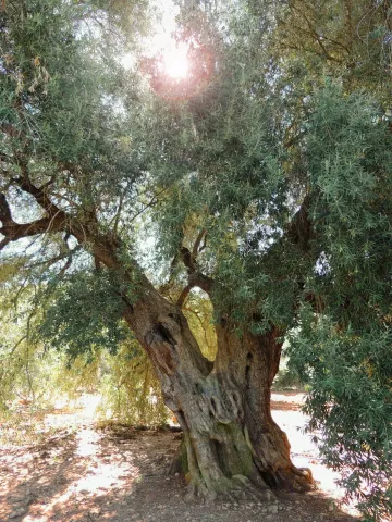
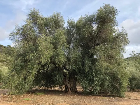
If by anything it is characterized by Jaén it is by its olive trees. There are very old people and there are also large ones (which is not about their age) spread over different municipalities in the provincial geography. The uniqueness of the Arroyo del Ojanco olive tree lies, rather than its age, in its gigantic dimensions, so it has been proposed to be declared a Natural Monument of Andalusia. It is said that it is the largest olive tree in the world, and possibly it is, because the figures that cast its measures, referred to in the tab at the beginning of the article, tell us of a single copy. This should be added to its productive capacity, which is around 600 kg. olive per campaign (an adult irrigated olive tree usually does not reach 70 kg).


The two large branches (2.10 and 2.80 m of perimeter) that are bifurcan from its thick fuse bear all the weight of the cup, which becomes of such magnitude - especially when the fruit develops - which forces its dense foliage to rest on the ground at many ends of the cup. Anyway, everything in this portentous specimen is Guinness record.


So long a centenary history has generated some legendary accounts around this olive tree, as it was planted in the Roman era (which indeed built a magnificent villa a few hundred metres from Fuentebuena) or by friars after the Christian reconquest of these lands. Another version states that its size, so different from that of the olive trees around it, is because it was born from a blessed bouquet on a Palm Sunday.

To access the Fuentebuena olive, you have to go from the urban core of Arroyo del Ojanco to the local road JV-7.005 towards Beas de Segura. As you pass the crossing of Prados de Armijo, the olive tree is about 50 metres from the road.

Breve descripción

The millennial olive tree of Fuentebuena, declared by the Junta de Andalucía Monumento Natural, is one of the symbols of Arroyo del Ojanco. This is a privileged vestige that has resisted so many generations between corns and bandages, between ice of raw winters and summers of extenuating dryness.

Ubicación
Latitud
38.320028
Longitud
-2.905589
Distrito
Municipio
Ubicación en el mapa
POINT (-2.905589 38.320028)
Imágenes carrusel
imagen
Image
olivo.jpg
Imagen principal
Desactivado
imagen
Image
Oliva-de-Fuentebuena.jpg
Imagen principal
Desactivado
imagen
Image
DSCN3042.JPG
Imagen principal
Desactivado
Imágenes cabecera
imagen
Image
Olivo-de-Fuentebuena20180317-01.jpg
Imagen principal
Activado
Microsite al que pertenece
Loading map
Preparing points of interest and routes...

Natural Monument Forest de la Bañizuela

Submitted by brandcode_deweloper on
Id
6498414
Descripción
Descripción larga

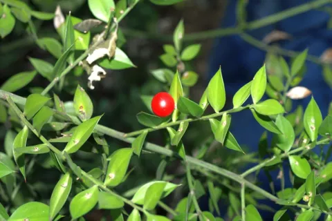
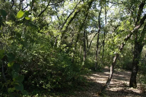
Here we can observe plant species such as the whining, coscoja, peach, yellow jasmine, clematides, madreselva and so to complete a multitude of trees and shrubs among which the Arrayan de La Bañizuela, a unique specimen, stands out. The arrayan or myrtle usually has an arbustive bearing, but the one we find in the Bañizuela Forest stands out precisely for its large size and the thickness of its trunk, more specific to a tree than to a bush. Another element that has made possible the recognition of this space as a natural monument has been the characteristic of its soil: limestones, dolomies and margocalizas belonging to the Jurassic period.

Breve descripción

The area called the Bañizuela Forest, located in Torre del Campo (Jaén) in an old garden of about two hectares of extension, now dominated by a rich Mediterranean forest mass in which we enjoy very old specimens.

Ubicación
Código Postal
23640
Latitud
37.756350
Longitud
-3.897150
Distrito
Municipio
Ubicación en el mapa
POINT (-3.89715 37.75635)
Tipos de punto de interés
Imágenes carrusel
imagen
Image
230_MN_05%20%281%29.jpg
Imagen principal
Desactivado
imagen
Image
1511_MI_02.jpg
Imagen principal
Desactivado
imagen
Image
230_MN_02.jpg
Imagen principal
Desactivado
Imágenes cabecera
imagen
Image
1511_MI_01.jpg
Imagen principal
Activado
Microsite al que pertenece
Loading map
Preparing points of interest and routes...

Monument to the Sacred Heart of Jesus

Submitted by brandcode_deweloper on
Id
4485539
Descripción
Descripción larga

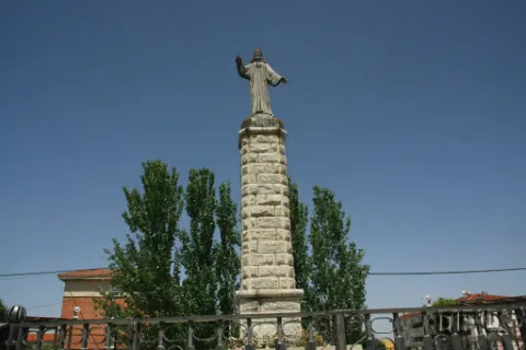
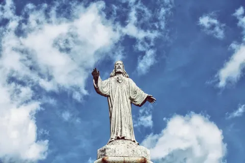
The history of this sculpture and of the reason for its construction is due to the fact that in the 19th century, devotion to this image grew significantly, with Mayor Lucas Guillén being very devoted to it.

Therefore, after the destruction of religious images in 1937, it was decided by popular vote to erect this sculpture based on works such as the Christ of the Corcovate of Rio de Janeiro or the Sacred Heart of Jesus of the Cerro de los Angeles in Madrid.

It was performed by the Sales de La Carolina brothers in 1950.

Breve descripción

Located on the promenade that bears its same name, this sculpture is located on a high pillar and surrounded by a fence.

Telecomunicaciones
Sitio web
www.guarroman.es/ciudad/conoce-la-ciudad/edificios-y-monumentos/
Teléfono de contacto
953 615 004 / 953 615 306
Ubicación
Código Postal
23210
Latitud
38.184060
Longitud
-3.685480
Distrito
Municipio
Ubicación en el mapa
POINT (-3.68548 38.18406)
Tipos de punto de interés
Imágenes carrusel
imagen
Image
Monumento%20al%20Sagrado%20Coraz%C3%B3n%20de%20Jes%C3%BAs.jpg
Imagen principal
Desactivado
Imágenes cabecera
imagen
Image
Monumento%20al%20Sagrado%20Coraz%C3%B3n%20de%20Jes%C3%BAs.jpg
Imagen principal
Activado
Loading map
Preparing points of interest and routes...

Monument to San Francisco de Asís

Submitted by brandcode_deweloper on
Id
6613855
Descripción
Breve descripción

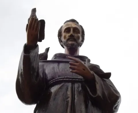
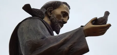
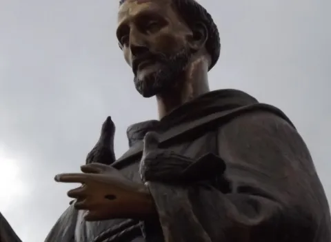
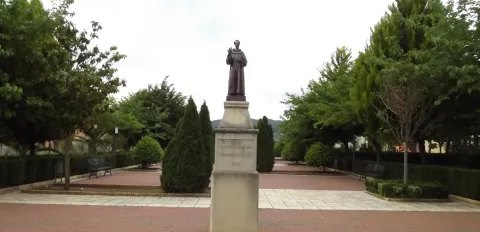
The saint is placed on three square-floor bodies. In the second body we find an inscription with the year of construction and on the third body, in a pyramidal form, we find a carving of round bouquet of San Francisco de Assis, bound with the sayal of the Franciscan, bound with a three-knots cord that represent the vows of poverty, chastity and obedience. He has a hand standing on his heart and a pigeon with the other. In both hands we can observe the stigmas.

Telecomunicaciones
Sitio web
www.arroyodelojanco.es
Teléfono de contacto
953 420 002
Ubicación
Código Postal
23340
Latitud
38.317030
Longitud
-2.899600
Distrito
Municipio
Ubicación en el mapa
POINT (-2.8996 38.31703)
Tipos de punto de interés
Imágenes carrusel
imagen
Image
1369231662%20%281%29.jpg
Imagen principal
Desactivado
imagen
Image
1369231661.jpg
Imagen principal
Desactivado
imagen
Image
1369231660.jpg
Imagen principal
Desactivado
Imágenes cabecera
imagen
Image
1369231659%20%281%29.jpg
Imagen principal
Activado
Loading map
Preparing points of interest and routes...

Monument to los mineros

Submitted by brandcode_deweloper on
Id
4485591
Descripción
Descripción larga

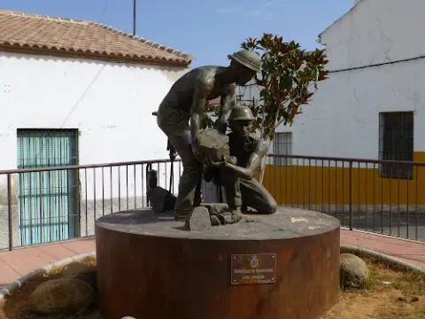
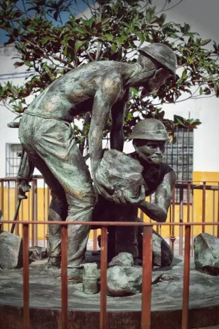
This work by Javier Ruiz Abel is a tribute to those granadino and almerian miners who in the late 19th and early 20th century came to work in the mines of the Linares - La Carolina district, of which in our municipal term we have some unique examples.

Telecomunicaciones
Sitio web
www.guarroman.es/ciudad/conoce-la-ciudad/edificios-y-monumentos/
Ubicación
Código Postal
23210
Latitud
38.181480
Longitud
-3.687920
Distrito
Municipio
Ubicación en el mapa
POINT (-3.68792 38.18148)
Tipos de punto de interés
Imágenes carrusel
imagen
Image
wmonumento%20mineros.jpg
Imagen principal
Desactivado
Imágenes cabecera
imagen
Image
Monumento%20a%20los%20mineros.jpg
Imagen principal
Activado
Loading map
Preparing points of interest and routes...

Monument to la Batalla de las Navas de Tolosa.

Submitted by brandcode_deweloper on
Id
4383810
Descripción
Breve descripción

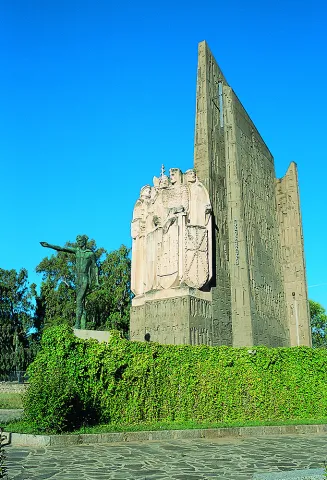
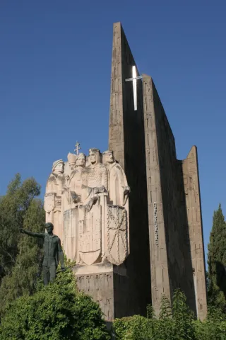
The Monument to the Battle is a memorial to the great battles in the province of Jaén, the Battle of the Navas de Tolosa and the Battle of Bailén. It is located in the provincial capital, in the centre of the Plaza de las Batallas, on the Paseo de la Estación, in front of the Parque de la Concordia and the Government Subdelegation.

Telecomunicaciones
Sitio web
www.redjaen.es
Teléfono de contacto
953 660 255
Correo electrónico
info@lacarolina.es
Ubicación
Código Postal
23200
Latitud
38.277920
Longitud
-3.606620
Dirección
C/ Alemania, 2
Distrito
Municipio
Ubicación en el mapa
POINT (-3.60662 38.27792)
Tipos de punto de interés
Imágenes carrusel
imagen
Image
Mon073.jpg
Imagen principal
Desactivado
imagen
Image
monumento-batalla-navas-de-tolosa4jpg__940x620_q83_1284x642_q75_middle.jpg
Imagen principal
Desactivado
Imágenes cabecera
imagen
Image
navasdetolosamonument.jpg
Imagen principal
Activado
Loading map
Preparing points of interest and routes...

Monument to Jorge Manrique

Submitted by brandcode_deweloper on
Id
657289
Descripción
Descripción larga

These lines correspond to the Treaty of the Mountain, studied by the Duke of Almazan, a document that some researchers attribute to Jorge Manrique. To talk about the 15th century in the Sierra de Segura is to talk about the Manrique family and the border period. A situation in which attacks and responses by Christians and Muslims were frequent. This danger and the border situation can only be seen by entering Segura de la Sierra: remains of walls, towers, entrance doors and on top of the hill, the watchful castle.

The Visits Books of the Order of Santiago described in the late 15th century the castle of Segura de la Sierra as a military compound with weapons to face a siege or, if necessary, to organize a village to attack the enemy. We cannot forget that in 1434 Rodrigo Manrique organized a village to conquer Huécar in the Altiplano granadino.

In Segura de la Sierra, taking advantage of this privileged position and under the security offered by its walls is where Jorge Manrique was raised under the care of his mother, Mrs. Mencía de Figueroa, in the house that still today is preserved five hundred years later.

Breve descripción

A candle on an oak table, a tintero with a pen and a half-write piece of paper. A figure draws attention to the rest of the room dedicated to the Manrique family on the second floor of the tower of tribute in the castle of Segura. Jorge Manrique is a character closely linked to Segura de la Sierra. If we were to imagine the poet in front of the paper, we might think that the text might start like this: "remind me to be very noble, Mr. Brother, having once said, in they are closer to mockery, you will see if you wanted me to write something about the work of the Montaria."

Ubicación
Latitud
38.298857
Longitud
-2.651877
Distrito
Ubicación en el mapa
POINT (-2.651877 38.298857)
Tipos de punto de interés
Imágenes carrusel
imagen
Image
6%20%283%29.jpg
Imagen principal
Desactivado
imagen
Image
10633135523_4ee3bea4f5_b.jpg
Imagen principal
Desactivado
imagen
Image
Segura_de_la_Sierra_PM_091668_E.jpg
Imagen principal
Desactivado
Loading map
Preparing points of interest and routes...
Marcas de calidad

Monument to Félix Rodríguez de la Fuente

Submitted by brandcode_deweloper on
Id
8108303
Descripción
Descripción larga

Built in 1980

Breve descripción
Source dedicated to the memory of Félix Rodríguez de la Fuente, a lover of nature. It has a tile plate where the honorado and the year of construction are named.
Telecomunicaciones
Teléfono de contacto
953 566 001
Ubicación
Código Postal
23658
Latitud
37.746690
Longitud
-3.906610
Dirección
Camino de la Sierra, 1
Distrito
Municipio
Ubicación en el mapa
POINT (-3.90661 37.74669)
Tipos de punto de interés
Imágenes carrusel
imagen
Image
Monumento%20a%20F%C3%A9lix%20Rodr%C3%ADguez%20de%20la%20Fuente3.jpg
Imagen principal
Desactivado
Imágenes cabecera
imagen
Image
Monumento%20a%20F%C3%A9lix%20Rodr%C3%ADguez%20de%20la%20Fuente.jpg
Imagen principal
Activado
Loading map
Preparing points of interest and routes...

Mount Salfaraf

Submitted by brandcode_deweloper on
Id
5709823
Descripción
Breve descripción

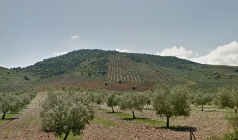
The elevation of Salfaraf is a residual relief of the tectonic unit of the tabular shed of the plateau which, as a witness hill, is independent from the surrounding area, causing a landscape milestone, with a large visual basin.

The topographic contrast with the surrounding terrain and the altitude above 1000 m make it easily identifiable.

Coronado by shrubs and isolated feet of oak and cashew, it is occupied almost until its summit by olive groves that constitute the main use, also being remarkable the minor hunting. From its peak there are interesting views of other milestones such as the Guadalmena reservoir, the Yelmo or Segura de la Sierra.

Ubicación
Latitud
37.772886
Longitud
-3.788329
Ubicación en el mapa
POINT (-3.788329 37.772886)
Tipos de punto de interés
Imágenes cabecera
imagen
Image
Monte%20Salfaraf.jpg
Imagen principal
Activado
Microsite al que pertenece
Loading map
Preparing points of interest and routes...