Saltar al contenido principal
icon-intereses-viajar-solo

Mount La Sierra

Submitted by brandcode_deweloper on
Id
2190681
Descripción
Descripción larga

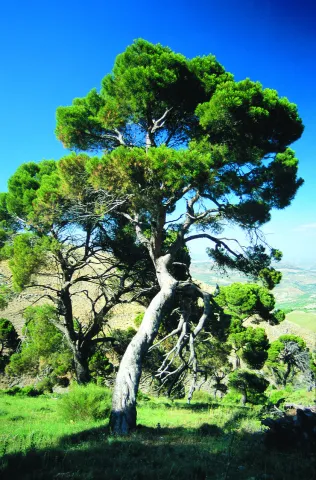
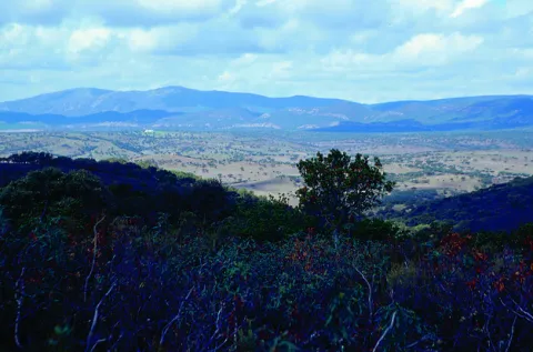
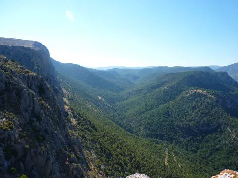
The mountain is surrounded by two convergent valleys: that of the Quibrajano River (where the Protected Species Recovery Centre is located) and the Hazadillas Canyon, with a recreational fit equipped with grills, tables, banks, recreational furniture, fountains, kiosk, etc., as well as other facilities.

This natural space is used as a place of leisure and leisure by the people of Jaén, given its proximity to the city.

Breve descripción

The Monte la Sierra peri-urban park conforms to the mountain of the same name, of 2,720 hectares and property of the City of Jaén, consonated with the Council of Environment of the Junta de Andalucía, which is located in the municipal term of Jaén.

Ubicación
Latitud
37.653790
Longitud
-3.713720
Distrito
Municipio
Ubicación en el mapa
POINT (-3.71372 37.65379)
Tipos de punto de interés
Imágenes carrusel
imagen
Image
Natu284%20%281%29.jpg
Imagen principal
Desactivado
imagen
Image
Natu248%20%282%29.jpg
Imagen principal
Desactivado
Imágenes cabecera
imagen
Image
Ca%C3%B1ada_Hazadillas01_24J.jpg
Imagen principal
Activado
Microsite al que pertenece
Loading map
Preparing points of interest and routes...
Mount Cuarto de Ardal

Submitted by brandcode_deweloper on
Id
8095030
Descripción
Descripción larga

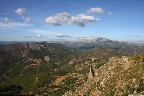
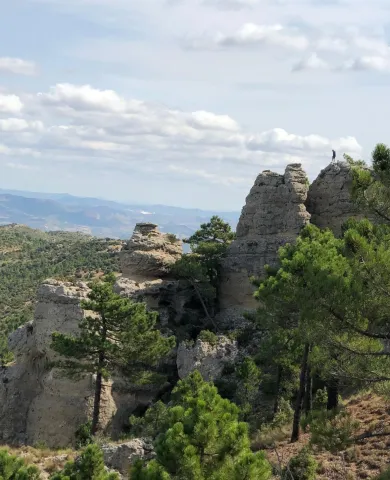
At 1440 m high is the MONTE ARDAL, which can be accessed by the road that reaches San Bartolomé, to the crossing that is moving to the left. It is a classroom of nature located in a forest shelter, with views of the village, the surrounding mountains,... in addition to the shelter, there is also a recreation area, adapted don barbecues, tables, and covered by a porch.

Breve descripción

Northof the term, there is a mountain, theArdal Room, in which the oaks, together with the retama, predominate, the albar thorn, wild rosals, juniper, ivy and madreselva. An ideal ground for the cicnetic species of major hunting (boar, deer, corzo...), and also of pastures, especially for the cattle of ligia.

Telecomunicaciones
Correo electrónico
ayuntamiento@genave.es
Ubicación
Código Postal
23392
Latitud
38.429970
Longitud
-2.733050
Distrito
Municipio
Ubicación en el mapa
POINT (-2.73305 38.42997)
Imágenes carrusel
imagen
Image
Cuarto%20de%20Ardal%2C2.JPG
Imagen principal
Desactivado
Imágenes cabecera
imagen
Image
Cuarto%20de%20Ardal%2C%20%281%29.jpg
Imagen principal
Activado
Loading map
Preparing points of interest and routes...

Mount Aznaitín

Submitted by brandcode_deweloper on
Id
5693260
Descripción
Descripción larga

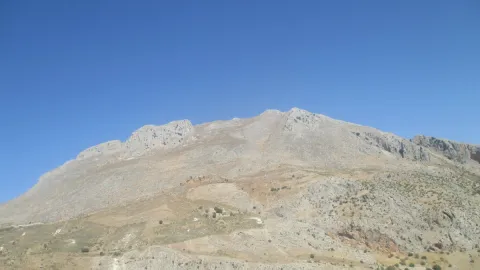
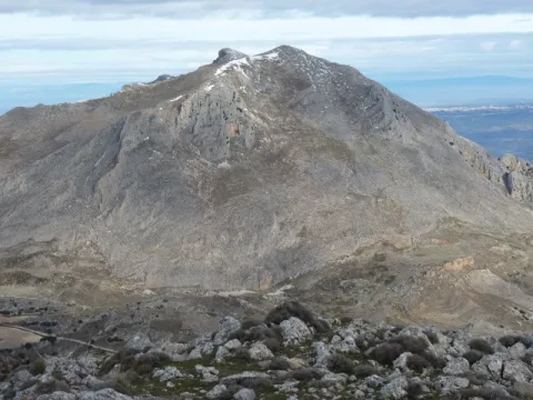
In the Aznaitín, some plant endemisms typical of Sierra Magina are maintained. At its summit the municipal terms of Jimena, Torres and Albanchez de Mágina, whose populations are located at their feet, as do the prehistoric caves, where the former inhabitants left their mark for posterity. Not in vain the Aznaitin impregnated the pupil of Antonio Machado from the far Baeza and incorporated him into his poetry.

Breve descripción

The Az-Naitín (Nathin in local dialect) is a mountain located in Sierra Magina, Jaén, Spain. The origin of the toponymy in Arabic would be Isnatin or Asnatin, and it is noted that it can come from its ancient name in ibero as Neitin, which refers to the great iberous god Neton, the god of Thunder and fire, which according to the legend dwells in the mountain. It has a special visual appeal, especially from the East side or from the Guadalquivir valley. It has a considerable altitude, 1745 m, which allows to see much of the province of Jaén.

Ubicación
Latitud
37.841370
Longitud
-3.476880
Distrito
Municipio
Ubicación en el mapa
POINT (-3.47688 37.84137)
Tipos de punto de interés
Imágenes carrusel
imagen
Image
3.jpg
Imagen principal
Desactivado
Imágenes cabecera
imagen
Image
4.jpg
Imagen principal
Activado
Microsite al que pertenece
Loading map
Preparing points of interest and routes...
Monastery of Montesión

Submitted by brandcode_deweloper on
Id
918965
Descripción
Descripción larga

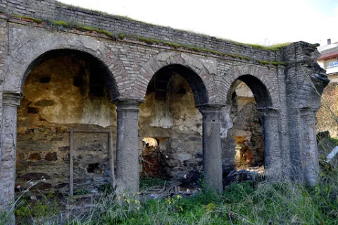
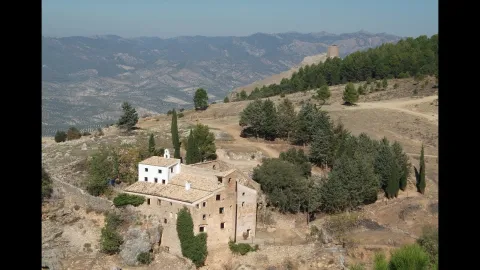
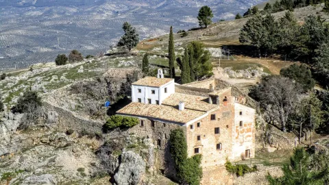
This is evident in the lack of materials and in the lack of furniture. Only the chapel with a Latin cross floor and a dome in which some frescoes are still preserved stand out.

The difficulties of the 17th century may have motivated the foundation of this monastery especially at a time when bad crops, hunger and bad weather caused the emergence of epidemics of the feared plague. The order of San Antonio Abad was dedicated to the healing of the sick and the fear of contagion caused these buildings to be far from the populations. Along with the plague, the economic crisis, the rise in prices, wars and in general the hardships led to an increase in the clergy and religious foundations in a context in which the Monarchy offered a contradictory vision that oscillated from splendor and misery or boom and decline.

Breve descripción

Soledad and remoteness are the adjectives that come to mind when we are next to the Monastery, in Cazorla. Every year, on the last Sunday of September a rosemary makes Montesión come back to life, as during the year there was only one person in it, the danger of ruin in the building being constant. The visitor can appreciate different stages in its construction although its foundation dates back to 1625. The monasteries under the advocation of St. Paul and St. Anthony Abad highlighted for their poverty and austerity as you can see if you approach Montession.

Ubicación
Latitud
37.912893
Longitud
-3.003887
Municipio
Ubicación en el mapa
POINT (-3.003887 37.912893)
Tipos de punto de interés
Imágenes carrusel
imagen
Image
maxresdefault.jpg
Imagen principal
Desactivado
imagen
Image
857187Master.jpg
Imagen principal
Desactivado
Imágenes cabecera
imagen
Image
2%20%283%29%20%281%29.jpg
Imagen principal
Activado
Loading map
Preparing points of interest and routes...
Marcas de calidad

Alto de Santa Ana Mill-Museum

Submitted by brandcode_deweloper on
Id
2343682
Descripción
Descripción larga

It was the first, and therefore oldest, to operate in Valdepeñas. It began to ground the day on August 15, 1540 and had two milling stones. Its owner, Juanín LeClerque, called it the Upper Mill of Santa Ana and also built a second mill, called the Bajo of Santa Ana, which also had two stones. Both mills were the only ones in Valdepeñas until the 18th century.

In 1787, the batan, used until then to cast wool, was transformed into a mill, and was built in the area of El Ejido de San Sebastián by Catherine González de Medina.

It is currently dedicated to the museum and divided into three sections: Portal, dedicated to the historical part; Molino, dedicated to the mill, its parts and operation; and Hoorno, which hosts a small sample of objects and techniques specific to the popular arts and customs of Valdepeñas and its region.

Breve descripción

3-storey Arab-origin hydraulic flour mill. The construction is in bankruptcy, adapting to the skirt of a hillside. In its interior are presented useful and tools of the 19th century.

Telecomunicaciones
Teléfono de contacto
953 310 044 / 953 310 111
Correo electrónico
serafinpulido@msn.com
Ubicación
Código Postal
23150
Latitud
37.590170
Longitud
-3.823590
Dirección
Molino de Santa Ana, 29
Distrito
Ubicación en el mapa
POINT (-3.82359 37.59017)
Tipos de punto de interés
Imágenes carrusel
imagen
Image
Valdepe%C3%B1as%20de%20Ja%C3%A9n%20027.jpg
Imagen principal
Desactivado
imagen
Image
Valdepe%C3%B1as%20de%20Ja%C3%A9n%20028.jpg
Imagen principal
Desactivado
Imágenes cabecera
imagen
Image
Valdepe%C3%B1as%20de%20Ja%C3%A9n%20031.jpg
Imagen principal
Activado
Horario
Concerted visits. Weekends: 10: 00 - 14: 00 and 17: 00 - 20: 00.
Microsite al que pertenece
Loading map
Preparing points of interest and routes...
Flour Mill and Frondosa Naturaleza Interpretation Centre

Submitted by brandcode_deweloper on
Id
2343514
Descripción
Breve descripción

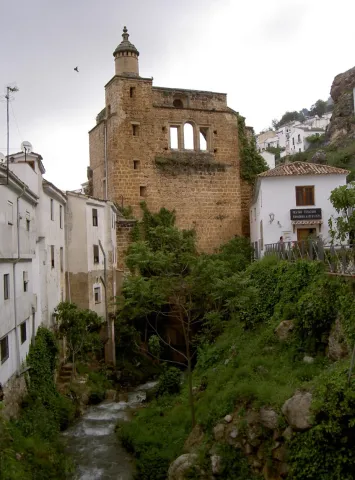
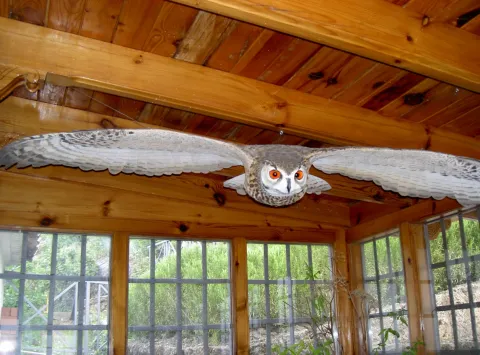
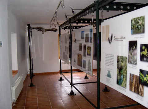
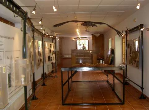
Frondosa Nature contains, among other elements, audiovisual, olfactory panels, images and sounds of the flora and fauna of this protected natural space, bird reproductions and a model of the Natural Park of Cazorla, Segura and the Villas.

Telecomunicaciones
Sitio web
www.almagaia.eu
Teléfono de contacto
953 721 330
Correo electrónico
info@almagaia.es
Ubicación
Nombre
La Casa de la Luz.
Código Postal
23470
Latitud
37.905224
Longitud
-2.998526
Dirección
Camino del Ángel, 7-9
Municipio
Ubicación en el mapa
POINT (-2.998526 37.905224)
Tipos de punto de interés
Imágenes carrusel
imagen
Image
PICT5925.jpg
Imagen principal
Desactivado
imagen
Image
PICT5929.jpg
Imagen principal
Desactivado
imagen
Image
PICT5927.jpg
Imagen principal
Desactivado
imagen
Image
PICT5926.jpg
Imagen principal
Desactivado
Imágenes cabecera
imagen
Image
PICT5936.jpg
Imagen principal
Activado
Horario
10: 30 - 13: 30 and 16: 00 - 19: 00.
Loading map
Preparing points of interest and routes...

Flour Mill el Gato

Submitted by brandcode_deweloper on
Id
8107962
Descripción
Descripción larga

Dated between 1950 / 1959. Electric flour mill with elevators and threads that carry wheat and flour from one machine to another. It has atrojes for the storage of wheat, atroje for the damp, alfanje, milling stay and machine stay. The chunks are built in tapial and spun, the function being to store the grain. The alfanje, built in brick and wood, is where you will find the set of milling stones. Inside is the gear that moves the stone. The stay of the milling is where the process of milling the grain is carried out. The machine stay is the second floor where you will find the trickle, the clean and the fender.

Breve descripción

Located in the Hutar or Hutar Birth. It's the next mill to the Trinity Mill. He took advantage of the strength of the Hutar Arroyo water. The mill is within a newly built building. The waterfall remains with its blinded arches that brought water to the mill. In the surroundings are its mill stones

Telecomunicaciones
Sitio web
www.huesa.es
Correo electrónico
ayuntamiento@carboneros.es
Ubicación
Código Postal
23487
Latitud
37.764260
Longitud
-3.077970
Municipio
Ubicación en el mapa
POINT (-3.07797 37.76426)
Imágenes carrusel
imagen
Image
p1330838.jpg
Imagen principal
Desactivado
Imágenes cabecera
imagen
Image
p1330739-copia.jpg
Imagen principal
Activado
Loading map
Preparing points of interest and routes...
Mill of the Cubo

Submitted by brandcode_deweloper on
Id
4884561
Descripción
Breve descripción

It is a fortified flour mill that takes the name of the stream of the cube, is built by the Order of Calatrava in 1437. It is the largest and best preserved fortified mill built by the South Peninsular Military Orders. In this place, down to the river of the Cube, we find an area of high ecological and landscape value.

Telecomunicaciones
Sitio web
www.tosiria.com
Teléfono de contacto
622 626 159
Ubicación
Código Postal
23650
Latitud
37.743900
Longitud
-3.940700
Distrito
Municipio
Ubicación en el mapa
POINT (-3.9407 37.7439)
Tipos de punto de interés
Imágenes carrusel
imagen
Image
molino%20del%20cubo.jpg
Imagen principal
Desactivado
imagen
Image
molino%20del%20cubo%202.jpg
Imagen principal
Desactivado
Imágenes cabecera
imagen
Image
molino.jpg
Imagen principal
Activado
Loading map
Preparing points of interest and routes...

Lower Mill or Vicarage Mill

Submitted by brandcode_deweloper on
Id
4707246
Descripción
Descripción larga

It consists of one wheel and two milling stones, the first to mould wheat and the second for other grain types; the network of acequias and canals that fed it is kept in use but only for the irrigation of the annexed gardens.

Breve descripción

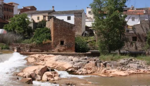
This flour mill is located on the right bank of the Guadalimar, upstream of the core of Puente de Génave, being the most interesting from the architectural and historical point of view. It appears to be mentioned in Philip II's Relations in which it is said that it is "a particular flour mill in which all the neighbors of Génave grind" and that they went here due to the absence of streams with sufficient flows for the construction of a mill in that locality; from this circumstance derives the name of "Génave mill" with which it is also known.

Telecomunicaciones
Sitio web
www.puentedegenave.es/el-municipio/patrimonio-historico.html
Correo electrónico
pgenave@puentedegenave.es
Ubicación
Código Postal
23350
Latitud
38.354562
Longitud
-2.803199
Distrito
Municipio
Ubicación en el mapa
POINT (-2.803199 38.354562)
Tipos de punto de interés
Imágenes carrusel
imagen
Image
111430.jpg
Imagen principal
Desactivado
Imágenes cabecera
imagen
Image
Almazara_de_la_Vicarxa.jpg
Imagen principal
Activado
Loading map
Preparing points of interest and routes...

Canena Small Mill

Submitted by brandcode_deweloper on
Id
8001060
Descripción
Descripción larga

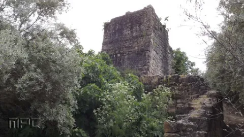
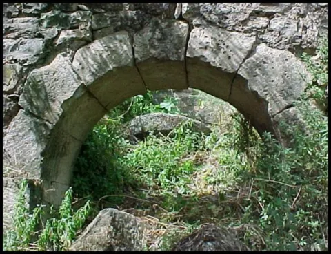
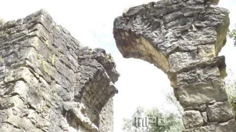
The mill is a hydraulic construction of at least Roman times that served for the grinding of cereal. The initial remains could be dated in the Roman era, but then much improved in the 16th century when it was bought by Francisco de los Cobos. The existing remains allow to contemplate several arches of the aqueduct, the water storage tank and hydraulic drive.

Breve descripción

The architectural and urban elements of interest of Canena are the aqueduct and mill of El Molinillo, located next to the stream of the Yedra.

Telecomunicaciones
Sitio web
https://canena.es/
Correo electrónico
canena@canena.es
Ubicación
Código Postal
23420
Latitud
38.047680
Longitud
-3.482890
Dirección
Carretera 322 Km. 135
Municipio
Ubicación en el mapa
POINT (-3.48289 38.04768)
Tipos de punto de interés
Imágenes carrusel
imagen
Image
molinillo%20canena.jpg
Imagen principal
Desactivado
imagen
Image
molinillo%20canena3.jpg
Imagen principal
Desactivado
Imágenes cabecera
imagen
Image
molinillo%20canena2.jpg
Imagen principal
Activado
Loading map
Preparing points of interest and routes...