Saltar al contenido principal
icon-intereses-viajar-solo

Los Perales Strait

Submitted by brandcode_deweloper on
Id
913048
Descripción
Descripción larga

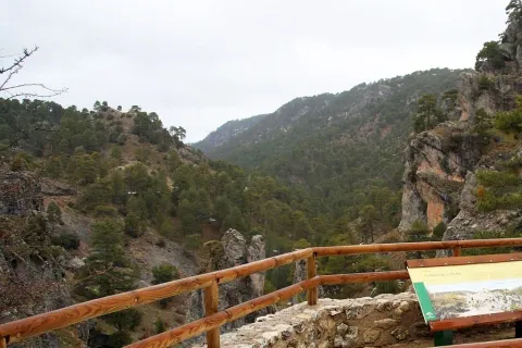
There are two places to enjoy the Strait of Perals:

  • Undoubtedly a good place to observe the beauty of this Strait is the lookout that appears on the left side of the Navas road. It's not signposted, so you have to pay attention, though it has no loss.
  • In the valley of Valdetrillos in the ascending direction there is a track that can be seen from the lookout. To get to it you have to turn back on the runway of the Navas and take the road cut by a chain that goes to the right. We have to cross the bridge over the Rambla stream. After a period of half an hour walking we view the basin of the Valdetrillos stream from where the Strait of the Perals and the lookout that has been referred to above are observed.

In Cazorla take the Sierra road (A-319) until the crossing known as the Empalme del Valle. Turn right on the JF-7092 road and after passing the bridge over the Guadalquivir River (4 km from the Empalme) follow the left track (JF-7091). Between the km 27 and 28 of the road signs is the lookout with views of the Strait of the Perales.

Breve descripción

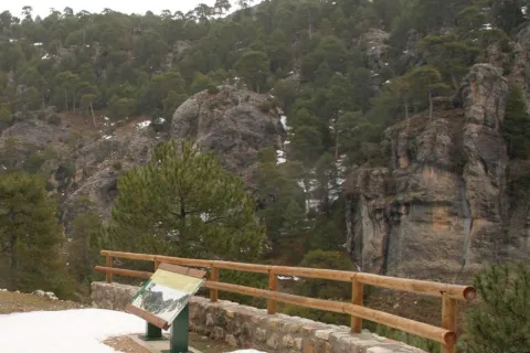
Singular throat that stands out for the aesthetics of its curious rock formations. At the bottom the stream of Valdetrillos breaks into fast joys that put the sound note. In this area it is easy to see how the agile muflons, the montane males, and even the majestic flight of the royal eagle, the leonate vulture or the drifted eagle climb through vertical walls. At the end of the valley the Calarillas provides perspectives of the highest mountains of this natural space.
Ubicación
Latitud
37.912893
Longitud
-3.003887
Municipio
Ubicación en el mapa
POINT (-3.003887 37.912893)
Tipos de punto de interés
Imágenes carrusel
imagen
Image
perales.jpg
Imagen principal
Desactivado
Imágenes cabecera
imagen
Image
1515_MI_01.jpg
Imagen principal
Activado
Loading map
Preparing points of interest and routes...

El Yelmo Free Flight Station

Submitted by brandcode_deweloper on
Id
1921810
Descripción
Descripción larga

INTERNATIONAL AIR FESTIVAL -The Yelmo is the most important festival in Spain on flight issues. A very original festival that allows you to enjoy the projection of films linked to air and air sports, and a fair with the best products for the practice of free flight, as well as acrobatic exhibitions, concerts and cultural activities.

Breve descripción

The Yelmo is the most emblematic mountain in the Sierra de Segura. With a height of 1.807 meters above sea level, it is a privileged lookout over the Jienese province and the borders. The great attraction of the place, located in the heart of Natural Park, is joined by its exceptional conditions. The west-facing flight is about 1,000 meters high and specialists consider it one of the best in Spain. The poniente breeze allows to fly all year round, except for adverse weather conditions.

Telecomunicaciones
Teléfono de contacto
953 482 131 / 650 116 801
Ubicación
Nombre
Club de Parapente “El Yelmo”
Código Postal
23293
Latitud
38.253746
Longitud
-2.660571
Dirección
C/ Andalucía, 164 F 1º
Distrito
Ubicación en el mapa
POINT (-2.660571 38.253746)
Loading map
Preparing points of interest and routes...

Huesa Station

Submitted by brandcode_deweloper on
Id
4535653
Descripción
Breve descripción

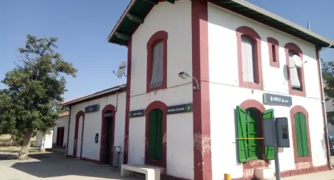
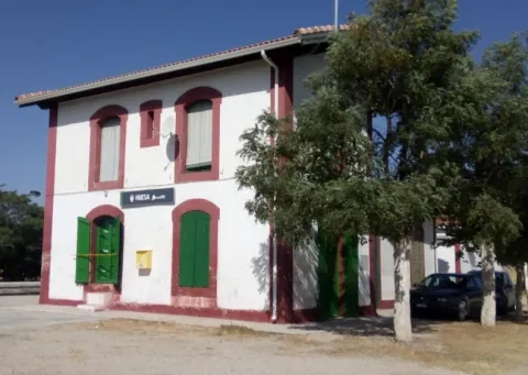
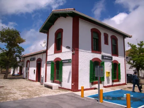
Huesa belongs to the region of Alto Guadalquivir, extending from the center of the region to the south of it, just on the provincial border with Granada. It gives the capital 137 Km. The station is located at point 82.7 of the railway line of Iberian width Linares Baeza-Almería, between the stations of Larva and Cabra del Santo Cristo- Alicún.

Telecomunicaciones
Teléfono de contacto
902 432 343
Ubicación
Código Postal
23487
Latitud
37.717060
Longitud
-3.186950
Dirección
Estación, s/n
Municipio
Ubicación en el mapa
POINT (-3.18695 37.71706)
Tipos de punto de interés
Imágenes carrusel
imagen
Image
Estaci%C3%B3n%20de%20Huesa%202.jpg
Imagen principal
Desactivado
imagen
Image
Estaci%C3%B3n%20de%20Huesa.jpg
Imagen principal
Desactivado
Imágenes cabecera
imagen
Image
5699259710_896b12e639_b.jpg
Imagen principal
Activado
Loading map
Preparing points of interest and routes...

Estaca Grande

Submitted by brandcode_deweloper on
Id
7461237
Descripción
Descripción larga
  • Your access is made on foot field through.
  • The person who best knows and has studied the centenary olive trees in Martos is Mr. Ciriaco Castro Toro, retired technician of the City Council.
Breve descripción

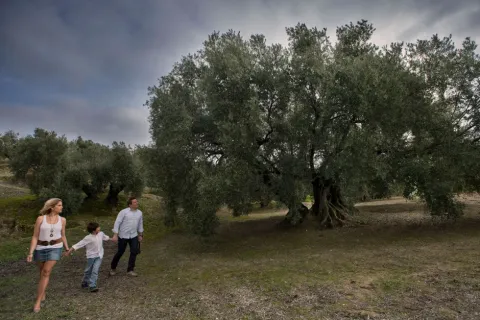
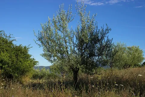
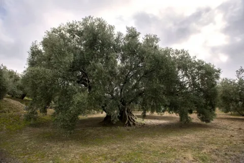
La Estaca Grande is a unique olive tree, about 300 years old, located about 450 metres from the Via Verde del Oil, right in the area called Cañada del Abandado, in the municipal term of Martos. In Jaén the olive trees are also known as stacas, in reference to their primary phase and to one of the planting methods.

Telecomunicaciones
Sitio web
https://www.martos.es/
Teléfono de contacto
953 704 005
Correo electrónico
concejal.jerena@martos.es
Ubicación
Nombre
Cañada del Abandonado
Código Postal
23600
Latitud
37.735290
Longitud
-3.970170
Distrito
Municipio
Ubicación en el mapa
POINT (-3.97017 37.73529)
Tipos de punto de interés
Imágenes carrusel
imagen
Image
estca-grande-2.jpg
Imagen principal
Desactivado
imagen
Image
olivo-estaca.jpg
Imagen principal
Desactivado
Imágenes cabecera
imagen
Image
estaca-grande-1.jpg
Imagen principal
Activado
Microsite al que pertenece
Loading map
Preparing points of interest and routes...

Azur Art Space

Submitted by brandcode_deweloper on
Id
6058624
Descripción
Breve descripción

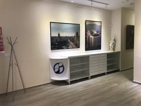
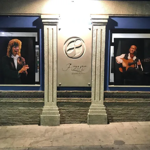
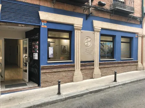
Azur is an art gallery that offers continuous exhibitions at various points in the centre of Jaén, representing the best artists in the province. It also has a coworking workshop where artists can develop their work. Let yourself be surprised by contemporary art and visit us.

Telecomunicaciones
Sitio web
https://www.espaciodearteazur.com/
Teléfono de contacto
687 118 125
Correo electrónico
azuracademia@gmail.com
Ubicación
Código Postal
23001
Latitud
37.768082
Longitud
-3.785806
Dirección
C/ Tablerón, 18
Distrito
Municipio
Ubicación en el mapa
POINT (-3.785806 37.768082)
Tipos de punto de interés
Imágenes carrusel
imagen
Image
4.jpg
Imagen principal
Desactivado
imagen
Image
6.jpg
Imagen principal
Desactivado
imagen
Image
3.jpg
Imagen principal
Desactivado
imagen
Image
5.jpg
Imagen principal
Desactivado
Imágenes cabecera
imagen
Image
1.jpg
Imagen principal
Activado
Horario
Monday to Sunday: 10: 00 - 13: 30 and 17: 30 - 20: 30.
Loading map
Preparing points of interest and routes...

Virgen del Castillo Hermitage-Sanctuary

Submitted by brandcode_deweloper on
Id
3984792
Descripción
Descripción larga

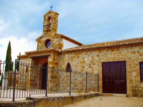
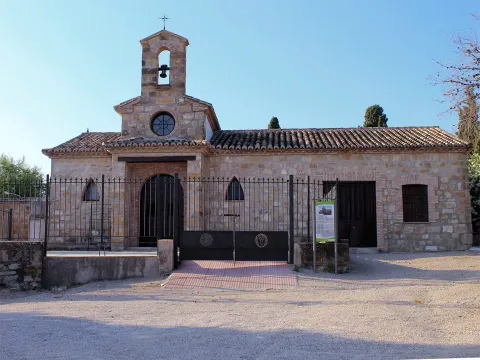
Located on the top of the hill of the Castle, it offers beautiful views of the entire town of Vilches. On this hill was located the Castle of Vilches, of which to this day few remains are preserved due to the construction of the church of Santiago - and later of the Ermite - on its courtyard of weapons.

The Hermitage houses the image of the patron of Vilches, who every 14 August is brought down in procession to the parish of San Miguel for the celebration of the parties to which it gives name.

Breve descripción

Arrested on the ancient medieval church of Santiago, the Ermita- Sanctuary of the Virgin of the Castle dates back to the 18th century.

Telecomunicaciones
Sitio web
www.ayuntamientovilches.es/es/
Teléfono de contacto
953 630 075
Ubicación
Código Postal
23220
Latitud
38.204470
Longitud
-3.507490
Dirección
Plaza Mayor
Distrito
Municipio
Ubicación en el mapa
POINT (-3.50749 38.20447)
Tipos de punto de interés
Imágenes carrusel
imagen
Image
Mon374.jpg
Imagen principal
Desactivado
imagen
Image
7.jpg
Imagen principal
Desactivado
Imágenes cabecera
imagen
Image
CastillodeVilches%202.jpg
Imagen principal
Activado
Microsite al que pertenece
Loading map
Preparing points of interest and routes...

Hermitage of the Señor de las Lluvias

Submitted by brandcode_deweloper on
Id
4619143
Descripción
Descripción larga

It is the only hermitage that is preserved in the 18th century Mengibar. It is located next to the Municipal Cemetery and was formerly known as Ermita del Humilladero. Today, it houses five images that process in the Holy Week of Mengibarians, including the Christ of the Rain that is traditionally entrusted in the years and periods of drought, hence its name.

Breve descripción

It is a small hermitage, of three narrow ships, the canyon vault centre and the adjoining sides separated from the centre by two large arches of half point brick seen.

Telecomunicaciones
Sitio web
https://mengibarturismo.com/
Teléfono de contacto
677 222 285
Correo electrónico
turismo@aytomengibar.com
Ubicación
Código Postal
23620
Latitud
37.964740
Longitud
-3.807580
Dirección
Camino de Mengíbar, 2
Distrito
Municipio
Ubicación en el mapa
POINT (-3.80758 37.96474)
Tipos de punto de interés
Imágenes carrusel
imagen
Image
La%20Ermita%20del%20Se%C3%B1or%20de%20las%20Lluvias.JPG
Imagen principal
Desactivado
Imágenes cabecera
imagen
Image
main_image_97252.jpeg
Imagen principal
Activado
Microsite al que pertenece
Loading map
Preparing points of interest and routes...

Hermitage of the Cristo del Llano

Submitted by brandcode_deweloper on
Id
5868386
Descripción
Descripción larga

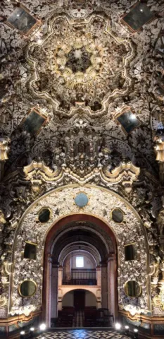
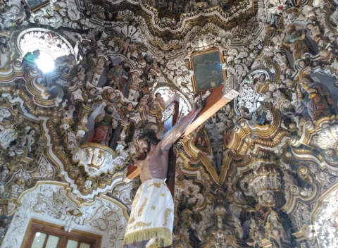
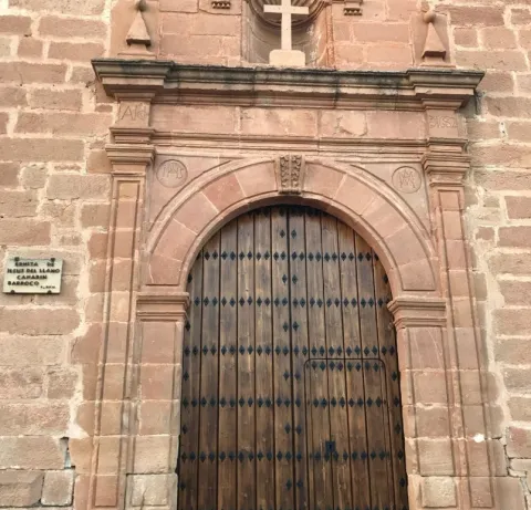
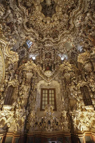
It is a shrimp-tower in spadna that dominates by its volume the rest of the temple, whose interior stands out by its funning decoration with geometric and vegetable elements that fill its walls to frescoes with scenes of the New Testament that close the vault in height. It is a building built of reddish stone of regular cut and seat, with a ship with high choir at the feet to which it is accessed through a staircase inserted into a volume attached on the west side; cruise and high presbytery on steps, behind which the shrimp is available.

Breve descripción

Work of the 17th century, extended in its header with one of the most impressive shrimp of the Andalusian baroque.

Telecomunicaciones
Sitio web
www.laencinaturismo.com
Teléfono de contacto
953 613 029
Correo electrónico
info@laencinaturismo.com
Ubicación
Código Postal
23711
Latitud
38.175190
Longitud
-3.774800
Dirección
Plaza de La Ermita, 1
Distrito
Ubicación en el mapa
POINT (-3.7748 38.17519)
Tipos de punto de interés
Imágenes carrusel
imagen
Image
2.jpg
Imagen principal
Desactivado
imagen
Image
1.jpg
Imagen principal
Desactivado
imagen
Image
3.jpg
Imagen principal
Desactivado
Imágenes cabecera
imagen
Image
_MG_1989.jpg
Imagen principal
Activado
Horario
Monday to Friday: 13: 15 - 14: 15. Saturdays, Sundays and holidays: 11: 00 - 14: 00 and 16: 30 - 18: 30.
Microsite al que pertenece
Loading map
Preparing points of interest and routes...

Hermitage of the Cristo del Humilladero

Submitted by brandcode_deweloper on
Id
4444651
Descripción
Descripción larga

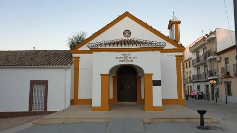
It has a single body, with a small furnace in the center with a half-point arch, in which the Christ of the Humiliadero appears. Everything is decorated with motifs of chromed poly wood, in the upper furnace is the Virgin of Pilar.
The Humiliadero Christ arrived in Lopera in 1941 and is the work of the Valencian imaginary Amadeo Ruiz Olmos. The hermitage is kept almost closed all year round, the loperans and visitors who close to it, make their prayers through a small window. In 1761 the soldadesque of the Most Holy Christ of the Humiliadero is founded, it is characteristic of this soldadesque, the fluttering of flags during the processing of his Christ and the shooting of arrows. The fair and festivities of the Christos in honor of the Christ of the Veracruz and Christ of the Humilladero has been held since 1628. The processional cross of Christ is a replica, the original one is found in the sacristy of the parish, was donated by the Pelaez family.

Breve descripción

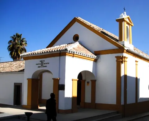
The Hermitage of the Christ of the Humiliadero or the Christ of the Chico is from the 18th century, Baroque style. The cover of the hermitage has a vanity in which the main entrance is framed with a half-point arch, it is crowned with a front with molding. It is covered in two waters and has a porch that serves as a front to the hermitage, with reduced arches. On the right side he has a swordsman. The main altar, also from the 18th century and baroque style, is in perfect conservation. The dimensions of the altar are 3.20 × 5.40 meters.

Telecomunicaciones
Sitio web
www.lopera.es
Teléfono de contacto
953 516 250
Correo electrónico
lopera@promojaen.es
Ubicación
Código Postal
23780
Latitud
37.944720
Longitud
-4.211810
Dirección
C/ San Roque, 2
Distrito
Municipio
Ubicación en el mapa
POINT (-4.21181 37.94472)
Tipos de punto de interés
Imágenes carrusel
imagen
Image
Ermita%20del%20Cristo%20del%20Humilladero.jpg
Imagen principal
Desactivado
Imágenes cabecera
imagen
Image
emirta.jpg
Imagen principal
Activado
Loading map
Preparing points of interest and routes...

Hermitage of the Cristo de la Vera Cruz

Submitted by brandcode_deweloper on
Id
4585075
Descripción
Breve descripción

It dates from the XVII@-@ XVIII centuries. It houses the image of the pattern, the Most Holy Christ of Veracruz, in a baroque style shrimp whose decoration is due to the painter Ginés Navarro. The outer cover dates from the reconstruction of the temple that was made to the neo-Gothic taste by the neighbors in the first half of the 19th century.

Telecomunicaciones
Sitio web
www.redjaen.es/francis/?m=c&o=8079
Ubicación
Código Postal
23338
Latitud
38.159280
Longitud
-3.031710
Dirección
C/ Veracruz
Municipio
Ubicación en el mapa
POINT (-3.03171 38.15928)
Tipos de punto de interés
Imágenes carrusel
imagen
Image
Ermita%20del%20Cristo%20de%20la%20Vera%20Cruz%202.jpg
Imagen principal
Desactivado
Imágenes cabecera
imagen
Image
DSCN4255.JPG
Imagen principal
Activado
Loading map
Preparing points of interest and routes...