Saltar al contenido principal
icon-intereses-viajar-solo

Castle of Tobaruela

Submitted by brandcode_deweloper on
Id
320626
Descripción
Descripción larga

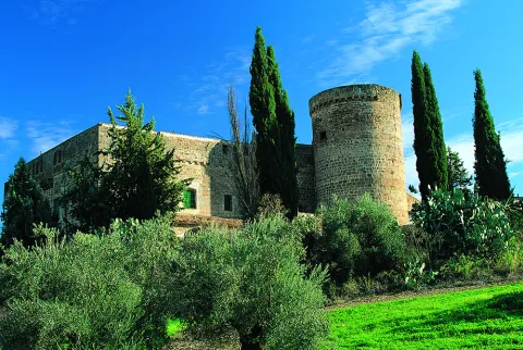
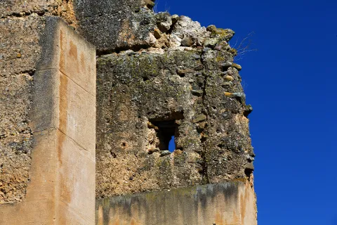
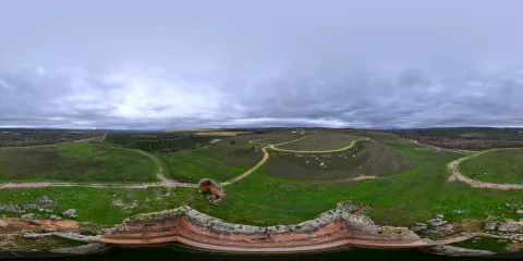
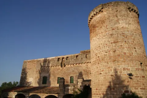
The castle of the Tobaruela is a very late residential building in which you can appreciate the most obvious features of the architectural evolution that this type of fortifications suffered throughout the 15th century. They were originally fully military castles with a Tribute Tower with a double function as a defensive and residential element. The process of transformation begins with the articulation of the residential area around a central courtyard and the conversion of the tower into an exclusively defensive element. Finally, the Tribute Tower will reduce its size, even disappearing, using the space it occupies to improve the articulation of the residential area.

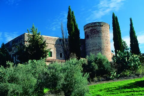
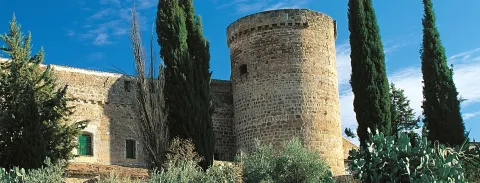
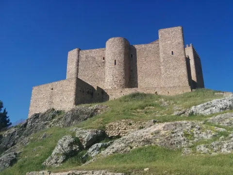
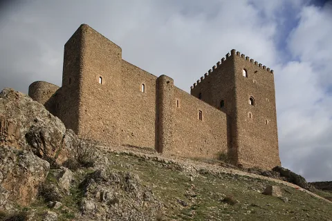
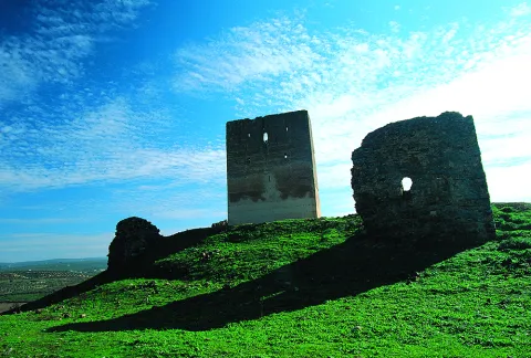
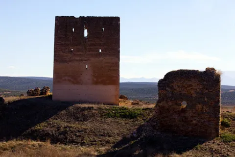
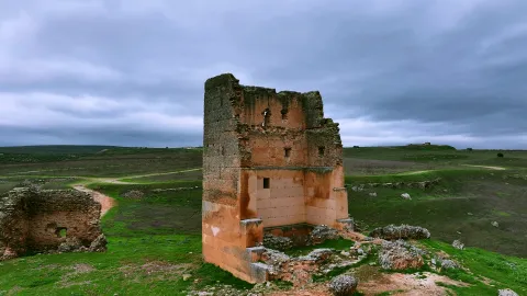
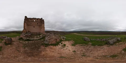
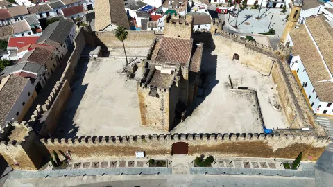
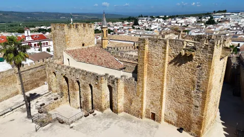
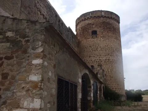
It is a rectangular-floor castle with evidence that it was not finished, which incorporates a rectangular tower in the southeast corner, which could be identified with that of the Tribute, and which would have as its purpose the defense of the main access. In the south-west corner, an elegant bilobulated tower was set up on three vaulted floors. It was protected on three of its fronts by an anthemide and a dry pit.

On the canvas is the main door that allows access to the interior of the fortification, with a rectangular cover of armchairs arranged to rope and framed by stylized pinacles, topped with plant motifs. The vanity is made up of a carpanel arch with a molding decoration at the inner angle of the arch. A series of heraldic shields are available on the arch. Below to the left is the shield of Portugal, in reference to Juana of Portugal, the first wife of Alonso Sánchez de Carvajal. To the right the shield of Pacheco, by his second wife, Maria Pacheco. On these we found the shields of Carvajal and Cueva.

Internally the fortification is organized around a porticated courtyard on one of its fronts, which is completed in height with large windows of panel arches held on columns. The rooms and rooms were distributed around the courtyard, especially on the second floor.

During the Middle Ages, the confrontation between Peter I and Henry II Trastámara brought with it the progress and political relevance of various lines such as the Carvajales. Linares is consolidated as a rural core of a certain entity, appearing in the sources as one of the most populated villages of the Baeza Council in the early 15th century. A situation that would serve as an incentive to attract second-row nobles and hydalgos.

At this time the rural fortresses that constituted the characteristic housing of the nobility begin to appear also in the cities, as nobility houses that will incorporate defensive elements. They were solid residences of military appearance to the outside, but refined inside. They could be seen as genuine bulwarks in which to take refuge in the event of the development of urban nobility.

For this period is the Castle of the Tobaruela, a very late military work that reflects the situation of political struggle of the end of the Middle Ages. The Catholic Kings, with the aim of ending the nobility conflicts that had characterized the previous centuries, ordered the destruction of numerous castles, while prohibiting the construction of new ones. Some of the gentlemen, while omitting the legislation, built fortresses, such as the Tobaruela Castle, built in 1475 by Alonso Sánchez Carvajal, in the context of his clashes with Juan de Benavides. In order to avoid the real prohibition, and in this way to avoid requesting the permission of the monarchs, Alonso Sánchez Carvajal justified the construction of this castle before the authorities, arguing that the works carried out pursued the restoration of an old fortress, which has raised the hypothesis that it could be built on an earlier fortification.

Breve descripción

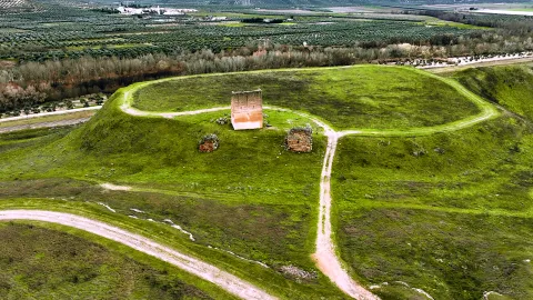
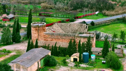
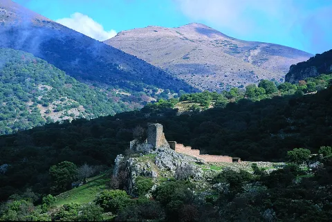
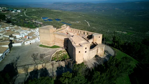
The castle of the Tobaruela is a military-looking and rectangular-floor signage building, articulated around a partially porticated central courtyard. This castle-palace is made up of wall canvases and two towers, a square that could correspond to the Tribute and a beautiful bilobulated tower. The main door of the castle is framed by a monumental cover with four nobility shields. The castle was protected by an anthemide and a dry pit. It is currently privately owned.
The Carvajales' lineage was one of those who benefited from the conflict that erupted in the second half of the 14th century, which would face Peter I and Henry II Tratámara, thanks to the support they provided to the trastamarist side, which would lead him to become one of the most powerful and influential families of Alto Guadalquivir. In this context, there is a rivalry between two important nobility groups, the Carvajales and the Benavides, which led Alonso Sánchez Carvajal, in a struggle with Juan de Benavides, to build in 1475 the castle of the Tobaruela, an action that would cause problems with the monarchy, since it would not comply with the prohibition of the Catholic Kings to build new fortifications, a mandate aimed at ending the nobility conflicts.
Telecomunicaciones
Sitio web
www.ctobaruela.wordpress.com
Ubicación
Código Postal
23700
Latitud
38.068512
Longitud
-3.675819
Dirección
Carretera A-302, km. 3
Distrito
Municipio
Ubicación en el mapa
POINT (-3.675819 38.068512)
Tipos de punto de interés
Imágenes carrusel
imagen
Image
castillo_tobaruela3.jpg
Imagen principal
Desactivado
imagen
Image
castillo_tobaruela2.jpg
Imagen principal
Desactivado
imagen
Image
Mon063.jpg
Imagen principal
Desactivado
imagen
Image
Mon183.jpg
Imagen principal
Desactivado
imagen
Image
Mon464.jpg
Imagen principal
Desactivado
Imágenes cabecera
imagen
Image
Castillos_Cacbecera%20%284%29.jpg
Imagen principal
Activado
Horario
Castle not visitable.
Microsite al que pertenece
Loading map
Preparing points of interest and routes...

Castle of Solera

Submitted by brandcode_deweloper on
Id
4652708
Descripción
Descripción larga

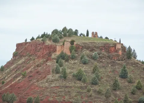
It is in a rocky spur at 1,090 meters high and is the highest castle in the province of Jaén. Two constructive phases are distinguished. At the top there are walls of irregular size masonry that delimit a small enclosure to which is associated a aljibe that still retains remains of the pointed cover vault. Below, there are remains of other larger buildings, a real castle flanked by masonry towers of armchairs at the angles and walls that close the enclosure. The communication between the two areas is carried out through a passage covered by a vault of half a barrel, also of masonry, and which preserves the remains of enlucido.

The whole construction is mounted on top of the rock that serves as a foundation. The original paraments with a strong deterioration are masked by recent remodeling.

From the Castle of Solera, of Nazari origin, you can see splendid views of the Vega in which the Jandulilla River and the Garganton River converge, as well as the village of Bélmez de la Moraleda and the Torreón del Lucero, which gives an idea of the defensive system that these lands had in the past.

Breve descripción

The Castle of Solera is located in the town of the same name, belonging since 1975 to the municipality of Huelma in the province of Jaén. Andalusia. The ruins of this Arab castle, of masonry and on a rocky needle, testified to the difficulties that Christians must have had until they managed to conquer it in 1433. The Castle was declared a Historical Monument in 1.985.

Telecomunicaciones
Sitio web
www.aytohuelma.es
Teléfono de contacto
953 390 210
Ubicación
Código Postal
23569
Latitud
37.684380
Longitud
-3.369020
Distrito
Municipio
Ubicación en el mapa
POINT (-3.36902 37.68438)
Tipos de punto de interés
Imágenes carrusel
imagen
Image
Castillo%20de%20Solera.jpg
Imagen principal
Desactivado
Imágenes cabecera
imagen
Image
132095-el-castillo-de-solera.jpg
Imagen principal
Activado
Loading map
Preparing points of interest and routes...

Castle of Segura de la Sierra

Submitted by brandcode_deweloper on
Id
6250036
Descripción
Descripción larga

El recinto exterior abarca una gran superficie, en la que se distinguen muros que pertenecerían a construcciones características de un castillo y dos grande aljibes excavados en la roca, destinados a recoger y almacenar agua.

La barbacana, muy restaurada, está formada por un antemuro que protegía el lado oeste, más accesible, y una puerta con dos tramos de escalera en codo, lo que dificultaba la entrada a los posibles atacantes y que sería el acceso original.

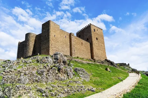
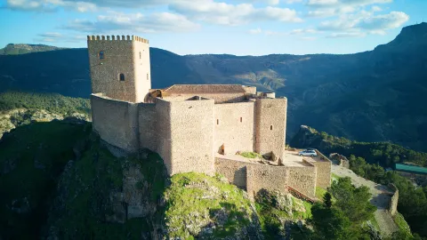
El alcázar, de forma trapezoidal, tiene cuatro torres esquineras y dos más pequeñas en los lienzos sur y sureste, esta última semicircular. La entrada, también en codo, pero con una subida en rampa, se sitúa en la torre noroeste, mientras que la torre del Homenaje, situada en el sector este, con 18,43 m de altura, se estructuraba en tres plantas y terraza comunicadas por una escalera empotrada en el grueso de los muros. Las torres están comunicadas por un adarve que recorre todo el recinto.

En el interior del recinto se conserva una capilla erigida en el siglo XIII por la Orden de Santiago, de estilo mudéjar, con una nave rectangular y ábside semicircular. Frente a ella hay una gran sala o refectorio con arcos apuntados, en la que, probablemente, el techo original fuese más alto que el actual, pudiendo haber sido reutilizada como polvorín durante la Guerra de la Independencia (1808-1814). El aljibe existente en el centro del patio de armas se construyó para el aprovisionamiento de los defensores del castillo en caso de que los atacantes hubiesen conquistado el recinto exterior. Durante las excavaciones arqueológicas realizadas en 2001 salieron a la luz restos de otras construcciones de diversas cronologías: una vivienda del siglo X, lienzos de la muralla de tapial del siglo XII y de una torre almohade o un baño. El baño debió estar decorado con cierta suntuosidad, como muestran los restos de elementos decorativos recuperados, lo que correspondería a residencia de un importante señor.

Un segundo recinto de mampostería trabada con argamasa se extiende por la ladera oeste, de sur a nordeste. En él se distinguen restos de hasta siete torreones, mientras que en su interior son visibles restos de otras estructuras. 

Al nordeste, a la misma altitud de la villa, se conservan restos de un pequeño recinto con una gran torre de tapial, conocida como la “Torre de las Eras” de, al menos, cuatro niveles, horadada por numerosas saeteras de la que tan sólo quedan en pie dos de sus lados. Unos metros al este se observan los restos de una torre esquinera de menor tamaño, y de unas caballerizas y un silo excavados en la roca, situados entre ambas.

En la ladera sur del cerro sobre el que se asienta el castillo se encuentra la Torre del Agua, construcción almohade de planta rectangular y realizada en un tapial muy duro (tabiyya). Formada por tres muros, tiene como cierre trasero la roca natural. Originalmente carecía de entrada u otros vanos, pues su función parece haber sido la protección de un manantial al que se accedería desde la parte superior. 

La ocupación del cerro en el que se asienta Segura de la Sierra es anterior a la construcción de la fortaleza y de los grandes recintos de murallas hoy visibles en la población, erigidos probablemente como resultado de las transformaciones sociopolíticas que sufrió al-Andalus a partir del siglo XI. Los restos más antiguos documentados durante las investigaciones arqueológicas corresponden a una vivienda del siglo IX bajo el castillo.

La desmembración del Califato de Córdoba, a principios del siglo XI, causó un continuo cambio de manos de Segura, que, tras pertenecer a la taifa de Murcia, llegó a ser reino independiente entre 1043 y 1044, antes de caer bajo el control de la Taifa de Denia. La conquista de esta última por el rey de Zaragoza propició un nuevo período de independencia entre 1076 y 1079, pasando finalmente a formar parte del reino de Sevilla, hasta la ocupación de Segura por los almorávides en 1091.

Durante la crisis del movimiento almorávide Ibrahim ibn Hamusk se sublevó en Sócovos de Yeste, apoderándose de Segura en 1147, aliándose con el reino creado en Levante y Murcia por ibn Sai ibn Mardanis. Esta alianza propició que ibn Hamusk se apoderase de un gran territorio, tomando Jaén, Baeza y Úbeda. Estos territorios que formaron parte de un reino independiente pasaron a manos almohades en 1169, quedando ibn Hamusk como gobernador de sus territorios en Jaén. 

En ese momento Saqura se describe ya como una fortaleza (hisn) comparable a una ciudad (medina) por la importancia de su población. Entre los siglos XI y XIII se produjo una amplia fortificación en la Sierra de Segura.

Tras la conquista castellana de la comarca, entre 1226 y 1239, Fernando III reparte paulatinamente los territorios a la Orden de Santiago, concediéndole Segura el 21 de agosto de 1242, localidad a la que la Orden trasladará la Encomienda Mayor de Castilla desde Uclés. En 1243 tenía Concejo y recibió el fuero de Cuenca. 

El castillo de Segura sirvió como bastión durante las luchas nobiliarias de los siglos XIV y XV, bajo la autoridad de la familia Manrique, y como lugar desde el que partieron numerosos ataques al reino nazarí de Granada, teniendo como uno de sus principales protagonistas a Rodrigo Manrique, Maestre de la Orden de Santiago y padre del poeta Jorge Manrique.

Permaneció como sede de la Encomienda y cabeza del señorío santiaguista durante toda la Edad Moderna. 

En 1748 se constituye la Provincia Marítima de Segura de la Sierra, por el aprovisionamiento de madera para la política naval del reinado de Fernando VI, lo que produjo la degradación forestal de la comarca.

En 1810 fue nuevamente escenario de un conflicto bélico, con el enfrentamiento con las tropas napoleónicas, que arrasaron y quemaron tanto la villa como el castillo, que permaneció en ruinas hasta una serie de restauraciones llevadas a cabo en el castillo y las murallas de la localidad durante los años 60 y 70 del siglo XX. En 2001 la Universidad de Jaén acometió la primera intervención arqueológica en el castillo y en 2021 en parte de la muralla de la villa, en la zona de la puerta de Góntar.

La villa de Segura de la Sierra y su castillo están declarados Conjunto Histórico Artístico y Paisaje Pintoresco.

LEYENDAS
Leyenda del ajedrez del rey de Segura. Mudarra, sobrino del rey de Córdoba, ganó una partida de ajedrez al rey de Segura siendo huésped de su castillo. El monarca indignado le llamó “hijo de nadie”, ante lo que Mudarra le asesinó golpeándole iracundo con el tablero en la cabeza. Huyó a Córdoba donde su madre le relató la historia de su padre, Gonzalo Gustioz, a cuyos hijos, los 7 infantes de Salas, decapitaron por orden de su tío Ruy Velázquez, como venganza por una grave afrenta a la familia de su esposa durante las celebraciones de su boda. 

Mudarra partió a Castilla en busca de Ruy Velázquez, al que dio muerte cerca de Burgos, completando su venganza quemando viva a doña Lambra, esposa de su tío e instigadora del asesinato de los infantes.
 

Breve descripción

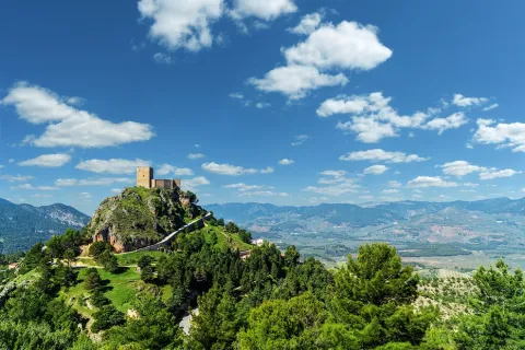
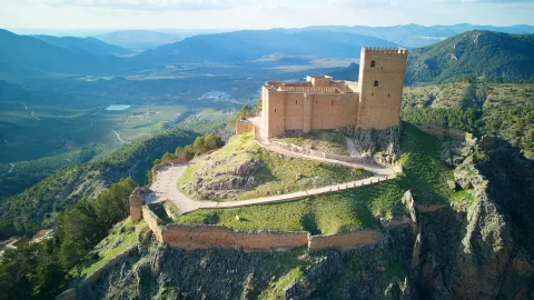
The castle of Segura de la Sierra is made up of an outer enclosure of tapial and an alcázar protected by a barbacana, made in masonry, a Christian work built between the 13th and 14th centuries, although taking advantage of the remains of the previous Muslim fortification. Many defensive elements extend along the hill side on which it sits, while inside the castle a chapel, a capitular room, a bathroom and other structures are preserved from different chronological moments. The walls embrace the villa, in which samples of typical serrana architecture and monumental buildings are alternated.
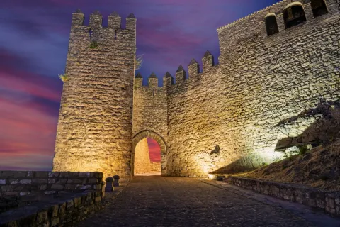
The dismemberment of the Califate of Cordoba, in the early 11th century, caused a continuous change of hands of Segura, becoming the center of the independent kingdom of ibn Hamusk in the 12th century. After the Spanish conquest of the region, in 1242 Fernando III granted Segura to the Order of Santiago, which would make it the major envoys of Castile. From it, numerous attacks took place on the Nazari kingdom of Granada and served as a bastion during the nobility struggles of the 14th and 15th centuries, under the authority of the Manrique family. In 1810 it was the scene of the confrontation with the Napoleonic troops, which destroyed and burned both the village and the castle.
After several restorations, the village of Segura de la Sierra and its castle are declared an Artistic Historical Set and Pintoresque Landscape.

Telecomunicaciones
Sitio web
www.claritasturismo.com/experiencias-segura-de-la-sierra/
Teléfono de contacto
682 834 293
Correo electrónico
info@castilloseguradelasierra.com
Ubicación
Código Postal
23379
Latitud
38.299210
Longitud
-2.649790
Dirección
C/ Castillo
Distrito
Ubicación en el mapa
POINT (-2.64979 38.29921)
Tipos de punto de interés
Imágenes carrusel
imagen
Image
img-20160526-184330-largejpg.jpg
Imagen principal
Desactivado
imagen
Image
_MG_0250%20%281%29.jpg
Imagen principal
Desactivado
imagen
Image
Segura de la Sierra
Imagen principal
Desactivado
imagen
Image
Segura de la Sierra
Imagen principal
Desactivado
Imágenes cabecera
imagen
Image
CYB_Segura_Sierra_01
Imagen principal
Desactivado
imagen
Image
CYB_Segura_Sierra_02
Imagen principal
Desactivado
Horario
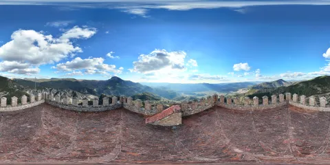
1 may - 31 oct: tuesday to sunday 10: 30 - 14: 00 and 17: 00 - 20: 30. 1 nov - 30 abr: tuesday to sunday 10: 00 - 14: 00 and 16: 00 - 18: 30.
Experiencia 360
Image
cyb_segura_sierra_360_02
Image
cyb_segura_sierra_360_02
Loading map
Preparing points of interest and routes...
Marcas de calidad

Castle of Santo Tomé

Submitted by brandcode_deweloper on
Id
4869549
Descripción
Breve descripción

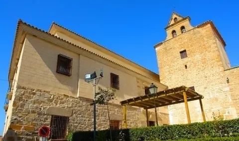
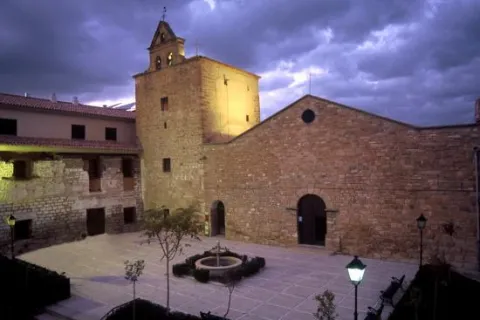
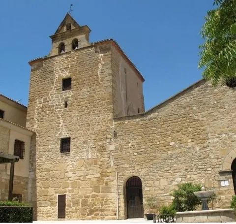
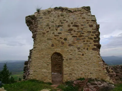
During the Middle Ages, Sao Tomé was linked to the archbishop of Toledo and was part of the territory of theCazorla advance. To meet the defensive objectives, in the14th century a castle roseof which only is preservedthe tower of tributewith a rectangular base, almost square and a single floor, which was preserved as a bell tower on the left side of the church. The tower, which retains its Gothic features, is of masonry and regular yarn on its ground floor and of armchair on the upper area, and is covered by a roof. As the original military function was changed to the religious function, aSwordsmanwith two holes for the bells, cornice and triangular front that hosts another bell. It was declaredGood of Cultural Interestin 1985.

Telecomunicaciones
Sitio web
www.santotome.es/el-municipio/patrimonio-historico.html
Teléfono de contacto
953 736 200
Correo electrónico
aytostotome@gmail.com
Ubicación
Código Postal
23311
Latitud
38.028480
Longitud
-3.101980
Dirección
Plaza Montemar
Municipio
Ubicación en el mapa
POINT (-3.10198 38.02848)
Tipos de punto de interés
Imágenes carrusel
imagen
Image
Castillo%20de%20Santo%20Tom%C3%A9.jpg
Imagen principal
Desactivado
imagen
Image
Castillo%20de%20Santo%20Tom%C3%A9%202.jpeg
Imagen principal
Desactivado
Imágenes cabecera
imagen
Image
Castillo-de-santo-tomas-1%20%281%29.jpg
Imagen principal
Activado
Loading map
Preparing points of interest and routes...

Castle of Santa Eufemia

Submitted by brandcode_deweloper on
Id
320545
Descripción
Descripción larga

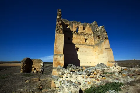
Entre los siglos XI - XII se edificó, dentro del recinto del espolón sur, una esbelta torre, que tendría como objetivo controlar las principales vías de comunicación e incrementar la capacidad defensiva de Cástulo ante el avance de los ejércitos cristianos por el Guadalquivir. Fue construida en tapial de argamasa, disminuyendo el grosor de sus muros en altura, creando un perfil interno escalonado que corresponde a su división en cuatro pisos y uno subterráneo. Cada piso estaba dividido en dos estancias mediante un muro central, sobre el que se apoyaría la escalera que los conectaba. En el primero, una mitad contendría un aljibe, mientras que el resto sería macizo. La puerta de acceso a la torre estaría situada en la segunda planta, y se accedería a ella a través de una rampa ubicada junto a uno de sus laterales.
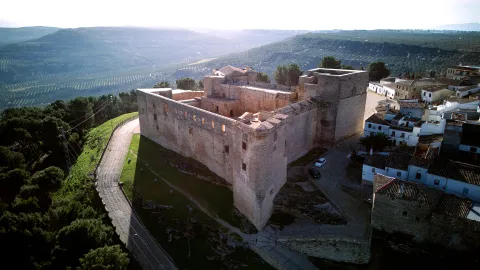
Tras la conquista cristiana de la zona en 1227, la esbelta torre islámica se convierte en la torre de Homenaje de un pequeño castillo, cuya estructura estaría conformado por un lienzo de mampostería defendido por torres perimetrales de planta cuadrada. La fortaleza quedaría aislada del resto del asentamiento por un foso defensivo, construido en este momento para incrementar su capacidad defensiva por su lado norte, que se acentuaría con edificación de las torres de tapial de piedra. Los materiales encontrados en su entorno definen una fase de ocupación datable entre los siglos XIII y XIV, tras la cual la fortificación es abandonada definitivamente.
En el siglo XV, el yacimiento de Cástulo se usó para la extracción de materiales de construcción, lo que contribuyó a desmantelar gran cantidad de estructuras, acelerando el proceso de deterioro y ruina del castillo. Actualmente, la gran torre de tapial, de la que se conserva tan solo un mitad de la misma, se encuentra restaurada.

La ocupación del lugar se inició 3000 a.n.e., un poblado basado en una economía agraria que en el Bronce Medio que se vinculará a los yacimientos minerales de su entorno. Al final de este período la ciudad se convirtió en un destacado núcleo de población, con una orientación económica mixta, en base a la explotación ganadera, agrícola y minera de la comarca. 

La explotación de las minas de Sierra Morena continuó en el periodo ibérico, convirtiendo a Cástulo en uno de los oppidum más importantes de Andalucía. Capital de la Oretania, acuñó su propia moneda. En el año 228 a.n.e. los cartagineses, bajo las órdenes del general Amílcar Barca conquistaron la ciudad. 

En el año 206 a.n.e. los romanos tomaron la ciudad. El control económico sobre los yacimientos metalíferos de Sierra Morena Oriental, le propició alcanzar una gran prosperidad económica y social, la cual quedó reflejada en la proliferación de edificios públicos, los cuales han sido documentados durante diversas investigaciones arqueológicas.

Esta prosperidad continuó en época visigoda: fue sede episcopal hasta finales del VI cuando iniciara un largo proceso de decadencia, perdiendo importancia en favor de Beatia o Viatia (Baeza), situación que llevó aparejada la pérdida de población, quedando reducida su ocupación a pequeñas áreas de la antigua urbe romana.

Cástulo permanecerá ocupada en época islámica, siendo conocida como el hisn Qastuluna, un pequeño enclave dedicado básicamente a la agricultura y la ganadería, que aún conservaría algunos tramos de su cerca defensiva.

A medida que se consolida el Estado Omeya, surgirán conflictos con los sectores tribales, fundamentalmente beréberes, que defienden su independencia. En el año 784, bajo el gobierno del emir `Abd al-Rahman I, entre los años 785 y 786 se produce el enfrentamiento de las tropas del emir con las bereberes que estaban comandadas por Abu-l-Aswad, luchas que culminarían con la derrota de los ejércitos bereberes en la batalla de Qastuluna. 

También tuvo protagonismo en las luchas acaecidas entre los siglos IX y X, con la la ocupación de Qastuluna por el rebelde muladí Ubay ben Alah ben AI-Shaliya, quien gobernó este ámbito territorial durante aproximadamente veinte años, hasta que Abd al-Rahman III puso fin a su revuelta, recuperando este emplazamiento, quedando Qastuluna integrada dentro del iqlim (distrito) de Bayyasa (Baeza).

Finalmente, la inseguridad generada en el Alto Guadalquivir tras la caída del Califato y la formación de los reinos de Taifas, determinó que muchas alquerías de la zona se fortificaran, proceso que se aceleraría con las algaradas y expediciones llevadas a cabo por estos territorios los ejércitos cristianos, principalmente durante el periodo almohade, lo que determinó la construcción de fortalezas en puntos estratégicos de los principales cursos fluviales del Alto Guadalquivir. A este proceso de fortificación corresponde la construcción de una torre de tapial que conformaría el germen del Castillo de Santa Eufemia.

Tras su conquista de esta zona en 1227, los pobladores cristianos se establecen principalmente en las ciudades y en los recintos fortificados más significativos, abandonándose definitivamente numerosos asentamientos rurales, husun campesinos y otras fortalezas alejadas de las zonas fronterizas. No obstante, dado su carácter estratégico para el control de las vías de comunicación de esta zona, los elementos defensivos de Cástulo serían ampliados con la edificación de un castillo que utilizó la antigua torre islámica como torre de Homenaje. No obstante, en el siglo XIV, dada su lejanía de la nueva línea fronteriza (Cordilleras Béticas), Cástulo es abandonado definitivamente, siendo utilizado como cantera que abastecería de materiales de construcción a las ciudades de Baeza y Linares. Un siglo más tarde se ordena la demolición de las murallas y restos de edificios que quedaban en pie.
 

Breve descripción

The settlement of Catulo is located on a large plateau at about 300 m in height, on the right bank of the Guadalimar River. The castle of Santa Eufemia occupies an independent plateau south of the main, strongly defended by the steep slope of its slopes, which create a 40-meter gap. In it the pillows erected a large tapial tower, which the castellans would become a small castle by surrounding it with a new fence of walls pulled by smaller towers. Its northern flank, less steep, was protected with a pit.
Cástulo was a prominent population centre and one of the most important oppidum in Andalusia, thanks to the exploitation of the mines of Sierra Morena, from which materials were extracted from the Bronze Age until the beginning of its decline in the 5th century, a circumstance that would lead it to lose its protagonism in favor of the neighbouring city of Baeza. The Islamic Catulus became an enclave known as hoss Qastuluna, which would develop an economic activity focused on the agricultural and livestock exploitation of its most immediate environment. According to Islamic textual sources, between the 9th and 10th centuries he participated in the conflicts that faced the Omeya State and the Berber tribal sectors, as well as in the uprisings of the Muladic peasant communities. Finally, the insecurity generated in the Alto Guadalquivir following the disappearance of the Califate of Cordoba, and its fragmentation in the kingdoms of Taifas, together with the advance of the Christian armies, determined the construction of the fortification of Santa Euphemia, in the Almohad period, which the Castellans will complete in the first half of the 13th century. A century later, Catulus and the castle were definitely abandoned.

Telecomunicaciones
Teléfono de contacto
953 106 074
Correo electrónico
museoarqueologicolinares.ccd@juntadeandalucia.es
Ubicación
Código Postal
23700
Latitud
38.087695
Longitud
-3.640179
Distrito
Municipio
Ubicación en el mapa
POINT (-3.640179 38.087695)
Tipos de punto de interés
Imágenes carrusel
imagen
Image
Mon065.jpg
Imagen principal
Desactivado
imagen
Image
Castillo%20de%20Santa%20Eufemia.jpg
Imagen principal
Desactivado
imagen
Image
castillo_santa_eufemia
Imagen principal
Desactivado
imagen
Image
Castillo de Santa Eufemia
Imagen principal
Desactivado
Imágenes cabecera
imagen
Image
CyB_Linares_01
Imagen principal
Desactivado
imagen
Image
CyB_Linares_02
Imagen principal
Desactivado
imagen
Image
CyB_Linares_03
Imagen principal
Desactivado
Horario
Mannas: 09: 00 - 14: 00. Late: 15: 30 - 18: 30 (winter) / 15: 30 - 20: 00 (summer). Monday's closed.
Microsite al que pertenece
Experiencia 360
Image
CyB_Linares
Image
CyB_Linares
Loading map
Preparing points of interest and routes...

Castle of San Esteban

Submitted by brandcode_deweloper on
Id
4763849
Descripción
Descripción larga

Datos Históricos

Como es habitual en el Alto Guadalquivir, el origen de Santisteban se remonta a un antiguo poblado ibérico, así, en época del emperador Adriano había un oppidum conocido con el nombre de Ilugo, ubicado cerca de la actual población.

La romanización entró en crisis en los siglos II y III de nuestra era y, durante la etapa visigótica, cambió el primitivo nombre de Ilugo por el de San Esteban.

En época musulmana el municipio se conoció con el nombre Sant Estiban, siendo cabecera de un Iqlim o distrito, según distintas crónicas árabes. Desde el principio de la invasión árabe, esta zona será en distintas ocasiones subyugadas como lugar estratégico de paso hacia Toledo. El trazado por la Comarca de importantes vías romanas (Augusta o Camino de Aníbal) provocó que fuera una ruta habitual durante la ocupación árabe. 

El ser arteria de comunicaciones y plaza fuerte por su orografía, le valió también ser protagonistas de las luchas entre los Banu Habil contra el poder central del omeya.

En 914, el castillo de Santisteban fue ocupado por los cuatro hermanos Banu Habil. Uno de ellos, Habil, fue atacado por un ejército cordobés. El rebelde llegó a un acuerdo con Abd al-Rahman, mediante el cual prometía servir al emir y participar con su gente en las expediciones que este realizara, pero a condición de que se le permitiera continuar viviendo en Sant Astiban.

En 924 Abd el-Rahman III durante veinticinco días cercó estrechamente el castillo de San Esteban e hizo construir hasta seis fortines en su entorno para estrechar el cerco y, no pudiendo proseguirlo personalmente, encargó a sus generales que rindieran la fortaleza. El asedio rescató esta plaza para los omeyas.

Su sistema defensivo, al hundirse el Califato de Córdoba, se hizo más complejo y eficaz. Se reestructuró la fortificación dotándola de murallas con tapial de argamasa, se ensanchó el arrabal, se mejoró la canalización de aguas, se dotó a la población de fuentes y de aljibes y se construyó una fuerte alcazaba en la cumbre del cerro.

Este castillo fue sitiado en 1225 por Fernando III el Santo, al que se le rindieron los musulmanes en 1226. Santisteban se entregó a cambio de una suma de dinero y acémilas. 

Con ello quedaba subsanada una grave deficiencia: hasta entonces las conquistas andaluzas de Castilla habían estado unidas a ella por un estrecho cordón umbilical (el territorio comprendido entre las cuencas de Jándula y el Guarrizas). Con la adquisición de Iznatoraf y Santisteban se aseguraban los caminos de Úbeda y Baeza. 

Aunque, en principio, el rey le dio rango de tierra de realengo, a partir de 1254, Alfonso X lo donó a Úbeda, si bien por mandato de Sancho IV, en 1285, recuperó su condición de villazgo de realengo asignándole la custodia del puerto de Montizón. Esta situación se mantuvo hasta que Fernando IV, en 1300, lo concedió en señorío a la Orden de Calatrava, aunque solo tres años después volvió a recuperar su condición de tierra de realengo.

El papel preponderante de la capital del Condado, en la baja Edad Media, hizo que se dotara el castillo de una torre rectangular, actualmente muy deteriorada, que abría con puerta de arco gótico, cubierta en su interior con bóveda de medio cañón apuntada y, en 1337, Alfonso XI consolidó el conjunto de la fortificación, al levantarse una nueva y sólida muralla que discurría por lo que después sería el palacio de los duques de Medinaceli, con accesos como las puertas nombradas como Ojo de la Villa, los Tiradores del Salteadero, la de Baeza y la Nueva o del Espíritu Santo.

A partir de 1371, Enrique II convirtió Santisteban en señorío a favor de Men Rodríguez de Benavides, incluyendo además Navas y Castellar. En 1473 Enrique IV concedió a Díaz Sánchez de Benavides el título y privilegio de Condado de Santisteban y así lo confirmaron los Reyes Católicos.

Fue declarado Bien de Interés Cultural en el BOE el 29 de junio de 1985.

Descripción

En torno al escarpe de la meseta se organizaron sucesivamente el oppidum y el castillo altomedieval. Sobre este asentamiento construyeron los beréberes un recinto de calicanto muy empedrado que coronaba el cerro en tornos a los siglos XI y XII. Para asentarlo hubieron de excavar parcialmente el borde del escarpe y luego, concluido el muro, rellenaron el espacio interior, contribuyendo con ello a la nivelación de la meseta natural. 

Esta obra se completó con otra cristiana en el siglo XIII en cuyo recinto cabían holgadamente más de dos mil personas.

El castillo, con unas medidas de  62 por 140 metros, contaba con torreones tanto macizos como huecos. El único torreón que queda en la actualidad, cuya función básica era la de proteger y vigilar el acceso al castillo, es de planta rectangular, y mide 6,10 por 5,30 m de lado. 

La entrada a la torre se hacía por una puerta rematada por un arco apuntado. En una de las jambas de la entrada, cerca del suelo, un mampuesto presenta una cruz potenzada toscamente labrada. El aposento interior se cubría con bóveda de medio cañón apuntada. 

Aparte del castillo, hubo murallas construidas en 1337 de las que aún quedan vestigios en el pueblo, así, en el lado Norte se pueden apreciar restos de una muralla que bajaba por la ladera hasta otro pequeño cerro conocido como La Torrecilla, en la que existía un torreón que desapareció totalmente y que cerraba la población por el oeste; o también se puede destacar una torre albarrana rectangular que es hoy día el campanario de la iglesia de Santa María.

Los habitantes del castillo se comunicaban con el pueblo por medio de unas minas que partían desde el centro de la meseta y medían unos setecientos metros. 

De su pasado ibero-romano se han encontrado infinidad de restos arqueológicos: exvotos íberos de bronce y barro, cuentas de collar poli cromadas, cerámicas prerromanas y romanas, y monedas de estas épocas.

Breve descripción

Santisteban del Puerto and its term are located between the left bank of the Guadalimar and the southern edges of the Plateau. Its forms are gently flattened and accumulate a great diversity of ecosystems.

The Castle was located on a rigged hill, with an almost rectangular walled perimeter, with 820 meters in height and about two hundred in diameter. Its defensive system reached part of the population. From the fortress were connected the castles of Vilches, Torre Alver, Iznatoraf and Chiclana.

Ubicación
Latitud
38.249610
Longitud
-3.209460
Dirección
C/ Murallas, 18
Distrito
Ubicación en el mapa
POINT (-3.20946 38.24961)
Tipos de punto de interés
Imágenes carrusel
imagen
Image
7.jpg
Imagen principal
Desactivado
Imágenes cabecera
imagen
Image
Castillo%20de%20San%20Esteban2.jpg
Imagen principal
Activado
Loading map
Preparing points of interest and routes...

Castle of Sabiote

Submitted by brandcode_deweloper on
Id
914565
Descripción
Descripción larga

El asentamiento que surgió en Sabiote tras la conquista islámica, probablemente sería un lugar de refugio dotado de una muralla de tapial de tierra, utilizado por los pobladores de las alquerías de su entorno más inmediato.  

La aproximación de los ejércitos cristianos tras la conquista de Toledo y territorios de La Mancha, con el consiguiente desplazamiento de población hacia el sur, ocasionó la expansión del centro urbano de Sabiote, ampliándose su recinto amurallado hacia el sur y suroeste. A este momento pertenecen algunas reformas en el antiguo recinto amurallado, sobre todo en el sector Nororiental, entre las que destacan las tres torres macizas de mampostería que se adosan a los lienzos de tapial.

Pero la mayor transformación de la trama urbana se produjo tras la conquista castellana, entre 1227 y 1229, y su concesión a la Orden Militar de Calatrava en 1257 por Alfonso X. La ampliación del casco urbano hacia las vertientes Norte, Oeste y Suroeste, que quedaron circunscritas por una nueva muralla, y el refuerzo de las antiguas defensas, se completó con la construcción de una sólida fortificación en el extremo Norte del antiguo hisn, que supuso la destrucción del hábitat musulmán en esta zona. 

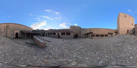
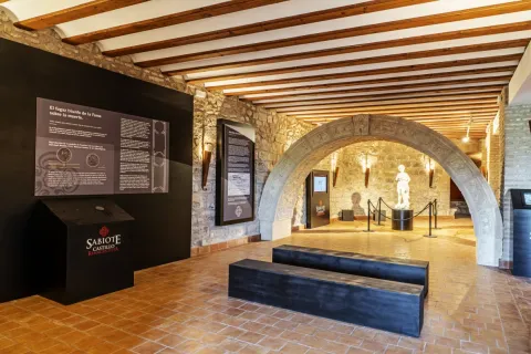
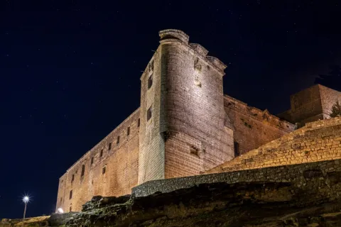
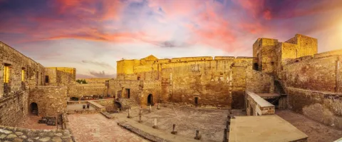
La nueva fortaleza, un recinto en mampostería, de planta rectangular, estaba jalonada por siete torres macizas edificadas con el mismo material, cuatro de ellas esquineras y el resto en los espacios intermedios. Entre estas últimas sobresale la gran Torre de Homenaje en el frente Sur, que protegía la puerta principal y a la que se accedía por un patín que conducía a la primera planta. El castillo se organizó entorno a un pequeño patio pavimentado con losas de piedra, muy alterado por las construcciones renacentistas. En el sector Este se levantó un lienzo de muralla entre las torres de la Puerta y del Baluarte, creando un amplio patio cerrado. La fortificación contó con diversas dependencias para uso cotidiano, entre las que destaca una que, por sus dimensiones y elementos documentados en intervenciones arqueológicas, pudo corresponder a una casa Tercia que la Orden edificaría en el interior de la fortaleza. En la zona Norte, se documentó una estructura con dirección Este-Oeste, que pudo utilizarse como la capilla u oratorio del castillo.

Entre finales del S. XV y principios del XVI, Sabiote pasa a manos de Don Francisco de los Cobos, quien encarga a Andrés de Vandelvira la transformación del castillo en un majestuoso palacio renacentista, reformas que afectarán tanto al espacio interior como a sus sistemas defensivos. Se amplían las torres de los ángulos con sólidos baluartes, se engrosan los lienzos de muralla al revestirse con refuerzos de mampostería regular y bloques de sillarejo en las esquinas, 
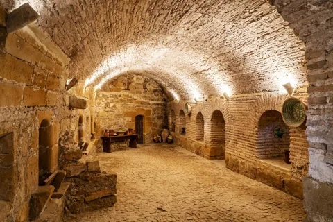
La función residencial se potencia erigiendo nuevos cuerpos palatinos, que alcanzan los cuatro pisos, y cambian los accesos al interior de la fortaleza. La puerta principal, un arco de medio punto monumental coronado con el escudo de la familia de los Cobos, en el lienzo Sur, estaba precedida de un foso, salvado mediante un puente levadizo. En el espacio interior se crearon nuevas dependencias en torno a un gran patio porticado, con arcos sobre columnas en tres de sus frentes, que ocupaban en gran medida todo el antiguo patio de armas. La construcción de los patios inferiores y de unas caballerizas subterráneas provocó la destrucción de la mayor parte de las estructuras y estancias internas de la fortaleza medieval, como la Torre del Homenaje o el patín.

El conjunto fue ampliamente restaurado durante la segunda mitad del siglo XX.

Las excavaciones arqueológicas realizadas en la Plaza del Castillo, en el tramo norte y este del recinto amurallado y en su interior, documentaron la ocupación de la actual Sabiote desde la Prehistoria. La aparición de tumbas en cista, fondos de cabañas y silos, así como numeroso material, confirma la existencia de un poblado del periodo Calcolítico (2500 a. C.). Este tipo de asentamientos tenían una economía de subsistencia basada en la caza, la pesca, la recolección y la agricultura, favorecida en este caso por la proximidad de la fértil vega de los ríos Guadalquivir y Guadalimar.

Los estudios arqueológicos documentaron también la existencia de dos fases de ocupación de época islámica, una primera entre los siglos VIII-X y una segunda, del siglo XI al XIII, más importante que la primera desde el punto de vista estructural, que se correspondería con los restos de un núcleo amurallado islámico, denominado Hisn Sabiyyuto.

Este núcleo de población fue conquistado por Fernando III entre 1227 y 1229, durante las incursiones militares desarrolladas en la Loma de Úbeda. A partir de estos momentos se otorga al municipio el Fuero de Cuenca. En el año de 1257, Alfonso X entregó la villa a la Orden Militar de Calatrava en compensación por la villa y castillo de Almoguera. 

Los calatravos llevaron a cabo una profunda transformación en el asentamiento islámico, construyendo un castillo en el punto más estratégico del antiguo hisn islámico, a la vez que emprendían la edificación de un nuevo recinto amurallado que engloba y anula en algunos puntos las defensas musulmanas. La trama urbana fue enormemente transformada, abandonándose amplios espacios intramuros, algunos de los cuales se aprovecharon como zonas de necrópolis.

La red de fortificaciones erigida por la Orden de Calatrava jugó un importante papel fronterizo en la expansión territorial emprendida por los ejércitos castellanos durante los siglos XIII y XIV; en el marco de las luchas nobiliarias durante el reinado de Enrique IV, en la segunda mitad del siglo XV; y posicionándose en el bando de Isabel en la lucha por la sucesión al trono de Castilla. 

Sabiote pertenecerá a la Orden Militar de Calatrava hasta finales del S. XV o principios del XVI, siendo finalmente vendida por Don Alonso de Baeza a Don Francisco de los Cobos. El nuevo propietario encargará a Andrés de Vandelvira la reforma del castillo para transformarlo en un majestuoso palacio renacentista.

Breve descripción

The Fortification of Sabiote had its origin in a small fortified emiral- caliphal settlement, which was destroyed by the construction of a solid fortress of the Order of Calatrava, a walled, rectangular-floor enclosure with seven solid towers. The acquisition of the whole by Don Francisco de los Cobos in the late 15th or early 16th century will lead to the last great transformation, by ordering Andrés de Vandelvira to reform the castle to transform it into a majestic Renaissance palace that is articulated around a porticated courtyard, in what was the old square of weapons.
The archaeological excavations have confirmed the existence of a town of the Copper Age in the castle area, as well as its occupation in the Islamic period with the remains of an Islamic walled core dated between the 11th and 13th centuries (Hisn Sabiyyyuto), which was conquered by Fernando III between 1227 and 1229. In 1257, the Military Order of Calatrava receives the villa from the hands of Alfonso X, building a new fortress that will participate in the defence of the borders during the 13th and 14th centuries; in the nobility struggles during the reign of Henry IV (second half of the 15th century); and in the struggle for succession to the throne of Castile, on the side of Elizabeth. In 1537 Don Francisco de los Cobos acquired the villa.
The "Triangle of the Renaissance," together with Baeza and Ubeda, is part of the "Andrés de Vandelvira" Renaissance Route, along with Ubeda, Baeza, Canena and Villacarillo.

Telecomunicaciones
Sitio web
www.sabiote.com
Teléfono de contacto
953 773 002
Ubicación
Nombre
Castillo de Sabiote
Código Postal
23410
Latitud
38.071190
Longitud
-3.302500
Municipio
Cómo llegar (URL de Google Maps)
https://www.google.es/maps/dir/Castillo+de+Sabiote,+23410+Sabiote,+Jaén/@37.7591539,-3.7729584,15z/data=!4m8!4m7!1m0!1m5!1m1!1s0xd6ef1b04fbdebd9:0xb2b4687a73a5d798!2m2!1d-3.3024972!2d38.0711908?entry=ttu&g_ep=EgoyMDI2MDIxNi4wIKXMDSoASAFQAw%3D%3D
Ubicación en el mapa
POINT (-3.3025 38.07119)
Tipos de punto de interés
Imágenes carrusel
imagen
Image
Castillo%20de%20Sabiote%20by%20Partal1.jpg
Imagen principal
Desactivado
imagen
Image
Castillo%20de%20Sabiote%20by%20Partal18.jpg
Imagen principal
Desactivado
imagen
Image
Castillo de Sabiote
Imagen principal
Desactivado
imagen
Image
Castillo de Sabiote
Imagen principal
Desactivado
imagen
Image
Castillo de Sabiote
Imagen principal
Desactivado
imagen
Image
Castillo de Sabiote
Imagen principal
Desactivado
imagen
Image
Castillo de Sabiote
Imagen principal
Desactivado
Imágenes cabecera
imagen
Image
CYB_SABIOTE_01
Imagen principal
Desactivado
imagen
Image
CYB_SABIOTE_02
Imagen principal
Desactivado
Microsite al que pertenece
Experiencia 360
Image
cyb_sabiote_castillo
Image
cyb_sabiote_castillo
Loading map
Preparing points of interest and routes...

Castle of Navas de Tolosa

Submitted by brandcode_deweloper on
Id
320510
Descripción
Descripción larga

The castle of the Navas de Tolosa is made up of a trapeze-shaped walled enclosure and a hexagonal plant tower located at its northeastern angle. Possibly there was a second external enclosure to which some visible canvas would belong in the surroundings of the castle.

The site of the fortification, very destroyed, was possibly built in a tapial of argamase on a base of masonry, adapts to the rocky plateau on which it sits, using it as a foundation and as part of its defense. Inside it are distinguished some sections of walls that would belong to internal dependencies and a possible aljibe.

Two accesses are kept inside the fortress, the main door was located on its west side, protected by a narrow wall that supports a natural rock skid. On the eastern flank, next to the tower, a narrow posterna is opened partially hidden by a rock that gives it visual protection and creates a narrow corridor to reach it.

The tower, built in a very compact tapial with its high lime content, retains about 14 m from the outside and only two from the inside. In the outer plucido of the tower there are still some lines that would be part of some type of decoration or simulation of large armchairs, a technique known as false parting, especially in the area of the posterna.

Inside there is a rectangular space that occupies much of the stay, leaving a narrow corridor around it. It is possible to be an aljibe to collect and store the rain water, whose cover would hold the ground on the first floor of the tower.

To the north-east of the fortress there are traces of a rectangular building with internal divisions, perhaps the hermitage that was erected shortly after the Christian conquest. Other walls that are distinguished in their surroundings could be evidence of the existence of a small plateau.

The area of Despeñacolos has attracted inhabitants since Prehistory for its steep orography, in which caves and coats proliferate, as well as for its natural sites conducive to sacralization.

But it was its strategic value with respect to the natural steps that pass through Sierra Morena, so fortifications were erected during the Middle Ages, and even in previous periods, with the aim of controlling the communication routes between the Plateau and al- Ándalus.

Although the small plateau could be inhabited already in the Bronze Age and in Roman times, the Castle of Navas de Tolosa, it would be built between the XI- XII centuries by Muslims to control the natural steps of Despeñacolos. Years later, they would strengthen their defensive role in an attempt to stop the progress of Christian troops. This fortress became one of the "doors" of the passage of the Muradal, along with Castro Ferral, which made it a goal to beat. After the battle of the Navas de Tolosa will definitely be in the power of Castile.

The fortress was part of the stage of one of the most prominent milestones in the medieval history of the Peninsular, because of its significance in the advance of the Christian kingdoms over al- Ándalus, the battle of the Saves of Tolosa, fought on July 16, 1212. Conceived as a crusade, it was a contest in which the routes and steps to the Plateau played a fundamental role. A coalition of Christian kings, Alfonso VIII of Castile, Peter II of Aragon and Sancho VII of Navarra, supported by Pope Innocent III, faced against the Almohad Caliph of Muhammad al-Nasir, in whose army fighters from the Maghreb, from sub-Saharan territories and from Turkish contingents were integrated.

On 12 July 1212, troops under the command of Don Diego López de Haro took over the Puerto del Muradal. Two days later, after being blocked in the passage of the Slayer, Christians camp in the place known as the King's Table, from where they went to battle, defeating the Almohad army.

After the victory of the Christian armies, the fortification of the Navas would remain important on the route of the Muradal throughout the 13th century, becoming one of the strategic points for control of the passage of troops during the conquest of Alto Guadalquivir. In 1217 the archbishop of Toledo was awarded the castles of the region, with the consent of Pope Honorio III, who confirmed them as the limits of the Toledo archdiocese.

According to the written sources, this space was repopulated by Spanish contingents throughout the 13th century, and its castle was demolished in 1473 under the mandate of the City of Baeza.

Breve descripción

The castle of Navas de Tolosa is a small fortification in height that takes advantage of the defensive possibilities offered by the rock formation on which it is based, a hoss of a certain magnitude, capable of hosting a small military garrison. It is made up of a walled enclosure and a hexagonal tower, and may have had a second enclosure to protect them. Because of the presence in its surroundings of numerous vestiges of construction it may have been surrounded by a small population that would find refuge among its walls in case of danger.
The castle of the Navas de Tolosa or the Collados or the Eagles was one of the fortresses that were built to protect the Puerto del Muradal, one of the main mountain steps that communicated al- Andalus with the Plateau. The transcendental battle of the Navas de Tolosa marked its history, as it would be taken by the Castilians in the context of the confrontation between the Christian and Muslim sides, in July 1212. During the 13th century, it would have the role of protecting and monitoring the passage of troops and supplies for the campaigns carried out by Christian armies in the conquest of al- Andalus.

Telecomunicaciones
Sitio web
www.lacarolina.innovasur.es
Teléfono de contacto
953 660 600 / 953 661 251
Correo electrónico
info@lacarolina.es
Ubicación
Código Postal
23212
Latitud
38.299530
Longitud
-3.597440
Dirección
En las proximidades de la A-IV, pasado el kilómetro 265, entre Santa Elena y La Carolina.
Distrito
Municipio
Ubicación en el mapa
POINT (-3.59744 38.29953)
Tipos de punto de interés
Imágenes carrusel
imagen
Image
castillo navas
Imagen principal
Desactivado
Imágenes cabecera
imagen
Image
6672445Master.jpg
Imagen principal
Activado
Horario
Visit after contact with managers. Private property.
Experiencia 360
Image
CyB_La_Guardia
Image
CyB_La_Guardia
Loading map
Preparing points of interest and routes...

Castle of Mata Bejid

Submitted by brandcode_deweloper on
Id
4349094
Descripción
Breve descripción

Fortress of Muslim origin of rectangular plant. It has two towers on both sides rather damaged, the north one consists of an inner stay covered with pointed vault (tower of tribute), and the south one has a body under massif and the upper one living. The castle is divided into two large areas, the square of arms (it became in recent times a cortijo, from which are preserved the arches of the zahurdas that gave to this great courtyard) and the Islamic alcazar (at a higher level than the rest of the castle).

Telecomunicaciones
Sitio web
www.cambil-arbuniel.es
Teléfono de contacto
953 300 011
Ubicación
Código Postal
23120
Latitud
37.704940
Longitud
-3.510560
Distrito
Municipio
Ubicación en el mapa
POINT (-3.51056 37.70494)
Tipos de punto de interés
Imágenes carrusel
imagen
Image
Mon177.jpg
Imagen principal
Desactivado
imagen
Image
1590760151_707070_1590760253_noticia_normal.jpg
Imagen principal
Desactivado
Imágenes cabecera
imagen
Image
Castillo_Matabejid.jpeg
Imagen principal
Activado
Microsite al que pertenece
Loading map
Preparing points of interest and routes...

Lopera Castle

Submitted by brandcode_deweloper on
Id
2292974
Descripción
Descripción larga
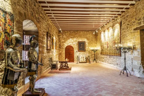
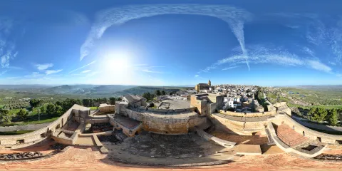
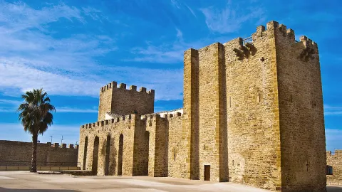
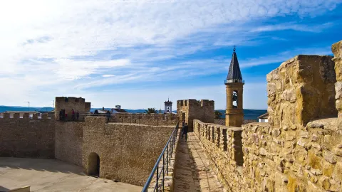
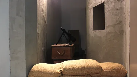
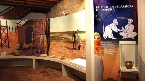
The original construction was a fortified rural church, built in masonry repointed with lime mortar, with an irregular basilica plan and a quadrangular head offset to the left, a characteristic that defines those known as “Crooked” head Churches. It was divided into three naves, the central one being the widest, by arches on pillars and columns, lacking a transept, whose capitals have late Romanesque decoration. On the outside, on its northern side, during the archaeological excavations, part of a “U”-shaped trench excavated in the geological base was located, with an approximate depth of 2 m, and a dry-joined masonry wall that rests directly on the pit, possibly an antemural that delimited a narrow list. The excavations also revealed the existence of numerous burials both inside and outside the temple, most of them in the head and in its surroundings. The bodies rested in trapezoidal or anthropomorphic graves excavated in the rock, some with marked heads, and covered by earthen mounds or, in some cases, stone slabs. A burial covered by part of a large ceramic container stood out. This first building was destroyed and burned by the Nasrid armies of Muhammad V, allies of King Pedro I, around 1368, during the conflicts between the Castilian king and his half-brother Enrique II of Trastámara. After its destruction, a new church was built that maintains its layout, although it incorporates modifications. Two towers are erected, that of San Miguel, at the foot of the church and that of Santa María, which will encompass the head, now with a semicircular shape inside. This new fortification corresponds to the external walled enclosure that is preserved today, with an irregular pentagonal layout and five solid corner towers, built in masonry. It was defended by a rampart or a barbican and a moat. In the parade ground, the new fortified church was rebuilt as a fortress: two large towers joined by two sections of walls that form a wide walkway with loopholes, supported by semicircular arches on buttresses. This building was functionally divided into two environments: the lower one for religious use and the upper one for military use. The worship space was divided into three naves, the central one being the widest. A large terrace was formed above the cult area, which would serve as a parade ground and give access to the defensive elements of the walls and tower of Santa María. At this time the burials will be concentrated in the exterior area, relegated to the head and surrounding areas, with the exception of two tombs that are located inside next to the large arch that gives access to the apse area, the most sacred space of this new church. Between the end of the 15th century and the first half of the 16th century, this fortified church was adapted into a castle-palace. The works consisted of the construction of two large bodies and a small porticoed patio with three carpanel arches with Renaissance capitals, which would serve as the articulating axis of the noble residence, around which various rooms are distributed. The apse area of ​​the church was transformed into an oratory by the Commander of Lopera D. Juan Pacheco in 1535, covered by a barrel vault decorated with Renaissance plasterwork and painted inscriptions, which was also accessed from the exterior patio through a new door made on the north façade, equipped with a portico on columns. On the outside of the building, archaeological excavations brought to light a garden space, with a large patio, with a fountain that was supplied with water extracted by a water wheel and an orchard area, which confirm its use as a residential home. In the 20th century the castle functioned as a residence and winery, a phase from which numerous buried wine cellars are preserved to the west of the San Miguel tower, which caused the destruction of the archaeological levels. In the area around Lopera, sites from the Bronze and Iron Age have been found; settlements of the Lower Roman Empire with continued occupation until the Visigothic period; as well as rural settlements from the Emiral period, which used the Cerro de San Cristóbal as a common place of refuge, including the Lopera farm itself, which we could identify with the population of Bayyara cited in Islamic sources. The archaeological investigations carried out to date in its historic center confirm the existence of this farm that exploited the agricultural resources of the area in the 12th and 13th centuries. After the conquest, Lopera was handed over, in 1240–1241, to the Military Order of Calatrava, creating the Commandery of Lopera, which would reinforce its primitive defenses between the 14th and 15th centuries. The Order managed to form an extensive lordship in the extreme southwest of the current province of Jaén, which included large areas of the Campiña and a good part of the foothills of the Sierras Sur, bordering the Kingdom of Granada, which led it to promote extensive fortification work in its possessions. This network of fortifications played an important border role in the territorial expansion undertaken by the Castilian armies during the 13th and 14th centuries, regaining prominence in the second half of the 15th century, within the framework of the noble struggles during the reign of Henry IV. In the confrontation between the supporters of the Castilian monarch against the followers of a noble coalition headed by D. Pedro Pacheco, Marquis of Villena and D. Pedro Girón, Master of Calatrava, the members of the Order actively participating in the contest. During the conflict, the Lopera fortress was attacked and looted in 1466 by the allies of the Constable of Castile, led by the Mayor of Andújar, Pedro de Escavias. It was declared an independent town by Philip II in 1595. In the 19th century, with the confiscation, the assets of the church were acquired for the most part by bourgeoisie, the ownership of the castle passing into the hands of Alonso de Valenzuela, deputy and mayor of Lopera, in 1856. During the Spanish Civil War, Lopera once again became a prominent scene of a war, since the dividing line between both national and republican sides, popularly known as the Andújar front, was located around the town. Numerous vestiges have remained of this conflict in the area around Lopera: machine gun nests, Republican trenches, an anti-tank fort, basements and caves used as anti-aircraft shelters in the same town. The most notable episode was the Battle of Lopera, fought between December 27 and 29, 1936, in which the rebellious armies conquered Lopera. Finally, in the 20th century the Calatrava fortress was used as a wine cellar, a new use that profoundly transformed the original structure of the defensive complex, conditioned as a temporary residence and wine cellar and introducing irreversible changes to the castle.
Breve descripción
The castillo de Lopera, which is currently made up of two enclosures, offers a configuration resulting from its complex historical evolution, starting from an original fortified church to becoming a castle-palace formed by two large towers joined by two sections of wall, located in the center of a walled enclosure with towers in the corners.  After the Castilian conquest, Lopera was handed over, in 1240–1241, to the Military Order of Calatrava, creating the Commandery of Lopera, which would reinforce its primitive defenses between the 14th and 15th centuries. It played an important role as a border fortress in the advance of the Castilian armies through the Giennese countryside during the 13th and 14th centuries, regaining prominence in the second half of the 15th century, within the framework of the noble struggles that were settled during the reign of Henry IV. It was attacked and looted in 1466 by the allies of the Constable of Castile, led by the Mayor of Andújar, Pedro de Escavias. Finally, in 1595 it was declared an independent town by the monarch Felipe II.
Ubicación
Código Postal
23780
Latitud
37.943710
Longitud
-4.213650
Dirección
C/ Castillo, s/n
Distrito
Municipio
Ubicación en el mapa
POINT (-4.21365 37.94371)
Tipos de punto de interés
Imágenes carrusel
imagen
Image
VISTA%20A%C3%89REA.jpg
Imagen principal
Desactivado
imagen
Image
patio%20de%20armas.JPG
Imagen principal
Desactivado
imagen
Image
castillo de lopera
Imagen principal
Desactivado
imagen
Image
castillo lopera
Imagen principal
Desactivado
imagen
Image
castillo lopera
Imagen principal
Desactivado
Imagen principal
Desactivado
Imágenes cabecera
imagen
Image
CyB_Lopera_01
Imagen principal
Activado
imagen
Image
CyB_Lopera_02
Imagen principal
Desactivado
Horario
Tuesday to Friday: showings at 10:00 and 12:00. Saturdays and Sundays: passes at 10:00, 12:00 and 17:00 (winter) or 9:00, 11:00 and 13:00 (summer).
Experiencia 360
Image
CyB_Lopera
Image
CyB_Lopera
Loading map
Preparing points of interest and routes...
Marcas de calidad