ALTERNATIVE GR 247.1 STAGE 1: Prado Maguillo and Forestrand House Refuge El Bodegón - Río Madera
Hiking, GR247 Forest Routes
Santiago Pontones



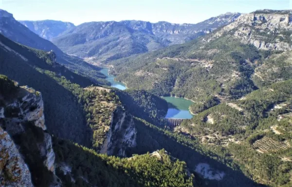
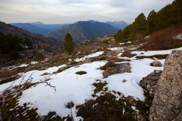
This is one of the most impressive hiking routes in the Segura saw. As we gain height, vegetation is scarce to a piornal austere. Once on the top of the calar, we discover the great and overwhelming atmosphere of the high mountain of Segureña: a huge karmic platform, 5 km long, with meadows where the flocks of Segureña sheep are pasted, broken by dolinas (sodas called "sorbeores" in the region), vaguadillas and sharp rocky.
Is part of

ROUTE NAME
Cañada del Saucar-Cumbre del Puntal de la Misa
TRAIL TYPE
Linear. Round trip
DIFFICULTY
Baja
TOTAL DISTANCE (IN KILOMETERS) 5,9 km (solo ida)
Stretch of asphalt or concrete: 0
Section of track, forest road, or dry watercourse: 0.01
Trail section: 0
Sections of livestock trails: 0
HUSO 30S
ESTIMATED TRAVEL TIME
3 h 22 min (ida y vuelta)
ROAD SURFACE TYPE
Sandy and rocky
ELEVATION CHANGE
466mm
93mm
DIFFICULTY. RATING ACCORDING TO THE MIDE METHOD
1
MEANS
Severity of the natural environment
1
ITINERARY
Route guidance
1
DISPLACEMENT
Difficulty moving about
3
EFFORT
Amount of effort required
ACCESSIBILITY TYPE
TIME OF YEAR
SIGNALING
No
PERFIL DE ALTURAS

MORE INFORMATION
TUNNELS
STEEL VIADUCTS
METAL WALKWAYS
WATER POINTS
PONTOONS
GUARD BOOTHS AND BARRIERS
SWITCHMAN'S CABINS
CYCLABILITY
RECREATIONAL OR SPORTS AREAS NEAR THE TRAIL
AID STATIONS
LINKS TO OTHER TRAILS
SHELTERS
RECOMMENDATIONS
OTHER INFORMATION OF INTEREST (ARCHITECTURAL OR HISTORICAL-CULTURAL, GEOLOGICAL-ECOLOGICAL)
The tour is marked PR-A 1196
Water at the source of the Cañada del Saucar, at the beginning of the route.
Technical Description
This is one of the most impressive hiking routes in the Segura saw. As we gain height, vegetation is scarce to a piornal austere. Once on the top of the calar, we discover the great and overwhelming atmosphere of the high mountain of Segureña: a huge karmic platform, 5 km long, with meadows where the flocks of Segureña sheep are pasted, broken by dolinas (sodas called "sorbeores" in the region), vaguadillas and sharp rocky.
The remains of stone walls of ancient agricultural terraces remain on the ground, witnesses to the hardness of the old rural life, in which the serrans went up from the nearby villages to sow cereals, taking advantage of the moisture that the soil conserves in a few pits. It is now unthinkable to make such hard daily displacements to start such scarce yields.
From the forest surveillance site of the Puntal de la Misa, and along the east side of the calar, we will dominate unforgettable panoramic over an infinite succession of mountain curtain across the deep valley of the Segura River.
The calar is frequented by flocks of mountain goats and overtaken by the lion vulture. In the cut there are also pilgrims hawks. The whole area is full of boar. It is easy to see the piquiroja chova and the alpine accentor.