Saltar al contenido principal

Viewpoint Casco Antiguo de Arjona

Submitted by brandcode_deweloper on
Id
7470431
Descripción
Breve descripción

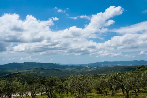
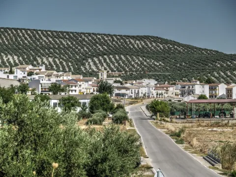
This town occupies a central position in the olive countryside of Jaén. The old fortified site offers magnificent views of the entire western countryside of the province of Jaén.

Ubicación
Latitud
37.935290
Longitud
-4.054010
Dirección
Casco antiguo de Arjona
Distrito
Municipio
Ubicación en el mapa
POINT (-4.05401 37.93529)
Tipos de punto de interés
Imágenes carrusel
imagen
Image
view-856935_1920.jpg
Imagen principal
Desactivado
imagen
Image
tuscany-4459537_1920.jpg
Imagen principal
Desactivado
Imágenes cabecera
imagen
Image
olive-tree-1495365_1920.jpg
Imagen principal
Activado
Microsite al que pertenece
Loading map
Preparing points of interest and routes...
Interés

Viewpoint Campos de Larva

Submitted by brandcode_deweloper on
Id
8094285
Descripción
Descripción larga

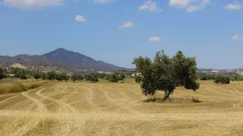
Over the past decades, the landscape of Larva has changed according to agricultural needs. The fields seen, originally, have been occupied by large cereal crops, being the main food support for their inhabitants. Over time, the steppe landscape has undergone a great transformation, leaving the cultivation of the olive tree, and occupying the largest area for agricultural use, passing to a second level the cultivation of the cereal.

Breve descripción

One of the most unknown corners of the Sierra Magina region is the village of Larva. Larva is located in a privileged place between two Natural Parks in the province of Jaén.

Telecomunicaciones
Teléfono de contacto
953 781 500
Correo electrónico
ayuntamiento@larva.es
Ubicación
Código Postal
23591
Latitud
37.760203
Longitud
-3.202937
Distrito
Municipio
Ubicación en el mapa
POINT (-3.202937 37.760203)
Tipos de punto de interés
Imágenes carrusel
imagen
Image
MIRADOR%20larva%20%281%29.jpg
Imagen principal
Desactivado
Imágenes cabecera
imagen
Image
MIRADOR%20larva2.jpg
Imagen principal
Activado
Microsite al que pertenece
Loading map
Preparing points of interest and routes...

Mines of the Centenillo

Submitted by brandcode_deweloper on
Id
2854769
Descripción
Descripción larga

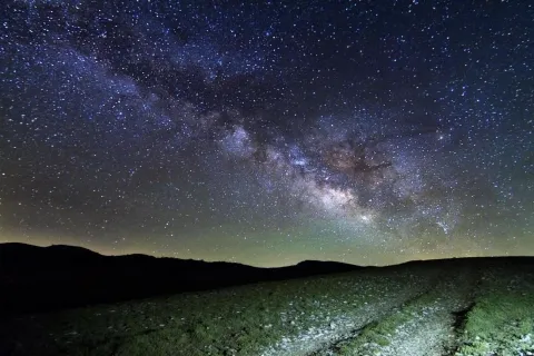
In spring it is possible to enjoy the elusive zodiacal light, while in summer it is an excellent place to observe the constellations that are being hidden in the West. Especially recommended to observe in group the different rains of stars that take place throughout the year due to their wide accessibility and the size of the explanade, where large groups can meet.

It is an excellent place to approach the family to enjoy the firmament on winter and spring nights. We recommend not to leave the explanade and not to go into the ruins under any circumstances for security matters.

Breve descripción

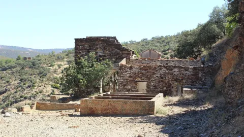
Few places are thought to be more appropriate for the observation of the firmament than the set of ancient mines abandoned from "El Centenillo," in Baños de la Encina, Jaén. Just 500 metres from this village in the west direction, we find a large explanade surrounded by old abandoned buildings. The horizon in the north, west and south direction is completely free of light pollution, with an impressive darkness in the cenit. This area is currently being restored.

Ubicación
Latitud
38.348123
Longitud
-3.732338
Dirección
Pedanía El Centenillo
Distrito
Ubicación en el mapa
POINT (-3.732338 38.348123)
Tipos de punto de interés
Imágenes carrusel
imagen
Image
_MG_9754%20%281%29.jpg
Imagen principal
Desactivado
Imágenes cabecera
imagen
Image
_MG_9754%20%281%29.jpg
Imagen principal
Activado
Microsite al que pertenece
Loading map
Preparing points of interest and routes...
Interés

Mine of the Avellanar

Submitted by brandcode_deweloper on
Id
4749429
Descripción
Breve descripción

It's a galena mine in operation until recently. To get there you have to go along the road that leaves Aldeahermosa and goes towards the estate "El Puerco," after crossing the door of this estate you follow the road for 1.5 km, you reach a sign that indicates that to the right is the mine, by the river Dañador.

Ubicación
Latitud
38.342560
Longitud
-3.103740
Distrito
Municipio
Ubicación en el mapa
POINT (-3.10374 38.34256)
Tipos de punto de interés
Imágenes carrusel
imagen
Image
minaavellanar.jpg
Imagen principal
Desactivado
Imágenes cabecera
imagen
Image
20.jpg
Imagen principal
Activado
Microsite al que pertenece
Loading map
Preparing points of interest and routes...

Escañuela Municipal Picnic Area

Submitted by brandcode_deweloper on
Id
4479295
Descripción
Descripción larga

Location: West of the city centre.
Distance: 600 m.
Medium: Tourism vehicle.
Access route: Directly from the urban centre via the asphalt road JV-2,044.

Breve descripción

A leisure place with shade areas, banks, tables and water sources.

Telecomunicaciones
Sitio web
www.escanuela.es
Teléfono de contacto
953 345 101
Ubicación
Código Postal
23657
Latitud
37.878690
Longitud
-4.033390
Distrito
Municipio
Ubicación en el mapa
POINT (-4.03339 37.87869)
Tipos de punto de interés
Imágenes carrusel
imagen
Image
Merendero%20Municipal%20Esca%C3%B1uela.jpg
Imagen principal
Desactivado
Imágenes cabecera
imagen
Image
merendero%20esca%C3%B1uelas.jpg
Imagen principal
Activado
Microsite al que pertenece
Loading map
Preparing points of interest and routes...

Melojar

Submitted by brandcode_deweloper on
Id
880471
Descripción
Descripción larga

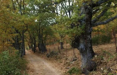
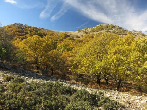
Just get out of the car, we will find ourselves surrounded by twins (Quercus pirenaica), in a thick and very closed forest. Melojar is one of the most demanding ecosystems in soil quality, depth of this and humidity, in the Park is poorly represented, only a few nuclei of the Segura saw. They maintain a entourage of plant species that accompany the melojo, forming one of the most important and interesting forests in the Park.

These forests were more abundant and extensive in past times, but the use of their wood, the transformation of the soil they occupy and sometimes the plunder to which they have been subjected, reduced them to small spots or enclaves, reaching very low today, especially in southern Spain. In the park already it must have been small the extension that would occupy this forest, but at present only a few very small enclaves remain, where the twins form bosquets, and there are also isolated specimens intermingled in the pineapples (salgareños).

The twins are oily and, therefore, to the melojar environment reminiscent of that of the Atlantic forests, moist, with bruises, of stray trunks and covered with moss, specific to Galicia, Asturias or Centro Europa. The melojar extends through the Atlantic area of the Iberian Peninsula, but also through the central system and other areas of the interior, reaching Sierra Morena.

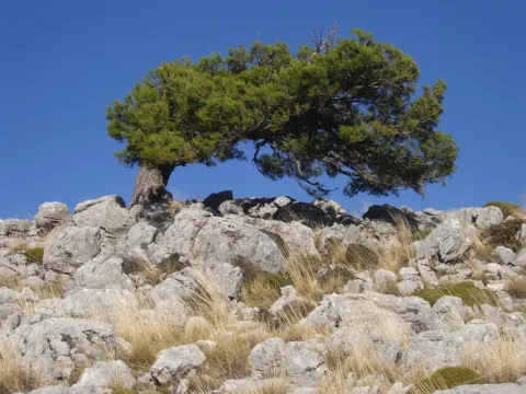
In the melojar we find other arboreal elements such as the pespejón (Sorbus tormentinalis), the complaint (Quercus faginea) (with which it is sometimes hybrided producing a hybrid called Quercus x welwitschii), arches (Acer granatense) and salgarean pines (Pinus nigra salzmannii) generally repopulation. They also abound shrubs such as majuelos (Crataegus monogina), black thorns (Crataegus laciniata), aligustres (Ligustrun vulgare), skirmishes (Rosa spp.), magullos (Malus sylvestris), zarzas (Rubus ulmifolius, R. canescens) and some willows or sarctiles (Salix atronaea).

On the ground of the melojar we find herbaceas, including Poa nemoralis, Brachypodium sylvaticin and medium Briza, other companions are the gold button (Geum sylvaticum), primavera (Primula vulgaris), violets (Viola odorata), filipendales (Filipendula vulgaris), orchids (Orchis langei, O. coriophora), narcissos (Narcissus triandus palidulus), and species of Solomon (and the area of the idatus).

LOCATION

It is on the verge of the track that accesses Las Herrerias, which we take from the road that goes from Siles to Rio Madera (JF-7038), to take the detour after passing through the CEDEFO de Navalhora. We'll go up to see the start of a forest track that goes left, to counter if we go to the Wood River. It's well indicated as the Herrerías. We can park or continue by vehicle, we advise parking and walking on the track a few meters.

Breve descripción

Canyon of Poyo Torres

Ubicación
Latitud
38.387861
Longitud
-2.582637
Distrito
Municipio
Ubicación en el mapa
POINT (-2.582637 38.387861)
Tipos de punto de interés
Imágenes carrusel
imagen
Image
melojar.png
Imagen principal
Desactivado
imagen
Image
melojar.jpg
Imagen principal
Desactivado
Imágenes cabecera
imagen
Image
617_img.png
Imagen principal
Activado
Loading map
Preparing points of interest and routes...

Marchena

Submitted by brandcode_deweloper on
Id
918937
Descripción
Descripción larga

A spectacular rise in which we gain height in a dizzy way, elevation curves and great precipities that make them as natural glances: this is what you can find in Marchena. You can't miss the houses attached to the rock known as the Mound right in the village of the same name on the way to Marchena. We find the olive tree, fruit trees and orchards next to oak and pine trees.

In Marchena you can make three small paths PR-A 107 known as "Arab Alquerías," the PR-A 101 that goes from the Picachos to the Tutubiero Age and the PR-A 102 known as the Mirabete road.

Breve descripción

Marchena sits on a hillside next to a small valley. Streets, stairs, up and down. Rinses surrounded by silence and tranquility only broken by the sound of water. It is surprising the number of orchards, whose survival is explained by the remoteness from trading populations. Recovecos, windows and doors for statures of another time, calmed and dazzling alleys that contrast with the green of the forest surrounding the village.

Ubicación
Latitud
38.188620
Longitud
-2.498080
Ubicación en el mapa
POINT (-2.49808 38.18862)
Tipos de punto de interés
Imágenes carrusel
imagen
Image
fuente_1_7736.jpg
Imagen principal
Desactivado
Imágenes cabecera
imagen
Image
800px-Marchena%2C_Ja%C3%A9n_24J_01.jpg
Imagen principal
Activado
Loading map
Preparing points of interest and routes...
Marcas de calidad

Wildlife Observation Sites

Submitted by brandcode_deweloper on
Id
921316
Descripción
Descripción larga


A continuación referimos los senderos y algunas de las especies de más interés que se pueden observar en cada una:

Cerrada del Utrero

Buitre leonado, martín pescador, mirlo acuático, chova piquirroja, oropéndola, vencejo real.

Laguna de Valdeazores

Gavilán, azor común, garza real, zampullín común, gallineta común, ánade azulón, focha común, somormujo lavanco, cárabo, oropéndola.

Río Borosa

Azor común, búho real, águila real, gavilán, cárabo, mirlo acuático, martín pescador, oropéndola, lúgano, golondrina dáurica.

Cueva de La Malena

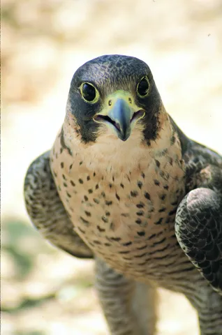
Buitre leonado, halcón peregrino, ratonero, martín pescador, reyezuelo listado, piquituerto, mosquitero papialbo.

El Chorro

Águila calzada, buitre leonado, alimoche, azor, halcón común, avión roquero, piquituerto.

La Presilla

Halcón peregrino, buitre leonado, mochuelo, chova piquirroja, collalba negra, escribano soteño, roquero solitario, avión roquero, lúgano, zorzal alirrojo.

Paraje Natural del Alto Guadalquivir – Puente de la Cerrada

Gallineta común, aguilucho lagunero, aguilucho cenizo, milano negro, rascón europeo, ánade friso, pato cuchara, porrón europeo, carricero común, andarríos chico, chorlitejo grande.

El Chillar

Halcón peregrino, cernícalo vulgar, búho real, mochuelo, alcaraván, collalba rubia, buitrón, bisbita pratense, gorrión chillón, abejaruco, carraca, garcilla bueyera.

Barranco del Guadalentín

Quebrantahuesos, águila real, águila culebrera, águila calzada, águila perdicera, halcón peregrino, gavilán, azor, verderón serrano, oropéndola, mirlo acuático, reyezuelo listado, mosquitero papialbo.

Arroyo Guazalamanco

Gavilán, ratonero, azor, críalo europeo, golondrina dáurica, rabilargo, mirlo acuático, chochín, oropéndola, petirrojo.

ZONAS DE AVISTAMIENTO DE FAUNA SALVAJE

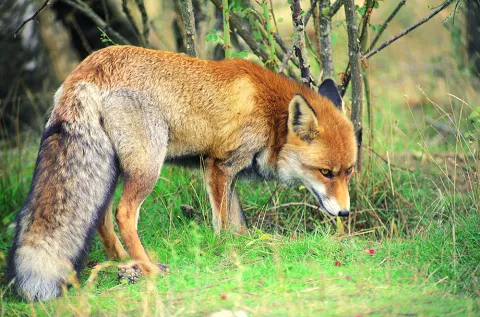
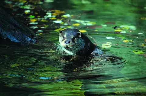
El avistamiento relativamente frecuente de fauna salvaje es uno de los atractivos más conocidos y destacados del Parque Natural. Ciervos, gamos, muflones, cabras monteses, jabalíes y diversas aves rapaces son muy abundantes, como consecuencia de lo agreste del territorio, de su gran extensión y de su buen estado de conservación.

Pero es preciso tener en cuenta una serie de consideraciones para no ver defraudadas tus expectativas y para que tu actividad no perturbe la vida animal:

  • La presencia de los animales salvajes es siempre imprevisible. En ningún lugar ni en ningún momento se puede asegurar que va a haber avistamientos. Aunque sea obvio, no olvides que el Parque no es un zoo.

  • La mayoría de los avistamientos se producen a larga distancia. Es importante llevar prismáticos.
  • La observación de fauna en estado salvaje depende de diversas condiciones ambientales, sobre todo las climatológicas, así como de la época del año y de la hora del día. Generalmente, para ver grandes herbívoros hay que aprovechar las primeras y últimas horas del día. Sin embargo, las grandes rapaces se hacen más visibles durante las horas centrales del día, ya que aprovechan las cálidas corrientes térmicas para el vuelo.
  • El color del pelaje de los grandes herbívoros los camufla en el medio, por lo que es preciso tener paciencia y constancia en la observación. Lo más frecuente es detectar su presencia cuando se mueven.
  • Las alteraciones que producimos cuando estamos en el medio en el que viven los animales deben ser mínimas. Algunas normas y actitudes te facilitarán la observación y supondrán menos molestias para ellos:
    • Ante todo, sé respetuoso y mero espectador de la naturaleza.
    • Intenta pasar desapercibido. Es mejor ir solo o en pequeños grupos, y con vestimenta apropiada de colorido poco llamativo. Ten en cuenta que, con toda probabilidad, los animales detectarán tu presencia mucho antes que tú la suya, ya que el temor hacia nosotros está inscrito en su memoria genética tras miles de años de ser perseguidos por el ser humano.
    • El silencio es imprescindible. Aprovecha para escuchar e interpretar los mil sonidos de la naturaleza que suelen pasar desapercibidos.
    • Jamás intentes perseguir a los animales o acercarte a su medio más íntimo, como nidos o zonas de paridera y cría. Puedes causar daños irreparables y exponerte a respuestas agresivas.
    • Se recomienda no salir de las pistas y senderos.
    • Todas las especies están protegidas por la normativa correspondiente, que hay que respetar. Siguiendo los consejos anteriores, no tendrás ningún problema.
  • En el Parque Natural hay empresas especializadas que están autorizadas para llevar a los visitantes en vehículos todoterreno por zonas donde está prohibido el acceso a coches particulares. Son zonas donde el avistamiento de fauna es frecuente.
  • La berrea del ciervo es uno de los acontecimientos más seguidos en el Parque. La zona tradicionalmente más popular es la de Bujaraiza, en el embalse del Tranco. Pero hay otras de berrea menos frecuentadas, muy cerca del Parque Natural, en las estribaciones de Sierra Morena cercanas a Génave, Puente de Génave y Arroyo del Ojanco. Se trata de grandes fincas privadas dedicadas a la caza mayor, donde los venados son muy abundantes, aunque hay que observarlos desde el otro lado de las vallas de cerramiento de las propiedades.
  • En el Parque de Fauna Silvestre de Collado del Almendral podrás ver con gran comodidad ciervos, gamos, muflones y cabras monteses en semicautividad.

Por otra parte, ten presente que, además de los grandes herbívoros y las rapaces, el Parque Natural está lleno de otros muchos animales cuya observación te puede resultar muy gratificante.

Las ardillas son abundantísimas, así como las avecillas forestales (carboneros, herrerillos, mitos, pinzones, etc.) y otros muchos pájaros. El inconfundible canto de pequeñas rapaces nocturnas, como el cárabo y el autillo, son habituales en los bosques del Parque y en el entorno de pueblos y aldeas.

En los ríos podrás ver al mirlo acuático, habitante de las aguas rápidas y limpias. Y, por supuesto, a las truchas. Miles de especies de invertebrados, así como pequeños anfibios y reptiles se ofrecerán a tu vista… a veces, no hay escena de caza más apasionante que la de una simple salamanquesa que acecha con infinita paciencia a los mosquitos posados sobre las blancas paredes de un cortijo, en las frescas y estrelladas noches del verano.

En todo el Parque Natural se puede avistar fauna salvaje, pero en este mapa te sugerimos una serie de áreas y enclaves donde es más fácil la observación de los grandes herbívoros y las rapaces.

Breve descripción

SENDERS OF ORNITOLOGIC INTEREST

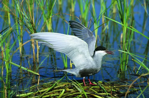
In the southern area of the Park and its nearby environment there are ten paths of Ornithological Interest. They are all in easily accessible places of great landscape beauty and at the beginning they have a panel with very complete information about the species of birds that can be observed, the route and the environment.

Ubicación
Latitud
37.772886
Longitud
-3.788329
Distrito
Municipio
Ubicación en el mapa
POINT (-3.788329 37.772886)
Imágenes carrusel
imagen
Image
2.png
Imagen principal
Desactivado
imagen
Image
1.png
Imagen principal
Desactivado
imagen
Image
3.png
Imagen principal
Desactivado
imagen
Image
Natu083.jpg
Imagen principal
Desactivado
imagen
Image
Natu094.jpg
Imagen principal
Desactivado
imagen
Image
Natu098.jpg
Imagen principal
Desactivado
imagen
Image
Natu156.jpg
Imagen principal
Desactivado
imagen
Image
Natu136.jpg
Imagen principal
Desactivado
imagen
Image
Natu186.jpg
Imagen principal
Desactivado
imagen
Image
Natu193.jpg
Imagen principal
Desactivado
imagen
Image
Natu207.jpg
Imagen principal
Desactivado
imagen
Image
Natu155.jpg
Imagen principal
Desactivado
imagen
Image
Natu212.jpg
Imagen principal
Desactivado
imagen
Image
Natu240.jpg
Imagen principal
Desactivado
imagen
Image
Natu262.jpg
Imagen principal
Desactivado
imagen
Image
Natu257.jpg
Imagen principal
Desactivado
imagen
Image
Natu256.jpg
Imagen principal
Desactivado
imagen
Image
Natu244.jpg
Imagen principal
Desactivado
Imágenes cabecera
imagen
Image
muflon.png
Imagen principal
Activado
Loading map
Preparing points of interest and routes...

The Hanging Gardens: La Vegetación de Las Rocas

Submitted by brandcode_deweloper on
Id
882062
Descripción
Descripción larga

Due to the presence of numerous rocky walls, both wet and dry, the rupic formations (small rock plants) are very abundant in the Park, forming true hanging gardens.

The limestone acts as a sponge by storing water, making life possible between its fissures and small shelves of a multitude of species that adapt to it. Some of these species live on the rocks for simple need, as only in them do they find shelter in front of the tooth of the herbivores.
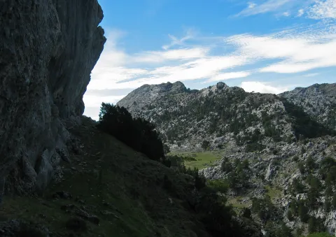
Among the plant formations that populate the rocks we will distinguish two, those that are in dry walls and those that prefer wet and slender walls, much more scarce. A good place to see both very close is in the Las Villas saw, in Poyo Sequillo the dry walls and in the Cerrada de San Ginés the wet walls.
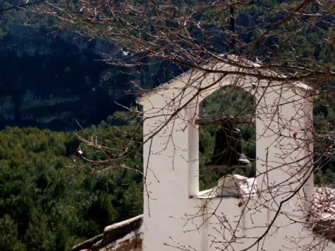
In the area of Poyo Sequillo we will enjoy a magnificent panoramic view of the Sierra de las Villas and its geological formations in bed. Rupicular plants such as the Cazorla violet (Viola cazorlensis), pipyrimañas (Sanguisorba rupestris), rock tea (Jasonia glutinosa), geranium of the waterfalls (Geranium cataractarum), stone breakers (Teucrium rotundifolium), tomils (Thymus orospedanus), and five branches (Potentilla caulescens), among others.
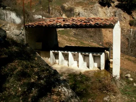
In the Cerrada de San Ginés, we will find the endemic carnivora plant known as the Andalusian grasilla (Pinguicula vallisnerifolia), as well as the widow's flower (Trachelium caeruleum), the Cazorla (Silla reverchinii), the five-in-branch (Potentilla caulescens), which lives in both dry and humid environments, and unnamed species such as Galium erytrirhizon, ferns as the hair of Venus (Adiantum capilluls- venerans and others as Aplentians). The tour has a little more than a kilometer and we advise to do it, because in this small closed the dry walls are alternating with rezummers.

_

As we enter the Las Villas mountains from Mogón, Sao Tomé or Chilluévar, we pass the reservoir of Aguascebas, and a few kilometers later, in the area known as the Collado del Pocico, a series of rocky cuts that flank the road, colonized by a lot of rupeal species, begins on our right.

_

From the previous site, following the road and after overcoming the Collado de la Traviesa and the cortijo of the same name, we reached the recreational area of Gil Cobo. In it we left the vehicle and took a track that goes right before crossing the bridge over the river Aguacebas of Gil Cobo. As soon as we walk, we'll start to see the slimming walls. Just half a mile, on our right, we'll have a big wall with a rupic community of wet wall.

Breve descripción

Poyo Sequillo and Cerrada de San Ginés

Ubicación
Latitud
37.913410
Longitud
-3.003750
Municipio
Ubicación en el mapa
POINT (-3.00375 37.91341)
Tipos de punto de interés
Imágenes carrusel
imagen
Image
cerrada.jpg
Imagen principal
Desactivado
Imágenes cabecera
imagen
Image
16283_ue3ikjl8bzcgqs12.jpg
Imagen principal
Activado
Loading map
Preparing points of interest and routes...

Los Anchos

Submitted by brandcode_deweloper on
Id
659877
Descripción
Descripción larga

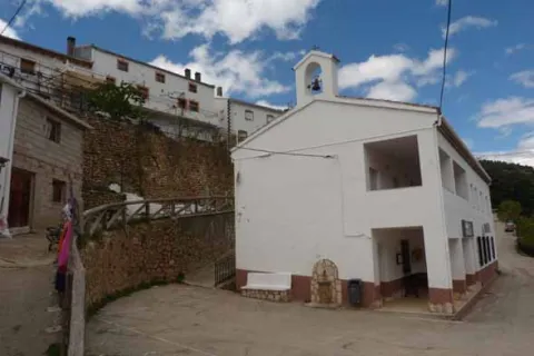
After a first group of houses, in which the Alma Serrana Ethnological Museum is located, we come to the Anchos to move us to another time. Baked streets, a laundry room that conveys tranquility through the water reflection, an oven or a small hermitage.

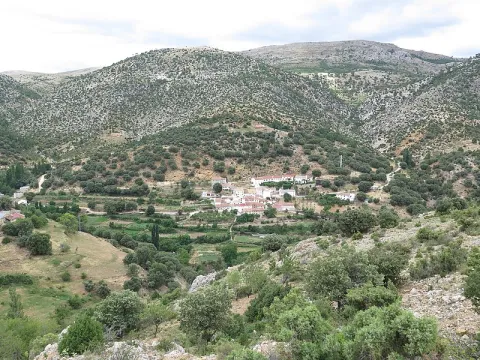
The Anchos conserves houses with a barely altered construction, the common being the wood, the gilded walls and the forging bars. A railing marks the limit between the houses and the gardens, being an unbeatable place to view the landscape and make a stop on the way. The village is located on a plain surrounded by mountains and next to the houses are the gardens that are still cultivated today.

Through the Anchos passes the GR 147, so we can do the path towards the River Madera or towards the Toba.

Breve descripción

From the crossing of the Venta Rampees a very narrow road leads us to the village of Los Anchos. The road seems to be lost to the interior of the mountain for just over four kilometres until we begin to see some gardens on terraces that indicate the beginning of human presence.

Ubicación
Latitud
38.223587
Longitud
-2.584503
Ubicación en el mapa
POINT (-2.584503 38.223587)
Tipos de punto de interés
Imágenes carrusel
imagen
Image
601_image_1.jpg
Imagen principal
Desactivado
imagen
Image
601_image_2.jpg
Imagen principal
Desactivado
imagen
Image
Vegetaci%C3%B3n%20Los%20Anchos.jpg
Imagen principal
Desactivado
Imágenes cabecera
imagen
Image
Fuente_Anchos037.JPG
Imagen principal
Activado
Loading map
Preparing points of interest and routes...