Saltar al contenido principal

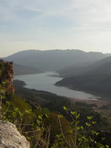
Viewpoint of the Castle of Albanchez de Mágina

Submitted by brandcode_deweloper on
Id
2980294
Descripción
Descripción larga

The town of Albanchez de Magina is accessed from the capital by the A-316 in the direction of Ubeda: After going about 12 km, to the right, we will turn to the A-320 in the direction of Mancha Real. In this town we will take the JA-3106 road towards Torres. Finally, from here we will head for the JA-1107 to Albanchez, which is about 12 km away.

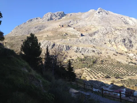
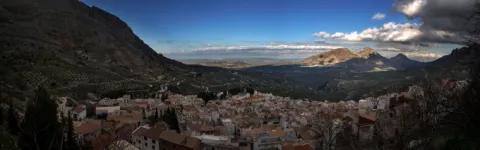
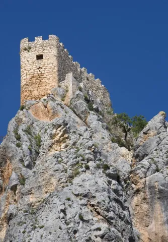
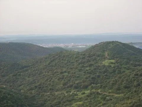
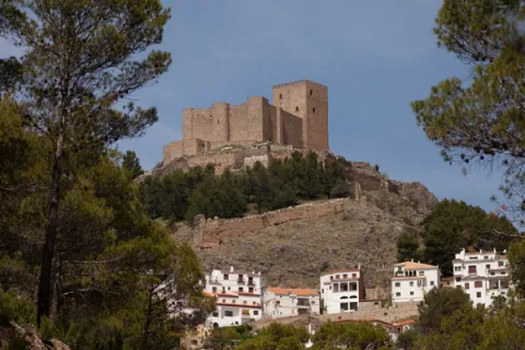
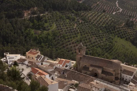
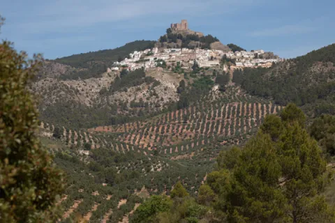
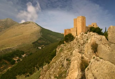
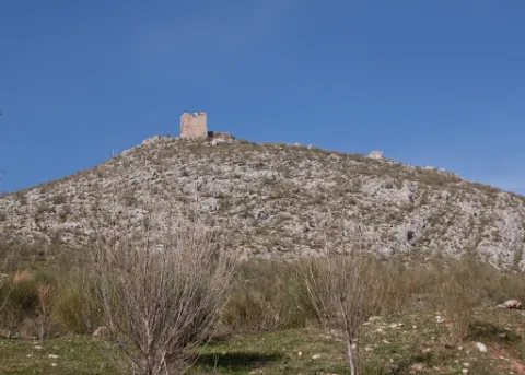
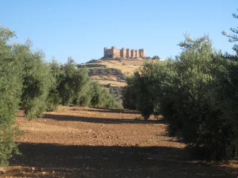
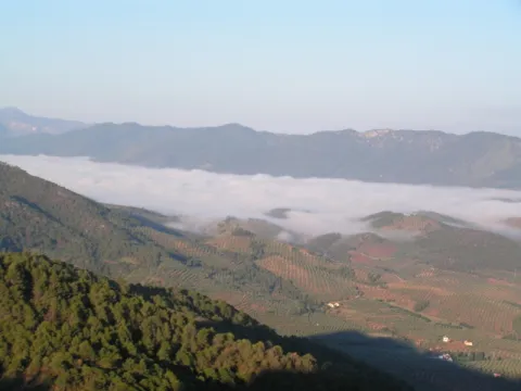
Albanchez de Mágina clings over the rocky skirmish of Mount Aznaitín (1,745 meters), headed towards the vertigo of a wide and deep valley watered by the often-flowing channel of the Albanchez River. On the needle of a sharp farallon lies its rocky castle of Arab origin, becoming an unbeatable lookout over the northern geography of this mountain massif of the Natural Park of Sierra Magina.

Breve descripción

The rise to this rock castle is already worth it. The feeling is to be attached to the nest of a rapacious bird on the walls of Mount Aznaitin, on the valley of the Cuadros River.

Ubicación
Código Postal
23538
Latitud
37.790110
Longitud
-3.468140
Distrito
Ubicación en el mapa
POINT (-3.46814 37.79011)
Tipos de punto de interés
Imágenes carrusel
imagen
Image
miradoralbanchez.jpg
Imagen principal
Desactivado
imagen
Image
63503204d18160dd6a733e989b70c404_L.jpg
Imagen principal
Desactivado
Imágenes cabecera
imagen
Image
19.jpg
Imagen principal
Activado
Microsite al que pertenece
Loading map
Preparing points of interest and routes...

Viewpoint of the Chiclana de Segura Castle

Submitted by brandcode_deweloper on
Id
4443197
Descripción
Descripción larga
On the castle hill, next to its ruins and within the town center is this splendid viewpoint. It can be reached through several streets, but this path (which does not have steps) has steep slopes. Located at the highest and most inaccessible point of the town, the castle has been declared an Asset of Cultural Interest since 1985. Although only a few paintings of its walls, towers, cistern and rooms are preserved, it has one of the greatest panoramic views that can be enjoyed today, reaching the view of four different provinces (Ciudad Real, Albacete, Granada and Jaén). You can also see numerous geographical features such as the Sierra Morena, the Sierra de Segura, the Sierra de Alcaraz or the Sierra Nevada. The Chiclana de Segura castle, of Arab origin and built in the 12th century, stands out above the buildings, which made it almost impregnable at the time of the Reconquista. A feat that Ferdinand III achieved around the year 1235, and shortly afterwards he handed over the castle to the Order of Santiago, becoming the head of the Montizon-Chiclana Commandery and the reason why Jorge Manrique resides in the municipality, upon being named Commander of the Order. Jorge Manrique himself may have commissioned a series of works in the fortress: “a spiral staircase for a false door, two dogs, a cave, a cupboard for a bookcase”… What is clear is that Jorge Manrique refers to this fortress in his poem love castle. II (…) named fortress is in the high mountains of a slope, on a broken rock, solid all of love, very well put (…). Without a doubt, it is worth visiting Chiclana de Segura and climbing its narrow and steep streets to delight in this visual spectacle (it also has a panoramic elevator - unique in the province - with which you can directly access the upper part of the castle).
Breve descripción
From this viewpoint, located next to the castle ruins, at the top of a hill, we will get impressive views of four different provinces: Ciudad Real, Granada, Albacete and Jaén itself.

Ubicación
Código Postal
23264
Latitud
38.310820
Longitud
-3.044500
Distrito
Municipio
Ubicación en el mapa
POINT (-3.0445 38.31082)
Tipos de punto de interés
Imágenes cabecera
imagen
Image
Natural2MiradordelCastillo.jpg
Imagen principal
Activado
Microsite al que pertenece
Loading map
Preparing points of interest and routes...

Viewpoint of Los Alarcones

Submitted by brandcode_deweloper on
Id
5860849
Descripción
Descripción larga

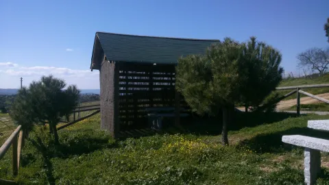
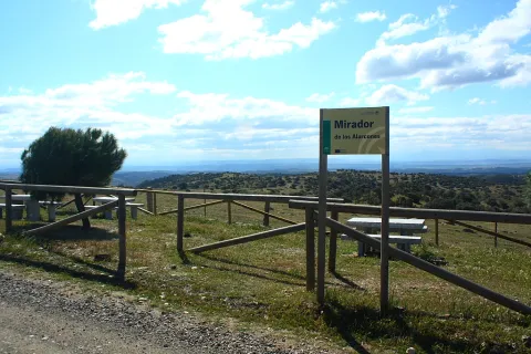
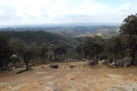
This lookout, located between adhesives, shows us in the distance the saws of Los Calderones and Ambroz, which make up the north-eastern end of the Sierra de Andújar Natural Park. This place, greatly linked to well-known cattle, opens a landscape where the humanized and the natural live together in balance. In these dehesas, the predominant species is the oak, which is altered in some areas with cork. It is curious to see how the higher stripes of solana show areas of rallies and sometimes covered with pringy pits, while in the most intertwined umbria in the valleys that make up these loins, vegetation hardly allows to see the ground. Many cynegetic species find shelter and food in these formations. It is not unusual to cross with some partridge followed by its partridges or to check how some eagle merods through the area for food.

Breve descripción

On the local road that links the farms of Los Escoriales and Sealadores.

Telecomunicaciones
Teléfono de contacto
953 549 030
Ubicación
Código Postal
23740
Latitud
38.038650
Longitud
-4.051620
Distrito
Municipio
Ubicación en el mapa
POINT (-4.05162 38.03865)
Tipos de punto de interés
Imágenes carrusel
imagen
Image
miradorAlarcones.jpg
Imagen principal
Desactivado
Imágenes cabecera
imagen
Image
mirador%20sierra%20andujar.JPG
Imagen principal
Activado
Microsite al que pertenece
Loading map
Preparing points of interest and routes...

Viewpoint of Las Majadillas

Submitted by brandcode_deweloper on
Id
5860740
Descripción
Breve descripción

Half way to the path of the Centenera, on the public mountain called the Baldius. The view of the Majadillas attracts by the divergence of its landscapes; on the one hand, an agricultural landscape where the olive trees predominate, although in the areas near the Vega del Guadalquivir, the irrigated crops stand out, and on the other, an agribusiness landscape dominated by plucked oak of Mediterranean mountain. The town of Marmolejo, known for its medicinal water springs, which led to the creation of the spa and which deal with kidney and digestive problems, can be seen at a distance. To the right of Marmolejo we see the Guadalquivir valley, which is seen between mountains. However, despite the fantastic views, we advise the visitor to turn from time to time the look to the sky, as it is possible to see eagles such as the scum or the real one, whose bearing will surprise us.

Ubicación
Código Postal
23770
Latitud
38.045009
Longitud
-4.170940
Distrito
Municipio
Ubicación en el mapa
POINT (-4.17094 38.045009)
Tipos de punto de interés
Imágenes carrusel
imagen
Image
miradormarmolejo.jpg
Imagen principal
Desactivado
Imágenes cabecera
imagen
Image
6345963Master.jpg
Imagen principal
Activado
Loading map
Preparing points of interest and routes...

Viewpoint of Camino Viejo

Submitted by brandcode_deweloper on
Id
5860474
Descripción
Breve descripción

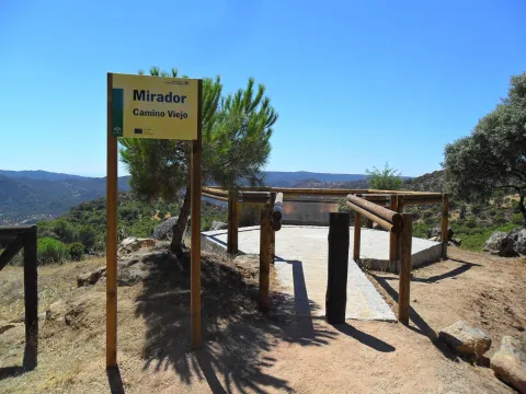
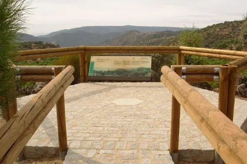
Near the Sanctuary of the Virgin of the Head, right on the path that goes from here to New Place. The Viewer of the Old Way of Andújar is located in a place where landscapes, history and tradition take their own life. The road leading to the lookout is traveled throughout the year by a multitude of pilgrims on their journey to the Sanctuary of the Virgin of the Head, Queen and Lady of Sierra Morena, which is also the oldest known Romry. To the attractive views of the place we must add this added value, as it is part of the culture, idiosyncrasy and fervor of its people. From the balcony we can see the refreshing beauty of the valley of the Jandula River (tributary of the Guadalquivir, to which it is joined later) with a typical and lush riverside forest, where the olmos take special prominence. Right across the street, covered with a pine cloak, the Marquitos hill stands out and, to its left down, the area called the New Place, where you can see the facilities of a forest nursery. The vegetation is typically Mediterranean, alternating areas of oak with pine and black areas.

Telecomunicaciones
Teléfono de contacto
953 549 030
Ubicación
Latitud
38.037700
Longitud
-4.053800
Distrito
Municipio
Ubicación en el mapa
POINT (-4.0538 38.0377)
Tipos de punto de interés
Imágenes carrusel
imagen
Image
miradorcaminoviejo.jpg
Imagen principal
Desactivado
Imágenes cabecera
imagen
Image
M_Camino_Viejo01.jpg
Imagen principal
Activado
Loading map
Preparing points of interest and routes...

Viewpoint Castle of Segura de la Sierra

Submitted by brandcode_deweloper on
Id
7480918
Descripción
Breve descripción

One of the treasures of the Sierras de Cazorla, Segura and Las Villas natural park, lifts the visitor over the mountains and shows on one side the mountain olive groves and on the other the most extensive forests of the Iberian Peninsula.

Ubicación
Código Postal
23379
Latitud
38.299210
Longitud
-2.649790
Dirección
C/ Castillo, s/n
Distrito
Ubicación en el mapa
POINT (-2.64979 38.29921)
Tipos de punto de interés
Imágenes carrusel
imagen
Image
Segura_de_la_Sierra_PM_091677_E.jpg
Imagen principal
Desactivado
imagen
Image
Segura_de_la_Sierra_PM_091756_E.jpg
Imagen principal
Desactivado
Imágenes cabecera
imagen
Image
Segura_de_la_Sierra_PM_091670_E.jpg
Imagen principal
Activado
Microsite al que pertenece
Loading map
Preparing points of interest and routes...

Viewpoint Castle of Santa Catalina

Submitted by brandcode_deweloper on
Id
7477305
Descripción
Breve descripción

A walk outside the Parador offers an aerial view over the olive groves of the countryside, between Jaén and Sierra Morena.

Ubicación
Código Postal
23003
Latitud
37.767780
Longitud
-3.799800
Dirección
Cerro, C/ Sta. Catalina, s/n
Distrito
Municipio
Ubicación en el mapa
POINT (-3.7998 37.76778)
Tipos de punto de interés
Imágenes carrusel
imagen
Image
image_104368.jpeg
Imagen principal
Desactivado
imagen
Image
image_217365.jpeg
Imagen principal
Desactivado
Microsite al que pertenece
Loading map
Preparing points of interest and routes...

Viewpoint Castle of la Peña de Martos

Submitted by brandcode_deweloper on
Id
7474476
Descripción
Breve descripción

An excursion from the city centre of Martos will lead you to the ruin of the mystery-filled castle. It is a great lookout over the longest olive groves in the province.

Ubicación
Código Postal
23600
Latitud
37.718020
Longitud
-3.960870
Distrito
Municipio
Ubicación en el mapa
POINT (-3.96087 37.71802)
Tipos de punto de interés
Imágenes carrusel
imagen
Image
castillo-martos.jpg
Imagen principal
Desactivado
Imágenes cabecera
imagen
Image
castillo-pena.jpg
Imagen principal
Activado
Microsite al que pertenece
Loading map
Preparing points of interest and routes...

Viewpoint Castle of Baños de la Encina

Submitted by brandcode_deweloper on
Id
7473108
Descripción
Breve descripción

One of the oldest castles in Europe, a film scene, magnificent Almohad military construction, allows us an extensive view of the olive grove near Sierra Morena.

Ubicación
Nombre
Cerro del Cueto
Código Postal
23711
Latitud
38.170310
Longitud
-3.775320
Dirección
Plaza de Santa María, 1
Distrito
Ubicación en el mapa
POINT (-3.77532 38.17031)
Tipos de punto de interés
Imágenes carrusel
imagen
Image
mirador.jpg
Imagen principal
Desactivado
Imágenes cabecera
imagen
Image
banos-encina.jpg
Imagen principal
Activado
Loading map
Preparing points of interest and routes...

Viewpoint Casco Histórico de Iznatoraf

Submitted by brandcode_deweloper on
Id
7504663
Descripción
Breve descripción

One of the highest towns in Andalusia, this urban town is located at 1000 meters of altitude, as a watchhouse over tens of kilometers of olive trees in all directions. The view of the Sierra de Las Villas is spectacular.

Ubicación
Código Postal
23338
Latitud
38.157390
Longitud
-3.033010
Municipio
Ubicación en el mapa
POINT (-3.03301 38.15739)
Tipos de punto de interés
Imágenes carrusel
imagen
Image
image_148449.jpeg
Imagen principal
Desactivado
imagen
Image
image_148455.jpeg
Imagen principal
Desactivado
Imágenes cabecera
imagen
Image
image_165313.jpeg
Imagen principal
Activado
Loading map
Preparing points of interest and routes...