Saltar al contenido principal

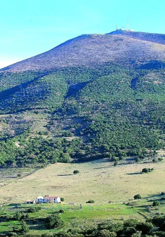
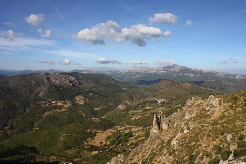
Mount La Sierra

Submitted by brandcode_deweloper on
Id
2190681
Descripción
Descripción larga

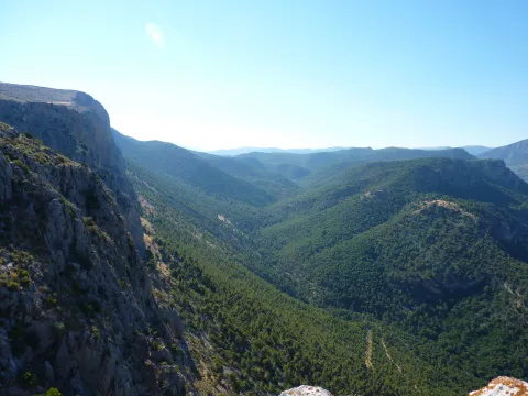
The mountain is surrounded by two convergent valleys: that of the Quibrajano River (where the Protected Species Recovery Centre is located) and the Hazadillas Canyon, with a recreational fit equipped with grills, tables, banks, recreational furniture, fountains, kiosk, etc., as well as other facilities.

This natural space is used as a place of leisure and leisure by the people of Jaén, given its proximity to the city.

Breve descripción

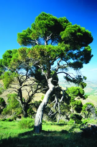
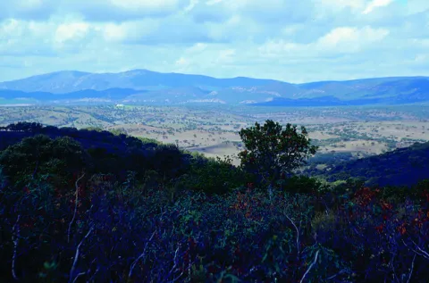
The Monte la Sierra peri-urban park conforms to the mountain of the same name, of 2,720 hectares and property of the City of Jaén, consonated with the Council of Environment of the Junta de Andalucía, which is located in the municipal term of Jaén.

Ubicación
Latitud
37.653790
Longitud
-3.713720
Distrito
Municipio
Ubicación en el mapa
POINT (-3.71372 37.65379)
Tipos de punto de interés
Imágenes carrusel
imagen
Image
Natu284%20%281%29.jpg
Imagen principal
Desactivado
imagen
Image
Natu248%20%282%29.jpg
Imagen principal
Desactivado
Imágenes cabecera
imagen
Image
Ca%C3%B1ada_Hazadillas01_24J.jpg
Imagen principal
Activado
Microsite al que pertenece
Loading map
Preparing points of interest and routes...
Mount Cuarto de Ardal

Submitted by brandcode_deweloper on
Id
8095030
Descripción
Descripción larga

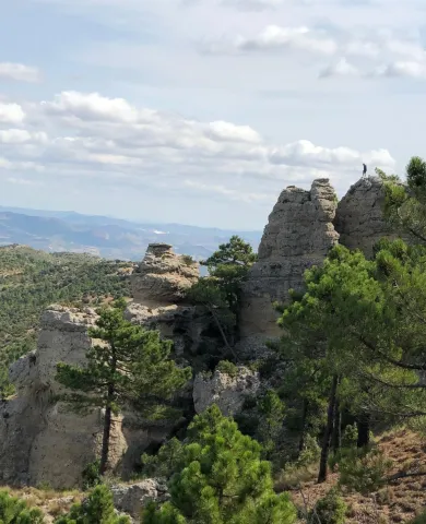
At 1440 m high is the MONTE ARDAL, which can be accessed by the road that reaches San Bartolomé, to the crossing that is moving to the left. It is a classroom of nature located in a forest shelter, with views of the village, the surrounding mountains,... in addition to the shelter, there is also a recreation area, adapted don barbecues, tables, and covered by a porch.

Breve descripción

Northof the term, there is a mountain, theArdal Room, in which the oaks, together with the retama, predominate, the albar thorn, wild rosals, juniper, ivy and madreselva. An ideal ground for the cicnetic species of major hunting (boar, deer, corzo...), and also of pastures, especially for the cattle of ligia.

Telecomunicaciones
Correo electrónico
ayuntamiento@genave.es
Ubicación
Código Postal
23392
Latitud
38.429970
Longitud
-2.733050
Distrito
Municipio
Ubicación en el mapa
POINT (-2.73305 38.42997)
Imágenes carrusel
imagen
Image
Cuarto%20de%20Ardal%2C2.JPG
Imagen principal
Desactivado
Imágenes cabecera
imagen
Image
Cuarto%20de%20Ardal%2C%20%281%29.jpg
Imagen principal
Activado
Loading map
Preparing points of interest and routes...

Mount Aznaitín

Submitted by brandcode_deweloper on
Id
5693260
Descripción
Descripción larga

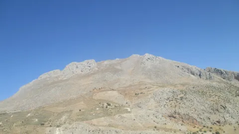
In the Aznaitín, some plant endemisms typical of Sierra Magina are maintained. At its summit the municipal terms of Jimena, Torres and Albanchez de Mágina, whose populations are located at their feet, as do the prehistoric caves, where the former inhabitants left their mark for posterity. Not in vain the Aznaitin impregnated the pupil of Antonio Machado from the far Baeza and incorporated him into his poetry.

Breve descripción

The Az-Naitín (Nathin in local dialect) is a mountain located in Sierra Magina, Jaén, Spain. The origin of the toponymy in Arabic would be Isnatin or Asnatin, and it is noted that it can come from its ancient name in ibero as Neitin, which refers to the great iberous god Neton, the god of Thunder and fire, which according to the legend dwells in the mountain. It has a special visual appeal, especially from the East side or from the Guadalquivir valley. It has a considerable altitude, 1745 m, which allows to see much of the province of Jaén.

Ubicación
Latitud
37.841370
Longitud
-3.476880
Distrito
Municipio
Ubicación en el mapa
POINT (-3.47688 37.84137)
Tipos de punto de interés
Imágenes carrusel
imagen
Image
3.jpg
Imagen principal
Desactivado
Imágenes cabecera
imagen
Image
4.jpg
Imagen principal
Activado
Microsite al que pertenece
Loading map
Preparing points of interest and routes...
Flour Mill el Gato

Submitted by brandcode_deweloper on
Id
8107962
Descripción
Descripción larga

Dated between 1950 / 1959. Electric flour mill with elevators and threads that carry wheat and flour from one machine to another. It has atrojes for the storage of wheat, atroje for the damp, alfanje, milling stay and machine stay. The chunks are built in tapial and spun, the function being to store the grain. The alfanje, built in brick and wood, is where you will find the set of milling stones. Inside is the gear that moves the stone. The stay of the milling is where the process of milling the grain is carried out. The machine stay is the second floor where you will find the trickle, the clean and the fender.

Breve descripción

Located in the Hutar or Hutar Birth. It's the next mill to the Trinity Mill. He took advantage of the strength of the Hutar Arroyo water. The mill is within a newly built building. The waterfall remains with its blinded arches that brought water to the mill. In the surroundings are its mill stones

Telecomunicaciones
Sitio web
www.huesa.es
Correo electrónico
ayuntamiento@carboneros.es
Ubicación
Código Postal
23487
Latitud
37.764260
Longitud
-3.077970
Municipio
Ubicación en el mapa
POINT (-3.07797 37.76426)
Imágenes carrusel
imagen
Image
p1330838.jpg
Imagen principal
Desactivado
Imágenes cabecera
imagen
Image
p1330739-copia.jpg
Imagen principal
Activado
Loading map
Preparing points of interest and routes...

Viewpoints: Balconies overlooking the countryside

Submitted by brandcode_deweloper on
Id
6551106
Descripción
Descripción larga

For this reason, the Arjona Historical Set is "Balcony de la Campiña." This aspect of "Balcony" of the countryside has been taken care of in Arjona, with the construction of looking parks that offer the citizen the possibility to contemplate the landscape of the countryside of Olivar, as well as the silhouette that leave on the horizon, other cities or geographical accidents such as the plain of the Guadalquivir Valley in Andújar, with Sierra Morena behind its back in its northern landscape, or the mountain chains of Sierra Magina, the Peña de Martos or the site of the Castle of Santa Catalina (Jaén) to the south.

Most of these viewpoints are located within the tour of the guided tours, two of them, those called "Mirador del Cemeterio de los Santos" and the "Mirador de la Plaza del Rey Alhamar," are specifically located in the area of the primitive Alcázar, that is, in the highest area of the town, the first looks to the North and the second to the South. The other viewpoints are located at lower levels, not less interesting, on Sol Street and Adarves Street.

These viewpoints provide an extraordinary incentive to the Uruguayan monumental heritage, providing landscape values of a strategic nature, which makes it a reference point to contemplate much of the North countryside and the South Serrania of the province.

Breve descripción

Arjona becomes a strategic enclave that controls a delimited visual panorama on the horizon, to the North by Sierra Morena and to the South by Sierra Magina. That is why we can distinguish 4 areas with a high or very high environmental aesthetic level, as well as enclaves from which you can see a panoramic view that acquires value by itself.

Ubicación
Código Postal
23760
Latitud
37.936475
Longitud
-4.055188
Distrito
Municipio
Ubicación en el mapa
POINT (-4.055188 37.936475)
Tipos de punto de interés
Imágenes carrusel
imagen
Image
12.jpg
Imagen principal
Desactivado
imagen
Image
10.jpg
Imagen principal
Desactivado
Imágenes cabecera
imagen
Image
13.jpg
Imagen principal
Activado
Microsite al que pertenece
Loading map
Preparing points of interest and routes...
Viewpoint Paseo de Antonio Machado

Submitted by brandcode_deweloper on
Id
7500350
Descripción
Breve descripción

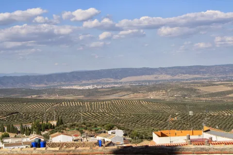
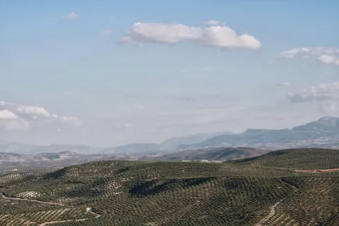
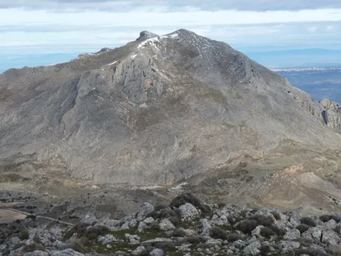
Known as La Muralla, this perimeter street to the city of Baeza offers beautiful views over the olive grove, the Guadalquivir valley and the natural park of Sierra Magina.

Ubicación
Código Postal
23440
Latitud
37.992360
Longitud
-3.469560
Municipio
Ubicación en el mapa
POINT (-3.46956 37.99236)
Tipos de punto de interés
Imágenes carrusel
imagen
Image
Baeza_Paseo_Antonio_Machado_010.jpg
Imagen principal
Desactivado
Microsite al que pertenece
Loading map
Preparing points of interest and routes...

Viewpoint el Tapadero

Submitted by brandcode_deweloper on
Id
913206
Descripción
Descripción larga

A tortuous sabina mora, with the trunk tanned by the passage of years and the inclemences of time, welcomes us to the lookout, from which you can see an impressive and majestic panorama of the saw of Las Villas, which as a balcony opens to show us, in a close-up, the delicious valley of Chillar stream and, at the bottom, the valley of the Guadalquivir River, which is lost among the olive lomas.

We suggest:

  • Continue our promotion, to the Collado del Agua de Los Perros, which with its 1200 m altitude, allows us to have a magnificent and spectacular view of this saw.
  • Consider the twilight on the horizon. The tenuous light that surrounds the place produces fantastic tones on the rocks and accentuates the powerful forms of its relief, accentuating the magical charm of the place.

Carretera JH-1755, which links the town of Villanueva del Archbishop with the village of Tranco, known as "Transversal de las Villas." The location of the lookout is well marked by a sign.

Breve descripción

This lookout is located on the top of a rocky wall, with more than 200 m of vertical fall, on an abyss whose vision produces impression. The steep slopes are populated by Mediterranean forest spots, which anchor their roots in the pure rock. It is common to observe the mountain goats climbing along the hillsides, as well as the majestic flight of great rapaces, especially leonate vultures, but also royal eagles, scallops, baskets, hawks, gavilanes... and, if there is luck, even the recently reintroduced bones.

Ubicación
Latitud
37.912893
Longitud
-3.003887
Municipio
Ubicación en el mapa
POINT (-3.003887 37.912893)
Tipos de punto de interés
Imágenes carrusel
imagen
Image
miradorT.jpg
Imagen principal
Desactivado
Imágenes cabecera
imagen
Image
mirador-tapadero.png
Imagen principal
Activado
Loading map
Preparing points of interest and routes...

Viewpoint El Portichuelo

Submitted by brandcode_deweloper on
Id
5925155
Descripción
Breve descripción

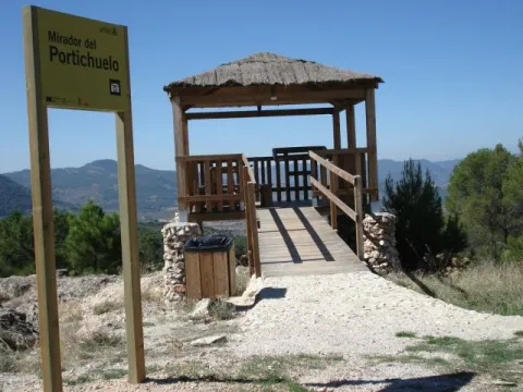
From this viewpoint we can get a wonderful and very close view of the village of Siles, as it is just 3 km from the Villa.
Access to this lookout is through a forest track accessible with any type of vehicle (car, bike, mountain bike, etc.) and access to the lookout is also adapted for people with disabilities.

Ubicación
Latitud
38.388600
Longitud
-2.581570
Distrito
Municipio
Ubicación en el mapa
POINT (-2.58157 38.3886)
Tipos de punto de interés
Imágenes carrusel
imagen
Image
miradorportichuelo.png
Imagen principal
Desactivado
Imágenes cabecera
imagen
Image
11.jpg
Imagen principal
Activado
Loading map
Preparing points of interest and routes...

Viewpoint of the Keep / Tower de Cuadros

Submitted by brandcode_deweloper on
Id
2980306
Descripción
Descripción larga

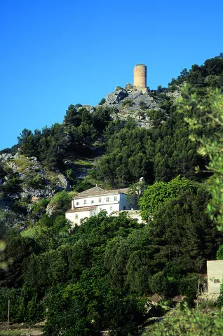
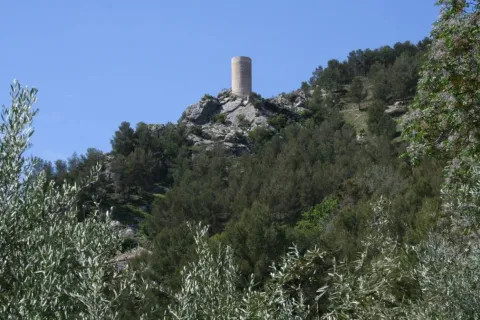
It is a watchtower, of Arab origin, perfectly conditioned as a lookout that offers the visitor beautiful views of the valley of the Cuadros River, surrounded by gardens and crops, and part of the Natural Park of Sierra Magina. It is accessed through the signposted path of the Viñas and is a privileged place to contemplate one of Europe's largest highland forests, whose glasses intertwine with each other by forming a plant vault that barely lets the sky see.

Breve descripción

The lookout is located near the recreational area El Adelfal de Cuadros, near the shrine of the Virgin of Cuadros, south of the city centre, about 4 km. of Bedmar; access directly by the road JV-3.222.

Ubicación
Código Postal
23537
Latitud
37.789330
Longitud
-3.409500
Dirección
Camino de Fresneda a Cuellos
Distrito
Municipio
Ubicación en el mapa
POINT (-3.4095 37.78933)
Tipos de punto de interés
Imágenes carrusel
imagen
Image
Mon443.jpg
Imagen principal
Desactivado
Imágenes cabecera
imagen
Image
20.jpg
Imagen principal
Activado
Microsite al que pertenece
Loading map
Preparing points of interest and routes...
Viewpoint of the Pico Almadén

Submitted by brandcode_deweloper on
Id
2980318
Descripción
Descripción larga

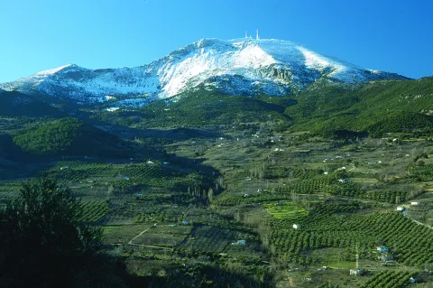
At 1,883 m above sea level, the visual basin is 360º, and can be seen from the Almadén almost the entire province, even the tops of Sierra Nevada. From the botanical point of view, the Almadén peak offers an interesting snapshot of the different bioclimatic floors, from the Mediterranean to the Mediterranean, which exist in the Natural Park of Sierra Magina.

Breve descripción

In Mancha Real we will take, by the Alameda de las Pillas, the so-called road of the Repetidor, that in a constant and zigzagueante ascent of 35 km. that leads us to the top of the Almadén, one of the ceilings of the province where the municipal boundaries of Cambil, Pegalajar and Torres converge

Ubicación
Código Postal
23120
Latitud
37.725060
Longitud
-3.466650
Dirección
Carretera A-324
Distrito
Municipio
Ubicación en el mapa
POINT (-3.46665 37.72506)
Tipos de punto de interés
Imágenes carrusel
imagen
Image
Natu363.jpg
Imagen principal
Desactivado
Imágenes cabecera
imagen
Image
21.jpg
Imagen principal
Activado
Microsite al que pertenece
Loading map
Preparing points of interest and routes...