Saltar al contenido principal

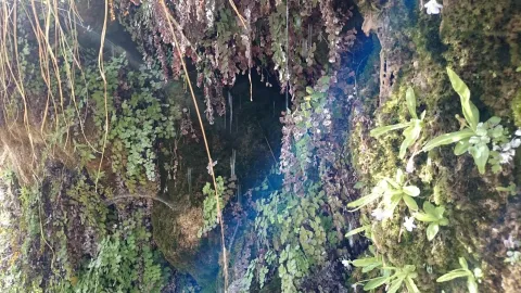
Fountain of the Almoteja

Submitted by brandcode_deweloper on
Id
880909
Descripción
Descripción larga

In the fountain we can see the catacamosque (Pinguicola vallisneriifolia), small carnivora plant endemic to the Park, which feeds on insects. In this place a signposted path of 1 '5 km is started, which ascends on a hillside from which you can see very good panorama of the Bucentaina and the Stone of the Hole.

SITUATION

In the km 2.2 of the Siles to Las Azeas road (JF-7012), it starts a forest track that leads to the Area after 1.5 km.

Breve descripción

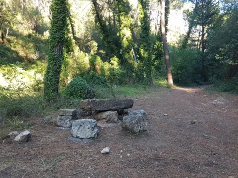
This Recreative Area is in a cool and pleasant place next to the Arroyo del Barranco de los Tejos and has tables and fountain. Although it has a small parking lot, we recommend walking to enjoy the river vegetation of the stream, with abundant willows.

Ubicación
Latitud
38.359810
Longitud
-2.569110
Dirección
km 2,2 de la carretera de Siles a Las Acebeas
Distrito
Municipio
Ubicación en el mapa
POINT (-2.56911 38.35981)
Tipos de punto de interés
Imágenes carrusel
imagen
Image
Fuente%20Almoteja.jpg
Imagen principal
Desactivado
Imágenes cabecera
imagen
Image
fuente-almoteja.jpg
Imagen principal
Activado
Loading map
Preparing points of interest and routes...

Fuenmayor

Submitted by brandcode_deweloper on
Id
5846796
Descripción
Breve descripción

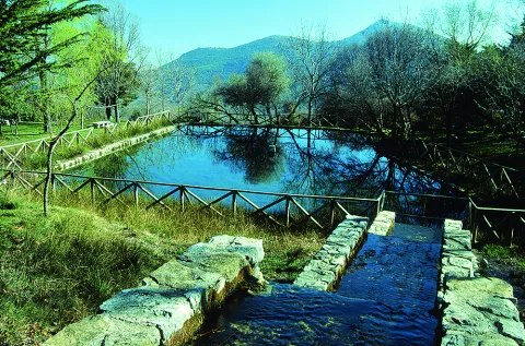
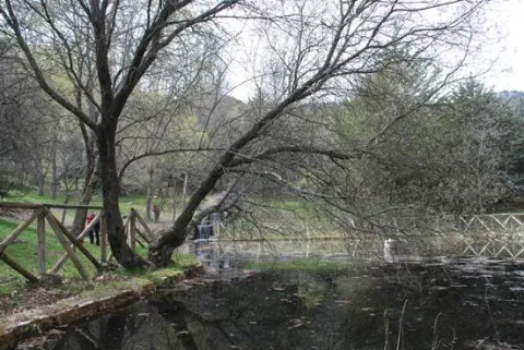
Traditional meringero area around a high-flow source that feeds a pond, around which the furniture of the picnic area is distributed. It is the starting place of several hiking routes.

Ubicación
Latitud
37.785140
Longitud
-3.509250
Distrito
Municipio
Ubicación en el mapa
POINT (-3.50925 37.78514)
Tipos de punto de interés
Imágenes carrusel
imagen
Image
Natu438.jpg
Imagen principal
Desactivado
Imágenes cabecera
imagen
Image
Fuenmayor.jpg
Imagen principal
Activado
Microsite al que pertenece
Loading map
Preparing points of interest and routes...
Fault of Tíscar

Submitted by brandcode_deweloper on
Id
876119
Descripción
Descripción larga

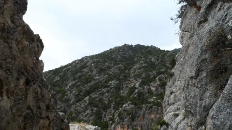
The Tiscar Falla is a sinistra tear fracture that borders the Quesada saw by the E, running always close to the Quesada- well Alcón road. The fracture plane is almost vertical. The failure has cut the southern end of the Sierra de Cazorla, moving the southern fragment to the NW about 8 km.

At the proposed point the failure plane can be observed, with associated failure rocks, as well as some horizontal strands that show the movement of this fracture.

Source: Inventory of Georresources of Andalusia. Environmental Council. Junta de Andalusia.

Breve descripción

Tiscar failure

Ubicación
Latitud
37.912893
Longitud
-3.003887
Municipio
Ubicación en el mapa
POINT (-3.003887 37.912893)
Tipos de punto de interés
Imágenes carrusel
imagen
Image
falla-tiscar.jpg
Imagen principal
Desactivado
imagen
Image
piedras.jpg
Imagen principal
Desactivado
imagen
Image
Natu215.jpg
Imagen principal
Desactivado
Imágenes cabecera
imagen
Image
tiscar.jpg
Imagen principal
Activado
Loading map
Preparing points of interest and routes...

Los Perales Strait

Submitted by brandcode_deweloper on
Id
913048
Descripción
Descripción larga

There are two places to enjoy the Strait of Perals:

  • Undoubtedly a good place to observe the beauty of this Strait is the lookout that appears on the left side of the Navas road. It's not signposted, so you have to pay attention, though it has no loss.
  • In the valley of Valdetrillos in the ascending direction there is a track that can be seen from the lookout. To get to it you have to turn back on the runway of the Navas and take the road cut by a chain that goes to the right. We have to cross the bridge over the Rambla stream. After a period of half an hour walking we view the basin of the Valdetrillos stream from where the Strait of the Perals and the lookout that has been referred to above are observed.

In Cazorla take the Sierra road (A-319) until the crossing known as the Empalme del Valle. Turn right on the JF-7092 road and after passing the bridge over the Guadalquivir River (4 km from the Empalme) follow the left track (JF-7091). Between the km 27 and 28 of the road signs is the lookout with views of the Strait of the Perales.

Breve descripción

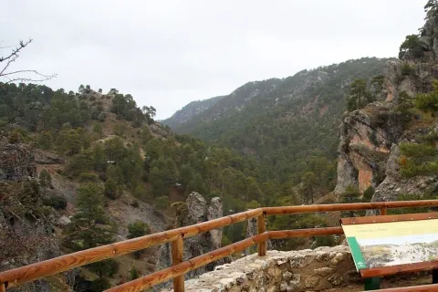
Singular throat that stands out for the aesthetics of its curious rock formations. At the bottom the stream of Valdetrillos breaks into fast joys that put the sound note. In this area it is easy to see how the agile muflons, the montane males, and even the majestic flight of the royal eagle, the leonate vulture or the drifted eagle climb through vertical walls. At the end of the valley the Calarillas provides perspectives of the highest mountains of this natural space.

Ubicación
Latitud
37.912893
Longitud
-3.003887
Municipio
Ubicación en el mapa
POINT (-3.003887 37.912893)
Tipos de punto de interés
Imágenes carrusel
imagen
Image
perales.jpg
Imagen principal
Desactivado
Imágenes cabecera
imagen
Image
1515_MI_01.jpg
Imagen principal
Activado
Loading map
Preparing points of interest and routes...

Estaca Grande

Submitted by brandcode_deweloper on
Id
7461237
Descripción
Descripción larga
  • Your access is made on foot field through.
  • The person who best knows and has studied the centenary olive trees in Martos is Mr. Ciriaco Castro Toro, retired technician of the City Council.
Breve descripción

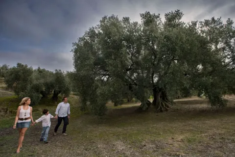
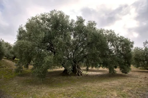
La Estaca Grande is a unique olive tree, about 300 years old, located about 450 metres from the Via Verde del Oil, right in the area called Cañada del Abandado, in the municipal term of Martos. In Jaén the olive trees are also known as stacas, in reference to their primary phase and to one of the planting methods.

Telecomunicaciones
Sitio web
https://www.martos.es/
Teléfono de contacto
953 704 005
Correo electrónico
concejal.jerena@martos.es
Ubicación
Nombre
Cañada del Abandonado
Código Postal
23600
Latitud
37.735290
Longitud
-3.970170
Distrito
Municipio
Ubicación en el mapa
POINT (-3.97017 37.73529)
Tipos de punto de interés
Imágenes carrusel
imagen
Image
estca-grande-2.jpg
Imagen principal
Desactivado
imagen
Image
olivo-estaca.jpg
Imagen principal
Desactivado
Imágenes cabecera
imagen
Image
estaca-grande-1.jpg
Imagen principal
Activado
Microsite al que pertenece
Loading map
Preparing points of interest and routes...
Hermitage of the Calvario

Submitted by brandcode_deweloper on
Id
8108554
Descripción
Descripción larga

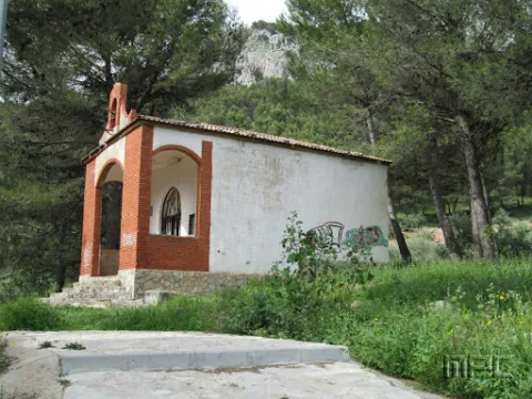
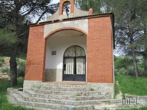
Inside there is a figure of a Crucified Christ as well as a Cross Way that was donated by the marriage Mr José Martínez García and Mr María Velasco Czech in 1989. It was rebuilt in 1984.

Breve descripción

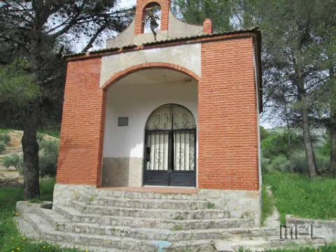
It is a small hermitage located on the way of the Dehesa which is reached after a road of stone crosses. It is accessed through a portico with a reduced arch and a swordsman by cutting the whole.

Telecomunicaciones
Sitio web
www.jamilena.es
Teléfono de contacto
953 566 001
Correo electrónico
ayuntamientojamilena@gmail.com
Ubicación
Código Postal
23003
Latitud
37.744390
Longitud
-3.904840
Dirección
Camino de las Cruces
Distrito
Municipio
Ubicación en el mapa
POINT (-3.90484 37.74439)
Tipos de punto de interés
Imágenes carrusel
imagen
Image
Ermita%20del%20Calvario.jpg
Imagen principal
Desactivado
imagen
Image
Ermita%20del%20Calvario2.jpg
Imagen principal
Desactivado
Imágenes cabecera
imagen
Image
Ermita%20del%20Calvario.jpg
Imagen principal
Activado
Loading map
Preparing points of interest and routes...

Hermitage of San Juan Bautista

Submitted by brandcode_deweloper on
Id
8090814
Descripción
Descripción larga

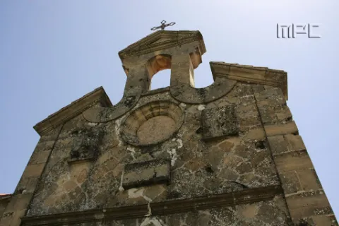
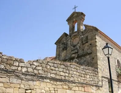
Behind the Palace is a house that was once a hermitage of St. John the Baptist: it retains the structure of the 17th's conventual gates, a small swordsman and, of course, remarkable paving as the tradition of Jabalfifth commands.

Breve descripción

Built by order of the Marquise Dona Catalina de Rojas and Sandoval, the first stone was placed in 1635. The stone wall, about three meters high, was later built around 1820, using the stones from the old castle and melting. It is currently decacralized and conditioned as a housing; though not inhabited and in a ruinous state.

Telecomunicaciones
Sitio web
www.jabalquinto.es/el-municipio/patrimonio-historico.html
Teléfono de contacto
953 617 056 / 953 617 373
Ubicación
Código Postal
23712
Latitud
38.019170
Longitud
-3.724520
Distrito
Municipio
Ubicación en el mapa
POINT (-3.72452 38.01917)
Tipos de punto de interés
Imágenes carrusel
imagen
Image
ermita%20de%20San%20Juan%20Bautista2.jpg
Imagen principal
Desactivado
Imágenes cabecera
imagen
Image
ermita%20de%20San%20Juan%20Bautista%20%282%29.jpg
Imagen principal
Activado
Loading map
Preparing points of interest and routes...

Holm Oak and Juniper Forests

Submitted by brandcode_deweloper on
Id
920671
Descripción
Descripción larga

They are found on the stony and slope slopes, forming clear forests in which they coexist with some pine of several species (Pinus nigra salzmannii, Pinus pinaster and Pinus halepensis), according to the altitude and orientation of the slope, as well as cornicabra (Pistacia terebinthus), ruscos (Ruscus aculeatus) and a herbaceous entourage such as charts, rompesacos and cerveres (Poa bulbosa, Cynosurus echinatus, Aegilops, and the acrachacellus (Arrachacus), and the acellus (Arrachatus), and the other (Arrachus).

From the Recreative Area of Linarejos, we walk along the track that goes up the hill. We will go through a quarry and a barrier, these are two indicators that confirm that we are on the right track. At 3 km from the Recreative Area we will see a detour to our left, a track that enters us into a rock maze. It is a torque, in which this formation of oaks and juniper is extended. Two leads are coming out to our left, one after the other, and they both get us into this torcal. If we do not want to go too far, because it is a difficult ground to go through, from the main track we see this plant formation in the same way.

Breve descripción

The Navillas, Peña Gallinera

The oak (Quercus ilex ballota) and juniperus oxicedrus (Juniperus oxicedrus) are a unique feature of these limestone saws. It is difficult to see a formation of these pure characteristics, since it is normal to see them intermingled in enclosures, pine trees and in slices of Mediterranean forests, but in a few places, like this, we can see them with their characteristic elements.

Ubicación
Latitud
37.912893
Longitud
-3.003887
Municipio
Ubicación en el mapa
POINT (-3.003887 37.912893)
Imágenes carrusel
imagen
Image
encinares_enebrales.png
Imagen principal
Desactivado
imagen
Image
ales%20%281%29.jpg
Imagen principal
Desactivado
Imágenes cabecera
imagen
Image
4eladera%20del%20espinar%2C%20barranco%20de%20la%20pinada%2C%20barranco%20de%20las%20esparragueras%2C%20barranco%20de%20las%20liebres.jpg
Imagen principal
Activado
Loading map
Preparing points of interest and routes...

Holm Oak Forest

Submitted by brandcode_deweloper on
Id
880004
Descripción
Descripción larga

Our goal is to see one of the most spectacular oak trees in the Park, where we will see large, very large oak trees and a forest of tale. Give the place where we left the car, we continue on foot on the track about 6 km. The rise is easy and uncomplicated.

We'll get to a crossroads, we'll follow right. A little higher, a source is intuited under an oak. For that place, to the right of the track and above the source we will find large copies of oak, although in reality we have been walking through a magnificent oak for a long time. The crossing of the track is where the old forest house of the Fountain del Roble was. This is where the burning reaches all its magnificence.

In this forest dominated by the oak we find some other complaint (Quercus faginea), serbals (Sorbus domestica), pespejones (Sorbus torinlis), majuelos (Crataegus monogina), skirmishes (Rosa spp.), laureolas (Daphne laureola), thorns (Berberis vulgaris australis), torvizcos (Daphne gidium), peonies or mountain roses (Paeonia broteroi), orchids (Orchis, the dominant, Chiphiphipis, and the contiguera (Ophanacteria), and the domineas.

In our saws we can see many oak forests. For example, on the rise to Santiago de la Sword from Tobos, on the Esperilla, before Fuente Steel, or on the access track to the Pegueras. The name of engraving has meant Mediterranean forest, but the matter is not so simple.

Rather, we should say that burning is a phase of the Mediterranean forest. The lauroid forest, which we discussed elsewhere, is also Mediterranean forest. In any case, the engraving does exist as such, in addition to the fact that its main component, the encin (Quercus ilex ballota), is in almost all the plant formations of the Park, with the exception of the summits and the cold deciduous forests, of the high mountain.

LOCATION

From Coto Ríos we take the road A-319 towards the Tranco and less than a kilometer away to the right towards the campsite of the Llanos de Arance. We overcome it and follow it (the road becomes a forest track), until it reaches the control of Aguamula. As we pass it we follow the track to the left, discarding another one to the right, from here we will travel the right margin of the Tranco reservoir. We take the first detour to be presented to our right at 2.1 km from the above control. It is a great crossing where the track is widened and where we must turn to our right making a closed curve that places us almost 180º to the sense of our march. This is the track that goes up to Majalalto, passing through the Fountain del Roble. In that place we left the vehicle, as the track is closed to traffic with a chain.

Breve descripción

Our goal is to see one of the most spectacular oak trees in the Park, where we will see large, very large oak trees and a forest of tale. Give the place where we left the car, we continue on foot on the track about 6 km. The rise is easy and uncomplicated.

We'll get to a crossroads, we'll follow right. A little higher, a source is intuited under an oak. For that place, to the right of the track and above the source we will find large copies of oak, although in reality we have been walking through a magnificent oak for a long time. The crossing of the track is where the old forest house of the Fountain del Roble was. This is where the burning reaches all its magnificence.

In this forest dominated by the oak we find some other complaint (Quercus faginea), serbals (Sorbus domestica), pespejones (Sorbus torinlis), majuelos (Crataegus monogina), skirmishes (Rosa spp.), laureolas (Daphne laureola), thorns (Berberis vulgaris australis), torvizcos (Daphne gidium), peonies or mountain roses (Paeonia broteroi), orchids (Orchis, the dominant, Chiphiphipis, and the contiguera (Ophanacteria), and the domineas.

In our saws we can see many oak forests. For example, on the rise to Santiago de la Sword from Tobos, on the Esperilla, before Fuente Steel, or on the access track to the Pegueras. The name of engraving has meant Mediterranean forest, but the matter is not so simple.

Rather, we should say that burning is a phase of the Mediterranean forest. The lauroid forest, which we discussed elsewhere, is also Mediterranean forest. In any case, the engraving does exist as such, in addition to the fact that its main component, the encin (Quercus ilex ballota), is in almost all the plant formations of the Park, with the exception of the summits and the cold deciduous forests, of the high mountain.

LOCATION

From Coto Ríos we take the road A-319 towards the Tranco and less than a kilometer away to the right towards the campsite of the Llanos de Arance. We overcome it and follow it (the road becomes a forest track), until it reaches the control of Aguamula. As we pass it we follow the track to the left, discarding another one to the right, from here we will travel the right margin of the Tranco reservoir. We take the first detour to be presented to our right at 2.1 km from the above control. It is a great crossing where the track is widened and where we must turn to our right making a closed curve that places us almost 180º to the sense of our march. This is the track that goes up to Majalalto, passing through the Fountain del Roble. In that place we left the vehicle, as the track is closed to traffic with a chain.

Ubicación
Latitud
37.912893
Longitud
-3.003887
Municipio
Ubicación en el mapa
POINT (-3.003887 37.912893)
Tipos de punto de interés
Imágenes carrusel
imagen
Image
Natu021.jpg
Imagen principal
Desactivado
imagen
Image
IMG_0815._Encinar.jpg
Imagen principal
Desactivado
Imágenes cabecera
imagen
Image
encinar.png
Imagen principal
Activado
Loading map
Preparing points of interest and routes...

Millenary Holm Oak

Submitted by brandcode_deweloper on
Id
4573103
Descripción
Descripción larga

We can deduce that this was the dominant landscape a few centuries ago, when after the Reconquista arrived in this village the first inhabitants attracted by the wealth of this dehesa and the possibilities it offered, not only for its cattle, but also to make it "land of bread."

Until the 19th century there were still many oak feet, but it was during this and especially during the first years of the last 20th century that they were significantly reduced, in some cases to devote the land to cereal, vineyard or olive trees and in others to obtaining charcoal. However we can still see some spots of indigenous vegetation in the vicinity of Cabeza Montosa and the hill of the Peones.

This fierce struggle of man against the dehesa has allowed some of the oak to be kept so that its shadow would cover the reapers and the flocks that took advantage of the rashes, or to collect the stones that were taken from the fallow. The fact is that in cases like this, in the face of lack of competition, it is possible that the few specimens of oak have grown more vigorously.

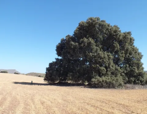
Its trunk has a considerable bearing for an oak and its cup is the widest in the entire province with about 30 meters in diameter and 300 meters in perimeter. This oak is part of the catalogue of unique trees in Spain and is waiting to be declared as Good of Natural Interest, not in vain is of the few millennia trees left on the peninsula.

It is located very close to the railway station of Cabra del Santo Cristo, next to the cortijo of "La Viña." We can access up to the millennial oak through an asphalt road, in good condition, that leaves from the passage to the level that is in the Station. We just have to follow the direction of the signage and within 2 km we will have no doubt when we see it to the left of the road, while to the right the above-mentioned cortijo of the Viña will serve as a reference.

From Cabra we can also walk along the lane that runs through the Fifth, Alamedilla and Gamelloncillo, for which we will walk through space of about 6 km (only one way). It is advisable to finish our route at the station of Cabra and stay in your canteen to take a refreshment with good viandas to recover from the effort, or, if we want to continue to know this ancient dehesa, continue track and return to Hidalgo and the Mill Barranco, but then we will extend our route to about 18 km and have walked by asphalt for a considerable part of the road.

Breve descripción

The area known as the Llanos de la Estación, or of Hidalgo, is today a very anthropolized landscape where the alternative crops of olive and cereal predominate, although it is easy to notice considerable specimens of oak, as well as numerous chaps on the linds that demarcate the agricultural farms.

Ubicación
Latitud
37.704030
Longitud
-3.286990
Distrito
Ubicación en el mapa
POINT (-3.28699 37.70403)
Tipos de punto de interés
Imágenes carrusel
imagen
Image
Encina%20Centenaria.jpg
Imagen principal
Desactivado
imagen
Image
Encina%20Centenaria%202.jpg
Imagen principal
Desactivado
Imágenes cabecera
imagen
Image
17.jpg
Imagen principal
Activado
Microsite al que pertenece
Loading map
Preparing points of interest and routes...
Interés