Saltar al contenido principal

Víboras Reservoir

Submitted by brandcode_deweloper on
Id
6115159
Descripción
Breve descripción

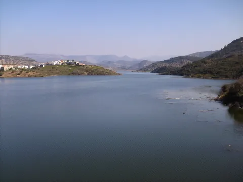
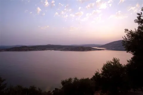
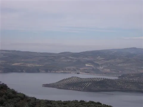
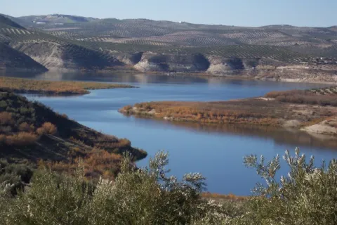
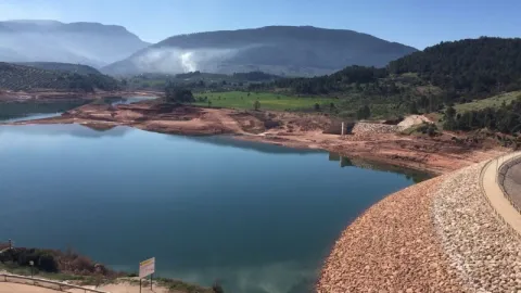
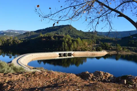
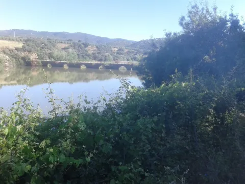
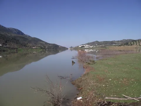
The Víboras, is one of the most requested swamps by the sports fishing clubs of the province, even by club of other provinces, reaching a few weekends up to four competitions on its shores, with seven areas enabled for the freshwater competitions, thanks to the collaboration of the municipal team of Las Casillas de Martos.

Ubicación
Código Postal
23614
Latitud
37.638034
Longitud
-3.999677
Distrito
Municipio
Ubicación en el mapa
POINT (-3.999677 37.638034)
Imágenes carrusel
imagen
Image
Embalse%20del%20V%C3%ADboras.jpg
Imagen principal
Desactivado
Imágenes cabecera
imagen
Image
DSCF6882.JPG
Imagen principal
Activado
Loading map
Preparing points of interest and routes...
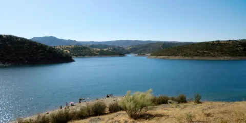
Rumblar Reservoir

Submitted by brandcode_deweloper on
Id
6115043
Descripción
Breve descripción

The tent, barbo and Black Bass are present, although the big fish are very rare. The average size is small or at most medium, so it's a perfect place with polo and it can end with a lot.

Ubicación
Código Postal
23711
Latitud
38.191160
Longitud
-3.785430
Distrito
Ubicación en el mapa
POINT (-3.78543 38.19116)
Imágenes carrusel
imagen
Image
Playa-el-tamujoso-embalse-del-rumblar-e1435315737961.jpg
Imagen principal
Desactivado
imagen
Image
Natu159.jpg
Imagen principal
Desactivado
Imágenes cabecera
imagen
Image
Natu103.jpg
Imagen principal
Activado
Microsite al que pertenece
Loading map
Preparing points of interest and routes...

Tranco Reservoir

Submitted by brandcode_deweloper on
Id
912713
Descripción
Descripción larga

The reservoir is mainly nourished by the waters of the Guadalquivir, it has almost 500 cubic meters of capacity and 1500 hectares of surface. Much of it was previously occupied by the beautiful Vega de Hornos and the Guadalquivir valley.

We suggest...

The Tranco road is usually quite busy on dates of greater tourist influx, so, if you really want to enjoy the landscape, do not agree to look at it from the car and stop for a while at the dam or at some viewpoint, as usual. Our advice is: walk. On the right bank, you have several forest tracks, as well as the circular signposted path PR-A 149, which begins very close to the village of Fuente la Higuera. On the left, there are two signposted paths: the PR-A 193, which starts 1.1 km from the Tranco dam to the north, and a stretch of the GR-144, which is taken halfway between the Hornos de Segura and Cañada Morales, in a pronounced curve. In addition, in the environment of the reservoir you will not find many earrings.

Breve descripción

It is one of the largest reservoirs in Spain and is a first-class landscape resource in the Natural Park, so its entire environment is especially protected as the Bujaraiza Reserve Area. The left bank is on the A-319 road, and has various viewpoints, recreational areas, signposted trails and accommodation and restoration services, as well as water sports facilities. The right margin is mostly passed through forest tracks and roads. In its beginning (southern part) has several views of the Félix Rodríguez de la Fuente route.

Ubicación
Latitud
37.772886
Longitud
-3.788329
Distrito
Municipio
Ubicación en el mapa
POINT (-3.788329 37.772886)
Imágenes carrusel
imagen
Image
_mg_3284-jpg
Imagen principal
Desactivado
imagen
Image
_mg_0792-jpg
Imagen principal
Desactivado
imagen
Image
_mg_3280-jpg
Imagen principal
Desactivado
imagen
Image
img_0526-copia-jpg
Imagen principal
Desactivado
imagen
Image
img_0528-copia-jpg
Imagen principal
Desactivado
Imágenes cabecera
imagen
Image
_mg_0793-jpg
Imagen principal
Activado
Loading map
Preparing points of interest and routes...

Yeguas Reservoir

Submitted by brandcode_deweloper on
Id
6115426
Descripción
Breve descripción

An English stage, ideal for facing tents and barbs above the kilo.It therefore requires a reel and a certain distance to deceive its untrustworthy fish, which usually enter into fine, half-water, and with continuous barley of spice. A very sophisticated plug is also used, with elastic to the third, fourth or fifth tranche, or the bologna in case this technique is dominated.

Ubicación
Código Postal
23770
Latitud
38.079566
Longitud
-4.164839
Distrito
Municipio
Ubicación en el mapa
POINT (-4.164839 38.079566)
Imágenes carrusel
imagen
Image
embalse_yeguas.png
Imagen principal
Desactivado
Imágenes cabecera
imagen
Image
Yeguas_Ferro.jpg
Imagen principal
Activado
Microsite al que pertenece
Loading map
Preparing points of interest and routes...
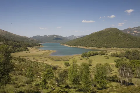
Jándula Reservoir

Submitted by brandcode_deweloper on
Id
5861609
Descripción
Breve descripción

From this viewpoint you can see a beautiful landscape, in which rounded lomas occur with adhesitated extensions around the Jandula reservoir. The effect of the soil reflections on the packaged waters provides a beautiful picture. It is curious to see the clear line that borders the banks of the loins, which suggests how far the water level reaches in rainy times. The reservoir contains species such as black-bass, tent and barb. And next to them, a fish that is only found in these waters and tributaries of the Jandula, called Bogardilla. An ideal time to visit this viewpoint is the autumn, when deer will give us the sound show of the berrea. And with a little luck, we can contemplate the struggle of the males, horn against horn, on their arduous path to reproduction.

Telecomunicaciones
Teléfono de contacto
953 549 030
Ubicación
Código Postal
23740
Latitud
38.258730
Longitud
-3.934320
Distrito
Municipio
Ubicación en el mapa
POINT (-3.93432 38.25873)
Imágenes carrusel
imagen
Image
Natu054.jpg
Imagen principal
Desactivado
imagen
Image
rio-jandula.jpg
Imagen principal
Desactivado
imagen
Image
Natu073.jpg
Imagen principal
Desactivado
imagen
Image
Natu419.jpg
Imagen principal
Desactivado
imagen
Image
Natu425.jpg
Imagen principal
Desactivado
imagen
Image
Natu388.jpg
Imagen principal
Desactivado
imagen
Image
Natu384.jpg
Imagen principal
Desactivado
imagen
Image
Natu118%20%281%29.jpg
Imagen principal
Desactivado
imagen
Image
Natu185.jpg
Imagen principal
Desactivado
Imágenes cabecera
imagen
Image
Natu071.jpg
Imagen principal
Activado
Microsite al que pertenece
Loading map
Preparing points of interest and routes...

Guadalén Reservoir

Submitted by brandcode_deweloper on
Id
3985461
Descripción
Descripción larga

The useful capacity of the reservoir is 163 hm ³, although its total capacity is 175 hm ³ this is reduced due to the filling of sediments in the background.

Its main tributary is the Guadalén River, which is born to the south of the Montiel Field and crosses Sierra Morena, also highlighting the contribution of the Dañador and Montizón rivers to the main tributary.

Other smaller tributaries that pour their waters on the swamp, or on the Guadalén River before being repressed, are the streams of Galapagar, Oilla, the Navas, the Herrerías and Madriscal, among others.

Breve descripción

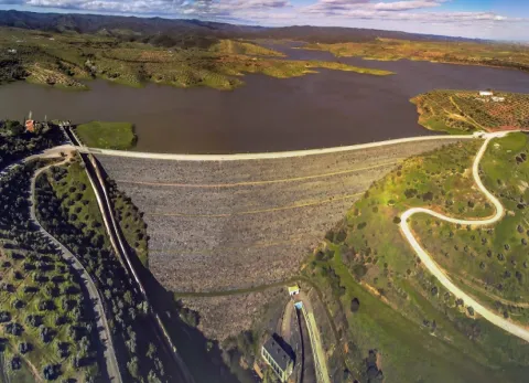
It was built between 1946 and 1954, and opened in April 1953, as an infrastructure for the irrigation of the surrounding lands, within the general plans for the colonization of Franco.

Ubicación
Latitud
38.170456
Longitud
-3.455026
Distrito
Municipio
Ubicación en el mapa
POINT (-3.455026 38.170456)
Imágenes carrusel
imagen
Image
3.jpg
Imagen principal
Desactivado
imagen
Image
2%20%281%29.jpg
Imagen principal
Desactivado
Imágenes cabecera
imagen
Image
1.jpg
Imagen principal
Activado
Loading map
Preparing points of interest and routes...
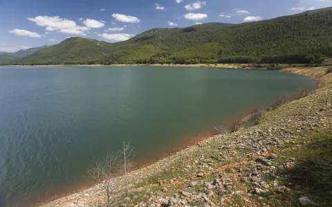
Vadomojón Reservoir

Submitted by brandcode_deweloper on
Id
1909767
Descripción
Descripción larga

The Vadamojón Embalse was built to manage the irrigation and ecological flow of the present rivers. It is one of the most important in the Guadalquivir basin, its waters being clear, fresh and with great ecological potential. The landscape of the basin is characterized by its wavy elevations of soft slopes. Its sweet and splattering waters come, among other sources, from the Víboras and San Juan rivers.

Since its implementation in 1997, Vadomojón has become one of the most important free fishing or competition scenarios in both the Sierra Sur region and the Campiña de Baena region in the province of Córdoba.

Vadomojón is a recent reservoir of transparent waters capable of hosting important populations of those fish such as the barbo that inhabited the waters of the Guadaljoz River before the construction of the dam. Other species present are the cachuelo, the boga, the fangs, the tent, the black lubine or the rainbow trout.

A wide variety of fishing methods and techniques can be used in Vadomojón, such as coup, bolognese, English, light or artificial fishing.

One of the most frequent fishing areas in Vadomojón is Caldera, which is accessed by the Víboras River.

Along with the fish, there are birds like flamingos and royal garzas

Breve descripción

The Embalse de Vadomojón was built in 1993, located in the channel of the Guadaljoz River. It is part of the municipalities of Alcaudete (village of Noguerones) and Baena, in the province of Jaén and Córdoba respectively. It belongs to the Guadalquivir Hydrographic Confederation (Córdoba area).

Ubicación
Latitud
37.588140
Longitud
-4.081294
Distrito
Municipio
Ubicación en el mapa
POINT (-4.081294 37.58814)
Imágenes carrusel
imagen
Image
5.jpg
Imagen principal
Desactivado
imagen
Image
1%20%283%29.jpg
Imagen principal
Desactivado
Imágenes cabecera
imagen
Image
4%20%282%29.jpg
Imagen principal
Activado
Loading map
Preparing points of interest and routes...
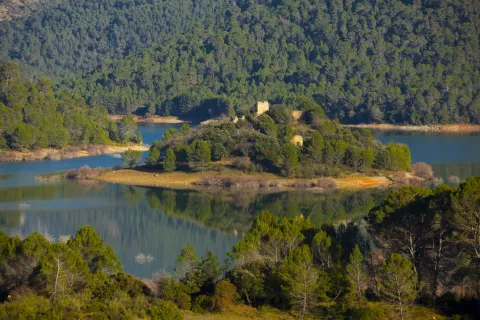
Siles Reservoir

Submitted by brandcode_deweloper on
Id
873003
Descripción
Descripción larga

The Siles dam, which was completed in 2015, receives its water from the Gualimar River and the Carrizas River.
It is a reservoir that receives its water from the Guadalimar River and the Carrizas River, located close to its head and belonging to the Guadalquivir Hydrographic Confederation.

The reservoir is almost entirely the municipal term of Siles (Jaén), although it enters approximately 500 meters in the term of Villaverde de de Guadalimar. It is named after Dam de Siles, when the dam is found in the municipality of the same nomenclature.

The reservoir has an extension of 21.1 ha, with a capacity to store 30 hm ³ of water. The type of dam is from Arc Gravity and was completed in 2015.

Breve descripción

Siles packaging

Ubicación
Latitud
38.387861
Longitud
-2.582637
Distrito
Municipio
Ubicación en el mapa
POINT (-2.582637 38.387861)
Imágenes carrusel
imagen
Image
presasiles.jpg
Imagen principal
Desactivado
Imágenes cabecera
imagen
Image
2%20%281%29.jpg
Imagen principal
Activado
Loading map
Preparing points of interest and routes...
Ropera Reservoir

Submitted by brandcode_deweloper on
Id
6217864
Descripción
Breve descripción

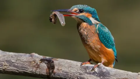
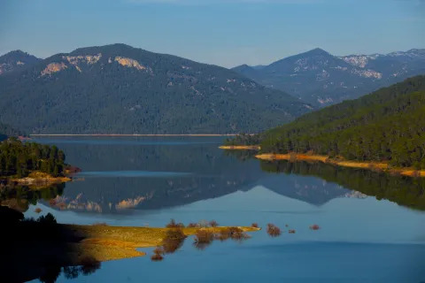
Located in the municipal term of Marmolejo this reservoir is important for the reproduction of Common Calamón, they also raise Common Avetorillo, Imperial Garza, White Cigareña, Common Ciguenuela, Chico Chorlitejo and Martín Pescador. Crab Garcilla in passage, and invert of aquatics.

Ubicación
Código Postal
23770
Latitud
38.063668
Longitud
-4.177130
Distrito
Municipio
Ubicación en el mapa
POINT (-4.17713 38.063668)
Imágenes carrusel
imagen
Image
F195_Foto_01.jpg
Imagen principal
Desactivado
imagen
Image
martin.jpg
Imagen principal
Desactivado
Imágenes cabecera
imagen
Image
11253827Master.jpg
Imagen principal
Activado
Microsite al que pertenece
Loading map
Preparing points of interest and routes...
La Fernandina Reservoir

Submitted by brandcode_deweloper on
Id
4399329
Descripción
Breve descripción

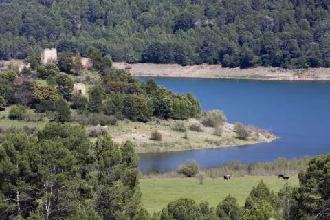
The environment of the La Fernandina reservoir presents beautiful images of the Mediterranean forest, with the presence of abundant oak, being an ideal place for the development of an interesting extensive livestock. From the geological point of view, the slate is very large.

Ubicación
Código Postal
23211
Latitud
38.207010
Longitud
-3.573720
Distrito
Municipio
Ubicación en el mapa
POINT (-3.57372 38.20701)
Imágenes carrusel
imagen
Image
Natu062.jpg
Imagen principal
Desactivado
Imágenes cabecera
imagen
Image
46643996.jpg
Imagen principal
Activado
Loading map
Preparing points of interest and routes...