Saltar al contenido principal

Tierra Bridge

Submitted by brandcode_deweloper on
Id
4571576
Descripción
Descripción larga

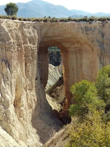
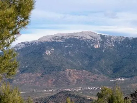
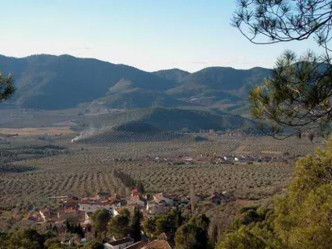
As we approach the Earth Bridge, the landscape becomes ruinous and lunar-looking. The immediate environment is full of hills and saws.

This natural enclave blends forest spots (especially pine trees) with white areas without just vegetation. We can observe wild vegetation and numerous repopulations of different ages. There is a wide range of shrubs and grasses adapted to the scarcity of rain, as it corresponds to its location in one of the most torrid areas of the Sierra Magina region.

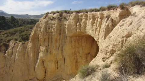
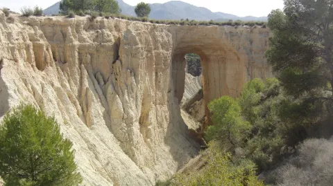
In the area we can see around us and on the very floor of the road, the effects of water erosion on the geological materials around us. It is a succession of minions that extend in depth by communicating with each other. When the rain water circulates on the surface, it is soon filtered through these holes, but dragging many suspended particles that sometimes form true clay slices. It is easy to imagine that the erosive power is increasing more and more, so the mixes join each other to form the greater ones. When it affects a road, the risk to circulation is evident, whether by car, bike or even walking. In this process is the origin of the formation of the Earth Bridge.

The process is given on soft materials such as margas, margous sands or uncompact clay sands. If there was a somewhat more compact and resistant material tank above them, it may not be eroded so easily, leaving a package of materials suspended in the air. The objective of this route is to check on-site the extraordinary dimensions of this phenomenon.

Finally remember that we are on the margas of the Cretaceous, a period in which marine animals such as amonites, belemnites, and other gastropods lived, which we can find through the fossilized and pyritized soil.

Breve descripción

It is located on the northern side of the Rambla del Bizco, in a partially flat area but broken by countless rambles of very difficult orography.
Ubicación
Latitud
37.703622
Longitud
-3.286707
Distrito
Ubicación en el mapa
POINT (-3.286707 37.703622)
Tipos de punto de interés
Imágenes carrusel
imagen
Image
14.jpg
Imagen principal
Desactivado
imagen
Image
12.jpg
Imagen principal
Desactivado
Imágenes cabecera
imagen
Image
13.jpg
Imagen principal
Activado
Microsite al que pertenece
Loading map
Preparing points of interest and routes...

Marmolejo Pine and Well

Submitted by brandcode_deweloper on
Id
4971076
Descripción
Breve descripción

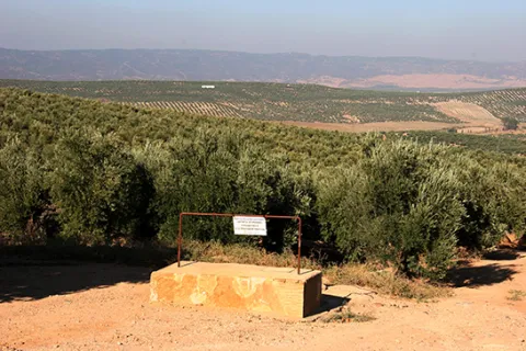
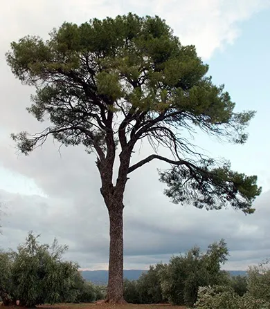
It is the symbolic tree of the town declared a protected landscape element. In its vicinity is the well of Marmolejo, whose construction dates from 1730, according to a tile of the well's brocal. He brought water to the people of Arjona and Arjonilla.

Ubicación
Código Postal
23770
Latitud
37.973510
Longitud
-4.106660
Distrito
Municipio
Ubicación en el mapa
POINT (-4.10666 37.97351)
Tipos de punto de interés
Imágenes carrusel
imagen
Image
IMG_0010ab.jpg
Imagen principal
Desactivado
imagen
Image
1.jpg
Imagen principal
Desactivado
Imágenes cabecera
imagen
Image
IMG_0012aad.jpg
Imagen principal
Activado
Loading map
Preparing points of interest and routes...

Negral or Resinero Pine Forest

Submitted by brandcode_deweloper on
Id
881318
Descripción
Descripción larga

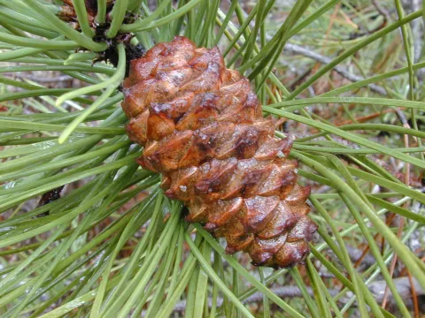
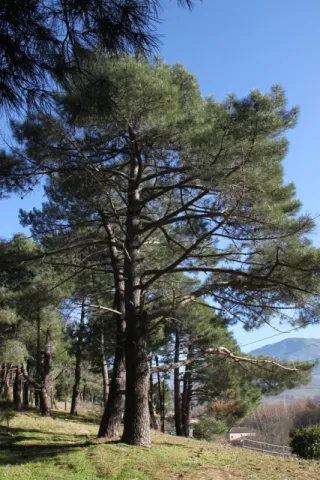
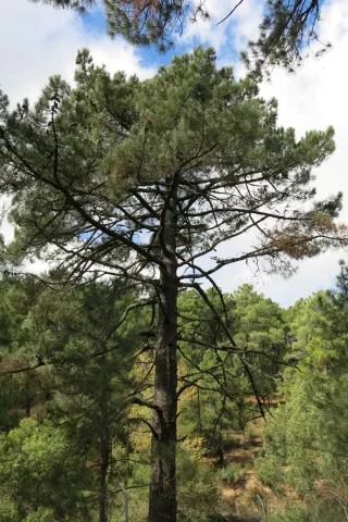
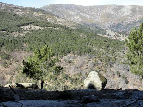
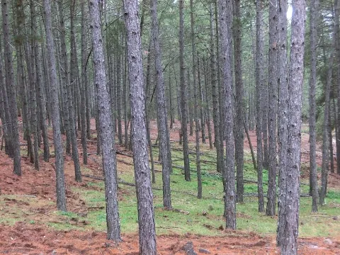
El Chorro is on a platform at 1350 m of altitude, flanked to the west by the large cuts that raise the foothills of the saw on the jiennese countryside, and to the east by Mount Gilillo (1847 m). In the skirt that forms this platform is extended an extensive black pine pinar, which is what is called in the area to the Pinus pinaster.

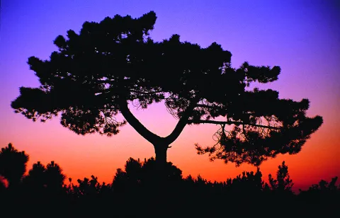
The orientation of this hillside we walk through is west and northwest, making sunsets a great added value to the enjoyment of the pine. In this area, an observatory of rapacious birds has been installed, especially of lethal vultures.

This black pine saw its area of natural presence expanded by serving as a raw material in the extraction of the essence of trementine (avocado), the main product that is obtained from the resin. In the early 20th century many slopes of these saws were populated with this pine.

The pineapple that we visit is barely sotoscala at first, but then it is enriched with endrines (Prunus spinosa), majuelos (Crataegus monogina), skirmishes (Rosa spp.). As we reach the stream of the Chorro, this little forest is thick and on the front side that has a north orientation is enriched with madreselvas (Lonicera peryclimenum hispanica), with mountain roses (Paeonia broteroi), and numerous orchids (Orchis cazorlensis, Orchis tenera, Neotinea maculata,...).

LOCATION

We access the road that leaves La Iruela in the direction of Riogazas and the Chorro. About 10 km away we reach an old forest house on our left and on the shore of the road. From this point we follow the track already walking, not more than 2 km., through a thick forest of black pines (Pinus pinaster).

Breve descripción

El Chorro

Ubicación
Latitud
37.920351
Longitud
-2.994140
Municipio
Ubicación en el mapa
POINT (-2.99414 37.920351)
Tipos de punto de interés
Imágenes carrusel
imagen
Image
Pinus_pinaster.jpg
Imagen principal
Desactivado
imagen
Image
62-Pinus-pinaster-porte-PH-IMG_0142-427x640.jpg
Imagen principal
Desactivado
imagen
Image
el-pino-laricio-pinus-nigra-el-pino-carrasco-pinus-halepensis-y-el-pino-resinero-pinus-pinaster-son-las-especies-resineras-por-excelencia-fundamentalmente-la-c3baltima.jpg
Imagen principal
Desactivado
Imágenes cabecera
imagen
Image
DSCN3318.jpg
Imagen principal
Activado
Loading map
Preparing points of interest and routes...

Laricio or Salgareño Pine Forest

Submitted by brandcode_deweloper on
Id
921538
Descripción
Descripción larga

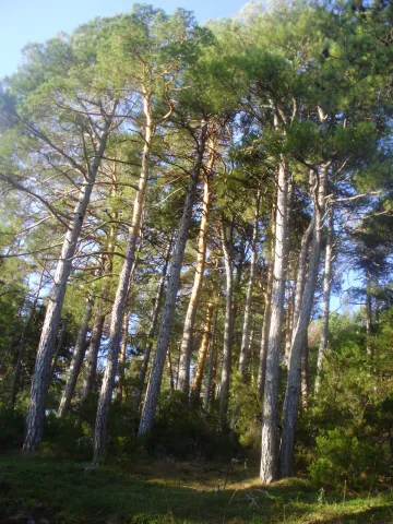
After walking through this pine tree and returning to the track we have accessed, if we look south, the clear days look perfectly Sierra Nevada and looking north the Gualay valley opens. The track opens through the rocky moles of the Cabañas peak and the lastras of the Cagasebo rope.

This forest is dominated by the salgarean pine (Pinus nigra salzmannii), which is sometimes accompanied by maple (Acer granatense), mustard (Sorbus aria) and whine (Quercus faginea), and in the sotoquela by rastera savines (Juniperus sabina), rake juniperus (Juniperus communis hemisphaerica), thorns (Berberis vulgaris australis), tirelles (Prunus postrata), enamubios (a), and other species (the celium (a), as well as the celium (a), and the celibelium (a), and the celium (a).

The name that has always been known in these saws to this pine is that of Salgareño. The etymology of his name is as beautiful as the pine itself; salgareño comes from sarga, a vulgar name with which several willows are known. It alludes to the fine and slender of the branches, as does the pine bear when young, slender and right. By this slender and fine figure, the ancient inhabitants of the saws baptized this pine of the high mountain of Serrana as Salgareño.

We access Puerto Llano on the track from the birth of the Guadalquivir to Pozo Alcón. Puerto Llano is the highest point of the track, where we are surrounded by a splendid pine pine pines, called salgareños in these saws.

Breve descripción

This forest is one of the botanical and landscape jewels of the Park. The plant formation we are going to describe is considered endemic to this saw, as it only exists in the high mountain of the Park. In the endemic pinar of Puerto Llano we recommend walking without haste. Most of the pine trees that form it are over 600 years old.

Ubicación
Latitud
37.702695
Longitud
-2.935057
Municipio
Ubicación en el mapa
POINT (-2.935057 37.702695)
Imágenes carrusel
imagen
Image
pinar.jpg
Imagen principal
Desactivado
imagen
Image
P9080814.JPG
Imagen principal
Desactivado
Imágenes cabecera
imagen
Image
unnamed.jpg
Imagen principal
Activado
Loading map
Preparing points of interest and routes...

Carrasco Pine Forest

Submitted by brandcode_deweloper on
Id
880721
Descripción
Descripción larga

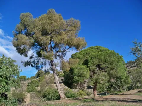
The main attraction of this forest track is the carrasco pine forest that crosses, under which a closed forest of oak, madroños and doves grows. In addition, just as the village of Puentehonda appears before us, we see on the right, on the same road, two gigantic and venerable examples of carrasco pine, which are included in the Inventory of Singular Trees of Andalusia with the names of Pino de los Barrilos de Puentehonda and Pino del Cerro Bucentaina and respectively. The latter is 32 m high and 4.5 m in diameter at its base.

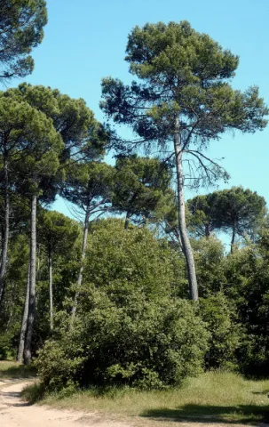
If of any pine you can say is Mediterranean, this is the carrasco pine (Pinus halepensis). Its same vernacular name indicates hardness, as it is a tree that colonizes rocky, arid grounds, stony and sunny slopes, where no other tree can live. Because of its capacity to hold in dry periods (it survives with less than 300 mm of rain per year) and its colonizing capacity of degraded and dry areas, it extends through much of the Park, from its basal areas to 1600 m of altitude. This pine has been, next to the Salgareño, one of the most planted pine trees in the mountains of these saws. Where the aridity is noted, a tree plants it face: our carrasco pine.

The normal thing in the composition of this forest is to find an arbustive stratum characteristic of the serial phases of the Mediterranean forest, usually of initial phases, but also with an arbustive stratum of more advanced phases in the process of plant succession. This is how we find pineapples with rosemary (Rosmarinus officinalis), lentils (Pistacia lenticus), cornicabras (Pistacia terebinthus), aliagas (Genista scorpius), jara morisca (Cistus salvifolius), juniperus oxicedrus (juniperus oxicedrus). fumans (fumana thymifolia), asparagus (Asparragus acutifolius). There are also numerous aromatic plants, such as ejanas (Thymus masticina) and omilos (Thymus orospedanus, Thymus zigis), but a species that almost always accompanies the carrion pines is the spartum (Stypa tenacsima).

LOCATION

Start of the tour in the Recreative Area of La Peña del Olivar, on the road from Siles to Las Azeas. It's marked PR-A 175. This route, of just under 5 km, runs along a narrow forest track that we recommend to walk. The first kilometer is quite steep, but the rest is barely at a level.

Breve descripción

Bucentaine

Ubicación
Latitud
38.387861
Longitud
-2.582637
Distrito
Municipio
Ubicación en el mapa
POINT (-2.582637 38.387861)
Tipos de punto de interés
Imágenes carrusel
imagen
Image
Natu070.jpg
Imagen principal
Desactivado
imagen
Image
Pino_carrasco_%2815136285053%29.jpg
Imagen principal
Desactivado
Imágenes cabecera
imagen
Image
02.jpg
Imagen principal
Activado
Loading map
Preparing points of interest and routes...

The Olive Grove

Submitted by brandcode_deweloper on
Id
4970924
Descripción
Breve descripción

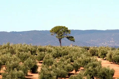
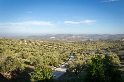
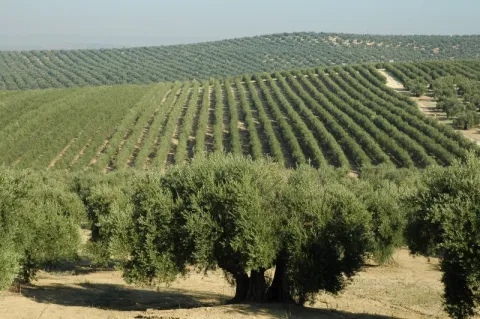
The olive tree has an important ecological function. To be themain ecosystemIt's the one that determines most of its fauna. In the old logs of the centenary olive trees find numerous refugebirds, mammals and reptiles.Its fruits are a food of great energy value that takes advantage of the species that live in the olive grove as well as those migratory birds that replenish forces for their long traverses. Among the species that live in a continuous way are: the green and the green in the months of spring and summer, and in winter the curled curled, the red petrored and the common zorzal.

Ubicación
Código Postal
23750
Latitud
37.973520
Longitud
-4.106670
Distrito
Municipio
Ubicación en el mapa
POINT (-4.10667 37.97352)
Tipos de punto de interés
Imágenes carrusel
imagen
Image
1865881.jpeg
Imagen principal
Desactivado
Imágenes cabecera
imagen
Image
olivar_tradicional_frente_a_olivar_en_seto.jpg
Imagen principal
Activado
Loading map
Preparing points of interest and routes...

El Ojuelo y el Robledo

Submitted by brandcode_deweloper on
Id
919095
Descripción
Descripción larga

If you go through the fertile vein on which the Ojuelo sits, you will reach the Robledo right at the feet of the Yelm. A long street with houses on both sides leads us to a small square with a hermitage and a little higher a forest house, which will be the headquarters of a Thematic Air Space starring free flight sports, as the take-off of the Yelmo is very close.

The Robledo marks at 900 meters of altitude the cut between the cultivation of the olive tree and the pine tree. By going through a forest track you can climb up to the Yelmo, making a stop at a lookout next to the track that offers spectacular views over the valley.

Breve descripción

The Ojuelo extends around a road crossing next to the one with a small park and a hermitage. A great source is a stop to fill the canteen with fresh water and talk with the neighbors. Although it celebrates parties in June, the olive-tree parties, the Ojuelo is known for those it celebrates in the first week of August, with verbenas that people from all over the region come to.

Ubicación
Latitud
38.298857
Longitud
-2.651877
Distrito
Ubicación en el mapa
POINT (-2.651877 38.298857)
Tipos de punto de interés
Imágenes carrusel
imagen
Image
ojuelo.jpg
Imagen principal
Desactivado
Imágenes cabecera
imagen
Image
00010472.jpg
Imagen principal
Activado
Loading map
Preparing points of interest and routes...
Marcas de calidad

El Nacimiento

Submitted by brandcode_deweloper on
Id
4573220
Descripción
Descripción larga

The landscape is determined by human perception and is the result of the interaction of the elements of nature and man, then human action has conditioned the transformation of the natural landscape and the inclusion of cultural elements that give it value, so it is necessary to preserve and enhance them. We are therefore facing a natural resource that has allowed not only subsistence but also economic activity since man arrived on these lands.

It is now difficult to imagine what this spring and its immediate course would be like without that interaction by which human beings have created a laundry room, which is what we now see in the Birth, or downstream in the Matias and the Birth mills, in the Balsa, the Charcón, the Pileta and Arroyo launchers, or the numerous pools and the network of waterfalls for the irrigation of the place known as the "Site." At some point these infrastructures must have been created and we are likely to have to reassemble long before the repopulation of the Cabrilla Site. Today we will deal only with the environment closest to the Birth, so the relative to what we find downstream of this stream that so much life has spread since time immemorial will be part of the future of a new post.

To try to imagine what those places were like not long ago, when they still fulfilled the task for which they were created, we counted, of course, on the impagable photographic work of Arturo Cerda and Rico, so that we can see in some of their photos also a certain evolution, is the case of the same spring in its natural state prior to its channelling, for not so long ago, until 1910, where today we see the seven years, there was only a plateau from which the crystal waters of the Sierra Cruzada were kept.

Breve descripción

There would be no Cabra of the Holy Christ without this spring. With this very categorical statement I intend to highlight its enormous value, because those waters that have been irrigating our fields for centuries have brought the necessary energy to our mills, have gathered along their journey to long lavenders, have taken their waters to the abrevaderos, fountains and streets of the urban centre and not only to give to drink, but also to the domestic tasks, the works, or the irrigation of the gardens so characteristic of the interior of our homes.

Ubicación
Latitud
37.705870
Longitud
-3.286837
Dirección
Cabra del Santo Cristo
Distrito
Ubicación en el mapa
POINT (-3.286837 37.70587)
Imágenes carrusel
imagen
Image
nacimiento%20%281%29.jpg
Imagen principal
Desactivado
Imágenes cabecera
imagen
Image
18.jpg
Imagen principal
Activado
Microsite al que pertenece
Loading map
Preparing points of interest and routes...

El Cerro de Castellón

Submitted by brandcode_deweloper on
Id
8088833
Descripción
Descripción larga

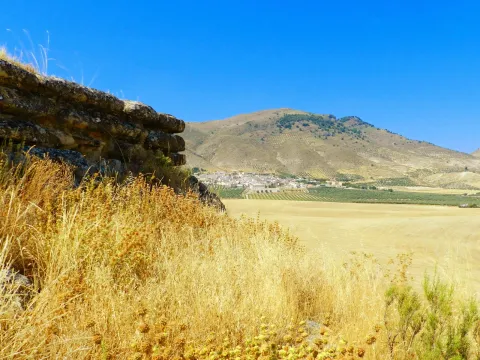
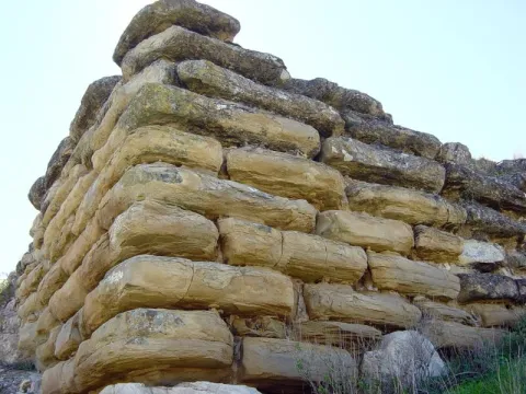
It has a rectangular plant facing from northeast to southeast and a walled enclosure. The best preserved wall is the northeast, 18.70 meters long and 4 meters high in its highest corner. It consists of several rows of large-scale stones, on which a wall of tapial, now missing, would be raised. In its interior it retains a seam of regular armchairs, smaller than those of the outer wall, of 6.30 meters in length and 2 meters in width.

Although it dates from Iberian chronology, both ceramic decorated with Iberian ceramic bands andterra sigillataRoman, so you can deduce a continued occupation of the land; as well as medieval ceramics.

Its mission was to monitor and control the communication routes, as it is closely linked to the corridor of the Guadiana Minor River, which communicates the upper valley of Guadalquivir with the highlands of Guadix and Baza.

In 1985 it was declared Good of Cultural Interest.

Breve descripción

On the hill of Castellón are preserved the remains of an Iberian cyclopian fortress between the II and I BC centuries It is a walled enclosure, with a quadrangular structure and an aljibe inside it, built with limestone armchairs that reach a meter and a half in length.

Telecomunicaciones
Sitio web
www.larva.es/el-municipio/patrimonio-historico.html
Correo electrónico
ayuntamiento@larva.es
Ubicación
Código Postal
23591
Latitud
37.770410
Longitud
-3.192560
Distrito
Municipio
Ubicación en el mapa
POINT (-3.19256 37.77041)
Tipos de punto de interés
Imágenes carrusel
imagen
Image
El%20Cerro%20de%20Castell%C3%B3n2.JPG
Imagen principal
Desactivado
imagen
Image
El%20Cerro%20de%20Castellon3%20%282%29.jpg
Imagen principal
Desactivado
Imágenes cabecera
imagen
Image
El%20Cerro%20de%20Castell%C3%B3n.jpg
Imagen principal
Activado
Microsite al que pertenece
Loading map
Preparing points of interest and routes...

El Batanejo

Submitted by brandcode_deweloper on
Id
4524622
Descripción
Breve descripción

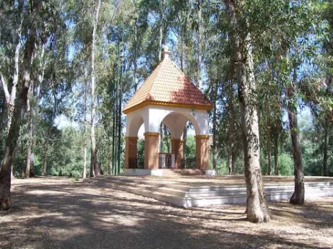
In the vicinity of the town of Villanueva de la Reina we can visit the beautiful and traditional area known as El Batanejo. It is located on the banks of the Guadalquivir River, where the large amount of eucalyptus and its conditioned places will allow us to enjoy an ideal place for rest.

Ubicación
Código Postal
23730
Latitud
38.026220
Longitud
-3.910080
Distrito
Ubicación en el mapa
POINT (-3.91008 38.02622)
Tipos de punto de interés
Imágenes carrusel
imagen
Image
batanejo.jpg
Imagen principal
Desactivado
Imágenes cabecera
imagen
Image
unnamed.jpg
Imagen principal
Activado
Microsite al que pertenece
Loading map
Preparing points of interest and routes...