Saltar al contenido principal

Utrero Gorge

Submitted by brandcode_deweloper on
Id
2980150
Descripción
Descripción larga

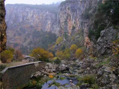
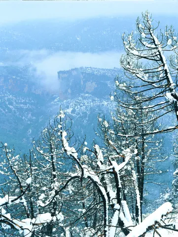
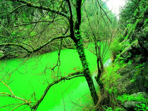
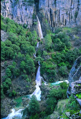
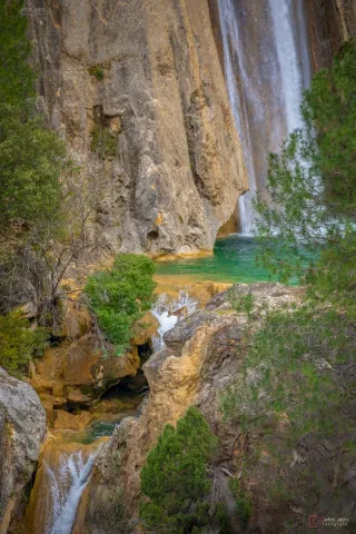
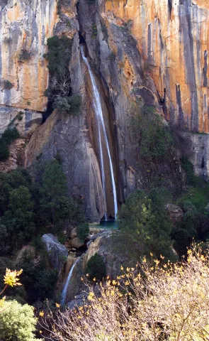
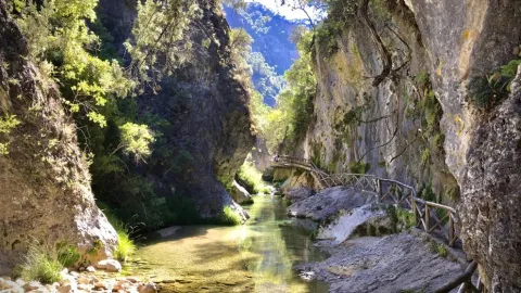
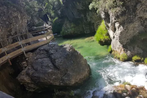
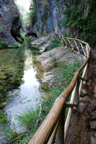
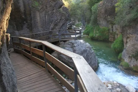
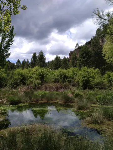
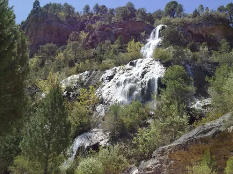
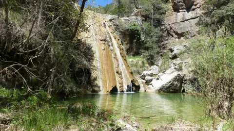
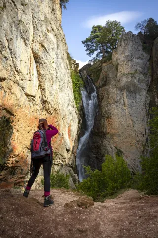
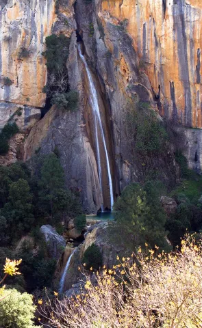
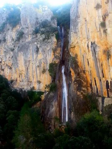
The site known as Cerrada del Utroo-Linarejos is an amazing natural work sculpted by the Guadalquivir River in the limestone that surrounds it. The path is walked on foot, allowing us to appreciate the sharp rocks and overlooks created by water over hundreds of thousands of years. It is a charming walk where the labiérnago, the cornicabra and the willow will accompany us to one of the most photographed places of the Natural Park Sierras de Cazorla, Segura and Las Villas: the "horse tail" or Cascada de Linarejos. The path, of 1.6 km, has a circular route to return to the road on a pleasant itinerary of about 45 minutes. It may be of interest to get to know the small town of Vadillo-Castril, where the former RIFE sawmill was and which today is the home of two agencies of great importance for the natural park: the School of Forest Capataces and the Forest Defense Centre.

Breve descripción

From Cazorla, following the road of the A-319 saw to the crossing known as the valley junction. At this point we will turn right and continue on the JF-7092 road. Just before passing the bridge over the Guadalquivir River (about 4 km from the junction) the Cerrada del Utrero path begins.
Ubicación
Código Postal
23470
Latitud
37.924623
Longitud
-2.927399
Dirección
Carretera de Vadillo Castril a Buruchel
Municipio
Ubicación en el mapa
POINT (-2.927399 37.924623)
Tipos de punto de interés
Imágenes carrusel
imagen
Image
8.jpg
Imagen principal
Desactivado
imagen
Image
7.JPG
Imagen principal
Desactivado
imagen
Image
9.jpg
Imagen principal
Desactivado
imagen
Image
Natu289.jpg
Imagen principal
Desactivado
imagen
Image
Natu294.jpg
Imagen principal
Desactivado
Imágenes cabecera
imagen
Image
5.jpg
Imagen principal
Activado
Loading map
Preparing points of interest and routes...

Cerrada de Utrero - Linarejos Waterfall

Submitted by brandcode_deweloper on
Id
874733
Descripción
Descripción larga

The sector of the Cerrada de Utroo-Lancar de Linarejos is located in materials of the Prebetic of the Betic Cordillera. In particular, in the Cerrada de Utrero, the Guadalquivir River fits into limestone of the Superior Jurassic often dolomitised that develop constructive and destructive karmic forms at different scales.

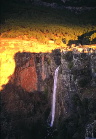
The narrow river-karctic valley was carved during the quaternary along the axis of a synchronous N40E direction. The karctic canyon of the closed is one km long and has a profile scaled by the development of travertines and pozas. The walls of the valley are pulled by minor karmic forms of great beauty and spectacular lapiaces The setting of the Guadalquivir River has left the stream of Linarejos hanging producing an impressive waterfall, known as the Cascade of Linarejos. This water jump of several tens of meters develops a travertine mass with "horse tail" morphology and cascade facies. The Lanchar de Linarejos is located on the SE flank of the synclinal and features a sequence of lapiaces and structural alleys controlled by conjugated diaclases.

Source: Inventory of Georresources of Andalusia. Environmental Council. Junta de Andalusia.

Breve descripción

Closed from Utrero, Linarejos

Ubicación
Latitud
37.920351
Longitud
-2.994140
Municipio
Ubicación en el mapa
POINT (-2.99414 37.920351)
Tipos de punto de interés
Imágenes carrusel
imagen
Image
Natu091.jpg
Imagen principal
Desactivado
imagen
Image
cascada-linarejos-cazorla.jpg
Imagen principal
Desactivado
Imágenes cabecera
imagen
Image
cascada_de_linarejos_g.jpg
Imagen principal
Activado
Loading map
Preparing points of interest and routes...

Elías Gorge

Submitted by brandcode_deweloper on
Id
874689
Descripción
Descripción larga

The river incision of the Borosa River in the Cretaceous limestone of Urgonian faces produces the strong fitting of the channel in this area, generating a narrow karmic valley with vertical walls more than 10 m in height and about 400 m in length.

This spectacular throat known as the Cerrada de Elias can be crossed over a pendant walkway several meters above the river, which is suspended on the vertical walls of the Cerrada.

Source: Inventory of Georresources of Andalusia. Environmental Council. Junta de Andalusia.

Breve descripción

Closed of Elijah

Ubicación
Latitud
37.920351
Longitud
-2.994140
Municipio
Ubicación en el mapa
POINT (-2.99414 37.920351)
Tipos de punto de interés
Imágenes carrusel
imagen
Image
img_tayala_20201019-104833_imagenes_lv_terceros_cerrada_de_elias-198-kHfF-U484165980244z1B-992x558%40LaVanguardia-Web%20%281%29.jpg
Imagen principal
Desactivado
imagen
Image
687_ss_03-jpg
Imagen principal
Desactivado
imagen
Image
CR09-e1515518982814%20%281%29.jpg
Imagen principal
Desactivado
Imágenes cabecera
imagen
Image
687_ss_01-jpg
Imagen principal
Activado
Loading map
Preparing points of interest and routes...

Castle of Bujaraiza

Submitted by brandcode_deweloper on
Id
918389
Descripción
Descripción larga

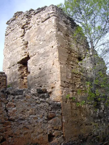
They highlight the remains of the tower of tribute located in the courtyard of arms. It is worth taking advantage of the low levels of the reservoir to walk to the castle from the above-mentioned viewpoint.

Breve descripción

Small Arab fortress built on a hill that today becomes an island when the level of the reservoir rises, which gives it a special charm despite its deteriorating appearance. It can be seen from the viewpoint of Félix Rodríguez de la Fuente, in the km 60.5.

Ubicación
Latitud
37.912893
Longitud
-3.003887
Municipio
Ubicación en el mapa
POINT (-3.003887 37.912893)
Tipos de punto de interés
Imágenes carrusel
imagen
Image
1%20%282%29.jpg
Imagen principal
Desactivado
imagen
Image
2%20%283%29.jpg
Imagen principal
Desactivado
imagen
Image
Natu067.jpg
Imagen principal
Desactivado
imagen
Image
Natu074.jpg
Imagen principal
Desactivado
Imágenes cabecera
imagen
Image
experiencia-bujaraiza.jpg
Imagen principal
Activado
Loading map
Preparing points of interest and routes...

Castillejo de Mata Bejid (Torres Pass)

Submitted by brandcode_deweloper on
Id
5844957
Descripción
Breve descripción

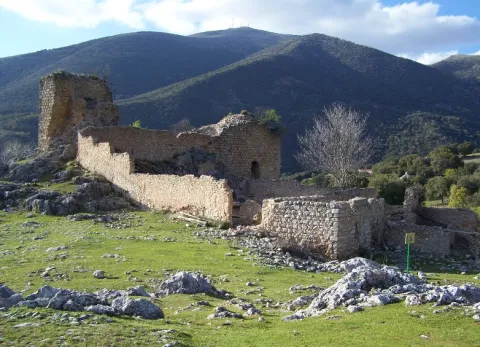
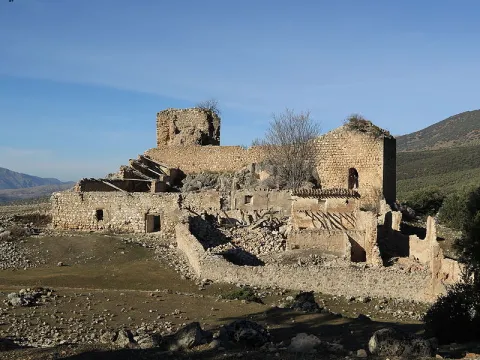
It is a passage between mountains, some above 2,000 m., which offers a spectacular landscape: the southern side of the Natural Park of Sierra Magina, with mountains more than 2,000 meters of altitude (Almadén, 2,036 m., Ponce, 2,006 m and Cerro Cárceles, 2,061 m.), dehesas in height of complaints, flocks of sheep... The Castlejo de Mata Bejid is a beautiful place that housed a garrison that was watching this passage at the border in the Middle Ages. The first half of the 20th century saw a number of families of settlers cultivating the dehesas along the way. This castle was donated to the city of Jaén by the Catholic Kings in 1494, in reward for the services provided in the conquest of Cambil and Alhabar. Access is made from the A-324 road from Cambil to Huelma.

Ubicación
Latitud
37.704930
Longitud
-3.510540
Distrito
Municipio
Ubicación en el mapa
POINT (-3.51054 37.70493)
Tipos de punto de interés
Imágenes carrusel
imagen
Image
Castillejo%20de%20Mata%20Bejid%20%28Puerto%20de%20Torres%29.jpg
Imagen principal
Desactivado
Imágenes cabecera
imagen
Image
Castillo_Matabejid.JPG
Imagen principal
Activado
Microsite al que pertenece
Loading map
Preparing points of interest and routes...

Waterfall la Escaruela

Submitted by brandcode_deweloper on
Id
912020
Descripción
Descripción larga

The waterfall is located next to the Falcones (1448 m), mountain always visible from any street of Cazorla, and a natural stone wall "Los Castellones" (1,820 m), elevation as a fortress from where it is named. To appreciate the water leaps it will be necessary to climb up a narrow path that runs next to the slope of the stream where you will be accompanied by the cornicabra (Pistacia terebinthus), a very abundant species on this path. By moving along the path you will appreciate the impressive fall of water as soon as the limestone walls serve as slides.

We suggest:

  • Next to the bridge from where the waterfall is seen, a right-hand road leads us to the control of Riogazas. It is a pleasant walk in which you will find a fountain called "The River" and another beautiful waterfall, that of the Magdalena. From here goes down a road to Cazorla.

In the Iruela you have to reach the square of the City Hall from where the road ascends towards the hotel Riogazas. 5 km from the Iruela and after two lookouts with meringeros there is a bridge. To the left we can see the Cascade of the Escaleruela.

Breve descripción

When you look at the waterfall you discover a stream covered in vegetation that barely lets the water see. Your look continues to ascend among limestone walls to discover how a stream with numerous water leaps is unraveling, only visible in periods of abundant rain and ice. Although we are very close to the localities of Cazorla and the Iruela wild nature begins to manifest in this spectacular leap of water, premonition of what we will find later.

Ubicación
Latitud
37.912893
Longitud
-3.003887
Municipio
Ubicación en el mapa
POINT (-3.003887 37.912893)
Tipos de punto de interés
Imágenes carrusel
imagen
Image
escaruela.jpg
Imagen principal
Desactivado
Imágenes cabecera
imagen
Image
unnamed%20%283%29.jpg
Imagen principal
Activado
Loading map
Preparing points of interest and routes...

Waterfall El Saltador

Submitted by brandcode_deweloper on
Id
5929475
Descripción
Descripción larga

Information and Observations

  • We will have to leave the vehicle at the entrance of the lane because there is a barrier to avoid the passage of vehicles.
  • The property through which the lane passes is private so it is not allowed to enter the lane with vehicle.
Breve descripción

The Saltador is a natural waterfall in the Arroyo del Tejuelo; this stream receives the waters of the Arroyo de Andrés and the Sierra del Agua, then joins the Arroyo de la Fuente del Tejo and forms the flow of the Tu River.

Ubicación
Latitud
38.388680
Longitud
-2.581360
Distrito
Municipio
Ubicación en el mapa
POINT (-2.58136 38.38868)
Imágenes carrusel
imagen
Image
Natu150.jpg
Imagen principal
Desactivado
Imágenes cabecera
imagen
Image
5.jpg
Imagen principal
Activado
Loading map
Preparing points of interest and routes...

Waterfall of Chorro Gil

Submitted by brandcode_deweloper on
Id
878082
Descripción
Descripción larga

The upper part of the Borosa River, has a scalated profile for the development of pozas and waterfalls in which travertine terraces are formed with spectacular botroidal calcite morphologies that were precipitated during the most humid and warm periods of the Quaternary.

Although travertine appear throughout the river, the highest concentration is located in the sector between the organ jump and the electric power plant. Its formation is due to the precipitation of calcite caused by the tear-up of the river waters produced by the turbulent regime of the water leaps in the areas with the greatest slope. This precipitation occurs in areas of dense vegetation receding elements of plants and producing subvertical sheets known as cascade facies.

Breve descripción

Travertines and cascade of Chorro Gil

Ubicación
Latitud
37.912893
Longitud
-3.003887
Dirección
Cascada de Chorro Gil
Municipio
Ubicación en el mapa
POINT (-3.003887 37.912893)
Tipos de punto de interés
Imágenes carrusel
imagen
Image
salto-de-los-organos-jpg
Imagen principal
Desactivado
Imágenes cabecera
imagen
Image
Natu069%20%281%29.jpg
Imagen principal
Activado
Loading map
Preparing points of interest and routes...

Casas-cueva de Pegalajar

Submitted by brandcode_deweloper on
Id
5848815
Descripción
Breve descripción

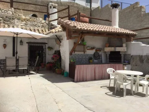
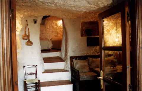
Set of troglodite houses rehabilitated as second residences and holiday tourist houses. They now make up a picturesque neighborhood, on horseback between the Serrezuela and the city centre. Very memorable.

Ubicación
Latitud
37.740061
Longitud
-3.645026
Distrito
Municipio
Ubicación en el mapa
POINT (-3.645026 37.740061)
Tipos de punto de interés
Imágenes carrusel
imagen
Image
01387888.jpg
Imagen principal
Desactivado
imagen
Image
68.jpg
Imagen principal
Desactivado
Imágenes cabecera
imagen
Image
cuevapelagar%20%281%29.jpg
Imagen principal
Activado
Microsite al que pertenece
Loading map
Preparing points of interest and routes...

A-316 Road, Torreperogil-Villacarrillo-Villanueva del Arzobispo Section

Submitted by brandcode_deweloper on
Id
7468197
Descripción
Descripción larga

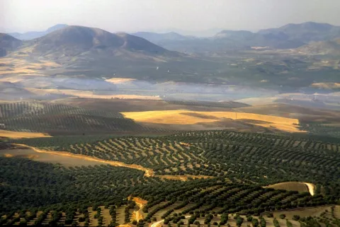
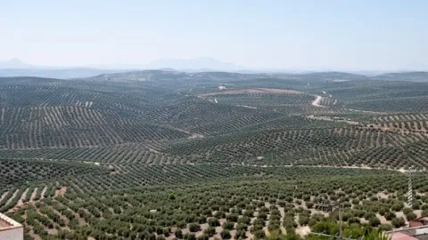
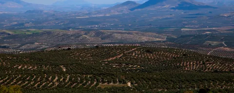
In particular this stretch of road runs almost air in the interflude of the valleys of the Guadalimar and the Guadalquivir. From this area you can see thousands of hectares of olive trees in a single look, framed by the horizons of Sierra Morena on one side, and Sierra de Segura and Sierra de Las Villas on the other.

Breve descripción

It is just an example of the great olive groves that can be seen when travelling through the province of Jaén.

Ubicación
Latitud
37.772886
Longitud
-3.788329
Municipio
Ubicación en el mapa
POINT (-3.788329 37.772886)
Tipos de punto de interés
Imágenes carrusel
imagen
Image
272ca59b7f36e64b14d2565ff1caba3a.jpg
Imagen principal
Desactivado
imagen
Image
olivos%20%281%29.jpg
Imagen principal
Desactivado
Imágenes cabecera
imagen
Image
miradores.png
Imagen principal
Activado
Loading map
Preparing points of interest and routes...