Saltar al contenido principal

Control Checkpoint of La Cabrera

Submitted by brandcode_deweloper on
Id
2854602
Descripción
Descripción larga

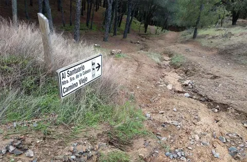
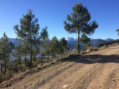
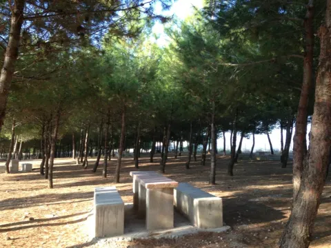
The access road runs through a relatively easy forest track; this track is taken from the same town of Marmolejo, after crossing the bridge over the Guadalquivir River at the height of the spa.

Right on the north bank of the river a right turn is taken towards the Aliseda, follow those signs and this way for 12.5 km until you reach the closed control door. There you can leave the vehicle and put things on the other side by entering the pedestrian door.

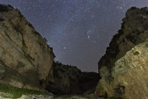
This point is especially suitable for those fans with telescopes and their own means in search of an outstanding sky and with light-taking to connect their equipment.

Breve descripción

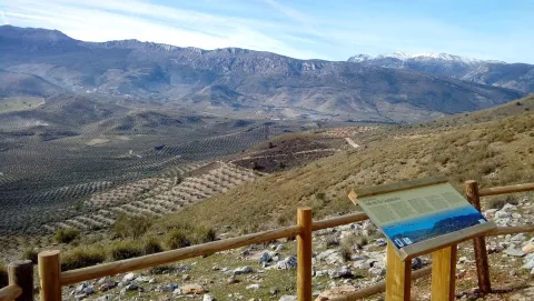
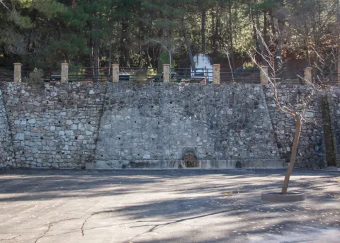
Another privileged place is La Cabrera Control, in Marmolejo. The great advantage of this enclave is that it currently has an electric current that can be taken directly from an external plug that is located on the wall of the guard's surveillance shed.

Telecomunicaciones
Sitio web
www.andalucia.org/es/marmolejo-turismo-cultural-control-de-la-cabrera
Ubicación
Latitud
38.044893
Longitud
-4.170983
Distrito
Municipio
Ubicación en el mapa
POINT (-4.170983 38.044893)
Tipos de punto de interés
Imágenes carrusel
imagen
Image
Sendero%20Control%20de%20la%20Cabrera-Santuario%20Virgen%20de%20la%20Cabeza2.jpg
Imagen principal
Desactivado
Imágenes cabecera
imagen
Image
JJG_1117%20%281%29.jpg
Imagen principal
Activado
Microsite al que pertenece
Loading map
Preparing points of interest and routes...

Complex Arroyo de la Rambla (PB-4)

Submitted by brandcode_deweloper on
Id
875717
Descripción
Descripción larga

Discovered in 1992. It currently reaches a total of 5.117 m of development with important prospects for exploring new galleries. This very important complex is located in the vicinity of the Pantano de la Bolera, in the Barrio known by Arroyo de la Rambla, the two mouths of access are opened in the municipal term Peal de Becerro (Jaén) and much of the cavity is developed under the term Cazorla (Jaén). Along with this large complex, several more cavities have been located that have not been able to communicate to date (PB-1, PB-2, PB-5, PB-7), which were certainly part of it at the time, and these cavities are currently being explored.

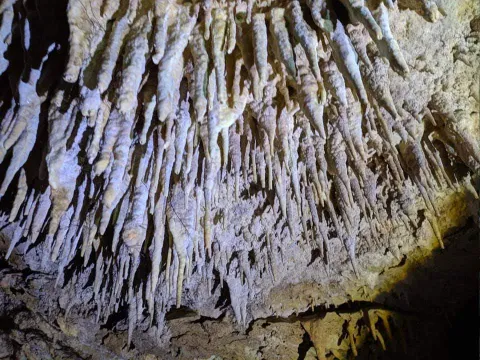
The main entrance, of small dimensions, provides access to a floor room that is damaged by the blocks that cover it, ceilings between two and four meters high and spacious, allowing to accommodate several dozen people. At the bottom, between blocks, the sinuous continuation is opened. Close steps and several descending highlights lead almost to the level of the ravine, and it is often found flooded. The water input is done through the PB-6 sink. A narrow corridor with clay-covered floor, followed by several climates, leads again to the level of the entrance room, out of reach of the waters. The transit through them is balized, to try to mitigate as much as possible the alteration of the floor, after the steps to be followed you have to climb to a top floor with the help of a small staircase of about 10 m.

This apartment is characterized by a succession of steps between blocks that once stranded back down to the level of the gallery. From this point the continuation is more problematic, as the succession of ramps, steps between blocks, des climes, etc. make their description very monotonous. The second staircase opens a large room and an almost horizontal corridor of about 100 meters with the floor covered with gours and ceilings with large stalactic blankets, flags, etc. We meet about 700 meters from the mouth. A new drop to a siphon (usually dry) allows the passage, also between blocks, rips, and narrow steps of about 300 meters of very accidental gallery that leads to the final room or the siphon. Large room with different possibilities of continuation.

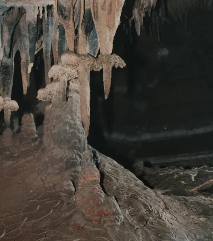
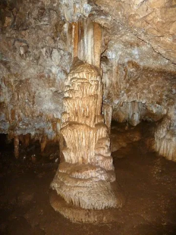
The 60-meter-long siphon with a penetrable gap to 6 meters under water leads to a descending gallery that connects with a large cavity, circulated by an active river that spills its waters in the Valentine's Source (PB-1 and PB-5). Currently in exploration of spelologists. This succession of rooms is beautifully decorated by spelotems in various ways, among which are predominantly ceilings covered with stalactite stylized.

About a hundred meters from the mouth, a new succession of weeds return us to the theoretical level of water, changing the morphology of the cavity strongly. After several stretches and decreases the dimensions of the gallery increase. In this area the two possible entries to the Network of the Talegas are located (flooded sectors, Red Gallery, Sala Alicia, etc.). Continuing through the main gallery you can reach the Paso Javi, a small laminator that cuts a rock barrier (this step is very common to find it flooded), if it is under the waters, the pass is carried out by a strong ramp to the right of the pass, followed by a vertical - easy to overdo - descent that goes down to the level of the main gallery, after the Paso Javi. The continuation is obvious, just follow the gallery, yes, with some other narrowing and passage between blocks, until you reach the gallery of the Levels, easy to recognize by the calcite sidewalks that go through all the walls, blocks and other speleotems.

From here a new rebound between blocks and slices lead to the header of some scarves. A few meters before reaching them and on the left wall, several narrow steps are opened, between blocks, which reach the base of these scarves. It is entering the Cebra Gallery, thus called by the successive levels of floating calcite that have been fixed on the clay walls; corresponding to different flood stadiums.

Source: Inventory of Georresources of Andalusia. Environmental Council. Junta de Andalusia.

Breve descripción

Arroyo de la Rambla complex

Ubicación
Latitud
37.912140
Longitud
-3.124060
Municipio
Ubicación en el mapa
POINT (-3.12406 37.91214)
Tipos de punto de interés
Imágenes carrusel
imagen
Image
7-0.png
Imagen principal
Desactivado
imagen
Image
201712-01%20Columna%20%281%29.jpg
Imagen principal
Desactivado
Imágenes cabecera
imagen
Image
espeleologia_cazorla-2.jpeg
Imagen principal
Activado
Loading map
Preparing points of interest and routes...

Hill San Cristobal

Submitted by brandcode_deweloper on
Id
4281365
Descripción
Descripción larga

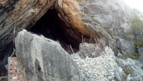
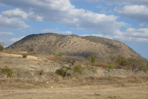
Its northwest face belongs to Jaén and is a private mountain, with a repopulation pine. Its southeast face belongs to La Guardia and corresponds to a mountain of oak and low mountain, very altered by man's hand. In spite of this, it has the attraction of the rise to the hill on the "old road," the visit to the Cabrera Cave (whose neolithic vestiges have just passed into history by burning the entire cave) and the arrival in the recreational area of the Allanadas del Santo. It has the Hermitage of San Sebastián (pattern of La Guardia), tables, barbecues, a small football field and one of the seven geodetic vertices of the municipality of Jaén. This one with the appeal of being placed at the top of a pillar about five meters high, with a ladder to be able to climb.

The proximity to Jaén (15 to 20 minutes) allows you to visit in the summer evenings with the possibility of eating there with the family, after the small route. Access is made from La Guardia, next to the Castle of the town.

Breve descripción

El Cerro San Cristóbal on a mountain that delimits the municipal terms of Jaén and La Guardia de Jaén.

Ubicación
Latitud
37.745911
Longitud
-3.712489
Distrito
Ubicación en el mapa
POINT (-3.712489 37.745911)
Tipos de punto de interés
Imágenes carrusel
imagen
Image
cerrosancristobal.jpg
Imagen principal
Desactivado
imagen
Image
cumbresancristobal-jpg
Imagen principal
Desactivado
imagen
Image
cumbresancristobal1-jpg
Imagen principal
Desactivado
Imágenes cabecera
imagen
Image
30.jpg
Imagen principal
Activado
Microsite al que pertenece
Loading map
Preparing points of interest and routes...

Hill Miguelico

Submitted by brandcode_deweloper on
Id
4873420
Descripción
Breve descripción

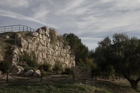
On the surface of an old oppídum and taking advantage of a cyclopeia wall (9th and X century), a plateau that would be the germ of the present town of Torredelcampo is consolidated.On its west side, acyclopoeia walland in the south-east is still preserved aVisigoda necropolis. On the east side is the hermitage of Santa Ana.

Ubicación
Código Postal
23640
Latitud
37.753720
Longitud
-3.904730
Distrito
Municipio
Ubicación en el mapa
POINT (-3.90473 37.75372)
Tipos de punto de interés
Imágenes carrusel
imagen
Image
miguelico.png
Imagen principal
Desactivado
Imágenes cabecera
imagen
Image
Muralla_Ciclopea_Cerro_Miguelico.jpg
Imagen principal
Activado
Loading map
Preparing points of interest and routes...

Hill Gordo

Submitted by brandcode_deweloper on
Id
4520165
Descripción
Descripción larga

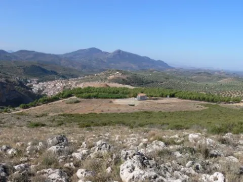
It is a high place, located at a considerable altitude (924 m.), which has impressive panoramic views of the town and its municipal term. It's 1 km away. to the east of Fuensanta de Martos, and it is accessed by the road JA-3301, towards the Sierra de la Pandera.

Ubicación
Latitud
37.646291
Longitud
-3.911022
Distrito
Ubicación en el mapa
POINT (-3.911022 37.646291)
Tipos de punto de interés
Imágenes carrusel
imagen
Image
Cerro_Gordo_Fuensanta.jpg
Imagen principal
Desactivado
Imágenes cabecera
imagen
Image
Cerro_Gordo_Fuensanta2.jpg
Imagen principal
Activado
Loading map
Preparing points of interest and routes...

Hill of San Miguel

Submitted by brandcode_deweloper on
Id
5631210
Descripción
Descripción larga

Benatae is the smallest municipality in the Sierra de Segura and is fully included in the Natural Park of the Sierras de Cazorla, Segura and Las Villas, so it is a perfect place for lovers of tranquility and nature.

The Cerro de San Miguel is located 1.5 kilometres east of the city centre of Benatae, in the direction of Puente Honda.

The Cerro de San Miguel is a recreational area with excellent views of the park. On one of its slopes, a source that gives origin to its name, one of the many water sources that spatter the municipality, stands out.

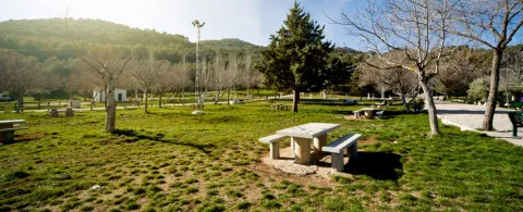
The recreational area has several tables and its corresponding banks, barbecues, the pillar and a large explanade.

In the recreational area you can see the vegetation and fauna typical of the Natural Park and from where you can observe excellent landscapes.

On the hill dominates the black pine pine pineapple, under which grows a stinking little forest with juniper, lentif, jars and crocodile. The fox, boar and squirrel are very abundant, and it is possible to contemplate mountain goats at the summit. Among the raptures are the pilgrim hawk, the seedling eagle and the leonate vulture.

From the Cerro de San Miguel you can take hiking routes, not so, in the recreational area we find the panel of beginning of the path (PR-A 179) to the summit of Peñalta (1,412 m.).

Breve descripción

It's a recreational area at 1.5 km. from the city centre, and from which we will get magnificent views of the Natural Park of the Sierra de Cazorla, Segura and Las Villas.

Telecomunicaciones
Sitio web
www.benatae.es
Teléfono de contacto
953 482 080
Ubicación
Código Postal
23390
Latitud
38.345040
Longitud
-2.643430
Distrito
Municipio
Ubicación en el mapa
POINT (-2.64343 38.34504)
Tipos de punto de interés
Imágenes carrusel
imagen
Image
Cerro%20de%20San%20Miguel.jpg
Imagen principal
Desactivado
Imágenes cabecera
imagen
Image
p1100918.jpg
Imagen principal
Activado
Loading map
Preparing points of interest and routes...

Hill of los Palancares

Submitted by brandcode_deweloper on
Id
8096219
Descripción
Descripción larga

To the north of the term, there is a mountain, the fourth of Ardal, in which the oaks predominate, along with the retama, the albar thorn, wild rosals, juniper, ivy and madreselva. An ideal ground for the cicnetic species of major hunting (boar, deer, corzo...), and also of pastures, especially for the cattle of ligia.

Breve descripción

Located north of the Sierra de Segura region, at an altitude of 835 m., most of the territory of Génave is included in the Natural Park of the Sierras de Cazorla, Segura and Las Villas.

Telecomunicaciones
Correo electrónico
ayuntamiento@genave.es
Ubicación
Código Postal
23392
Latitud
38.429960
Longitud
-2.733040
Distrito
Municipio
Ubicación en el mapa
POINT (-2.73304 38.42996)
Tipos de punto de interés
Imágenes carrusel
imagen
Image
Cerro%20de%20los%20Palancares%2C2%20%281%29.jpg
Imagen principal
Desactivado
Imágenes cabecera
imagen
Image
Cerro%20de%20los%20Palancares%2C%20%281%29.jpg
Imagen principal
Activado
Loading map
Preparing points of interest and routes...

Hill of la Coronilla

Submitted by brandcode_deweloper on
Id
8094686
Descripción
Descripción larga

The Coronilla has now become a prominent archaeological site from which important pieces have been extracted, some of which are exhibited in the Ibero Museum of Jaén. It is an orza, a closed clay container for domestic use.

Breve descripción

The Cerro de la Coronilla, located in the cortijo of the Atalaya, where the first major settlement of Cazalilla has been identified, configured thanks to its height as an integral element of a strategic defensive system of the area in the Copper Age. It is a small fortified enclosure with a control and deterrence function in the middle of the countryside.

Telecomunicaciones
Teléfono de contacto
953 537 131
Correo electrónico
castalla@cazalilla.es
Ubicación
Código Postal
23628
Latitud
37.941810
Longitud
-3.871490
Distrito
Municipio
Ubicación en el mapa
POINT (-3.87149 37.94181)
Tipos de punto de interés
Imágenes cabecera
imagen
Image
Cerro%20de%20la%20Coronilla%2C.jpg
Imagen principal
Activado
Loading map
Preparing points of interest and routes...

La Herradura Gorge and Mesto Glen

Submitted by brandcode_deweloper on
Id
912316
Descripción
Descripción larga

This bridge was built when, in the sixty of the last century, the repressive waters buried the Molinillo Bridge, which passed through the Guadalanimin a little below, and which allowed, from time immemorial, the access of reels to a road that unites the inhabitants of the scattered cores in the upper part of the Sierra (Nava de San Pedro, Puntal de Ana María, la Loma de la Sarga, Vadillo de Castril, etc.) with El Almicarán and Pozo Alcón. Much of the wheat that was sown in that mountainous area became a flour mill that was at the confluence of the Guazalamanco River with the Guadalanimin, very close to the said bridge, and that gave name to the site.

This historic road, which progress was responsible for truncating more than forty years ago, is already collected in the medieval chronicles. It was also the way to the Mesta, where the cattle of Pozo Alcón and Castril were led to the winter of Sierra Morena, with a softer and more prone climate for sheep and cows. The journey that communicates the reservoir with the Vado de las Carretas, near the Nava de San Pedro is via pecuaria and, officially, receives the illustrative name "Cordel de Visas Pintoresca." The first stretch of this journey, which passes through the cortijo de los Tontos, forest house of the Puntal de Ana María and cortijo del Raso del Peral (the highest point of the road at about 1,320 m of altitude) is known as Cañada del Mesto, and is a pleasant walk (about 8 km away and back from where we have left the vehicle) that will surprise us by the natural viewpoints we find on the route (Cortijo de los Tontos, Puntal de Ana María and the Poyo del Raso) and the views that give us. If we continue about 5 K. further forward we find the Vado de las Carretas and the Cerradas del Guadalentín and Canaliega.

We suggest...

  • That before we take the road on foot that leads us to the Cerrada de la Herradura, in the vicinity of the Molinillo Forest House, we lie, with the maximum of precautions, to the edges of the cut that give view to the reservoir and to the final stretch of the Guazalamanco River, before we connect with the Guadalmin. If the level of the reservoir is low we can see the old Molinillo bridge and what's left of the small old flour factory. In that case, a recommended option is that, through a sidewalk that leaves east of the forest house, just in front of the large bridge, we go down to the river bank and approach the mill. There are still remains of the old systems used for the milling of wheat.

The Cerrada de la Herradura is located in the tail of the Bolera reservoir and is accessed by the Dehesa del Rincón, a large entrelano located on the right bank of that reservoir. From Pozo Alcón you have to take the A-326, up the Avenida de la Bolera, direction to Castril. By passing the campsite de la Bolera and the km 7, we take a detour that comes to our left and that borders the Forest House of la Bolera (it indicates to the Hornico). On an unasphalted road, always following the main road, you reach the Molinillo Forest House, now apricot of cattle, 7.7 Km. later. There we left the vehicle and followed the path of the route that indicates the Road Vado. About 800 meters later a narrow bridge crosses a riverbed. We meet at the Herradura Clock. If we continue the road, until it begins to descend again, 3.5 Km. later, we will make the journey known as Cañada del Mesto.

Breve descripción

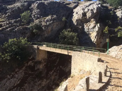
Depending on the level of the reservoir, the cannon is more or less deep. The best point to have a view of it is the same bridge that crosses it. With the safety that gives us its metal railing we can look and see polish trout and barbs in the crystal waters that the Guadalanimín River carries at its entrance to La Bolera.

Ubicación
Latitud
37.702695
Longitud
-2.935057
Municipio
Ubicación en el mapa
POINT (-2.935057 37.702695)
Tipos de punto de interés
Imágenes carrusel
imagen
Image
unnamed.png
Imagen principal
Desactivado
Imágenes cabecera
imagen
Image
herradura.jpg
Imagen principal
Activado
Loading map
Preparing points of interest and routes...

La Bolera Gorge

Submitted by brandcode_deweloper on
Id
912227
Descripción
Descripción larga

When that happens, the old Ituri Canal, already without use, loads its bed of crystalline liquid and discharges it to the riverbed, forming several waterfalls and chorreaderos of fine rain. At that time, neither the gallid waters, nor the technical difficulties that the current may pose, prevent the visitor from enjoying a unique show. Not in vain, this is one of the canyons preferred by the fans of this adventure sport of our country.

We suggest...

  • To practice barranquism within the Natural Park it is necessary to have permission from the Environmental Council.
  • It is possible that the vents of the reservoir will relieve water. To be sure we are not surprised by an avenue inside the canyon, it is recommended to request information on this matter from the administration of the reservoir (Tfno. 953 738 251)
  • Under normal conditions, there is no need for large physical powers or advanced knowledge to carry out the activity with a specialized guide. Several multiadventure companies offer this service in the area.

To go to the Bolera Clock there would be two options. The first is to go to the Bolera reservoir, as the dam is raised on the beginning of the canyon. A highly recommended option to observe the parade is the visit of the Peña de la Alcantarilla. To get to this place, in Pozo Alcón we take the road A-326 towards Castril. Just as we enter the Natural Park (there is a large panel indicating it as we pass a bridge after a long straight, past the km 6), we leave the main road turning left, passing through one of the entrances of Campsite La Bolera, we follow a narrow road to a parking lot located 30 meters from where the asphalt ends, 1 km later.

Breve descripción

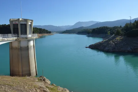
The Cerrada de la Bolera is one of the most spectacular and beautiful cannons in the Natural Park. From above, from the dam of the reservoir of the same name, from the bridge on which the road A-326 saves the parade or from the view of the Peña de la Alcantarilla, the view impresses. However, the most beautiful surprises are kept in their insides, in a territory reserved exclusively for barranquists. The shedding does not always carry water, as the leaks cause, in the driest times, the flow flow in a lower section, sometimes leaving the canyon dry. And yet, it is worth going through, because the forms that have modeled the river are very attractive. If on the contrary the level of the reservoir is high, those same leaks turn the journey into a dream.

Ubicación
Latitud
37.702695
Longitud
-2.935057
Municipio
Ubicación en el mapa
POINT (-2.935057 37.702695)
Tipos de punto de interés
Imágenes carrusel
imagen
Image
Pantano_de_la_Bolera_%28Pozo_Alc%C3%B3n%29.jpg
Imagen principal
Desactivado
Imágenes cabecera
imagen
Image
JDCANO_PANTANO_BOLERA.jpg
Imagen principal
Activado
Loading map
Preparing points of interest and routes...