Saltar al contenido principal

Landscapes

Submitted by brandcode_deweloper on
Id
1913945
Descripción
Descripción larga

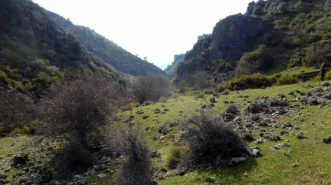
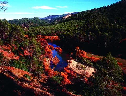
This diversity is conditioned by its irregular topography from the 400 m of Fuente Álamo to the 1.553 m of the peak of La Martina, as well as by the pronounced dominant climatology, with temos peratures that ascend to the 35 ° C du rante the months of vera no and descend to the -6 ° C in winter.

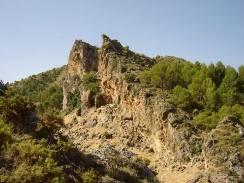
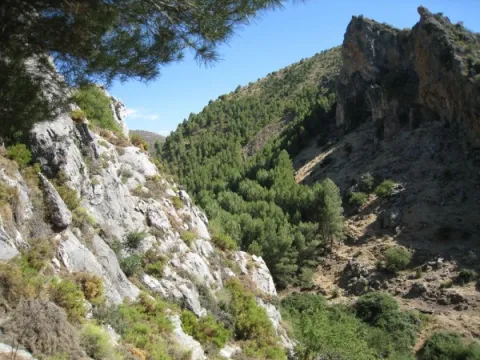
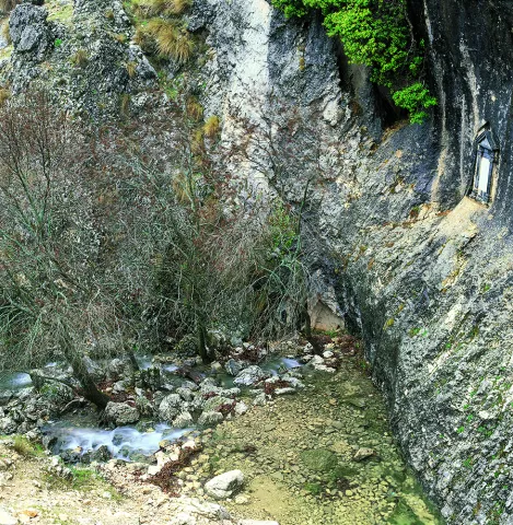
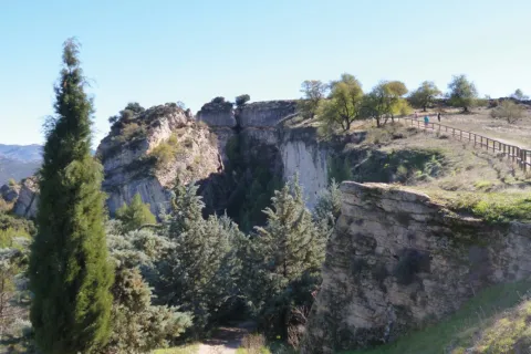
It is important to highlight forms such as Los Tajos, impressive cut and rocky, under which the natural vegetation is served, as a sign of what at one time were the Mediterranean bays of the southern Iberian Peninsula, species such as the oak (Quercus rotundifolia) and the whim (Quercus faginea) dominate the arboreum stratum and others like the peonies (Poeoni broteroi), madreselvas (Lonicera implexa), majuelos (Crataegus monogytoo, or the forest, etc.).

In these enclaves, and developing on the limestone walls, we can find an ende- same plant from the south of the Iberian Peninsula from which only 22 populations of Andalusia have been found and is listed as in danger of extinction, the Saetica Sarcopacnos subsp. Baetica.

As for the fauna that we can find in this ecosystem, from birds such as the vulgar cernicalo (Falco tinnunculus), gratilla (Corvus mone-du / o), piquirroja (Pymhocorax pyrrohocorax), crows (Corvus corax), red roquero (Monticola saxatilis), etc. We can also observe the occasional passage of some perdicular eagle couple (Hieraaetus fasciatus), the migration of the leonate vultures (Gyps fulvus) and other birds found in the forest area such as the boy owl (As / o otus), the real red colirar (Phien / curus phoen / curus), the oropen (On'o / us or / us), etc.

There is also a great diversity of wild mammals in this area that seek refuge in this enclave, although they are species that are difficult to observe, we can detect their presence based on prints and other records, species such as the Garduña (Tuesday foina), Gin (Genettagenetta), badger (Meles meles) and a large number of microfuels that act as the basis of the trophic chain.

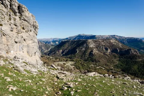
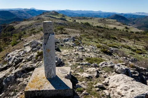
It is also interesting to discover the area of Los Llanos, a large plateau where the tree vegetation is absent and where the number of stone or majano accumulations that give the territory a lunar look stand out.

Despite their yerma appearance, the Llanos have high biodiversity and possibilities for observing wildlife. The flora is characterized by the abundance of aromatic species such as lavandas (Lavandula), rosemary (Rosamrinus officinalis), tomi llos (Thymus) etc and fauna, we find a large number of birds linked to this type of large and unequipped ecosystems of arboreal vegetation such as the common cogujada (Calerida cristata), the montesina cogujada (Calenda íeck / oe), the chitovia (Lullulina arbórea), the calandria (Melanocorypha cala), the common (Saxacarus), the (Saguluus párama), the (La páribana (Párárágina), the (La párágina), the (Página), the common (La página), the

Breve descripción

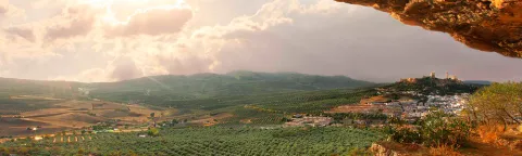
Alcalá la Real is located within the betico territories of the Andes, characterized by a great diversity of landscapes and ecosystems.
Ubicación
Código Postal
23680
Latitud
37.461290
Longitud
-3.922290
Distrito
Municipio
Ubicación en el mapa
POINT (-3.92229 37.46129)
Tipos de punto de interés
Imágenes carrusel
imagen
Image
paisajes.jpg
Imagen principal
Desactivado
Imágenes cabecera
imagen
Image
alcala-naturaleza.jpg
Imagen principal
Activado
Microsite al que pertenece
Loading map
Preparing points of interest and routes...

Andalusian Astronomical Observatory

Submitted by brandcode_deweloper on
Id
2897118
Descripción
Descripción larga

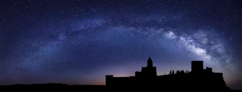
The South Sierra de Jaén, which obtained the Starligth Reserve certificate in 2014, retains the natural lighting and nocturnal conditions of the night sky intact. It is also a space where a commitment has been made to the defence of the quality of the night sky, access to the light of the stars and the different associated values.

The main building, about 70 square meters, houses the multi-purpose room and library, observatory control room, small kitchen, toilet and archive.

To the north of the main building and completely independent, is the observatory itself. The lower floor serves as a storage room for the various instrumentation and accessories of the telescopes and has a small workshop for the repairs.

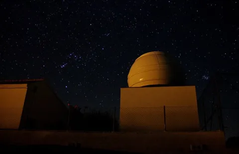
The 4-meter-in-diameter Scope Dome dome, installed on the top, has a Meade S / C LX200-ACF GPS telescope of 0.30 meters of opening at f / 10, in an equatorial fork mount, supported by an independent rigid column.

The whole of the Andalusian Observatory of Astronomy: Dome, telescope as well as its battery of accessories and instrumentation can be operated remotely from anywhere.

On the terrace of the control room there is a weather station specially designed for use in an astronomical observatory and an AllSky automatic camera for meteor detection.

Breve descripción

In the village of La Pedriza, 8 km from Alcalá la Real with an impressive dark sky, the Einstein Society of Astronomy, with the collaboration of the Alcalá la Real City Council, has first-class facilities for astronomical observation and dissemination: the Andaluz Observatory of Astronomy.

Telecomunicaciones
Sitio web
www.astroalcala.es
Teléfono de contacto
661 090 957
Correo electrónico
espartero@astroalcala.es
Ubicación
Código Postal
23688
Latitud
37.414820
Longitud
-3.953560
Distrito
Municipio
Ubicación en el mapa
POINT (-3.95356 37.41482)
Tipos de punto de interés
Imágenes carrusel
imagen
Image
starlight-mota-1536x584.jpg
Imagen principal
Desactivado
imagen
Image
C-2020-F3-Neowise-blog.png
Imagen principal
Desactivado
Imágenes cabecera
imagen
Image
observatorioandaluzastronomia_jaen2.jpg
Imagen principal
Activado
Microsite al que pertenece
Loading map
Preparing points of interest and routes...
Marcas de calidad

Navalta y Navalconejo

Submitted by brandcode_deweloper on
Id
8094809
Descripción
Descripción larga


Location:To the west of the town, in the foothills of the mountain set of the South Sierra.
Distance:7 km.

Medium:Tourism vehicle.

Access route:Taking the road leading to the Hoya del Salobral.

Breve descripción

These are fenced valleys surrounded by burning and painting, which are located next to the road leading to Navalcán. They are very visited in the fall by cardo mushroom seekers. The livestock holding (sheep and goats) is very present in this area, with several cortijos in the surroundings dedicated to this work.

Telecomunicaciones
Sitio web
www.noalejo.es/el-municipio/patrimonio-natural.html
Teléfono de contacto
953 306 134
Ubicación
Código Postal
23140
Latitud
37.528500
Longitud
-3.660950
Distrito
Municipio
Ubicación en el mapa
POINT (-3.66095 37.5285)
Tipos de punto de interés
Imágenes cabecera
imagen
Image
Navalta%20y%20Navalconejo..jpg
Imagen principal
Activado
Microsite al que pertenece
Loading map
Preparing points of interest and routes...

Navalcán

Submitted by brandcode_deweloper on
Id
4867827
Descripción
Breve descripción

Depression of karmic origin that belongs to the typical landscape of the Mediterranean mountain. At the same time, we will be able to see a large number of sections, caves, river courses, Mediterranean flora and fauna.

Ubicación
Código Postal
23140
Latitud
37.529021
Longitud
-3.654217
Distrito
Municipio
Ubicación en el mapa
POINT (-3.654217 37.529021)
Tipos de punto de interés
Imágenes carrusel
imagen
Image
navalcan1.jpg
Imagen principal
Desactivado
Imágenes cabecera
imagen
Image
navalcan1-600x450.jpg
Imagen principal
Activado
Microsite al que pertenece
Loading map
Preparing points of interest and routes...

Nava del Espino

Submitted by brandcode_deweloper on
Id
913357
Descripción
Descripción larga

From the Nava del Espino there are roads that lead you to the highest peaks of the Sierra de Cazorla, among which are the Poyos de la Mesa. It is a very recommended route by the views on the Guadalquivir that from this plancie you can reach.

If you stop your way in this place you can enjoy the landscape and if you are at the right time it will be easy to see some go feeding on their meadows.

About 2 km from the Navy following the track you brought, and on the left there is a recreational area next to the Fountain of the Garganta. An ideal place to rest and restore strength.

In Cazorla take the Sierra road (A-319) until the crossing known as the Empalme del Valle. Turn right on the JF-7092 road and after passing the bridge over the Guadalquivir River (4 km from the Empalme) follow the left track (JF-7091). In the km 21 of the road signs is the Nava del Espino.

Breve descripción

By going up the way of the Navas we come to this place which is surprising by its breadth. At 1430 m of altitude you will find high mountain grasslands, some pine-covered areas and an old abandoned forest house that indicate that we have reached the destination. Around you, high hills that seem like we can almost touch with our hands like the Tejo Head, from where it is possible to contemplate the Sierra Nevada summits.

Ubicación
Latitud
37.912893
Longitud
-3.003887
Municipio
Ubicación en el mapa
POINT (-3.003887 37.912893)
Tipos de punto de interés
Imágenes carrusel
imagen
Image
espino%20%281%29.jpg
Imagen principal
Desactivado
Imágenes cabecera
imagen
Image
6942435Master.jpg
Imagen principal
Activado
Loading map
Preparing points of interest and routes...

Source of the River Segura

Submitted by brandcode_deweloper on
Id
877023
Descripción
Descripción larga

The birth of the Segura River is a penetrable siphon, with an explored length of 354 meters and a 17 meters gap. The exploration of this cavity was carried out by spelebuchers of the Madrid Standard Group during the 1979 and 1980 years, carrying out an important work of disobstruction within the siphon. (G.E. STANDARD, 1980) The emergence is located at the bottom of a blind valley in the foothills of the Sierra de Segura near the population of Pontones. It is a flooded gallery where three air bubbles are located at about 100, 160 and 255 m from the mouth.

Source: Inventory of Georresources of Andalusia. Environmental Council. Junta de Andalusia.

Breve descripción

This is a karmic surgence located at the entrance of a circular cavity of several meters in diameter. This is associated with the aquifer of higher Cretaceous dolomies and limestone. It is located in the vicinity of the inverse failure contact between the carbonates of the Upper Cretaceous and the waterproof margas of the Middle Myocene. It is a cavity that could in origin correspond to a small dolin, developed on subhorizontal layers.

Ubicación
Latitud
38.091458
Longitud
-2.701760
Ubicación en el mapa
POINT (-2.70176 38.091458)
Tipos de punto de interés
Imágenes carrusel
imagen
Image
nacimiento-del-segura.jpg
Imagen principal
Desactivado
imagen
Image
17201575670_6b5d38a518_b.jpg
Imagen principal
Desactivado
imagen
Image
7609945Master%20%281%29.jpg
Imagen principal
Desactivado
Imágenes cabecera
imagen
Image
Nacimiento%20del%20Segura.jpg
Imagen principal
Activado
Loading map
Preparing points of interest and routes...

Source of the River San Juan

Submitted by brandcode_deweloper on
Id
8091631
Descripción
Descripción larga

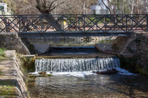
Natural area of great beauty of water and tiled wires that invite to relax, turned into a recreational area, magnificent enclave to spend a pleasant day of countryside surrounded by nature, enjoy the environment, rest under the dense tree grove or take some hiking route. The space has a magnificent road with banks, tables, stationery, a small bar, children's playground and a large parking lot. This area attracts thousands of visitors from many municipalities, some very far away.

From the same pozas of the Nacimiento, a channel known by the neighbors by "el Caz," that allows to water the orchards of the river along several kilometres, and that rejoins the river in the village, next to the Roman bridge of Triana, where the permits for the fishing stop "El Carrizal," whose upper section is the same Birth of the San Juan River, were issued. The nearest pool to the river was used for the release of trout and fishing for both people with reduced mobility and children, learning the values and techniques needed to manage themselves within this sport and get their own catches (there is a children's fishing school in the town in the summer, taking advantage of school holidays).

The fishing ground was about 4 km. where roads have been enabled, making many parts of the banks practicable and facilitating the formation of pokes, where fish can find better shelter and more water.

Fishing could also be practiced in the Valdepeñas Bridge, where one of the most remarkable pozas of the fishing ground is formed, both by the number of trout and by the quality of the trout. The environment of Nacimiento del Río San Juan is characterized by a typical Mediterranean landscape, with the oak and the coscoja as protagonists. Other plants present are the lentif, the white jara, the thyme and the rosemary, but, without a doubt, the white lamo is the most abundant species in the Birth and on the river bank. In this we can see fertile gardens that make up the "Vega castillera," which acquires its maximum splendor in spring with the flowering of the cherry trees, very abundant in the area, irrigated from the very pods of the birth by "the Caz" mentioned above.

This area, owned by the City Council, houses a multitude of outdoor physical activities.

Breve descripción

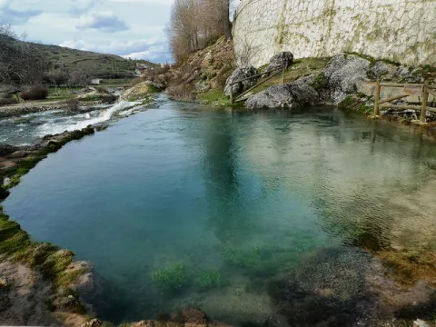
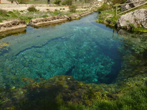
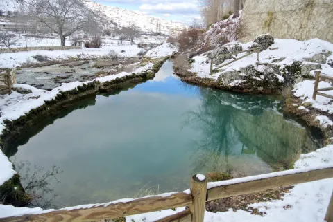
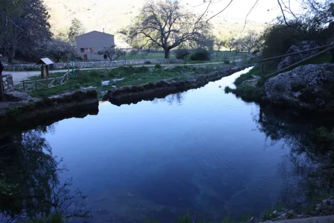
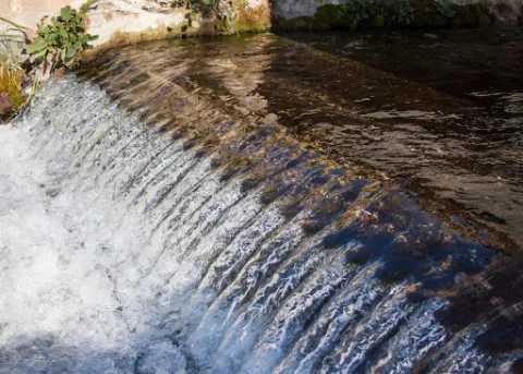
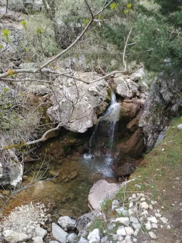
The Birth of the San Juan River is located in the municipal term of Castillo de Locubín in the depression between the hills of the Sierrezuela and the Nava. This idyllic landscape, surrounded by vegetation, has in the abundance water that springs from the interior of the mountain its main characteristic. It is a place of great beauty, where several pools of crystalline water have been naturally formed, from which the groundwater springs, forming beautiful and intermittent columns of bubbles to the surface. In addition, we can observe small waterfalls and channels. It is accessed by the road C-3221, which links Castillo with the nearby town of Valdepeñas de Jaén.

Telecomunicaciones
Sitio web
www.aytocastillodelocubin.org/?page_id=1283
Teléfono de contacto
953 591 364
Ubicación
Código Postal
23670
Latitud
37.540360
Longitud
-3.919260
Distrito
Ubicación en el mapa
POINT (-3.91926 37.54036)
Imágenes carrusel
imagen
Image
nacimiento%20del%20r%C3%ADo%20san%20juan.jpg
Imagen principal
Desactivado
imagen
Image
nacimiento%20del%20r%C3%ADo%20san%20juan3.jpg
Imagen principal
Desactivado
Imágenes cabecera
imagen
Image
nacimiento%20del%20r%C3%ADo%20san%20juan2.JPG
Imagen principal
Activado
Loading map
Preparing points of interest and routes...

Source of the River Arbuniel

Submitted by brandcode_deweloper on
Id
8091520
Descripción
Descripción larga

It is one of the most cuddly and important springs in Sierra Magina, being the pride of the shrubs. Although water sprouts through limestone rocks and liasic dolomies of an aquifer, it has a marked saline character because it arises in the breast of margas with triasic plaster.

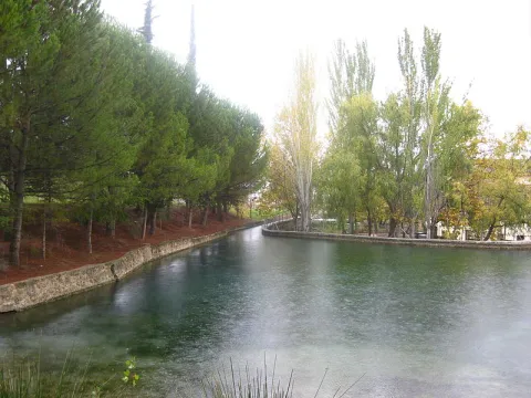
The waters of the birth are collected in an artificial construction raft that stores them and leads by a system of waterfalls that runs throughout the village.

Next to the birth is one of the four power plants that used the waters of the river for the production of electricity.
This beautiful area is conditioned with a meringero area that allows visitors to enjoy a picnic in a unique natural environment.

The river course is channeled in a multitude of waterfalls that give wealth to the land of the municipality and irrigate many hectares of land. Previously it gave impetus to flour and oil mills, while it is currently used for the irrigation of the olive tree, true economic engine of the area.

The space has a magnificent road with barbecues, banks, tables, stationery, a small bar and children's playground, where you can spend a pleasant day surrounded by nature and where you can take advantage of the freshness of the place and the shadows of the trees.

In the birth of the Arbuniel you can see ducks and river crabs, which inhabit in its channel thanks to the great amount of lime of its waters, and abundant trout.

Breve descripción

The Birth of the Arbuniel River, also known as The Birth of Water, is located on the slopes of Mount Torre de Gallarín, in the vicinity of the urban town of Arbuniel (Cambil), within the region of Sierra Magina.

Telecomunicaciones
Sitio web
www.cambil-arbuniel.es/municipio/patrimonio-natural/nacimiento-de-arbuniel/
Ubicación
Código Postal
23193
Latitud
37.624420
Longitud
-3.540790
Dirección
Camino del Álamo, 3. Arbuniel
Distrito
Municipio
Ubicación en el mapa
POINT (-3.54079 37.62442)
Imágenes carrusel
imagen
Image
Nacimiento%20del%20r%C3%ADo%20Arbuniel2.JPG
Imagen principal
Desactivado
imagen
Image
Nacimiento%20de%20Arbuniel.jpg
Imagen principal
Desactivado
Imágenes cabecera
imagen
Image
Nacimiento%20del%20r%C3%ADo%20Arbuniel3.jpg
Imagen principal
Activado
Microsite al que pertenece
Loading map
Preparing points of interest and routes...

Source of the Guadalquivir - Cañada de Las Fuentes

Submitted by brandcode_deweloper on
Id
913244
Descripción
Descripción larga

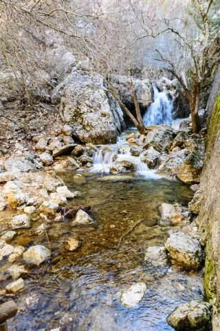
The "official" birth of the Guadalquivir River has been placed under a plaque that reproduces a poem by the brothers Alvarez Quintero. But, in the strict sense, the sources of Guadalquivir are found in the spacious honnada of the Cañada de las Fuentes. In this place there are several streams that come down from the nearby mountains: that of the Teatines, that of the Cold John or the stream of Light among others.

The place has overcome moments of intense tourist pressure and today, with a more appropriate public use order, we are presented with clean and sensitive, so our visit must be at all times silent and respectful.

From the Cañada de las Fuentes you are a step away from enjoying some of the most striking routes in the area.

We suggest...

  • Up to the peak of Cabañas, at whose foot is a forest track in acceptable condition, about 10 km. Following the track that goes to Pozo Alcón from the birth we arrive, after 2.5 km, to the pine of the three crosses. Here begins the track that goes up to this proud viewpoint of the Sierra del Pozo.
  • Walk by the Cañada de la Fuente. About a mile from the forest house of the same name, a road to the right begins surrounded by majuelos and maples, with some of the largest specimens of pine larice of the Park. On the way it is easy to observe we, even muflons in the lapiaz on the right, as well as millennia tejos
  • Continue two kilometers along the track that goes up to Pozo Alcón and, 300 meters before the pine of the three crosses, take the left road to the Prados de Navahondona.

From Cazorla you can reach the Sierra road, A319. In the Empalme del Valle we will see an indication of the birth to the right, and follow that direction for 4 km until you find a bridge over the Guadalquivir. As we pass the bridge we turn right to the Bridge of Herrerías. From here, without leaving the main road, there are 11 km to the Birth.

Breve descripción

The birth of the most important river of Andalusia occurs in an area of great ecological value within Natural Park. It is a cool and pleasant place, where strawberries, maples and majuelos accompany the "Rio Grande," as the Arabs called it, in these first steps. Around it we find curious geological formations with dense pine pineapples and black. About a hundred meters above is the forest house of the Cañada de las Fuentes where there is a recreational area that often come to go and deer in small groups.

Ubicación
Latitud
37.702695
Longitud
-2.935057
Municipio
Ubicación en el mapa
POINT (-2.935057 37.702695)
Tipos de punto de interés
Imágenes carrusel
imagen
Image
17060619146_d431e5bd2f_b.jpg
Imagen principal
Desactivado
imagen
Image
Natu078.jpg
Imagen principal
Desactivado
imagen
Image
Natu183.jpg
Imagen principal
Desactivado
imagen
Image
Natu218.jpg
Imagen principal
Desactivado
imagen
Image
Natu217%20%281%29.jpg
Imagen principal
Desactivado
imagen
Image
Natu219.jpg
Imagen principal
Desactivado
imagen
Image
Natu237.jpg
Imagen principal
Desactivado
imagen
Image
Natu251.jpg
Imagen principal
Desactivado
Imágenes cabecera
imagen
Image
Natu015.jpg
Imagen principal
Activado
Loading map
Preparing points of interest and routes...

Source of the Guadalquivir

Submitted by brandcode_deweloper on
Id
876915
Descripción
Descripción larga

This is a set of karmic developments, among which is the one located on a vertical wall of a river cannon excavated in jurassic limestone. The latter is the one historically considered "the birth of the Guadalquivir River." However the river is fed by all the streams and births that are located somewhat above in the so-called "Cañada de las Fuentes."

Source: Inventory of Georresources of Andalusia. Environmental Council. Junta de Andalusia.

Breve descripción

Birth of the Guadalquivir

Ubicación
Latitud
37.842982
Longitud
-3.066921
Dirección
Cañada de las 7 Fuentes
Municipio
Ubicación en el mapa
POINT (-3.066921 37.842982)
Tipos de punto de interés
Imágenes carrusel
imagen
Image
guadalquivir.jpg
Imagen principal
Desactivado
imagen
Image
nacimiento-del-gadalquivir-1-jpg
Imagen principal
Desactivado
Imágenes cabecera
imagen
Image
guadaquivir.png
Imagen principal
Activado
Horario
Site: Tuesday to Sunday 10: 00 - 13: 00 (upon reservation). Porcilla Museum: Tuesday to Sunday 10: 00 - 13: 00.
Loading map
Preparing points of interest and routes...