Saltar al contenido principal

Gorge of Hornos

Submitted by brandcode_deweloper on
Id
913080
Descripción
Descripción larga

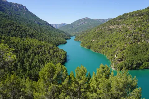
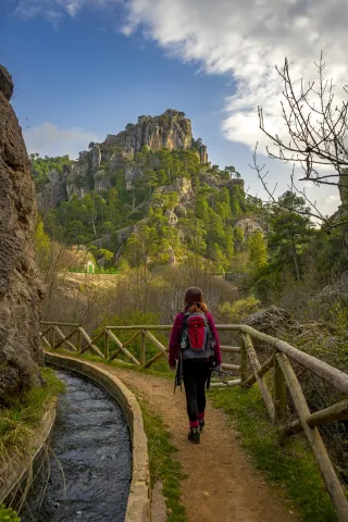
Half a mile from Hornos, on the right, you will find the look at Las Celadillas. Later on, do not stop visiting the charming village of La Capellanía, whose crossing is well marked to the left. From there you can walk along the signposted path PR-A 150, which is close to the steep slopes of the Yelmo Chico and allows you to contemplate a wide range of views. The A-317a road itself lends itself to the walk, as it has very little traffic since the new A-317 road was built from Hornos to Santiago de la Espada.

Breve descripción

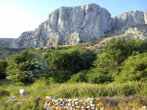
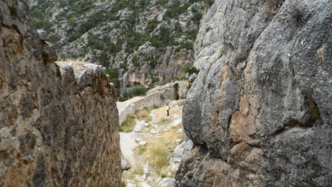
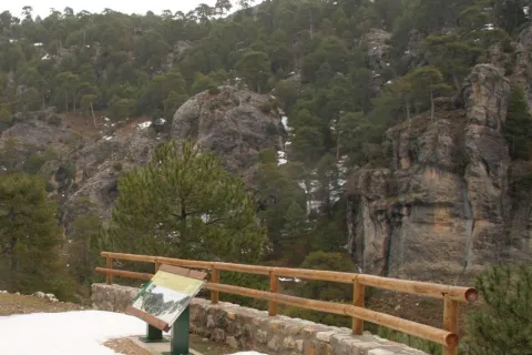
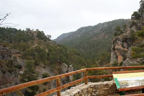
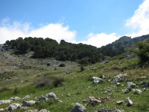
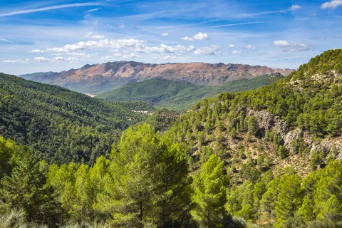
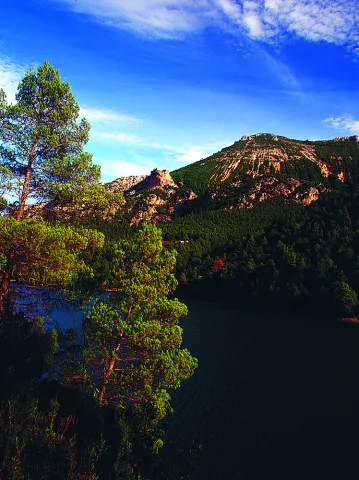
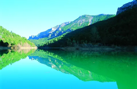
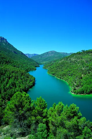
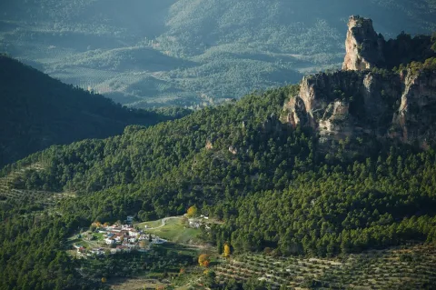
It is a long and deep valley all along the winding road A-317a, which rises at first between olive groves and then between closed pine trees, which are of carrasco pine in the lower area, black pine in the middle altitude strip and larix pine in the higher parts. Mixed with them, the oak trees and other species of the Mediterranean forest abound, forming a landscape of remarkable longitude.

Ubicación
Latitud
38.210827
Longitud
-2.685734
Distrito
Municipio
Ubicación en el mapa
POINT (-2.685734 38.210827)
Tipos de punto de interés
Imágenes carrusel
imagen
Image
Aldea%20de%20La%20Capellan%C3%ADa%20y%20valle%20de%20La%20Garganta%20-%20copia.jpg
Imagen principal
Desactivado
Imágenes cabecera
imagen
Image
hornos1.jpg
Imagen principal
Activado
Loading map
Preparing points of interest and routes...

Fountain of the Gargantón

Submitted by brandcode_deweloper on
Id
5845859
Descripción
Breve descripción

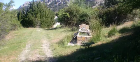
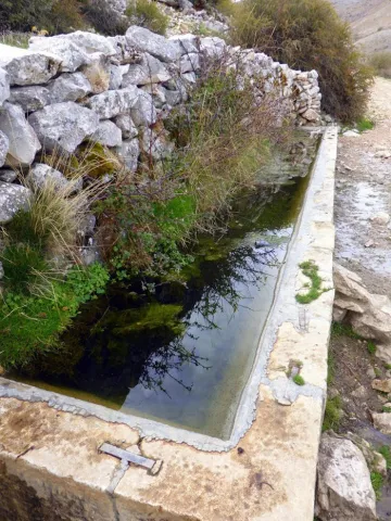
Caudalosa fountain fed by the Garganton River, one of the most important watercourses on the southern side of the Sierra Magina mountains. In summer the park and the bar next to the fountain are places to stop.

Ubicación
Latitud
37.723720
Longitud
-3.382640
Distrito
Ubicación en el mapa
POINT (-3.38264 37.72372)
Tipos de punto de interés
Imágenes carrusel
imagen
Image
1465030943_456942_1465032471_album_normal%20%281%29.jpg
Imagen principal
Desactivado
imagen
Image
fuente%20%282%29.jpg
Imagen principal
Desactivado
Imágenes cabecera
imagen
Image
13641265.jpg
Imagen principal
Activado
Microsite al que pertenece
Loading map
Preparing points of interest and routes...

Fuenmayor

Submitted by brandcode_deweloper on
Id
5846796
Descripción
Breve descripción

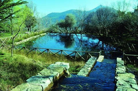
Traditional meringero area around a high-flow source that feeds a pond, around which the furniture of the picnic area is distributed. It is the starting place of several hiking routes.

Ubicación
Latitud
37.785140
Longitud
-3.509250
Distrito
Municipio
Ubicación en el mapa
POINT (-3.50925 37.78514)
Tipos de punto de interés
Imágenes carrusel
imagen
Image
Natu438.jpg
Imagen principal
Desactivado
Imágenes cabecera
imagen
Image
Fuenmayor.jpg
Imagen principal
Activado
Microsite al que pertenece
Loading map
Preparing points of interest and routes...

Fault of Tíscar

Submitted by brandcode_deweloper on
Id
876119
Descripción
Descripción larga

The Tiscar Falla is a sinistra tear fracture that borders the Quesada saw by the E, running always close to the Quesada- well Alcón road. The fracture plane is almost vertical. The failure has cut the southern end of the Sierra de Cazorla, moving the southern fragment to the NW about 8 km.

At the proposed point the failure plane can be observed, with associated failure rocks, as well as some horizontal strands that show the movement of this fracture.

Source: Inventory of Georresources of Andalusia. Environmental Council. Junta de Andalusia.

Breve descripción

Tiscar failure

Ubicación
Latitud
37.912893
Longitud
-3.003887
Municipio
Ubicación en el mapa
POINT (-3.003887 37.912893)
Tipos de punto de interés
Imágenes carrusel
imagen
Image
falla-tiscar.jpg
Imagen principal
Desactivado
imagen
Image
piedras.jpg
Imagen principal
Desactivado
imagen
Image
Natu215.jpg
Imagen principal
Desactivado
Imágenes cabecera
imagen
Image
tiscar.jpg
Imagen principal
Activado
Loading map
Preparing points of interest and routes...

Los Perales Strait

Submitted by brandcode_deweloper on
Id
913048
Descripción
Descripción larga

There are two places to enjoy the Strait of Perals:

  • Undoubtedly a good place to observe the beauty of this Strait is the lookout that appears on the left side of the Navas road. It's not signposted, so you have to pay attention, though it has no loss.
  • In the valley of Valdetrillos in the ascending direction there is a track that can be seen from the lookout. To get to it you have to turn back on the runway of the Navas and take the road cut by a chain that goes to the right. We have to cross the bridge over the Rambla stream. After a period of half an hour walking we view the basin of the Valdetrillos stream from where the Strait of the Perals and the lookout that has been referred to above are observed.

In Cazorla take the Sierra road (A-319) until the crossing known as the Empalme del Valle. Turn right on the JF-7092 road and after passing the bridge over the Guadalquivir River (4 km from the Empalme) follow the left track (JF-7091). Between the km 27 and 28 of the road signs is the lookout with views of the Strait of the Perales.

Breve descripción

Singular throat that stands out for the aesthetics of its curious rock formations. At the bottom the stream of Valdetrillos breaks into fast joys that put the sound note. In this area it is easy to see how the agile muflons, the montane males, and even the majestic flight of the royal eagle, the leonate vulture or the drifted eagle climb through vertical walls. At the end of the valley the Calarillas provides perspectives of the highest mountains of this natural space.

Ubicación
Latitud
37.912893
Longitud
-3.003887
Municipio
Ubicación en el mapa
POINT (-3.003887 37.912893)
Tipos de punto de interés
Imágenes carrusel
imagen
Image
perales.jpg
Imagen principal
Desactivado
Imágenes cabecera
imagen
Image
1515_MI_01.jpg
Imagen principal
Activado
Loading map
Preparing points of interest and routes...

Holm Oak and Juniper Forests

Submitted by brandcode_deweloper on
Id
920671
Descripción
Descripción larga

They are found on the stony and slope slopes, forming clear forests in which they coexist with some pine of several species (Pinus nigra salzmannii, Pinus pinaster and Pinus halepensis), according to the altitude and orientation of the slope, as well as cornicabra (Pistacia terebinthus), ruscos (Ruscus aculeatus) and a herbaceous entourage such as charts, rompesacos and cerveres (Poa bulbosa, Cynosurus echinatus, Aegilops, and the acrachacellus (Arrachacus), and the acellus (Arrachatus), and the other (Arrachus).

From the Recreative Area of Linarejos, we walk along the track that goes up the hill. We will go through a quarry and a barrier, these are two indicators that confirm that we are on the right track. At 3 km from the Recreative Area we will see a detour to our left, a track that enters us into a rock maze. It is a torque, in which this formation of oaks and juniper is extended. Two leads are coming out to our left, one after the other, and they both get us into this torcal. If we do not want to go too far, because it is a difficult ground to go through, from the main track we see this plant formation in the same way.

Breve descripción

The Navillas, Peña Gallinera

The oak (Quercus ilex ballota) and juniperus oxicedrus (Juniperus oxicedrus) are a unique feature of these limestone saws. It is difficult to see a formation of these pure characteristics, since it is normal to see them intermingled in enclosures, pine trees and in slices of Mediterranean forests, but in a few places, like this, we can see them with their characteristic elements.

Ubicación
Latitud
37.912893
Longitud
-3.003887
Municipio
Ubicación en el mapa
POINT (-3.003887 37.912893)
Imágenes carrusel
imagen
Image
encinares_enebrales.png
Imagen principal
Desactivado
imagen
Image
ales%20%281%29.jpg
Imagen principal
Desactivado
Imágenes cabecera
imagen
Image
4eladera%20del%20espinar%2C%20barranco%20de%20la%20pinada%2C%20barranco%20de%20las%20esparragueras%2C%20barranco%20de%20las%20liebres.jpg
Imagen principal
Activado
Loading map
Preparing points of interest and routes...

Holm Oak Forest

Submitted by brandcode_deweloper on
Id
880004
Descripción
Descripción larga

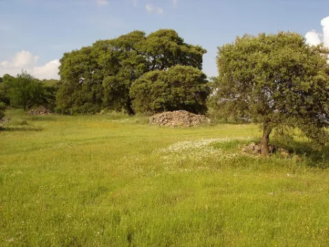
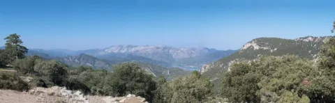
Our goal is to see one of the most spectacular oak trees in the Park, where we will see large, very large oak trees and a forest of tale. Give the place where we left the car, we continue on foot on the track about 6 km. The rise is easy and uncomplicated.

We'll get to a crossroads, we'll follow right. A little higher, a source is intuited under an oak. For that place, to the right of the track and above the source we will find large copies of oak, although in reality we have been walking through a magnificent oak for a long time. The crossing of the track is where the old forest house of the Fountain del Roble was. This is where the burning reaches all its magnificence.

In this forest dominated by the oak we find some other complaint (Quercus faginea), serbals (Sorbus domestica), pespejones (Sorbus torinlis), majuelos (Crataegus monogina), skirmishes (Rosa spp.), laureolas (Daphne laureola), thorns (Berberis vulgaris australis), torvizcos (Daphne gidium), peonies or mountain roses (Paeonia broteroi), orchids (Orchis, the dominant, Chiphiphipis, and the contiguera (Ophanacteria), and the domineas.

In our saws we can see many oak forests. For example, on the rise to Santiago de la Sword from Tobos, on the Esperilla, before Fuente Steel, or on the access track to the Pegueras. The name of engraving has meant Mediterranean forest, but the matter is not so simple.

Rather, we should say that burning is a phase of the Mediterranean forest. The lauroid forest, which we discussed elsewhere, is also Mediterranean forest. In any case, the engraving does exist as such, in addition to the fact that its main component, the encin (Quercus ilex ballota), is in almost all the plant formations of the Park, with the exception of the summits and the cold deciduous forests, of the high mountain.

LOCATION

From Coto Ríos we take the road A-319 towards the Tranco and less than a kilometer away to the right towards the campsite of the Llanos de Arance. We overcome it and follow it (the road becomes a forest track), until it reaches the control of Aguamula. As we pass it we follow the track to the left, discarding another one to the right, from here we will travel the right margin of the Tranco reservoir. We take the first detour to be presented to our right at 2.1 km from the above control. It is a great crossing where the track is widened and where we must turn to our right making a closed curve that places us almost 180º to the sense of our march. This is the track that goes up to Majalalto, passing through the Fountain del Roble. In that place we left the vehicle, as the track is closed to traffic with a chain.

Breve descripción

Our goal is to see one of the most spectacular oak trees in the Park, where we will see large, very large oak trees and a forest of tale. Give the place where we left the car, we continue on foot on the track about 6 km. The rise is easy and uncomplicated.

We'll get to a crossroads, we'll follow right. A little higher, a source is intuited under an oak. For that place, to the right of the track and above the source we will find large copies of oak, although in reality we have been walking through a magnificent oak for a long time. The crossing of the track is where the old forest house of the Fountain del Roble was. This is where the burning reaches all its magnificence.

In this forest dominated by the oak we find some other complaint (Quercus faginea), serbals (Sorbus domestica), pespejones (Sorbus torinlis), majuelos (Crataegus monogina), skirmishes (Rosa spp.), laureolas (Daphne laureola), thorns (Berberis vulgaris australis), torvizcos (Daphne gidium), peonies or mountain roses (Paeonia broteroi), orchids (Orchis, the dominant, Chiphiphipis, and the contiguera (Ophanacteria), and the domineas.

In our saws we can see many oak forests. For example, on the rise to Santiago de la Sword from Tobos, on the Esperilla, before Fuente Steel, or on the access track to the Pegueras. The name of engraving has meant Mediterranean forest, but the matter is not so simple.

Rather, we should say that burning is a phase of the Mediterranean forest. The lauroid forest, which we discussed elsewhere, is also Mediterranean forest. In any case, the engraving does exist as such, in addition to the fact that its main component, the encin (Quercus ilex ballota), is in almost all the plant formations of the Park, with the exception of the summits and the cold deciduous forests, of the high mountain.

LOCATION

From Coto Ríos we take the road A-319 towards the Tranco and less than a kilometer away to the right towards the campsite of the Llanos de Arance. We overcome it and follow it (the road becomes a forest track), until it reaches the control of Aguamula. As we pass it we follow the track to the left, discarding another one to the right, from here we will travel the right margin of the Tranco reservoir. We take the first detour to be presented to our right at 2.1 km from the above control. It is a great crossing where the track is widened and where we must turn to our right making a closed curve that places us almost 180º to the sense of our march. This is the track that goes up to Majalalto, passing through the Fountain del Roble. In that place we left the vehicle, as the track is closed to traffic with a chain.
Ubicación
Latitud
37.912893
Longitud
-3.003887
Municipio
Ubicación en el mapa
POINT (-3.003887 37.912893)
Tipos de punto de interés
Imágenes carrusel
imagen
Image
Natu021.jpg
Imagen principal
Desactivado
imagen
Image
IMG_0815._Encinar.jpg
Imagen principal
Desactivado
Imágenes cabecera
imagen
Image
encinar.png
Imagen principal
Activado
Loading map
Preparing points of interest and routes...

Beautiful Holm Oak

Submitted by brandcode_deweloper on
Id
8091775
Descripción
Descripción larga

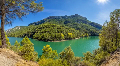
It is an elongated plateau in the north-south-west sense that presents in all directions abrupt slopes. It has dimensions of 500 meters on its longest axis, about 270 meters on the narrowest side and an area of about 10 hectares.

Archaeologists especially highlight their landscape values with an indigenous vegetation of oak and other species of the Mediterranean mountain.
The site has been the subject of some limited archaeological interventions and the general lines of a Master Plan to address the comprehensive treatment of the site from research and protection to dissemination and value, even though only progress was made in this regard.

The realization in Cabeza Baja of an emergency excavation in 1986, motivated by the increase and extension of the archaeological expolio, offered a series of key archaeological data to define the entity of the site. The data obtained in the excavation indicate that the oppidum of Cabeza Baja de Encina Hermosa is founded between the end of the third century BC and the mid-second century and develops a population that must follow the typical Iberian urbanism of the Alto Guadalquivir.

The first continued occupation of Cabeza Baja (early S.II and final of the S.III BC) was probably by contingents of tubular origin arrived from Obulco, although no other nuclei such as Iponoba, Tucci or even the Iberian nuclei of Alcalá la Real should be excluded. The excavations pointed to the existence of various structures; the existence of an Iberian wall around the plateau was demonstrated. The thickness of the wall can be estimated at 3 meters.

The finding of a level of fire was identified as a possible cause of the abandonment of these units.

Breve descripción

The lower head of Encina Hermosa is an archaeological settlement known from the ascentral times. It is located in the municipality of Castillo de Locubín. In a straight line of about 7 km. of the population of Alcaudete, northwestern, and 5.5 km. of Castillo de Locubín, in a southeast sense. From the city of Jaén, you can access the N-432 road to the village of Ventes del Carrizal, and from here, following the way of the Bath Cortijo to the hill.
Telecomunicaciones
Sitio web
www.aytocastillodelocubin.org/?page_id=1284
Teléfono de contacto
953 591 364
Ubicación
Nombre
Castillo de Locubín
Código Postal
23670
Latitud
37.527956
Longitud
-3.942249
Distrito
Ubicación en el mapa
POINT (-3.942249 37.527956)
Tipos de punto de interés
Imágenes carrusel
imagen
Image
Encina%20Hermosa%20%281%29.jpg
Imagen principal
Desactivado
Imágenes cabecera
imagen
Image
Encina%20Hermosa2.jpg
Imagen principal
Activado
Loading map
Preparing points of interest and routes...

Anchuricas Reservoir

Submitted by brandcode_deweloper on
Id
873053
Descripción
Descripción larga

Under these waters is the old Casicas house; the dam that created this reservoir to store water for the Miller hydropower plant was completed in 1957, and once the water of the Segura River began to pour into the house it became the home only of the trout and barbs that were born in the new reservoir.

Testimony of the continuity of the house is its church, a simple rectangular structure very damaged by the passage of time but still serenely rises from the reservoir on a mound, surrounded by oaks, pans and pans.

Leonate vultures are a common view of the reservoir; the surrounding mountains offer an ideal shelter for these rapacious birds and also provide spectacular viewpoints from which to enjoy their views. The views from Puntal de la Misa, Umbria de los Eguijones and the peak of the Mahalon are possibly the most impressive in this area.

We recommend...

  • In summer it is difficult to resist the temptation to leave the vehicle in one of the accesses to the reservoir and enjoy a bath in a true mountain lake. It is also an excellent place to practice piragüism.
  • A circular route part of the church of Las Casicas and surrounds the entire reservoir, crossing several villages with beautiful views of Anchuricas. The route is marked PR-A 128.

UBICATION

The reservoir of Anchuricas can be reached from Segura de la Sierra or Santiago de la Espada. From Segura de la Sierra, follow the provincial road JF-7038 to Rio Madera and continue towards La Toba. After passing the detour that leads to the village of La Toba, you will see the reservoir on the right. The same path leads to Miller's Boards and ascends to Santiago de la Sword.

Breve descripción

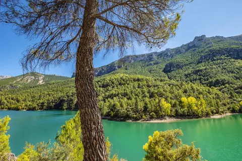
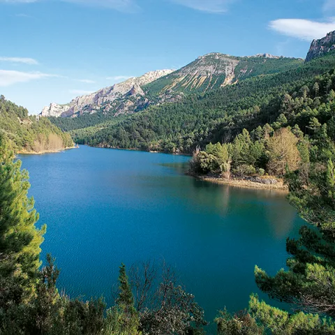
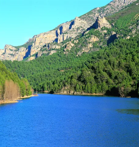
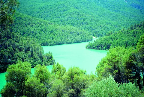
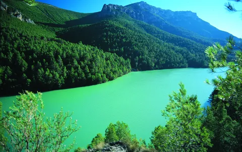
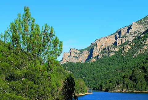
This small reservoir, attached between dense pine trees and high mountains, is a pleasant surprise for visitors because the water level is usually high and actually looks like a narrow lake. The water enters from the Segura River, once it leaves La Toba, and continues from 4 to 5 kilometres to the dam. Depending on the amount of sunlight present, the water in the tank can acquire a variety of different aspects, from an intense blue to an emerald green, which only adds to the mysteries that are already hidden under its surface.

Ubicación
Latitud
37.772886
Longitud
-3.788329
Ubicación en el mapa
POINT (-3.788329 37.772886)
Imágenes carrusel
imagen
Image
Cazorla%20anchuricas%202.jpg
Imagen principal
Desactivado
imagen
Image
Cazorla%20parque%20natural.jpg
Imagen principal
Desactivado
imagen
Image
anchuricas.png
Imagen principal
Desactivado
imagen
Image
26221616Master.jpg
Imagen principal
Desactivado
imagen
Image
Natu079.jpg
Imagen principal
Desactivado
imagen
Image
Natu080.jpg
Imagen principal
Desactivado
imagen
Image
Natu092.jpg
Imagen principal
Desactivado
imagen
Image
Natu057.jpg
Imagen principal
Desactivado
imagen
Image
Natu112.jpg
Imagen principal
Desactivado
imagen
Image
Natu380.jpg
Imagen principal
Desactivado
imagen
Image
Natu127.jpg
Imagen principal
Desactivado
imagen
Image
Natu230.jpg
Imagen principal
Desactivado
imagen
Image
Natu252.jpg
Imagen principal
Desactivado
imagen
Image
Natu253.jpg
Imagen principal
Desactivado
imagen
Image
Natu269.jpg
Imagen principal
Desactivado
Imágenes cabecera
imagen
Image
Cazorla%20anchuricas%201.jpg
Imagen principal
Activado
Loading map
Preparing points of interest and routes...

Aguas Negras Reservoir and Valdeazores Lagoon

Submitted by brandcode_deweloper on
Id
912573
Descripción
Descripción larga

By coming down from Collado Bermejo you will first find the Lagoon of Valdeazores, a natural stagnation of the stream of the same name that has been repressed with a wall at its bottom. The lagoon is an intense turquoise blue, surrounded by nozzles, strawberries, complaints and maples.

About 800 meters later you will find the reservoir of Aguas Negras, another paradoxical place where a dam was built years ago for the hydroelectric use of the Borosa River.

Crossing the dam and walking a few hundred meters you can reach the birth of Aguas Negras - or the birth of Boros- an emergency that helped by the Arroyo del Inferno gives rise to some of the most important tributaries of Guadalquivir in its high stretch.

We suggest:

  • From the Interpretation Centre of the Borosa River (next to the farm), a well-known route to the reservoirs, passing through the Cerrada de Elias and the leap of the Organs. If you have time, give a day to this spectacular route.
  • Visit the San Pedro Navy by the way we had brought to the hill of Fuente Bermejo.

In Cazorla take the Sierra road (A-319) until the crossing known as the Empalme del Valle. Turn right on the JF-7092 road and after passing the bridge over the Guadalquivir River (4 km from the Empalme) follow the left track (JF-7091). We go through the Nava del Espino, the Nava de San Pedro, the Nava Ciazo and follow in the direction of the Campos, but before we reach them, on the Collado de la Fuente Bermejo a road to the left takes us to the lagoons.

Breve descripción

The natural wealth and beauty of these two sites have made them visited by an infinite number of hikers in recent decades; but this pressure has not prevented the lagoons from remaining unique and beautiful. You are in one of the areas of maximum protection of the Park, an extremely delicate ecosystem that has favored this explosion of biodiversity: real anades, seals and petirrodes find an ideal shelter in these "ponds" and in the vegetation surrounding them.

Ubicación
Nombre
Embalse Aguas Negras
Latitud
37.912893
Longitud
-3.003887
Municipio
Ubicación en el mapa
POINT (-3.003887 37.912893)
Tipos de punto de interés
Imágenes carrusel
imagen
Image
lagunas-de-aguas-negras-cazorla-2-jpg
Imagen principal
Desactivado
imagen
Image
lagunas-de-aguas-negras-cazorla-1-jpg
Imagen principal
Desactivado
Imágenes cabecera
imagen
Image
lagunas-de-aguas-negras-cazorla-3-jpg
Imagen principal
Activado
Loading map
Preparing points of interest and routes...