Saltar al contenido principal

La Hueta

Submitted by brandcode_deweloper on
Id
659691
Descripción
Descripción larga

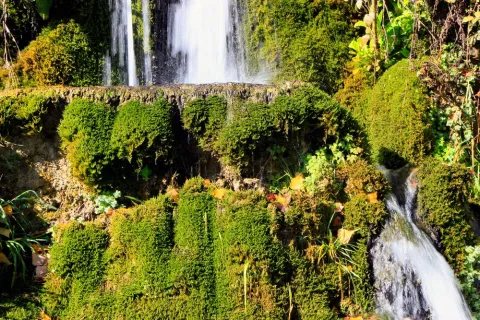
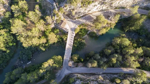
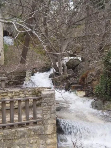
In the vicinity of the Hueta there are waterfalls and a lagoon that we suggest you discover. Very close to the Hueta there are other villages such as Puente Honda and you can even approach the ruins of the castle of the same name.

Breve descripción

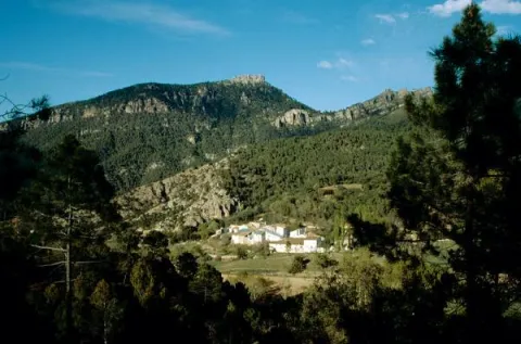
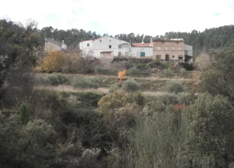
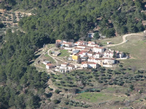
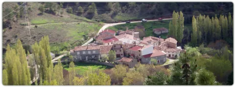
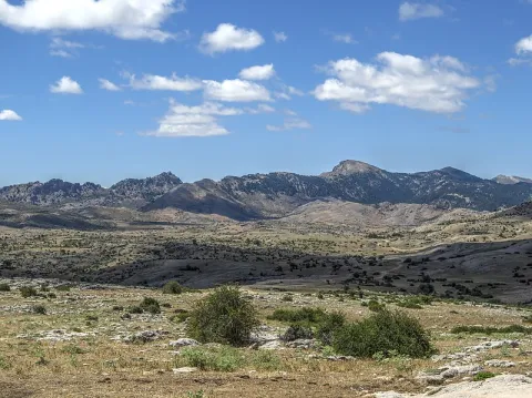
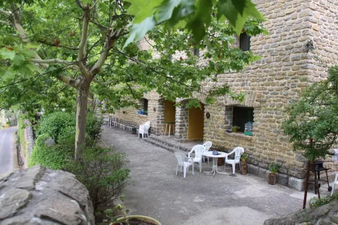
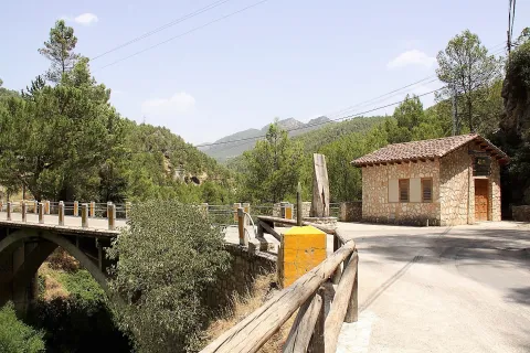
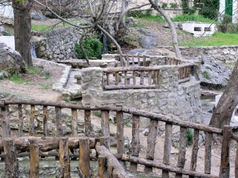
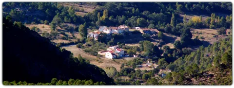
After going down a very sinuous road we reach a small valley in which La Hueta is located, which is divided into two neighborhoods. In the centre of the village you will find a laundry and a small garden with the image of the virgin of Fatima. From the set stands out the landscape that surrounds the village, highlighting at the bottom the hill of Bucentaina with the spectacular Piedra del Agujero, in a sea of pine trees sauté with complaints and oaks, which contrasts with the areas adapted to the cultivation next to the village.

Ubicación
Latitud
38.318022
Longitud
-2.661052
Distrito
Municipio
Ubicación en el mapa
POINT (-2.661052 38.318022)
Tipos de punto de interés
Imágenes carrusel
imagen
Image
599_img.png
Imagen principal
Desactivado
imagen
Image
599_image_1.jpg
Imagen principal
Desactivado
Imágenes cabecera
imagen
Image
aldeahueta.png
Imagen principal
Activado
Loading map
Preparing points of interest and routes...
Marcas de calidad

The Chaplaincy

Submitted by brandcode_deweloper on
Id
659644
Descripción
Descripción larga

A small hermitage, which at the time made the school, brings to our head memories of past times. Its position allows it to have a privileged view over the nearby mountains, which you can know more in depth if you do the circular path of the Yelmo Chico, the PR-A 150 that part of the Capellania.

Breve descripción

Jars, rosemary and pines accompany the road leading to the Capellania. Small gardens between the pine trees and some olive trees lead to the area where the village is located. It has an immense central meadow with several roads that lead to the different houses.

Ubicación
Latitud
37.913575
Longitud
-3.011814
Municipio
Ubicación en el mapa
POINT (-3.011814 37.913575)
Tipos de punto de interés
Imágenes carrusel
imagen
Image
6%20%281%29.jpg
Imagen principal
Desactivado
imagen
Image
b4b8d505ab9cd1db1bf562f9e4900a0b40f1d770.jpeg
Imagen principal
Desactivado
Imágenes cabecera
imagen
Image
Cazorla_%2814277828194%29.jpg
Imagen principal
Activado
Loading map
Preparing points of interest and routes...
Marcas de calidad

La Ballestera y Montalvo

Submitted by brandcode_deweloper on
Id
659617
Descripción
Descripción larga

The crossbow is made up of two cores of houses separated by an old laundry room that awaits the arrival of people in laundry clothes. During the winter it has only four neighbors. It surprises the cleaning of the village and the freshness of the water that runs next to it. If you close your eyes you can discover that the silence is broken only by the rooster singing, the cat's maullido or the water running.

Next to the Ballestera we find Montalvo with a completely different landscape. It dominates an elevation that is accessed by a road that zigzaguea to the village and offers us impressive views over the valley. You can see narrow streets, narrow walls, houses recovered from ruin, all surrounded by privileged views of the valley.

Breve descripción

A very narrow road surrounded by trees leads us to the Ballestera. You will pass through a bread oven and an old haystack, witnesses from another time, from the self-sufficient past of this village. The gardens are intermingled with the pines and some olive trees, the result of the need to get oil before.

Ubicación
Latitud
38.148202
Longitud
-2.693707
Ubicación en el mapa
POINT (-2.693707 38.148202)
Tipos de punto de interés
Imágenes carrusel
imagen
Image
596_img.png
Imagen principal
Desactivado
imagen
Image
IMG_7633.JPG
Imagen principal
Desactivado
Imágenes cabecera
imagen
Image
ballesteraMontalvo%20%281%29.jpg
Imagen principal
Activado
Loading map
Preparing points of interest and routes...
Marcas de calidad

The Stone Wall

Submitted by brandcode_deweloper on
Id
4971000
Descripción
Breve descripción

This is an old mud quarry next to the city centre. It has an artificial water lagoon very interesting for its ecological function.

Ubicación
Código Postal
23750
Latitud
37.973500
Longitud
-4.106650
Distrito
Municipio
Ubicación en el mapa
POINT (-4.10665 37.9735)
Tipos de punto de interés
Imágenes carrusel
imagen
Image
albarrada.png
Imagen principal
Desactivado
Imágenes cabecera
imagen
Image
Olivar.jpg
Imagen principal
Activado
Microsite al que pertenece
Loading map
Preparing points of interest and routes...

Karst of Pinar Negro

Submitted by brandcode_deweloper on
Id
876621
Descripción
Descripción larga

In the eastern part of the Sierra de Segura there is a spectacular karmic landscape, characterized by the presence of an exokarst of exceptional beauty with an immense field of dolins and uvalas, splashed with sims, of different scale. This karmic relief is controlled litologically and structurally, and conditioned by a high mountain climate, with level periods that accentuate the dissolution in karmic cavities. In this area, a carbonated altiplanicie that includes from the fields of Hernán Perea to those of the Black Pinar, stands out a series of simas, within dolinas and uvalas, among which stand out the one of the Campo del Espino, the one of the Hunzón, the one of the Cortijo, and mainly the very one of the Black Pinar.

The morphology of these cavities, with frequent balance chimneys, uses and some subhorizontal galleries, with clear structural control, reflects the importance of dissolution in the geomorphological evolution of them, with few examples of tectonic simas such. The most important of its development is that of the Black Pinar which is the sink of a large dolina of 105 x 130 m. In the area around the mouth a small channel runs through which a water course temporarily circulates that penetrates the cavity as a ponor. It has a large mouth (8 x 2 m.) that communicates with a large initial well of 10 x 16 m that descends to 104 m., where a second well of 40 m is started; reaching the bottom of the main track of the sima. Fifteen meters above the second well is the side track of smaller dimensions, but it reaches more depth, reaching more than 100 m.

Source: Inventory of Georresources of Andalusia. Environmental Council. Junta de Andalusia.

Breve descripción

Karst of Black Pinar

Ubicación
Latitud
38.298857
Longitud
-2.651877
Distrito
Ubicación en el mapa
POINT (-2.651877 38.298857)
Tipos de punto de interés
Imágenes carrusel
imagen
Image
10379407Master.jpg
Imagen principal
Desactivado
Imágenes cabecera
imagen
Image
800px-Campos_de_Hern%C3%A1n_Perea_24J_01.jpg
Imagen principal
Activado
Loading map
Preparing points of interest and routes...

Confluence of Miller

Submitted by brandcode_deweloper on
Id
913153
Descripción
Descripción larga

Here was born in the 1950s a village with the same name: Miller's Boards. This core was created to house the personnel employed in the construction of Miller's hydraulic power plant. To supply water to this plant the reservoirs of the Anchuricas (Segura River) and the Old River (Zumeta River) were built. The water jumps are 185 and 195 meters high respectively.

A magnificent view of Las Juntas is from the place known as the Loma del Paerón. To get to this point we recommend you make the route "Loma del Paerón" which is identified as PR-A 108. From here a natural lookout is opened before you to contemplate the valleys of the Zumeta and Segura rivers, and the union of both.

In front of the Loma are the Cañás de la Muela, where there is a large colony of leonado vulture, as well as the Iberian village of the Peñón de los Almendros, the village of Góntar... You're in a magical area worth discovering.

We suggest...

  • If you get to Miller's Boards after you have made a good route, where you have known villages like Miller, the Coke's Calar or the Eguijones' Cave, you certainly need to get a good dip (only in summer, of course...).
  • To know and remember the history of the following pineers who, until the 1950s of the 20th century, carried wood through the rivers, helped with hooks and shooting beasts.
  • There is a great book for hiking in the area: Valleys of the Segura River and Zumeta. It describes with precision and deep knowledge a series of routes that you will certainly love.

It is reached through the road JF-7038 from the town of Santiago de la Espada after 22 km. From Segura de la Sierra we can also reach the road in the direction of Rio Madera - La Toba - Miller's Boards. This way the distance is 54 km. and a time of about 1 hour.

Breve descripción

With this suggestive name we know the union of two important rivers of the Sierra de Segura: the Zumeta and the Segura. Together they say goodbye to Jaén - this peaceful and beautiful parachute - to enter the province of Albacete. From the bridge it is easy to imagine the ancient "pineros" preparing the logs that arrived from the two rivers and that would take them, after a fabulous journey, to the Mediterranean, with no tool other than a double-pointed hazelnut stick hook.

Ubicación
Latitud
38.298857
Longitud
-2.651877
Distrito
Ubicación en el mapa
POINT (-2.651877 38.298857)
Tipos de punto de interés
Imágenes carrusel
imagen
Image
19250548_143367852884610_5379292057515744177_o.jpg
Imagen principal
Desactivado
imagen
Image
17%20Las%20Juntas%20de%20Miller.jpg
Imagen principal
Desactivado
imagen
Image
6%20Juntas%20de%20Miller.JPG
Imagen principal
Desactivado
Imágenes cabecera
imagen
Image
43310356724_616217becc_b.jpg
Imagen principal
Activado
Loading map
Preparing points of interest and routes...

Hútar

Submitted by brandcode_deweloper on
Id
5848201
Descripción
Breve descripción

Water spring located in the municipal term of Albanchez de Magina, just where the Hútar stream is born. It is a traditional area of meringeros, with barbecues, swimming pool and games for children among other facilities..

Ubicación
Latitud
37.792170
Longitud
-3.466120
Distrito
Ubicación en el mapa
POINT (-3.46612 37.79217)
Tipos de punto de interés
Imágenes carrusel
imagen
Image
hutar.jpeg
Imagen principal
Desactivado
Imágenes cabecera
imagen
Image
Hutar.jpg
Imagen principal
Activado
Microsite al que pertenece
Loading map
Preparing points of interest and routes...

Cora Botanical Garden

Submitted by brandcode_deweloper on
Id
5713992
Descripción
Descripción larga

Since 2013 the Association of the Cultural Garden of the Cora, has had the institutional recognition and the transfer of the land by unanimous agreement of all the political groups of the City of Jódar.

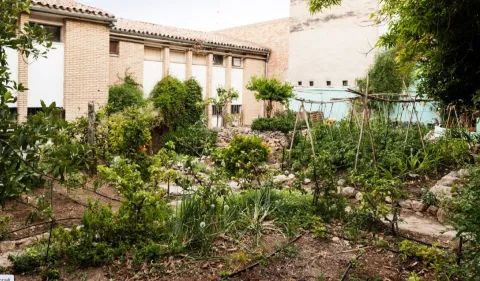
Everything in the Garden of Cora has a why, a story that goes unnoticed in the eyes of the visitor. It is necessary to decipher the meaning of each component or inhabitant of this space in order to understand the true value of what the walls of this old school, which despite not being occupied by children's laughter and games, remain synonymous with life and the future.

Thanks to the work of the members of the Echo Cultural Association of the Garden of Cora, here is a real laboratory activity; the recovery and conservation of local seeds - or other sources - at risk of extinction as well as the cultivation of specimens from other areas of the planet that are considered especially interesting based on the climatic conditions of the area.

Breve descripción

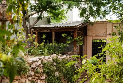
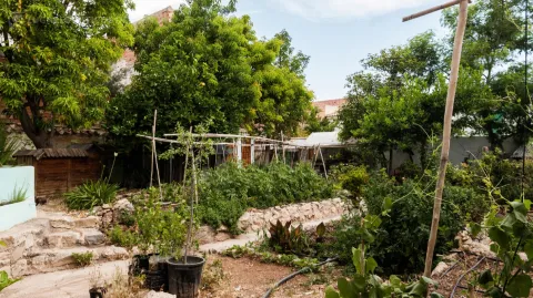
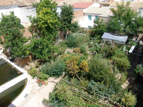
Located in the municipality of Jódar, in an old school that was occupied in the early 1990s, the Garden of Cora is a reality built thanks to the solidarity and selfless work of the people who are members of the association that manages it.
In its banks it houses a complex amalgam of promising species and plant varieties of high agroecological value, extremely unique and many of them almost unknown or at risk of disappearance, a fact that has attracted visits by experts and scholars from countless points on the planet. To date, the garden maintains a quota of about 400 different varieties - either in direct cultivation through its seed bank.

Telecomunicaciones
Sitio web
https://huertodelacora.es.tl/
Teléfono de contacto
622 345 626
Ubicación
Código Postal
23500
Latitud
37.838500
Longitud
-3.354360
Dirección
C/ Sevilla, 29
Distrito
Municipio
Ubicación en el mapa
POINT (-3.35436 37.8385)
Tipos de punto de interés
Imágenes carrusel
imagen
Image
7.jpg
Imagen principal
Desactivado
imagen
Image
6.jpg
Imagen principal
Desactivado
imagen
Image
5.jpg
Imagen principal
Desactivado
Imágenes cabecera
imagen
Image
8.jpg
Imagen principal
Activado
Microsite al que pertenece
Loading map
Preparing points of interest and routes...

Orchard of the Sordo o Huerta de San Lázaro

Submitted by brandcode_deweloper on
Id
6616170
Descripción
Descripción larga

That historic day will play an important role, as the heat attached to the scarcity of the liquid element for the French troops would be a key factor in defeating the Galo army, which in the last moments of the struggle would despair to reach the desired place where to satisfy the unbearable thirst. The popular tradition tells us that many of these soldiers will be thrown into the river of the San Lazaro Garden, the only place near with water, with the following phrase "To die here and resurrect in Paris."

Breve descripción

The Orerta de San Lazaro, or commonly known as the Orerta del Sordo, is a prominent symbol of the battle of 1808, where both armies converge during the Battle of Bailen of 1808. Declared as Good of Cultural Interest with a category of "Historic Site," it retains within it the old line that acted as a dividing line between the French and Spanish army during the battle.

Ubicación
Latitud
38.092970
Longitud
-3.786950
Distrito
Municipio
Ubicación en el mapa
POINT (-3.78695 38.09297)
Tipos de punto de interés
Imágenes carrusel
imagen
Image
unnamed%20%281%29.jpg
Imagen principal
Desactivado
Imágenes cabecera
imagen
Image
huerta-san-lazaro-scaled-jpg
Imagen principal
Activado
Microsite al que pertenece
Loading map
Preparing points of interest and routes...

Granites of La Puerta de Segura

Submitted by brandcode_deweloper on
Id
876209
Descripción
Descripción larga

Aflation of paleozoic granite surrounded by prebetic (triasic) materials with which it has a relationship of inconformity. Part of the village is built on the granite, which force a meandro in the Guadalimar River.

These are pink-coloured granules in afloor, in which large quartz and feldspar crystals are distinguished, in general unmeteorized. They are part of a recently exhumed paleorelieve after the erosion of the triastic clays and herring that cover them regionally. This is the granitic outcrop of the Central Iberian Zone of the southernmost Iberian Massif and further into the Betic Externs.

Source: Inventory of Georresources of Andalusia. Environmental Council. Junta de Andalusia.
Breve descripción

Granites of The Safe Gate

Ubicación
Latitud
38.079566
Longitud
-4.164839
Distrito
Municipio
Ubicación en el mapa
POINT (-4.164839 38.079566)
Tipos de punto de interés
Imágenes carrusel
imagen
Image
puerta-segura%20%281%29.jpg
Imagen principal
Desactivado
Imágenes cabecera
imagen
Image
la_puerta_segura_1.jpg
Imagen principal
Activado
Loading map
Preparing points of interest and routes...