Saltar al contenido principal
Image
patrimonio de la humanidad

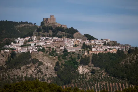
Shaded Hillside of Cabeza Gorda

Submitted by brandcode_deweloper on
Id
660013
Descripción
Descripción larga

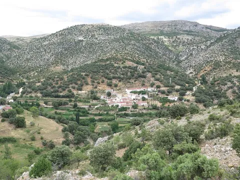
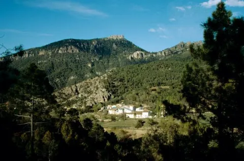
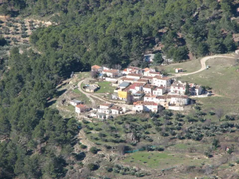
Traditional constructions have only been modified, although the most rewarding is the view that you can enjoy from the village that really constitutes a natural balcony open to an overwhelming landscape in which stands out on the whole Calar del Cobo with the Puntal of the Mass.

If you like them, you can't stop visiting the Umbria, as it's a very good area for the collection of these mushrooms. In addition, a delicious unmarked road leads to the nearby village of Cabeza Gorda, located on the opposite side of a mountain, which is naturally called Morro de Cabeza Gorda.

Breve descripción

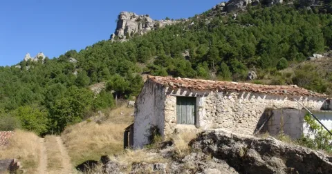
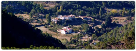
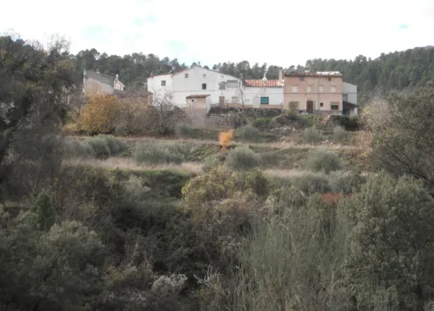
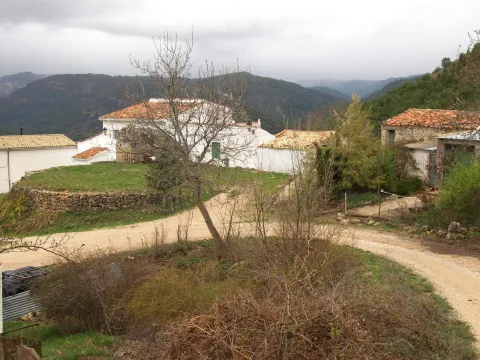
Despite being called the Umbria de Cabeza Gorda we are in front of a village located on a solana, with vegetation typical of the Mediterranean forest. You can see an isolated house around an explanade belonging to the ancient era, next to which there are some cherry trees and a fountain that welcome us.
Ubicación
Latitud
38.183050
Longitud
-2.626130
Distrito
Ubicación en el mapa
POINT (-2.62613 38.18305)
Tipos de punto de interés
Imágenes carrusel
imagen
Image
1137903Master.jpg
Imagen principal
Desactivado
imagen
Image
unnamed%20%281%29.png
Imagen principal
Desactivado
Imágenes cabecera
imagen
Image
8.jpg
Imagen principal
Activado
Loading map
Preparing points of interest and routes...
Marcas de calidad

Square de Santa María

Submitted by brandcode_deweloper on
Id
918485
Descripción
Descripción larga

The Church of Santa Maria was the most important monument of the advance of Cazorla. As a Renaissance, his inspiration is attributed to Andrew of Vandelvira or one of his disciples. It is built on the Cerezuelo River, taking advantage of the vault that covers the river and crosses the entire Plaza.

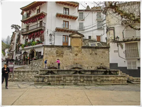
It is not the only unique building we find there: the House of the Clérigos, the Thematic Center of Threatened Species, the old Conistorial Houses (in an alley above the square) or the Fountain of the Chain (built in 1605) are some of the many visits we can make here.

In the square we also find nice restaurants that offer a great sample of local cuisine. To enjoy these dishes in the quiet dusk is one more reason to often go to this suggestive square.

We suggest:

  • Visit the ruins of Santa Maria, know its history and its curious construction. You can order information from the tourist office (953 71 01 02).
  • Up by the river Cerezuelo, passing the ruins of Santa María in the direction of the castle of La Yedra, and walking along one of the small routes that begin in this area. An information panel will help you to better know this area of the city.

In Cazorla, we leave the Plaza de la Constitución, in the center of the village. From here follow Doctor Muñoz Street to La Corredera Square. At the end of this, we turn right and immediately left, following the signs to the Castle of La Yedra. After passing by the balcony of Zabaleta and crossing the street José Salcedo Cano - a narrow and steep street with numerous pots in its balconies - we reached the Plaza de Santa María.

Breve descripción

Reaching the Old Square or Santa Maria Square through the old town of Cazorla is a surprise for the walker. The open space with the high slopes of the Peña de los Halcones, the Gilillo peak or the castle of La Yedra make it difficult for you to see what you have at your height. But at your height there is a beautiful square full of history and charm, where the ruins of the Church of Santa Maria demand the attention of the many travelers who come to this place.

Ubicación
Latitud
37.912893
Longitud
-3.003887
Municipio
Ubicación en el mapa
POINT (-3.003887 37.912893)
Tipos de punto de interés
Imágenes carrusel
imagen
Image
6%20%282%29.jpg
Imagen principal
Desactivado
Imágenes cabecera
imagen
Image
7%20%281%29%20%281%29.jpg
Imagen principal
Activado
Loading map
Preparing points of interest and routes...
Marcas de calidad

Moralejos

Submitted by brandcode_deweloper on
Id
919022
Descripción
Descripción larga

Lacquered walls and old wooden windows resist the passage of time miraculously. The gardens, which remain active, are arranged next to the houses alternating with some meadows. On the other side of the Trujala River is the Mount Navalhora and to the far away we see the unmistakable silhouette of the Navalperal.

Through the path PR-A 198 you will enjoy the landscape and you can approach Segura la Vieja, the settlement prior to the current Segura de la Sierra, which has an impressive view of the area.

Breve descripción

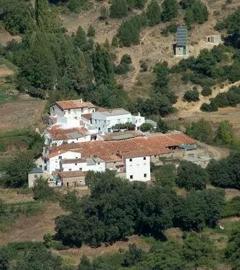
A serpenteous road leads us to the bottom of the valley in which the village of Moralejos is located, consisting of two groups of houses. A spectacular house of stone view welcomes us.

Ubicación
Latitud
38.302980
Longitud
-2.624380
Distrito
Ubicación en el mapa
POINT (-2.62438 38.30298)
Tipos de punto de interés
Imágenes carrusel
imagen
Image
moralejos.jpeg
Imagen principal
Desactivado
Imágenes cabecera
imagen
Image
00007371.jpg
Imagen principal
Activado
Loading map
Preparing points of interest and routes...
Marcas de calidad

Monument to Jorge Manrique

Submitted by brandcode_deweloper on
Id
657289
Descripción
Descripción larga

These lines correspond to the Treaty of the Mountain, studied by the Duke of Almazan, a document that some researchers attribute to Jorge Manrique. To talk about the 15th century in the Sierra de Segura is to talk about the Manrique family and the border period. A situation in which attacks and responses by Christians and Muslims were frequent. This danger and the border situation can only be seen by entering Segura de la Sierra: remains of walls, towers, entrance doors and on top of the hill, the watchful castle.

The Visits Books of the Order of Santiago described in the late 15th century the castle of Segura de la Sierra as a military compound with weapons to face a siege or, if necessary, to organize a village to attack the enemy. We cannot forget that in 1434 Rodrigo Manrique organized a village to conquer Huécar in the Altiplano granadino.

In Segura de la Sierra, taking advantage of this privileged position and under the security offered by its walls is where Jorge Manrique was raised under the care of his mother, Mrs. Mencía de Figueroa, in the house that still today is preserved five hundred years later.

Breve descripción

A candle on an oak table, a tintero with a pen and a half-write piece of paper. A figure draws attention to the rest of the room dedicated to the Manrique family on the second floor of the tower of tribute in the castle of Segura. Jorge Manrique is a character closely linked to Segura de la Sierra. If we were to imagine the poet in front of the paper, we might think that the text might start like this: "remind me to be very noble, Mr. Brother, having once said, in they are closer to mockery, you will see if you wanted me to write something about the work of the Montaria."

Ubicación
Latitud
38.298857
Longitud
-2.651877
Distrito
Ubicación en el mapa
POINT (-2.651877 38.298857)
Tipos de punto de interés
Imágenes carrusel
imagen
Image
6%20%283%29.jpg
Imagen principal
Desactivado
imagen
Image
10633135523_4ee3bea4f5_b.jpg
Imagen principal
Desactivado
imagen
Image
Segura_de_la_Sierra_PM_091668_E.jpg
Imagen principal
Desactivado
Loading map
Preparing points of interest and routes...
Marcas de calidad

Monastery of Montesión

Submitted by brandcode_deweloper on
Id
918965
Descripción
Descripción larga

This is evident in the lack of materials and in the lack of furniture. Only the chapel with a Latin cross floor and a dome in which some frescoes are still preserved stand out.

The difficulties of the 17th century may have motivated the foundation of this monastery especially at a time when bad crops, hunger and bad weather caused the emergence of epidemics of the feared plague. The order of San Antonio Abad was dedicated to the healing of the sick and the fear of contagion caused these buildings to be far from the populations. Along with the plague, the economic crisis, the rise in prices, wars and in general the hardships led to an increase in the clergy and religious foundations in a context in which the Monarchy offered a contradictory vision that oscillated from splendor and misery or boom and decline.

Breve descripción

Soledad and remoteness are the adjectives that come to mind when we are next to the Monastery, in Cazorla. Every year, on the last Sunday of September a rosemary makes Montesión come back to life, as during the year there was only one person in it, the danger of ruin in the building being constant. The visitor can appreciate different stages in its construction although its foundation dates back to 1625. The monasteries under the advocation of St. Paul and St. Anthony Abad highlighted for their poverty and austerity as you can see if you approach Montession.

Ubicación
Latitud
37.912893
Longitud
-3.003887
Municipio
Ubicación en el mapa
POINT (-3.003887 37.912893)
Tipos de punto de interés
Imágenes carrusel
imagen
Image
maxresdefault.jpg
Imagen principal
Desactivado
imagen
Image
857187Master.jpg
Imagen principal
Desactivado
Imágenes cabecera
imagen
Image
2%20%283%29%20%281%29.jpg
Imagen principal
Activado
Loading map
Preparing points of interest and routes...
Marcas de calidad

Marchena

Submitted by brandcode_deweloper on
Id
918937
Descripción
Descripción larga

A spectacular rise in which we gain height in a dizzy way, elevation curves and great precipities that make them as natural glances: this is what you can find in Marchena. You can't miss the houses attached to the rock known as the Mound right in the village of the same name on the way to Marchena. We find the olive tree, fruit trees and orchards next to oak and pine trees.

In Marchena you can make three small paths PR-A 107 known as "Arab Alquerías," the PR-A 101 that goes from the Picachos to the Tutubiero Age and the PR-A 102 known as the Mirabete road.

Breve descripción

Marchena sits on a hillside next to a small valley. Streets, stairs, up and down. Rinses surrounded by silence and tranquility only broken by the sound of water. It is surprising the number of orchards, whose survival is explained by the remoteness from trading populations. Recovecos, windows and doors for statures of another time, calmed and dazzling alleys that contrast with the green of the forest surrounding the village.

Ubicación
Latitud
38.188620
Longitud
-2.498080
Ubicación en el mapa
POINT (-2.49808 38.18862)
Tipos de punto de interés
Imágenes carrusel
imagen
Image
fuente_1_7736.jpg
Imagen principal
Desactivado
Imágenes cabecera
imagen
Image
800px-Marchena%2C_Ja%C3%A9n_24J_01.jpg
Imagen principal
Activado
Loading map
Preparing points of interest and routes...
Marcas de calidad

La Hueta

Submitted by brandcode_deweloper on
Id
659691
Descripción
Descripción larga

In the vicinity of the Hueta there are waterfalls and a lagoon that we suggest you discover. Very close to the Hueta there are other villages such as Puente Honda and you can even approach the ruins of the castle of the same name.

Breve descripción

After going down a very sinuous road we reach a small valley in which La Hueta is located, which is divided into two neighborhoods. In the centre of the village you will find a laundry and a small garden with the image of the virgin of Fatima. From the set stands out the landscape that surrounds the village, highlighting at the bottom the hill of Bucentaina with the spectacular Piedra del Agujero, in a sea of pine trees sauté with complaints and oaks, which contrasts with the areas adapted to the cultivation next to the village.

Ubicación
Latitud
38.318022
Longitud
-2.661052
Distrito
Municipio
Ubicación en el mapa
POINT (-2.661052 38.318022)
Tipos de punto de interés
Imágenes carrusel
imagen
Image
599_img.png
Imagen principal
Desactivado
imagen
Image
599_image_1.jpg
Imagen principal
Desactivado
Imágenes cabecera
imagen
Image
aldeahueta.png
Imagen principal
Activado
Loading map
Preparing points of interest and routes...
Marcas de calidad

The Chaplaincy

Submitted by brandcode_deweloper on
Id
659644
Descripción
Descripción larga

A small hermitage, which at the time made the school, brings to our head memories of past times. Its position allows it to have a privileged view over the nearby mountains, which you can know more in depth if you do the circular path of the Yelmo Chico, the PR-A 150 that part of the Capellania.

Breve descripción

Jars, rosemary and pines accompany the road leading to the Capellania. Small gardens between the pine trees and some olive trees lead to the area where the village is located. It has an immense central meadow with several roads that lead to the different houses.

Ubicación
Latitud
37.913575
Longitud
-3.011814
Municipio
Ubicación en el mapa
POINT (-3.011814 37.913575)
Tipos de punto de interés
Imágenes carrusel
imagen
Image
6%20%281%29.jpg
Imagen principal
Desactivado
imagen
Image
b4b8d505ab9cd1db1bf562f9e4900a0b40f1d770.jpeg
Imagen principal
Desactivado
Imágenes cabecera
imagen
Image
Cazorla_%2814277828194%29.jpg
Imagen principal
Activado
Loading map
Preparing points of interest and routes...
Marcas de calidad

La Ballestera y Montalvo

Submitted by brandcode_deweloper on
Id
659617
Descripción
Descripción larga

The crossbow is made up of two cores of houses separated by an old laundry room that awaits the arrival of people in laundry clothes. During the winter it has only four neighbors. It surprises the cleaning of the village and the freshness of the water that runs next to it. If you close your eyes you can discover that the silence is broken only by the rooster singing, the cat's maullido or the water running.

Next to the Ballestera we find Montalvo with a completely different landscape. It dominates an elevation that is accessed by a road that zigzaguea to the village and offers us impressive views over the valley. You can see narrow streets, narrow walls, houses recovered from ruin, all surrounded by privileged views of the valley.

Breve descripción

A very narrow road surrounded by trees leads us to the Ballestera. You will pass through a bread oven and an old haystack, witnesses from another time, from the self-sufficient past of this village. The gardens are intermingled with the pines and some olive trees, the result of the need to get oil before.

Ubicación
Latitud
38.148202
Longitud
-2.693707
Ubicación en el mapa
POINT (-2.693707 38.148202)
Tipos de punto de interés
Imágenes carrusel
imagen
Image
596_img.png
Imagen principal
Desactivado
imagen
Image
IMG_7633.JPG
Imagen principal
Desactivado
Imágenes cabecera
imagen
Image
ballesteraMontalvo%20%281%29.jpg
Imagen principal
Activado
Loading map
Preparing points of interest and routes...
Marcas de calidad

Church of los Jesuitas

Submitted by brandcode_deweloper on
Id
918621
Descripción
Descripción larga

Thanks to this father's work, we know many things about the College of the Society of Jesus in Segura de la Sierra. The buildings that are preserved today in Segura de la Sierra are the result of one of its neighbours' efforts to make a religious foundation. His name was Cristóbal Rodríguez de Moya and, in the face of his wife's death, he understood that he would have a problem with his heritage of not marrying one of his three daughters. By choosing his daughters for religious life, he founded a College.

To observe the interior of the Church of the Jesuits is not to do so in the key of the history of art or to analyze the restoration that the building has suffered, it is to have a vision of society from the end of the 16th century to approach its fears and a religiosity that permeated all aspects of life, of fear of the devil or to die in sin. An approach to daily life in a small mountain community, with the poor of solemnity to which the Society of Jesus attended with its pastoral missions.

In short, it is about knowing one more episode of the history of the end of the 16th century in Segura, the plague of 1596, the famine of 1605, the charity, the fears and poverty of a large part of the population and the collective sadness of the death of Francisca de Avilés, the last daughter of Cristóbal Rodríguez de Moya. To mentally recite the passage of this woman's death puts the hairs at the top, with a mass attended by all the people and even the Franciscans of Santa María de la Peña, of Orcera, to give the last farewell to the foundress.

Breve descripción

Let's imagine for a moment an afternoon of 1606. A priest named Manuel de Arceo is finishing writing the last chapter of the history of the foundation of the College of Segura. He does not want to take the lead, nor to go into history, but only fulfils the orders he has received from Rome to record the Jesuits foundations and to prevent their process from falling into oblivion. A few days later, Father Arceo received a new assignment, to go to New Granada to take over the new Jesuit province.

Ubicación
Latitud
38.298550
Longitud
-2.652490
Distrito
Ubicación en el mapa
POINT (-2.65249 38.29855)
Imágenes carrusel
imagen
Image
segura-de-la-sierra-iglesia-2-jpg
Imagen principal
Desactivado
imagen
Image
jesuitas.jpg
Imagen principal
Desactivado
Imágenes cabecera
imagen
Image
Iglesia%20de%20los%20Jesuitas%20%28Segura%20de%20la%20Sierra%29-1%20%283%29.jpg
Imagen principal
Activado
Loading map
Preparing points of interest and routes...
Marcas de calidad