Saltar al contenido principal

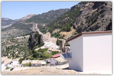
Segura de la Sierra Castle Interpretation Center

Submitted by brandcode_deweloper on
Id
2343598
Descripción
Descripción larga
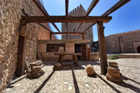
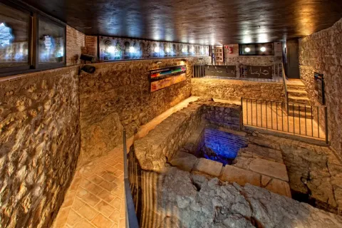
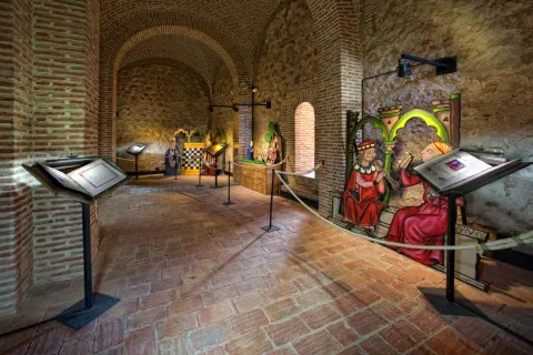
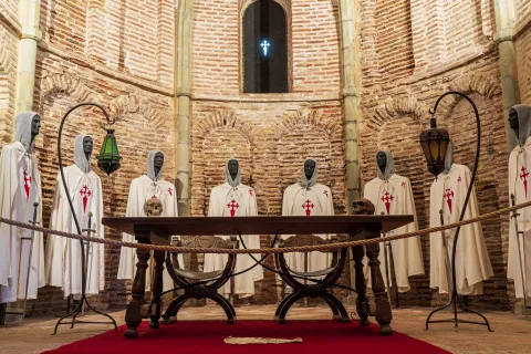
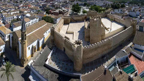
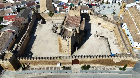
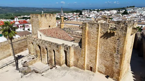
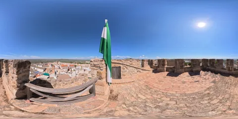
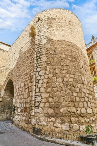
In the Islamic period the town was fortified and provided with a triple enclosure of walls. This fortification was accessed through four gates: Catena, which is the best preserved, Gontar, Mediodia or Orcera and the New Gate, which was rebuilt in the 16th century. It was declared a Picturesque Landscape and Historic-Artistic Site along with the town. Currently, it is home to an interpretation center called Segura de la Sierra. Border Territory in which you can delve into the Middle Ages, during which Segura de la Sierra was a relevant enclave. This interpretive space consists of several exhibition sets from the family environment of the warrior poet, ranging from sound elements that recreate the conversation that Jorge Manrique has with his father, Don Rodrigo, on the stage of the Coplas on the death of his father, as well as other interpretive speeches more linked to the author's poetic work. After visiting Jorge Manrique's interpretive space, it is possible to climb the battlements of the Torre del Homenaje and shudder with the spectacular views it offers: El Yelmo, with its more than 1,800 meters of altitude and symbol of the Sierra de Segura; Segura La Vieja (Iberian town), the Cerro de Góntar, the Peñalta viewpoint and so on countless landmarks that, together with a relaxed reading of Manriqueña poetry, will offer the visitor an emotion that will connect them forever with Segura de la Sierra.
Breve descripción
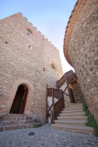
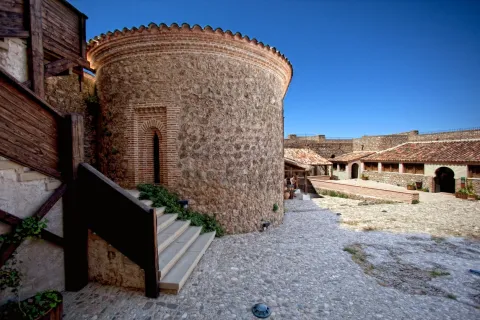
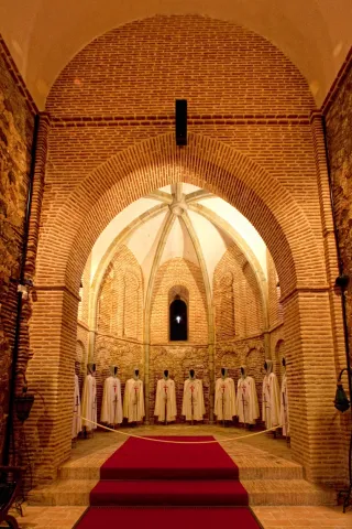
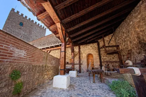
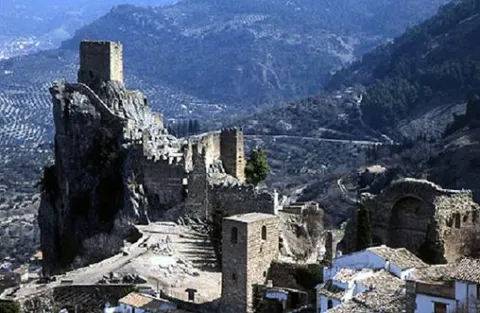
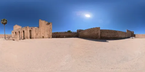
Of Muslim origin, its factory denotes an evident Christian remodeling, dating mostly to the second half of the 13th century. Inside we can find the Parade Ground, the Capilla de Santa Ana y la Torre del Homenaje with three floors. It was besieged during the French invasion and later restored.
Ubicación
Nombre
Castillo de Segura de la Sierra
Código Postal
23379
Latitud
38.299220
Longitud
-2.649790
Distrito
Ubicación en el mapa
POINT (-2.64979 38.29922)
Tipos de punto de interés
Imágenes carrusel
imagen
Image
IMG_4369.jpg
Imagen principal
Desactivado
imagen
Image
IMG_4372.jpg
Imagen principal
Desactivado
imagen
Image
IMG_4384.jpg
Imagen principal
Desactivado
imagen
Image
IMG_4387.jpg
Imagen principal
Desactivado
imagen
Image
IMG_4404.jpg
Imagen principal
Desactivado
imagen
Image
IMG_4420.jpg
Imagen principal
Desactivado
imagen
Image
IMG_4425.jpg
Imagen principal
Desactivado
Imágenes cabecera
imagen
Image
Segura%20de%20la%20Sierra18.jpg
Imagen principal
Activado
Horario
May 1 - Oct 31: Tuesday to Sunday 10:30 - 14:00 and 17:00 - 20:30. Nov 1 - Apr 30: Tuesday to Sunday 10:00 - 14:00 and 16:00 - 18:30.
Loading map
Preparing points of interest and routes...
Marcas de calidad

Interpretation Centre Castle of la Villa

Submitted by brandcode_deweloper on
Id
2343382
Descripción
Descripción larga

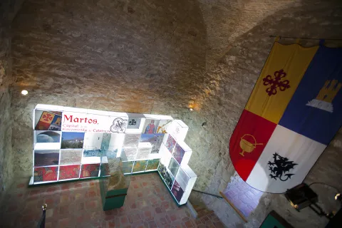
It has several rooms in which we can see the history of the town of Martos from its origins to the present, making special interest in the Calatrava era, as Martos was the capital of the commission.

On the terrace of the tower we will enjoy a view full of living history, where the peculiarity of its consolidated home with its medieval plot, its rock with the remains of the Alta Fortress and the oil culture with a consolidated landscape of centenary olive groves prevails.

Breve descripción

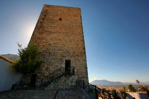
In the lower fortress of Martos is located the Interpretation Centre Castillo de la Villa, located in its Torre del Tribute.

Telecomunicaciones
Teléfono de contacto
953 703 050
Ubicación
Código Postal
23600
Latitud
37.723620
Longitud
-3.967240
Dirección
C/ Primero de Mayo, 34
Distrito
Municipio
Ubicación en el mapa
POINT (-3.96724 37.72362)
Tipos de punto de interés
Imágenes carrusel
imagen
Image
15%20%281%29.jpg
Imagen principal
Desactivado
imagen
Image
desarrollo-tenflowers_martos_img_6160-copia.jpg
Imagen principal
Desactivado
Imágenes cabecera
imagen
Image
desarrollo-tenflowers_martos_img_6215-copia%20%281%29.jpg
Imagen principal
Activado
Horario
Check the schedule.
Loading map
Preparing points of interest and routes...

Interpretation Centre Castle of La Iruela

Submitted by brandcode_deweloper on
Id
2343586
Descripción
Breve descripción

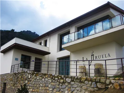
This centre is born of the need to have a space where the visitor can know and interpret the history of La Iruela, making a journey from its origins to the present and can enjoy in a didactic way and through technological means of the historical, heritage, cultural, natural and ethnic heritage of the place. It is located in the Historical Set composed of the Castle of La Iruela and the Church of Santo Domingo de Silos, monumental symbols of the town, declared an artistic Historical Set in 1985.

Telecomunicaciones
Teléfono de contacto
953 720 712 / 691 782 295
Ubicación
Código Postal
23476
Latitud
37.920900
Longitud
-2.990120
Dirección
Esperilla Alta, s/n
Municipio
Ubicación en el mapa
POINT (-2.99012 37.9209)
Tipos de punto de interés
Imágenes carrusel
imagen
Image
image_104333.jpeg
Imagen principal
Desactivado
imagen
Image
725_img.png
Imagen principal
Desactivado
Imágenes cabecera
imagen
Image
thb_g_1.jpg
Imagen principal
Activado
Horario
Wednesday to Sunday: 10: 30 - 13: 30 and 16: 00 - 18: 30 (October to April).
Loading map
Preparing points of interest and routes...
Marcas de calidad

Centro de Int. del Patrimonio Histórico y cultural del P.N. Despeñaperros

Submitted by brandcode_deweloper on
Id
5871311
Descripción
Descripción larga

Also close to the Iberian Sanctuary "Cueva de los Muñecos" to where you can access through a signposted path that begins at the doors of the Interpretation Center.
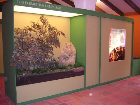
The Interpretation Centre has an exhibition area divided into 6 interpretative sets:

1. Elements of the landscape
2. Prehistory and Old Age
3. The Middle Ages. The Battle of the Navas de Tolosa
4. The Modern Age. New populations
5. The Contemporary Age
6. Audiovisual room. Dog-biting in time.

All these interpretative sets are made up of models, backlit information media, exhibition of real elements and replica in vitrines, ambiances and documentary projections.

Breve descripción

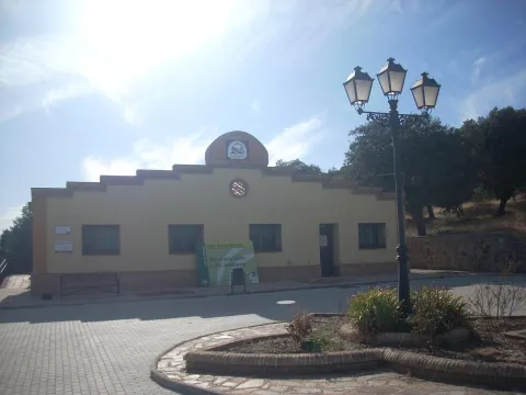
Located in a privileged place, in the "Collado de Los Jardines" before entering the Centre you can enjoy in the surroundings of an authentic forest of Quejigos of great ecological value.

Telecomunicaciones
Teléfono de contacto
953 664 307
Ubicación
Código Postal
23213
Latitud
38.410020
Longitud
-3.561010
Distrito
Municipio
Ubicación en el mapa
POINT (-3.56101 38.41002)
Tipos de punto de interés
Imágenes carrusel
imagen
Image
26010179Master.jpg
Imagen principal
Desactivado
Imágenes cabecera
imagen
Image
DSCN5729.jpg
Imagen principal
Activado
Loading map
Preparing points of interest and routes...

Fresnedilla Astronomical Outreach Center

Submitted by brandcode_deweloper on
Id
886028
Descripción
Descripción larga

Spaces and equipment

The design and forecasting of the space of the observatory is based on the different services it offers to the visitor, based on a modest and functional conception. It has three different spaces:

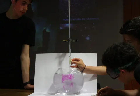
Multi-use room. Exhibition of audiovisual of own production with the aim of introducing visitors to the topics of most interest and scientific news. It offers us a space in which to conduct courses, congresses, talks and conferences, development of workshops, exhibitions, introduction to the use of planispheres, of web tools in the world of astronomy and astrophysics.

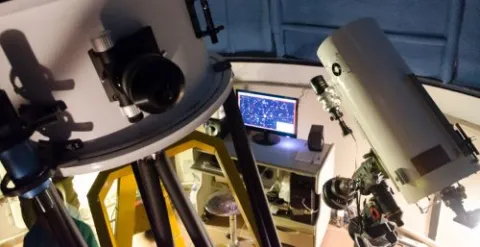
Main Observatory. It is the heart of the center, under a dome of 5 m, is the most pointed equipment in the field of astronomical observation, including the main telescope of 460 mm of fully computerized aperture and a 300 mm Dark-Kirkham of excellent optical quality dedicated exclusively to astronomical photography. The equipment is completed with high-sensitivity CCD cameras for capture of deep and planetary sky images, filters and wheel with computerized filters, self-guidance systems and an automated weather station that controls all systems autonomously...

This complete equipment allows us to introduce the visitor into the magic of observation under dome by doing live observations or through monitor by receiving on closed circuit the images of both the telescope and the video or the computer. In turn your remote control program will soon allow us to make use of the On-line installation. Its advanced equipment allows its use by research and teaching teams.

Solarium. Located in the open air on the terrace, it allows natural planetarium sessions with green laser pointer, observations with prismatic different calibre and telescopes of different design and function (some of them self-making).

The aim is to introduce the visitor to the various techniques and means of observation according to the object to be studied. For this we will use plateaus and stellar cards. We also have five secondary teams with instruments for initiation, advanced and assisted navigation.

Activities

The Fresnedilla Observatory offers the user high quality experiences, exclusive and programmed and supervised by professionals with extensive experience in teaching and dissemination.

Our entity has been planning a series of activities that have been consolidated over the years, in our annual plan of activities: annual outreach days, open-door days, training monitors and initiation courses, astrophotography courses, observation sessions, workshops, guided tours, lectures in educational centres and participation in cultural weeks in them, support for congresses, visits of professionals to our centres, exhibitions, training courses for dynamic and scientific dissemination...

The methodology that guides the staging of each proposal allows the manipulation, observation and research by the participants, making use of various teaching instruments and the latest technologies, both audiovisual and instrumentation. At the same time, classic channels are used, close to the visitor, from murals, work guides to Tales and theatrical. In short, we are committed to an active, varied, original and quality methodology.

The complete equipment, the natural environment in which it is located and the quality of the sky, makes this area a reference in our community, offering the visitor the opportunity to make observations and activities in an observatory with professional benefits, providing a new alternative offer of leisure and cultural to the visitor of the Natural Park and affecting the tourist development of the area with an attractive, quality and respectful activity.

Breve descripción

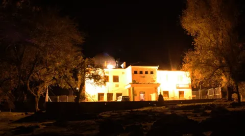
In 2009, the Astronomical Outreach Centre of Fresnedilla opened its doors. Developed in collaboration with the City Council of Villacarillo, the Tourism, Trade and Sport Council of the Junta de Andalucía and the collaboration of the Parque de las Ciencias Consortium of Granada, this centre arises from the need to develop specific activities of dissemination and astronomical research in a dark sky of excellent quality, with a stable and permanent infrastructure of easy access to the general public.

The Fresneilla Observatory is located in the heart of the most extensive Natural Park in South Europe, the P.N. de Cazorla, Segura and the Villas, a unique natural attraction, which attracts more than 200,000 visitors each year. In the surroundings of the observatory we can visit places with a special charm: Navazalto, cascade of Chorrogil, around Aguascebas, Peñacorba, which are incorporated into the activity that the observatory develops through guided didactic routes, night hiking and orientation techniques and observation sessions in emblematic areas.

Telecomunicaciones
Teléfono de contacto
659 473 549
Ubicación
Código Postal
23300
Latitud
38.061000
Longitud
-2.944330
Municipio
Ubicación en el mapa
POINT (-2.94433 38.061)
Tipos de punto de interés
Imágenes carrusel
imagen
Image
DSC6654_p-500x257.jpg
Imagen principal
Desactivado
imagen
Image
IMG_7437-1024x705.jpg
Imagen principal
Desactivado
Imágenes cabecera
imagen
Image
IMG_0916-1024x569.jpg
Imagen principal
Activado
Loading map
Preparing points of interest and routes...

Lopera Castle

Submitted by brandcode_deweloper on
Id
2292974
Descripción
Descripción larga
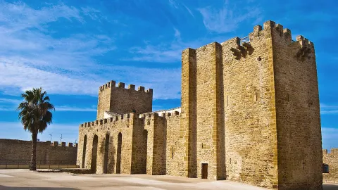
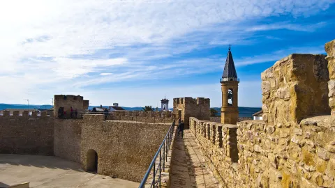
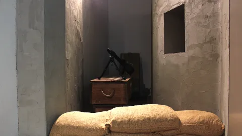
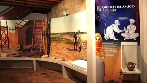
The original construction was a fortified rural church, built in masonry repointed with lime mortar, with an irregular basilica plan and a quadrangular head offset to the left, a characteristic that defines those known as “Crooked” head Churches. It was divided into three naves, the central one being the widest, by arches on pillars and columns, lacking a transept, whose capitals have late Romanesque decoration. On the outside, on its northern side, during the archaeological excavations, part of a “U”-shaped trench excavated in the geological base was located, with an approximate depth of 2 m, and a dry-joined masonry wall that rests directly on the pit, possibly an antemural that delimited a narrow list. The excavations also revealed the existence of numerous burials both inside and outside the temple, most of them in the head and in its surroundings. The bodies rested in trapezoidal or anthropomorphic graves excavated in the rock, some with marked heads, and covered by earthen mounds or, in some cases, stone slabs. A burial covered by part of a large ceramic container stood out. This first building was destroyed and burned by the Nasrid armies of Muhammad V, allies of King Pedro I, around 1368, during the conflicts between the Castilian king and his half-brother Enrique II of Trastámara. After its destruction, a new church was built that maintains its layout, although it incorporates modifications. Two towers are erected, that of San Miguel, at the foot of the church and that of Santa María, which will encompass the head, now with a semicircular shape inside. This new fortification corresponds to the external walled enclosure that is preserved today, with an irregular pentagonal layout and five solid corner towers, built in masonry. It was defended by a rampart or a barbican and a moat. In the parade ground, the new fortified church was rebuilt as a fortress: two large towers joined by two sections of walls that form a wide walkway with loopholes, supported by semicircular arches on buttresses. This building was functionally divided into two environments: the lower one for religious use and the upper one for military use. The worship space was divided into three naves, the central one being the widest. A large terrace was formed above the cult area, which would serve as a parade ground and give access to the defensive elements of the walls and tower of Santa María. At this time the burials will be concentrated in the exterior area, relegated to the head and surrounding areas, with the exception of two tombs that are located inside next to the large arch that gives access to the apse area, the most sacred space of this new church. Between the end of the 15th century and the first half of the 16th century, this fortified church was adapted into a castle-palace. The works consisted of the construction of two large bodies and a small porticoed patio with three carpanel arches with Renaissance capitals, which would serve as the articulating axis of the noble residence, around which various rooms are distributed. The apse area of ​​the church was transformed into an oratory by the Commander of Lopera D. Juan Pacheco in 1535, covered by a barrel vault decorated with Renaissance plasterwork and painted inscriptions, which was also accessed from the exterior patio through a new door made on the north façade, equipped with a portico on columns. On the outside of the building, archaeological excavations brought to light a garden space, with a large patio, with a fountain that was supplied with water extracted by a water wheel and an orchard area, which confirm its use as a residential home. In the 20th century the castle functioned as a residence and winery, a phase from which numerous buried wine cellars are preserved to the west of the San Miguel tower, which caused the destruction of the archaeological levels. In the area around Lopera, sites from the Bronze and Iron Age have been found; settlements of the Lower Roman Empire with continued occupation until the Visigothic period; as well as rural settlements from the Emiral period, which used the Cerro de San Cristóbal as a common place of refuge, including the Lopera farm itself, which we could identify with the population of Bayyara cited in Islamic sources. The archaeological investigations carried out to date in its historic center confirm the existence of this farm that exploited the agricultural resources of the area in the 12th and 13th centuries. After the conquest, Lopera was handed over, in 1240–1241, to the Military Order of Calatrava, creating the Commandery of Lopera, which would reinforce its primitive defenses between the 14th and 15th centuries. The Order managed to form an extensive lordship in the extreme southwest of the current province of Jaén, which included large areas of the Campiña and a good part of the foothills of the Sierras Sur, bordering the Kingdom of Granada, which led it to promote extensive fortification work in its possessions. This network of fortifications played an important border role in the territorial expansion undertaken by the Castilian armies during the 13th and 14th centuries, regaining prominence in the second half of the 15th century, within the framework of the noble struggles during the reign of Henry IV. In the confrontation between the supporters of the Castilian monarch against the followers of a noble coalition headed by D. Pedro Pacheco, Marquis of Villena and D. Pedro Girón, Master of Calatrava, the members of the Order actively participating in the contest. During the conflict, the Lopera fortress was attacked and looted in 1466 by the allies of the Constable of Castile, led by the Mayor of Andújar, Pedro de Escavias. It was declared an independent town by Philip II in 1595. In the 19th century, with the confiscation, the assets of the church were acquired for the most part by bourgeoisie, the ownership of the castle passing into the hands of Alonso de Valenzuela, deputy and mayor of Lopera, in 1856. During the Spanish Civil War, Lopera once again became a prominent scene of a war, since the dividing line between both national and republican sides, popularly known as the Andújar front, was located around the town. Numerous vestiges have remained of this conflict in the area around Lopera: machine gun nests, Republican trenches, an anti-tank fort, basements and caves used as anti-aircraft shelters in the same town. The most notable episode was the Battle of Lopera, fought between December 27 and 29, 1936, in which the rebellious armies conquered Lopera. Finally, in the 20th century the Calatrava fortress was used as a wine cellar, a new use that profoundly transformed the original structure of the defensive complex, conditioned as a temporary residence and wine cellar and introducing irreversible changes to the castle.
Breve descripción
The castillo de Lopera, which is currently made up of two enclosures, offers a configuration resulting from its complex historical evolution, starting from an original fortified church to becoming a castle-palace formed by two large towers joined by two sections of wall, located in the center of a walled enclosure with towers in the corners.  After the Castilian conquest, Lopera was handed over, in 1240–1241, to the Military Order of Calatrava, creating the Commandery of Lopera, which would reinforce its primitive defenses between the 14th and 15th centuries. It played an important role as a border fortress in the advance of the Castilian armies through the Giennese countryside during the 13th and 14th centuries, regaining prominence in the second half of the 15th century, within the framework of the noble struggles that were settled during the reign of Henry IV. It was attacked and looted in 1466 by the allies of the Constable of Castile, led by the Mayor of Andújar, Pedro de Escavias. Finally, in 1595 it was declared an independent town by the monarch Felipe II.

Ubicación
Código Postal
23780
Latitud
37.943710
Longitud
-4.213650
Dirección
C/ Castillo, s/n
Distrito
Municipio
Ubicación en el mapa
POINT (-4.21365 37.94371)
Tipos de punto de interés
Imágenes carrusel
imagen
Image
VISTA%20A%C3%89REA.jpg
Imagen principal
Desactivado
imagen
Image
patio%20de%20armas.JPG
Imagen principal
Desactivado
imagen
Image
castillo de lopera
Imagen principal
Desactivado
imagen
Image
castillo lopera
Imagen principal
Desactivado
imagen
Image
castillo lopera
Imagen principal
Desactivado
Imagen principal
Desactivado
Imágenes cabecera
imagen
Image
CyB_Lopera_01
Imagen principal
Activado
imagen
Image
CyB_Lopera_02
Imagen principal
Desactivado
Horario
Tuesday to Friday: showings at 10:00 and 12:00. Saturdays and Sundays: passes at 10:00, 12:00 and 17:00 (winter) or 9:00, 11:00 and 13:00 (summer).
Experiencia 360
Image
CyB_Lopera
Image
CyB_Lopera
Loading map
Preparing points of interest and routes...
Marcas de calidad

Andrés Segovia House-Museum - Palace of the Orozco

Submitted by brandcode_deweloper on
Id
2279165
Descripción
Descripción larga

Basement.In this place a crypt has been built that received on 4 June 2002, the remains of Andrés Segovia, thus fulfilling his desire to rest in Linares, a city that saw him born.

Ground floor.In addition to the interior and exterior courtyards, the Music Room and the Hall of Acts, are also located on this ground floor the President's Office and a room for Direction and Offices.

First floor.It has rooms for the Library, Archive and Museum. In the latter are installed numerous furniture, essentials and various documentation related to the Segovia Master.


Breve descripción

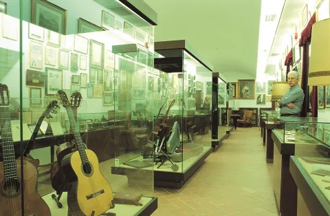
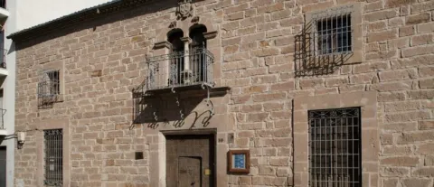
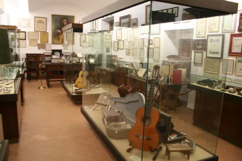
Located in the palace of the Orozco, in this monographic museum are installed numerous furniture, essentials and various documentation related to the life and work of Master Segovia. Guitars, personal objects, costumes, research by Doctor "Honoris Causa" of various universities, decorations, titles, appointments, awards, discography, books or photographs. In the crypt, the remains of the great guitarist rest.

Telecomunicaciones
Sitio web
www.fundacionsegovia.wixsite.com/museoandressegovia
Teléfono de contacto
953 650 936
Correo electrónico
turismo@aytolinares.es
Ubicación
Código Postal
23700
Latitud
38.092400
Longitud
-3.631940
Dirección
C/ Cánovas del Castillo Pontón, 59
Distrito
Municipio
Ubicación en el mapa
POINT (-3.63194 38.0924)
Tipos de punto de interés
Imágenes carrusel
imagen
Image
Arte66.jpg
Imagen principal
Desactivado
imagen
Image
2%20%281%29.jpg
Imagen principal
Desactivado
Imágenes cabecera
imagen
Image
Museo_andres_Segovia._jpg.jpg
Imagen principal
Activado
Horario
16 sept - 15 jun: tuesday, thursday and saturday mornings 10: 00 - 13: 30; tuesday and thursday evenings 16: 00 - 18: 30. 16 jun - 15 sept: tuesday, thursday and saturday mornings 10: 00 - 13: 30; afternoon closed.
Loading map
Preparing points of interest and routes...

Former Hospital of the Order of Calatrava House Museum

Submitted by brandcode_deweloper on
Id
2343706
Descripción
Breve descripción

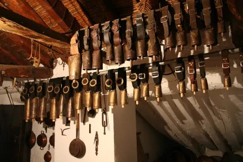
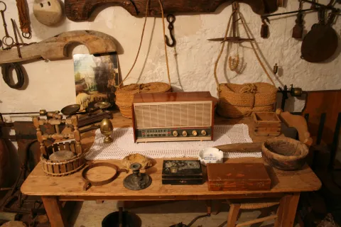
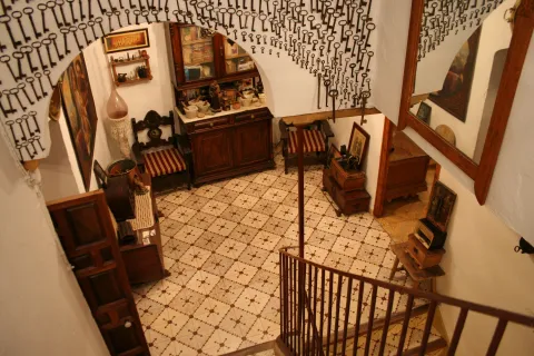
18th century building, rehabilitated and privately owned. It is a three-storey building, organized according to the architectural peculiarities of the time, within which you can see antiques concerning agriculture, ceramics, popular crafts, customs and everything related to the traditions of the Andalusian people.

Telecomunicaciones
Sitio web
www.casamuseo.com
Teléfono de contacto
953 260 629
Correo electrónico
visitas@casamuseo.com
Ubicación
Código Postal
23670
Latitud
37.528420
Longitud
-3.945310
Dirección
C/ Josefa Mena, 18
Distrito
Ubicación en el mapa
POINT (-3.94531 37.52842)
Tipos de punto de interés
Imágenes carrusel
imagen
Image
043.jpg
Imagen principal
Desactivado
imagen
Image
046%20%281%29.jpg
Imagen principal
Desactivado
Imágenes cabecera
imagen
Image
034.jpg
Imagen principal
Activado
Horario
Concert visit.
Loading map
Preparing points of interest and routes...

Arab Baths

Submitted by brandcode_deweloper on
Id
2275715
Descripción
Descripción larga
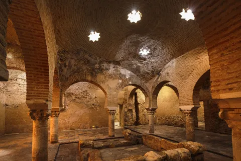
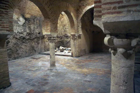
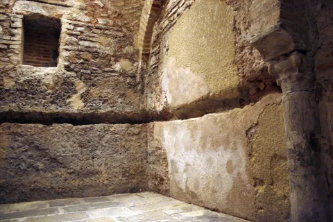
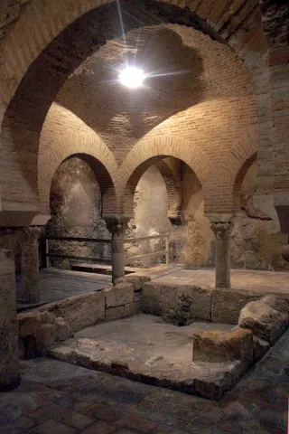
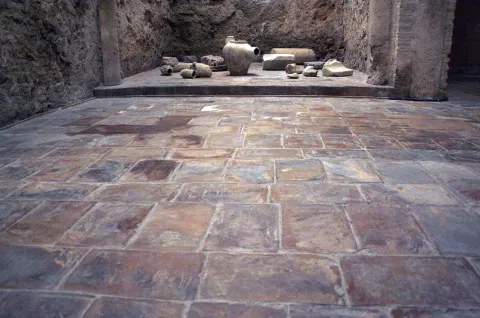
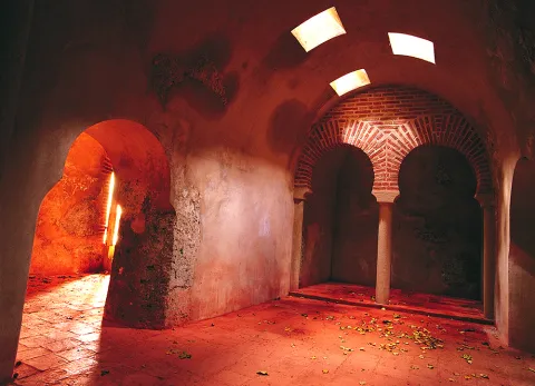
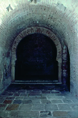
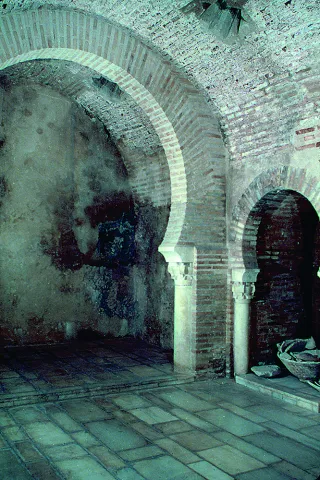
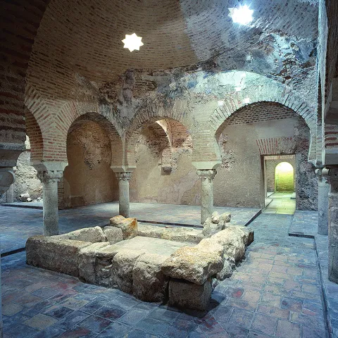
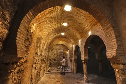
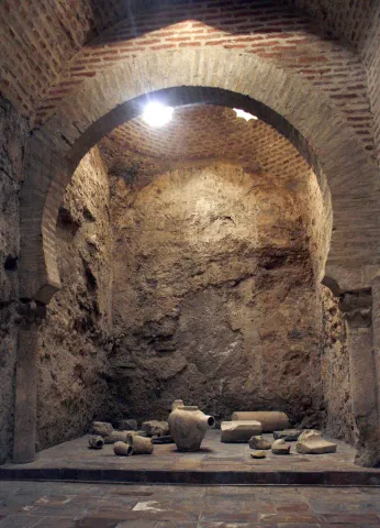
After the conquest of the city in 1246 by Ferdinand III the Saint, its use continued during the first years of Christian rule. It will be between the 14th and 15th centuries when its function as a bath disappears when the Christians establish tanneries in its rooms. Proof of this are the remains of its facilities that are still preserved in the Temperate and Hot Rooms. At the end of the 16th century, Don Fernando de Torres y Portugal, Count of Villardompardo and Viceroy of Peru, built his Palace on the Baths, leaving part of them hidden between the foundations and basements, remaining this way during the 18th and 19th centuries. At the beginning of the 20th century, the Palace became part of the real estate assets of the Provincial Council of Jaén, an institution that, between 1901 and 1903, freed up the space of several houses adjacent to the property in order to build a Chapel for the Women's Hospice. These works must have affected the remains that still remained of the bathrooms. In 1913, during the inspection of the Palacio de Villardompardo factory for the preparation of the Monumental Catalog of Jaén, a small part of the Baths was discovered by Don Enrique Romero de Torres. Just four years later, they were visited by the Professor of Archeology Mr. Manuel Gómez Moreno, who, once the appropriate data had been taken, proposed the property as a National Monument. This proposal was accepted and in 1931 the remains were declared a National Monument with the General Registry number 528. In 1936 the restoration works began under the direction of Mr. Leopoldo Torres Balbás and his partner, the architect from Jaén, Mr. Luis Berges Martínez. However, these works would be interrupted by the beginning of the Civil War. It would not be until 1970 when the General Directorate of Fine Arts commissioned the first restoration project of the Baths to the architect Luis Berges Roldán, son of the previous one. This initial project was followed by six more in successive years, the last two in 1980 and 1982, in agreement with the Provincial Council of Jaén. Thanks to the work, most of the Rooms that can be seen today were discovered. Once the works were completed in 1984, the Europa Nostra Association awarded the Medal of Honor that year to the restoration of the Arab Baths. The rooms that make up the Arab Baths are: Lobby (al-bayt al-maslaj) The entrance hall is a transverse room 14 meters long by 3.80 meters wide, with bedrooms at both ends separated from the rest of the room by horseshoe arches on half columns, a scheme that will be repeated in all the other rooms. On both sides of the entrance there are two blocks. The room is covered by a barrel vault and has 18 star lights. The floor was covered in white marble and the walls were plastered and painted with decoration of red arches on a white background. Cold Room (al-bayt al-barid) Adjacent and very similar to the previous one although smaller in size (11.4 m x 3.50 m.), this room is also covered by a half-barrel vault in which 12 windows are located. The bedroom located on the far right is covered with a dome with 5 lights. Temperate Room (al-bayt al-wastani) It consists of a large square hall measuring 11.30 m x 11.30 m which, in turn, encloses another central square, this one covered by a large dome with a hemispherical cap on pendentives. The dome does not rest on solid walls but on horseshoe arches supported by eight columns. In the four corners of the great hall there are four other smaller domes, and the remaining spaces are covered with four half-barrel vaults with 3 windows in each of them. This large room gives way, through two horseshoe arches, to another room of 11.30 m x 2.80 m that presides over the entire complex and is covered by a half-barrel vault; having two bedrooms at the ends covered with domes with windows. Hot Room (al-bayt al-sajum) With dimensions of 15.90 m long by 3.30 m wide, the hot room is very similar to the previous rooms. It is covered with a half-barrel vault with 15 windows and with two bedrooms at the ends with 5 windows each. This room is located next to the boilers where the water was heated. Its walls are covered by hidden chimneys through which hot air circulated. In the center of the room, a large flared arch separates it from the place where the boiler was. On both sides of this central arch, two small rooms contain: one, a square sitz bath and the other, two jars. Under its stone floor, the entire room is hollow: numerous small brick pillars support it, allowing hot air to circulate, which, due to its natural tendency, rises and adheres to the floor, warming it. Juan Eslava Galán makes continuous mention of both spaces in Los Templarios and Salomón's Table. (…) In the center of the Magdalena neighborhood, surrounded by the initiation places of the old matriarchal sanctuary, in front of the palace of the counts of Villardompardo, scions of the Torres family, in whose basements you can visit the Arab baths where the Moorish king died (…) The Templars and Solomon's Table. Chapter 27. In the same building that makes up the Villardompardo palace there is also the Museo Internacional de Arte Naïf “Manuel Moral”, the first and only one in Spain specialized in this art; and the Museo de Artes y Costumbres Populares de Jaén. In the square in front of the palace, there is also an element that Juan Eslava Galán is very interested in in his research on the Templars: the duck fountain. (…) in the Santa Luisa de Marillac square (…). In the center, emerging from the still water, an octagonal pillar (so common in Templar and Calatrava construction) supports a hemisphere (the stone of the Mother Goddess) on which stands a goose with its palmiped legs extended on the stone. (…). Let us remember that the goose is one of the main symbols of the matriarchal cults of the sanctuary (...) The Templars and Solomon's Table. Chapter 26.
Breve descripción
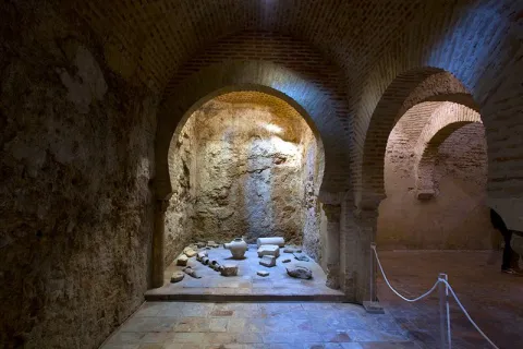
Built in the 11th century, the Arab Baths are located in the basements of the Palacio de Villardompardo. They have an area of ​​450 square meters, which probably makes them the largest of those that can be visited in Spain. Judging by the remains of Almohad decoration that are preserved in some of its rooms, they must have been restored towards the end of the 12th century.
Ubicación
Código Postal
23004
Latitud
37.771137
Longitud
-3.794066
Dirección
Plaza de Santa Luisa de Marillac
Distrito
Municipio
Ubicación en el mapa
POINT (-3.794066 37.771137)
Tipos de punto de interés
Imágenes carrusel
imagen
Image
image_217353%20%281%29.jpeg
Imagen principal
Desactivado
imagen
Image
baños árabes
Imagen principal
Desactivado
imagen
Image
baños árabes
Imagen principal
Desactivado
imagen
Image
baños árabes
Imagen principal
Desactivado
imagen
Image
baños árabes
Imagen principal
Desactivado
imagen
Image
baños árabes
Imagen principal
Desactivado
imagen
Image
baños árabes
Imagen principal
Desactivado
imagen
Image
baños árabes
Imagen principal
Desactivado
imagen
Image
baños árabes
Imagen principal
Desactivado
imagen
Image
baños árabes
Imagen principal
Desactivado
imagen
Image
baños árabes
Imagen principal
Desactivado
Imágenes cabecera
imagen
Image
Ja%E2%80%9An%20Ba%C2%A4os%20%C2%A0rabes%202.jpg
Imagen principal
Activado
Horario
Tuesday to Saturday and holidays: 09:00 - 21:00. Sundays: 09:00 - 15:00. Closed Mondays (except February 28, May 2, August 15 and December 26) and January 1 and 6 and December 24, 25 and 31. Access until 1 hour before closing.
Microsite al que pertenece
Loading map
Preparing points of interest and routes...
Marcas de calidad

San Lorenzo Arch

Submitted by brandcode_deweloper on
Id
12675639
Descripción
Descripción larga
We can highlight some curiosities: -   It was the place where the body of the monarch Ferdinand IV, king of Castile, who died in Jaén, was laid to rest.  -   Juan de Olid (secretary of Constable Iranzo) and his wife Randelez are buried inside. -   Maximilian of Austria was baptized in 1555, who, if recognized, would be the half-brother of Philip the Fair. It can be visited by prior reservation with one of the authorized companies and guides: Association of Official Guides: 606 68 23 03 Claritas Tourism: 678 77 50 43 Lizard Tours: 953 71 52 15 For more information, contact the Municipal Tourism Office: 953 19 04 55
Breve descripción
Building that was part of the extinct Iglesia de San Lorenzo (erected between the 13th and 14th centuries). After the demolition of said temple in 1825, the arch was preserved, housing inside a room on the upper floor (which at the time would be the Sacristy) and a small chapel on the ground floor. It has been listed as a National Monument since 1877 and its interior contains Moorish tiles and coffered ceilings. It is currently owned by the Jaén City Council and is used as the headquarters of the Jaén association “Amigos de San Antón”. The San Lorenzo arch also stands out for the enormous historical legacy it holds, having been veiled by the monarch Ferdinand IV, king of Castile, who died in Jaén and which Eslava Galán himself attests to in The Templars and the Table of Solomon. (…) The same tradition assures that they watched over the monarch's body, or even buried it, in the Arco de San Lorenzo de Jaén. (…) The Templars and Solomon's Table. Chapter 21. Another historical milestone that the Arco de San Lorenzo treasures is that Juan de Olid, secretary of Constable Iranzo, lies here. Historical and also literary milestone, because Juan de Olid is the hero that Juan Eslava Galán uses to go “En busca del unicornio”. The author also mentions this fact in The Templars and the Table of Solomon (…) Juan de Olid and his wife were buried in the parish of San Lorenzo, belonging to the hospital founded by Don Luis (…) The Templars and Solomon's Table. Chapter 22.
Ubicación
Código Postal
23002
Latitud
37.766541
Longitud
-3.792381
Dirección
C/ Almendros Aguilar, 27
Distrito
Municipio
Ubicación en el mapa
POINT (-3.792381 37.766541)
Tipos de punto de interés
Imágenes carrusel
imagen
Image
arco-de-san-lorenzo-j-a-partal-1-1-jpg
Imagen principal
Desactivado
imagen
Image
arco-de-san-lorenzo-j-a-partal-3-jpg
Imagen principal
Desactivado
Imágenes cabecera
imagen
Image
arco-de-san-lorenzo-1-jpg
Imagen principal
Activado
Loading map
Preparing points of interest and routes...