Saltar al contenido principal

El torreón de Lupión

Submitted by brandcode_deweloper on
Id
8088950
Descripción
Descripción larga
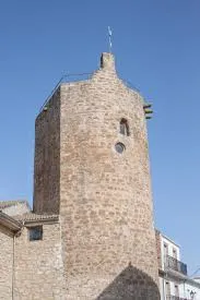
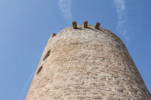
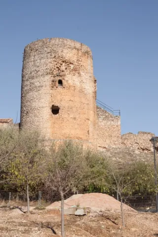
The tower of Lupión belonged to an old medieval castle datable to the 13th century, built of masonry in regular courses, with roughly hewn stone facings. Its floor plan is square on the inner side, the older part, adjoining the parade ground, while the outer side, facing the street, is round — perhaps because it was later remodelled to reduce the destructive effects of artillery. Internally, its two floors are covered with brick domed vaults. The terrace preserves its crenellated structure with corbels, as well as the brackets of a now-vanished defensive machicolation. It was declared a Site of Cultural Interest in 1985.
Breve descripción
Lupión is a small municipality located two kilometres from Begíjar and very close to Baeza. When it was an Ibero-Roman oppidum, it had rich pastureland and abundant wolves, which gave rise to its name.
Telecomunicaciones
Sitio web
www.lupion.es/el-municipio/patrimonio-historico.html
Ubicación
Código Postal
23528
Latitud
37.99674
Longitud
-3.54664
Dirección
La Loma, Jaén
Municipio
Ubicación en el mapa
POINT (-3.54664 37.99674)
Tipos de punto de interés
Imágenes carrusel
imagen
Image
torreon%20lupion2%20%281%29.jpg
Imagen principal
Desactivado
Imágenes cabecera
imagen
Image
torreon%20lupion.jpg
Imagen principal
Activado
Loading map
Preparing points of interest and routes...
El cubo

Submitted by brandcode_deweloper on
Id
4868835
Descripción
Descripción larga

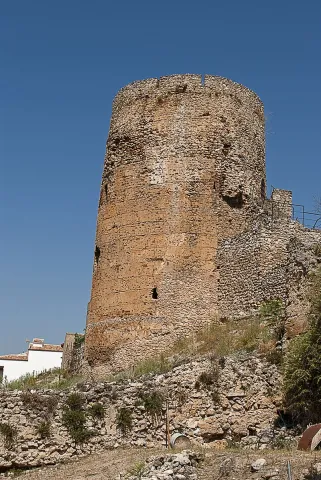
Within the Cube we can consider up to four spatial and functional levels: At the lower level or ground floor, we find ourselves in front of a circular floor room of approximately 8 m in diameter with a half-orange vault with a height of approximately 10 m.

Due to this considerable height it could have been divided into several levels with structures and wooden entwels. The site available in these defence towers was so valuable that it took advantage of the smallest space for the storage of food, utensils and the shelter of people that the Order of Santiago kept under its protection.

The intermediate level or first floor is a circular room of smaller size because it contains the staircase access to the roof. It has a vault pointed on nerves where its intermediate cloth is also made of stone.

From the roof, we can see the plain where the Kurah was framed in the time of Al-Ándalus, this allowed the control of the four cardinal points against the fronts of advance.

Breve descripción

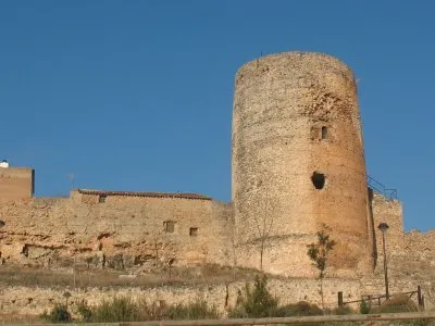
The tower has a height of 21.5 m and is made of masonry with lime mortar. The average diameter is 8.5 m and the thickness of the walls is more than 2.75 m.

Ubicación
Código Postal
23380
Latitud
38.386690
Longitud
-2.582460
Distrito
Municipio
Ubicación en el mapa
POINT (-2.58246 38.38669)
Tipos de punto de interés
Imágenes carrusel
imagen
Image
8.jpg
Imagen principal
Desactivado
imagen
Image
9.jpg
Imagen principal
Desactivado
Imágenes cabecera
imagen
Image
5%20%285%29.jpg
Imagen principal
Activado
Loading map
Preparing points of interest and routes...
Cave of the Morrón

Submitted by brandcode_deweloper on
Id
4872240
Descripción
Breve descripción

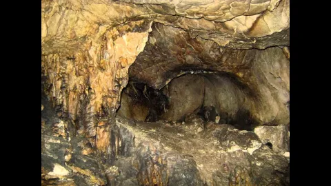
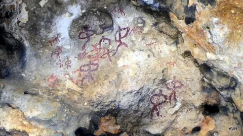
It is one of the greatPaleolithic-era rock sanctuariesthey are located in the Alto Guadalquivir. The paintings are in a small room in the Cave. These are two different chromatism caprics, one red and one black. It is very likely that we are facing a sanctuary in which the paintings have a magical propitiatory purpose for hunting, which was the main means of life of the surrounding populations. These rock paintings have been declaredGood for Cultural Interest.On the outskirts is"The Beast"which is as popularly known the bridge thatAndrés Vandelvira built in 1565,on behalf of Maria de Mendoza.

Ubicación
Código Postal
23540
Latitud
37.784650
Longitud
-3.508180
Distrito
Municipio
Ubicación en el mapa
POINT (-3.50818 37.78465)
Tipos de punto de interés
Imágenes carrusel
imagen
Image
cueva%20morron.jpg
Imagen principal
Desactivado
Imágenes cabecera
imagen
Image
100_7655.jpg
Imagen principal
Activado
Microsite al que pertenece
Loading map
Preparing points of interest and routes...
Graja Cave

Submitted by brandcode_deweloper on
Id
5692889
Descripción
Descripción larga

The great presence of limestone and the karmic effects make our province abundant the caves and coats that served as a home for those who lived these lands thousands of years ago. The Cueva de la Graja is an example of this; this rocky coat located at the north end of the Aznaitín at 750 meters high houses rock art manifestations with an age of 2000 to 5000 years before our age. The cave can be visited by requesting it previously in the City of Jimena.

Breve descripción

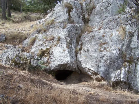
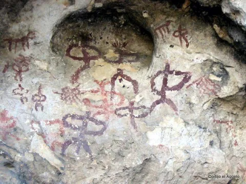
At the north end of the Aznaitin massif, in the area known as "the Cimbra," is the Cueva de la Graja. It is really a 6-meter-deep coat by 6-wide, which in its highest part reaches 5 meters. In addition to offering wonderful views from its 750 meters of altitude, this coat houses rock art manifestations that were made between 2000 and 5000 years before our era. Made with pigments obtained through the mixture of iron oxide, clays and animal fats; the paintings represent rites and grazing work. Declared an Artistic Historical Monument in 1924, the cave can be visited on request in the City of Jimena.

Telecomunicaciones
Sitio web
www.lugaresmiticosdejaen.com/es/articulos/lugares/cueva-de-la-graja
Correo electrónico
ayuntamientodejimena@gmail.com
Ubicación
Código Postal
23530
Latitud
37.833960
Longitud
-3.473090
Distrito
Municipio
Ubicación en el mapa
POINT (-3.47309 37.83396)
Tipos de punto de interés
Imágenes carrusel
imagen
Image
12.jpg
Imagen principal
Desactivado
imagen
Image
13.jpg
Imagen principal
Desactivado
Imágenes cabecera
imagen
Image
11.jpg
Imagen principal
Activado
Microsite al que pertenece
Loading map
Preparing points of interest and routes...
Mata Bejid Farmhouse

Submitted by brandcode_deweloper on
Id
5857145
Descripción
Breve descripción

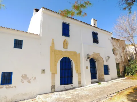
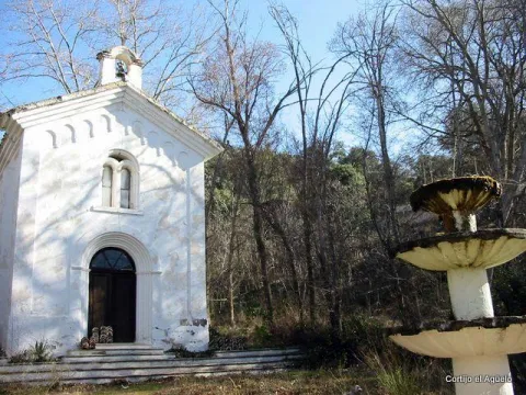
In this private estate the spirit of the belle époque with rural dyes is still revived. It is a private property with an interesting chapel, gardens, house of the gentlemen and even a regional style garage.

Ubicación
Latitud
37.676846
Longitud
-3.564921
Distrito
Municipio
Ubicación en el mapa
POINT (-3.564921 37.676846)
Tipos de punto de interés
Imágenes carrusel
imagen
Image
Ermita_Begid.jpg
Imagen principal
Desactivado
Imágenes cabecera
imagen
Image
Cortijada%20Mata%20Bejid.png
Imagen principal
Activado
Microsite al que pertenece
Loading map
Preparing points of interest and routes...
Convent of Santa Ana

Submitted by brandcode_deweloper on
Id
4639785
Descripción
Breve descripción

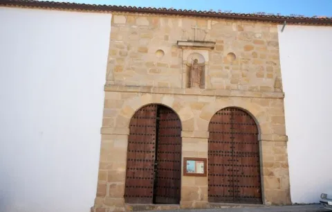
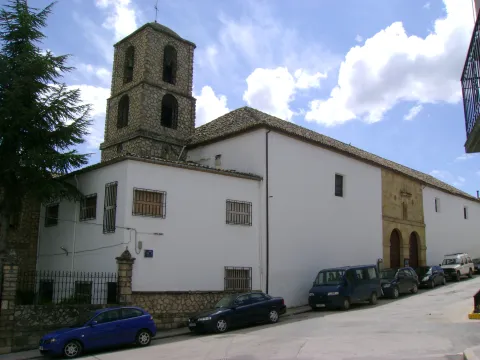
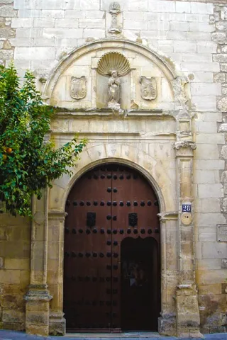
The Santa Ana Sunday convent was built in 1540 at the request of Fray Domingo de Baltanás, Dominican, theologian and writer. The cover of the church is made of silery stone, with a hornacina where the figure of the Santo Domingo de Guzmán, founder of the Dominican order, is represented. The interior of the church is made up of a single ship. In the convent, a magnificent 16th century cloister, with fourteen columns that support part of the dependencies, is removed. Around the courtyard is the refectory with a remarkable mural of 1584.

Telecomunicaciones
Sitio web
www.villanuevadelarzobispo.es
Ubicación
Código Postal
23330
Latitud
38.168820
Longitud
-3.012450
Dirección
C/ Santa Ana, 21
Ubicación en el mapa
POINT (-3.01245 38.16882)
Tipos de punto de interés
Imágenes carrusel
imagen
Image
Convento%20de%20Santa%20Ana%2C%20Villanueva%20del%20Arzobispo%202.jpeg
Imagen principal
Desactivado
imagen
Image
Convento%20de%20Santa%20Ana%2C%20Villanueva%20del%20Arzobispo.jpeg
Imagen principal
Desactivado
Imágenes cabecera
imagen
Image
Villanueva_del_Arzobispo_-_Convento_de_Santa_Ana%20%281%29.jpg
Imagen principal
Activado
Loading map
Preparing points of interest and routes...
Convent of Nuestra Señora de la Piedad

Submitted by brandcode_deweloper on
Id
4884756
Descripción
Breve descripción

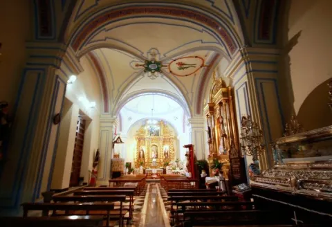
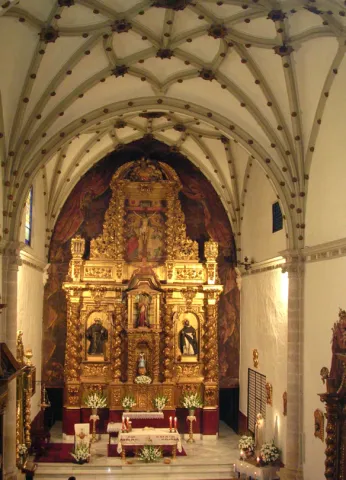
Founded by Don Jerónimo de Padilla and Pacheco around the year 1540, belonging to theOrder of Santiagoand with a triple function:house a convent of Dominican nuns, be a family pantheon for the founders and serve as a school for home maidens. The church presentsone shipdivided into three sections, with side chapels embedded in the wall. It hasdouble choruson the feet and on the side of the presbytery. The altarpiece is baroque from 1728. The ship is divided into three sections with star Gothic vaults and separated by half-point arches, columns and capitals. The profusion of santiaguine shells and the general composition of late and Renaissance Gothic elements are a decorative element. In the interior of the convent you can highlight the double floor cloister, you cannot visit it as a closing convent.

Telecomunicaciones
Teléfono de contacto
953 571 749
Ubicación
Código Postal
23650
Latitud
37.765410
Longitud
-3.956930
Dirección
C/ Monjas Altas, 28
Distrito
Municipio
Ubicación en el mapa
POINT (-3.95693 37.76541)
Tipos de punto de interés
Imágenes carrusel
imagen
Image
convento%20nuestra%20se%C3%B1ora%20de%20la%20piedad%202.jpg
Imagen principal
Desactivado
imagen
Image
convento%20nuestra%20se%C3%B1ora%20de%20la%20piedad.jpg
Imagen principal
Desactivado
Imágenes cabecera
imagen
Image
web11domi.jpg
Imagen principal
Activado
Loading map
Preparing points of interest and routes...
Convent of los Carmelitas Descalzos de Mancha Real

Submitted by brandcode_deweloper on
Id
5387160
Descripción
Breve descripción

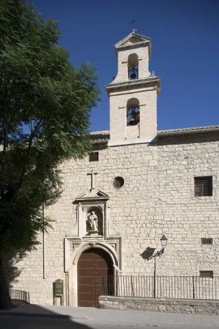
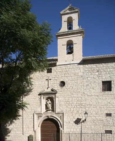
It was founded by San Juan de la Cruz when it was in Baeza on 12 October 1586, putting it under the patronage of the Immaculate Conception, as we can see in the commemorative plaque of the façade. It is accessed through a cover with a half-point arch flanked by pilasters. The set is removed by a cornice that supports four pinacles.

Telecomunicaciones
Sitio web
www.manchareal.es
Teléfono de contacto
953 350 157
Ubicación
Código Postal
23002
Latitud
37.763360
Longitud
-3.791910
Dirección
C/ Carrera de Jesús, 0
Distrito
Municipio
Ubicación en el mapa
POINT (-3.79191 37.76336)
Tipos de punto de interés
Imágenes carrusel
imagen
Image
conventodelascarmelitasdescalzas.jpg
Imagen principal
Desactivado
Imágenes cabecera
imagen
Image
convento%20%281%29.jpg
Imagen principal
Activado
Horario
Wednesday to Sunday: 10: 30 - 14: 00. Late by season (see web).
Microsite al que pertenece
Loading map
Preparing points of interest and routes...
Convent of las Carmelitas Descalzas

Submitted by brandcode_deweloper on
Id
11346436
Descripción
Descripción larga

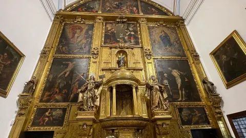
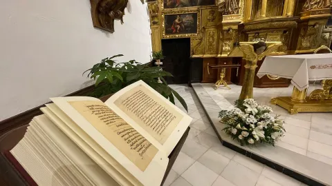
They are also kept in the Convent of Santa Teresa of Jesus, founded by the marriage of Francisco Palomino Ulloa and Juana of Quesada in 1615, two memorable objects: a handwritten copy of the "Spiritual Song" of San Juan de la Cruz and a calling bell belonging to Santa Teresa. It is highly recommended to acquire the typical sweets that make in their work the Carmelite nuns barefoot in a traditional and homemade way, especially their famed cupcakes.

Breve descripción

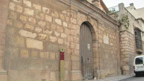
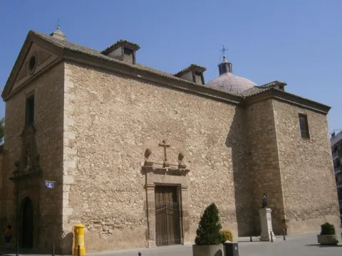
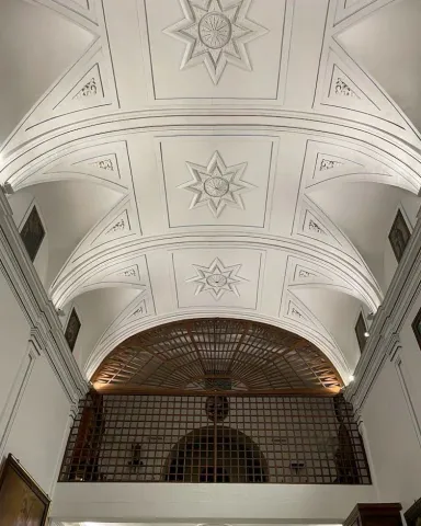
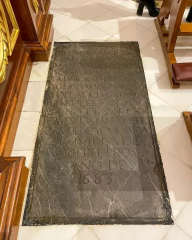
This convent, built in a Baroque style and located in the heart of the historic city, very close to the cathedral, is dedicated to Santa Teresa de Jesús and in the interior of its Church, built in 1673, is the burial of Eufrasio López de Rojas, author, among others, of the façade of the cathedral of Jaén.

Telecomunicaciones
Sitio web
www.carmelitasdescalzas.net/Monasterios/
Teléfono de contacto
953 232 707
Ubicación
Código Postal
23002
Latitud
37.763350
Longitud
-3.791829
Dirección
C/ Carrera de Jesús, 25
Distrito
Municipio
Ubicación en el mapa
POINT (-3.791829 37.76335)
Tipos de punto de interés
Imágenes carrusel
imagen
Image
Carmelitas2.jpg
Imagen principal
Desactivado
imagen
Image
Carmelitas1.jpg
Imagen principal
Desactivado
imagen
Image
Carmelitas3.jpg
Imagen principal
Desactivado
imagen
Image
Convento%2011.jpg
Imagen principal
Desactivado
imagen
Image
Convento%2012.jpg
Imagen principal
Desactivado
imagen
Image
_G8Y3254%20%281%29.jpg
Imagen principal
Desactivado
Imágenes cabecera
imagen
Image
_G8Y3254.jpg
Imagen principal
Activado
Horario
Saturdays and Sundays: 10: 00 - 12: 00. Free access.
Loading map
Preparing points of interest and routes...
Interés

Convent of Cazalla

Submitted by brandcode_deweloper on
Id
4406075
Descripción
Descripción larga

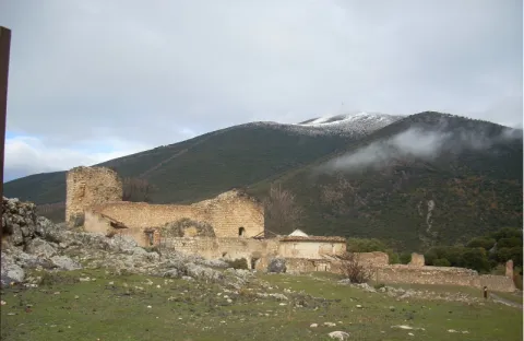
This convent is very linked to Our Lady of Hope, as we can see below. Often, when we hear about Our Lady of Hope, we automatically associate her with Seville and her Holy Week. However, one thing that many people are not aware of is that its origin is located in the province of Jaén, specifically in the region of Sierra Magina, according to some studies and the finding of a document, image of the left, of great importance on this subject. With the transcription that is presented we intend to see how in the toponymy of the convent of Cazalla a reference to the Virgin Macarena appears, in the year 1749, coinciding with the epoch of the highest splendor of the Order of the Basilios, as well as the Cadastre of the Marquis of the Ensenada. This report, which refers to a guide to the transport of cattle, is the only document found in the municipal archive, so far, where it is confirmed something that supports previous studies, such as that published by Rafael Ortega and Sagrista, "The Monastery of Our Lady of Hope, in the cazalla, belonging to the order of San Basilio Magno," where the origin of such a Marian advocation, the famous Virgin Esperanza Macarena of Seville, is determined in these places. What seems to be fully observed is that the diffuse center of the Basil monks in Andalusia comes from the region of Sierra Mágina, in particular Mata-Begid and the said Cazalla Convent, as Vicente Oya shows, to see the website www.camorl.iesata.es, or the book by Hilario Arenas González "La Macarena de Sevilla."
With this small review, we are only trying to make known an interesting line of research that we are now in the process of developing.

Breve descripción

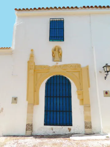
Since the 15th century there was a monastery of agustines in the place of Cazalla, which in 1578 became of the order of S. Basilio Magno. From that convent, it reached its highest splendor in the 18th century, reaching to have 13 monks, 3 leagues, 8 servants to own more than 200 flocks of cultivation (approximately 130 Hectareas) as known to the remains currently existing, only one cover remains, with a half-point bow blinded that gave access to the temple and, above it, the statue of S. Basilio Great, on a stacked hornadine up to half. It is a cast size of small proportions, which only lets see the head of the holy headline, with a luenga beard and a mitre. The size has been recently restored.

Telecomunicaciones
Sitio web
www.carcheles.es/el-municipio/patrimonio-historico.html
Correo electrónico
Webmaster@carcheles.es
Ubicación
Código Postal
23192
Latitud
37.634520
Longitud
-3.640970
Distrito
Municipio
Ubicación en el mapa
POINT (-3.64097 37.63452)
Tipos de punto de interés
Imágenes carrusel
imagen
Image
convento%20%282%29.jpg
Imagen principal
Desactivado
Imágenes cabecera
imagen
Image
Convento%20de%20Cazalla%20%281%29.jpg
Imagen principal
Activado
Microsite al que pertenece
Loading map
Preparing points of interest and routes...