Saltar al contenido principal

Town Hall of Rus

Submitted by brandcode_deweloper on
Id
4554789
Descripción
Breve descripción

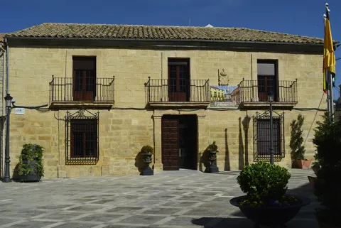
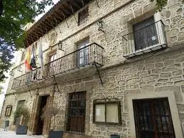
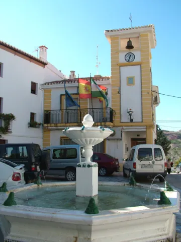
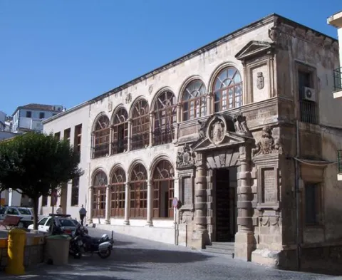
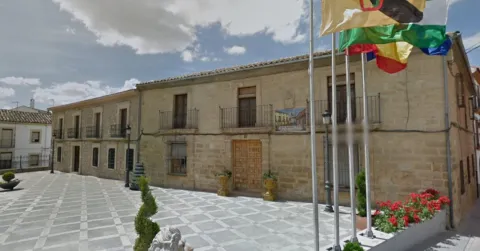
The City Hall, a building of the 20th century silery, of a classic air, is the president of the Plaza de la Constitución. It has a door flanked by pilassas, intellized and recercated holes and, in the upper part, the shield of the municipality.

Telecomunicaciones
Sitio web
www.rus.es
Teléfono de contacto
953 770 002
Correo electrónico
web@rus.es
Ubicación
Código Postal
23430
Latitud
38.048000
Longitud
-3.461810
Dirección
Plaza de la Constitución, 1
Municipio
Ubicación en el mapa
POINT (-3.46181 38.048)
Tipos de punto de interés
Imágenes carrusel
imagen
Image
rus.jpg
Imagen principal
Desactivado
Imágenes cabecera
imagen
Image
Ayuntamiento%20Rus.jpg
Imagen principal
Activado
Loading map
Preparing points of interest and routes...

Town Hall of Pegalajar

Submitted by brandcode_deweloper on
Id
4658310
Descripción
Breve descripción

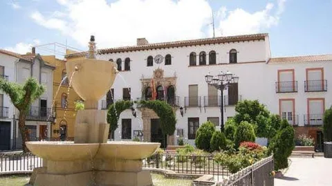
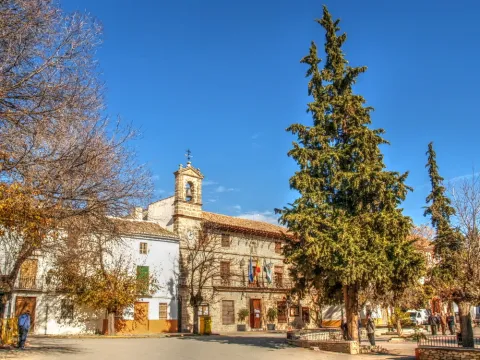
Its construction is linked to the repopulation of the southern part of Jaén in the time of Charles V. It preserves the18th century facade. It is fully rebuilt and only maintains its original track, the two-story cover of the 17th century.

Telecomunicaciones
Sitio web
www.ayto-pegalajar.org
Teléfono de contacto
953 360 003
Ubicación
Código Postal
23110
Latitud
37.737840
Longitud
-3.650930
Dirección
Plaza de la Constitución, 10
Distrito
Municipio
Ubicación en el mapa
POINT (-3.65093 37.73784)
Tipos de punto de interés
Imágenes carrusel
imagen
Image
Mon474.jpg
Imagen principal
Desactivado
imagen
Image
pegalajar-ayuntamiento-1--644x362.jpg
Imagen principal
Desactivado
Imágenes cabecera
imagen
Image
ayuntamiento.png
Imagen principal
Activado
Microsite al que pertenece
Loading map
Preparing points of interest and routes...

Town Hall of Noalejo

Submitted by brandcode_deweloper on
Id
4867653
Descripción
Breve descripción

Building built at the end of16th century. At first it was a convent under the title of Our Lady of the Assumption, and this is the reason for the small image that presides over the facade. In the 18th century it became for the first time the House of the Council. The original construction corresponds to athree-storey building and swordsmanI had a bell with three crunches. It had different units anda central courtyard.A big ladderimperial two meters, immense and majestic, raised us to the second floor. On the third floor the schools were installed.

Telecomunicaciones
Sitio web
www.noalejo.es
Teléfono de contacto
953 306 134
Correo electrónico
noalejo@andaluciajunta.es
Ubicación
Código Postal
23140
Latitud
37.529460
Longitud
-3.653660
Dirección
Plaza España, 1
Distrito
Municipio
Ubicación en el mapa
POINT (-3.65366 37.52946)
Tipos de punto de interés
Imágenes carrusel
imagen
Image
noalejo.jpg
Imagen principal
Desactivado
Imágenes cabecera
imagen
Image
noalejo3.jpg
Imagen principal
Activado
Microsite al que pertenece
Loading map
Preparing points of interest and routes...

Town Hall of Hinojares

Submitted by brandcode_deweloper on
Id
4591486
Descripción
Descripción larga

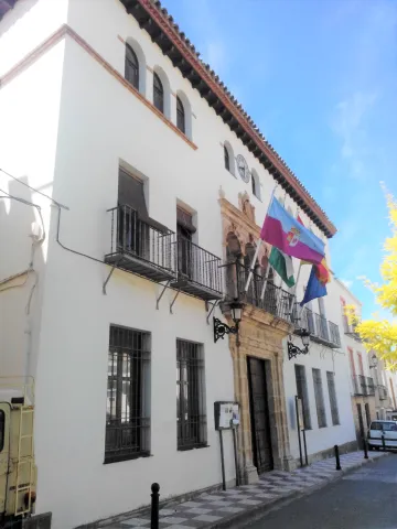
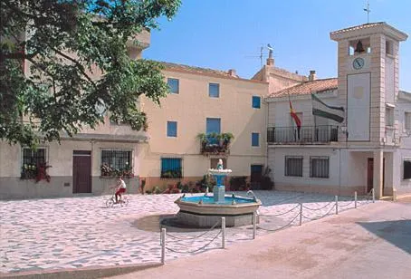
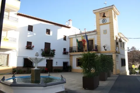
With three heights and bounds, the most outstanding is that of the balcony on the first floor, in a vertical line with the access door, and crowned by a small attic with a watch that imitates that of the municipalities colonized in the 18th century, but which is located not in the center but on one of the sides of the building, and on which a small bell is installed.

Breve descripción

The other significant building of Hinojares is the City Hall, also in the same line of architectural austerity and without concessions to decoration and aesthetics.

Ubicación
Latitud
37.715363
Longitud
-2.999162
Dirección
Plaza Constitución, 14
Municipio
Ubicación en el mapa
POINT (-2.999162 37.715363)
Tipos de punto de interés
Imágenes carrusel
imagen
Image
AYNT%20HINOJARES.jpg
Imagen principal
Desactivado
imagen
Image
AYNT%20HINOJARES%202.jpg
Imagen principal
Desactivado
Imágenes cabecera
imagen
Image
113.jpg
Imagen principal
Activado
Loading map
Preparing points of interest and routes...

Old Town Hall, Former Prison, and Cabildo

Submitted by brandcode_deweloper on
Id
2293022
Descripción
Descripción larga

The construction is part of an ambitious plan for the beautification of the city of Martos, seeking to create a capital worthy of the Endowment according to its Roman legacy. Urbanistically the façade of the Cárcel would vertebrate the space of the main square of the city (current Plaza de la Constitución), also remodeling the nearby church of Santa Marta and the Sanctuary of Nuestra Señora de la Villa, and having in the central part of the square the Fuente de Neptuno, disappeared work of which we have references in the History of the Peña de Martos de Diego de Villalta. In addition to this intervention in the main square, new roads and spaces would be built, such as the street and the square of the Fuente Nueva, the district of the Heras, the street of the Albollón, etc., and a series of convents and churches were also founded.

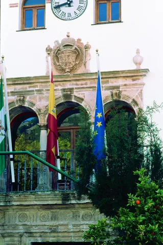
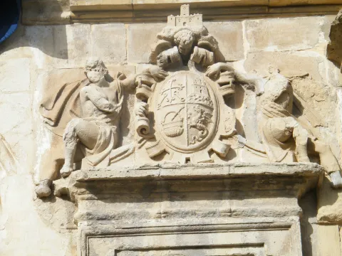
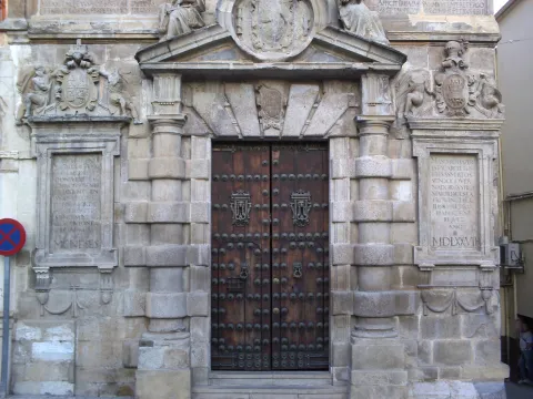
The main façade of the Prison is structured as a double gallery of half-point arches supported by dogrous columns (four arches on the lower floor and six on the upper floor), the cover being located in a decentralized way on the right side (on which a blind balcony is available as a temple, topped with a straight fronton). In the jets of the central part of the upper arcade we find heraldic shields, killing the whole facade with a large cornice.

Breve descripción

The building was built by the architect Francisco del Castillo between 1557- 1577 on behalf of Governor Pedro Aboz Enríquez and Mr Antonio de Padilla Meneses, Justice Mayor of Calatrava in the Kingdom of Jaén.

Telecomunicaciones
Sitio web
www.martos.es
Teléfono de contacto
953 704 005
Ubicación
Código Postal
23700
Latitud
37.722920
Longitud
-3.965830
Dirección
Plaza de la Constitución, 21
Distrito
Municipio
Ubicación en el mapa
POINT (-3.96583 37.72292)
Tipos de punto de interés
Imágenes carrusel
imagen
Image
Martos-Escudo-C%C3%A1rcel.jpg
Imagen principal
Desactivado
imagen
Image
P1100304-1024x768.jpg
Imagen principal
Desactivado
imagen
Image
Martos_-_Portada_del_Ayuntamiento_K03.jpg
Imagen principal
Desactivado
Imágenes cabecera
imagen
Image
main_image_43929.jpeg
Imagen principal
Activado
Horario
External visit.
Loading map
Preparing points of interest and routes...

Arch of la Plaza

Submitted by brandcode_deweloper on
Id
4485954
Descripción
Descripción larga

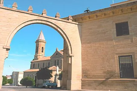
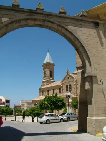
The religious, administrative and social centre is the Plaza de Andalucía, of generous proportions and houses with arqueras and balconades, to which it is accessed through a replacement arch of another of Gothic origin. This arch, which was the gateway to the medieval fortress of the old walled enclosure, was rebuilt in 1952 over the ancient medieval arch.

Telecomunicaciones
Sitio web
www.porcuna.es
Ubicación
Código Postal
23790
Latitud
37.870160
Longitud
-4.184900
Distrito
Municipio
Ubicación en el mapa
POINT (-4.1849 37.87016)
Tipos de punto de interés
Imágenes carrusel
imagen
Image
Arco%20de%20la%20Plaza%20Porcuna%20%281%29.jpg
Imagen principal
Desactivado
Imágenes cabecera
imagen
Image
Arco%20de%20la%20Plaza%20Porcuna.jpg
Imagen principal
Activado
Loading map
Preparing points of interest and routes...

Arch of la Encarnación

Submitted by brandcode_deweloper on
Id
4659054
Descripción
Breve descripción

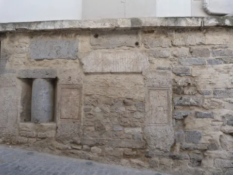
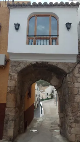
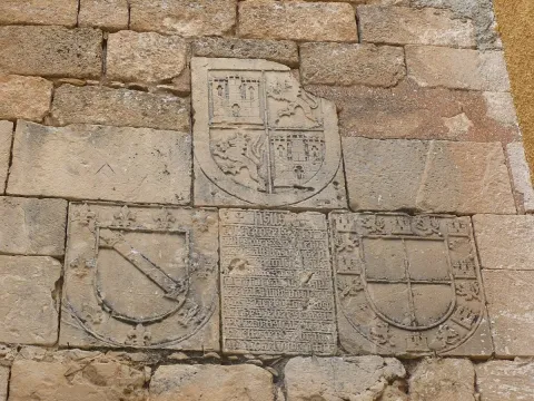
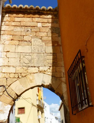
On the Arc of the Incarnation of Pegalajar, a pointed arch that was the main entrance door to the castle of Pegalajar, is a commemorative stone surrounded by heraldic shields. The stone is recorded in relief with a textual gothic letter, in some parts damaged. The writing box of the stone is distributed in relief lines where the photographs are attached. It uses some abbreviations and the concealment of some letters at the end or in the middle of the word. Words are usually separated by scores. Head the tombstone the word "Jheits ", framed in two crosses, religious invocation usual at the beginning of all public writings, followed by the date, the reference to the king reigning and then the ordinator of it and the type of work commemorative. The transcription of the stone is as follows:

Telecomunicaciones
Sitio web
www.ayto-pegalajar.org
Correo electrónico
pegalajar@promojaen.es
Ubicación
Código Postal
23110
Latitud
37.738970
Longitud
-3.649050
Distrito
Municipio
Ubicación en el mapa
POINT (-3.64905 37.73897)
Tipos de punto de interés
Imágenes carrusel
imagen
Image
arco%20de%20la%20encarnaci%C3%B3n%202.jpg
Imagen principal
Desactivado
imagen
Image
arco%20de%20la%20encarnaci%C3%B3n.jpg
Imagen principal
Desactivado
Imágenes cabecera
imagen
Image
10486986676_87a2769dfe_b.jpg
Imagen principal
Activado
Microsite al que pertenece
Loading map
Preparing points of interest and routes...

Former San Felipe Neri Seminary (current UNIA headquarters)

Submitted by brandcode_deweloper on
Id
5965089
Descripción
Breve descripción

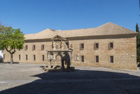
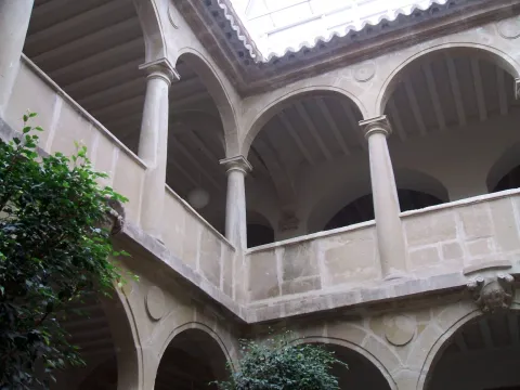
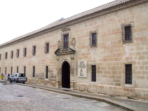
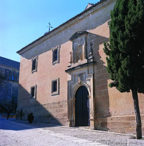
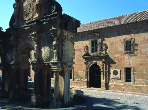
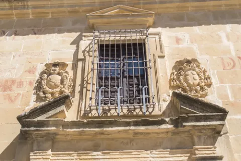
Founded as a seminary in 1660 by the bishop of Jaén, Fernando Andrade de Castro. The works were carried out by Eufrassio López de Rojas, author of the façade of the Cathedral of Jaén. It ceased to be used for the purpose of 1969. From the outside stands the façade that looks at the square of Santa Maria with two high floors where critical and festive cheers decorate its stones. The interior features a courtyard with narrow Tuscan columns and double arqueria. Today it houses the Antonio Machado headquarters of the International University of Andalusia.

Telecomunicaciones
Sitio web
www.baeza.es
Teléfono de contacto
953 742 775
Ubicación
Código Postal
23440
Latitud
37.990432
Longitud
-3.468978
Dirección
Plaza Santa María, s/n
Municipio
Ubicación en el mapa
POINT (-3.468978 37.990432)
Tipos de punto de interés
Imágenes carrusel
imagen
Image
shutterstock_670115896.jpg
Imagen principal
Desactivado
imagen
Image
seminario-felipe.jpg
Imagen principal
Desactivado
imagen
Image
Baeza_-_Seminario_de_San_Felipe_Neri_1.jpg
Imagen principal
Desactivado
imagen
Image
Mon016.jpg
Imagen principal
Desactivado
imagen
Image
Mon547.jpg
Imagen principal
Desactivado
Imágenes cabecera
imagen
Image
shutterstock_670115821.jpg
Imagen principal
Activado
Horario
Monday to Friday: 09: 00 - 14: 00. Saturday, Sunday and holidays closed.
Loading map
Preparing points of interest and routes...

Former Hospital of San Miguel

Submitted by brandcode_deweloper on
Id
1487115
Descripción
Descripción larga

The first fact of the existence of the Hospital of San Miguel is given by Jimena Jurado "Historia o Anales del Municipio Albense Urgavonense" 1643, arguing that already in 1488 a total of six hospitals are quoted in Arjona (Santa María, San Miguel, San Juan, Santiago, San Bartolomé, Santa Olaya).

Another data showing the antiquity of these Hospitals was found in 1542, when the Supreme Pontiff issued his Bula to make an inventory of the number of hospitals in Spain, calling for the elimination of those who by their poverty did not meet basic needs. In response to the Bula, the lobby next to the officers of the village's cofradies meet and decide to reduce all hospitals to one, leaving only the Hospital of San Miguel, which was better located and more capable.

As far as the location is concerned, there is no doubt that it occupied the left side of what is now Hospital Street and the old La Plaza Street (now Cervantes). The most obvious evidence of its location is found in a drawing from 1628, published by Don Juan González in "Historia de la Ciudad de Arjona" 1905.

At the end of the 17th century the family of the perpetual regior of the villa Corrales Javalera serves it as endowments, highlighting the breadth of its rooms, highlighting an oratory above all. From this date on, the historical reviews that refer to the above-mentioned hospital are remarkable, highlighting that of Don Pascual Madoz, who, in his "Geographical, Statistical and Historical Dictionary of Spain" 1845 writes "Arjona...... has a Hospital entitled San Miguel, with public prayer, founded in 1665 by Don Bernabé Corrales Javalera...... The hospital is in charge of an administrator and has a surgeon and nurse to assist the suffering humanity of both sexes that is admitted to it."

The progress of the centuries, the new laws inherited from the French tradition, public hygiene and urban police, close the location of the hospital. These ordinances put in place the mechanisms for the new location of the Hospital, June 1863 in a Act of the Council "the governor is asked to allow the House of the King and to temporarily enable the hospital..." This house located in the square of Santa María belongs to Don José Pérez de Herrasti, which gives way for a modest price, thus increasing the works to transfer the Hospital to that place, leaving the works completed in 1868, as demonstrated by the letter that the Architect d. José María Cuenca (architect of the province), emits the mayor of the town.

Since then and after having undergone several remodelations such as that in 1924, in which part of it was sank, it has served as a reference in the cure of the sick, specializing in primary care, until in the 1990s when a new hospital complex in Arjona is built. The site that occupied this hospital, suffered a series of remodeling at the end of the 20th century, passing through the center of Youth Information, until today becoming the Museum of Arts and Costumbres Juan Eslava Galán and the Archaeological Museum City of Arjona, next to the old people's residence "Fundación Corrales Javalera," which follows the legacy used by the Bernabé Corrales Javalera in the second Mitad of the 17th century.

Breve descripción

Today's missing building, which was erected at the site that today occupies the town council. The date of its construction is not known, but through the study of different sources it is brought closer to the 13th century, framed in the context of the Christian reconquest under the baton of Fernando III the Holy. In 1244 Arjona is conquered and as such began to form Cofradias under the title of a saint, to whom the aid goes to the most disadvantaged.

Telecomunicaciones
Sitio web
www.visitarjona.com/cultura/otros-monumentos/antiguo-hospital-de-san-miguel
Teléfono de contacto
953 523 325 / 953 523 641
Ubicación
Código Postal
23760
Latitud
37.935170
Longitud
-4.054660
Dirección
C/ Cervantes, 9
Distrito
Municipio
Ubicación en el mapa
POINT (-4.05466 37.93517)
Tipos de punto de interés
Imágenes carrusel
imagen
Image
Antiguo%20Hospital%20de%20San%20Miguel.jpg
Imagen principal
Desactivado
Imágenes cabecera
imagen
Image
arjona-hospital01.jpg
Imagen principal
Activado
Loading map
Preparing points of interest and routes...

Former Civil Guard Barracks

Submitted by brandcode_deweloper on
Id
8103250
Descripción
Descripción larga

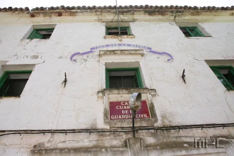
Located in the northern part of the population, at the beginning of it.

Breve descripción

Today abandoned building, it retains on its facade the emblem of the civil guard. It highlights the greenish color of its main door and windows.

Telecomunicaciones
Correo electrónico
ayuntamiento@carboneros.es
Ubicación
Código Postal
23211
Latitud
38.232766
Longitud
-3.630393
Dirección
C/ Escolástica, 8
Distrito
Municipio
Ubicación en el mapa
POINT (-3.630393 38.232766)
Tipos de punto de interés
Imágenes carrusel
imagen
Image
Antiguo%20Cuartel%20de%20la%20Guardia%20Civil%202.jpg
Imagen principal
Desactivado
Imágenes cabecera
imagen
Image
Antiguo%20Cuartel%20de%20la%20Guardia%20Civil.jpg
Imagen principal
Activado
Loading map
Preparing points of interest and routes...