Saltar al contenido principal

Santa Potenciana Hermitage Archaeological Site

Submitted by brandcode_deweloper on
Id
4524002
Descripción
Breve descripción

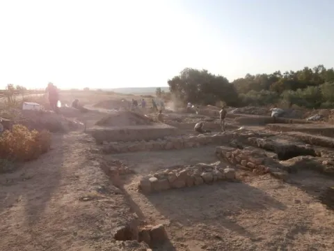
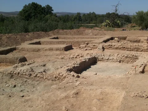
The excavations of the Archaeological site Hermitage Santa Potenica de Villanueva de la Reina have been presenting new findings, withnew materials and structures that confirm this area as a historic crossing of cultures between large cities. An archaeological site that has, in five years, achieved great results andtake the municipality of Villanueva de la Reina to specialized and prestigious forums.

Telecomunicaciones
Sitio web
www.redjaen.es/francis/?m=c&o=93197
Teléfono de contacto
953 537 110
Ubicación
Código Postal
23730
Latitud
38.027860
Longitud
-3.912560
Distrito
Ubicación en el mapa
POINT (-3.91256 38.02786)
Tipos de punto de interés
Imágenes carrusel
imagen
Image
Yacimiento%20Ermita%20Santa%20Potenciana.jpg
Imagen principal
Desactivado
Imágenes cabecera
imagen
Image
Yacimiento_de_la_Ermita_de_Santa_Potenciana.jpg
Imagen principal
Activado
Microsite al que pertenece
Loading map
Preparing points of interest and routes...
Town Planning of Aldeaquemada

Submitted by brandcode_deweloper on
Id
5869042
Descripción
Descripción larga

We can also find other architectural monuments in Aldeaquemada, which come from the time of the colonization of Charles III, highlighting:

• Church of the Purple Conception (18th century). A colonial-type church with a single ship. A vertical trend in relation to the rest of the buildings. Its facade is made of brick and is articulated in two bodies. In the first one, in rectangular form, the only differentiated elements are a narrow cover with a half-point arch and above, two lunetes that keep the line of horizontality. In the second body, a slight swordsman with a bell tower is triangulated, culminating in a small front. There are two houses on both sides of the church, corresponding to the old house of the priest and the post commander.

• The Comandante's House has also come to serve as a city hall for many years and even... The poultry house where bulls and bravas were locked up during the holidays of San Miguel! It is now the Retired Home, renovated and opened in April.

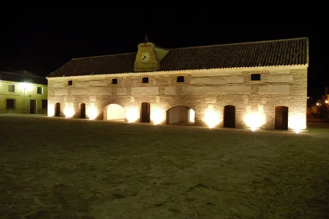
• Diezm and Labrador site (18th century). Building of the time of colonization and present in all the foundations of Charles III. It was dedicated to housing the cereals harvested by the farmers and as a warehouse in times of famine. Current town hall of the town, it is built in brick, of rectangular floor, of two floors and roof to two waters where it has a discreet structure of grabbard brick that houses the city's watch. New atypical uses: some of their rooms have performed the role of dungeon, home of the retired, butcher's shop, teleclub and, of course, municipal warehouse.

Breve descripción

Aldeaquemada was born as a crossroads of roads, faithful to that function is the layout of its streets: rectangular urbanism, with long rectilinear axes. Aldeaquemada, is certainly the "Perla urbanística de Sierra Morena," for its urban innovations of structuring the streets on cross-sectional axes that divide it into squares and for the conservation of its original layout, hence it can be considered the entire urban town of the town as one more monument. The streets are perfectly aligned with the cardinal points, and the church with the altar
East.

Telecomunicaciones
Sitio web
www.aldeaquemada.com
Teléfono de contacto
680 104 199
Correo electrónico
turismo.aldeaquemada@gmail.com
Ubicación
Código Postal
23215
Latitud
38.412120
Longitud
-3.373310
Distrito
Municipio
Ubicación en el mapa
POINT (-3.37331 38.41212)
Tipos de punto de interés
Imágenes carrusel
imagen
Image
Aldeaquemada.png
Imagen principal
Desactivado
imagen
Image
Urbanismo_Aldeaquemada.jpg
Imagen principal
Desactivado
Imágenes cabecera
imagen
Image
Aldeaquemada%202.jpg
Imagen principal
Activado
Loading map
Preparing points of interest and routes...

Dark Towers

Submitted by brandcode_deweloper on
Id
4892712
Descripción
Breve descripción

They're themost representative element of the urban complex of Torreperogil. They were part of the old castle - a fortress built in the 13th century, between 1230 and 1240 and which gave rise to the villa that was built after the battle of the Navas de Tolosa. At the end of the 19th century there were four towers, but at present only two are preserved. One of them is a square floor, it is accessed inside by an intellized door. It has a single floor covered by a pointed vault and it has aspillers in its paraments. The other, known as the ochavada tower, has an octagonal plant, is built of thick armchair and crowned with powerful shoes for the support of the matacans. To access its interior, it has a narrow warhead door and is given light by small saetera windows. They have been rehabilitated in recent yearsof the 20th centuryhowMunicipal Auditorium. The Ochavado Torreon and the Square TorreonThey are declared a Historical Monument.(BOE 26 / 06 / 1985).

Telecomunicaciones
Sitio web
www.torreperogil.es
Teléfono de contacto
953 776 000
Correo electrónico
info@torreperogil.es
Ubicación
Código Postal
23320
Latitud
38.034620
Longitud
-3.287700
Dirección
C/ las Torres, 19D
Distrito
Municipio
Ubicación en el mapa
POINT (-3.2877 38.03462)
Tipos de punto de interés
Imágenes carrusel
imagen
Image
torres%20oscuras.jpg
Imagen principal
Desactivado
Imágenes cabecera
imagen
Image
torres%20%281%29.jpg
Imagen principal
Activado
Microsite al que pertenece
Loading map
Preparing points of interest and routes...

Santa Catalina Towers

Submitted by brandcode_deweloper on
Id
4672189
Descripción
Descripción larga

According to some authors, the torres- atalaya of the area of Orcera and Segura of the Sierra must be reconsidered and dated again as coming from the time of Carthaginese domination of the peninsula, between the years 237 and 202 before Christ, for being quoted in Tito Livio asTowers of Anibal, being in one of them where one of the Scipion brothers died in the warrior refriegas of 211 BC This hypothesis must be taken into account and confronted by the specialists of ancient history of Spain, but in no case can it be held seriously that they are only medieval, Islamic, Almohade or Christian. Its origin, although in medieval times they were the subject of partial restorations or reconstructions, possibly from the third century BC, between the years cited and in the occasion of the wars between Rome and Cartago for the possession of the peninsula.

This tower is a twin of the tower of Santa Catalina II, it seems to be a Muslim work of the late 12th or early 13th century and its function would be to monitor the intricate landscape of hills surrounding them.

Its quadrangular plant measures about 5.30 by 4.20 meters from sides, its height of about 14 meters, the thickness of its walls on the ground is 1.19 meters, and the access gap is about 7 meters high. Its interior is organized in 4 plants separated by beams that supported the zócalos resulting from the progressive narrowing of the walls.

Breve descripción

The Tower of Santa Catalina I is located in the municipal term of Orcera, province of Jaén, and is part of the defensive set of three towers that exist between Segura de la Sierra and Orcera, and are named after Santa Catalina.

Telecomunicaciones
Teléfono de contacto
953 480 154
Correo electrónico
ayuntamiento@orcera.es
Ubicación
Código Postal
23370
Latitud
38.313210
Longitud
-2.673180
Distrito
Municipio
Ubicación en el mapa
POINT (-2.67318 38.31321)
Tipos de punto de interés
Imágenes carrusel
imagen
Image
santa%20catalina.jpg
Imagen principal
Desactivado
Imágenes cabecera
imagen
Image
10264136784_cd928a76e8_b.jpg
Imagen principal
Activado
Loading map
Preparing points of interest and routes...

Customs Towers

Submitted by brandcode_deweloper on
Id
4383877
Descripción
Breve descripción

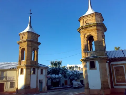
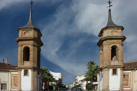
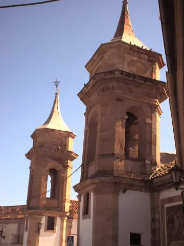
The towers of the Customs (18th century) were built to flank the passage to the Customs Square, where taxes and tolls were charged. These neoclassical-style constructions are one of the most well-known and representative monuments of La Carolina. They intended to bring a sign architecture to the capital of the New People and a revolution to the urban planning of the time. In 1792 they were moved to keep the north entrance of the city. In the original plane of the population, a tower was planned to be erected for each vertex of the city.

Telecomunicaciones
Sitio web
www.lacarolina.innovasur.es
Teléfono de contacto
953 660 034
Correo electrónico
info@lacarolina.es
Ubicación
Código Postal
23200
Latitud
38.276040
Longitud
-3.611560
Dirección
C/ de Madrid
Distrito
Municipio
Ubicación en el mapa
POINT (-3.61156 38.27604)
Tipos de punto de interés
Imágenes carrusel
imagen
Image
1200px-La_Carolina_-_010_%2830102808753%29.jpg
Imagen principal
Desactivado
imagen
Image
00502096.jpg
Imagen principal
Desactivado
imagen
Image
5104433718_40f0c329fc_b.jpg
Imagen principal
Desactivado
Imágenes cabecera
imagen
Image
Aduana_0104_03.jpg
Imagen principal
Activado
Microsite al que pertenece
Loading map
Preparing points of interest and routes...
Keep / Tower Medieval de Villarrodrigo

Submitted by brandcode_deweloper on
Id
3964217
Descripción
Descripción larga

In the back there is a single safetiere set at high height to illuminate the snail staircase that gives access to a terrace. The only inner stay is covered with a shell vault.

Despite the fact that in the 1960s its upper part was decoupled to the level of the surrounding houses, some of which have been joined by two of its sides, it arouses a great interest not only for its own architectural typology but also for the medieval urban scenography it reproduces in the center of the municipality.

Breve descripción

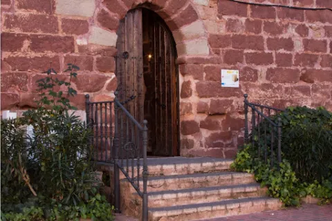
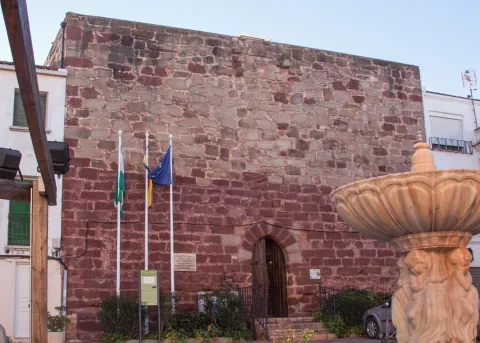
The Torreon de Villarrodrigo is of a square floor and is made of good masonry covered by large irregular armchairs. Its main façade, of 13.60 meters, has an arch door made up of striking carved candles, an entrance that is somewhat elevated with respect to the level of the square.

Telecomunicaciones
Sitio web
www.villarrodrigo.es/el-municipio/patrimonio-historico.html
Correo electrónico
villarrodrigo@promojaen.es
Ubicación
Código Postal
23393
Latitud
38.032400
Longitud
-3.287500
Dirección
C/ la Torre, 5
Distrito
Municipio
Ubicación en el mapa
POINT (-3.2875 38.0324)
Tipos de punto de interés
Imágenes carrusel
imagen
Image
image_content_13099033_20171223114005.jpg
Imagen principal
Desactivado
imagen
Image
unnamed.jpg
Imagen principal
Desactivado
Imágenes cabecera
imagen
Image
fortaleza32.jpg
Imagen principal
Activado
Microsite al que pertenece
Loading map
Preparing points of interest and routes...
Keep / Tower Árabe

Submitted by brandcode_deweloper on
Id
4909134
Descripción
Descripción larga

On the surface of the plateau there are traces of ancient fortification, possibly a Roman fortress or ibera linked to Oretania.

In the middle of the S. IX, an Arab fortification was built in Sorihuela to defend the left margin of Guadalquivir and as the advance of the Guadalimar River.

In 1235 Fernando III conquered Sorihuela, a small Arab house, giving it as a service to the infant Mr Sancho, Bishop of Toledo, as part of the advance of Cazorla and border to the Muslims. Sorihuela was soon revalued for its proximity to the Montizón road that was communicating Sierra Morena with Castile.

The tower of Tribute was ordered to be built by the Toledo archbishops at the end of the 13th century, taking advantage of the primitive structure of the small medieval castle. This tower guaranteed that the advance would receive the rent of the marzadga that all the inhabitants were to pay to the Archbishopric for their belonging to the Lordship of Toledo as well as the tribute of the plumbing paid by those who intended to free themselves from the service of weapons.

Even at the end of the 16th century he was occupied by a guardian dependent on the warden of Iznatoraf.

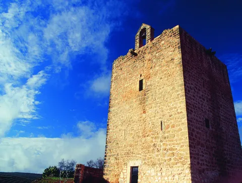
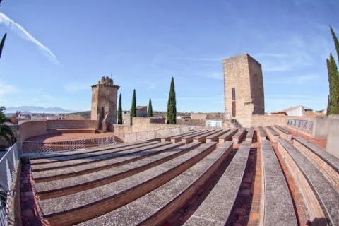
The tower of tribute is square of regular masonry placed with yarn and chains on the corners of silery, ready to rope and sawn. The plant has 9.4 meters of side and 13.7 to the almond parapet.

Breve descripción

Sorihuela de Guadalimar is located to the north of the Guadalquivir and Guadalimar rivers, at the foot of the Loma de Chiclana in the Sierra de las Cuatro Villas. In its vicinity the old way of Montizón, which was a common communication route with Castile through Sierra Morena, was taking place. The castle of Sorihuela was located on a rocky promontory above the town. The only vestige that is preserved is the tower of tribute, raised in the 13th century.

Telecomunicaciones
Sitio web
www.aytosorihueladelguadalimar.es
Teléfono de contacto
953 430 004
Ubicación
Código Postal
23270
Latitud
38.240920
Longitud
-3.053800
Dirección
C/ Eras, 9
Distrito
Municipio
Ubicación en el mapa
POINT (-3.0538 38.24092)
Tipos de punto de interés
Imágenes carrusel
imagen
Image
Mon511.jpg
Imagen principal
Desactivado
imagen
Image
270px-Castillo_de_Sorihuela_-_entrada_a_la_torre.jpg
Imagen principal
Desactivado
Imágenes cabecera
imagen
Image
sorihuela_del_guadalimar_1%20%281%29.jpg
Imagen principal
Activado
Loading map
Preparing points of interest and routes...
Torreón

Submitted by brandcode_deweloper on
Id
4650480
Descripción
Breve descripción
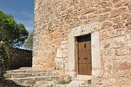
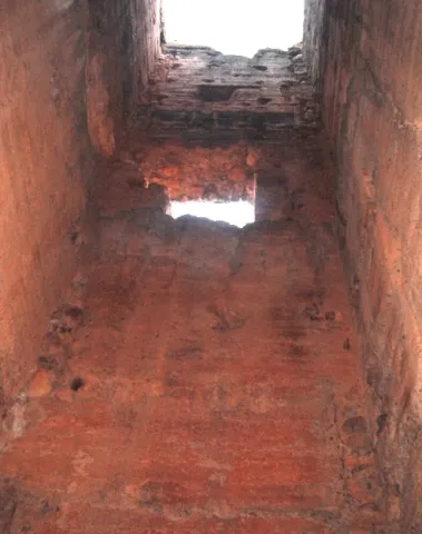
The tower, as it survives today, is built of regular masonry, with ashlar stretcher-and-header corner stones, and has had homes attached to it in modern times. It must have been the keep of a small but strong castle that carried out relatively important military functions throughout the 13th and 14th centuries: it acted as a stronghold of Calatrava power in the Martos countryside and played a leading role in bloody battles, such as the one popular tradition attributes to the conflict between the King of Castile and the King of Granada in 1431. It originally had two floors, of which only the lower one survives, with a narrow entrance featuring a semicircular arch made up of large voussoirs, which contrast with the reduced size of the opening itself, kept small for security reasons. This doorway, a window, and the remains of another arch are the few significant elements that can still be seen today. It was declared a Site of Cultural Interest in 1985.
Telecomunicaciones
Sitio web
www.higueradecalatrava.es/el-municipio/patrimonio-historico.html
Teléfono de contacto
953 529107
Ubicación
Código Postal
23611
Latitud
37.79899
Longitud
-4.15984
Dirección
C/ Torre, 26
Distrito
Ubicación en el mapa
POINT (-4.15984 37.79899)
Tipos de punto de interés
Imágenes carrusel
imagen
Image
torreon%20%20higuera%20calatrava.jpg
Imagen principal
Desactivado
Imágenes cabecera
imagen
Image
Torre_higuera.jpg
Imagen principal
Activado
Loading map
Preparing points of interest and routes...
Mocha Tower

Submitted by brandcode_deweloper on
Id
4540320
Descripción
Descripción larga

Its construction was to be carried out between the 13th and 14th centuries and over time it was joined by houses of little entity that distorted its image. In 1987 the Cultural delegation of the Junta de Andalucía, in view of its state of advanced deterioration, carried out a restoration for the emergency procedure led by the architect Luis Carlos Gutiérrez Calatrava, which was modelic in terms of its rigor and treatment: consolidation of vaults and construction of roof for the evacuation of water, repair of external and interior locks, replacement of parts and outdoor carpentry and conditioning of the exterior and areas of access.

It was declared Good of Cultural Interest in 1985

Breve descripción

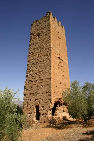
The Mocha tower, the other preserved in the medieval castle, is less elegant than the Clock. It is about seven meters from the side, it is made of masonry in one of its parts, it has its corners reinforced with rope and sawn, and it is topped with squiners - beams whose ends stand out to the outside.

Telecomunicaciones
Sitio web
www.pealdebecerro.es
Teléfono de contacto
953 730 075
Correo electrónico
ayuntamiento@pealdebecerro.es
Ubicación
Código Postal
23460
Latitud
37.911650
Longitud
-3.127570
Distrito
Municipio
Ubicación en el mapa
POINT (-3.12757 37.91165)
Tipos de punto de interés
Imágenes carrusel
imagen
Image
torre-mocha-peal-de-becerro-jpg
Imagen principal
Desactivado
Imágenes cabecera
imagen
Image
torre-mocha-y-paisaje-peal-de-becerro-jpg
Imagen principal
Activado
Loading map
Preparing points of interest and routes...
Tower of the Risquillo

Submitted by brandcode_deweloper on
Id
5387308
Descripción
Breve descripción

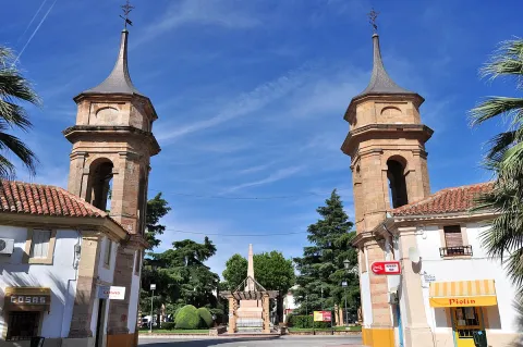
They are remains ofa bajomieval tower(tower of the homage of the old castle), probably from the 13th century thatconserves 4 m highand is located on a small hill a few meters fromCortijo Risquillo.

Ubicación
Código Postal
23100
Latitud
37.929300
Longitud
-3.560670
Distrito
Municipio
Ubicación en el mapa
POINT (-3.56067 37.9293)
Tipos de punto de interés
Imágenes carrusel
imagen
Image
t.%20risquillo.jpg
Imagen principal
Desactivado
Imágenes cabecera
imagen
Image
torre.jpg
Imagen principal
Activado
Microsite al que pertenece
Loading map
Preparing points of interest and routes...