Saltar al contenido principal

Úbeda RV Parking Area

Submitted by brandcode_deweloper on
Id
11767010
Redes sociales
Facebook
https://www.facebook.com/ubeda.turismo
Descripción
Breve descripción

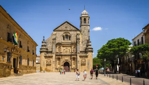
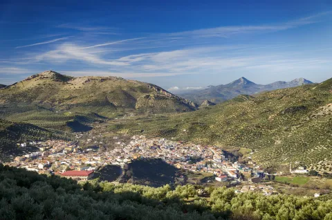
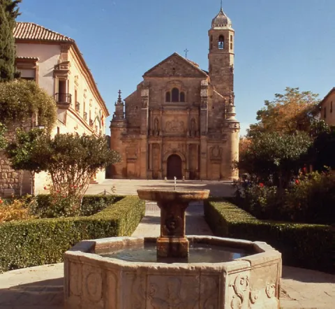
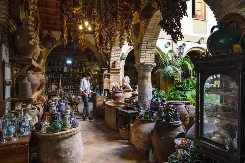
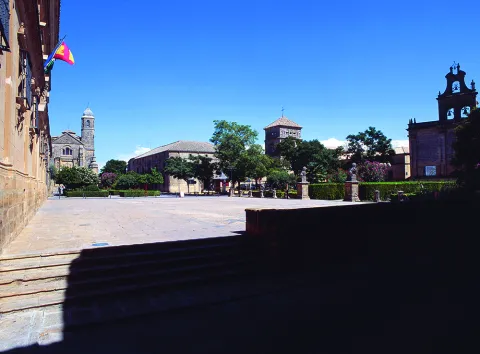
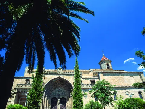
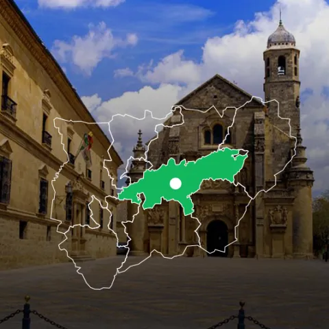
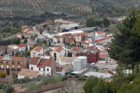
The city (World Heritage) has 48 notable monuments and over a hundred buildings of interest (Renaissance, Arab, Baroque and Gothic). Very important your Holy Week. A must visit to the Museum of the pottery and the Centre for the interpretation of the olive and oil.

Información de contacto
Teléfono
953 779 204
Sitio web
www.turismodeubeda.com
Correo electrónico
promocion@ubeda.es
Ubicación
Código Postal
23400
Latitud
38.006390
Longitud
-3.379440
Dirección
Travesía del Comendador Messía, s/n
Municipio
Ubicación en el mapa
POINT (-3.37944 38.00639)
Tipo de alojamiento
Imágenes
imagen
Image
visita-ubeda-baeza-individuales.jpg
Imagen principal
Activado
Horario
24 h
Qué ofrece

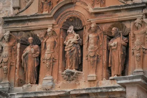
Ubeda has a beautiful monumental and cultural heritage that makes it a fundamental destination for those interested in the Renaissance architecture.

From its heritage we will highlight the excellent degree of conservation of many of its buildings, which still keep details of the time as can be the doors of claveted wood, the iron aldabas, the lanterns and the bars.

Loading map
Preparing points of interest and routes...
El Hotel

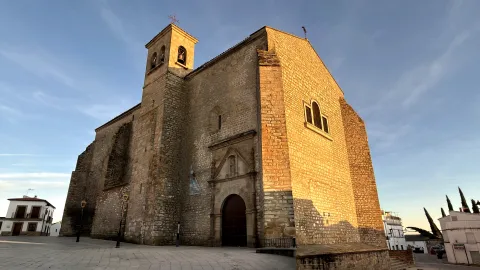
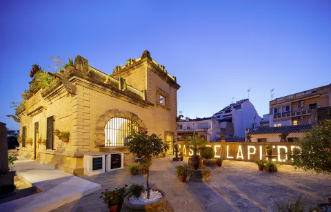
Free parking. Maximum stay, 48 hours. It is not allowed to remove chairs, tables, or other camping elements. All services and the historic centre are about 800 m away.

Number of places: 10 places.

Maximum permanence:Two nights.

Services included:

  • Empty of grey water

  • emptying of black water

  • Water filling

Valdepeñas de Jaén

Submitted by brandcode_deweloper on
Id
785241
Perfil de redes sociales
Facebook
https://www.facebook.com/Aytovaldepjaen/
Twitter
https://twitter.com/aytovaldepjaen
Descripción
Breve descripción

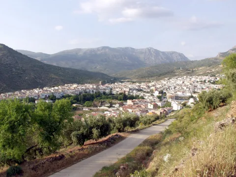
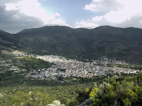
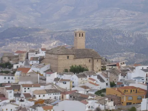
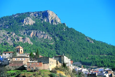
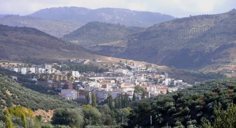
Valdepeñas de Jaén is a municipality in the province of Jaén, located in the Sierra Sur region, south-west of the province.

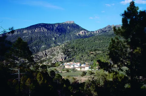
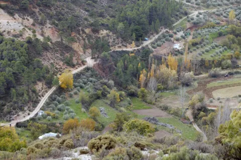
The forest area of its municipal area is important, as it is located between the mountains of the Pandera, to the north, and from Alta Coloma to the southeast. Giant Simas, complaints and centenary oaks with peaks that reach 2000 m., define this territory. This particular environment makes this territory ideal for major hunting.

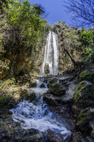
Thanks to its privileged geographical location, Valdepeñas de Jaén has natural areas of great beauty, with abundant water, many fountains and streams, such as the "Las Chorreras" and "El canyon de Pitillos."

Valdepeñas de Jaén is an agricultural municipality, dedicated mainly to the cultivation of the olive tree; livestock, with a significant number of dairy goats, and with the oil industry, as the only representation of the industrial sector.

From the point of view of the architectural and cultural heritage, they stand out: the church of Santiago Apostle, from the 16th century; the Mill and Museum of Santa Ana and the hermitage of the Holy Christ of Chircales.

Telecomunicaciones
Teléfono
953 310 111
Sitio web
www.sierrasurjaen.com
Fax
953 310 873
Correo electrónico
informacion@sierrasurjaen.com
Ubicación
Nombre
Valdepeñas de Jaén
Latitud
37.589990
Longitud
-3.815320
Distrito
Ubicación en el mapa
POINT (-3.81532 37.58999)
Imágenes
imagen
Image
026d37c8-f20e-4826-c560-fc4bd77cf68d?t=1689185839921
Imagen principal
Desactivado
imagen
Image
3915a8f7-9fa8-0fa7-ed74-33482ff4ea91?t=1689185840042
Imagen principal
Desactivado
imagen
Image
bf7bbb7c-a151-ac2a-8f75-8e8664552c21?t=1689185840462
Imagen principal
Desactivado
imagen
Image
98453ab0-439f-cba6-73c5-54b3a5b25a7c?t=1689185840881
Imagen principal
Desactivado
imagen
Image
0bccdf26-5a8b-ef52-9de2-440899afc7de?t=1595248348518
Imagen principal
Desactivado
imagen
Image
15f6355e-9e6c-3e9e-6918-eac63f4aa7f1?t=1609851228739
Imagen principal
Desactivado
imagen
Image
7cd536a0-35a3-14ef-e466-e2a09999c223?t=1609851228907
Imagen principal
Desactivado
imagen
Image
4b6a3aba-5a3a-9311-a524-6110d01145a2?t=1609851229068
Imagen principal
Desactivado
imagen
Image
afccba20-2c98-3860-39e8-8b8d90520758?t=1609851229232
Imagen principal
Desactivado
imagen
Image
883f69b0-3a2a-6539-e34e-36bb2a558298?t=1609851229437
Imagen principal
Desactivado
imagen
Image
140fa0cb-2c88-1a1e-4de2-d5edcf44c392?t=1609851229713
Imagen principal
Desactivado
imagen
Image
369762fb-6339-eab1-5f10-e099e16da4f4?t=1609851229863
Imagen principal
Desactivado
imagen
Image
e44f53d6-8cba-c851-c3c1-18b8a91385df?t=1609851230036
Imagen principal
Desactivado
imagen
Image
9bfa7b28-47f3-3615-5f27-1fa546ff704c?t=1609851230215
Imagen principal
Desactivado
Información adicional
Imágenes cabecera
imagen
Image
Valdepeñas
Imagen principal
Desactivado
Datos de interés

Tourist area: Sierra Sur and Campiña de Jaén
Distance to the capital (km): 34
Altitude over sea level (m): 923
Extension (km ²): 184
Number of inhabitants: 4,573
Gentilicon: Valdepeñeros
Postal code: 23150

Videos
Video file
Cultura

Valdepeñas de Jaén, founded by Carlos I, shares with Mancha Real and Los Villares, being one of the paradigms of the Renaissance urbanism, inspired by the theories of the trattadist Vitrubio.

Its urban morphology had to adapt a reticular route to the irregular orography of the hill on which this municipality is based. The city centre was located in the most flat part with a large trapezoidal square where the most emblematic buildings are located.

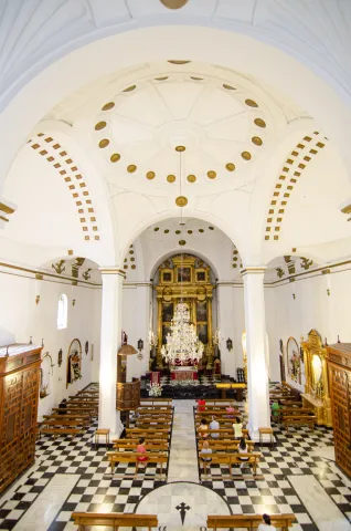
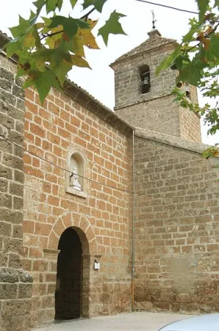
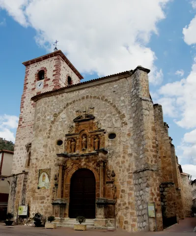
  • Parish Church of James the Apostle (s. XVI-XVII). Located on one of the corners of the square, it stands out both by height and volumetric, following the rules of Vitrubio that the most representative building must dominate the urban whole. Its cover, located not at the foot of the temple, but laterally to the square, opens with a simple half-point arch on which goes a second body with veneer intended to host the image of the saint holder. Built in the 16th century, in a Renaissance style, it is evident in the classicism and simplicity of its cover, in the proportionality of the tower and in the clarity and internal spatial amplitude.
  • Sanctuary and Hermitage of the Christ of Chircales. The origin of this sanctuary goes back to the Middle Ages. Located in the Chircal area about 20 km. of the city centre. On the first Sunday of May there is a pilgrimage to this sanctuary.
  • Mill Museum Alto de Santa Ana. It is a hydraulic flour mill of medieval origin. Restored in 2001, and in operation, it houses an ethnographic museum, of popular traditions and customs.
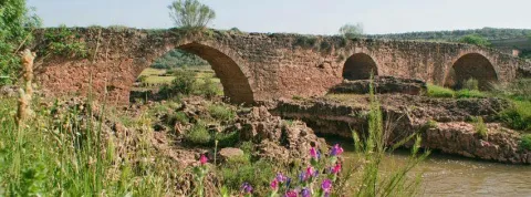
  • Santa Ana Bridge. Of possible medieval origin, also called the Dehesa or the Hundidero. Built in stone toba armchairs of the town, it has a single arch, under which they cross the waters of the river Ranera, tributary of the Víboras.

Other monuments of interest are: the episcopal residence, reformed in the 17th century under the inspection of Eufrassio López de Rojas and converted into episcopal headquarters when the Augustino bishop Fray Diego Melo of Portugal took refuge until his death in Valdepeñas; the Hermitage of Our Lady of the Angustias of the Parrizoso (on the banks of the Quebrajano reservoir) and the Hermitage of San SebastiánIn the old Egido, it has an attached cemetery.

Naturaleza

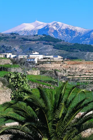
Valdepeñas de Jaén is a municipality with large forest mass when placed inside the subbetic saws. It is the highest point in the South Sierra to the north with the Pandera saw, with 1872 m., and to the south with the Alta Coloma saw.

The city centre is located 920 m. of altitude, located in a valley and surrounded by huge mountains. The natural environment with little exploitation by man must be highlighted. An environment full of walnuts, pastures, chaps and centenary complaints. His great saws, the Pandera and Sierra Vestinkers, mountains that are covered in snow during the winter.

Among the trees, the Coal Complaints, a millennial tree that has been declared a natural monument.

In this landscape of high mountains and abrupt areas lives a great diversity of wild animals who freely camp through the saws. An ideal place for the cynegetic species, especially for major hunting: deer, wowls, boars, muflons... among others.

A place where water is a true treasure of these lands that offer us countless fountains, waterfalls, reservoirs, rivers and streams which are contonated by these saws giving rise to places of a unique beauty such as: Paraje de las Chorras, Pitillos, declared Natural Monument and which conserves a forest of unique tiles in the region and of the few existing in Andalusia, Navalayegua's lookout, Salto del Hoyo, Chircales, el Castellón, el Vadillo or el Charco de Utrera, a large waterfall of 25 m, or the swamp of the Quebrajano and its imposing cannons.

The areas of the valley, populated by olive trees is the primary crop, next to the livestock and small game cynetic species, also has a goats' cabin Very important dairy.
We can say that the term of Valdepeñas we offers privileged places to contemplate nature in its greatest splendor and let him delight us and seduce us.

Fiestas y Eventos

Valdepeñas is a town of deep-rooted customs and traditions that make it unique. Where festivities are held that do not lose traditions like La Candelaria, In which the fire remains the protagonist, or the carnivals that fill the streets of the town with color and joy. There are also these parties:Holy Week, with dramatic representations of scenes of the Passion of Christ full of religiosity and that awaken the emotion among the attendees.

  • Romeria del Cristo de Chircales, which takes place on the first Sunday of May. The joyful and colorful Romeria in honor of the Most Holy Christ of Chircales, where the unique environment in which it is celebrated and the devotion he feels for his saint makes it a day expected by the Valdepeños and the visitors.
  • Realenga parties, are held in mid-August and attend them is like making a trip to the 16th century, enjoying the Renaissance gastronomy of those years, walking through a medieval market, listening to music, attending theatrical performances, animal samples, shooting with bow... Everything in the dress of the time creates a fantastic atmosphere.
  • September Big Fair. To fire the summer, the Great Fair takes place, where music and fun are guaranteed. Party that revolves around the Christ of Chircales, For these days it is carried from its hermitage to the church of the people.
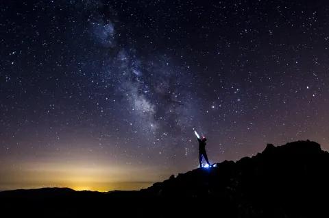
  • The agribusiness character of the massif of the South Sierra and Pandera in particular, it provides an exceptional framework for the development of activities related to nature and active tourism, such as free flight, hiking, cycling or mountain bike (It is not obvious that Pandera itself is the end of a remarkable mountain stage of the Ciclisto Tour to Spain) or astrotourism.
  • The old military base of The Pandera is the highest point of the Starlight Reserve No. Sierra Sur de Jaén and an emblematic place for the observation of the firmament. At its top there is a great explanade where in the past there have been important remains of astronomy fans that brought together hundreds of people. Another very interesting point is the Cortijo del Moralejo.
  • Jaén Valdepeñas Interpretation Center. It is located in San Isidro S.C.A. Jaén Road, km. 2. and dedicated to the history of olive and olive oil. It belongs to the Red de Almazaras oleoturísticas de la Sierra Sur.
Gastronomía

The gastronomy in the town is very linked to the livestock. The local receptarium gives hands to the surrounding mountains to incorporate into the table Triguero asparagus and cardo mushrooms and also aromatic herbs used as additives in many of the dishes.

Of the most typical dishes, we highlight:

  • "Chop to the chard.", it is cooked and well watered with a salsa of almonds, tomatoes, pepper... all very heavy with the bias.
  • "Carnerete."A chickenpox with lamb meat.
  • "Peanuts"
  • Migas with potatoes.

Between the typical sweets: "Ochíos" "nochebuenos as" "Sin salas," rosquetas, "roscos de vino" and "bollas de higo."

Typical drinks as the "resol" and "old milk", typical Christmas drink that mixes: milk, spirit, coffee, cinnamon and lemon crusts.

Historia

The oldest remains documented in the term Valdepeñas go back to the Bronze ageand are located in the area called "Castellón."

During Roman times a proliferation of small houses linked to the peasantry, as the remains in the Ventilla, Navalenga, El Torcal, La Solana, Pitillos and others testify.

In the Islamic period the castle of Susana, mentioned in the Arab and Christian chronicles, is raised with a rather busy existence, being conquered on several occasions by both sides.

What today is Valdepeñas de Jaén was founded on 1539 by the Emperor Carlos V, as a new population, within the project of colonization and repopulation of the saws of Jaén.

In the new towns is implanted a urbanism called colonial, in the form of a damer, in which the streets in reticle will give to the main square, the place in which are the most representative buildings: church, town hall, posite... A kind of urbanism that has been maintained to this day.

By 1550, the population was fully constituted, but as a place under the jurisdiction of Jaén. It will be in 1579 and thanks to the donation of 1,370,000 Maravedis who contributed their 170 neighbors, King Philip II gives Valdepeñas the title of the village, disconnecting from the city of Jaén.

Valdepeñas took an active part in the War of Independence, possibly encouraged by the Bishop of Jaén, who resided in the palace that the bishopric had in the city.

In 1917 obtained the title City, granted by S.M. King D. Alfonso XIII.

Loading map
Preparing points of interest and routes...
Imagen principal
imagen
Image
bd00fe5b-0aa1-5c0f-2b41-4bb61c4eb0cc?t=1689185839799
Imagen principal
Activado

Úbeda

Submitted by brandcode_deweloper on
Id
785118
Perfil de redes sociales
Facebook
https://www.facebook.com/pages/Turismo-de-%C3%9Abeda/173591095987915
Twitter
https://twitter.com/Turismodeubeda
Descripción
Breve descripción

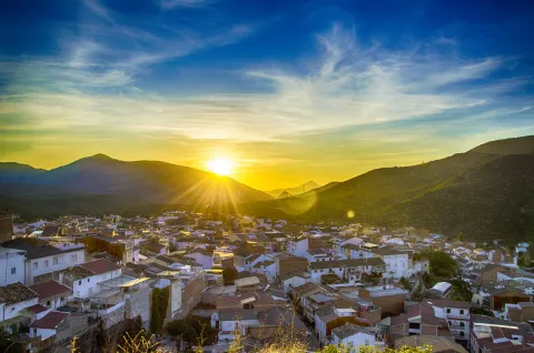
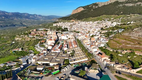
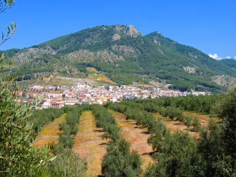
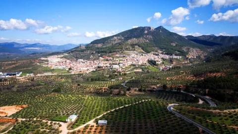
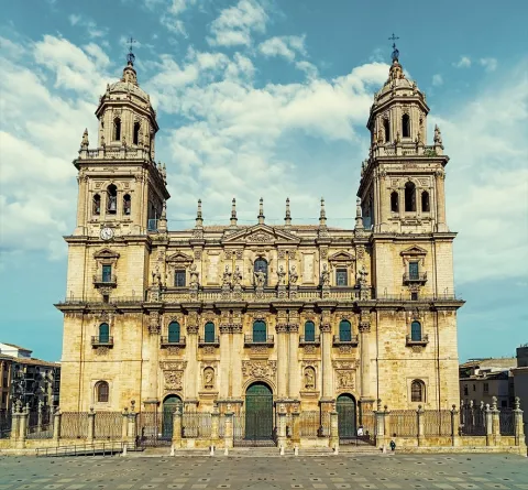
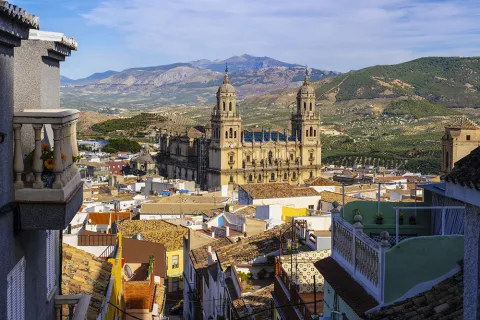
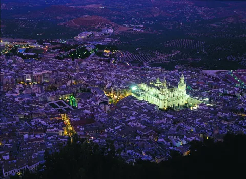
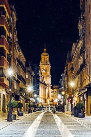
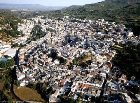
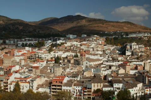
This important city, settled on the hills of its own name, is located in the centre of the province of Jaénand is the capital of the region called La Loma.

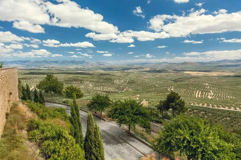
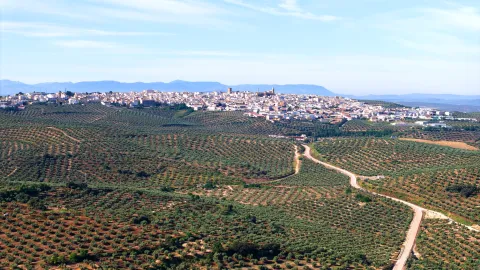
Surrounded by a landscape of an extraordinary natural beautyin which the flat grounds for the cultivation of the cereal are alternated, with the smooth slopes of olive trees, seems to summarize the essence of the province of Jaén.

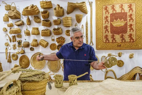
It is very important, within its varied economy, the crafts, with numerous workshops of pottery and ceramics, of forge, size, glass, tapestries, spartum, singing, etc.

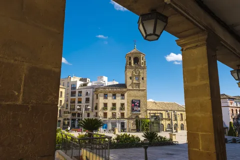
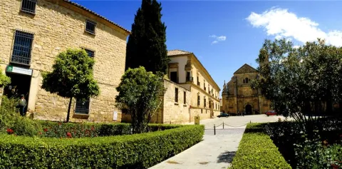
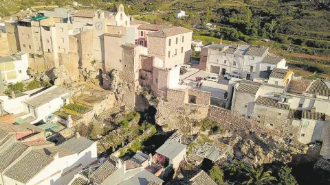
As we walk through its lordship streets to admire the monuments, churches, palaces and lordship houses, we move virtually to the times of the historical splendor of this city.

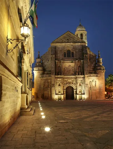
Ubeda is known as "the city of the Andalusian Renaissance"for the quantity and quality of the monuments of this artistic age.

Together with Baeza, it has been declared World Cultural Heritage by Unesco on 3 July 2003.

Telecomunicaciones
Teléfono
953 779 204
Sitio web
www.turismodeubeda.com
Correo electrónico
promocion@ubeda.es
Ubicación
Nombre
Úbeda
Latitud
38.012640
Longitud
-3.371590
Municipio
Ubicación en el mapa
POINT (-3.37159 38.01264)
Imágenes
imagen
Image
4799c128-4243-ddbe-4c6c-d5f7ee6541a5?t=1603983703047
Imagen principal
Desactivado
imagen
Image
b990224c-93ea-e0df-74c2-b7e6183a3016?t=1603984517266
Imagen principal
Desactivado
imagen
Image
751f0349-5ec0-e737-56cf-235536e32ce7?t=1603983703075
Imagen principal
Desactivado
imagen
Image
6ddd0085-05f6-e8ef-366a-1963e112a78f?t=1603983703173
Imagen principal
Desactivado
imagen
Image
079eab40-54b9-462f-9652-50503cdb19b9?t=1585914434000
Imagen principal
Desactivado
imagen
Image
658dab1d-a8b7-6142-60d7-be18c41b4400?t=1620124630064
Imagen principal
Desactivado
imagen
Image
783f65fe-f295-0ac3-a5f1-c8a445f97f9d?t=1603987184323
Imagen principal
Desactivado
imagen
Image
a1c2cc59-155f-b35e-3797-8753b948883f?t=1603987072290
Imagen principal
Desactivado
imagen
Image
d514a2f2-df93-6914-23d0-4a2d3d8def54?t=1585914433864
Imagen principal
Desactivado
imagen
Image
96a361d6-abc7-8d8a-ac2d-39d7b956fb9a?t=1585914432211
Imagen principal
Desactivado
imagen
Image
34223fac-9819-3cc8-ab77-1ea66239de9c?t=1585914433058
Imagen principal
Desactivado
imagen
Image
897fc220-a1c5-8dc7-21a7-f794bb4b5ab1?t=1585914432869
Imagen principal
Desactivado
imagen
Image
fd162935-02a3-19d4-6d0a-e70d45e30088?t=1585914432724
Imagen principal
Desactivado
imagen
Image
c31acbfe-c818-2117-4875-2a38f23fdadd?t=1585777415890
Imagen principal
Desactivado
imagen
Image
a3df8019-f7c4-818f-49a7-812719c7627e?t=1585914432622
Imagen principal
Desactivado
imagen
Image
d66bcf17-80e3-b88c-1e2b-9e0c440410ed?t=1602853416998
Imagen principal
Desactivado
imagen
Image
ac732a47-55b6-b0eb-e42d-53cde4d8d4b5?t=1602853581698
Imagen principal
Desactivado
imagen
Image
5f1448d6-c40c-9c82-d042-dffbb558575d?t=1602853977830
Imagen principal
Desactivado
imagen
Image
8e10cba1-a64b-07b1-57ea-fa3bbbc174a1?t=1602854679588
Imagen principal
Desactivado
imagen
Image
a370e5d1-865a-9977-a663-e2feb66503c8?t=1602854760846
Imagen principal
Desactivado
imagen
Image
8f29648a-eadd-6fcc-1d1c-72ed12871101?t=1602858438953
Imagen principal
Desactivado
imagen
Image
d91d519d-ed0d-52aa-15a1-d61aeea22169?t=1602858557129
Imagen principal
Desactivado
imagen
Image
ec2bae3a-6a55-0359-e557-f51383218c1d?t=1602858895450
Imagen principal
Desactivado
Información adicional
Curiosidades

Oficina De Turismo De Úbeda
Plaza Andalucía, 5, 23400 Úbeda, Jaén
http://turismodeubeda.com/index.php/es/

Imágenes cabecera
imagen
Image
f6f7b606-a62a-fa14-8ad1-f8933a23bfde?t=1611066284336
Imagen principal
Desactivado
Datos de interés

Tourist area: Ubeda / Baeza
Distance to the capital (km): 56
Altitude over sea level (m): 757
Extension (km ²): 404
Number of inhabitants: 34345
Gentilicon: Ubetens
Postal code: 23400

Videos
Video file
Cultura

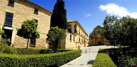
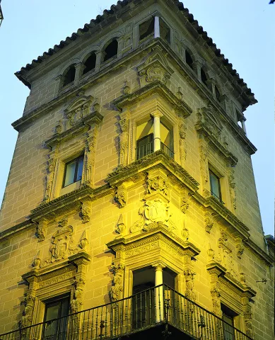
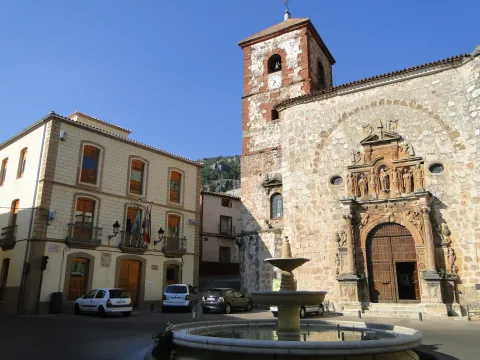
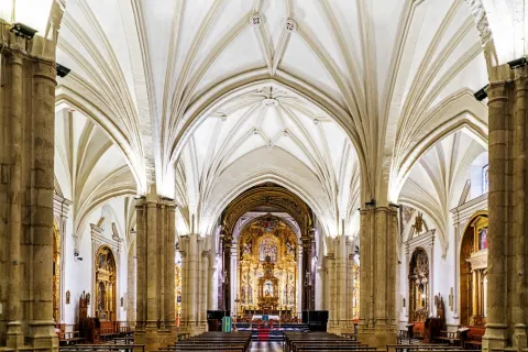
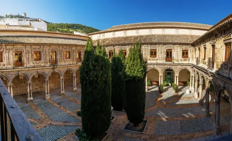
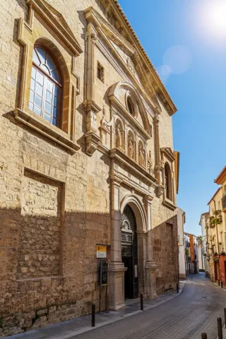
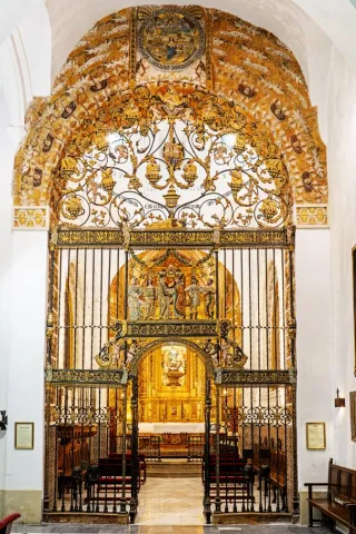
Ubeda has a beautiful monumental and cultural heritage that makes it a fundamental destination for those interested in the Renaissance architecture.

From its heritage we will highlight the excellent degree of conservation of many of its buildings, which still keep details of the time as can be the doors of claveted wood, the iron aldabas, the lanterns and the bars.

It covers such a number of monuments, churches, palaces and master houses, that it would be difficult for us to list them here to the full. Among its most notable monuments of Ubeda are the following:

Historical center:

  • Plaza Vázquez de Molina
  • Sacra Capilla Funeraria de El Salvador del Mundo
  • Basilica of Santa Maria de los Reales Alcázares
  • Palace of Vázquez de Molina or Palace of the Chains. Current City Hall and houses the Andrés de Vandelvira Interpretation Center
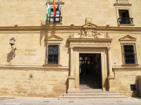
  • Deán Ortega Palace. Current National Tourism Parator
  • Hospital de los Honrados Viejos de El Salvador
  • Palace of the Marquis de Mancera
  • Vela de los Cobos Palace
  • Church of San Pedro
  • Church of St. Paul. Located at 1 May.

Barrio del Alcázar, San Lorenzo and Santo Domingo:

  • Casa de Las Torres
  • Palace of the Medinilla
  • Church of San Lorenzo
  • Church of Santo Domingo

San Isidoro district:

  • Santiago Hospital
  • Palacio del Marqués de la Rambla
  • Church of San Isidoro
  • Church and Convent of the Most Holy Trinity

Barrios de San Pablo y San Nicolás:

  • Church of San Nicolás de Bari
  • Convent of the Immaculate Conception. It houses a museum.
  • Casa de la Tercia - Olivar and Oil Interpretation Center

Barrios de San Millán y Santo Tomás:

  • Valencia Street. Numerous craft workshops to visit.
  • Church of San Millán
  • Palacio Francisco de los Cobos

Route of San Juan de la Cruz:

  • Convent of San Miguel and Oratorio of San Juan de la Cruz

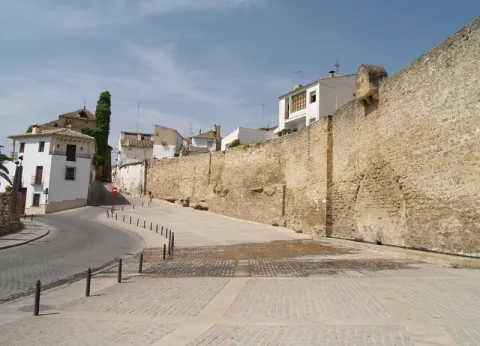
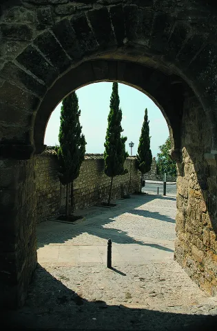
In addition to these interesting attractions, we suggest a visit to the walls to contemplate the extraordinary panorama obtained from them.

Naturaleza

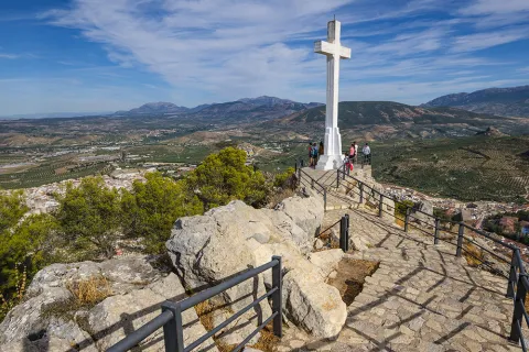
It is the main center of the region called La Loma. Ubeda is located on a hill at 750 m of altitude, and is surrounded by the valleys of the Guadalquivir and the Guadalimar.

Very close, around it, are the Natural Parks of Despeñacolos, Sierra Magina and Sierras de Cazorla, Segura and Las Villas.

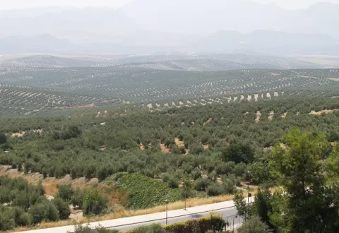
The landscape is very characteristic because it is composed of a "sea of olive trees," as the poet Antonio Machado wrote.

Fiestas y Eventos

The city of Ubeda presents a mosaic of cultural activities, festivals, fairs, romanias... Events all very deeply rooted in the population and with a very consolidated organization, which makes visitors from all parts of Spain participate.

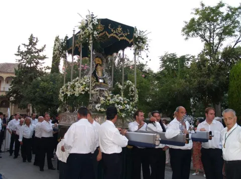
It is worth the celebration of the Holy Week, one of the most popular parties in Andalusia, being declared a National Tourist Interest Party.

On May 1, the Romeria de la Virgen de Guadalupe, patron of Ubeda and known as the "Great Romery." That day the Virgin moved from her sanctuary to the village of Santa Eulalia.

Typical are also the San Antón fires"the lumbres." On January 16, fires are made in the different neighborhoods, where sardines are roasted or the cobbled.

Special emphasis party of San Isidro Labradoron 15 May, farmers' employers and who enjoy much devotion among the olive workers.

Together with the neighbouring city of Baeza, the Festival of Ancient Music. And in the last months of the year, the puppet and tale festivals take place.

And we cannot stop quoting the San Miguel Fairon September 29, the city's patron party. And during the days of this fair the Autumn Theatre Show takes place, as well as high-quality musical activities and children's activities for all ages.

Other relevant events highlight theFlamenco and Mestizo Festival "City of Ubeda" or Exhibition of Autumn Theatre of Ubeda.

+ INFO

Gastronomía

The ubetense cuisine is basically Mediterranean, with influences both manchegas, alumina and Andalusian root.

The table includes legumes, game meat and products derived from the "slaughter of the pig," and, of course, virgin olive oil and table olives. Among the most outstanding dishes would be:

  • The crumbs (reminiscent of the shepherds in transhumanism).
  • The ointment, an olive oil cake.
  • The slick.
  • Potage of beans with eggplants.

The bars and canteens are the traditional meeting point of the ubetens. If you visit the city in September you can attend the Fiesta de la Tapa.

We cannot forget the "Gourmet days of the Renaissance". They take place from January to March in the most emblematic restaurants, where both lunch time and dinner are accompanied by shows.

Historia

The latest archaeological research shows that the first settlements of Ubeda date back to the Copper and Bronze Age (III and II millennium A.C), being the "oldest city in Europe" scientifically documented.

In search of product exchanges the Greeks will arrive and later the Carthaginians, who would be defeated by the Romans. It is under the Roman Empire, from the battle of Llipa in 206 BC, when the old city is romanized and will be known as the Betula.

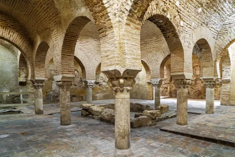
The city takes on importance with the arrival of the Arabs, in particular with Abdeleran II, in the S. IX, who overlooks it with the name of Ubbada or Ubbadat Al-Arab (Ubeda "of the Arabs"). As a Muslim city it was surrounded by walls and became one of the most important cities of Al- Andalus, due mainly to its crafts and trade.

In the S. XI it will be conquered by the alparavids. And the definitive Christian conquest was carried out in 1234 by King Fernando III.

A number of factors, such as the geographical location, its extensive and rich jurisdiction, as well as the presence of an increasingly powerful nobility, would lay the foundation for the splendor that Ubeda reached in the 16th century.

The economic development of the city based on agriculture and on the feral livestock, the rotations of the forests that represented an increase in the land of cultivation, and having a mesta of its own, will base the greatest splendor of the city, which was a demographic increase to reach 18,000 inhabitants.

In addition to the ubetense nobility and the Orders of Cavalry, we found a group of neighbors who have prospered (doctors, tailor, scribes, bots...) that will lead to an incipient bourgeoisie.

To highlight the role of Francisco de los Cobos, secretary of Charles I, who, with his interest in art and under the advice of the architect Andrés de Vandelvira, fills the city with palaces. In Ubeda, take root the humanist currents of the Renaissance. It will be Juan Vázquez de Molina, Secretary of Charles I and Philip II, who will continue with the planning initiated by his predecessor.

Declive:
The 17th and 18th centuries are of decline for the city, as Spain is in a general crisis. The bad crops, the unfair pressure of taxation to cover the cost of wars, corruption, the power of the clergy, the expulsion of the Moorish, will be factors that contribute to the loss of that splendor that characterized this city.

Later, in 1820 and 1836, ecclesiastical disamortizations, Carlist wars, Civil War and post-war will come.

Recovery:
It will be in the 1960s and 70s of the last century, thanks to the development pull, when slowly it was the "Florence of Alta Andalucía" go to the present place and become a provincial reference point, head of the region of La Loma and a centre of industry and services of increasing importance.

Otra información

Known people born in Ubeda:

  • Antonio Muñoz Molina, writer and member of the Royal Academy of Language.
  • Joaquín Sabina, singer.

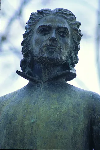
In Ubeda dies San Juan de la Cruzon 14 December 1591.

The popular saying of leaving or "walking on the hills of Ubeda," has its origin in the conquest of the Almohades of the Jienese city of Ubeda in 1234. It seems that one of the most important captains of King Fernando III "the Holy," disappeared moments before entering into combat, and that he appeared after the city was conquered. Asked where he had been, he replied that he had been lost by the hills of Ubeda.

Loading map
Preparing points of interest and routes...
Imagen principal
imagen
Image
9bbdff4c-5e18-d227-f40c-7c89c56fd0d7?t=1603979510184
Imagen principal
Activado
Literatura

These reasons are further enriched by the fact that San Juan de la Cruz died here, having been brought to the city to recover from a slight fever, and by the fact that it is the birthplace of Antonio Muñoz Molina, winner of the Premio Planeta and the Princess of Asturias Award for Literature.

You must come to Úbeda and venture into its streets and monuments, discovering them through the eyes of these authors. Without doubt, a different way to enjoy this monumental city.

Torreperogil

Submitted by brandcode_deweloper on
Id
4892283
Perfil de redes sociales
Facebook
https://www.facebook.com/AytoTorreperogil/
Twitter
https://twitter.com/torreperogil
Youtube
https://www.youtube.com/user/AyTorreperogil
Descripción
Breve descripción

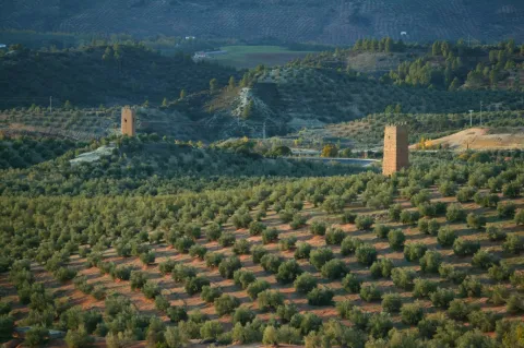
Municipality located in the the heart of the region of La Loma, 8 km fromUbeda with which it maintains a close link. Surrounded by olive groves, with a picturesque urban core of white, crouched and well-known houses.

Part of its term is included in the Natural Area of Alto Guadalquivir. This natural area is made up of the reservoirsBridge of the Closed (Torreperogyl),Dona AldonzaandPedro Marínand the river and river sections between the swamps.

This river, which runs south of the municipality, borders the municipality of Cazorla.

Highlights the olive tree as a majority of its land, also the cultivation of chickpeas and vegetables in the vegas of the Guadalquivir Valley to the south of the municipality and a small area of its land, dedicated to the vine, which provides a quality wine. There is a protected geographical indication of "Wines of the land of Torreperogil."

As for its industry, it is important to point out the construction, as is the predominant sector. In the crafts, the size of olive wood stands out.

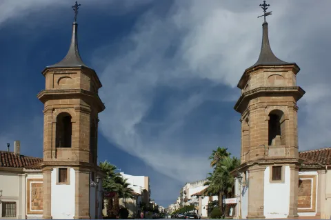
Of his Historical Heritage The Parish Church of Santa Maria Major, which is the most unique monument, the so-called Dark Towers (remains of the old fortress of But Gil) and hermitage of the Virgin of Mercy.

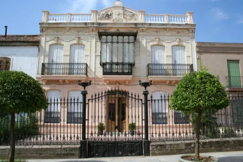
Torreperogil has a wide range of historical houses dated between the 19th and 20th century.

Telecomunicaciones
Teléfono
953 776 000
Sitio web
www.torreperogil.es
Fax
953 776 025
Correo electrónico
info@torreperogil.es
Ubicación
Nombre
Torreperogil
Latitud
38.034620
Longitud
-3.287700
Municipio
Ubicación en el mapa
POINT (-3.2877 38.03462)
Imágenes
imagen
Image
93d7675a-bc97-bc16-810e-bbfa259065f5?t=1605042473338
Imagen principal
Desactivado
imagen
Image
db133356-2c60-54a1-263f-1b54d869f3dc?t=1598963760580
Imagen principal
Desactivado
imagen
Image
bade3139-c0ac-0add-0f76-07e9f0cba84e?t=1598963783568
Imagen principal
Desactivado
Imágenes cabecera
imagen
Image
Torreperogil
Imagen principal
Desactivado
Datos de interés

Tourist area: Ubeda / Baeza

Distance to the capital (km): 63

Altitude over sea level (m): 749

Extension (Km2): 90 '87

Number of inhabitants: 7,276

Gentillo: Peroxileños or Torreños

Postal code: 23320

Videos
Video file
Cultura
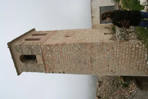
  • Dark Towers: They are the most representative element of the urban complex of Torreperogil. They were part of the old castle - a fortress built in the 13th century, between 1230 and 1240 and which gave rise to the villa that was built after the battle of the Navas de Tolosa. At the end of the 19th century there were four towers, but at present only two are preserved. One of them is a square floor, it is accessed inside by an intellized door. It has a single floor covered by a pointed vault and it has aspillers in its paraments. The other, known as the ochavada tower, has an octagonal plant, is built of thick armchair and crowned with powerful shoes for the support of the matacans. To access its interior, it has a narrow warhead door and is given light by small saetera windows. They have been rehabilitated in recent years of the 20th century how Municipal Auditorium.The Ochavado Torreon and the Square Torreon eThey are declared a Historical Monument.
  • Church Santa Maria la Mayor, also known as the Assumption, dates from the first decades of the 16th century. It is a work of Gothic tracewith a single, slender polygonal headboard, divided into three sections with starry and very high Gothic vaults. It's proven that The main vault is work of Andrés de Vandelvira, which was decorated with Renaissance paintings of the seven virtues. On the outside four powerful counterforces. It has two covers, one of them works by Diego de Alcázar, disciple of Vandelvira, It shows on the bow and central space a hornant with the stone image of Our Lady of the Assumption with the Child in arms. The main cover is attractive and great. The access with a refined double arch and on it, stone images of Santa María la Mayor and San Juan Evangelista. Inside, a magnificent altarpiece, dated 1571, known as the "Stone Altar ", the work of Alonso de Vandelvira, with a high relief that represents the Descending Christ on the Cross and the city of Jerusalem at the bottom. The altar bank conserves the 16th century Sevillian tile and on it the figure of the lying Christ. It has been declared Good of Cultural Interest with the type of monument, in 2010.
  • Hermitage of the Vthe irgen of Mercy: Built between 1593 and 1634. Inside it is a rectangular-floor ship, which has been restored in 1960, covered with a half-barrel vault with lunetes and articulated with five hornant chapels on each side. The presbyterium is covered with half orange on pechines and communicates with the shrimp by means of a half-point arc on double mends. The Camarín, with baroque bills, with 18th-century gypsies, stands out. The main façade was built between 1960 and 1965, while the southern cover, of Renaissance style, was from the 16th century. The image of the Virgin of Mercy, patron of Torreperogil is an anonymous author and was sculpted in 1939, although it was restored in 1960.

Naturaleza

Torreperogyl has an extension of 90,87 km2 and at an average altitude of 749 m. on the sea level, it is on the top of the plateau of La Loma, framed by the Guadalimar River to the north, and by the Guadalquivir River to the south.

The cultivation of chickpeas and vegetables becomes important in the fruit and vegetable fields of the Guadalquivir valley.

There is also, a small part of the dedicated land to the cultivation of life. The result is one of the few Jiennense municipalities with wine production. It also has a geographical indication of "Wines of the land of Torreperogil," which also covers other nearby locations.

By the term of Torreperogil, among many other species are moved as emblematic as the grubb, cappuccino herrererillo, royal anade (azulon), ash aguilucho, common badger, fox, European otter, boar, gineta or musk cat, gamo, deer, montess goat, Guadiana boga, barbo andaluz, trout and crebra of stairs.

From the urban centre panoramic that are visible are spectacular: to the north the foothills of Sierra Morena, to the south Magina saw and the depression of Guadalquivir, and to the east the Serras of Cazorla, Segura and Las Villas.

At present the olive tree has been displacing the other cropsin the driest areas the almonds spatter in white in the spring.

But in addition to this great framework in which it is located, Torreperogil has places of special interest, among them we will mention:

  • El Paso Real Canyon. On a millennial road, Cañada Real de la Meseta, a recreational area has been built with parking, shadow areas and children's playground. A place to spend a nice family day.
  • Close Bridge. It is a basin regulatory reservoir, belonging to the Guadalquivir River, where you can enjoy the typical landscape of the wetland (especially carrizos), as well as the abundant aquatic fauna that forms the ecosystem: avetoro, large tick, squid, duck ral, duck spoon, common focha...

The confluence of such environments makes this place a space of great diversity, which has served your declaration asSpecial Protection Area for Birds.

Fiestas y Eventos
  • San Antón January 17. Around the bonfires, they taste roasted chickpeas accompanied by punch, drink made from Torreperogil wine, soda and sugar.
  • Carnival in February. It is commemorated in the municipality since time immemorial. It is a tradition that has never ceased to be celebrated and in which the "masked," which is a character who is disguised in old garments increases the concurrence becoming the most genuine of the carnival.
  • Romeria in honor of James the Apostle. In the hermitage of the Holy built on the estate El Pósito, every First of May is celebrated the rosemary and the bathroom in the river of the image of Santiago Apostle, mounted on a horse. The most unique of this party is found in the horse racing with flamenco-bound rider, which in the morning and in the afternoon mark the beginning and end of the party.
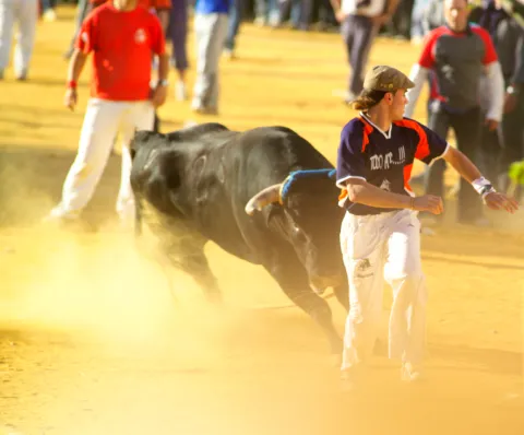
  • Celebrations in honor of Saint Gregory and the Virgin of Mercy. In Torreperogil they celebrate their patron parties in the second week of September. The most prominent are the braggard coils, the brandy bull in the morning, the fire bulls, a man who under a bull costume covered in flares admonishes the attendees, and the flamenco and rock festivals.

There is also the Corpus Christi, San Isidro, the Cruces de Mayo...

Gastronomía

The gastronomy of Torreperogil is based on the good products of the earth. We highlight the following dishes:

  • Aeggplant knife. Typical dish, made with eggplant of the earth, green onion bread, tomatoes, olive oil, garlic, parsley cumins and salt.
  • Caldy rice with rabbit. A dish that cannot be missed on the days of field food. We need: Rabbit, rice, green and red peppers, tomatoes, garlic, laurel, black pepper ground sweet pepper, saffron salt and parsley.
  • Cod scallops. The alrajos is a typical meal in the region of La Loma: flour, oil, tomato, onion, red and green pepper cod, mushrooms, cumin, pepper, peppermint, garlic, parsley, pepper and colouring.
  • Dizziness: Overcooked chickpeas, onions, olive oil, Pimenton and dry red pepper.
  • Pipirrana: Potatoes, olive oil, cod, onions, pepper.
  • Gachamita. With olive oil, garlic, potatoes, water flour and salt.

From your confectionery we quote: Drinks, Ochíos, Hornazos, Roscos de frying pan, Sweet panecetes....

Wine types: White, pink and dyes.

TheS.C.A. Our Lady of Mercywas born in 1956. During the visit you will know the modern facilities opened in 2005 and the most advanced techniques for the development of theOlive oilsandWines with protected geographical indication Wines from the land of Torreperogil.

The white varieties of grapes that they produce represent approximately 70% of the surface, the most representative being the Jaén Blanco variety. Pedro Ximénez, Airén and, to a lesser extent, Palomino Fino, Cirial, Jaén colorado and others are also grown. The remaining 30% of the surface is dedicated to the cultivation of red varieties, especially early ring and ink garnacha although Cabernet Sauvignon and Merlot are also grown.

Products Degusta Jaén: In addition to the wines mentioned, there are breads, sweets and beer, meat and sausages such as the white butyfarra with the label "Degusta Jaén Quality" which gives them recognition at national and European level.

Historia

It was founded by the Phoenicians. During the Roman era it became more important. In the period of Al-Andalus its fortifications were reconstructed.

The name Torreperogil has His origin in the master of the tower around which the people were built: But Xil of Zatia.

This man was a Spanish gentleman who distinguished himself in the Christian conquest of Ubeda in 1231 at the orders of Fernando III and one of those who settled in the villages of the Loma de Ubeda

Under the jurisdiction of the Gil remained up 1369, date on which his personal lord and friend of Peter I was killed next to him in Montiel. After his death, Henry II granted Torreperogil to Ubeda in lordship, for the support received. He achieved his independence in 1635, granted by Philip IV, something that Ubeda does not accept and this makes his declaration of villa is delayed until 1642.

For the centuries XVI and XVII consolidates its urban centre and its population. In the 19th century the villa had been distinguished for its struggle against the French in 1808, its cooperation in the Carlist wars with the maintenance of the national militia and for having been the first people to proclaim Alfonso XII kingand so this monarch granted him the title of Very Illustre Villa de Torreperogil.

Loading map
Preparing points of interest and routes...
Imagen principal
imagen
Image
Torreperogil
Imagen principal
Activado

Porcuna

Submitted by brandcode_deweloper on
Id
749735
Perfil de redes sociales
Facebook
https://www.facebook.com/AyuntamientoDePorcuna/
Twitter
https://twitter.com/aytoporcuna
Instagram
https://www.instagram.com/ayuntamientoporcuna/
Descripción
Breve descripción

Among large plains of green olive trees is a noble atalaya in which is found Porcra, a universe in stone carved through its six thousand years of history.

Canteros of all times recorded in their walls the mark of an illustrious past, leaving for eternity the echo of their master's. In it the sculptural set of Cerrillo Blanco was modeled; the solid foundations of the Roman Obulco were raised; it served as the custody of an Andalusian bulwark and was the site of matres and calatraves.

Its golden stone carved by hand looks majestic in monuments and squares that open to the astonishment of those who contemplate it.

Our earth, changing in appearance, but unchanging spirit, has traveled through time wrapped in names that narrate the same essence: Ipolca, Obulco, Bulkuna... Porcella.

Today, Porcilla invites you to enter into its charms, to lose you through its serene streets, to feel the closeness of its people and to taste, without haste, the truth of its gastronomy. Because here, every stone tells a story and every story awaits you.

Telecomunicaciones
Teléfono
953 544 004
Sitio web
www.porcuna.es
Fax
953 544 606
Correo electrónico
ayuntamiento@porcuna.es
Ubicación
Nombre
Porcuna
Latitud
37.871140
Longitud
-4.183990
Distrito
Municipio
Ubicación en el mapa
POINT (-4.18399 37.87114)
Imágenes
imagen
Image
img_5364-jpg
Imagen principal
Desactivado
imagen
Image
2531-0120-1-jpg
Imagen principal
Desactivado
imagen
Image
2438-1439-jpg
Imagen principal
Desactivado
imagen
Image
_mg_3740-jpg
Imagen principal
Desactivado
imagen
Image
img_9531b-jpg
Imagen principal
Desactivado
imagen
Image
2241-0082-jpg
Imagen principal
Desactivado
imagen
Image
04-1-jpg
Imagen principal
Desactivado
imagen
Image
img_7925-jpg
Imagen principal
Desactivado
imagen
Image
02-1-jpg
Imagen principal
Desactivado
imagen
Image
img_6720-2-jpg
Imagen principal
Desactivado
imagen
Image
foto-parroquia-jpg
Imagen principal
Desactivado
imagen
Image
img_9364-jpg
Imagen principal
Desactivado
imagen
Image
1657-0934-jpg
Imagen principal
Desactivado
Información adicional
Curiosidades

Oficina de Información Turística

Plaza de Andalucía, 3

Tlf.: 953 545 130

oficinaturismo@porcuna.es


Imágenes cabecera
imagen
Image
Porcuna
Imagen principal
Desactivado
Datos de interés

Tourist area: Sierra Sur and Campiña de Jaén

Distance to the capital (km): 42

Altitude over sea level (m): 427

Extension (km ²): 174.5

Number of inhabitants: 7,055

Gentilicon: Porcunenses

Postal code: 23790

Videos
Video file
Cultura

Ibero site of White Crow

The pale tone of its rocks gives meaning to the name of this small hill located two and a half kilometres from the urban core of Porcra: White Crow.

Archeologically involved during the 1970s of the last century, the process of human use of the field is delimited in three moments.

First, during the tartesic period, there is a distinction between an inhumation necropolis dated around the 7th century BC. There are twenty-four individual graves and a double-chamber grave.

From a second epoch, around the 5th century BC, is the largest Iberian sculptural ensemble of the national territory. A thousand three hundred fragments among which are more than thirty sculptures. The warrior of double armor, symbol by anthonomasia of the Iberian world in general, stands out.

Finally, necropolis continued to be used for such purposes from the 5th century BC to the 1st century BC, changing the first rite of imhumation to the rite of incineration.

Roman Amphitheatre of Obulco

The Roman Amphitheatre of Obulco was one of the largest show buildings of the Roman Hispania, an example of the enormous magnitude of the ancient Ibolca-Obulco police. It was the largest of the cities of the Protohistoric and Roman Iberia in the time of Julius Caesar.

This amphitheater shows the imposing archaeological reality of Municipality Pontificensis Obulconensis in the 1st century BC, when it was raised about five hundred meters from the walls.

After the last great intervention of this colossal amphitheatre, its monumental remains, of more than one hectare of surface, have been managed to size and integrate in harmony with the existing neighborhood, allowing its visitors to walk through a large section of the southern façade with its imposing counterstrong of piled chairs in the Hellenistic style, see the doors and volitories, the outer access routes and the large falls of cyclopeia blocks, then be able to enter the cavies or steps, and come down from the wall of the podium to the space of the sand and carcerwhere to appreciate the dimensions and panorama that the old gladiators who fought in the seaweed or games.

Cisterna Romana de La Calderona

The Roman Cistera de La Calderona is a colossal underground hydraulic complex of the Pontifical Municipality of Obulco, intended to store water, which has been in use for more than two millennia and has arrived to this day in exceptional state of conservation.

It was accidentally rediscovered by one of the neighbors of the three contemporary houses that are available over it and intended for air-raid in the Spanish War of 1936. It was originally a large public water tank with several years of rainwater collection and three catchment wells.

The project has been completed by building a contemporary building of access through ramps to the complex and with the excavation of approximately 500 m ² of the large Roman neighborhood of the poniente, where part of a cross-sectional enlisted street have been exhumed, three houses organized around patios, a shop and a butcher-carnage, which allow to qualify this block of the neighborhood as a handicraft and commercial sector of the city.

Boabdil Tower

In an era of invasions and conquests, during the Middle Ages, two names express the same reality. The Muslim Bulkūna and the Christian Porcella live together and share the same territory.

On the remains of an Andalusian bulwark, which in turn was erected on Roman vestiges, the Castle of Porcra is fortified with new defenses to become a Christian alcazar.

Ten are the towers that make up the castle's walled enclosure and one of them, the last to be built, which is maintained until today. The New Tower was raised during the first half of the 15th century by the precept of the Calatravo gentleman Don Luis de Guzmán.

It is also called the Tower of Boabdil for what happened in 1483 when the last sultanate of the Nazarí Kingdom of Granada, Boabdil, was taken as a prisoner to that tower after being arrested in the Battle of Lucena.

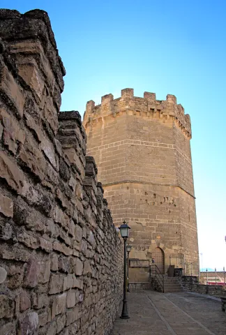
The tower is octagonal base, is 28 meters high and has an ochavada shape. Its interior, of two floors and a terrace, will house the medieval rooms of the Archaeological Museum Municipal Obulco.

Church of Santa Ana

The first data that are held from the hermitage of Santa Ana are from the late 15th century although its exact origin is unknown, being able to be reassembled at the end of the 13th century.

Santa Ana is drawn like a hermitage of a ship, with several adjacent dependencies such as the house of the santera and some corrals. During the later centuries the whole is spread and consolidated until in the 19th century it is closed to worship. In the 20th century, the property is sold to the Juárez family for use as a bread oven.

The recent intervention carried out by the City of Porcra has involved the restoration and recovery of the original building. These works have brought to light important findings: unique pavements, numerous burial or wall paintings in the altar area.

Today, the ancient church of Santa Ana has become the Visitors' Reception Centre.

Royal meat stores

This is one of the most modest buildings, which was mentioned in the 15th century, next to the organization of the square: the carnage of the villa, the Church Mayor and the Cabildo.

The Royal Carniceries, called for the Crown's control over meat, supplied the population with beef and sheep for more than five hundred years, from the Middle Ages to the Second Republic.

From this moment on, the city's library is located in the building and, in addition, the work-bag functions are performed there, to be, before its restoration, the Comarcal Court.

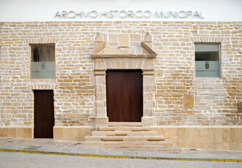
In 2015 this space was opened after the rehabilitation and value that the City Council of Porcilla carried out, hosting, there, the municipal services of Historical Archives and Tourist Information Office.

There are some of the vestiges that can be seen inside the building. It is also worth the attention to stop and observe its inclinated facade witness to the Lisbon earthquake of 1755.

The Royal Posite of Charles IV. City Council

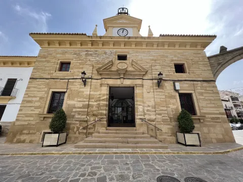
In the square of Andalusia was built in the Enlightenment of the King Charles IV in 1798 the Royal Po'sito, that is, a public warehouse of grain for consumption and sowing. It is a functional building offacade of silleri ́ a with beautiful classic cover, which consistsof three ships, one main and two lateral, separated by stone arches on which the deck rests. The building is accessed after climbing a step, an element that allows to generate a lower level or ventilation gallery.

After the Civil War contest, the building was ruined and a major reform had to be made.Although the works were directed by Ramón Pajares Pardo, the project is due to the architect and National Architecture Prize José Luis Fernández del amo, the first project he signed.

The building currently houses the headquarters of the City of Porcra. The large "glass yard" is a bright space that acts as a distributor of the entire ground floor and also functions as a main public service room.

Galleries of the Royal Posite of Carlos IV. Municipal Archaeological Museum of Porcilla

This is abouta space located under the building of the Royal Posite, current City Hall.In its day were the ventilation galleries and prevented the moisture from reaching the grain store. In origin they had no direct access from the outside, only one registration trap. Over time, several entry doors were opened, allowing this place to take different uses, from construction materials storage to dungeon or hardware shop.

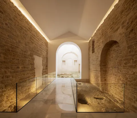
Following the major reform in 2017, the space was restored and opened to the public. During the intervention, archaeological remains of Roman and medieval times, now integrated into the journey, came to light. The vaults system used in its construction is particularly noteworthy.

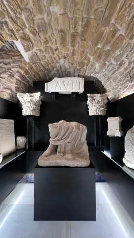
In 2023, two museum rooms were incorporated into the whole, which greatly enrich the understanding of the past of Porcra: one dedicated to the world of the Turdulum and the other to the Roman period. Both offer a clear and accessible journey through the cultures that left a deep mark on the ancient Obulco.

Ntra Parish. Sra. de la Asunción

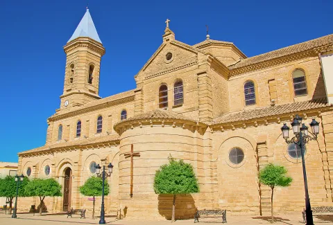
The Parish Church of Our Lady of the Assumption of Porcilla, concluded in the early 20th century thanks to a popular subscription, rises on the site of the ancient Church of Santa Maria la Mayor. The building, wide and bright, has a Neo-Byzantine style and is articulated in three ships covered with cross vaults. The sacristy, attached to the head, belongs to the temple of the 17th century and is connected to the rectoral house, which houses the residence of the parish priest, the archive, the office and the parish hall.

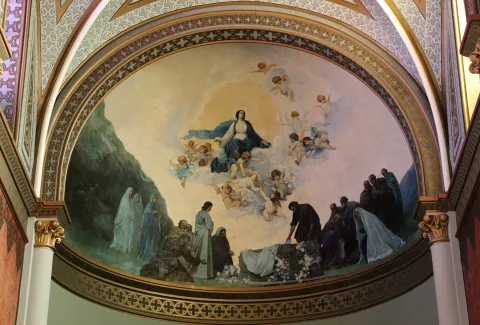
After the construction of the new temple, Julio Romero de Torres was commissioned to paint the vault of the apse, where the artist represented the Assumption of the Virgin, surrounded by a chorus of angels. The work was so impressed that he was asked for two new murals for the capels of the cruise. In one of them he made the Holy Supper, showing the apostles attentive to the moment when Jesus instituted the Eucharist. On the other, he represented The Holy Family in a serene sunset, with the Child Jesus in Mary's arms and the silent presence of St. Joseph. In addition, the temple retains five more works of the painter: an oil of St. John the Baptist in prayer and four canvases of the evangelists located in the pechines of the cruise.

House of the Stone

Summary of the millennial craftsmanship of the stone in Porcra. The bartender and marmolist Antonio Aguilera Ruedas (1896-1980) built it in the middle of the 20th century for 30 years with considerable personal effort and firm mastery.

Its extravagant and eclectic combination of solutions, techniques and decorations exalt the work of the stone. Their personal and unusual explanations that portray in an unusual way the complex parallel trajectory between building and author draw attention.

In August 2018 it was reopened following the reforms that the City Council of Porcilla made. After an important work of cleaning and restoring the stone a sophisticated lighting system is chosen to bring all the beauty to the craftsmanship of the stone. At the same time, an extensive set of ramps, built in marble concrete, gives access to a glass elevator, a unique dissonant element but that will allow access to the entire building.

Naturaleza

The natural environment of Porcilla forms a unique environmental heritage, modelled by thousands of years of history, a marked Mediterranean climate and the constant presence of the olive tree as an identity element of the landscape.

Geological description

The municipality is based on extensive margous formations of the Mioceno Medio-Superior, shaping a homogeneous and gently undulating relief, characterized by rounded hills and looms. In a timely way, the spurs and rocky outflows of sand-calcareous litology, more resistant to erosion.

Edaphology

The soils of the municipal term are mostly limestone and little or medium-evolved. Clear margas, with shallow but fertile profiles, and a slightly basic pH that promotes the development of crops characteristic of the countryside, predominate.

Climate

The climate of Porcilla is continental-temperate Mediterranean. The average annual temperature is around 17 ° C and precipitation is 563 mm, with marked annual irregularities and long periods of drought. Winters are temperate, with diurnal peaks close to 13 ° C, while in summer they are easily reached 40 ° C, with few rains.

Hydrogeology and hydrology

The municipality is located on two aquifers: the Porcra aquifer, which occupies almost the entire municipal area, and the Aluvial aquifer of Guadalquivir, located to the north. The term is integrated into the Guadalquivir watershed, and its main channels are the Salado stream, which crosses the municipality from southwest to northwest to the Guadalquivir, and the Saladillo stream, its main tributary.

Flora and vegetation

Porcula is integrated into the Mediterranean region, and has a dry climate with mild temperatures in winter and hot summers.

The olive tree is today the dominant agrosystem and a true monoculture that occupies almost the entire territory, although there are also areas with natural herbaceous species. Porcilla also houses four endemic species of great biological value: Hispanic, Betic, Ibero-Atlantic Mediterranean-Maghreb and Bético-Maghreb.

Fauna

Agricultural activity conditions the availability of habitats, but the olive tree offers a plant cover that allows the presence of a diverse fauna. Birds, small mammals, reptiles and invertebrates find in this ecosystem an enabling space for their food and shelter.

In it we can observe species such as: the green and the green; and in winter the capirate curved, the red petrored and the common zorzal.

The biodiversity of the olive tree is very much increased when, together with it, streams with riverbank forests or Mediterranean bushes, made up of carrizos, adelfas and tarajes. And so we find: sparrows, pinches, jilgueros, nightingale, cogs, cordnices and cornejas. Amphibians: common toad, green frog, salamander; reptiles: rib, lizard and lizards; mammals: hares, rabbits, foxes, badges, jinetas...

Some areas are highly recommended where we can look at the nature we have described in that paragraph:

  • Jesus' walk. We're in front of the big garden of Porcra. It is an extensive public park with a large grove built in the late 19th century. It is the center of the city's playful and social life as it brings together the important parties of Porcra, from the Real Fair to the Oil Fair. This important green space with countless botanical species is populated by monuments or unique elements of the city's heritage, such as the church of Jesus, the house of the Stone or the important viewpoint of the round, a place from which you can see the beautiful landscape of the olive tree, as well as various villages neighbouring the countryside to the Subbetic Sierra of Córdoba and Jaén.
  • Llano de Alharilla. The village of the Alharilla located just 4 km from Porcilla is characterized by a large plain surrounded by ancient olive houses, many of them today become cozy recreational houses. A lush tree offers shade and freshness, creating an ideal environment for rest and coexistence. In addition, the space has a road, making it an ideal place for family recreation or to enjoy a field day in full nature.
  • Pillars and aljibes.The current pillars have their origin in the fountains or springs whose waters were channeled in time and date, perhaps protohistoric, to collect it in receptacles, the pillars, in order to have it available so that the cattle could easily be watered, for use in laundry or in pools for the irrigation of the many gardens that were established in their way. Taking as a driving thread the pillars and sources, you can make a hiking and visiting route: the pillar of La Galga, María Cotilla, the Great Source, the Girl Fountain, Uncle Pago and the Fuenhot, among others.

Fiestas y Eventos

Ride de Reyes (5 January).On the night of January 5, the streets of Porcra are filled with magic and illusion for the coming of His Majesties the Kings of the East. A variety of carrots, parades and musics make it shine, au ́ n ma's if it fits, tonight so special.

Day of Andalusia (28 February). The City Hall of Andaluci ́ a, an autonomous festival, is held in Porcra an institutional event in which the City Council holds the Concession of Honours and Distinctions to different personalities related to this city.

Carnival (February).Its tradition in this town dates back to the dawn of the 20th century, although it has been more recently when it has become particularly relevant. On the one hand, in the Cine- Teatro "Mari ́ a Bellido" a Carnival Gala takes place in which the letters and chords of different carnival groups intermingle with the rhythms of three by four of the local murgas. On the other hand, during the afternoon of the carnival season, there is a spectacular passage in which hundreds of people gather to show the elaborate work carried out for months. The color, music and dance flood everything, and the diversity takes hold of all those who encourage themselves to contemplate it.

San Benito, Patron de Porcilla (21 March).The devotional to San Benito in Porcra dates back to the 13th century and we have been aware that such religious functions have been carried out since the 16th century. It is therefore not to be removed that the veneration of the Holy Patro is so rooted among its neighbours. On March 21 of each year, a solemn celebration of the Eucharist takes place in its honor and subsequent process of the image, which is accompanied by the local music bands.

Holy Week.During Lent, Porcella is filled with tradition and solemnity. The streets of Porcra make up an exceptional framework for the processing of their cofradi'as that, with their knowledge of being, they move us to an environment or a nico of sobriety, devotion and beauty. Ten are the cofradi ́ as and hermandades that process in Porcra from Palm Sunday to Resurreccio Sunday.

San Marcos (25 April).In honor of this evangelist, a religious and later process is held to end with a popular verbena from the same neighborhood to which it gives name. It is worth noting the curious tradition of the "Spark of San Marcos." This is the realization of fires that traditionally light up in squares and high places, with wood and old things that were discarded and that the young people stacked for their subsequent burning. This tradition was carried out in order to invoke San Marcos Evangelista to bring rain beneficial to agriculture. At present, one of these fires continues to be made next to the hermitage.

May Crosses (first weekend of May).In various squares, streets and neighborhoods of the village, gilded with care for the occasion, the traditional Cruces de Mayo, a holiday that inundate each rinco with a festive air full of color, are raised. The streets are dressed in floral motifs and personal details, self-reflective of the life and traditions of the place, while the neighbors, with dedication and pride, compete to create the most beautiful and striking cross.

Romeria de Alharilla. Tourist interest party of Andalusia.The second Sunday of May takes place in Porcra one of the most important romeri's of Andaluci, which is celebrated in honor of the Santi-sima Virgen de Alharilla, Patrona and Alcaldessa Perpetua of the town. The previous week, the municipality is set up and its streets are filled with people to celebrate the holiday in honor of its patron. Among others, they highlight the spectacular ride of horses, in the afternoon of the evening, with riders and carriages that spread through the main streets. On Sunday, say great, thousands of devotees and rosemary gather to live a day of deep faith, culminating in the longed process of the Virgin, carried in paths between the two and the prayers.

Bervena de San Benito (11 July).San Benito de Nursia, patro ́ n de Porcra and de Europa, has a second holiday in July in which, following the religious feast, a popular verbena takes place in the neighborhood with its same name.

MiaqueFest (first weekend of August).This is one of the largest music festivals in the province of Jae'n. With an open and diverse spirit, the festival does not focus on a specific musical style, but rather accommodates a wide range of ideas in which consolidated figures from the national musical landscape are combined with others that begin to unpoint.

San Lorenzo (10 August).Following the celebration of the Holy Mass, the San Lorenzo process takes place on the main streets of the town. Subsequently, one of the popular verbenas is held with the most raigambre of Porcilla.

Real Fair (September).The so-called "Real Fair" unio ́ la devocio ́ n by San Benito and the Virgin of Soledad, miraculous intercesors in the face of a great storm, with the tradition of holding an annual cattle fair granted by Queen Elizabeth II to the City of Porcra. At present, these parties are held in the first days of September and it is worth noting its Flamenco Besana, Porcra Electronic Night, the young night with musical performances or the parade of giants and heads.

Oil Fair (last weekend of October). This is a holiday celebrated around olive oil, the main economic engine of the town, which had its orien in 2007. At the Porcilla Oil Fair there is a wide exhibition of agricultural machinery, numerous places where to taste the gastronomy, to you, crafts, conferences, oil tasting... All this closed on Sunday with the taste of the traditional hole of bread with extra virgin olive oil and olive harvested in our land.

Gastronomía

On horseback between Jaén and Córdoba, Porcella brings together in its kitchen the best of each of these provinces, always with its star ingredient: extra virgin olive oil. This liquid gold, the fruit of the extensive olive trees surrounding the municipality, not only permeates its recipes of an unmistakable taste, but also becomes the symbol of a tradition that defines its culinary essence.

At the table of Porcilla, the piirranas and the jiennese sparragados with the flaminquins and the Cordobese salmorejo live together in a perfect balance that enriches its gastronomic heritage. However, it is in his native recipes that the true essence of this land is found.

Among its most peculiar dishes are the rape, a small square cake that is formed by folding a wafer over a spicy minced meat filling. This craftsmanship dish becomes an essential for those who seek to taste something unique and authentic.

On the other hand, chicken in milk It surprises both his name and his history. This typical sweet, similar to the mazapan and the alfajor, evokes with its almond aroma an Andalusian past that has been recorded in the gastronomic memory of Porcella.

For lovers of the good table, the visit to Porcra would not be complete without testing these specialties, which represent a bridge between the past and the present, between tradition and innovation. In addition, local restaurants and bars offer the opportunity to enjoy these delights in a welcoming atmosphere, surrounded by the hospitality that characterizes the porcunenses.

Historia

The origins of Porcra go back to a group of villages of the Final Neolithic located in its surroundings. In the Copper Age (3rd millennium BC) the area becomes a nuclear centre of the countryside. Archaeological research has discovered on the hill of the Alcores one of the oldest fortifications documented in the Alto Guadalquivir, with double walled fence surrounded by circular cabins. Another similar village is located on the hill of Albalate and both remained during the Bronze Age (II millennium BC).

In the 7th and 6th centuries BC the Iberian culture was formed on these lands and so, on the hill of the Alcores, there appears a new urban planning, of geometric layout, with rectangular houses of adobe walls that are raised on stone zócalos, sometimes covered with mud. The area maintained its status as a great center of the countryside and in this Iberian era an aristocracy emerged with heroic political models, as did other Mediterranean regions. This elite, to perpetuate its stretch, represented its exploits and its origins, by passing on to us the wonderful sculptural ensemble of the warriors of Cerillo Blanco, who are already emblem of this culture. These sculptures were in a sacred enclosure on the hill of the Alcores, but shortly after their erection they were buried in the necropolis of Cerillo Blanco.

The Roman Obulco was the origin of the current Porcula, confirmed by the epigraphic findings and texts of Plinio, Ptolomeo and Estrabón. During the republic and the first Empire the city was of great importance and enjoyed some autonomy, as it coined its currency.

When the second civil war between Caesar and Pompey was about to end, a uprising led by the children of Pompey broke out on the Peninsula. In the face of this situation, Caesar was forced to quickly mobilize his legions towards the rebel areas. The chronicles report that it took only 27 days to travel the distance between Rome and Obulco, an example of the impressive logistics capacity of the general.

Once in Obulco, Caesar reorganized and concentrated his troops there before marching towards Córdoba, where the famous battle of Monda would take place. The triumph in this confrontation definitely consolidated its power.

Otra información

Water Footprint

The Water Hole is a road through Porcra and its surroundings, whose main thread is the water, that is, the water system in Porcra from early times to the present. It is proposed, therefore, a tour of the missing water tank of San Cristóbal and the current one of the street of the Cross; the so-called El Albercón street; Maria Bellido and his role in the Battle of Bailén (1808); the Roman Cisterna de la Calderona, as well as the different pillars and aljibes located, these already, outside the urban town of the Pilar, the Pilar, the Pilar and the Pilar, the Pilar, the Pilar, the Pilar, the Pilar and the Pilar.

Route of the Stone

The Route of the Stone proposes a tour of one of the most unique and defining elements of Porcilla: its golden sandstone. This rock, which has been taken from the local quarries for over 6,000 years, has been the leading thread in the history of the municipality, since with it the most emblematic monuments have been raised from the Iberian era to the present.

The quarry in Porcra is a millennial trade that has never been interrupted. Already the Iberians of the ancient Ipolca-Obulco used this stone for their sculptures, such as the well-known pieces of the set of White Cerrillo, which show an extraordinary technical domain. In Roman times, the local sandstone was again a protagonist in public buildings, foundations, decorative elements and hydraulic conductions. Later, during the Middle Ages and Modernity, it continued to be used in walls, churches, noble houses, civil spaces and hydraulic works, becoming the material identity of the city.

The route invites you to know the historical quarries, where still today the stone is extracted in a artisanal way, maintaining techniques that have passed from generation to generation. There you can see how you cut, size and prepare this material that has shaped Porcra for millennia.

Loading map
Preparing points of interest and routes...
Imagen principal
imagen
Image
Porcuna
Imagen principal
Activado

Pegalajar

Submitted by brandcode_deweloper on
Id
749615
Perfil de redes sociales
Facebook
https://www.facebook.com/ayuntamientopegalajar/
Descripción
Breve descripción

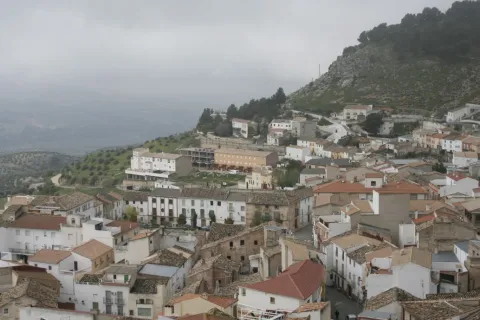
Municipality of west of the Sierra Magina regionwhose municipal term is entered by the north-east end in the Natural Park of Sierra Magina, which is part of the Subbetica and which offers beautiful and spectacular landscapes. The town is located at the feet of the Serrezuela, at 798 m above sea level, where the spring of the Fuente de la Reja that supplies the Charca and the Huerta, elements exclusive the local landscape of Pegalajar.

The municipal term of Paste occupies a extension of 80 km2and is located in the valley of the Guadalbullion River, about 18.8 km. from the city of Jaén. Pedany The lock is part of the municipality.

The olive tree, become practically monoculture, occupies the descending slopes of the numerous peaks that coronate the geomorphology of Pegalajar, focusing on the south and east and occupying approximately half of the municipal term.The economy is based on olive trees and the oil industry.

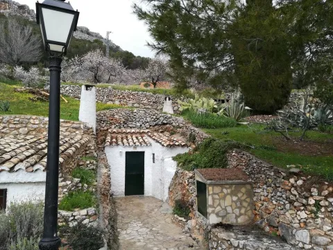
In the municipality of Pegalajar there are 26 Property declared Heritage Real estate of Andalusia, six of them too Good for Cultural Interest. Let us quote: The Church of Santa Cruz, Tower of the Head, Arc of the Incarnation, Castle of the Peñuelas, Medieval Arrabal, Conistory House, hermitage of the Virgin of the Snow, The Fountain of the Reja, the Charca and the Huerta, the Molinos, the Plaza de Toros, the Caves of the Serrezuela...

Telecomunicaciones
Teléfono
953 360 003
Sitio web
www.ayto-pegalajar.org
Fax
953 360 002
Correo electrónico
ayuntamientopubli@pegalajar.es
Ubicación
Nombre
Pegalajar
Latitud
37.740060
Longitud
-3.645020
Distrito
Municipio
Ubicación en el mapa
POINT (-3.64502 37.74006)
Imágenes
imagen
Image
7700b9b4-1f86-8d03-5d6c-80f8cbf28cb8?t=1621353747106
Imagen principal
Desactivado
imagen
Image
d420b1bd-20f1-a85f-8d06-d75f7020b357?t=1621353747368
Imagen principal
Desactivado
imagen
Image
img_9478-jpg
Imagen principal
Desactivado
imagen
Image
d6dabf3f-5dc2-5b96-0a15-c982914310b1?t=1621353747420
Imagen principal
Desactivado
imagen
Image
img_9482-jpg
Imagen principal
Desactivado
imagen
Image
73500c6e-b45f-bcfd-99e9-48782dbadc55?t=1595962404361
Imagen principal
Desactivado
imagen
Image
22bf0ed0-e023-731f-78ea-3bead20486f4?t=1621353747486
Imagen principal
Desactivado
imagen
Image
cf7993c4-d47a-1c6f-3caf-fbf1d28d3828?t=1621353747535
Imagen principal
Desactivado
imagen
Image
484a263b-7ebf-80db-d5eb-c5a55dd2ccd2?t=1621353747639
Imagen principal
Desactivado
imagen
Image
1250ab62-0360-ce68-bfa8-dcbe37eadd53?t=1603128932399
Imagen principal
Desactivado
imagen
Image
526cc8e9-ccf1-f5ff-976b-8089825ae4d1?t=1621353747714
Imagen principal
Desactivado
imagen
Image
e8da0954-ae46-57a9-9ba7-b631ac7bf71f?t=1603725645301
Imagen principal
Desactivado
Imágenes cabecera
imagen
Image
Pegalajar
Imagen principal
Desactivado
Datos de interés

Tourist area: Sierra Magina

Distance to the capital (km): 21

Altitude over sea level (m): 818

Extension (Km2): 79

Number of inhabitants: 3145

Gentilicon: Pegalajeños

Postal code: 23110

Videos
Video file
Cultura
  • Pegalajar City Council: Its construction is linked to the repopulation of the southern part of Jaén in the time of Charles V. It preserves the 18th century facade. It is fully rebuilt and only maintains its original track, the two-story cover of the 17th century.
  • Church of the Holy Cross: Built in the castle's enclosure in the 16th century Renaissance style. Its two covers with a very sober decoration are of mannerist style and in its interior, stands out the baroque altarpiece, from which only the top is preserved. The bell tower is the ancient tower of homage. It's declared Good of Cultural Interest in 1985.
  • Castle of the Peñuelas: In Christian chronicles it is cited as a Muslim fortress. Two different fortifications can be observed in the remaining remains. A previous one with a walled interior, with two entrance doors. One of them was protected by two circular turreons and the second was defended by two square turreons. He had another turret higher than the previous ones that today is the bell tower of the Church. The second outer enclosure is later, more damaged and served as an extension to the primitive fortification. One of its doors that is in good state of conservation is known as Arc of the Incarnation. Declared Good of Cultural Interest.
  • Tower of the Head: It was built between 1462 and 1470, Although it is likely to rise on the ruins of a previous one. It is part of a set of towers that crossed the province, such as the atalaya de la Pedregosa located in Serrezuela de Pegalajar. Declared Good of Cultural Interest
  • Arc of the Incarnation: It is about the main access door to the enclosure and the old castle of Pegalajar. It forms a pointed arch on which there is a commemorative stone in Gothic letter and two shields. The arms shield on the left belongs to a family linked to the Order of Calatrava and the shield on the right is from the city of Jaén. On top of all the above is the shield of Fernando III the Holy. It's kept in good condition. In the 19th century the chapel of La Incarnación was built in the adarve. It was declared Historical Monument in 1985.
Naturaleza

The Sticking Garden along with the Charca, is a Good Cultural Interest, for being an emblematic model of man-nature interaction.

The Serrezuela de Pegalajar is a Mediterranean mountain, with a large mass of pino carrasco repopulation, natural regeneration cells and other shrubs (majelo, juniper, torvisco...). Very abundant are also the aromatic plants (rosemary, alhucema and thyme). Between her fauna There's big. Rape (perishable eagle, common fencing), Night rapes (royal owl, mocha and autillo) and mountain goats in the rocky areas.

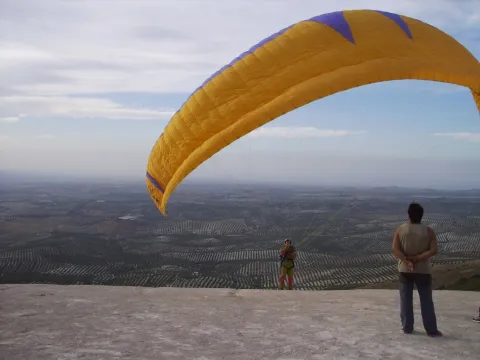
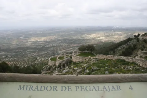
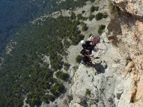
Currently takes advantage of this saw to do sport in nature: hiking, mountain bike, climbing, bulder, free flight... It has two views with splendid panoramic views of the mountain environment, and a recreational area known as "Seven Pillas."

Paste has numerous natural sites of high interest both environmental and cultural. Between them We stand out the following:

  • The Charca. It's a reservoir that collects the waters of the birth of the Fuente de la Reja since medieval times. In the beginning it was a simple dam with a containment stone wall and gates that regulated the water output through a network of kilometres of waterfalls, which allowed to water the orchard and olive lands located south of the urban core, distributed in banks. A spring that has never been enough to fertilize all the lands that extend at a decreasing level towards the Guadalbullion River. On the other hand, the years of drought the flow of the source is significantly reduced.
  • Source of the Reja. It is the natural spill of the underground aquifer and origin of the hydraulic system of the garden pegalajareña. A legend tells, that a lavender discovered the image of the Virgin of Grace in this place, building in his honor a hermitage over the source itself.
  • Recreative area "Seven Pills." This area is 2 km away. from Pegalajar, it is given this name due to the source in the vicinity and it is called in the same way. A space with merenderos and viewpoints from which an extraordinary panorama of the countryside, Sierra de Cazorla, Jaén capital and the municipal term of the municipality are obtained. Here is the flight center Seven Pills dedicated to the practice of the Paragliding.

Other areas of interest They deserve to be visited: Valle del Guadalbullón (The Lock) and Bercho Valley.

Fiestas y Eventos
  • Carnival: The arraigo among the pegalajareños is so important that after the Spanish Civil War, the festival of the masks continued to be celebrated.
  • Party in honor of the Virgin of Grace:Commemorated on the first Sunday of May. The participants go to the hermitage of the Virgin, located in the area where the spring of the Fuente de la Reja is located. A Mass is held in his honor and later the procession through the streets of the people.
  • San Gregorio Nacianceno: Devotion to this saint goes back to 1670, When the people decide to hold a feast and process the saint every year to rid the field of plagues.
  • Virgin of the Snow:: Between 4 and 8 AugustThe patron parties are held in honor of the Virgin of the Snow, with many activities dedicated to all the groups. The Flamenco Festival, to which there are notable figures at national level. Also the bulls and bullfights, which are held in the Plaza de Toros opened in 1919 and have many followers.
  • Flamenco Festival: A special mention is required of the Festival of Flamenco Art of Pegalajar, which has been held since 1969 and where each year it is honoured to different prominent figures of Flamenco Art.
Gastronomía

In Pegalajar we find a very varied gastronomy whose fundamental base are the products of the garden. Among the most traditional dishes we have:

  • Pipirrana: with tomato, garlic mallet, cooked egg, salt, olive oil.
  • Peanuts: soup garlic, chorizo red pepper.
  • Cazolilla: made from a traditional conserved called "tomato cake" consisting of dry tomato forming a large cake, which makes a sauce to which a saffrito of onion and cod is added.
  • Bercho rice: with potatoes and vegetables from the garden or with "peppers."

Warehouse:

  • Papajotes: fried mass of flour, milk, sugar and egg.
  • Fried skillet peas and nuts, sugar "tostah," roscs and almond stained...
  • Home licenses of endrin, purple or the mistel and wine of the country.
Historia

The first documented references date back to the Bronze Age. It has been found in the Cueva de los Majuelosdiscovered in the 1970s of the last century, a collective burial with human remains and instruments carved in bone and silex, polished stone, ceramic remains...

Another of the prehistoric references is the hill of Tower of the Head in which the remains of the Copper, Bronze, Iberian, Roman and medieval epoch are mixed.

From the Roman era, deposits have been located scattered by the municipal term, corresponding to small necropolis and villas that indicate the existence of a scattered habitat, with an agro-livestock economy. One of these. necropolis is the Port Altowhere there is also a pottery of the seedling land, pieces of Roman teagula and a stone-carved altar. There are other locations, such as the Canteruelathe Charcons, even in the vicinity of the Torre de la Cabeza has been located Roman ceramics made around.The four militaries found in 1975 in The lock They make known to us the existence of an important Roman road passing through this town. The insecurity of the area in the Middle Ages is reflected in the disappearance of the Roman houses scattered by the term and occupation of the natural strength of the Peña de los Vultreswhere it was built a pebble that is still preserved.

The origin of the villa is from the time of Al-Ándalus. Their existence revolves around the Source of the Tea, aquatic origin of La Charca. With peace and the rise of the caliphate between the X and XI centuries should have to expand the network of accesses and banks that form the Paste orchard.

The Christian conquest took place next to that of Jaén by Fernando IIIwhich also took over the castle of Pegalajar. The primitive Muslim compound was expanded after the conquest, with the construction of a second compound and strengthening of the first one with circular towers more resistant to the gunpowder attack.

From the conquest in 1246, was a village of Jaén, was part of its alfoz and its proximity to the Muslim kingdom of Granada made it a fundamental defense of this city, until the end of the Reconquest in 1492. On this date he loses the strategic value of his castle, but not its economic importancebecause at the feet of the fortress a fertile vega of orchards and olive trees, inherited from the Arabs.

The origin of the population of Pegalajar after the Reconquista was linked to the city of Jaén, on whom it depended administratively. This population was formed by men in the 13th century from several Spanish areas.

In 1559 King Philip II granted Pegalajar a real privilege for which he recognized him. Jaén's exemption and the title of the villa in exchange for a service to the Crown of a significant amount of maravedis. The municipality begins a period of economic and demographic improvement.

After XVII crisis, increased by the tabs and famine in the 18th century, there is a slow population growth leading to the expansion of the agricultural land and the various production, which was maintained until mid-term 20th century where, as in the rest of the province, a important emigration to cities in search of a better life.

Loading map
Preparing points of interest and routes...
Imagen principal
imagen
Image
Pegalajar
Imagen principal
Activado

Orcera

Submitted by brandcode_deweloper on
Id
749362
Perfil de redes sociales
Facebook
https://www.facebook.com/ayuntamiento.orcera/
Descripción
Breve descripción

Municipality belonging to the region Sierra de Segura, within the Natural Park of the Serras de Cazorla, Segura and Las Villas. Eminently forest and full of landscape attractions.

This municipality has the particularity of to be divided into two enclaves: one south-eastern, in which is the town of Orcera, and one in the north-western area of the region, bordering the province of Ciudad Real.

The cultivated land are in the west of the municipal term. The town is hidden in the skirts of Mount Peñalta, with an urban interiors and an excellent medieval town.

Economic activity It depends on the olive grove, the oil industry, the hunting, the forest and the tourism, as it is the gateway to the Natural Park of the Sierras de Cazorla, Segura and Las Villas.

Among its historical heritage we highlight: the Parroquial Church of the Assumption, the Towers of Santa Catalina, The fountain of the Chorros and its Old Town, among others.

Telecomunicaciones
Teléfono
953 480 154
Sitio web
www.orcera.es
Fax
953 480 155
Correo electrónico
ayuntamiento@orcera.es
Ubicación
Nombre
Orcera
Latitud
38.318020
Longitud
-2.661050
Distrito
Municipio
Ubicación en el mapa
POINT (-2.66105 38.31802)
Imágenes
imagen
Image
4d801f2d-0fbe-80cd-e9b3-da943df1b529?t=1621271852271
Imagen principal
Desactivado
imagen
Image
7564df32-691f-5fe6-5772-200271f90ab8?t=1596037186672
Imagen principal
Desactivado
imagen
Image
a3ef91bb-6788-aeb3-3ce1-52c63c6a049b?t=1596037276689
Imagen principal
Desactivado
imagen
Image
93ea953b-b7fb-00f7-6751-442e27f9d852?t=1621271784259
Imagen principal
Desactivado
imagen
Image
4b2b369e-2226-4eec-d0a4-6c1aa7068997?t=1596037329344
Imagen principal
Desactivado
imagen
Image
adf5b266-0623-263e-e83e-858b83feb20b?t=1603729407461
Imagen principal
Desactivado
imagen
Image
67588f5f-1456-f1f3-2a99-9ff944435ff8?t=1603729570170
Imagen principal
Desactivado
imagen
Image
6b96b240-e7be-da17-68df-cbe38bd19e5b?t=1621271852323
Imagen principal
Desactivado
imagen
Image
49fdaa46-c7f3-a242-9a12-4c6be0414434?t=1621271852458
Imagen principal
Desactivado
Información adicional
Curiosidades

C/ Joaquín Payá, s/n

Imágenes cabecera
imagen
Image
Orcera
Imagen principal
Desactivado
Datos de interés

Tourist area: Serras de Cazorla, Segura and the Villas

Distance to the capital (km): 151

Altitude over sea level (m): 797

Extension (Km2): 126

Number of inhabitants: 1,894

Gentillo: Orcerners

Postal code: 23370

Videos
Video file
Cultura
  • Church of Our Lady of the Assumption. It began to be built in 1530, finishing the works in 1570. The building is of a single ship divided into three sections that separate semi-columns with half-point arches covered with Gothic-style starvaults.
  • The major chapel also covered with a starry cross vault is accessed to it through a half-point backbone. It has side chapels.. The most important thing who owns is his magnificent mannerist coverfrom the ancient monastery of Santa María de la Peña. Data from last third of the 16th century and it is divided into two bodies: in the first one the arch door of half point is opened framed by Corinthian columns, with allegorical figures in the shrouds; in the upper body, a triple hornaine and the whole is removed by a triangular fronton divided with pinnacle. The tower is settled on a torreon of the primitive castle Medieval, it is quadrangular and consists of two bodies and bell tower, with soga and tendon reinforcements at the highest corners. On one side it has a magnificent window with a half-point arch on jambas caried between menillas, crowned by a triangular fronton. The other window displays in its half-point arch a whole decorative program: highlighted plates, cherubim in the key or semidesnude figures. This element is completed by lateral clumps. It was declared Good of Cultural Interest in 1985.
  • Fuente de los Chorros. Monumental source made of stone and brick, perhaps at the end of the 18th century. It is made up of a somewhat irregular silical frontis, in the central part of which two half-point arches and a triangular fronton that in its center carries a shield. They remove the fronton three pineapples, one at the vertex and the other at the ends.
  • Torres de Santa Catalina. Situations across the river OrceraWe see three Muslim towers dating back to the 12th century, when the advance of Christian troops required a strengthening of defensive structures. These atalayas and the one that rises in the church square, and that makes as the bell tower of the temple, will constitute the defensive line of the house. They have been declared Good of Cultural Interest.
  • Old helmet. Posee Orcera a medieval neighborhood who resist the vicissitudes of times. The old town of the population is perfectly adapted to the medium, with narrow alleys, intricate and unmistakable Islamic regent. The houses are built with slimmed masonry walls, and complicated asymmetric volumes, low height, original chimneys and Arab roofs.
Naturaleza

The municipal term of Orcera has 126 km2 and has the particularity that it is found divided into two enclaves:

  • The South-East enclavewhere the main population of the Orcera and is located within the Natural Park of the Sierras de Cazorla, Segura and Las Villas.
  • The second sector is in the North-West of the region, bordering the province of Ciudad Real in the foothills of Sierra Morena.

Orceradue to its location in the largest Natural Park in Spain has many picturesque areas and interesting placesincluding Armujus, with a huge river pool, The Straits, Cascade of the Hueta, Orcera Lagoon and Wood River.

The population centre is 795 m above sea level, on the hill of the Villares.

  • Key area:Its eastern part is very accidental from the orographic point of view, concentrating here the highest heights of the municipality: Peña Blonde (1625 m.), Engarbo (1595 m.), Navalhora (1419 m.), Los Villares (1209 m.) With a surface of 70 km2 is made up of forest mass (pineapples) and crossed by a warlike Wood River. The western part is the area of the valley, vertebrated by Orcera and Trujala rivers. Being the first tributary of the second, and this in turn, of the Guadalimar River. It is the most populated area of the municipality where the town's town centre and its villages are located. Here they concentrate. agricultural land, highlighting the olive tree, followed by cereal and orchards.
  • Northwest enclave:It is located to the northwest of the region, in the left bank of the Guadalmena River, which makes the border during a good stretch of the province of Jaén and Ciudad Real. It has a extension of 50 km2.The landscape is different from that of the other enclave, formed by shrubs, pastures, burning and scattered pine. It's a lower one on the mountain. The Marañosa (846 m.) maximum height.

Population is concentrated in the main core or municipal capital, the rest does in small villages or villages: La Hueta, La Marañosa, Linarejos, Los Arroyos and Valdemarin. Some of them, like Linarejos, are completely abandoned.

A space with many ecosystems in which infinity of species that make up rich and varied fauna:: from the rapacious birds, the carrionies, the cynetic species, both of major and minor hunting, the fish, amphibians, reptiles, as well as the characteristic fauna of the riverside vegetation that exists next to the stream and river.

No doubt, a true paradise where nature seems to be recreating. It is almost compulsory to make direct contact with one of the wonderful places that this territory hides, where in addition to observing "in situ" both vegetation and fauna, we can enjoy a fabulous panoramic view of the mountains and the jienese countryside.

Fiestas y Eventos
  • La Candelaria, February 2. This holiday has always been commemorated in Orcera. The celebration consists of a day of coexistence in the area known as The Convent. The typical snack of that day is "the Candelaria or Hornazo Rosca," that carries a hard egg in the center painted in colors. They also sing and dance a series of popular songs.
  • Holy Week. It's curious the custom that takes place on Good Friday in the procession of the Meeting, with the steps of Jesus of Nazareth. The Roman squadron that escorts Jesus of Nazareth prevents the procession of the Virgin of Soledad from approaching. At that time, an angel-dressed child will recite verses requiring soldiers to depose their attitude.
  • San Isidroon May 15. It has been held since the middle of the last century. A Mass is held in honor of the Holy and once finished, the gilded carrots for the occasion begin the way to the place known as Armujoaccompanied by all the orchards who wish to. It is tradition to distribute and consume a "crow."
  • Patrons in honor of Our Lady of the Assumption. These parties take place in honor of your patron from 10 to 15 August. They have a wide range of activities, including religious acts, pregon, verbenas, concerts, championships and traditional "cobblestones." One of the championships is of the Turkish bowling, the indigenous game of the Sierra de Segura that was almost lost and Orcera has been the pioneer of the resurgir of it, organizing in 1969 the "First Comarcal Championship."
Gastronomía

Orcera participates in the culinary wisdom of the serrana region to which it belongs. The wheat culture is manifested in many of its dishes.

  • Garlic of flour with walnuts: potato, flour, nests, garlic, green pepper, tomatoes, pepper, olive oil, salt and pepper.
  • Ajo-atao: potatoes, salt, garlic, olive oil, egg and vinegar.
  • Andrajos: saffrito of tomato, garlic, hare or mountain rabbit, mint and "the rags," homemade pasta made with water and flour.
  • Ajopringue: a dish of medieval origin, the main ingredient of which is the liver of the cooked, ground and seasoned pig with olive oil, red pepper, garlic, chopped parsley, tomato and miga of bread and all this seasoned with pimenton and saffron.

We must also mention the "roulette crumbs," made from corn flour. Among the products of the pig, in addition to the sausages, we must name the "fried," which is a long and slow frying of swine meat, tomato sauce, roasted peppers and other vegetables such as beans.

In his pastry shop, "The Traps," frying flour and eggs are then cooked in a roasted sugar syrup with orange, matalahuva and saffron peel.

The crow. is a drink made of wine, water, sugar and fruit. It is distributed in most acts as a symbol of brotherhood and hospitality.

Historia

It has been found that during the Neolithic valleys of the rivers as the Guadalimar were very populated, with centers of height like the Cerro de la Atalaya and Peñón Utrero, with abundant fortified remains and lower position sites, such as Cerro de la Coja. The first news we have about Orcera goes back to previous dates the Bronze age. In the Iberian period there is again news of a small occupation, which will increase during the stay of the Romans. Iberian and Roman remains have been found.

In the Islamic period, Orcera It was a small house located by the Orcera River. From the 11th century, and in the face of the danger of the Spanish armies of the 12th and 13th centuries, Orcera and the rest of the houses They raised defensive enclosures.. The three towers of Santa Catalina are preserved in the municipality. It was conquered in 1230 by the alfoz de Alcaraz of the current province of Albacete and belonged until 1258 to this jurisdiction of Alcaraz, going on this date to be part of the Segura Common and their land for a privilege of the king Sancho IV, which is preserved in the National Historical Archive. It will be donated as an Arrabal of Segura to the Order of Cavalry of Santiago, then owner of Segura.

In the area known as the "Convent" there was the Franciscan monastery of Our Lady of the Peña, in which in 1580 the procurators of the villas of the common to draw up "Orders of the Common of the village of Segura and its land," which was intended to save, preserve and manage the mountains of Segura.

These ordinances were confirmed by Philip II and were in force until 1744date on which the Segura Maritime Provincewhose seat and minister were located in Orcera, which was still in the area of Segura de la Sierra. In 1836 this maritime province was abolished, and the following year, 1837, Orcera became independent de Segura de la Sierra becoming an independent villa.

Loading map
Preparing points of interest and routes...
Imagen principal
imagen
Image
Orcera
Imagen principal
Activado

La Carolina

Submitted by brandcode_deweloper on
Id
739288
Perfil de redes sociales
Facebook
https://www.facebook.com/AyuntamientoLaCarolina
Twitter
https://twitter.com/aytolacarolina
Youtube
https://www.youtube.com/channel/UCBY6A3TaSP3JqhViYdshufw
Instagram
https://www.instagram.com/ayto_la_carolina/
Descripción
Breve descripción

La Carolina is a city at the foot of Sierra Morena and the Caraway, natural mountain port that links Castilla with Andalusia.

Its area is made up of extensive olive trees, but also the dehesas and the half-mountain areas populated by oak and pine trees. It is easy to find abandoned mine chimneys, clear signs of their past related to this activity.

It was the capital of the New People of Sierra Morena, a political project by the enlightened king, Charles III, in 1767. The main objective was to colonize and take advantage of the lands of Sierra Morena and to provide security to the mountain port, as it was a very unsafe place, where bandits and malefactors were camping. The population is made of settlers who came from central Europe, France and Germany mainly. A close collaborator of King Charles III, Pablo de Olavide, would be appointed responsible for the project, with the title of Superintendent of the New Populations of Sierra Morena.

The municipality of La Carolina is composed of five population centres: La Carolina, as main, Navas de Tolosa, La Fernandina, la Isabela and the Guindo. It is surrounded by natural areas such as the nearby Natural Park of Despeñacolos, the Fernandina reservoir or the small urban nucleus of the Guindo, which evokes its mining past.

In its artistic heritage are: The Palace of the Intendente Olavide, in Baroque style; the parish church of the Immaculate Conception, the seat of the ancient Carmelite foundation of San Juan de la Cruz, the Torrecillas del Molino de Viento and the Torres de la Aduana.

Telecomunicaciones
Teléfono
953 660 034
Sitio web
www.lacarolina.innovasur.es
Fax
953 681 626
Correo electrónico
info@lacarolina.es
Ubicación
Nombre
La Carolina
Latitud
38.274240
Longitud
-3.615270
Distrito
Municipio
Ubicación en el mapa
POINT (-3.61527 38.27424)
Imágenes
imagen
Image
f91faa0d-bd7e-a921-740d-33c048ef2e8f?t=1619532688353
Imagen principal
Desactivado
imagen
Image
1aacd6bf-6d2b-6336-9456-d95923815de8?t=1594142871900
Imagen principal
Desactivado
imagen
Image
9e49b509-9667-17c5-697b-fc861d03bf8c?t=1619532688419
Imagen principal
Desactivado
imagen
Image
e2b43921-6f14-e958-7cb1-de980f088f48?t=1594142869986
Imagen principal
Desactivado
imagen
Image
131f904e-ba6e-379c-daec-e19a7d0d88b4?t=1619532826514
Imagen principal
Desactivado
imagen
Image
4b85bd84-f1c0-34bb-d56a-a343c5bea6c1?t=1619532688547
Imagen principal
Desactivado
imagen
Image
07cad3d1-017c-774f-16d7-c166133050a9?t=1619532688596
Imagen principal
Desactivado
imagen
Image
fc7e8a03-c91f-3245-be11-c83899c22fe4?t=1603128351869
Imagen principal
Desactivado
Información adicional
Imágenes cabecera
imagen
Image
La Carolina
Imagen principal
Desactivado
Datos de interés

Tourist area: Sierra Morena / Sierras de Andújar and Despeñacolos
Distance to the capital (km): 66
Altitude over sea level (m): 595
Extension (km ²): 201
Number of inhabitants: 15,261
Gentilicon: Carolinenses
Postal code: 23200

Videos
Video file
Cultura
  • The municipal term of La Carolina is full of archaeological vestiges from Prehistory. Places like La Calera, El Minado or El Ochavo, so they testify. We met with Rupéstre art fields like Dona Lady, the Puntal or the Guindo. And also former mining holdings, mainly Roman, like Fountain Spis, or El Guindo.
  • The Church of the Immaculate Conception, built as a church of the convent of the barefoot Carmelites of the Peñuela, after the Colonization it is extended to serve as a parish to the nascent population. It has undergone several reforms over the years, and in 1899 the tower was built.
  • Palacio del Intendente Olavide, which was the residence of Mr Pedro Olavide, executive of the Sierra Morena Repopulation project. It was built in 1775, in neoclassical style and is located in the center of the village, right next to the parish church.
  • La Carolina Museum,The Centre for the Interpretation of the History of Mining in the New Populations of Jaén, integrated in the majestic building of the Palacio del Intendente Olavide, offers countless possibilities of knowledge, culture, history and research of the city, with the latest technologies, an unbeatable infrastructure and a human team that make it an inescapable cultural and tourist resource when visiting the city.
  • The Customs Towers, neoclassical style and airy architecture flank the main entrance to the city coming from Madrid.
  • Castillo de Navas de Tolosa: For more than two hundred years, it served as a defense and vigilance for the Muslim kingdom of what we know today as the passage of Despeñacolos, once Paso del Muradal. Today the silhouette of its tower stands out in a typical Sierra Morena dehesa in which you can also see braves.

Other monuments of interest are:

  • Hermitage of San Juan de la Cruz.
  • Monument to San Juan de la Cruz.
  • Old jail.
  • Monolitos de la Fundación.
  • Monument to the Battle of the Navas de Tolosa.
  • Mining heritage.
Naturaleza

Its enclave at the foot of Sierra Morena and at the limits of the Natural Park of Despeñacolos, makes La Carolina a municipality especially attractive to nature lovers. The visitor has the opportunity to enjoy a landscape full of contrasts, with steep mountains and wide dehesas, on which it is easy to see majestic birds.

The cultivated land represents only 10% of its extent, mostly dedicated to olive trees. The main agricultural activities are the cultivation of olive trees, livestock and hunting, greater and lesser. It also highlights its mining landscape, heritage of an industry that supported the life of the Carolinians: remains of abandoned mines, lavatories, remains of smelters...

The vegetation is very abundant and heterogeneous: olive, oak, cork, chestnut, eucalyptus, alms and oaks. The fauna, both in larger game animals (boar, goose, cords, reels...) and smaller (rabbits, hares, parrots, quail) is very abundant. There are also cattle of wild cattle, sheep and goats.

Part of the term La Carolina covers the mountains of Sierra Morena to the north, while towards the south the landscape becomes adhesitated, thus offering beautiful and contrasting landscapes. In the area of saw, the highest peak of the mountain range, La Estrella, with 1,300? m altitude. The nearby Natural Parks of Despeñacolos to the East and the Sierra de Andújar to the West.

To the South, the Embalse de La Fernandina allows sports fishing and presents beautiful images of the Mediterranean forest, being an ideal place for the development of a rich extensive livestock.

The villages abound in their term as well as the natural sites, making La Carolina a municipality of special human and natural appeal. It has three urban cores or pedanias, these being:

  • The village of Los Guindos, to the north of the term and in the surroundings of the saw, evokes its mining past.
  • Aldea La Fernandina: presents one of the simplest traces of the New Populations, of rectilinear and orthogonal design.
  • Aldea La Isabela: The route of this village, presents reminiscent of the European city of the Enlightenment.
Fiestas y Eventos

In addition to the Christmas and Carnival celebrations, the most rooted celebrations in the town are as follows:

  • Festivals of the Foundationthey are held from 3 to 5 July, in an attempt to link present and past from La Carolina, to value in a fun way its history, traditions and origin. The acts include the reading of the court and the tribute to the Colonoan act to claim the persons who still keep foreign surnames.
  • May Fair, has its origin in a cattle party that is very famous and that competed with the most important in Spain. A Selected livestock morphological competition (berrenda cow, seaweed sheep and serrana goat)
  • Festivals of San Juan de la Cruz, Patron from La Carolina. The last weekend of November is held. The tradition of Shake a live pig after the celebration of the Eucharist.
  • San Carlos Borromeo, which is celebrated on November 4 and is also co-patron of the city.
  • Romeria de San Isidroon the 15th of May, and is celebrated with a Romeria to the natural area of La Aliseda, a beautiful recreational area that is located in the village of Santa Elena, at the foot of Despeñacolos.
  • Carnivals, of the most renowned in the province of Jaén.
Gastronomía

Hunting is very present in the local gastronomy, so among the most traditional dishes we have:

  • Monkey meat, first adobada and then stew in sauce.
  • Pate of perdiz, typical Jaén dish that was born on these lands.
  • Scattered perdiz, a dish that can get cold.
  • Chickpeas, which is consumed preferably in Lent.
  • Migas and Pipirrana.
  • Jars with hare.
  • Trick asparagus.
  • Cod wet.

In the pastry shop, the following are typical:

  • Sweet gazes of the holiday of All Saints.
  • Summer gazhas: with fish and peppers, according to the recipe of the miners who came from Almería and Granada.
  • Oil nuts, Rice with milk, fried milk and drunks.
Historia

In the 18th century, the enlightened king Carlos III and its ministers (Aranda, Jovellanos and Campomans) decide to create the New Populations in Sierra Morena. At the head of the repopulation he put the Superintendent Pedro Olavidewho would be responsible for the settlement of settlers from France, Germany, the Netherlands and Switzerland.

In 1767, the The strength of the New Populationsestablishing the regulations and rules governing these new settlements, different from those of the rest of the country. This year, and near La Peñuela, a former Carmelite convent, La Carolina is founded, which would be the capital of all the new settlements in Sierra Morena.

The beautiful city of La Carolina is the best example of the city of Enlightenment. It is known as the City Jewel of the Holy Kingdom. This was designed as a Roman camp; that is, following two axes that are crossed, one from N to S, which is called cardo and another called decumano, from E to O that in the City Hall square is where they are, indicating this crossing the city center, according to the design of Simon Desnaux, supervised by Olavide. The avenues of Las Huertas and Juan Carlos I are the main lines for the division of the land. The result of its urbanization is an orthogonal mesh that divides it into squares, with streets and straight and wide avenues.

In the mid-19th century, La Carolina began the exploitation of its rich Argentine lead filons. Previous mining work already existed, but it will now be when a large-scale exploitation begins that will lead you, in the early and mid-20th century, to become the world's largest Argentine lead producer along with the nearby Linares, under the territorial delimitation of Linares- La Carolina mining district.

This led to a strong immigration of workers from nearby provinces that significantly changed their demography and sociology, even to the birth of populations around these farms such as El Centenillo or El Guindo.

But the mining crisis meant the closure of all the mines in the 1970s. Thus today, the buildings linked to this activity have become part of the landscape as witnesses to its industrial past, being inscribed in the catalogue of the Institute of Historical Heritage of Andalusia.

For a few decades, La Carolina has been in the industrialization sector and is now a city full of future.

Otra información

The village of The Guindsbecause of its geographical location it is a great place to make astronomical observations, especially in the autumn and winter months. In fact, it is included as a Mirador within the "Reserve Certification and Starlight Tourist Destination of Sierra Morena."

Loading map
Preparing points of interest and routes...
Imagen principal
imagen
Image
La Carolina
Imagen principal
Activado

Jaén

Submitted by brandcode_deweloper on
Id
735516
Perfil de redes sociales
Facebook
https://www.facebook.com/Turjaen-880368115409952
Twitter
https://twitter.com/turismodejaen
Instagram
https://www.instagram.com/turismodejaen/?hl=es
Descripción
Breve descripción

Jaén is an extensive municipality located in the south-west centre of the province, and in which the capital is located.

In its term two areas are distinguished: the countrysidewhich is located to the north and another, smaller, located to the south, which is the mountain.

As we go through its historical centre, in streets, corners and monuments we discover the richness of the coexistence of three cultures: Christian, Jewish and Muslim. We will walk through the narrow streets of the Jewish Quarter, we can visit the Arab baths of the 11th century in the basements of the palace of Villardompardo and admire the rosary of churches, some of them raised over ancient mosques and numerous convents. And visible from all points of the historical center is the Cathedrala true jewel of the Spanish Renaissance.

On the hill of Saint Catherine the imposing castle of the same name, from where you can admire extraordinary panoramic views over the Guadalquivir valley, the countryside and the Sierra Sur behind your back.

Jaén, the world's capital of olive oil, is today a modern city as its squares, gardens and large avenues testify.

Telecomunicaciones
Teléfono
953 313 281
Sitio web
https://www.jaencityofgastronomy.com/ www.culturayturismojaen.es
Correo electrónico
otjaen@andalucia.org
Ubicación
Nombre
Jaén
Latitud
37.772770
Longitud
-3.787970
Distrito
Municipio
Ubicación en el mapa
POINT (-3.78797 37.77277)
Imágenes
imagen
Image
565c6eb4-5942-2554-4006-8ceab143b8db?t=1619526386769
Imagen principal
Desactivado
imagen
Image
b424e57e-dc79-a428-daca-35eeb083bea1?t=1619526386986
Imagen principal
Desactivado
imagen
Image
55d454b0-8c1d-d414-0b1e-e823a8ec112e?t=1603985313163
Imagen principal
Desactivado
imagen
Image
7715a631-5b75-15b6-5980-62fd2f46d2e7?t=1603985472695
Imagen principal
Desactivado
imagen
Image
01dc3f35-ff78-28a9-7c8e-35e481da450c?t=1619526387099
Imagen principal
Desactivado
imagen
Image
0fa84b0a-05ed-c54d-7d4b-22183bb3e3a6?t=1619526387156
Imagen principal
Desactivado
imagen
Image
14937a6a-998e-3821-a140-fd3fd1ca419f?t=1603985313279
Imagen principal
Desactivado
imagen
Image
d06ab30b-57dd-c08d-06c5-3ede89eecc14?t=1585768371068
Imagen principal
Desactivado
imagen
Image
e6950987-2c4d-dd30-5a67-62a547b05db3?t=1619526387274
Imagen principal
Desactivado
imagen
Image
3540dc4f-fdd4-e549-c395-e4da63d47419?t=1619526387340
Imagen principal
Desactivado
imagen
Image
bfd586f4-48bc-d3aa-18ee-68705b3b0e19?t=1619526387391
Imagen principal
Desactivado
imagen
Image
144298d6-85db-03e9-e4c2-49526aac5889?t=1619526387572
Imagen principal
Desactivado
imagen
Image
0c7d68e7-f21d-8966-856c-2e62cd746a9f?t=1619526387623
Imagen principal
Desactivado
imagen
Image
48b3d107-5960-f7f2-e080-3c725a30800c?t=1619526387677
Imagen principal
Desactivado
imagen
Image
e1522135-9be2-ee72-37d1-29d49c34f935?t=1603115329866
Imagen principal
Desactivado
imagen
Image
7cae4916-09df-b35e-2986-f704ed193a4f?t=1619526387748
Imagen principal
Desactivado
imagen
Image
30754f84-6bf0-8bce-d131-7832dd6a306b?t=1619526387799
Imagen principal
Desactivado
imagen
Image
d5a8b2be-e7d6-1b7a-01b8-f4412b3d1e07?t=1603117566668
Imagen principal
Desactivado
imagen
Image
32ae96fb-7f94-4623-2b3d-b7fac51e241a?t=1619526387876
Imagen principal
Desactivado
imagen
Image
fcb67e8f-ebc1-467f-7b33-183b53cf1e8f?t=1619526387922
Imagen principal
Desactivado
imagen
Image
fedd54a5-2237-fd6e-425e-7237a8d0f26b?t=1619526388085
Imagen principal
Desactivado
imagen
Image
ec4ce20b-7984-d4fe-3bdf-d035228f9528?t=1619526388368
Imagen principal
Desactivado
imagen
Image
a3a10c78-37e3-21bd-b9d8-813f1849eefc?t=1619526388625
Imagen principal
Desactivado
Información adicional
Curiosidades

Horarios de visita


Oficina de información turística de Jaén.
C/ Carrera de Jesús, 2.
23002 Jaén
Tel. 953 190 455

Imágenes cabecera
imagen
Image
b963ff18-ff49-21ea-0900-3e68f5e313be?t=1606405214909
Imagen principal
Desactivado
Datos de interés

Tourist area: Jaén and surroundings
Altitude over sea level (m): 573
Extension (km ²): 424
Number of inhabitants: 120,021
Gentilicon: Jiennenses
Postal code: 2300x

Videos
Video file
Cultura

Jaén's architecture bears witness to the many civilisations that have inhabited the city and its surroundings throughout the centuries, resulting in an outstanding monumental heritage that includes both religious and civil buildings. Its historical and artistic legacy showcases a variety of architectural styles, including Gothic, Mudéjar, Renaissance, Baroque, and Neoclassical.

Among its most important monuments are the following:

  • Cathedral of the Assumption of the Virgin, a masterpiece by one of the greatest Renaissance architects, Andrés de Vandelvira, and the inspiration for the construction of many cathedrals throughout Latin America. It is regarded as one of the finest examples of Renaissance architecture in Andalusia, which is why the process to obtain UNESCO World Heritage status for the cathedral began several years ago. The city's first cathedral was built on the foundations of the former Great Mosque following the conquest of Jaén by King Ferdinand III of Castile, known as Saint Ferdinand, in 1246. Later, during the 14th century, Bishop Nicolás de Biedma brought to the city the relic of the Holy Face (Santa Faz or Santo Rostro), believed to be one of the three cloths that, according to Christian tradition, Saint Veronica used to wipe the sweat and blood from Jesus' face on his way to Calvary. The presence of this relic in the first Christian cathedral transformed it into an important pilgrimage destination, making its expansion necessary in the Gothic style. Elements of this Gothic phase can still be seen in the apse of the present cathedral. Due to structural problems that arose during the 14th century, a new Renaissance cathedral was commissioned from the architect Andrés de Vandelvira. Although construction continued for nearly three centuries, Vandelvira's original design remained largely faithful throughout the project, resulting in what is considered the most architecturally balanced, harmonious, and proportionate cathedral in Andalusia, with one of the most solemn and majestic interiors in the region.
  • Basilica of Saint Ildefonsus. After the Cathedral, it is the largest church in the city. The earliest records of the original building date back to 1248, when it was established as a chapel serving the Cathedral. Two centuries later, in 1430, it became the setting for the famous miracle of the descent of the Virgin Mary to the city of Jaén. Following this event, it became a sanctuary dedicated to the image of the Virgin housed inside, under the title of Our Lady of the Chapel. In the 16th century, the Virgin of the Chapel was proclaimed the patron saint of Jaén. Finally, in 2010, Pope Benedict XVI granted the church the status of Minor Basilica. The building features three entrances: the oldest, in Gothic style, is located at the rear of the church. The side entrance, in Renaissance style, displays a relief depicting the Chasuble Bestowal upon Saint Ildefonsus. The last to be built was the Neoclassical main façade, crowned by a statue of the saint to whom the basilica is dedicated.
  • Santa Catalina Castle. An ancient Caliphal fortress stood on the summit of Santa Catalina Hill as early as the 9th century. Centuries later, following the conquest of the city by King Ferdinand III in 1246, the Christian castle that survives today was built. During the 19th century, the castle underwent several modifications to strengthen its defensive structures in response to the Napoleonic invasion. Close to the castle, the building that now houses the National Parador was constructed in the 1960s. From the summit there are spectacular panoramic views of the city and its surroundings, especially from the Cross Viewpoint. The fortress also houses an Interpretation Centre that explores the history of the castle.
  • The Arab Baths. They are the largest and best-preserved Arab baths in Spain. Built in the 11th century during the reign of Abd al-Rahman II, they are located beneath the Villardompardo Palace in the heart of the city's historic centre. Covering an area of 450 square metres, they still preserve Almohad decorative elements, suggesting that they were restored towards the end of the 12th century. Between the 14th and 15th centuries, after they ceased functioning as public baths, the rooms were converted into tanneries. Later, at the end of the 16th century, Fernando de Torres y Portugal, Count of Villardompardo and Viceroy of Peru, built his palace above them. At the beginning of the 20th century, together with several adjoining buildings, they became part of a women's hospice. A section of the baths was rediscovered in 1913 and, a few years later, they were declared a National Monument. Today, following a restoration project that received the Europa Nostra Award, they form part of the "Arab Baths" Cultural Centre, which also houses the Museum of Popular Arts and Customs and the International Museum of Naïve Art.
  • Chapel of Jesús (Camarín de Jesús). The chapel and the convent church of Saint Joseph are the only surviving remains of the former Convent of Saint Joseph of the Discalced Carmelites, founded in the 16th century. The recently restored church, with its characteristic Carmelite façade featuring a niche, houses both the chapel and the Camarín de Jesús, created in the 17th century to enshrine the celebrated Renaissance sculpture of Nuestro Padre Jesús Nazareno ("El Abuelo"). The image belongs to the brotherhood founded in this very convent in 1588 and is carried in procession during the early hours of Good Friday before thousands of worshippers and pilgrims. The façade is adorned with a beautiful terracotta sculpture of Saint Joseph by the renowned ceramic artist Paco Tito.
  • Church of La Magdalena. Originally the city's Great Mosque during the Islamic period, it was converted into a parish church following the Christian conquest. Its main façade and interior are Gothic in style, while one of its towers still preserves the former Arab minaret. The church contains several important works of art, including Calvary by Jacobo Florentino "El Indaco", a panel of Our Lady of the Pillar attributed to Pedro Machuca, the 16th-century Christ of Clemency by Salvador de Cuéllar, and the 18th-century image of Saint Mary Magdalene by Mateo de Medina. The courtyard of the former mosque, with its rectangular ablution pool, served various public purposes during the Christian era and was landscaped with gardens and ornamental fish during the 20th century.
  • Church of Saint Bartholomew. It is one of the oldest churches still standing in the province of Jaén. Dating back to the medieval period, this religious monument features a Baroque exterior and a Mudéjar interior. Among its highlights is a green glazed ceramic baptismal font decorated with 15th-century Gothic inscriptions.
  • Provincial Council Palace. This palace was built in the mid-19th century by architect Jorge Porrua. Originally, the site was occupied by the Convent of Saint Francis, commissioned by King Ferdinand III in the 13th century. A century later, King Peter I of Castile ("Peter the Cruel") granted it to the Franciscan friars. Following the ecclesiastical confiscations, the building became public property and was eventually converted into the headquarters of the Provincial Council. Today, visitors can explore its central courtyard and the lower galleries.
  • Oppidum of Puente Tablas. The fortified Iberian settlement of Puente Tablas is located just 4 kilometres from Jaén. Over more than thirty years of archaeological research, the site has revealed its outstanding historical importance through evidence of continuous human occupation from the Bronze Age to the Islamic period. However, its most significant phase dates from the Iberian period, particularly the 4th century BC. Visitors can discover how the Iberians of the Upper Guadalquivir lived while exploring one of the most impressive defensive systems of the period, with more than 300 metres of preserved walls standing over 5 metres high. Visitors can enter the settlement by following the same route once used by its ancient inhabitants, passing through the famous Sun Gate.
Naturaleza

Half of the municipality of Jaén lies within the Baetic Mountain Range. This impressive landscape can best be appreciated from Santa Catalina Castle, an exceptional viewpoint overlooking both the city and the surrounding countryside.

To the south stretch rugged mountains and rocky peaks, forming the peri-urban parks of Santa Catalina and Monte La Sierra, where visitors can enjoy a wide variety of hiking trails and mountain routes just a short distance from the city centre.

To the north lies the fertile countryside, with gently rolling hills covered by centuries-old olive groves. Further afield, the landscape gradually gives way to pine forests, terebinths and holm oaks, announcing the arrival of the mountains.
Activities such as hiking, cycling, rock climbing and via ferrata are all within easy reach for both residents and visitors, only minutes from the city centre.

Fiestas y Eventos

The Bonfires and the San Antón International Urban Night Race, declared a Festival of National Tourist Interest, is held on the weekend closest to 17 January. More than 12,000 runners enjoy a unique atmosphere along the route, with music, flaming torches and enthusiastic crowds cheering them on. Afterwards, bonfires are lit in neighbourhoods and squares throughout the city. Around these fires, people gather to sing, dance and enjoy the traditional "melenchones", while sharing local cured meats, regional wines and rosetas (popcorn), creating a warm and festive atmosphere where unforgettable moments are shared.

Carnival. Carnival celebrations in Jaén have a history spanning more than 700 years. For over a month, comparsas, chirigotas and other carnival groups parade through the streets to the Darymelia Theatre, where they perform humorous, satirical and socially critical songs as part of the competition organised by the City Council. Local groups and individuals also take part in the fancy-dress competition, delighting spectators during the colourful parade through the city centre.

Holy Week in Jaén is a religious, cultural and tourist event of outstanding importance. Its brotherhoods and confraternities preserve a legacy dating back to the 16th century, renowned for the beauty and artistic quality of their religious sculptures. Holy Week has been declared both a Festival of National Tourist Interest and of Andalusian Tourist Interest. Twenty-one brotherhoods take part in the processions from Palm Sunday to Easter Sunday, with one of the most moving moments taking place during the early hours of Good Friday, when El Abuelo is carried through the streets.

The International Olive Oil and Related Industries Fair (Expoliva), held every two years at Jaén's Exhibition and Conference Centre, is recognised as one of the world's leading events in the olive oil sector. Over four days, it brings together farmers, machinery manufacturers, transport companies, olive oil producers from around the world, scientific symposiums and conferences, making Jaén the international capital of the olive-growing and olive oil industry.

San Lucas Fair. This fair originated in the 14th century through a privilege granted to the city by King Henry IV of Castile. Originally held in August to coincide with the harvest season, it was moved to October during the 19th century to coincide with a livestock fair. From 12 to 18 October, the city hosts numerous events including bullfights, concerts and theatre performances. At the Alfonso Sánchez Fairground, visitors can enjoy open festival tents serving traditional cuisine, live music, dancing and fairground attractions, as well as the traditional tents at the "La Vestida" fairground.
Music plays an important role in the city's cultural life. Jaén hosts the Autumn Festival, the prestigious Jaén International Piano Competition, Oleosónica, Jaén Sounds Like Opera, the Bolero and Latin American Music Festival, many other music festivals throughout the year, and the internationally recognised Jaén International Jazz Festival: "Jazz Among the Olive Trees".

Other Festivals and Events:

The Bonfires of Saint Anthony, held on 17 January. Amid singing and dancing, the traditional "melenchones" are performed while people share laughter, conversations and "rosetas" (popcorn). This festival has been declared a Festival of National Tourist Interest.

May Crosses Festival. A tradition in which local residents decorate crosses beside churches, in squares and other iconic places throughout the city. Both locals and visitors tour the crosses, enjoying the festive atmosphere, gastronomy and community spirit that surrounds them. Children also take centre stage on Friday afternoon, parading through the city centre with small floats decorated with crosses, Christs and Virgins of their devotion. They are dressed in traditional mantillas and accompanied by civil, religious and military representatives, delighting everyone who watches the procession.

Corpus Christi.

Festival in Honour of the Virgin of the Chapel, co-patron saint of the city. These festivities take place in the popular San Ildefonso district, combining religious devotion to the patron saint with celebrations in Jaén's best-known gastronomic quarter, where bars and restaurants extend their terraces into the streets to offer their finest dishes. The City Council also organises a wide programme of cultural and tourist activities throughout the festival. Every 11 June, the Lola Torres Choirs and Folk Dance Association holds a floral offering to the Virgin. Participants parade dressed in the traditional pastira costume (for women) and chirri costume (for men), joined by many other residents of Jaén. The celebration concludes with the performance of the traditional Bolero de Jaén before the Virgin's image. In the afternoon, the Virgin is carried in procession through the city centre to the cathedral.

25 November – Saint Catherine's Day. The feast day of Jaén's co-patron saint is celebrated on Santa Catalina Hill. After the procession climbs to the castle, a religious service is held inside. Afterwards, visitors enjoy food from the stalls and bars set up around the castle, where grilled sardines, barbecued meats, patatas a lo pobre and paella are among the traditional dishes served in a wonderful atmosphere of celebration and togetherness.

From the beginning of December, the city enjoys a wonderful Christmas atmosphere with the switching on of the festive lights and the start of an extensive programme of activities, including concerts, street music and theatre for all ages. The popular central street, Calle Carrera, is beautifully decorated and welcomes everyone who wishes to share moments of joy and celebration with the people of Jaén.

Gastronomía

Jaén's gastronomy is varied and is based on the Mediterranean diet, in which extra virgin olive oil gives dishes their distinctive aroma and flavour.

Among the city's most traditional dishes are:

  • Pipirrana, made with finely chopped ripe tomatoes and dressed with a mixture of extra virgin olive oil, green pepper, garlic, egg and salt. It is often topped with grated boiled egg and, optionally, tuna.
  • Homemade partridge pâté.
  • Migas with traditional accompaniments.
  • Scrambled eggs with broad beans and Iberian ham.
  • Broad beans, campion greens or spinach with pine nuts, showcasing the quality of Jaén's vegetable gardens.
  • Roast kid goat, chicken, young goat or lamb.
  • Trout from the rivers of Jaén.

Among the desserts, we should mention gachas dulces (sweet porridge), fried milk, and, of course, the traditional pastries made in the local convents (the Bernardas, Santa Clara and the Carmelite nuns).

If you would like to enjoy a unique culinary experience, the San Ildefonso district is home to two Michelin-starred restaurants: "Bagá" and "Dama Juana".

Historia

The human presence in the present city is seen from the calcolitic stage, also called the Copper Age, when there were several villages scattered around the area. In the surroundings of the city, rock paintings and remains of megalithic architecture have been found.

Otra información

Jaén is a city that houses a large number of legends very imbricated in the soul of its people. Maybe the most famous of them is the "Maline lizard"or"Jaén lizard. "The influence is such that it has become one of the symbols of the city, being present in its architecture, rides and concerts. It is based on the existence of a dragon (lizard) that had the population afraid and that with ingenious tactics its inhabitants managed to get rid of it.

Loading map
Preparing points of interest and routes...
Imagen principal
imagen
Image
a4c3eb80-f7b7-801d-a6f0-4d01416611b6?t=1603979481525
Imagen principal
Activado

Beas de Segura

Submitted by brandcode_deweloper on
Id
725377
Perfil de redes sociales
Facebook
https://es-la.facebook.com/pages/AYUNTAMIENTO-DE-BEAS-DE- SEGURA/125298257498380
Twitter
https://twitter.com/aytobeassegura
Descripción
Breve descripción

A town located to the north-east of the province, between Sierra Morena and the Sierra de Segura, with a landscape of large olive groves and mountain areas. Part of its term is included in the Natural Park of the Sierras de Cazorla, Segura and Las Villas, the largest protected space in Spain: the orographic labyrinth of valleys, calares, tachos, mountains and altiplanos of great hydrological importance (because of the large amount of rivers and streams that they handle); botany (lario pine, carrasco pine, black pine and many endemic species); faunistico-cynetic and landscape.

From all of which it follows that it is one of the most visited and frequented natural spaces in the country. In its term is the Embalse del Tranco de Beas, one of the most beautiful places in the entire Park. The urban core has a quiet, white and harmonious aspect, in which elements such as the Convent of the Carmelites, the Mocchio Bridge, the Parish of Our Lady of the Assumption and the Palace of the Sandovales stand out.

Telecomunicaciones
Teléfono
953 424 000
Sitio web
www.beasdesegura.es
Correo electrónico
turismo@beasdesegura.es
Ubicación
Nombre
Beas de Segura
Latitud
38.252530
Longitud
-2.889850
Distrito
Municipio
Ubicación en el mapa
POINT (-2.88985 38.25253)
Imágenes
imagen
Image
79945e94-3092-d99e-1404-1cf7692a4381?t=1585574461382
Imagen principal
Desactivado
imagen
Image
b8a94a81-da6c-d0c4-8cab-5f4f5136a71c?t=1616675872913
Imagen principal
Desactivado
imagen
Image
cff0ec28-2934-b2e1-ce19-53f1746163fd?t=1585574461798
Imagen principal
Desactivado
imagen
Image
31d69475-fd88-41ac-3e7b-bcaece457149?t=1616675873252
Imagen principal
Desactivado
imagen
Image
88bcf4cd-a186-1f8f-8170-cac04aa6998f?t=1585574456638
Imagen principal
Desactivado
imagen
Image
f05e0b2a-2d48-4d1f-ead4-d31316d00b49?t=1585574456825
Imagen principal
Desactivado
imagen
Image
0c9bc10a-ced0-46be-a896-2fa43b1c0cf6?t=1585574457518
Imagen principal
Desactivado
imagen
Image
a35ec1fb-ac27-b460-6d48-f560c3021388?t=1585574461578
Imagen principal
Desactivado
imagen
Image
151ff99d-bb15-0c69-fc80-350b68f240f9?t=1585087029731
Imagen principal
Desactivado
Información adicional
Curiosidades
  • http://www.turismobeasdesegura.es/
  • turismobeas@gmail.com
Imágenes cabecera
imagen
Image
4366d0ec-d1b6-4363-8869-a2a89e5b76f4?t=1611067513835
Imagen principal
Desactivado
Datos de interés

Tourist area: Serras de Cazorla, Segura and the Villas
Distance to the capital (km): 121
Altitude over sea level (m): 600
Extension (Km2): 155
Number of inhabitants: 5591
Gentilicon: Beassians
Postal code: 23280

Videos
Video file
Cultura

Few villas may presume to have been a source of poetic inspiration from some of the most universal literates. St. Teresa of Jesus, St. John of the Cross or Francis of Quevedo were captivated by the places they found in Beas de Segura, the main population core of the Sierra de Segura, with a strategic location and a legacy full of history.

The municipality also belongs to the pedanias of Cañada Catena, Cuevas de Ambrosio, Cazona, Los Santiagos, Cortijo de las Piedras and Prados de Armijo among others. Arroyo del Ojanco also belonged to Beas de Segura, until its segregation in 2001.

It is the most inhabited municipality of the Sierra de Segura region, also one of the entrance doors to the Natural Park on the road A-314 (Segura-Cortijos Nuevos), once the National 322 (Crta. Cordoba-Valencia) has been abandoned.

Beas is a bridge that links the Campo de Montiel with the Alto Guadalquivir and forced passage from Baja Andalucía to Levante. Its name comes from the Latin term Veha which means way or way, because it is located at the crossing of three Roman tracks that are headed for the Sierra, the Levante and the County. It's across the Beas River.

It has 35 archaeological sites in its term that give proof of its history. In the urban centre we will find medieval architecture, historical of the late 19th, etc. Beas de Segura also has villages that are a delight for the visitor.

We highlight the following points of interest:

  • The Carmelite Convent.Here was the first foundation of St. Teresa of Jesus in Andalusia in 1575. Three years later, San Juan de la Cruz arrived. A Renaissance style in his church stands out as a major altarpiece.
  • Mocchio Bridge.Located on the Guadalimar River, this bridge that belonged to the new Via Augusta, is made of limestone masonry. Paleolithic materials have been found nearby. Divide Beas from the neighbor Chiclana de Segura.
  • Church of the Assumption.It is of medieval origin, but was rebuilt in 1825 after the burning it suffered years earlier. In the 14th century the chapel was built where the gentlemen who made the incursion into the Nazarite territory of Granada were buried.
  • Uceda Street.The historical architecture representative of the 19th century is altered in this way with neo-Arab elements with classical and Renaissance lexicographs. To highlight another house with califal references with horseshoe arches and scones.


Naturaleza

In its municipal term the traveller is surprised with a landscape of valleys and mountains surrounded by a true sea of olive trees. The orography of the term is very rugged by the countless valleys and mountains that settle. Mountains such as Pico Corencia, Eagle Stone, Cerro de la Hoyera or Las Zanjas, with heights above 1,000 meters, and places such as the Water Cave (very close to the village and divided into two orchards communicated by a small but deep lake).

The areas of the Soto, Palananas, Buenamar, Aceres, Buzo de la Nieve or Fuente Pinilla are also important and deserve the attention of nature lovers and hiking. No less suggestive is the Mirador de las Maravillas, in the direction of the village of Cañada Catena, a limestone escarpe over the valley of the Beas River that gives name to the cortijo, used as rural accommodation.

Another of the attractions of the municipality is the aerodrome of El Cornicabral, located in the N-322, about five kilometres from the city centre of Beas. It has two cross-tracks of 1,500 and 700 metres long, two hangars for 800 and 600 square metres aircraft and free camping area with service building.
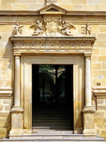
 

Fiestas y Eventos

On January 23, the eve of the day of Our Lady of Peace where the lumbres burn in all the corners of the town while tasting typical products. After Holy Week The big local party is taking place. From 22 to 25 April the parties of San Marcos that bring together thousands of people from the most diverse backgrounds around the running of bravas, soaked in the streets of the town.

Although the first skirmishes, for the younger ones, begin on the afternoon of the 23rd, the adrenaline is fired when, one after another, the reses are jumping into the sand. Bulls and cows, between clouds of dust and screams of the spectators to see almost the hundred that, during the afternoon of the 24 and all the day 25, will walk the streets led by squadrons to care for and guide them with a rope of between 10 and 25 meters. After the summer period with the festivities of its different villages already held, ends the festive cycle with the fair and parties from 17 to 20 September in honor of the Our Lady of Peace.
 

Gastronomía

Beas was always a land of passage for the transhuman pastors who crossed the manchegan lands looking for the pastures of the south for their cattle.

The fruit of this pastoral heritage, in Beas, the pastoralist cakes, made of flour, water and salt and amassed in a curted sheep or goat skin that the pastor carried on his journey, have been preserved. These cakes are the basis of other masses that are incorporated into the peas, such as the andrajos or galians, where the mass is cooked next to the hunting meat and sometimes with pieces of cod.

To highlight also the Easter bannazos, with several eggs cooked.
 

Historia

Beas de Segura is a villa full of history. Their occupation is documented from the Lower Paleolithic. It was in Roman times that Beas was consolidated as an urban core. From that time there are many tracks, such as villas, streets or the emblematic Mocho Bridge.

During the Islamic period, the stage of the highest splendor of Beas was reached in the time of Abdeleran III where it was part of the great district of the Alpujarra and Elvira. From that time it was its fortified enclosure, now already missing. Fernando III conquered Beas between 1224 and 1227 by joining her in the Crown of Castile, giving as an award to his Chancellor Don Juan, Bishop of Osma, the castle and the Villa of Beas, and this in turn the exchange with the Master of Santiago in exchange for inheritance. The title of Villa and other privileges received it in 1239, and in the 16th century, according to the Topographic Relations of Philip II, Beas appears as a flourishing economic center in the area of Segura, with a strong agricultural activity.
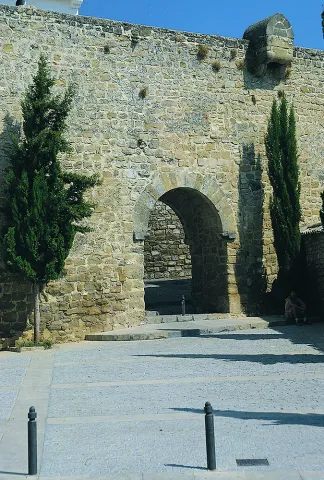
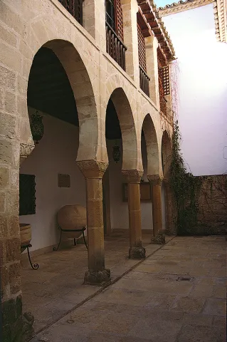
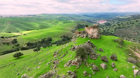
After the Reconquista was first included in the territorial demarcation of Toledo and within the Order of Santiago's Order, then passed to the Dependence of the Governor of Segura. Thus he was part of the Segura Common and all his territory was governed by the Ordinances. It was a crossroads of roads, hence its primitive name of Veha (way or way). Here are the three Roman tracks that were heading for the mountains, the Levante and El Condado.

At present, Beas is one of the main economic centres of the Sierra de Segura, whose region presupposes pride despite the fact that in the past it did not belong to the Segura Encomandación. Through the Beas River, the town is on horseback between the Sierra de Segura and the lands of El Condado and Sierra Morena. Beas de Segura offers the traveller a legacy impregnated in history, as demonstrated by the 35 archaeological sites located in its term.

The oldest pieces, including those of the Mocchio Bridge, are preserved in the archaeological section of the Provincial Museum. Beas is one of the doors of the Natural Park of the Sierras de Cazorla, Segura and Las Villas and an excellent starting point for entering the interior of these majestic lands.

Before, the traveller can walk his urban town, between narrow and tortuous streets that bear witness to a rich medieval and historical architecture of the late 19th century, such as Ángel Uceda Street and the building of the Old Carniceria. However, his main monumental claim is the Convent of the Descalzas Carmelites, which Saint Teresa of Jesus founded in houses owned by Catherine Maria de Sandoval and Godínez.

In a Renaissance style, the convent has a baroque cover and is structured with the classic half-point arch on imposts, with mensula in the key and rosettes. On the friso with triglyphs there is a split fronton and shields that frame the pilasters and bake with San José and El Niño. On the niche, the shield of the Order. A large triangular front and pinnacles kill the facade.

Loading map
Preparing points of interest and routes...
Imagen principal
imagen
Image
d383e669-73f6-0a29-76df-3aa2da3d3377?t=1603979643246
Imagen principal
Activado
Literatura

An appeal that captivated the greatest mystic poets: Santa Teresa, for whom this land was "most delightful and of a fine climate," and San Juan de la Cruz, who was constantly travelling to and from Beas from the various places his duties took him. 

The presence in the town of illustrious figures such as Santa Teresa de Jesús, San Juan de la Cruz and Ana de Jesús reinforces Beas's importance in the reform of the Carmelite Order.