Saltar al contenido principal
icon-intereses-cultura

Campos Hernán Perea

Submitted by brandcode_deweloper on
Id
911990
Descripción
Descripción larga

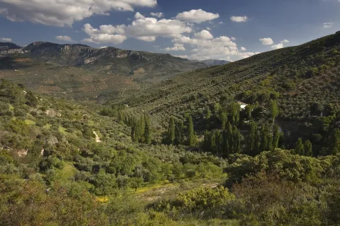
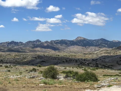
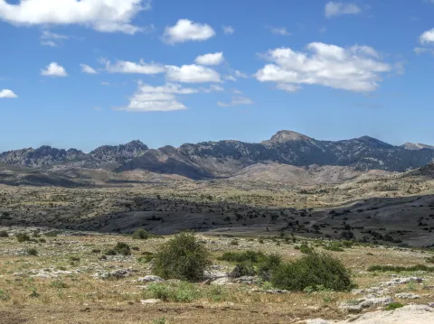
Its landscape is an exponent of karmic modeling. No one can say that he knows the Park in depth if he has not traveled the overwhelming plains of the Campos. The high mountain grazing is here the real protagonist; an activity that has, for centuries, allowed life in these remote territories, the homeland of the Segurean sheep.

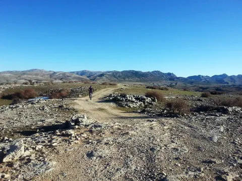
They say that in Los Campos solitude is felt. There are no fewer people here than in the wooded areas of the Park, because it is common to find some shepherd. What happens is that the clear breadth that our eyes perceive makes us more aware of our small than in dense forest areas.

The real beginning of the Hernán Perea Campos is about 11 km from Don Domingo, after having passed the Cañada Hermosa shelter, first of the three shelters that support the mountaineers on this route. They were built by the ICONA in the 1970s and are located next to the main road, which is surrounded by light depressions, dolins and sour rocky cords of limestone origin.

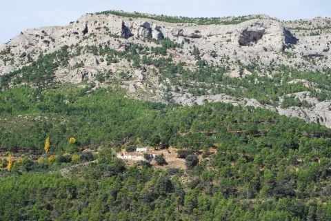
The harsh weather conditions have created a very adapted vegetation of piorns, albar thorn and common juniper (rake). We will also find some sown pieces of cereal, and of course many herbaceous plants from which the livestock is fed.

If we make the way in winter, with the snow covering its unique orography, we have the feeling of crossing an Arctic landscape. We must be very well informed of the weather, because a strong snow can put us in serious trouble. Spring is the best time to visit the Campos, when conditions are less demanding, although a good advice for any time is not to abandon at any time the main road that crosses the altiplanicie from north to south.

We suggest:

  • About 3.5 km from Don Domingo is the famous Pino Galapán, a 39-metre-high larix pine specimen in the area. A respectful visit to this "giant" in the Segura saw is required.
  • Rapist birds fly this place majestically throughout the year. The prismatics will be of great use to you to try to distinguish the royal eagle, the leonate vulture or... maybe the broken bones? The muflons are very abundant.
  • We must not forget that the beauty and grandiosity of the Campos is a major danger in certain times of the year. Winter, which here covers almost all autumn and part of spring, can be surprised by huge snowfalls that may eventually catch visitors, or leave them without the few visual references in the altiplanicie. In any case, in order to travel through these sites, you always have to use all-terrain vehicles, at least two cars, to provide support, as there is no telephone coverage. It is not advisable to stay in the winter months or in the twilight or night hours, and always to let third parties know that the tour begins.

From Santiago de la Espada we take the A-317 towards La Puebla de Don Fadrique. At 2.1 km, on the right, we find the JF-7091 road to La Matea. We take this road and follow it to the village of Don Domingo. The forest track towards Rambla Seca leads us to the fields of Hernán Perea.

Breve descripción

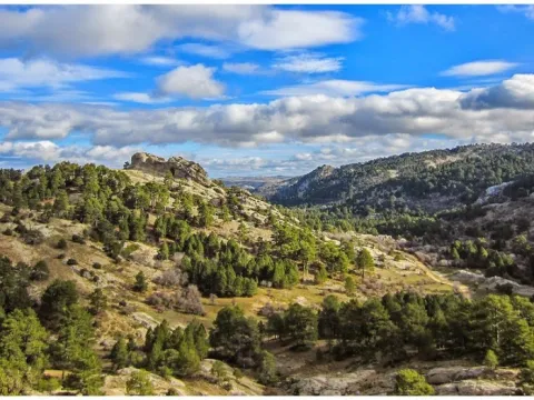
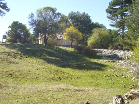
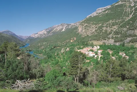
The fields of Hernán Pelea - or Perea, as is often called in the many mapas - make up the most extensive altiplanicie in Spain: they have an average altitude of 1600-1700 meters and an extension of more than 5,000 hectares. This vast altiplano represents one of the largest and most original landscapes of the Natural Park, quite different from all others.
Ubicación
Latitud
38.298857
Longitud
-2.651877
Distrito
Ubicación en el mapa
POINT (-2.651877 38.298857)
Tipos de punto de interés
Imágenes carrusel
imagen
Imagen
perea.jpg
Imagen principal
Desactivado
Loading map
Preparing points of interest and routes...

Fields of Hernán Perea

Submitted by brandcode_deweloper on
Id
2980186
Descripción
Descripción larga

The fields of Hernán Perea make up the most extensive altiplanicie in Spain. They have an average altitude of between 1,600 and 1,700 metres and an area of more than 5,000 hectares. This vast altiplano represents one of the largest and most original landscapes of the Natural Park Sierras de Cazorla, Segura and Las Villas, very different from all others. The harsh weather conditions have created a very adapted vegetation of piorns, albar thorn and common juniper (rake). Rapist birds fly this place majestically throughout the year. The prismatics will be of great use to us in trying to distinguish the royal eagle, the leonate vulture or... maybe the broken bones? The muflons are very abundant. About 3.5 km. From the village of Don Domingo is the famous Pino Galapán, a 39-metre-high larix pine specimen in the area. A visit to this botanical "giant" is required.
Breve descripción

In Santiago de la Espada we will take the road A-317 towards La Puebla de Don Fabrique (Granada). At 2.1 km, on the right, we will find the JF-7091 road leading to La Matea. We'll follow her to the village of Don Domingo. The forest track towards Rambla Seca will lead us to the fields of Hernán Perea.

Ubicación
Código Postal
23290
Latitud
37.981285
Longitud
-2.731904
Dirección
Camino de Pontones Don Domingo
Distrito
Municipio
Ubicación en el mapa
POINT (-2.731904 37.981285)
Tipos de punto de interés
Imágenes carrusel
imagen
Imagen
Campos_de_Hern%C3%A1n_Perea_24J_01.jpg
Imagen principal
Desactivado
Imágenes cabecera
imagen
Imagen
hernan-perea.jpg
Imagen principal
Activado
Loading map
Preparing points of interest and routes...

Calvary

Submitted by brandcode_deweloper on
Id
4885042
Descripción
Breve descripción

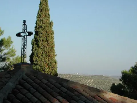
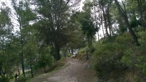
It's one of the local lungs. Located to the south-east of the city centre, it is a hill where there is pine mixed with oak and Mediterranean bushes. Through a wide and soft sidewalk, along which there are several stone crosses, you reach the top where you find theSan Cristóbal hermitage. On this path, at the evening of Holy Monday, the crucified Christ is processed.

Ubicación
Código Postal
23650
Latitud
37.763230
Longitud
-3.960880
Distrito
Municipio
Ubicación en el mapa
POINT (-3.96088 37.76323)
Tipos de punto de interés
Imágenes carrusel
imagen
Imagen
calvario.jpg
Imagen principal
Desactivado
Imágenes cabecera
imagen
Imagen
Calvario_de_Torredonjimeno.jpg
Imagen principal
Activado
Loading map
Preparing points of interest and routes...

Sponge Limestones of the Camino del Chorro

Submitted by brandcode_deweloper on
Id
874613
Descripción
Descripción larga

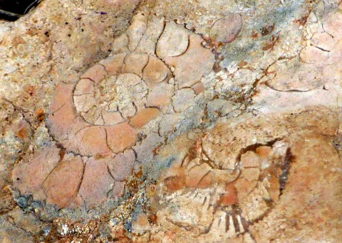
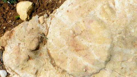
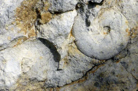
In the westernmost part of the Cazorla saw, tectonic scales of Cazorla and del Chorro, the Oxfordiense is also represented by nodular and rhythmic margoso- calcareas, by sponge and stromatolite bioconstructions, some of which perfectly retain the depository morphology, giving reliefs in the form of mounds ("mounds") made up of sponges and, most of them, of which are stromatolites. The spongiaries, siliceous sponges epigenized to calcite, appear mainly in the lower part of the bioherm, at first disorganized and fragmented and then adapted to different surfaces.

The stromatolites, on the other hand, constitute the majority of the bioconstructed body, and begin to be planar and then move to centrimetric columnar forms that together give cupolas of almost half a metre in diameter. Some of these depository morphologies can be observed on the slope of the road that from Cazorla leads to the Chorro, where this point of geological interest is located. These deposits culminate the depository sequence of the Oxfordiense in the saw of Cazorla, which is a sequence of deepening, in response to the oxfordiense transgression that caused the disappearance of the platform of the Lïas-Dogger, whose deposits are crowned by a "hardground" on which the Oxfordiense sequence is available. This sequence, in turn, is overtaken by another of lower Kimmeridgian age with which again the somerization that will culminate the Jurassic cycle begins.

Source: Inventory of Georresources of Andalusia. Environmental Council. Junta de Andalusia.

Breve descripción

Sponge limestone of the Chorro Road

Ubicación
Latitud
37.912893
Longitud
-3.003887
Municipio
Ubicación en el mapa
POINT (-3.003887 37.912893)
Tipos de punto de interés
Imágenes carrusel
imagen
Imagen
2%20%281%29.jpg
Imagen principal
Desactivado
imagen
Imagen
1%20%282%29.png
Imagen principal
Desactivado
imagen
Imagen
1.jpg
Imagen principal
Desactivado
imagen
Imagen
3%20%281%29.jpg
Imagen principal
Desactivado
Imágenes cabecera
imagen
Imagen
caliza.jpg
Imagen principal
Activado
Loading map
Preparing points of interest and routes...

Caldera del Tío Lobo and the Zurreón

Submitted by brandcode_deweloper on
Id
1869203
Descripción
Descripción larga

Location: Head of the Albanchez River.

Distance: 5 km.

Medium: On foot.

Access route: By mountain sidewalk.

Breve descripción

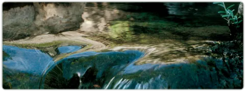
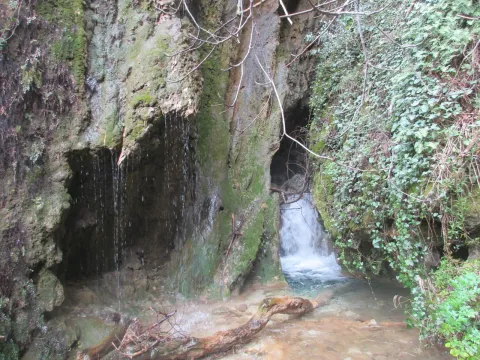
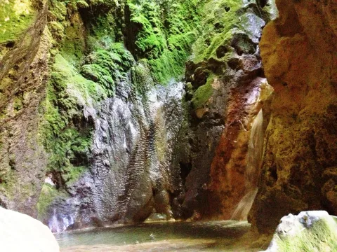
It is a set of river pods and a waterfall inside a cave, all in a very mountainous environment.

Ubicación
Latitud
37.766970
Longitud
-3.461280
Distrito
Ubicación en el mapa
POINT (-3.46128 37.76697)
Imágenes carrusel
imagen
Imagen
14830186Master.jpg
Imagen principal
Desactivado
Imágenes cabecera
imagen
Imagen
2394775Master.jpg
Imagen principal
Activado
Microsite al que pertenece
Loading map
Preparing points of interest and routes...

Guadalentín Headwaters via Fuente Acero

Submitted by brandcode_deweloper on
Id
911838
Descripción
Descripción larga

A road to the right is about 400 metres from the forest house of the source of Steel that will take us to the top of the Guadaltiín River.

From the Fuente de los Chorros, which can be considered its birth, to Vado Carretas, the Guadalanimin is watched by a high wall, the Cabrilla saw, which rises almost 1000 meters above its waters, and is shown in a succession of poyos and cliffs. In this Sierra there are some of the highest peaks of the Natural Park, such as the Cerro de los Tornajos, the Pico las Covachas or the Empanadas, which exceed 2,000 m. This saw is also the limit with the province of Granada.

The river is surrounded by beautiful pastures, cortijos and fields of abandoned crops, and with them great nogueras and other fruit trees that show us life in other times. Some of these corijos are in places that are remnants of peace and invite us to make a stop and enjoy the landscape.

We suggest...

  • Make the route from Fuente Steel to the Vado de las Carretas in order to admire these landscapes as a whole.
  • Stop you in the forest of complaints you'll find on the way.

In Cazorla take the Sierra road (A-319) until the crossing known as the Empalme del Valle. Turn right on the JF-7092 road and after passing the bridge over the Guadalquivir River (4 km from the Empalme) follow the left track (JF-7091). Passing the Sail of San Pedro and the Strait of the Perals we find on the right the ruins of the forest house of Fuente Econo.

Breve descripción

The Guadaltiín River in its journey has cultivated a valley of great beauty. Its shores are covered by lush vegetation: maples, strawberries, chopos, and complaints accompany it on its way. It stops in remnants of crystalline waters where the otter and the Iberian crab live; and sometimes the slopes narrow and form closed that accelerate the passage of the water. This is an essential excursion for anyone who wants to know this Natural Park.

Ubicación
Latitud
37.912893
Longitud
-3.003887
Municipio
Ubicación en el mapa
POINT (-3.003887 37.912893)
Imágenes carrusel
imagen
Imagen
1.png
Imagen principal
Desactivado
imagen
Imagen
3%20%281%29.jpg
Imagen principal
Desactivado
imagen
Imagen
4%20%281%29.jpg
Imagen principal
Desactivado
Imágenes cabecera
imagen
Imagen
9673418Master.jpg
Imagen principal
Activado
Loading map
Preparing points of interest and routes...

Burunchel

Submitted by brandcode_deweloper on
Id
659395
Descripción
Descripción larga

Since 2003, it has held a cattle fair in August, which had historically been one of the largest in the province of Jaén.

Breve descripción

Burunchel is settled on a hillside and still today you can perceive his past as an ancient dehesa. It is one of the entrances to the Natural Park and it is worth being approached by the hermitage of San Julián, from the 15th century and its facade.

Ubicación
Latitud
37.946090
Longitud
-2.954070
Municipio
Ubicación en el mapa
POINT (-2.95407 37.94609)
Tipos de punto de interés
Imágenes carrusel
imagen
Imagen
593_img.png
Imagen principal
Desactivado
imagen
Imagen
burunchel.jpg
Imagen principal
Desactivado
Imágenes cabecera
imagen
Imagen
burunchel%20%281%29.jpg
Imagen principal
Activado
Loading map
Preparing points of interest and routes...
Marcas de calidad

River Vault of Cerezuelo

Submitted by brandcode_deweloper on
Id
9346072
Descripción
Descripción larga

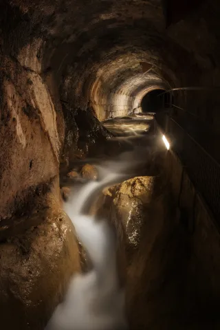
When he received the assignment, the Albacetean architect found it very difficult not to have a space of the size that Francisco de los Cobos asked for, so he solved it by building a vault on the River Cerezuelo; above the vault, the square of Santa Maria and on the square, the church, disproportionate by its enormous size, as they only lived a thousand inhabitants in the town, and yet almost cathedralicia. The project dated from 1535 and was a major engineering challenge for the media of the time.

It is said to be the only church in the world built on a river, and it is today, without a doubt, along with the vault on which it rises, the great tourist attraction in the city of Cazorla.

Breve descripción

The vault covering the Cerezuelo River was designed by Andrés de Vandelvira to be able to carry out the commission of Francisco de los Cobos, secretary of Charles V, as advance of Cazorla, of the construction of the church of Santa María. It is half-canyon, very compact, and adapts to the river's riverlevels throughout the plaza de Santa María, extending from the beginning of the plaza to the temple's header wall. The length of the tour is approximately 120 meters long.

Telecomunicaciones
Sitio web
www.turismoencazorla.com/dondeiryquever/monumentosycentros/bovedariocerezuelo.php
Teléfono de contacto
953 710 102
Correo electrónico
turismo@cazorla.es
Ubicación
Código Postal
23470
Latitud
37.909143
Longitud
-3.001215
Dirección
Plaza Sta. María
Municipio
Ubicación en el mapa
POINT (-3.001215 37.909143)
Tipos de punto de interés
Imágenes carrusel
imagen
Imagen
B%C3%B3veda%20r%C3%ADo%20Cerezuelo%202.jpg
Imagen principal
Desactivado
Imágenes cabecera
imagen
Imagen
B%C3%B3veda%20r%C3%ADo%20Cerezuelo%201.jpg
Imagen principal
Activado
Horario
Tuesday to Sunday: 10: 00 - 13: 00 and 16: 00 - 20: 00. Non-festive Monday closed. Guided tours every 30 minutes from 10: 00.
Loading map
Preparing points of interest and routes...

Gallery Forests

Submitted by brandcode_deweloper on
Id
879400
Descripción
Descripción larga

Many are the places where we can see a good forest in the gallery, both in the Segura River Valley and in the Guadalquivir Valley. The one we have chosen is on the upper stretch of the Segura River, in its way through the charming village of La Toba.

This defines the forests that accompany the rivers. Its components change along the river, from its birth to its mouth. The section we will see in the mountain areas of the Park corresponds to the sections of the high basin.

The forest we visit is made up of choperas (Populus nigra and Populus x canadensis), strawberries (Fraxinus angustifolia), saucedas formed by several willows (Salix eleagnos angustifolia, S. purpurea, S. atrcinerea and S. fragilis), zarzales (Rubus ulmifolius), and herbaceous formations of junches, molinies and cardics (Scripus holoschoenu, Juncus inflexius, Molinia caulea and Carpenex). We can also observe orchids such as daztilorrizas (Daztilorhiza elata) among these junkals.

Any time of the year is good for walking through this forest, with the most recommended autumn for its colors and the advanced spring for the great green nuance it presents and for the flowering of the orchids that populate it.

LOCATION

In the short detour that goes to the village of La Toba, as we pass the bridge over the Segura River, we park and we can enjoy directly a splendid riverside forest.

Breve descripción

Rio Segura, La Toba

Ubicación
Latitud
37.772886
Longitud
-3.788329
Ubicación en el mapa
POINT (-3.788329 37.772886)
Tipos de punto de interés
Imágenes carrusel
imagen
Imagen
La%20Toba%20%28Alonso%20Torrente%29.jpg
Imagen principal
Desactivado
imagen
Imagen
679_SS_09.jpg
Imagen principal
Desactivado
Imágenes cabecera
imagen
Imagen
_MG_3298.jpg
Imagen principal
Activado
Loading map
Preparing points of interest and routes...

Valley Floor Deciduous Forests

Submitted by brandcode_deweloper on
Id
920264
Descripción
Descripción larga

In the area of Tejina we have a splendid deciduous forest made up of complaints (Quercus faginea) that have leaves that are larger and more lustrous than those of high mountains, mapes of Montpelier (Acer monspessulanum), serbales (domestic Sorbus), pespejones (Sorbus tormentinalis) and pyruetans or wild perals (Pyrus bourgeana).

They are accompanied by shrubs such as majuelos (Crataegus monogina), endrines (Prunus spinosa), skirmishes or tapasses (Rosa spp.) and species of the Mediterranean forest, such as madroños (Arbutus unedo), agracejos or lebiernagos (Phylirea latifolia), wild jazmines (Jazminum fruticans), hedras (Hedera helix). In wet areas there are zarzas (Rubus ulmifolius), and in the forest and stony areas there are splits (Lavandula latifolia).

Among the herbaceous plants are grasses such as Brachypodium phoenocoids, Holcus lanatus, other species such as orchids (Ophrys lutea, O. apifera, O. tenthredinifera), trees (Trifolium campestre, T. strellatum), violets (Viola odorata) and others such as Bupleurum rigidum, Bellis perennis, etc.

We suggest:

  • When you are in places like this, very few, remember that these deciduous forests are authentic ecological shelters for fauna, because the fruits of many of its plant species mature in winter, which makes many birds survive when food is scarce in all other places. In turn, these birds help in the dispersion of the seeds. The human transformation of these areas threatens the stability of this ecosystem and involves serious biodiversity losses. Today many of the plant components of this forest are protected by law in Andalusia. We cannot afford to lose the most precious natural treasures, our forests.

Valle del Guadalquivir, on the road A-319 (km 42), a little below the Puente del Hacha, in the area known as Tejina.

Breve descripción

At the bottom of some valleys, deep and fertile soil coexist with thermal investment processes. These particular conditions of soil and climate make it possible to establish deciduous forests. These forests are very restricted to small enclaves in the Guadalquivir valley, as their ancient domains have been strongly transformed by human beings over the centuries.

Ubicación
Latitud
37.921120
Longitud
-2.991910
Municipio
Ubicación en el mapa
POINT (-2.99191 37.92112)
Imágenes carrusel
imagen
Imagen
valle.jpg
Imagen principal
Desactivado
Imágenes cabecera
imagen
Imagen
_fotodeeduardoviuales_6d80611f.jpg
Imagen principal
Activado
Loading map
Preparing points of interest and routes...