Saltar al contenido principal
icon-intereses-cultura

Peak Gilillo

Submitted by brandcode_deweloper on
Id
4486161
Descripción
Descripción larga

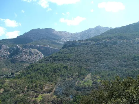
Location: To the south of the town, in the natural park of Cazorla, Segura and Las Villas.

Distance: 16 km

Medium: In vehicle tourism and on foot.

Access route: By the A-319 in the direction of La Iruela; at this point, after 13 km, we will take the Chorro road, then diverting by a horseshoe road leading to the Port of Tejo.

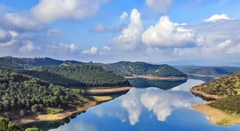
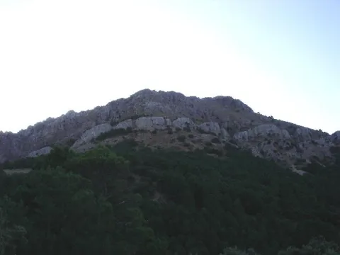
When you reach the port of Giillo, you leave the path to turn right and climb to the rocky top of the same name, spectacular atalaya with beautiful views in all directions. The fall is made to the port of Giillo, and we will have to pass through an old, ruined shelter where a path of descent begins, this one passes through the Loma de Los Castellones, with beautiful views of the Calar de Juana and the Cabañas, as well as a spectacular sincerity that remains to our left, soon we arrive to the Laguna de Cazorla, a great dolina where we will take a beautiful horseshoe path that is headed towards the Port of Tejo. From here on, a beautiful fall begins on the path of masonry passing under the Banderín and the Cejo de la Mora, with beautiful views towards Los Castellones and Giillo, until reaching the ruins of the Forest House of Prado Redondo, beautiful corner with a fountain.

Breve descripción
Ubicación
Latitud
37.869750
Longitud
-2.993650
Municipio
Ubicación en el mapa
POINT (-2.99365 37.86975)
Tipos de punto de interés
Imágenes carrusel
imagen
Image
gilillo.jpg
Imagen principal
Desactivado
Imágenes cabecera
imagen
Image
NaturalPicoGilillo.jpg
Imagen principal
Activado
Loading map
Preparing points of interest and routes...

Peña del Olivar

Submitted by brandcode_deweloper on
Id
5924636
Descripción
Descripción larga

Information and Comments:

  • The kiosco-bar is temporarily closed until further notice, by works of improvement in the installation.
  • The barbecues area can only be used when Environment gives the order that there is no danger of fire.
Breve descripción

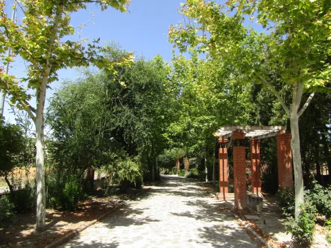
In this recreational area is the Peña del Olivar botanical collection, which is divided into two areas dedicated to the high and low mountain.

In the high mountain area, the visitor will discover the species of the great heights of the Segura saw such as the Sabina and the juniper or the larice pine. As it descends in altitude, the forest of maples, complaints, and mellows, as well as the forests of stalks, all taking a prominent place along the itinerary.

In the area dedicated to the low mountain you can discover the vegetation of the lauroid forest with, among other species, madroños and doves. The tour is completed by presenting the exclusive species of the place.

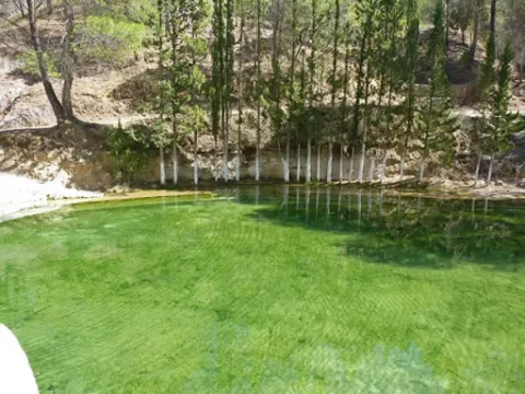
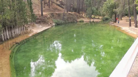
This area, which is traditionally appreciated by the neighbors of Siles, is part of a particularly lush and fresh environment in summer, when many people take advantage of bathing in the cold waters of the natural pool built just across the road, in the Barranco de los Tejos stream. The area has a fountain, bar with dining room, banks and tables to eat, barbecues and children's area. There is also a surprising Botanical Collection in a small and pleasant garden, with over a hundred species of natural park plants, some with exceptional ecological value because they are rare endemisms.

Ubicación
Latitud
38.388731
Longitud
-2.589810
Distrito
Municipio
Ubicación en el mapa
POINT (-2.58981 38.388731)
Tipos de punto de interés
Imágenes carrusel
imagen
Image
pe%C3%B1aolivar.jpg
Imagen principal
Desactivado
Imágenes cabecera
imagen
Image
1%20%281%29.jpg
Imagen principal
Activado
Microsite al que pertenece
Loading map
Preparing points of interest and routes...

Mining Heritage

Submitted by brandcode_deweloper on
Id
4383600
Descripción
Descripción larga

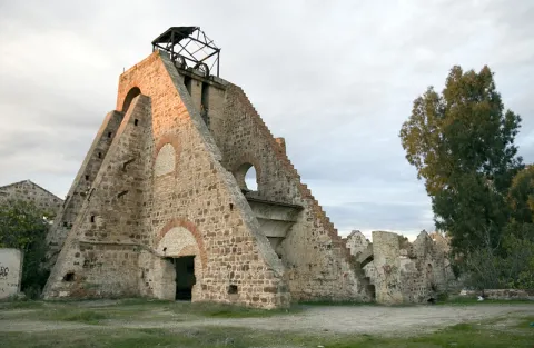
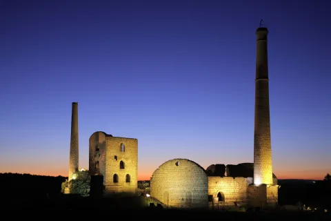
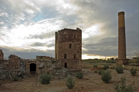
Since then, local associations and municipalities have begun to promote this interesting heritage. In 1999, because of the uniqueness, abundance and quality of this industrial mining landscape, heritage experts described the area in the British press as "the best kept secret in Europe" (Europe's best kept secret).

In the entire mining region, there are remains of high interest industrial archaeology, some unique examples in the world. This scattered set of buildings, railway stations, machine houses, chimneys, cabries and roads explain the history of one of the areas of southern Europe in which the Industrial Revolution took place, where English, Belgian, French and Spanish communities lived together. This combination of history and the use of natural resources is an excellent pretext for visiting the landscape of the chimneys, the landscape that welcomes visitors who arrive in Andalusia from the north.

Breve descripción

The mining activity of the Linares- La Carolina mining district extends over 4,000 years, as shown by archaeological investigations. Its importance was such that in 1869 lead production exceeded that of all England. The operation remained active until 1,991, when it closed the last mine in Linares for lack of profitability.

Telecomunicaciones
Sitio web
www.lacarolina.innovasur.es
Teléfono de contacto
953 660 034
Correo electrónico
info@lacarolina.es
Ubicación
Código Postal
23200
Latitud
38.274220
Longitud
-3.615160
Distrito
Municipio
Ubicación en el mapa
POINT (-3.61516 38.27422)
Tipos de punto de interés
Imágenes carrusel
imagen
Image
mineros.jpg
Imagen principal
Desactivado
imagen
Image
mineros%202.jpg
Imagen principal
Desactivado
Imágenes cabecera
imagen
Image
image_183804.jpeg
Imagen principal
Activado
Loading map
Preparing points of interest and routes...

Walk of the Walls

Submitted by brandcode_deweloper on
Id
3984471
Descripción
Descripción larga
Little by little, Antonio Machado is adapting to the rural environment of Baeza and its dazzling landscape outside the walls. Enjoy peri-urban walks that take you to the Alcázar hill and over the remains of the old wall. One of the spaces most frequented by Antonio Machado, who visits it again and again in his meditation exercises. At one point on said walk, a plaque and a monument to Antonio Machado with a bust of Pablo Serrano commemorate the poet today. This sculpture was made to honor the poet in 1966, although it did not arrive in Baeza until 1983. From the viewpoints along the promenade it dominates the middle valley of the Guadalquivir with its beautiful horizon carpeted with olive trees and outlined by the Cazorla, Mágina mountain ranges and the Aznaitín and Jabalcuz mountains. This image serves as an escape and an impulse for his creative capacity, creating here sublime verses that describe this landscape. PATHS (…) From the Moorish city behind the old walls, I contemplate the silent afternoon, alone with my shadow and my sorrow. The river runs, among gloomy orchards and gray olive groves, through the cheerful fields of Baeza The vines have golden branches on the red vines. Guadalquivir, like a broken cutlass and scattered, shines and mirrors. (…)
Breve descripción
Baeza Paseo de las Murallas and Antonio Machado. It begins in the Plaza de los Leones. Continue along the path of the walls and continue along the Antonio Machado walk. Good views of the Bishop Academy and Jaén olive oil bridge. We continue along the route and see a tribute to D. Antonio Machado. And from here at the end Impressive views of the Guadalquivir valley and at the end views of Úbeda.
Ubicación
Código Postal
23440
Latitud
37.987620
Longitud
-3.471160
Municipio
Ubicación en el mapa
POINT (-3.47116 37.98762)
Tipos de punto de interés
Imágenes carrusel
imagen
Image
muralla_baeza.png
Imagen principal
Desactivado
Imágenes cabecera
imagen
Image
57fd22895f44626a108a9ccbc88957b7_720x560.jpg
Imagen principal
Activado
Microsite al que pertenece
Loading map
Preparing points of interest and routes...

Parish Church of Our Lady of Peace

Submitted by brandcode_deweloper on
Id
4276831
Descripción
Breve descripción

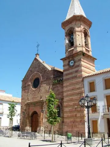
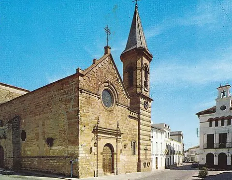
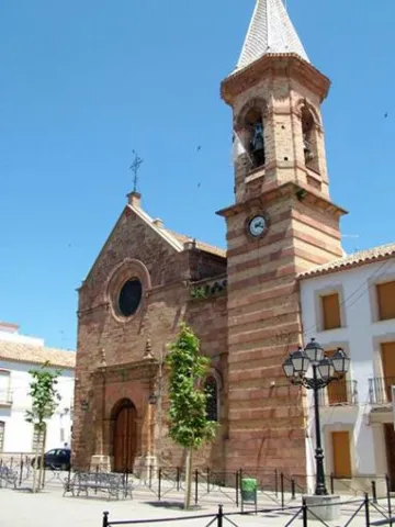
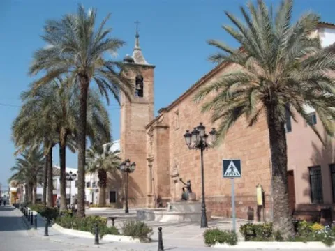
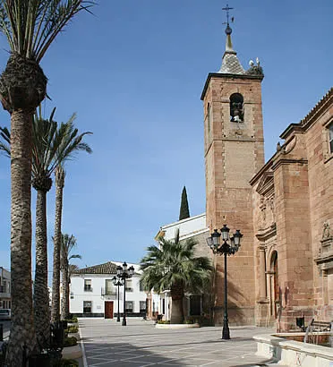
The Parish Church of Our Lady of Peace is located in Marmolejo. The origins of this church date back to the 14th century. This early foundation was added to the cruise in the 15th and 16th centuries and in the 18th the two covers. But the general configuration presented by this church today is the result of the reform carried out at the end of the 19th century by the architect Justino Flórez Llamas, under the historical and eclectic lexicography of the time, and which focused primarily on the west tower and facade.

Telecomunicaciones
Sitio web
www.villademarmolejo.es/urbanismo-y-monumentos/monumentos/iglesialapaz/
Teléfono de contacto
953 540 210
Ubicación
Código Postal
23770
Latitud
38.044960
Longitud
-4.170870
Dirección
Plaza de la Constitución, 3
Distrito
Municipio
Ubicación en el mapa
POINT (-4.17087 38.04496)
Tipos de punto de interés
Imágenes carrusel
imagen
Image
Parroqu%C3%ADa%20de%20Nuestra%20Se%C3%B1ora%20de%20la%20Paz3.jpeg
Imagen principal
Desactivado
imagen
Image
Parroqu%C3%ADa%20de%20Nuestra%20Se%C3%B1ora%20de%20la%20Paz.png
Imagen principal
Desactivado
Imágenes cabecera
imagen
Image
image_105936.jpeg
Imagen principal
Activado
Microsite al que pertenece
Loading map
Preparing points of interest and routes...

Parish of the Natividad de Nuestra Señora

Submitted by brandcode_deweloper on
Id
4523566
Descripción
Breve descripción

It was built on an earlier medieval temple and was founded in 1604 by Maria Notario de Lara, although its interior denotes Gothic traces. It is important to note its Major Retail of the S. XV). At the foot, it has a square base tower with two floors and a bell tower with half-point arches, which crown a pointed capital. On its northern side is the Chapel of the Rosary, an example of the Andalusian rococo of the first half of the 18th century.

Telecomunicaciones
Sitio web
www.vreina.com
Teléfono de contacto
953 537 127
Ubicación
Código Postal
23730
Latitud
38.005440
Longitud
-3.919940
Dirección
Plaza la Constitución, 9
Distrito
Ubicación en el mapa
POINT (-3.91994 38.00544)
Tipos de punto de interés
Imágenes carrusel
imagen
Image
Parroquia%20de%20la%20Natividad%20de%20Nuestra%20Se%C3%B1ora.jpg
Imagen principal
Desactivado
Imágenes cabecera
imagen
Image
villanuevareina.jpg
Imagen principal
Activado
Microsite al que pertenece
Loading map
Preparing points of interest and routes...

Jabalquinto Park

Submitted by brandcode_deweloper on
Id
8122790
Descripción
Descripción larga

The park is located in a public square in the centre of the city centre, with urban facilities and furniture dating back to the 1980s and which were old and in disuse. "It is a comprehensive project that will remodel this Freedom Park, which is almost 40 years old and has an image of deterioration," he adds. In this first phase, the entire infrastructure of supply, sanitation and public lighting is being changed. This performance will continue in a second phase in which all the urban furniture will be completed, consisting of banks running around the alcorques and the children's playground, as well as the covering of the fountain and the decorative lighting of the whole.

Breve descripción

New park on Avenida de Andalucía. It was designed to build a biosaludable park for outdoor sport with swing area for children.

Telecomunicaciones
Teléfono de contacto
953 617 056
Correo electrónico
jabalquinto@jabalquinto.es
Ubicación
Código Postal
23712
Latitud
38.019340
Longitud
-3.726970
Distrito
Municipio
Ubicación en el mapa
POINT (-3.72697 38.01934)
Tipos de punto de interés
Imágenes carrusel
imagen
Image
parque%20Jabalquinto%20%281%29.jpg
Imagen principal
Desactivado
Imágenes cabecera
imagen
Image
parque%20Jabalquinto2%20%281%29.jpg
Imagen principal
Activado
Loading map
Preparing points of interest and routes...

Pilar de la Dehesa Park

Submitted by brandcode_deweloper on
Id
4445246
Descripción
Descripción larga

Location: In the area of the same name, very close to the city centre.
Distance: 1.4 km
Medium: By vehicle tourism or on foot.
Access route:: A rural road that leaves the town directly

Breve descripción

Leisure and rest place with shade areas with barbecues, water sources and table

Ubicación
Código Postal
23628
Latitud
37.983890
Longitud
-3.882950
Distrito
Municipio
Ubicación en el mapa
POINT (-3.88295 37.98389)
Tipos de punto de interés
Imágenes carrusel
imagen
Image
pilardehesa.jpg
Imagen principal
Desactivado
Microsite al que pertenece
Loading map
Preparing points of interest and routes...

Natural Park Sierra de Andújar

Submitted by brandcode_deweloper on
Id
1914790
Descripción
Descripción larga

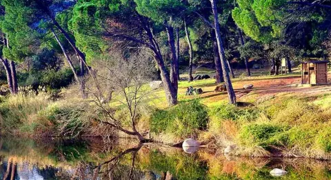
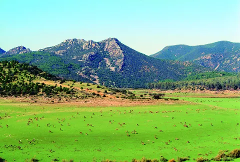
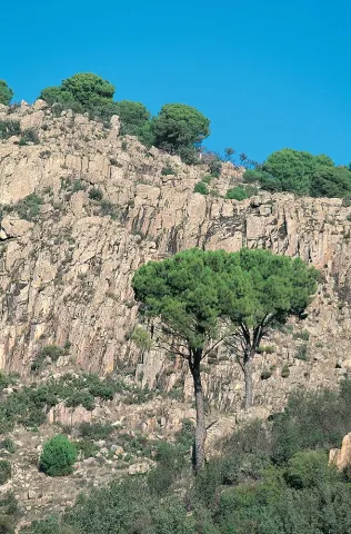
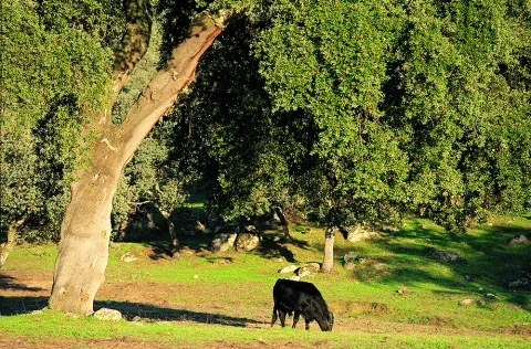
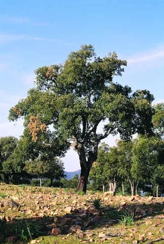
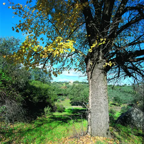
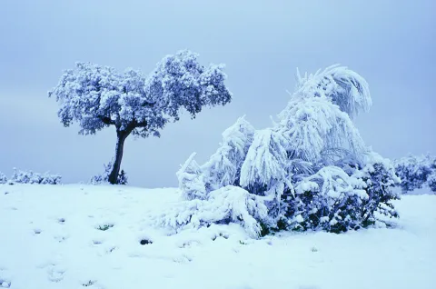
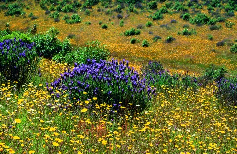
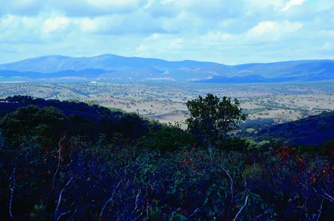
The Sierra de Andújar Natural Park has a varied morphology and altitude. The most extensive natural vegetation spots in Sierra Morena are observed in this environment, with the oaks, the complaints and the alcornoques being the predominant species.

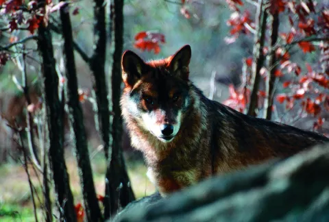
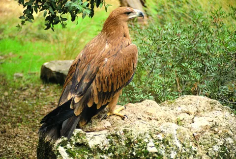
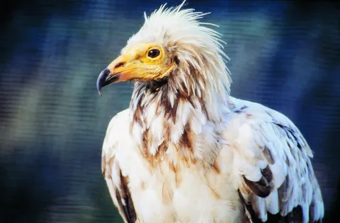
In Sierra Quintana, Atlantic obledals are located. In addition, valuable species of fauna, such as the lince or the royal eagle, find in the Sierras de Andújar one of its few shelters within the Iberian Peninsula.

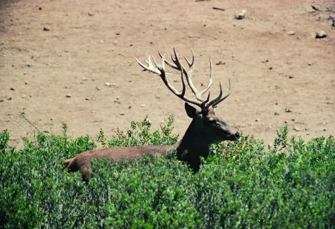
Livestock is of some importance in the local economy, with extensive dehesas dedicated to the raising of ligia bulls or to the exploitation of deer, gores, lambs, muflons and boars. Thus, hunting sport is a major economic resource in the famous public and private areas of the Park.

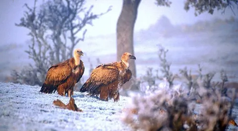
It is not difficult to see in the sky of the Sierra de Andújar Natural Park the spectacular flights of the royal, perdicular and imperial eagles, the last one on the Iberian Peninsula and which has in this area one of its last shelters. Three carrion species can also be observed: the leonate vulture, the black and the alenoche.

Of tourist interest are the Sanctuary of the Virgin of the Head, where each year by May is celebrated the oldest Romeria in Spain, the Jandula and Encinarejo reservoirs, the Cercado del Ciprés Environmental Complex, which has a botanical garden and a Nature Hall, among other facilities, or the Mirador del Peregrino.

BASIC PARTICULARS

Geographical location: To the north-west of the province

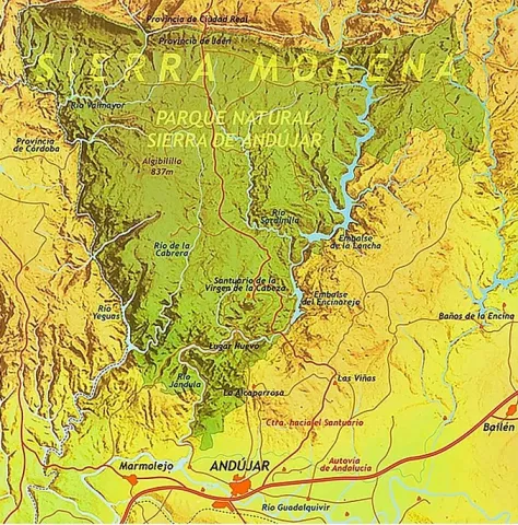
Municipalities: Andújar, Baños de la Encina, Villanueva de la Reina and Marmolejo

Coordinates: 38º16 'N; 4º6' W

Date of declaration1989

Area74,774 ha.

Altitude: between 500 and 1,290 m. (Pico Burcio del Pino)

Climate data:
- Average monthly temperatures: Between 9 ° C (January) and 28 ° C (August)
- Average annual accuracy: 570 mm.

Main training:
Mediterranean mountain of cherries and river vegetation

Natural Park Office:
Environmental complex Cercado del Ciprés
The way of the Rubials, s / n. 23740 Andújar
Tel.: + 34 953 539 620
Fax: + 34 953 012 508
Email:pn.andujar.cma @ juntadeandalucia.es

Visitors' Centre:
Peñallana vineyards
Ctra. A-6177 Andújar - Virgin of the Head Sanctuary, Km. 13. 23740 Andújar
Tel.: 953 549 030
Email:cv _ vinasdepenallana @ egmasa.es

Other protection figures:
Area of Special Protection for Birds [ZEPA (2002)]

Other equipment for public use:
- La Recta recreational area
- Recreative area of the Encinarejo
- Recreative area of the Aliseda
- Jabali recreational area
- Mirador de las Mahadillas
- Jandula Viewer
- Viewer of the Old Way
- Cosomal Viewer

More information:
http: / / www.juntadeandalucia.es / environment / site / web /
http: / / www.prodecan.es /

Breve descripción

The Natural Park of Sierra de Andújar is located to the northwest of the province of Jaén, in the heart of Sierra Morena, just a step from the city of Andújar. It has an area of 74,774 hectares, and contains four municipal terms: Andújar, Baños de la Encina, Villanueva de la Reina and Marmolejo.

Ubicación
Latitud
38.289780
Longitud
-4.028650
Distrito
Municipio
Ubicación en el mapa
POINT (-4.02865 38.28978)
Tipos de punto de interés
Imágenes carrusel
imagen
Image
Anotaci%C3%B3n%202020-04-16%20084514.jpg
Imagen principal
Desactivado
imagen
Image
Anotaci%C3%B3n%202020-04-16%20084445.jpg
Imagen principal
Desactivado
imagen
Image
Anotaci%C3%B3n%202020-04-16%20084429.jpg
Imagen principal
Desactivado
imagen
Image
Anotaci%C3%B3n%202020-04-16%200884850.jpg
Imagen principal
Desactivado
imagen
Image
Natu044.jpg
Imagen principal
Desactivado
imagen
Image
Natu422.jpg
Imagen principal
Desactivado
imagen
Image
Natu424.jpg
Imagen principal
Desactivado
imagen
Image
Natu135.jpg
Imagen principal
Desactivado
imagen
Image
Natu161.jpg
Imagen principal
Desactivado
imagen
Image
v-lwu0Cw.jpeg
Imagen principal
Desactivado
imagen
Image
Natu174.jpg
Imagen principal
Desactivado
imagen
Image
Natu267.jpg
Imagen principal
Desactivado
imagen
Image
Natu141.jpg
Imagen principal
Desactivado
imagen
Image
Natu142.jpg
Imagen principal
Desactivado
imagen
Image
Natu139.jpg
Imagen principal
Desactivado
imagen
Image
Natu158.jpg
Imagen principal
Desactivado
imagen
Image
Natu222.jpg
Imagen principal
Desactivado
imagen
Image
Natu245.jpg
Imagen principal
Desactivado
imagen
Image
Natu247.jpg
Imagen principal
Desactivado
imagen
Image
Natu248.jpg
Imagen principal
Desactivado
Imágenes cabecera
imagen
Image
9576153667_3b55af2da2_b.jpg
Imagen principal
Activado
Microsite al que pertenece
Loading map
Preparing points of interest and routes...

Manuel Jurado Park

Submitted by brandcode_deweloper on
Id
8521441
Descripción
Descripción larga

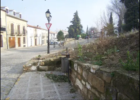
Park to extramuros south of the villa of Sabiote. Just where the south wall is attached to the west wall of the Sabiote wall. Located under the Pasaje de los Torreones and at the beginning of San Januario Street. In it is the Mill of the Manuel Jurado Park.

Breve descripción

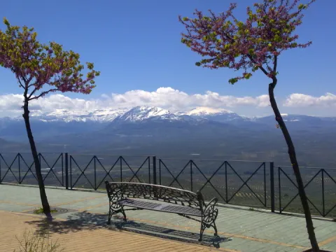
For its strategic position, it is a lookout with beautiful views over Sierra Magina, as well as those of Cazorla, Segura and Las Villas. This park was opened in June 2003.

Telecomunicaciones
Teléfono de contacto
953 773 002
Ubicación
Código Postal
23410
Latitud
38.068360
Longitud
-3.305080
Dirección
C/ San Juanario, 6
Municipio
Ubicación en el mapa
POINT (-3.30508 38.06836)
Tipos de punto de interés
Imágenes cabecera
imagen
Image
parque_manuel_jurado.jpg
Imagen principal
Activado
Loading map
Preparing points of interest and routes...