Saltar al contenido principal
icon-intereses-cultura

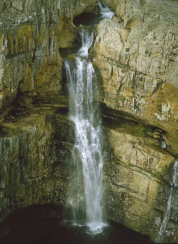
La Cimbarra Waterfall Natural Site

Submitted by brandcode_deweloper on
Id
1927564
Descripción
Descripción larga

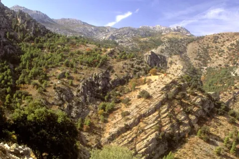
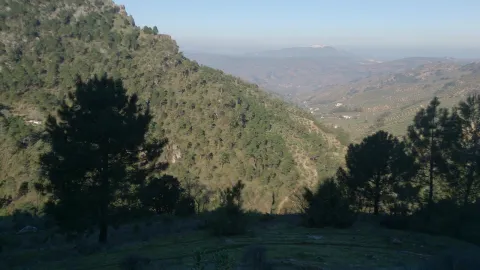
In the central region of Sierra Morena, on a substrate of slate and sandstone, this protected space is located characterized by its accidental relief.

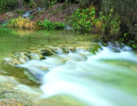
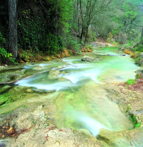
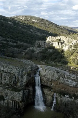
On the south-west side the river Guarrizas appears, creating strong slopes. On the contrary, the declives on the southeast side are softer. The napping of the river forms waterfalls, the most spectacular and beautiful being that of Cimbarra.

The flora is characterized by its heterogeneity. It abounds the mixed forest of oak and alcornoques, with an abundant Mediterranean bush. There is also an area of oak and repopulations of pineapple and black pine. The fauna is also rich and varied.

Among the medium-sized predators the fox and the gin abound, while numerous rapaces fly over the skies of this natural area of 534 hectares of extension, highlighting the royal eagle and the eagle.

Breve descripción

If for anything it is known Aldeaquemada is precisely for La Cimbarra. This spectacular waterfall, about 40 meters high, is located about two kilometres from the village in the south direction and has the category, as a protected natural space, of Natural Park. The access path is in good condition and efforts to improve it have been important in recent years.

Ubicación
Latitud
38.388645
Longitud
-3.414725
Distrito
Municipio
Ubicación en el mapa
POINT (-3.414725 38.388645)
Tipos de punto de interés
Imágenes carrusel
imagen
Image
xDESPE%C3%91APERROS%2C%20LA%20CIMBARRA.jpg
Imagen principal
Desactivado
imagen
Image
main_image_54214.jpeg
Imagen principal
Desactivado
Imágenes cabecera
imagen
Image
Cascada%20de%20la%20Cimbarra%20G%C3%BCido%20Monta%C3%B1%C3%A9s.jpg
Imagen principal
Activado
Loading map
Preparing points of interest and routes...

Natural Area Alto Guadalquivir

Submitted by brandcode_deweloper on
Id
2190557
Descripción
Descripción larga

The whole area of this artificial wet area - with an increasingly important water vegetation belt - is surrounded by crops.

The palustre vegetation of these swamps is basically made up of eneas and canes, accompanied by beets and tarays and on their shores are mainly developed the alms.

While, as far as fauna is concerned, an abundant and varied community of aquatic birds is concentrated in these reservoirs of Alto Guadalquivir, highlighting the colony of squid (species catalogued as threatened at community level), royal ducks and spoons, as well as imperial porrones and garzas.

The total area of this natural area, whose reference locations are Ubeda and Jódar, is 663 hectares.

Breve descripción

To the south of the famous hills of Ubeda, the Guadalquivir River was repressed in the 1950s in a succession of three small reservoirs: Doña Aldonza (301 hectares), Pedro Marín (240 hectares) and Puente de la Cerrada (122 hectares).

Ubicación
Latitud
37.779600
Longitud
-3.784910
Municipio
Ubicación en el mapa
POINT (-3.78491 37.7796)
Tipos de punto de interés
Imágenes carrusel
imagen
Image
Natu178.jpg
Imagen principal
Desactivado
imagen
Image
Natu179.jpg
Imagen principal
Desactivado
imagen
Image
Natu237.jpg
Imagen principal
Desactivado
Imágenes cabecera
imagen
Image
Natu049%20%281%29.jpg
Imagen principal
Activado
Loading map
Preparing points of interest and routes...

River Area of Cuadros

Submitted by brandcode_deweloper on
Id
2980270
Descripción
Descripción larga

Also known as "Senda de los Adelfares," it is a forest in a gallery made up of adelfas that develops along the birth of the Cuadros River, in the Natural Park of Sierra Magina. It is the most extensive formation in southern Spain with a high degree of conservation.

Breve descripción

Next to the shrine of the Virgin of Cuadros, south of the city centre, about 4 km. of Bedmar; access directly by the road JV-3.222.

Telecomunicaciones
Sitio web
www.bedmargarciez.es
Teléfono de contacto
953 760 002 / 953 760 043
Correo electrónico
alcaldía@bedmargarciez.es
Ubicación
Código Postal
23537
Latitud
37.787590
Longitud
-3.408670
Dirección
Carretera JA-4111
Distrito
Municipio
Ubicación en el mapa
POINT (-3.40867 37.78759)
Tipos de punto de interés
Imágenes carrusel
imagen
Image
nacimiento-rio-cuadros-1-jpg
Imagen principal
Desactivado
imagen
Image
nacimiento-rio-cuadros-jpg
Imagen principal
Desactivado
Imágenes cabecera
imagen
Image
%C3%81rea%20recreativa%20de%20Cuadros.jpg
Imagen principal
Activado
Microsite al que pertenece
Loading map
Preparing points of interest and routes...

Caño del Aguadero Natural Site

Submitted by brandcode_deweloper on
Id
1891235
Descripción
Descripción larga

Area of pastures traditionally dedicated to pasture, so the fountains, pilares- abrevadero and huts or pastor's cabins abound. The altitude of the saw allows the presence of birds that nedify above 1,500 meters, such as the Red Roquer, the Grey Collalba and the Royal Eagle.

Access by land lane from the nearby town of Bedmar.

13 Km tour, then walk routes.

Breve descripción

Water birth at 1,800 meters of altitude in a high mountain environment.

Ubicación
Latitud
37.791993
Longitud
-3.467877
Dirección
Caño del Aguadero
Distrito
Ubicación en el mapa
POINT (-3.467877 37.791993)
Tipos de punto de interés
Imágenes carrusel
imagen
Image
725_SS_03.jpg
Imagen principal
Desactivado
Imágenes cabecera
imagen
Image
725_SS_05.jpg
Imagen principal
Activado
Microsite al que pertenece
Loading map
Preparing points of interest and routes...

Ayozar Fountain Area

Submitted by brandcode_deweloper on
Id
8090292
Descripción
Descripción larga

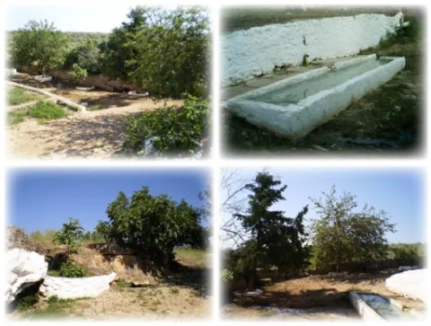
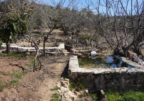
The fountain is accessed by Ayozar Street, located about 800 metres from the town. This source may be the most appreciated by the citizens, has a very good reputation for their water for use in the kitchen. It was formerly a place where the elders went with their grandchildren to take walks and make clay castles.

Breve descripción

The route from Castellar to the Pilar del Ayozar is ideal for hiking; since it is a small area, biodiversity is scarce. However, among the fauna of the area, we can highlight some frogs, creams, lizards and birds, while of their flora we can mention the fig trees, morale and alamos.

Telecomunicaciones
Sitio web
www.castellar.es/patrimonio-natural
Teléfono de contacto
953 460 005
Ubicación
Código Postal
23260
Latitud
38.253580
Longitud
-3.129160
Distrito
Municipio
Ubicación en el mapa
POINT (-3.12916 38.25358)
Tipos de punto de interés
Imágenes carrusel
imagen
Image
fuente%20del%20ayozar%20%281%29.jpg
Imagen principal
Desactivado
imagen
Image
fuente%20del%20ayozar2.jpg
Imagen principal
Desactivado
Imágenes cabecera
imagen
Image
fuente%20del%20ayozar9%20%281%29.jpg
Imagen principal
Activado
Loading map
Preparing points of interest and routes...

Hermitage of Consolación Site

Submitted by brandcode_deweloper on
Id
8090150
Descripción
Descripción larga

You get out of Castellar in the direction of Sorihuela del Guadalimar. 300 metres from the village exit, the road leading to the Sanctuary of the Virgin of Consolation is on the right. The journey consists of just over 4 km.

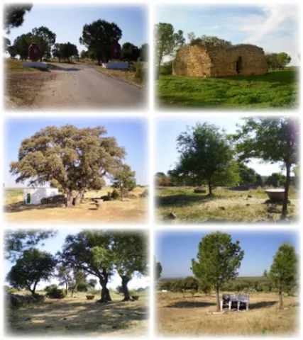
Biodiversity is rich given the small extent of this area. Of its fauna, we can highlight foxes, wild cats, some rabbits, hares, perdices, moles, mice, alacrans, lettuce, tortolas and zorzales, while of its flora, it is worth mentioning species such as the pine trees of repopulation for shadows, oaks, aloms, rosemary, lentils, matorra, retamas, acuche and cornicabra.

Breve descripción

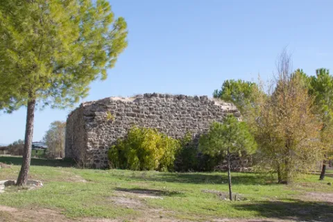
In this place is celebrated the traditional Romeria in honor of the Patron. It is a place of plenty known to all the locals and very frequented due to the visits made to the Patron, to the celebration of the typical "kit" in that place, and that it is a nearby place where you are very good to spend the day (domingueros). In this place we have two important references, the remains of the Castle of Espinosa and the Hermitage.

Telecomunicaciones
Sitio web
www.castellar.es/patrimonio-natural
Teléfono de contacto
953 460 005
Ubicación
Código Postal
23260
Latitud
38.244880
Longitud
-3.140810
Distrito
Municipio
Ubicación en el mapa
POINT (-3.14081 38.24488)
Tipos de punto de interés
Imágenes carrusel
imagen
Image
Paraje%20de%20la%20Ermita%20de%20Consolaci%C3%B3n%20%281%29.jpg
Imagen principal
Desactivado
Imágenes cabecera
imagen
Image
Paraje%20de%20la%20Ermita%20de%20Consolaci%C3%B3n4%20%281%29.jpg
Imagen principal
Activado
Loading map
Preparing points of interest and routes...

Area of Jesús del Monte

Submitted by brandcode_deweloper on
Id
4585369
Descripción
Breve descripción

The Cañada de la Madera has access to this natural setting, with good views of the park and a well-equipped road with drinking water and a hermitage. In this same place stands the Fuente del Avellano.

Ubicación
Código Postal
23338
Latitud
38.157030
Longitud
-3.032730
Municipio
Ubicación en el mapa
POINT (-3.03273 38.15703)
Tipos de punto de interés
Imágenes carrusel
imagen
Image
iznatoraf_jesus.jpg
Imagen principal
Desactivado
Imágenes cabecera
imagen
Image
3609997Master.jpg
Imagen principal
Activado
Loading map
Preparing points of interest and routes...

Giribaile Reservoir

Submitted by brandcode_deweloper on
Id
4554856
Descripción
Breve descripción

It affects the municipal terms of Ibros, Vilches, Rus, Canena, Ubeda, Navas de San Juan and Sabiote, in the skirts of theNatural area La Lambrain Rus. It is of the compaction type (80% of land).
The swamp collects the waters of the Guadalimar River, which belongs to the Guadalquivir watershed.

Ubicación
Código Postal
23430
Latitud
38.113562
Longitud
-3.461869
Municipio
Ubicación en el mapa
POINT (-3.461869 38.113562)
Imágenes carrusel
imagen
Image
Embalse%20de%20Giribaile.jpg
Imagen principal
Desactivado
Microsite al que pertenece
Loading map
Preparing points of interest and routes...

Vela de los Cobos Palace

Submitted by brandcode_deweloper on
Id
915979
Descripción
Descripción larga

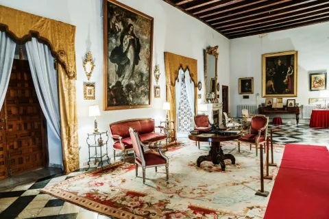
In the magazine Don Lope de Sosa (1924) Don Manuel Muro García published a document of great interest on the conditions developed by Andrés de Vandelvira to make the gallery high, complemented by some explanatory drawings on the margins, which are practically the only drawings, so far, that have come from his hand.

The document is dated May 3, 1561, and - although the architectural forms of the work of the gallery are essentially written in it - Vandelvira, of course, was responsible for much of the building, from which at present the facade has arrived intact. V.M. Ruiz Fuentes provides new data on the constructive process, as it states that the cover and the second body of the facade are already up before 1561, date of the beginning of the upper gallery, finished about 1563.

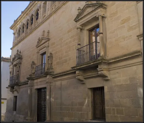
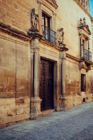
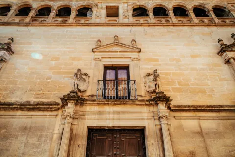
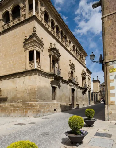
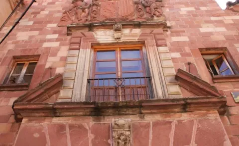
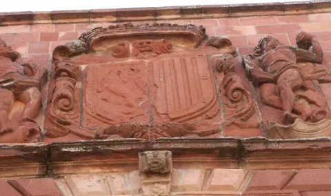
The palace does not keep the courtyard, which was perhaps also designed by Vandelvira, from which we know that its construction was started by 1564. The large facade of quarry stone, of marked horizonality, is articulated on three floors; on the bottom and centered is the cover, inintered and with two Corinthian columns (with the alternating sticks) on pedestal; on the axis with it is raised in the middle the main balcony stacked and with triangular front, covered with the familiar heraldic held by "savages," to the ends are opened two more balconies with jonic columns with heavy arches and triangular frontons.

Special protagonism acquires the windows in the corner of the noble or intermediate plant, in the way of the palace of the deán Ortega, with central column of white marble, pilasters and triangular front. The gallery on the last floor is made up of a series of arches of half-point on pillars, repeating in the corners the design with a column. This piece is the most plastic part of the whole, due to the wise compagination of hollow and solid, because the rest of the facade is a bit heavy, the isolated elements of it being the ones that give it a loan.

An interesting fact is the use of the balcony, which will slowly be imposed on the window. Finally, it is repeated in this palace the cornisa-internamento, used in the nearby palace of Vázquez de Molina, of a marked Italian accent, in which Andrés de Vandelvira also intervenes and is responsible for much of his factory. Mr Fernando Chueca Goitia said - in the monograph dedicated to the life and work of Andrés de Vandelvira - that the structure of the façade of the house of Vela de los Cobos is radically Spanish and is located in the line of the mature works of Alonso de Cobarrubias, the real architect.

In any case, what was done in this palace by Vandelvira will be taken as a reference point in other Ubetens palaces, such as that of the Marquis de la Rambla (16th century), that of Mancera (from the end of the 16th century), in which the gallery opened in the last body of its tower, or that of the Count of Guadiana, in whose tower, raised in the first two decades of the 17th century, is repeated the model of the sintered balcony with marble column, while reciting in the last body the composition of the gallery. But the gallery of the Vela de los Cobos palace will not only accommodate the large buildings, but will not be used frequently in the popular vernacular architecture of the city of Ubeda throughout the 17th and 18th centuries.

Breve descripción

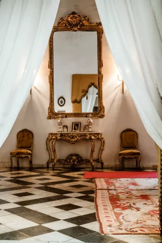
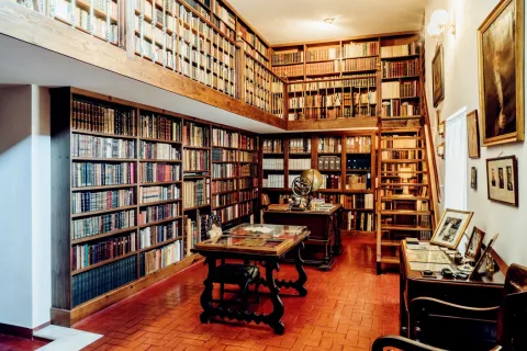
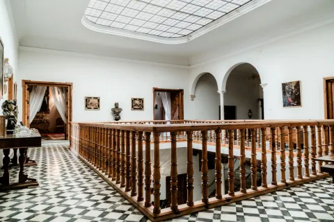
Monument of the Historical-Artistic Set. Declaration 04 / 02 / 1955. In the mid-16th century, the regior Francisco Vela de los Cobos ordered the construction of a palace close to that of Vázquez de Molina, known in the city with the name of its owner. Andrés de Vandelvira is the racist of the same, although the material execution was carried out by the bartender Jorge Leal.

Telecomunicaciones
Sitio web
www.andalucia.org/es/ubeda-turismo-cultural-palacio-vela-de-los-cobos
Teléfono de contacto
953 757 916
Correo electrónico
info@semerturismo.com
Ubicación
Código Postal
23400
Latitud
38.008890
Longitud
-3.368970
Dirección
C/ Juan Montilla, 4
Municipio
Ubicación en el mapa
POINT (-3.36897 38.00889)
Tipos de punto de interés
Imágenes carrusel
imagen
Image
1592911957107Fachada_Palacio_Vela_de_los_Cobos8252328212905390779%20%281%29.jpg
Imagen principal
Desactivado
imagen
Image
palacio%20vela%20de%20los%20cobos8-resize%20%281%29.jpg
Imagen principal
Desactivado
imagen
Image
palacio%20vela%20de%20los%20cobos7-resize%20%281%29.jpg
Imagen principal
Desactivado
imagen
Image
palacio%20vela%20de%20los%20cobos4-resize%20%281%29.jpg
Imagen principal
Desactivado
imagen
Image
palacio%20vela%20de%20los%20cobos3-resize%20%281%29.jpg
Imagen principal
Desactivado
imagen
Image
palacio%20vela%20de%20los%20cobos5-resize%20%281%29.jpg
Imagen principal
Desactivado
imagen
Image
palacio%20vela%20de%20los%20cobos%201-resize%20%281%29.jpg
Imagen principal
Desactivado
Imágenes cabecera
imagen
Image
_MG_2880-resize.jpg
Imagen principal
Activado
Horario
Guided and exclusive tours with limited quota. Tuesday to Saturday: 13: 00 and 19: 00. Sunday: 13: 00. Sunday afternoon and Monday closed (groups can arrange). Tickets in local SEMER Tourism and Culture, in front of the palace.
Microsite al que pertenece
Loading map
Preparing points of interest and routes...

Palacio Ducal Bailén

Submitted by brandcode_deweloper on
Id
6615871
Descripción
Descripción larga

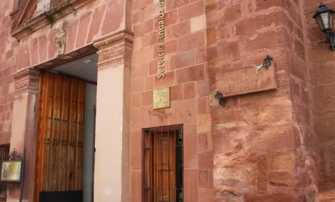
Today only its façade is preserved, highlighting its Renaissance style reflected by the two "tenants" that accompany the shield of the family topped by ducal crown (to the county of Bailén is added the ducado of Arcos) In 1970 it is disassembled piece by piece and installed in its current location.

Breve descripción

It was raised on the remains of the old Bailen Castle, built by Abderran I in the 9th century, on a visionary monastery. From 1349 it belonged to the Ponce de León family, first Condes de Bailén, until it was acquired by the mining family of the Bonaplata, who in 1893 sold it to the City Council, which installed its dependencies until 1930.

Telecomunicaciones
Sitio web
www.turismobailen.es/es
Teléfono de contacto
953 678 540
Correo electrónico
turismo@ayto-bailen.com
Ubicación
Código Postal
23710
Latitud
38.096080
Longitud
-3.777180
Dirección
C/ Nuestro Padre Jesús, 2
Distrito
Municipio
Ubicación en el mapa
POINT (-3.77718 38.09608)
Tipos de punto de interés
Imágenes carrusel
imagen
Image
1.jpg
Imagen principal
Desactivado
imagen
Image
3.jpg
Imagen principal
Desactivado
Imágenes cabecera
imagen
Image
2.jpg
Imagen principal
Activado
Microsite al que pertenece
Loading map
Preparing points of interest and routes...