Saltar al contenido principal

Southern Sierra Route

Submitted by brandcode_deweloper on
Breve descripción

Frontier and Renaissance


For centuries, the Sierra Sur region was a border with the Nasrid Kingdom of Granada, and this history is reflected in the numerous castles and fortresses that crown its towns. After the Reconquista, the territory was filled with Renaissance churches and buildings, where masters such as Vandelvira, Castillo "El Mozo"—very active in this region—and Martínez de Aranda worked, along with artisans from Granada.


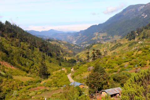
The route follows the historic communication axis with the Nasrid city, the N-321 (A-316 in its first section), which runs through a landscape of rolling mountains, white villages, and a heritage that blends defense, faith, and classical art.


-Torredelcampo. Renaissance architecture at the gateway to the Sierra Sur


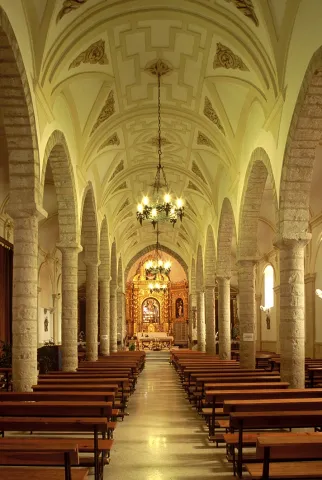
The Church of San Bartolomé is the main heritage landmark of Torredelcampo. The basilica-plan church follows the three-aisled model with groin vaults characteristic of the Jaén Renaissance. Although the typology derives from Vandelvira, its construction is attributed to Francisco del Castillo "the Elder" and Francisco del Castillo "the Younger," an architect closely linked to the Order of Calatrava.


Nearby, the Hermitage of Santa Ana stands out, located on Miguelico Hill, an area where important Iberian remains have been documented.


- Jamilena. Renaissance architecture in a former Calatrava stronghold


Located near Torredelcampo, Jamilena was once part of the domain of the Order of Calatrava. Its main heritage landmark is the Church of Our Lady of the Nativity, begun in the mid-16th century and designed by Francisco del Castillo "the Younger".


The church, renovated and completed in the first quarter of the 17th century, is particularly notable for its west portal, one of the most representative elements of its architecture.


-Torredonjimeno. A historic center linked to the Order of Calatrava


From Jamilena, returning to the A-316 provides access to Torredonjimeno, a town that, although administratively part of the Campiña region, shares a strong historical connection with the Order of Calatrava.


Its historic center is organized around the Town Hall Square, where one of the oldest Town Halls in the province (1630) is preserved, featuring a characteristic continuous balcony in the Classical style.


Nearby is the Church of San Pedro, an example of Classical architecture with Mudéjar elements. Its design is attributed to Castillo "el Mozo," while the fresco paintings on the vault were executed by Luis Ureña in 1597.

The town's main church is the Church of Santa María, begun in the early 16th century in the late Gothic style, although later enriched with Baroque chapels from the 17th and 18th centuries.

Also noteworthy is the Church of the Convent of La Piedad, belonging to the Dominican Order of nuns. Its façade dates from the early Renaissance, and inside, a Baroque altarpiece with Solomonic columns, dated 1728, stands out.

Torredonjimeno also preserves several hermitages, including the Hermitage of La Consolación, and is an enclave of great archaeological interest: one of the greatest Visigothic treasures in Spain, the Treasure of Torredonjimeno, was discovered in its surroundings, now dispersed among different collections.


-Martos. A historic city and monumental landmark of the Sierra Sur


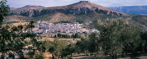
Martos, situated on a hill dominated by its fortress, is one of the most important historical centers of the Sierra Sur of Jaén. Its origins date back to Iberian and Roman times, but its current configuration reflects the medieval period and the significant architectural development of the Andalusian Renaissance.


In the upper part of town, the remains of the Castle of La Peña are preserved, along with the Albarrana Tower, symbols of its defensive past. In the town center, the Church of Santa Marta stands out, a temple of medieval origin renovated in the 16th and 17th centuries, as well as the Royal Church of Santa María de la Villa, one of the best examples of Renaissance architecture in Jaén, linked to the work of Vandelvira.


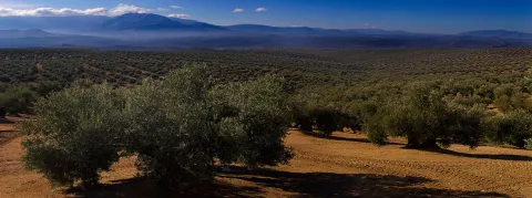
The civil heritage includes buildings such as the Old Hospital of San Juan de Dios and the Town Hall, which demonstrate the historical importance of the city. Martos is also a benchmark in olive cultivation, with a landscape that is part of the World Agricultural Heritage System.


-Alcaudete. Calatrava Fortress and Renaissance Heritage

& nbsp;

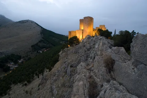
Alcaudete is one of the most representative towns in the Sierra Sur region of Jaén. Its skyline is dominated by the Calatrava Castle, one of the best-preserved fortresses in the province. The complex, of medieval origin, was the headquarters of the Order of Calatrava and retains walls, towers, and a parade ground that allow one to understand its defensive function on the border with Granada.


At the foot of the castle awaits the Church of Santa María la Mayor, begun in the 16th century and linked to the Andalusian Renaissance. Its main portal and tower show the influence of the great masters of the period. Also noteworthy in the town center are the Convent of Santa Clara, of medieval origin and renovated in modern times, and the Church of El Carmen, with Baroque elements.


-Castillo de Locubín. Renaissance architecture in a cherry orchard valley


On the route between Alcaudete and Alcalá la Real, a turnoff along the old road leads down to Castillo de Locubín, situated in a valley with a very distinctive panorama visible from the road.


The main heritage landmark is the Church of San Pedro, a single-nave church with excellent stonework. Its design is attributed to Alonso Barba, while the early Baroque classical portal is the work of Juan de Aranda Salazar, a native of this town and Master Builder of Jaén Cathedral. Its presence reflects the building tradition of the Martínez de Aranda family, who settled here in the late 16th century.


-Alcalá la Real. The city that opens up to the traveler from the light of La Mota


There are places where the horizon seems endless. In Alcalá la Real, another must-see stop on this route, you are welcomed by the majesty of its La Mota Fortress. It is a border town, where the sun bathes the walls and time stands still so that the traveler can breathe in the peace of a land that was once the key to kingdoms.


Here, the light of the Sierra Sur illuminates a past of knights, abbots, and artists that accompanies you every step of the way. There its story began: among walls, towers, and the imposing silhouette of the Abbey Church, which still echoes the master builders who erected it. A stroll through this area is to feel how the stone preserves the memory of a living frontier.


As you descend towards Llanillo, the city's rhythm changes. The Town Hall Square, the antique clock, the straight streets, and the birthplace of Martínez Montañés speak of an Alcalá that grew calmly, allowing the light to filter through convents, Renaissance pillars, and Baroque churches.


On the city's outskirts, from San Marcos to La Verónica, the view opens up again towards La Mota, inviting you to pause and contemplate. Around it, a string of villages offers an even more serene rhythm, with churches, altarpieces, and landscapes that accompany the traveler on an authentic, intimate, and luminous stay.


-Frailes. A mountain village to savor life slowly


Frailes appears nestled among gentle hills, with a tranquil rhythm that invites you to pause. Water, ever-present, defines the character of the village: fresh, abundant, and celebrated. Its Church of Santa Lucía, of humble origins in the 16th century, preserves the simplicity of a Mudéjar nave and a baptismal font brought from La Mota de Alcalá la Real, like a small bridge between stories.


-Valdepeñas de Jaén. Nature, history, and a layout that exudes order and calm

Valdepeñas de Jaén originated as a repopulation center in the 16th century, and even today it retains the orthogonal layout that organizes the flat part of the town. Calle Real connects its two main squares—Constitución and San Juan—where the Town Hall and the Church of Santiago stand, a Renaissance temple with three naves and groin vaults decorated with scallop shells, a nod to the pilgrim saint.

The municipality is a natural treasure: trails that cross yew forests—a rarity in Andalusia—centuries-old gall oaks, and places like Las Chorreras, a waterfall that surprises with its beauty. The Flour Mill, now a museum, allows visitors to understand the agricultural life that shaped the town.

-Los Villares. A town of Renaissance origin that looks towards Jaén

On the way to Jaén along the A-6050, you will arrive in Los Villares, another of the towns founded in the 16th century. Its recent growth has not erased its historic heart, which is organized around the Plaza Fernando Feijoo, with the Town Hall and the Church of San Juan Bautista, renovated in the 18th century.

The Casa Grande, former palace of the The Viscount of Villares House retains an elegant Neoclassical façade and the upper gallery typical of Jaén's palatial homes. Today it houses a library and exhibition spaces. The village keeps the tradition of wickerwork alive, with hands that continue to weave centuries-old crafts. In the surrounding area, Los Cañones offers nature and prehistoric art. A place to stop and admire.

imagen
Image
Ruta sierra sur
Imagen principal
Desactivado
Puntos del trazado
Latitud
37.771
Longitud
-3.897
Latitud
37.7467
Longitud
-3.91245
Latitud
37.765854
Longitud
-3.958865
Latitud
37.716667
Longitud
-3.966667
Latitud
37.588055
Longitud
-4.081389
Latitud
37.52796
Longitud
-3.94225
Latitud
37.4625
Longitud
-3.9227
Latitud
37.4722
Longitud
-3.9355
Latitud
37.59000
Longitud
-3.82000
Latitud
37.68771
Longitud
-3.81821
Desactivado

Route card

Torredelcampo

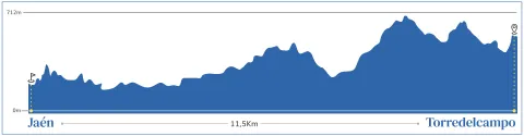
Partimos de Jaén por la A-316 para encontrar a 8 kms. este activo pueblo, que cuenta como su más preciado bien patrimonial dentro del núcleo la iglesia parroquial de San Bartolomé, templo de planta basilical dentro de la tipología más común de tres naves cubiertas con bóvedas vaídas impuesto por Vandelvira, aunque su autores fueron Francisco del Castillo “el Viejo” y  Francisco del Castillo “el Mozo”, arquitecto muy ligado a la Orden de Calatrava.
En su entorno es de destacar la ermita de Santa Ana, en el Cerro de Miguelico, donde se han hallado importantes restos ibéricos. Allí se celebra la Romería el primer domingo de mayo.


Jamilena

Próxima a Torredelcampo, la villa de Jamilena fue igualmente dominio de la Orden de Calatrava y del mismo modo la construcción de un nuevo templo a mediados del siglo XVI, constituye el hito más significativo: La iglesia de Nuestra Señora de la Natividad, igualmente proyectada por Castillo “el Mozo”, aunque reformada y terminada en el primer cuarto del siglo XVII. La portada de los pies es el elemento más destacado.


Torredonjimeno

Al mismo retornar a la A-316 desde Jamilena, nos desviamos a la próxima población de Torredonjimeno, que administrativamente no se incluye en la comarca de la Sierra Sur, sino que se considera cabeza de puente hacia la Campiña y por tanto iniciadora de otra ruta. No obstante su historia y su arte está tan ligado al resto, siempre por el común denominador de la Orden de Calatrava, que no vemos inconveniente en que el viajero se acerque a visitar su núcleo histórico en torno a la Plaza del Ayuntamiento, que luce un edificio de Cabildo de los más antiguos de la Provincia (1630) con un magnifico balcón corrido muy clásico. Cerca de él, la iglesia de San Pedro, una interesante muestra de arquitectura clasicista con elementos mudéjares y bóveda pintada al fresco, proyecto arquitectónico de Castillo “El Mozo” y las pinturas al fresco del pintor Luis Ureña, realizadas en 1597.

Templo mayor es la iglesia de Santa María, comenzada anteriormente a comienzos del siglo XVI, pero dentro de un estilo gótico tardío, aunque con capillas barrocas de los siglos XVII y XVIII.

Otro tanto ocurre con la iglesia del convento de la Piedad, de la Orden Dominicana en su rama femenina, coetánea de la anterior iglesia, aunque aquí su portada exterior es de un renacimiento temprano. A destacar su retablo barroco de columnas salomónicas, fechado en 1728.

Rodeada de diversas ermitas, entre las que destaca la Ermita de la Consolación, Torredonjimeno atestigua ser un centro religioso importante desde la antigüedad, como revela el hecho de haberse encontrado en sus cercanías uno de los dos mayores tesoros visigodos de España, el llamado Tesoro de Torredonjimeno, hoy desmembrado en distintas colecciones.


Martos

Cercana a Torredonjimeno, con la que guarda estrechos paralelismos históricos desde la Antigüedad, adquirió mayor protagonismo político en la Edad Media al convertirse en cabeza de la Vicaría de la Orden de Calatrava. No obstante en su subsuelo se encuentran todas las etapas de la historia con piezas muy brillantes, como el sarcófago paleocristiano, hoy en el Museo Provincial de Jaén. Sin embargo, será el siglo XVI, bajo el gobierno del comendador Pedro Aboz, cuando alcance el mayor esplendor urbano y monumental, teniendo como fiel arquitecto a Francisco del Castillo “El Mozo”, recién llegado de Roma en 1556.

La transformación del Martos renacentista, tomando como guía su pasado romano, tiene su precedente en la novela de Francisco Delicado, La Lozana andaluza, en la que se dedica un capítulo a contar la grandeza antigua y mitológica de ésta, su ciudad natal. El centro de actuación se encuentra en la Plaza del Ayuntamiento, con la construcción del edificio de Cárcel y Cabildo, con la más italianizante de todas las portadas que pueden verse en Jaén y parte de Andalucía, obra de Castillo. Este mismo arquitecto levantó el cuerpo superior de la torre de la iglesia de Santa Marta, el antiguo templo gótico, en la misma plaza; templo al que se le agregó en el siglo XVII la Capilla de Jesús, con importantes pinturas del artista barroco, Antonio Reinoso. Para el centro de este espacio llegó a hacer una fuente exenta rematada por la figura de Neptuno, que no se conserva. Pero en el nuevo parque construido hace unos años, en las afueras de la ciudad, se puede ver, trasladado de su sitio original, una monumental Fuente, de tipo pilar, obra también de Castillo “El Mozo”.

No lejos de esta plaza encontramos el descomunal templo de Santa María de la Villa, reconstruido después de la última guerra sobre el anterior renacentista, trazado igualmente por Castillo.

Un recorrido por todo este entorno nos permite admirar la potente torre del Castillo de la Villa, próximo a la anterior iglesia. Por debajo del Ayuntamiento, el Convento de las Trinitarias, obra de finales del siglo XVI, y en la misma calle, pero en sentido opuesto el Hospital de San Juan de Dios, de factura barroca del siglo XVIII. Toda esta parte alta del casco histórico intramuros es de un gran pintoresquismo y desde él se pueden disfrutar bellísimas panorámicas.

Descendiendo a la parte baja de la ciudad, y junto a la antigua carretera N-321, sobreviven algunas magníficas Villas de finales del siglo XIX y principios del XX, dentro del eclecticismo historicista y alguna modernista, testimonios del desarrollo industrial que tuvo la ciudad y que aún mantiene.


Alcaudete

Siguiendo nuestra ruta, la siguiente parada es Alcaudete, a unos 25 Km. de Martos. Villa señorial desde el siglo XIV en que pasó a manos de los Fernández de Córdoba.

La villa se extiende al pie de su formidable castillo medieval, recientemente restaurado, sacando a luz importantes transformaciones llevadas a cabo en el siglo XVI. Declarado Monumento Histórico en 1985, hoy es unos de los mejores castillos restaurados y estudiados de Jaén.

El moderno acceso para vehículos permite llegar con comodidad cerca del castillo y de la iglesia de Santa María. Ésta es el mayor templo de Alcaudete, en el corazón de la “villa”, hoy bastante despoblada y casi abandonada. Iniciada en torno al primer tercio del siglo XVI, no se termina hasta comienzos del siglo XVII, sucediéndose formas todavía góticas con un desbordante “plateresco” o renacimiento temprano, en las portadas, y un sobrio clasicismo en su cabecera y torre. En ella intervinieron Vandelvira, Castillo “El Mozo” y Martín de Bolívar. Magníficas son las puertas de la sacristía, labradas con relieves clasicistas. Además cuenta con algunas tallas barrocas del s. XVIII muy meritorias. La iglesia es Monumento Nacional desde 1931.

Fuera de la cerca histórica, en lo que ya era arrabal, se levanta otra buena iglesia en la segunda mitad del XVI: San Pedro, obra de Castillo “el Mozo”, dentro del tipo de templo de planta cuadrada separada por pilares y cubierto con bóvedas vaídas, extremadamente sobrio y elegante.

De destacar son también los Templos conventuales del Carmen (Carmelitas Descalzos), Santa Clara (Clarisas) y de Jesús y María (Franciscanas) y la capilla del cementerio, antigua Ermita de Santa Catalina, con interesantísimas pinturas escatológicas del siglo XVI.

La Plaza del Ayuntamiento es el centro neurálgico presidido por el edificio de Ayuntamiento, con buena portada barroca del siglo XVIII, y la antigua Ermita de la Aurora, transformada hoy en bar y vivienda.

De fama nacional son los dulces navideños, en particular las hojaldrinas, así como las conservas de vegetales, gracias a las espléndidas vegas, así como famosas son sus frutas, de las cuales se celebra un certamen anual con motivo de la Feria de Septiembre.

Reseñable es asimismo su Semana Santa con la puesta en escena del “Detente Abraham”, de antigua tradición, y los pasos con algunas tallas de gran mérito: Nuestro Padre Jesús Nazareno y San Elías, ambas en la iglesia del Carmen.


Castillo de Locubín

Abandonamos Alcaudete, camino de Alcalá la Real, por el nuevo trazado de la N-342, pero antes de llegar la abandonamos para seguir por la antigua en el desvío hacia Castillo de Locubín, que queda en el valle, admirando la bella panorámica de conjunto desde la carretera antes de descender.
Aparte de algunos restos romanos y medievales, el interés renacentista de esta villa radica en su iglesia de San Pedro, sencilla, de una nave, pero de muy buena cantería, diseño de Alonso Barba, con portada clasicista del primer barroco, obra de Juan de Aranda Salazar, pueblo natal de este interesante arquitecto del siglo XVII, Maestro Mayor de la catedral de Jaén, descendiente de la destacada familia de los Martínez de Aranda, canteros baezanos afincados en Castillo de Locubín a fines del siglo XVI.
Muy recomendable la visita en el mes de mayo para disfrutar de sus famosas cerezas y también de su repostería.


Alcalá la Real

Ciudad de frontera por excelencia, más cerca de Granada que de Jaén, fue un enclave estratégico en la guerra contra los nazaríes después de su conquista en 1341 por Alfonso XI. Previamente lo había sido de los musulmanes, desde la época de los reinos de taifas (siglo XI) cuando la familia de los Banu Said se hicieron fuertes en ella. Alfonso XI hizo de Alcalá una Abadía Real independiente de las diócesis vecinas, menos de la de Toledo. Esto hizo de Alcalá una plaza fuerte, rica e importante, encastillada en el cerro de La Mota, donde se desarrolló la ciudad originaria hasta bien entrado el s. XVI. Posteriormente se expandió hacia la parte vieja, el “Llanillo”, donde se desarrolla la Alcalá moderna.

En la Mota, desde donde se divisa Granada, parte de la campiña de Córdoba y toda la sierra sur de Jaén, tenemos la fortaleza medieval con una imponente Torre del Homenaje, en la cual podemos ver un Museo histórico de Alcalá y la iglesia abacial de Santa María, en su mayor parte obra renacentista realizada a lo largo de todo el siglo XVI y parte del siguiente, reconstruida recientemente; la parte de los pies es la más antigua y por el contrario la cabecera la más moderna. Los Maestros Martín de Bolívar y Ambrosio Vico, responsables de la mayor parte revelan la influencia granadina en su construcción, pero al final estará Ginés Martínez de Aranda, maestro baezano afincado en Castillo de Locubín, y arquitecto de confianza del Abad Maximiliano de Austria, quien en la última década del siglo XVI se ocupó de ésta y otras obras de fortificación en la misma Mota, antes de partir con el Abad a Cádiz y más tarde a Santiago de Compostela, donde diseñaría la famosa escalera del Obradoiro en la catedral. Un antecedente de dichas escaleras a pequeña escala puede verse en las Casas de Cabildo, edificio clasicista, junto a la iglesia.

Descendiendo hacia la ciudad nueva, la antigua iglesia de Santo Domingo, es la primera y más antigua, hoy en ruinas, de traza gótica, aunque con sacristía de finales del siglo XVI, dentro de la tradición vandelviriana.

Algo más abajo, ya en la parte alta de la nueva Alcalá, la iglesia de San Juan Bautista, data también de fines del siglo XVI (lo más antiguo: la capilla de la Concepción, de Ginés Martínez de Aranda), terminándose en el siglo XVII, dentro de la severidad clásica.

Ya, en el corazón del Llanillo”, la Plaza del ayuntamiento señala el centro neurálgico de una ciudad trazada con calles rectas, presidida por el edificio del Cabildo, obra del segundo tercio del siglo XVIII, pero terminado bajo el gusto neoclásico de la Academia. Célebre es su Reloj, fechado en 1791, del famoso relojero Fernando de Tapia y Castillo. En su interior destaca un retrato de Fernando VII, de Vicente López; el pendón de la ciudad, bordado, y una serie de cuadros religiosos del pintor local Luis de Melgar (siglo XVIII) y una “muerte de la Magdalena”, atribuida a Bocanegra.

Al lado, la calle Bordador, nos recuerda el lugar donde nació el celebérrimo escultor Juan Martinez Montañés, del cual existe monumento escultórico en la Plaza, obra de Jacinto Higueras.

Situándonos en la arteria principal que recorre “El Llanillo”, la Carrera de las Mercedes, encontraremos los hitos monumentales más importantes así como un conjunto de casas historicistas de comienzos del siglo XX remarcables. Al comienzo prácticamente de la carretera-calle, el Convento de Consolación, al fondo de la calle Real que desciende desde La Mota, alberga a la imagen de la patrona de Alcalá: la Virgen de las Mercedes, en un templo barroco con buenos retablos del siglo XVIII y una sacristía de planta poligonal, que al igual, que el antiguo claustro, conocido como el “Toril”, es obra de Juan de Aranda Salazar.

Algo más adelante, el Convento de la Encarnación, obra del siglo XVII, de construcción sencilla, pero que guarda en su clausura una interesante colección artística, sobre todo de Niños Jesús barrocos. Al lado, el Palacio Abacial, de 1781, obra barroca clasicista, propia de esa etapa final del siglo XVIII, y muy restaurada desde la segunda mitad del siglo XX, alberga hoy un interesante Museo de la Ciudad.

Al desembocar en el Paseo de los Álamos, donde se situaba la puerta de entrada a la ciudad desde Granada, encontramos una pieza excepcional del Renacimiento: Pilar de los Álamos, adosado al comienzo de la calle de su nombre, cuyos fantásticos relieves de excelente calidad están relacionados con las labores escultóricas del renacimiento granadino, en la línea del italiano Jacopo Florentino y de Diego de Siloe.

Frente al pilar, la Iglesia de San Antón, oculta en su volumetría exterior una planta oval, fruto también del barroco clasicista que domina en el último tercio del siglo XVIII a la ciudad y del que también es buena muestra la Iglesia de Las Angustias, en la calle homónima, paralela a la principal. Esta iglesia guarda además parte del retablo renacentista de pintura de la iglesia de Santo Domingo, obra del pintor Juan Ramírez, y otras atribuidas al pintor local Melchor de Raxis, descendiente de una familia de artistas venidos de Cerdeña, y a la que pertenecería otro ilustre imaginero: Pablo de Rojas.

Interesante y recomendable es un recorrido por el borde oriental de la ciudad, desde la Ermita de San Marcos, que conserva parte de su traza del siglo XVI, hasta la de La Verónica, coronando la loma frente a La Mota, con una excelente panorámica de la fortaleza y de la ciudad.

Para reponer fuerzas la gastronomía alcalaína nos brinda a través de su oferta de hostelería un buen surtido de tapas y platos singulares, entre los que ha alcanzado fama singular el “pollo a la secretaria”.

Y entre los acontecimientos culturales que han traspasado los límites provinciales, esta Etnosur, festival de músicas de todo el mundo con un atractivo programa complementario de actividades lúdicas y educativas, que se celebra en el mes de julio. Digna de ver es asimismo la Semana Santa alcalaína declara de Interés Turístico de Andalucía.

Muy peculiares son además en Alcalá la Real sus aldeas, que se expanden en un radio cercano en torno a los cinco o diez kilómetros, de gran belleza paisajística e incluso con piezas monumentales dignas de reseñarse, como Santa Ana, con su iglesia del siglo XVI de portada siloesca, o La Pedriza, con un buen retablo barroco.

Podemos pernoctar tanto en Alcalá como en alguno de los alojamientos rurales que nos ofrecen estas aldeas de alrededor antes de emprender el viaje de regreso a Jaén o continuar la visita en Alcalá.

La vuelta nos va a llevar a través de la agreste Sierra Sur de Jaén, otro “paraíso natural”, este menos conocido, en el que encontraremos aquellas villas que fueron asentamientos de colonización en el siglo XVI, acabada la guerra con los nazaríes para repoblar esta línea de frontera.

El camino lo podemos tomar a partir de Santa Ana en dirección a Frailes o bien saliendo de Alcalá por la A-403 y a la altura de la aldea de Ribera Baja, tomar el desvío, JV-4302, que nos conduce a Frailes, pasando por las aldeas de Ribera Baja y Ribera Alta.


Frailes

Pintoresco pueblo de sierra con magníficas vistas, famoso por su agua, por su vino y por su gastronomía. La iglesia de Santa Lucía, tiene su punto de partida en una construcción del siglo XVI muy sencilla de la que guarda su estructura de una sola nave cubierta con armadura de par e hilera de tradición mudéjar y presbiterio separado mediante arco toral de piedra, pero luego ampliada y reformada en el siglo XVIII. A destacar en su interior una pila bautismal, traída de la iglesia de la Mota de Alcalá la Real.

Abandonamos Frailes siguiendo la carretera JV-2262 que nos conduce a Valdepeñas de Jaén.


Valdepeñas de Jaén

Uno de los núcleos de repoblación llevados a cabo en el siglo XVI (1539), junto con Campillo de Arenas, Los Villares y Mancha Real, pronto alcanzó el título de Villa y el de Ciudad en 1917. Su amplio término municipal abarca el corazón de la Sierra Sur con diversas rutas de senderismo en las que apreciar especies arbóreas de gran rareza en Andalucía como el bosque de tejos en el paraje de los “Pitillos” o los buenos ejemplares de antiquísimos quejigos. La madera, fuente de riqueza principal durante mucho tiempo para la fabricación de carbón, posibilitó también industrias de vidrios, que alcanzaron un cierto renombre durante el siglo XVII.

En lo que es el casco histórico nos ha de llamar la atención el trazado ortogonal de las calles que se extienden en la parte más llana del emplazamiento, en la trama formada por los ejes longitudinales de las calles Bahondillo/Animas; Real/Cruces y Parras con sus transversales, más estrechas. La calle Real enlaza las dos plazas más importantes, la de la Constitución y la de San Juan, donde se sitúa el Ayuntamiento y la iglesia parroquial de Santiago. Esta última nos enlaza de nuevo con la rica serie de templos renacentistas de tres naves separadas por pilares y cubiertas con bóvedas vaídas, ornadas en este caso con profusión de veneras de yesería en alusión al santo titular.

La iglesia derivada de modelos vandelvirianos, pensamos que está más cerca del estilo personal de Castillo “El Mozo”.

En un recorrido por la ciudad vemos algunas portadas de estilo clasicista, si bien ya de los siglos XVI y XVII, entre ellas la que fuera residencia del Obispo, en la calle homónima.

Pero del más alto interés es la visita al Molino Harinero, en la calle Santa Ana, convertido en Museo al conservar su maquinaria y estancias, que explican esta importantísima actividad económica y suministra una información precisa sobre la cultura agraria.

En las afueras, viniendo desde Frailes, encontramos un moderno Parque, “El Chorrillo”, que aprovecha la corriente de agua natural con muy buen diseño. Remontándolo nos lleva a un paraje absolutamente espectacular: Las Chorreras, cascada natural de enorme belleza.

A 5 Km Chircales, es lugar famoso entre los vecinos de Valdepeñas y de otros lugares por su milagrero Cristo de Chircales o “del arroz” y la romería celebrada el primer domingo de mayo, en un paraje natural también muy hermoso y que hubo de ser oratorio o refugio de mozárabes en la Alta Edad Media.

No debemos abandonar Valdepeñas sin gozar de su cocina serrana de carnes y especialmente su repostería.


Los Villares

Salimos de Valdepeñas por la carretera A-6050 que nos conduce a Jaén, pasando por Los Villares, otro de los núcleos de colonización del siglo XVI, de similar trazado al de Valdepeñas. Por su cercanía a Jaén ha experimentado un gran crecimiento en fechas recientes al convertirse en zona residencial de mucho jiennenses. Del núcleo histórico, la plaza principal, Fernando Feijoo, concentra los edificios más significativos: Ayuntamiento e iglesia, sin especial valor monumental. El Ayuntamiento, remozado recientemente, conserva su estructura sobria de finales del siglo XVIII, de acuerdo al gusto académico imperante. La iglesia de San Juan Bautista, aunque se levanta en el siglo XVI sin embargo tiene una profunda remodelación en el siglo XVIII. Sin apartarnos mucho de la plaza, el palacio del Vizconde de los Villares, más conocido como “Casa Grande” es la única pieza de arquitectura civil que puede destacarse, con una fachada clasicista, ya del siglo XVIII, que responde a la tipología tradicional de casa-palacio jiennense con su galería abierta en la parte superior.

La rica tradición artesanal del trabajo del mimbre nos invita a llevarnos algún recuerdo de esta artesanía, así como disfrutar de su repostería.

En el entorno existen parajes naturales de gran belleza, como es el caso de “Los Cañones”, con muestras de pinturas prehistóricas.
La Campiña Route

Submitted by brandcode_deweloper on
Breve descripción

La Campiña Route

A Journey Through the Golden Light of the Guadalquivir

When you enter the Campiña of Jaén, the landscape opens up like an old book. The land is flat and generous, and the Guadalquivir crosses it with the calm of one who knows all its secrets. Here, among wheat fields and olive groves, the Renaissance left a mark that can still be found today in quiet squares, proud towers and temples gazing towards the horizon.

This route takes you through cities that grew to the rhythm of trade and craftsmanship, places where everyday life mingled with the grandeur of a new age. Andújar, the most powerful of them all, welcomes you with the elegance of its churches and the strength of its history. Lopera, Porcuna, Arjona and Arjonilla complete a mosaic of towns where Renaissance architecture coexists with the intensity of the Baroque that followed.

Master craftsmen who shaped the 16th century worked in these lands. Vandelvira's influence can be sensed in details and layouts, but it was Francisco del Castillo "El Mozo" and his brother Benito del Castillo who gave form to many of the buildings you see today. They were joined by craftsmen and architects from Córdoba, leaving behind an artistic landscape full of nuance.

On this route through the Campiña, you will come across towns holding stories of frontier life, nobility and faith. It means pausing at a Renaissance doorway glowing in the evening light, listening to the echo of an old market, or discovering how the light settles on a tower that has watched over the valley for centuries.

Mengíbar: Where History Keeps Watch from Above

Arriving in Mengíbar, your first impression is shaped by its Torre de Homenaje, a stone giant rising more than thirteen metres above the village. It is the last remaining trace of the medieval castle and still seems to guard the secrets of these lands, where the legendary Roman Iliturgis once stood, on the nearby Cerro Maquiz.

At the foot of the tower, the Church of San Pedro reveals the mark of the Renaissance. Its interior, with three naves and groin vaults, follows the model that Vandelvira spread throughout the province. Although the church was completed after his death, his architectural spirit still lives on in every pillar.

Walking along Calle Jaén, you'll come across the so-called Casa de la Inquisición, with a late Classicist doorway and ironwork worth a closer look. These are details that speak of a prosperous Mengíbar, linked to the Guadalquivir and its old river port, from where timber coming down from the Sierra de Segura once departed.

From here, the route opens up towards the Campiña. You can continue towards Andújar or take a detour towards Bailén, with its Church of La Encarnación and its history linked to the famous battle of 1808.

If you choose this variant, a short detour will take you to Baños de la Encina, where the imposing Caliphate castle dominates the horizon. Its Renaissance palace-houses and the Church of San Mateo complete a striking monumental ensemble. And in the Ermita del Cristo del Llano, the Baroque camarín — a burst of polychrome plasterwork and mirrors — will surround you with unexpected beauty.

Cazalilla: A Small Stop with Medieval Soul

A few kilometres from Mengíbar, Cazalilla appears as a quiet village that preserves traces of its old fortress. What remains is a semicircular tower, now built into the Church of La Magdalena, whose Gothic interior and Renaissance renovations tell centuries of history. The Classicist doorway and its tall tower from 1627 complete a simple ensemble full of character.

Villanueva de la Reina: The Village that Always Looked to the River

In Villanueva de la Reina, you meet the Guadalquivir once again, here accompanying a village with Roman roots — the ancient Noulas — and a medieval past still visible in its layout. Its Church of the Immaculate Conception preserves Gothic arches and pillars, transformed in the 17th century with an elegant Classicist doorway and a tower crowned by a beautiful spire.

Facing the church, the Town Hall also displays the strength of the Renaissance in the Campiña, with a gallery of arches and a late-16th-century doorway. A further Classicist doorway from the Hermitage of San Nicolás has been incorporated into its façade, adding a historic touch to the ensemble.

Andújar: The Great Gateway to the Guadalquivir

In Andújar, you feel you are in the natural capital of the Campiña. The Guadalquivir has embraced it for centuries, and its history unfolds through wide streets, bright squares and temples that speak of a powerful past. It was a frontier city, a city of trade and craftsmen, and it experienced one of its brightest moments during the Renaissance.

The monumental heart of the city beats around the Church of Santa María la Mayor, where Gothic and Classicist styles coexist naturally. Nearby, the Casa de Comedias, the old Pósito (granary) and the Renaissance doorways scattered throughout the historic centre recall the city's prosperity in the 16th and 17th centuries. The mark of master builders such as Castillo "El Mozo" and his brother Benito appears in details, layouts and architectural solutions that define Andújar's identity.

Its noble houses, churches and old city gates speak of a city that grew to the rhythm of trade and the river. And in its surroundings, nature asserts itself strongly: the Sierra de Andújar, one of the great sanctuaries of the Iberian lynx, offers a landscape that contrasts with the serenity of the Campiña.

Marmolejo: Waters that Tell Stories

Following the course of the Guadalquivir southwards, you come across Marmolejo, a village that has always lived in dialogue with the river. Its medicinal waters, famous for centuries, gave life to a renowned spa that even inspired Palacio Valdés in the film "La Hermana San Sulpicio." Here, the thermal tradition is part of the landscape.

In the historic centre, the Church of Nuestra Señora de la Paz stands out for its sober elegance. Its Classicist doorway, typical of the 17th century, hints at an interior that has been renovated but is full of detail, such as the two 18th-century Baroque altarpieces that arrived from Benavente.

On the outskirts, the Bridge over the Guadalquivir, with its seven stone arches, stands as one of the most spectacular works along the river. It was built by Benito del Castillo in the late 16th century. Its harmony and strength will surprise you.

Within its municipal boundaries, the Castillo de la Aragonesa recalls the area's medieval past, later transformed into a grand estate with a Neoclassical chapel.

Lopera: A Castle Guarding Centuries of Memory

Leaving Marmolejo and heading west, the landscape leads you to Lopera, a village that grew under the protection of a powerful castle. Right in the town centre stands its late-medieval castle, once a fortress of the Order of Calatrava and today a Historical Monument. Its walls, once a noble residence, hold the calm of places that have witnessed many lives and many battles.

Facing it, the Church of Santa María — or de la Purísima Concepción — shows the transition from late Gothic to the Renaissance. Inside awaits a jewel: the Renaissance tomb of Doña Marina Fernández de Torres, the work of the Jaén sculptor Juan de Reolid, delicate and solemn, attached to the wall as if it wanted to become part of the architecture itself. Among its Baroque altarpieces, some Granada-school paintings and 18th-century goldwork add brilliance to the ensemble.

The Town Hall, although rebuilt after the Civil War, retains the sober monumentality of the 17th century, reminding you of the historical importance of the place.

Porcuna: Where the Past Emerges Like a Sculpture

Porcuna welcomes you as a place where the past surfaces at every step. The ancient Iberian Obulco left behind treasures such as the sculptures of Cerrillo Blanco, and the medieval city later rose around the Torre Nueva, or Torre de Boabdil, today a museum and symbol of its history.

In the Plaza de Andalucía, the Church of the Asunción combines its Renaissance sacristy with a Neo-Romanesque nave decorated by a young Julio Romero de Torres. The Town Hall, housed in the former 18th-century Pósito, completes this monumental space. Nearby, the Convent of San Benito preserves medieval capitals and doorways that recall the legacy of the Order of Calatrava.

A pleasant stroll leads to the Ermita de Nuestro Padre Jesús, with its Baroque camarín, and to the striking Casa de Piedra, built entirely of stone by local stonemason Antonio Garrido over almost thirty years.

And if you want to experience the more intimate side of Porcuna, simply head to La Calderona, one of the most distinctive archaeological sites in the municipality, known for its rich Iberian and Roman remains.

Arjona: The Hill Where a Dynasty Was Born

Arjona rises on a hill overlooking the Campiña and holds a history as deep as it is fascinating. It was the ancient Roman Urgavo, later a stronghold of the Order of Calatrava, and later still the birthplace of the Nasrid dynasty that ruled Granada. In the 17th century, it once again rose to prominence with the discovery of the relics of the martyr saints Bonoso and Maximiano, which turned the city into a place of pilgrimage.

The heart of Arjona beats in the Plaza de Santa María, where centuries of history converge: a large Arab cistern, the Church of Santa María — Gothic with Baroque additions — and the Sanctuary of the Martyrs, a late-Renaissance work by Juan de Aranda Salazar, with its crypt and 18th-century camarín. Around it, five 17th-century wrought-iron crosses are still preserved, witnesses to the old pilgrimages.

In the lower part of the town, other churches show the evolution of the Renaissance in Arjona. The Church of San Juan preserves an early Granada-Renaissance doorway and a surprising Modernist crypt built for the Baron of Velasco. The Church of San Martín retains its Renaissance tower with a ceramic-tiled spire, the work of Castillo "El Mozo." And the Neo-Gothic Church of El Carmen recalls 19th-century devotion.

Arjona will reveal its Nasrid past through architectural details and public buildings where a very distinctive Neo-Nasrid style emerges.

You can reach Arjona from Porcuna either via the direct route or by passing through Higuera de Calatrava, where the Church of the Purísima Concepción surprises with its twisted Renaissance pillars, before continuing on to Arjona through open fields and quiet villages.

Arjonilla: The Tower that Guards a Legend

Just eight kilometres from Arjona lies Arjonilla, a town that was born as an independent lordship in 1553 and which literature remembers for the tragic story of Macías "El Enamorado," imprisoned and killed in its castle. Of that Calatrava fortress, what remains today is the Torre de Macías, rising over the town as a symbol of love and destiny.

Nearby, the Church of La Encarnación shows the transition from Gothic to the Renaissance: medieval pillars and arches, a highly Vandelvira-style Doric doorway, and a Classicist tower linked to the style of Castillo "El Mozo." Inside, a surprising Visigothic altar stone used as an altar, 16th-century mural paintings and a valuable collection of Baroque goldwork await you.

In the small square of Santiago, the Ermita de la Virgen de la Cabeza preserves a splendid 16th-century Mudéjar coffered ceiling, while on the outskirts, the Ermita de la Soledad recalls Vandelvira-style models such as the one in Andújar.

Arjonilla also preserves a good number of 18th-century noble houses and an elegant Courthouse building, the former 17th-century Town Hall, reflecting the sober Classicism of the late Jaén Renaissance.

Lahiguera: A Quiet Hilltop in the Campiña

On the way to Jaén, and before returning to Arjona, you come across Lahiguera, a serene town set on a gentle hill overlooking the landscape. Its silhouette is defined by the Church of La Consolación, an early-16th-century temple that preserves the simplicity and harmony of the area's earliest Renaissance buildings.

It is a single-nave church, covered with a Mudéjar-style tie-and-collar-beam roof, a detail that adds warmth and authenticity. Its presence, sober and elegant, sums up well the character of Lahiguera.

imagen
Image
Ruta Campiña
Imagen principal
Desactivado
Puntos del trazado
Latitud
37.76922
Longitud
-3.79028
Latitud
37.9704337
Longitud
-3.8288265
Latitud
37.984
Longitud
-3.882
Latitud
38.0047885
Longitud
-3.9151847
Latitud
38.03849.
Longitud
-4.0516619
Latitud
38.045
Longitud
-4.171
Latitud
37.9438
Longitud
-4.2142
Latitud
37.871
Longitud
-4.185
Latitud
37.936
Longitud
-4.055
Latitud
37.9741
Longitud
-4.10685
Latitud
37.971
Longitud
-3.989
Desactivado

Route card

Mengíbar

A 20 Km de Jaén en dirección norte por la autovía E-902 o A-44, nuestra primera parada, Mengíbar, en cuyas inmediaciones se cree estuvo la célebre ciudad romana de Iliturgis, en lo que es el rico yacimiento arqueológico de Cerro Maquiz. La identidad del pueblo está sin embargo más con su potente Torre, único vestigio del castillo medieval, Torre de Homenaje de altura superior a los 13 metros con tres estancias abovedadas en su interior. Próxima a ella, la iglesia de San Pedro, representa la huella renacentista, pese a su moderna reforma de 1970. Obedece al modelo vandelviriano de templo de tres naves separados por pilares y bóvedas vaídas, iniciada además en vida del maestro aunque terminada después de su muerte, posiblemente por Alonso Barba.

Otra pieza arquitectónica a destacar es la llamada Casa de la Inquisición, en la calle Jaén, que luce una portada clasicista muy tardía, no anterior al primer cuarto del siglo XVIII. Es interesante la rejería de forja que tiene.

Mengíbar fue destacado puerto fluvial, a orillas del Guadalquivir, por su buena situación geográfica sobre todo por el transporte de la madera proveniente de la Sierra de Segura.

Desde aquí nuestros pasos se dirigen hacia Andújar, “capital” de la Campiña. Podemos hacerlo, bien sin abandonar la autovía E-902 hasta Bailén, ciudad universalmente conocida por la célebre batalla ganada a los franceses en 1808, y que tiene una iglesia parroquial digna de visitarse, la iglesia de La Encarnación, gótica pero con aportaciones clasicistas importantes, y desde allí por la Autovía E-5 o A-4 a Andújar, o por el contrario, seguir en paralelo al curso del río por la carretera J-3413 y después la A-6075 hasta enlazar con la E-5, opción por la que hemos optado.

No obstante, si se elige la ruta de Bailén, merece la pena desplazarse desde allí a la vecina Baños de la Encina, bien por la carretera local JA-4100 o por la E-5 y desvío en el Polígono industrial por la A-6100. La villa es famosa por su castillo, de época califal, Monumento Nacional desde 1931, y el conjunto de todo el núcleo con numerosas casas-palacio fechables entre el siglo XVI y XVII, y la iglesia parroquial de San Mateo, en la que se dan la mano el gótico, renacimiento y barroco. También es imprescindible visitar la Ermita del Cristo del Llano, declarada Monumento Nacional recientemente, obra barroca en la que sobresale su camarín, de yeserías policromadas y espejos, donde se venera la imagen titular.

Cazalilla

A pocos kilómetros de Mengíbar por la comarcal J-3413, pasamos por la villa de Cazalilla, surgida a la sombra de una fortaleza de la que queda como rastro parte de un torreón semicircular que sirve de ábside a la iglesia parroquial de La Magdalena. Su interior tiene arcos apuntados, que hablan de un templo medieval luego transformado entre el siglo XVI y XVII. La portada, sencilla, es de rasgos clasicistas al igual que la torre, muy elevada y construida en 1627.


Villanueva de la Reina

Llegamos de nuevo junto al Guadalquivir en esta población, que originariamente se llamaba Villanueva de Andújar, por pertenecer a dicha ciudad, pero que cambió su nombre en reconocimiento a Isabel II. El núcleo se asienta sobre una antigua fundación romana, Noulas, y después seguida con otro asentamiento medieval. La iglesia parroquial de la Inmaculada Concepción, muestra en sus arcos y pilares góticos ese origen si bien se transforma en la primera década del siglo XVII. De ahí su elegante portada clasicista y la torre con un bello chapitel.
Frente a la iglesia, el Ayuntamiento, muestra también a través de la galería de arcos y su portada clasicistas de finales del XVI o principios del XVII el arraigo del estilo en Jaén, siempre realizado en excelente cantería. Recientemente se ha incorporado a la fachada una portada, también clasicista, pero más tardía, procedente de la ermita de San Nicolás.


Andújar

Salimos de Villanueva por la comarcal A-6075 hasta alcanzar la autovía E-5, que nos lleva enseguida a la “capital” de La Campiña, que ya bajo el antiguo Régimen fue sede de Corregimiento. En su subsuelo se suceden todas las etapas históricas desde el Neolítico, pero los vestigios más antiguos son los restos de sus murallas medievales. La Andújar monumental se reviste, sin embargo, en su mayor parte de Renacimiento y los nombres de Andrés de Vandelvira y los Castillo, Francisco y Benito, están presentes en ella.

El mayor interés de la visita se concentra en torno a dos plazas próximas entre si: la de Santa María y la de España. La primera fue donde estuvo el primitivo ayuntamiento y el Pósito, cuyos solares ocupan hoy la Casa de la Cultura y que da como vestigio de la época la Torre del Reloj, fechada en 1534, ostenta el escudo imperial de Carlos V junto al reloj de sol primitivo. Posteriormente se le añadiría otro de esfera moderno. Frente a ella la iglesia de Santa María, templo iniciado en gótico, como revelan las bóvedas de los pies, su antigua cabecera, que en una reforma radical en el primer tercio del siglo XVI se invierte la orientación y se transforma en una basílica clásica. La obra, que se prolonga a lo largo de todo el siglo, registra varias fases; en la primera aparecen los maestros Velasco y Tolosa, siendo tasada por Andrés de Vandelvira. Después, a partir de 1560 será Castillo “El Mozo” el que se haga cargo. Contiene el templo piezas de gran valor artístico, como el cuadro de El Greco, “La Oración del Huerto”, en la capilla conocida por el nombre del pintor, y en la que hay una valiosa talla también de Cristo atado a la columna, procedente de la iglesia de Santiago, obra del primer cuarto del siglo XVI. Otra pintura destacable es la Inmaculada, de la capilla de los Reinoso, obra o copia del Caballero de Arpino. También son de reseñar las tres rejas de forja, igualmente renacentistas.

A través de la calle Feria desembocamos enseguida en la Plaza de España, presidida por el Ayuntamiento, antigua Casa de Comedias construida en el primer cuarto del siglo XVII, luego modificado en el siglo XVIII con un proyecto neoclásico. Al lado, la iglesia de San Miguel, que mantiene su estructura gótica, pero su portada principal es una de las más bellas muestras del primer Renacimiento en la provincia, y en su interior el cancel y sotocoro es una magnífica pieza de carpintería con relieves de corte manierista de finales del siglo XVI. La Sacristía, del siglo XVII, destaca por su bóveda ovalada, pintada con las efigies de los apóstoles, atribuidas a Antonio García Reinoso.

El resto de las iglesias parroquiales parten todas de proyectos góticos originarios, pero con modificaciones renacentistas o barrocas. La de Santiago, hoy cerrada al culto, tuvo una reforma del presbiterio firmada por Vandelvira. Asimismo guarda en la Capilla del Cristo a la Columna, cuya imagen la hemos visto en Santa María, una de las mejores muestras del barroco delirante de procedencia cordobesa, en los muros y bóveda de yeserías realizados por los hermanos Primo.
La iglesia de San Bartolomé, ya fuera de la muralla en la actual Corredera de San Bartolomé, modificó su cabecera con elegantes bóvedas vaídas realizadas por Castillo “El Mozo”.

Por su parte la iglesia de Santa Marina, hoy dedicada a espacio cultural, se transformó todo su interior en el siglo XVII.

El recorrido por el centro histórico de la ciudad depara agradables sorpresas. Sus calles bastantes rectas y estrechas para resguardarse del calor, se enlazan a menudo a través de plazoletas o “altozanos”, que funcionan a modo de rótulas, focalizadas por la atractiva fachada de una casa-palacio. Tomemos la calle Maestra, paralela a las murallas, a espaldas de la Plaza de España, desde el Altozano de la Virgen, junto a la Puerta del Sol y que nos lleva hasta el Altozano de Santa Ana, en ese recorrido llama nuestra atención la Casa de los Niños de Don Gome, construida en una torre de la muralla, dentro del estilo del renacimiento manierista que domina en Andújar, y poco más adelante otra casa-torre en esquina, la de los Valdivia, del mismo estilo y cronología. Ya en el Altozano de Santa Ana, la casa-palacio de los Cárdenas, hoy sede de los juzgados, con capilla adjunta, es tal vez el mejor ejemplar de ese estilo que usa el almohadillado en las portadas, diseño de los Castillo, y que quedará ya como un signo identificador de la arquitectura civil andujareña hasta el siglo XVIII, repitiéndose por toda la ciudad.

La calle Ollerías, la calle más ancha y arteria comercial, marca el límite de las murallas y en ella o junto a ella se abren algunas fundaciones religiosas como la del Hospital de San Juan de Dios o la de las Monjas Trinitarias, en la vecina calle 22 de Julio, que data de finales del siglo XVI, y que contiene importantes obras de arte. En un borde de la ciudad, también, está el Colegio de los Jesuitas, frente a Santa Marina, convertido hoy en hospital, con una magnífica escalera barroca del siglo XVIII. Y algo más alejada del borde, los conventos de Jesús y María, de las monjas de San Francisco de Paula, uno de los más antiguos de Andújar, que luce en su iglesia un bellísimo artesonado mudéjar de forma ochavada, o el de las Capuchinas, actual Museo de Escultura “Antonio Orea”.

Fuera de la ciudad, en plena Sierra Morena, la Basílica y Real Santuario de Nuestra Señora de la Cabeza, la cual está declarada Fiesta de Interés Turístico Nacional, es la gran referencia andujareña por su famosa romería a finales de Abril, la más popular de toda Andalucía hasta la más moderna emergencia del Rocio de Huelva. A ella se refieren Cervantes y Lope de Vega. Después también célebre por el episodio de la Guerra Civil de 1936. El edificio, pese a haber sido reconstruido tras la Guerra, conserva la estructura de una nave cubierta con un gran cañón, que fuera proyectada por Andrés de Vandelvira en 1565. En esas fechas la ciudad se engalana para recibir a las numerosas cofradías que acuden desde muy diversos puntos de España.

En Las proximidades de Andújar, Los Villares de Andújar, se asienta sobre un enorme e importantísimo yacimiento romano de producción de “terra sigillata”, cerámica que se exportaba fuera de la Península. Esa tradición ceramista se conserva a través de la elaboración de artísticas piezas barrocas, como son sus famosa jarras. Un buen recuerdo para llevar de nuestra visita a Andújar.

Absolutamente recomendable es tapear en los bares de Andújar y no irse sin probar la carne de caza, ciervo o jabalí, en la que se especializa la cocina andujareña.


Marmolejo

Esta cercana población a Andújar se halla aguas abajo del Guadalquivir. Para llegar allí nos podemos desviar de la E-5, dirección Córdoba, tomando la carretera A-6176. Marmolejo es famoso por sus aguas medicinales, que han dado origen a un famoso Balneario, inmortalizado por Palacio Valdés en su novela “La Hermana San Sulpicio”.

Monumentalmente, la iglesia de Nuestra Señora de la Paz, es la pieza más destacable dentro del casco histórico; templo de comienzos del siglo XVII, como delata el clasicismo de su sencilla portada. Reformada modernamente, tiene dos retablos barrocos del siglo XVIII, procedentes de Benavente (Zamora).

Algo distanciado, el Puente sobre el Guadalquivir con sus siete ojos, es obra de Benito del Castillo, a finales del XVI y uno de los más espectaculares de este río.

En su término, es de destacar el Castillo de la Aragonesa, fortaleza medieval transformada en una gran hacienda con capilla neoclásica Marmolejo celebra con gran esplendor la Fiesta del Corpus. Un buen momento para acercarse.

Marmolejo celebra con gran esplendor la Fiesta del Corpus. Un buen momento para acercarse.


Lopera

Regresamos a E-5, dirección Córdoba, para dirigirnos a Lopera, desviándonos de ella para tomar la A-6175.

De este importante enclave militar de la Orden de Calatrava que da como testigo principal su Castillo bajomedieval, declarado Monumento Histórico, situado en el centro del pueblo, adquirido por la familia Valenzuela en 1856. Castillo residencial con capilla, allí estuvieron hasta la Guerra Civil dos tablas de Pedro Machuca.

Frente al castillo la iglesia de Santa María o de la Purísima Concepción, realizada en el estilo gótico tardío de finales del siglo XV y principios del XVI. En su interior es de destacar el Sepulcro de doña Marina Fernández de Torres, obra renacentista de mediados de siglo XVI, del tipo adosado al muro, del que es autor el escultor jiennense Juan de Reolid. De sus retablos barrocos, muy reformados, se conserva alguna pintura de escuela granadina reseñable y sobre todo algunas piezas de orfebrería barroca de finales del siglo XVIII.

El Ayuntamiento, aunque reconstruido tras la Guerra Civil, ofrece su estructura originaria del siglo XVII, sobrio, pero de evidente monumentalidad.

Muy conocidas en razón de su popularidad festiva, más que de su arquitectura, son las Ermitas de Jesús y la del Humilladero, por las dos imágenes de crucificados que guardan; una mayor,el Cristo de la Veracruz, en la de Jesús, y otra menor, la del Humilladero, el “Cristo Chico”,que dan origen a la “Fiesta de los Cristos” a finales de Agosto.

Lopera tiene fama por sus melones y sobre todo por el vino amontillado, el “Herruzo”, de gran calidad.


Porcuna

Abandonamos Lopera por la misma carretera, A-6175, camino de la cercana Porcuna, la antigua Obulco ibera, que ha proporcionado el espléndido conjunto de esculturas del yacimiento de Cerrillo Blanco (Museo Provincial de Jaén). Asentamiento romano importante sobre el que se configuró la Porcuna medieval, dominada por un castillo de la Orden de Calatrava cuyo perímetro abarcaba la amplia plaza actual de Andalucía en la que sitúa la iglesia y el ayuntamiento. Testigo de la fortaleza medieval es la Torre Nueva o Torrre de Boabdil, por ser tradición que en ella estuvo preso el rey granadino; construcción gótico-mudéjar del siglo XV, en cuyo interior se ha instalado un Museo de contenido arqueológico.

La iglesia de la Asunción, destaca en la Plaza de Andalucía, por su definido estilo neorrománico con que fue proyectada por Justino Flórez a fines del siglo XIX, sobre otra renacentista de la que sólo resta la Sacristía, realizada por Benito del Castillo. Del templo moderno cabe destacar las pinturas murales de un joven Julio Romero de Torres, poco conocido como pintor religioso y muralista.

En la misma Plaza, el actual Ayuntamiento es una rehabilitación del antiguo Pósito del siglo XVIII. Fuera de este núcleo central, merece ser conocido el antiguo Convento de San Benito, patrón de la ciudad y santo muy vinculado a la Orden Calatrava por tener en Jaén un Priorato de su mismo nombre. Conserva estructura y formas medievales en capiteles y puertas de acceso, fechables en el siglo XIII.

Otro punto de referencia es la ermita de Nuestro Padre Jesús, al fondo de un bonito Paseo, donde se venera la imagen homónima de mucha devoción, en su camarín barroco del siglo XVIII.

Antes de llegar a esta ermita, en el citado Paseo, se encuentra la “Casa de Piedra”, capricho extravagante del cantero local Antonio Garrido, que la levantó a sus expensas y con su trabajo personal, construyendo hasta el más pequeño elemento todo en piedra, tarea en la que invirtió veintinueve años (1931-1960), dentro de un estilo indefinido, exaltación de un oficio, el de la cantería, de tanta raigambre en Jaén (es visitable).

Porcuna engalana sus calles con motivo de la festividad del Corpus, pero muestra su mayor explosión de alegría con motivo de la Romería de la Virgen de Alharilla, el segundo domingo de mayo, con multitudinario desfile de cabalgaduras y coches a la cercana ermita, camino de Arjona, a donde encaminamos nuestros pasos.


Arjona

Ciudad cuna de la dinastía nazarí, que rigió los destinos de la Granada musulmana, fue en origen un importante asentamiento romano: Urgavo o Urgavo Alba. Después plaza fuerte de los calatravos y finalmente lugar sacralizado en el siglo XVII cuando el Obispo Moscoso y Sandoval impulsó la excavación y descubrimiento de los Santos Mártires de Arjona, Bonoso y Maximiano.

La mayor parte de todos estos hitos históricos tienen por escenario la actual Plaza de Santa María, en la cota más alta de la población, que se corresponde con el alcázar medieval y donde se halla un gran aljibe árabe, y dos templos: la iglesia de Santa María, la más antigua de Arjona, de traza gótica, con añadidos de época barroca, pero reformada tras la Guerra Civil. Frente a ella el Santuario de los Mártires, construido en 1634 en conmemoración de los hallazgos de las reliquias de Bonoso y Maximiano; templo sencillo de dos plantas, iglesia y cripta, proyecto de Juan de Aranda Salazar, dentro de su estilo tardorenacentista, aunque el camarín data del siglo XVIII.

El éxito de las reliquias promovió la creación de cofradías en muchos pueblos, que peregrinaban hasta aquí para rendir culto y dejando como testimonio cruces de forja, que eran erigidas en el entorno de la iglesia, de las que hoy subsisten cinco, fechadas en el siglo XVII, de valor histórico y artístico.

Descendiendo a la parte baja encontramos las huellas renacentistas en otras tantas iglesias, que iniciadas todavía dentro del gótico, tuvieron transformaciones significativas en el siglo XVI. La iglesia de San Juan, renovada casi por entero en ese momento, sin embargo conocería en el siglo XIX otra nueva modificación neohistoricista, que es la que presenta, pero aun queda su portada principal dentro del estilo del primer renacimiento granadino, dentro de la escuela de Siloé. En el interior, merece ser visitada la capilla y cripta del Barón de Velasco, obra de principios del siglo XX, proyectada por Justino Flórez, con esculturas de José Capuz, y bóveda con mosaicos de estilo “neobizantino”.

La iglesia de San Martín, que domina un amplio espacio donde se situaba el antigua ayuntamiento, que tenía galería o logia de tipo renacentista, no conserva del siglo XVI más que la torre, con un esbelto chapitel, chapado de cerámica, obra de Francisco del Castillo “El Mozo”, fechado en 1566, y un escudo en el exterior del obispo Delgado, que concuerda con la fecha anterior.

Curiosa resulta también la iglesia del Carmen, templo votivo mandado construir por don Isidoro Pérez de Herraste, a finales del siglo XIX, dentro del estilo neogótico imperante con una torre, réplica de la torre mudéjar de Santa Ana de Granada.

Por razones obvias el estilo “neoárabe” o más exactamente “neonazarí” aflora en edificios públicos significativos como el Salón de Plenos del actual Ayuntamiento.

Para llegar a Arjona desde Porcuna podemos elegir otra ruta alternativa: Tomar la A6052, a la misma salida de Porcuna, que nos lleva a HIGUERA DE CALATRAVA, donde podemos ver la iglesia de la Purísima Concepción, transformada su fábrica gótica en otra renacentista de fines del siglo XVI por Benito del Castillo. Resultan muy llamativos los dos pilares torsos junto a Presbiterio.

Desde Higuera, por la JA-3402, enlazamos con la A-321 y en el cruce del Pilar de Moya tomamos la A-306 que nos lleva a Arjona, pasando por Escañuela.


Arjonilla

A 8 Km de Arjona por la carretera A-6176 llegamos a esta villa emancipada de Arjona en 1553, famosa literariamente por haber sido encarcelado y muerto en su fortaleza Macias, “El Enamorado”, una de las más célebres leyendas de amor.

De aquel castillo calatravo, casi sólo resta la Torre del Homenaje, conocida como Torre de Macías.

Aparte de esta elevada torre envuelta en leyenda, otra torre también muy visible y de factura clásica es la de la iglesia parroquial de La Encarnación, templo iniciado a comienzos del siglo XVI con factura gótica en arcos y pilares, que a lo largo de su construcción fue adoptando soportes y otros elementos renacentistas, aunque se cubriera la nave principal con armadura mudéjar, hoy oculta bajo la bóveda de yeso barroca. Las formas clásicas triunfan en la portada principal y en la citada torre que se eleva sobre ella. La portada, dórica, es muy vandelviriana; sin embargo, la torre presenta un aparejo almohadillado, que la vincula con el arte de Castillo “El Mozo”, tan activo con los calatravos

La iglesia tiene por ara de altar un ara Visigoda, testigo de un importante asentamiento en el término municipal de Arjonilla. También llama la atención las pinturas murales descubiertas recientemente, dentro del estilo de finales del siglo XVI, próximo a los Raxis, y una buena colección de orfebrería barroca.

Cerca de la iglesia, en la plazoleta de Santiago, la ermita de Santiago o de la Virgen de la Cabeza, luce un espléndido artesonado mudéjar del siglo XVI. Y en las afueras la ermita de la Soledad, antigua parroquia de Santa María de Valrico, muestra una estructura similar a la de la Virgen de la Cabeza de Andújar, que vimos de Vandelvira.

Otras ermitas como la de Jesús Nazareno y la de San Roque, barrocas ambas, han sido muy reformadas.

Si es de destacar, aparte de un buen número de casas señoriales del siglo XVIII, dispersas por el casco histórico el edificio del Juzgado, antiguo Ayuntamiento, de la segunda década del siglo XVII, concebido dentro del clasicismo del último Renacimiento de Jaén.


Lahiguera

Regresamos de Arjonilla por la A-6176, pero antes de llegar a Arjona nos desviamos en el cruce con la A-305 y poco más adelante con la A-311, dirección Jaén, y al paso encontramos esta villa encaramada en una suave loma donde se destaca su iglesia parroquial de la Consolación, templo de principios del siglo XVI del tipo más sencillo de una sola nave cubierta con armadura de par y nudillo de tradición mudéjar.

Hinojares - Quesada (Route Nazarí)

Submitted by brandcode_deweloper on
Id
858134
Descripción larga

ROTOMETER:

Km 0.0. Departure.In the square of the Constitution of Hinojares (x = 500190; and = 4174475), at the height of the Fountain of the Frogs, we put the CK at 0.0 and we left the village upwards, on the street of the Church, towards the road of Tícar (A-6206).

Km 1.5 Cross of the Tranco de la Zorra (x = 501180; and = 4175910).In the stop we put the CK at 0.0 and turn left.

Km 1,1. Cuenca cross (x = 501825, and = 4175910).We left the main road, to turn right.

Km 3.7. Cuenca (x = 502725; and = 4176830).We park the car in the Consultorio, to visit the Birth of Seven Fuentes and the village; to reach the remains of the fortress and medieval village of the Castellones de Cuenca is complicated, but on the return to the main road, as we pass the last houses of the village, we can see the enclave on the other side of the ravine. When we reach the A-6206, in the stop we put the CK at 0.0 and turn right.

Km 10.2. Belerda Cross (x = 498490; and = 4180130).We're still on the front, direction Quesada. Another option is to turn left to visit The Casillas of Don Pedro and Las Belerdas and return back to this point, where we will follow left; the next point is 0.3 km.

Km 10.5. Entry into the Water Cave (x = 498220; and = 4180260).We turn left; 300 m away are the parking and access to a great open oquedad, crossed by the Arroyo de Tiscar, proposed as a Natural Monument; on leaving to the main road we turn left, to visit the Sanctuary and Castle of Peña Negra. We return to the A-6206, direction Quesada and to the entrance of the Vadillo Road (x = 498015; and = 4180895) we put the CK at 0.0.

Km. 4.8. Port of Tiscar (x = 496675; and = 4182345).We left the car in a space that we found on the right of the road, to go up, taking a walk, to the Atalaya del Infante Don Enrique (13th century) that is enabled as a lookout; behind the tower, the Picón del Rayal (1,834 m.), in the form of a colossal wave; "rayal" was synonymous with "border" in the Reconquista.

Km. 13.5. Quesada (x = 494160; and = 4188735).Here we can visit the Arc of the Saints, the Arc of the Maquita of Utrera, the remains of the Arab Alcazaba, the two churches and the Museum of Rafael Zabaleta.

Breve descripción

To weigh off natural areas of extraordinary beauty, the historical and cultural interest of this route is its main argument. We will cross a border land between Arabs and Christians that lasted three centuries, until the final take of Granada in 1492. It is essential to understand the culture and uniqueness of the lands of the ancient advance of Cazorla, dependent on the Archbishopric of Toledo, which was created in 1231 and which was abolished by the Cortes of Cadiz in 1811.

Latitud
37.844104
Longitud
-3.075856
Municipio
Ubicación en el mapa
POINT (-3.075856 37.844104)
imagen
Image
shutterstock_1403717486.jpg
Imagen principal
Activado
imagen
Image
quesada%20ruta%20%20de%20los%20nazaries%205.jpg
Imagen principal
Desactivado
imagen
Image
quesada%20ruta%20%20de%20los%20nazaries%202.jpg
Imagen principal
Desactivado

Nature

icon-intereses-naturaleza

Friends

icon-intereses-amigos

Adventure

icon-intereses-aventura

Culture

icon-intereses-cultura

Sport

icon-intereses-deporte

Eco-friendly

icon-intereses-eco-friendly

For couples

icon-intereses-en-pareja

Family

icon-intereses-familia

Gastronomy

icon-intereses-gastronomia

Municipality

icon-intereses-municipio

Low-cost tourism

icon-intereses-turismo-low-cost

Solo travel

icon-intereses-viajar-solo
Hinojares - Quesada (Ruta Nazarí)
All year round
Desactivado

The route starts from Hinojares, although by closeness it can be done, using almost the same time, from Pozo Alcón, due to the proximity of these two populations. The route is about 33 Km to Quesada and back. It is important to set in the description, to put the count to zero at the appropriate points.

Coordenadas / Huso 30S
30S x = 493326 and = 4188521
Tramo de asfalto o cemento
 
Tramo de pista o camino forestal
 
Tramo de vía pecuaria
 
Tramo de senda
 

Routes de Olivo

Submitted by brandcode_deweloper on
Id
7435987
Descripción larga

Discover Jaén and olive oil doing oleoturism

The province of Jaén, with its more than 60 million olive trees, is the largest producer of olive oil worldwide, the culture and traditions surrounding its cultivation, its fully humanized "olive sea" landscape throughout the centuries, the production of olive oil in its almazaras, the traditional and mechanized collection of olive oil, the visit to the Museum of the Olive Culture of the Hacienda la Laguna, emblematic cortijos and the enjoyment of its rich gastronomy irrigated with the "liquid gold," are some of the activities that Ritas del Olivo Interior offers for our Paradise.
Our company, specialized in activities around the Olive and Olive Oil, has been offering for a decade Oleoturism experiences, for all ages and for groups and individuals, making one of our main signs of identity known.

We perform any kind of experience to the letter, either for individuals in small groups with our own vip van and a very personalized professional guide service or for incentive groups, congresses, major or school with bus transfer and with unique and unrepeatable activities that you will never forget.

Let the people who love their fields and "feel the land of the olive land" be taken for us, discover our millennial culture.

Breve descripción

A new option to know the world of Extra Virgin Olive Oil with custom routes.

Latitud
37.991831
Longitud
-3.472649
Municipio
Ubicación en el mapa
POINT (-3.472649 37.991831)
imagen
Image
1sliderppal.jpg
Imagen principal
Activado
imagen
Image
79e08f32fa8a036f84441baab7b7a7ff_3_XL.jpg
Imagen principal
Desactivado
imagen
Image
79e08f32fa8a036f84441baab7b7a7ff_2_XL.jpg
Imagen principal
Desactivado

Nature

icon-intereses-naturaleza

Friends

icon-intereses-amigos

Adventure

icon-intereses-aventura

Culture

icon-intereses-cultura

Culture of the Bull

icon-intereses-cultura-del-toro

Sport

icon-intereses-deporte

Eco-friendly

icon-intereses-eco-friendly

For couples

icon-intereses-en-pareja

Family

icon-intereses-familia

Gastronomy

icon-intereses-gastronomia

Municipality

icon-intereses-municipio

Business

icon-intereses-negocios

Seniors

icon-intereses-senior

Low-cost tourism

icon-intereses-turismo-low-cost

Solo travel

icon-intereses-viajar-solo
Rutas de Olivo
All year round
Desactivado
Coordenadas / Huso 30S
30S x = 458498 and = 4205014

Route Antigua estación FFCC de Jódar

Submitted by brandcode_deweloper on
Id
2854331
Descripción larga

About 6 km away is Jódar, the largest town in Sierra Mágina. We'll be on the A-401 road. Jódar stands out for the offer of services, and for the castle that hosts one of the two Visitors' Centers of the natural park of Sierra Magina.

Our tour runs along the eastern side of Sierra Magina. Little by little and for 18 km the landscape of olive trees on a subdesert mountain.

To the right we will find the detour to Bélmez de la Moraleda. The waters of the Garganton River assigns to the green landscape and the presence of gardens. The main attraction of the town is the famous faces of Belgium, a curious phenomenon that attracts its own and strangers to this small town.

On the A-401, our walk will continue for 12 km towards Huelma. Almost at the end of the tour we find the pedany of Cabritas, a scattered rural habitat that hides dozens of ancient mills and gardens that for centuries, and from the Middle Ages made this place a vergel of fruit and vegetables.

Attention to the detour in the A-324, which in only three km leads us to the centre of Huelma, a town that offers us restoration services, and two jewels of the Andalusian Renaissance, the Church of the Immaculate Conception, the work of Andrés de Vandelvira, and the castle that watches the village from above.

Breve descripción

It is the route that links the Loma de Ubeda and the Guadalquivir River with the core of Sierra Magina.

The railway station of Jódar, is adjacent to the municipal term of Ubeda. In this station, in disuse, millions of tons of wood that came floating through the Guadalquivir from the Serras of Cazorla and Segura were embarked at another time. Similarly the spatter production of Jódar and Cabra of Saint Christ also used these railway docks to begin their long journey.

Latitud
37.913346
Longitud
-3.348917
Distrito
Municipio
Ubicación en el mapa
POINT (-3.348917 37.913346)
imagen
Image
9961866Master.jpg
Imagen principal
Activado
imagen
Image
PARQUE_NATURAL_CAZORLA%2C_SEGURA%2C_LAS_VILLAS._SIERRA_DE_SEGURA.jpg
Imagen principal
Desactivado
imagen
Image
R45.jpg
Imagen principal
Desactivado

Nature

icon-intereses-naturaleza

Friends

icon-intereses-amigos

Adventure

icon-intereses-aventura

Culture

icon-intereses-cultura

Sport

icon-intereses-deporte

Eco-friendly

icon-intereses-eco-friendly

For couples

icon-intereses-en-pareja

Family

icon-intereses-familia

Gastronomy

icon-intereses-gastronomia

Municipality

icon-intereses-municipio

Low-cost tourism

icon-intereses-turismo-low-cost

Solo travel

icon-intereses-viajar-solo
Ruta Antigua estación FFCC de Jódar
All year round
Desactivado

50 minutes (excluding stops).

Coordenadas / Huso 30S
30S x = 469330 and = 4196258
Tramo de asfalto o cemento
 
Tramo de pista o camino forestal
 
Tramo de vía pecuaria
 
Tramo de senda
 

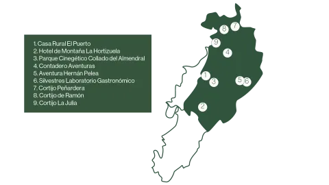
CIRCUIT 11. EXPLORING THE SIERRA DE SEGURA-DISCONNECT AND NATURE

Submitted by brandcode_deweloper on
Id
13496417
Descripción larga

Day 1.

Arrived at the accommodation.

Option A.

Farm House El Puerto, a refuge in the middle of the serrana nature.
Duration of experience: minimum stay of 1 night.
Price: from 150 €.

Option B.

Hotel de Montaña La Hortizuela with the experience Disconnect in nature with products from the territory.
Duration of experience: Minimum stay of 2 nights.
Price: From 200 €.

Day 2.

Option A.

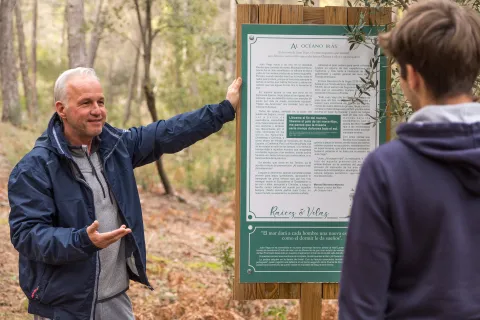
Learn about the importance of the Iberian wolf in the ecosystem in the Collado de Almond Cinegetic Park.
Duration of experience: 3 hours.
Price: 15 €/ adults and 11 €/ children. For retirees and children with disabilities entry is free.

Option B.

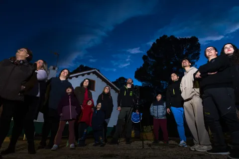
Safe birds: a first flight over the saw with Contadero Adventures.
Duration of experience: 4 hours
Price: 25 €/ person

Day 3.

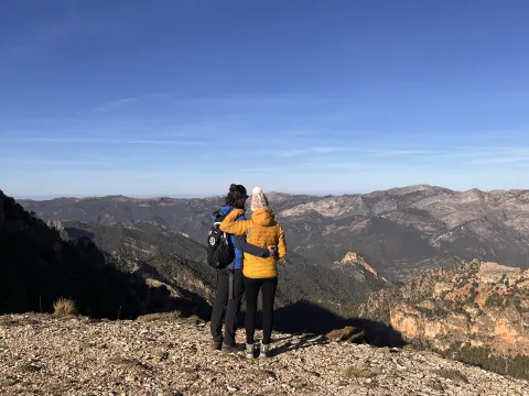
Discover the fields of Hernán Pelea with Adventure Hernán Pelea.
Duration of experience: between 4 and 5 hours.
Price: 50 €/ person.

Day 4.

Experience a unique gastronomic experience in the Serra de Segura with Silvestres Gastronomical laboratories.
Duration of experience: 4 hours.
Price: 75 €/ person.

Day 5.

Change of accommodation.

Immersion in the culture of oil in Siles in the Cortijo Peñardera.
Duration of experience: 2 days.
Price: 270 €/ person.

Day 6.

Change of accommodation.

Enjoy a stay in the Cortijo de Ramón between Roots and Candles.
Duration of experience: Minimum stay of 2 nights.
Price: from 72 €/ person.

(*) Prices may be subject to change.

GEOLOCALIZATION

Breve descripción

A circuit designed for lovers of nature, culture and indigenous flavors. In this tour, travelers can enjoy watching birds in their natural habitat or learning about the importance of the fauna of the territory. In addition, guided routes are offered to learn about the impressive landscapes of the Sierra de Segura. The circuit also invites you to discover the historical legacy of the area, exploring its monuments and traditions.

This circuit combines nature, history, gastronomy and a sustainable approach, which provides a complete experience in the Sierra de Segura.

Latitud
38.2803
Longitud
-2.6502
Distrito
Municipio
Ubicación en el mapa
POINT (-2.6502 38.2803)
imagen
Image
mapas-segura-5-png
Imagen principal
Activado
imagen
Image
_mg_6638-jpg
Imagen principal
Desactivado
imagen
Image
img_8027-1-jpg
Imagen principal
Desactivado
imagen
Image
_mg_6408-1-jpg
Imagen principal
Desactivado

Seniors

icon-intereses-senior

Friends

icon-intereses-amigos

Nature

icon-intereses-naturaleza

Groups

icon-intereses-grupos

Gastronomy

icon-intereses-gastronomia

For couples

icon-intereses-en-pareja

Family

icon-intereses-familia

Adventure

icon-intereses-aventura

Culture

icon-intereses-cultura

Municipality

icon-intereses-municipio

Eco-friendly

icon-intereses-eco-friendly
CIRCUITO 11. EXPLORANDO LA SIERRA DE SEGURA-DESCONEXIÓN Y NATURALEZA
Desactivado
Tramo de asfalto o cemento
 
Tramo de pista o camino forestal
 
Tramo de vía pecuaria
 
Tramo de senda
 

Enjoy a day as a transhumant shepherd with Vida Trashumante

Submitted by brandcode_deweloper on
Id
13486245
Descripción larga
In the heart of the Sierra de Segura, Pontones offers a unique experience of ecotourism by the hand of "Vida Trashumante." This innovative project combines the millennial tradition of transhumanism with practices of livestock and sustainable agriculture, creating a harmonious relationship between grazing and olive crops. The participants will immerse themselves in the day-to-day of the local pastors, discovering the essential role of the sheep in maintaining the ecological balance of the environment. During the day, they will join the traditional work, learning about the management of the flock and the practices that make this activity a model of sustainability and conservation. In short, "Life Trashumante" invites you to rediscover the essence of a living tradition, where land, animals and people coexist in perfect harmony. To close this experience, visitors can enjoy an appetizer made with local products.
Latitud
38.030014
Longitud
-2.652787
Ubicación en el mapa
POINT (-2.652787 38.030014)
imagen
Image
whatsapp-image-2025-03-06-at-10-47-47-2-jpeg
Imagen principal
Activado

Family

icon-intereses-familia

Eco-friendly

icon-intereses-eco-friendly

Groups

icon-intereses-grupos
Disfruta de una jornada como pastor trashumante con Vida Trashumante
All year round
Desactivado
Coordenadas / Huso 30S
30S x = 530472 and = 4209202

Camino de San Juan de la Cruz

Submitted by brandcode_deweloper on
Id
12414439
Descripción larga

The Calvary Convent is part of the first stage of the San Juan de la Cruz Road, which begins in Villanueva del Archbishop and links with Beas de Segura to Caravaca de la Cruz.

The eight months St. John spent here were the happiest of his life. At the age of 36, he had changed the gloomy and insanely Toledo cell to a convent in the middle of a mountain surrounded by pine trees, oaks, retamas, rosemary and splice. It was a very fruitful stage in the poetic. Here he designed and began the writing of his best works. He began his "Spiritual Song," "The Dark Night of the Soul" and the "Up to Mount Carmel."

In Villanueva del Archbishop, in addition to having lived in El Calvary and in the Sanctuary of the Fuensanta, there is news of a fact that occurred in the main square of the village:

"Once was Father Vicar, Fra Juan de la Cruz, to Villanueva del Archbishop, who was leagues and half of the Calvary Convent, and brought with him Father Fra Brocardo of San Lorenzo, who was still a brother, and passing through the square he saw as a poor, apparently very needy, he was asking for alms among the rich people there, and no one felt sorry. And thinking of finding more charity in the religious, he came to ask her. The Vicar Father returned to his partner, and told him that they had no money to give him, that he should give him alms of good example from poor to poor, venerating Christ in that poor man and kissing his feet. There was a lot of mud in the plaza, and the poor came barefoot, and with the feet of the lofty; but this was not a cause to delay obedience. For as the voice of the Prelado sounded, Fra Brocardo was cast at the feet of the poor, and he kissed them with great humility, and with this he continued his way, leaving those who saw him so built, that he found in them the charity that he had not found before."

San Juan de la Cruz passed through the Sanctuary of the Fuensanta de Villanueva del Archbishop, which was a Carmelite convent until 1599, fulfilling his obligation to visit the convent of Andalusia and maintaining a relationship with his procurator Fra Brocardo of San Lorenzo.

Breve descripción

San Juan de la Cruz, after being imprisoned in Toledo, arrived in Villanueva del Archbishop in 1578, specifically at the convent of Calvary, located in the Sierra de las Villas, where he found a sense of peace and well-being so intense that they marked him for life, always being his refuge in difficult times.

Latitud
38.163023
Longitud
-2.994247
Ubicación en el mapa
POINT (-2.994247 38.163023)
imagen
Image
b9f5ddea-abba-4494-9299-872f85824fca-jpeg
Imagen principal
Activado
imagen
Image
322b9c56-0a51-42b8-8447-dfeb1a9988a7-jpeg
Imagen principal
Desactivado
imagen
Image
d44b7e2f-6711-462e-9dbb-9c24427683ca-jpeg
Imagen principal
Desactivado
imagen
Image
5e5391ff-4be9-4691-beda-e581d5eb75c2-jpeg
Imagen principal
Desactivado
imagen
Image
3092e8c6-e50f-40b9-aba7-3832b2ed0d83-jpeg
Imagen principal
Desactivado
imagen
Image
d652c22f-69d4-4b6e-bbb4-507c7043dd02-jpeg
Imagen principal
Desactivado
imagen
Image
santuario-de-la-fuensanta-vva-del-arzobispo-jpg
Imagen principal
Desactivado
imagen
Image
santuario-de-la-fuensanta-interior-vva-del-arzobispo-jae-jpg
Imagen principal
Desactivado

Culture

icon-intereses-cultura
Camino de San Juan de la Cruz
Desactivado
Coordenadas / Huso 30S
30S x = 500504 and = 4223903
Tramo de asfalto o cemento
 
Tramo de pista o camino forestal
 
Tramo de vía pecuaria
 
Tramo de senda
 

The Transhumance and Village Route. Deep in the Sierra de Segura.

Submitted by brandcode_deweloper on
Id
10492723
Descripción larga

The mountain roads and the shelter where the young protagonists of the film are located.

This route perfectly represents the northern area of the natural park, in particular the most remote territory of the middle and high mountain, the unique landscapes of transhumanism, subsistence and deep rural life. Much of the municipality of Santiago- Pontones is located in a high mountain area, with very little human presence and public services, given the dispersion of the population centres that in most cases are small villages and many of them completely uninhabited. Despite this, it is an occupied territory, with a low population density, but which maintains much of its livestock, forestry and mountain farming.

Inside the natural park Serras de Cazorla, Segura and the Villas, the high Santiago Pontonesthe scattered network of villages and roads, the high mountain area of the Campos de Hernán Perea, have exceptional environmental and sociological conditions in the Andalusian and Spanish context. In this area there are the lowest temperatures of the Iberian Peninsula, reaching each winter temperatures close to -20 ° C. Its customs, its crops, its way of speaking, its annual cycles, the way of living, its traditional agricultural activities make this community and these landscapes an unparalleled attraction in the protected areas and rural areas of Spain.

One of its most interesting natural conditions is the extraordinary night skies. The village of Don Domingo, in this municipal term, is declared first Starlight site from Spain. In these locations are given the cleanest skies, without light pollution, of the Peninsula. In fact it is the destination of tourists who specialize in such observations.

Manuel Martín Cuenca, chooses these sites to place the forest paths and the mountain shelter, a house of fieldmen in the vernacular language (fire guards), which shows at the central moment of the film the isolation of this mountain area and thus allows the development of the argument.

Breve descripción

The municipal term of Santiago- Pontones. Pontones- Santiago de la Espada- Campos de Hernán Perea. Natural park Sierras de Cazorla, Segura y las Villas, Jaén.

imagen
Image
ruta-2.png
Imagen principal
Activado
imagen
Image
La%20Hija%2011.jpg
Imagen principal
Desactivado
imagen
Image
La%20Hija%2012.jpg
Imagen principal
Desactivado
imagen
Image
La%20Hija_frames_17.jpg
Imagen principal
Desactivado
imagen
Image
La%20Hija_frames_5.jpg
Imagen principal
Desactivado

Culture

icon-intereses-cultura
La ruta de la trashumancia y las aldeas. La Sierra de Segura profunda
All year round
Desactivado
Tramo de asfalto o cemento
 
Tramo de pista o camino forestal
 
Tramo de vía pecuaria
 
Tramo de senda
 

Section Jaén - Torredelcampo

Submitted by brandcode_deweloper on
Id
13070861
Breve descripción

The stretch of the Mozarto Road that extends from Jaén to Torredelcampo is a journey of approximately 13 km, with an accumulated gap of + 350 m and -200 m. Classified as of moderate difficulty, this stage offers an accessible challenge that allows pilgrims to immerse themselves in an experience that combines the urban environment of Jaén with the natural landscape of the South Sierra de Jaén.

_

The stage begins in the Plaza de Santa María, pressuring it is the Cathedral that houses one of the most important relics for Christianity: "the Holy Face." Following the yellow arrows we enter the street Maestra, entering into ancient neighborhoods where the memory of the Arab, Jewish and Christian cultures persists. The tour takes us to the Arc of San Lorenzo, the Plazoleta of Santiago, the Church of San Juan, the Palace of Villardompardo, which conserves important Arab Baths of the 10th century, the Convent of Santo Domingo or the Church of the Magdalena with its recollect courtyard. The information centres of the Pilgrim are located in the Office of Tourism of Jaén, Centre of Tourism Dynamization of the Province of Jaén and Palacio Villardompardo - Baños AArabs.

From here we will continue on the road of Córdoba following our way to the city of Torredelcampo.

TRANSITION TO RURAL ENVIRONMENT

As you leave Jaén, the road is headed for the Cordoba road. The pilgrims will follow the old road to Torredelfield, gradually ascending through residential areas until leaving behind the last buildings of Jaén. Once outside the urban core, the road enters the South Sierra, offering a change of landscape towards a more natural and rural environment.

The tour includes the downhill of several streams, which mark the beginning of a more ascending section. The pilgrims will pass through roads leading to the Vicar's House and the Sierra de Jabalcuz before facing a rise to a highway fence. Continuing, you reach a crossing with the Megatin road. After going down about 1 km, the route goes up again, taking the pilgrims to Torredelcamp.

LLEGATE AND EXPLORATION OF TORREDELCAMPO

As you approach Torredelcampo, the road enters through Andalucia Street, you will go through this welcoming town until you meet the Church of San Bartolomé, and the City Hall (Punto de Información al Peregrino), to continue to search for the exit to the old road of Santa Ana to which you will arrive in a short but pending rise. The origin of the present municipality is very related to the former Iberian inhabitants of Cerro Miguelico, in the I and II A.D. part of the population is moved to the present site of Torredelcampo. After the end of the conflicts at the end of the emirate, the inhabitants of the area are forced to concentrate on a single settlement. Near the Hermitage of the Patrona is the plain of Santa Ana, a recreational area with water and shadows that will bring you a well-deserved rest. But not only, but we will also find part of the legacy of his story with the remains of a Visigoda Necropolis and an old Oppidum Ibero.

The itinerary continues on the ancient road to Jamilena.

CONCLUSION OF THE RECORRID

The Jaén to Torredelcampo stage offers an experience that balances the urban environment with the natural landscape of the Sierra Sur de Jaén. The moderate difficulty of the journey makes it an accessible option, providing an opportunity to experience the beauty and history of the region. During this stage, pilgrims not only enjoy a challenging journey, but also have the opportunity to connect with the cultural heritage and tranquility of this part of the Mozarian Way.

Latitud
37.7796
Longitud
-3.7849
Distrito
Municipio
Ubicación en el mapa
POINT (-3.7849 37.7796)
imagen
Image
jaen-web-01-jpg
Imagen principal
Activado
imagen
Image
imagen-principal-jaen-torredelcampo-jpg-1
Imagen principal
Desactivado
imagen
Image
torredelcampo-web-10-jpg
Imagen principal
Desactivado
imagen
Image
jaen-web-69-1-jpg
Imagen principal
Desactivado

Nature

icon-intereses-naturaleza

Adventure

icon-intereses-aventura
Moderada
Tramo Jaén - Torredelcampo
11,5 km
400m
350m
Desactivado
Image
perfil_topografico_jaen_torredelcampo-jpg

Jaén

Torredelfield

Tramo de asfalto o cemento
 
Tramo de pista o camino forestal
 
Tramo de vía pecuaria
 
Tramo de senda