Saltar al contenido principal
icon-intereses-cultura-del-toro

San Francisco de Asís Park

Submitted by brandcode_deweloper on
Id
6615167
Descripción
Breve descripción

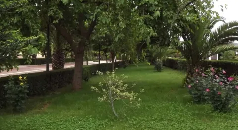
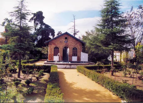
The main park has a large walk space surrounded by banks and gardens. Inside we can observe the monument to San Francisco de Assisi and the pond.

Ubicación
Latitud
38.318200
Longitud
-2.899350
Distrito
Municipio
Ubicación en el mapa
POINT (-2.89935 38.3182)
Tipos de punto de interés
Imágenes carrusel
imagen
Image
1369232244.jpg
Imagen principal
Desactivado
imagen
Image
1369232245.jpg
Imagen principal
Desactivado
Imágenes cabecera
imagen
Image
Captura%20de%20pantalla%202020-10-29%20152414.jpg
Imagen principal
Activado
Microsite al que pertenece
Loading map
Preparing points of interest and routes...

Las Quebradas Park

Submitted by brandcode_deweloper on
Id
4884966
Descripción
Descripción larga

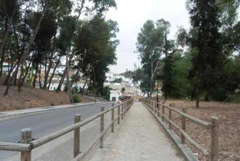
This park has large shade areas, rest banks, a children's recreation area and a delimited picnic area.

Breve descripción

Frondosa grove in the old town of Torredonjimeno where there is an area conditioned for leisure and free time consisting of a children's park and a picnic area.

Ubicación
Nombre
Cortijo de la Muña
Código Postal
23650
Latitud
37.766800
Longitud
-3.960900
Distrito
Municipio
Ubicación en el mapa
POINT (-3.9609 37.7668)
Tipos de punto de interés
Imágenes carrusel
imagen
Image
parquequebradas.jpg
Imagen principal
Desactivado
Imágenes cabecera
imagen
Image
6062256Master.jpg
Imagen principal
Activado
Microsite al que pertenece
Loading map
Preparing points of interest and routes...
Eduardo Carvajal Park

Submitted by brandcode_deweloper on
Id
6617037
Descripción
Breve descripción

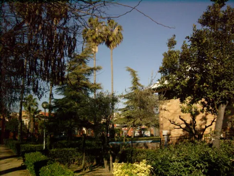
This park of extraordinary botanical wealth, popularly known as "El Vivero," is worked between 1893 and 1895, when Mr Eduardo Carvajal would be mayor of Bailén and from whom he has inherited his name. This garden will be one of its first views as you enter Bailén from the south on the Avenue del Parador. Inside you will find a wide variety of floral and arborea like the acacia of three thorns, the tree of love, rosals, American cane, cypress, alhelis, cineraria, carraspiques, sage, rosemary...

Ubicación
Latitud
38.091260
Longitud
-3.778070
Distrito
Municipio
Ubicación en el mapa
POINT (-3.77807 38.09126)
Tipos de punto de interés
Imágenes carrusel
imagen
Image
parque5.jpg
Imagen principal
Desactivado
imagen
Image
vivero.jpg
Imagen principal
Desactivado
Imágenes cabecera
imagen
Image
parque3.jpg
Imagen principal
Activado
Microsite al que pertenece
Loading map
Preparing points of interest and routes...
Cerrillo Blanco Archaeological Park

Submitted by brandcode_deweloper on
Id
4485896
Descripción
Descripción larga

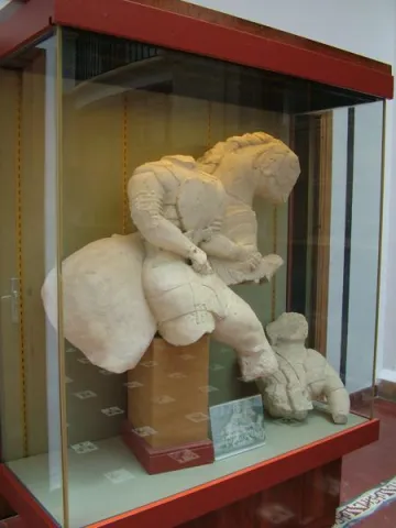
The sculptural ensemble located in this settlement is by far the most important and monumental that has provided Iberian archaeology and key to understanding this culture at the time of its full consolidation, during the fifth century before Christ. This sculptural ensemble is located in the Provincial Museum of Jaén. Other Iberian pieces are exhibited in the Municipal Archaeological Museum of Porcilla, located in the Tower of Boabdil.

Breve descripción

The settlement of Cerrillo Blanco is an extraordinary piece to understand not only the importance of the Iberian "oppidum" of Porcra, but also the very history of Alta Andalucía and the entire Iberian world in general.

Telecomunicaciones
Teléfono de contacto
666 445 513
Correo electrónico
info@museodeporcuna.com
Ubicación
Latitud
37.887160
Longitud
-4.179060
Distrito
Municipio
Ubicación en el mapa
POINT (-4.17906 37.88716)
Tipos de punto de interés
Imágenes carrusel
imagen
Image
museo%20arqueologico%20Cerrillo%20Blanco.jpeg
Imagen principal
Desactivado
imagen
Image
museo%20arqueologico%20Cerrillo%20Blanco%202.jpeg
Imagen principal
Desactivado
Imágenes cabecera
imagen
Image
Parque%20Arquel%C3%B3gico%20de%20Cerrillo%20Blanco.jpg
Imagen principal
Activado
Microsite al que pertenece
Loading map
Preparing points of interest and routes...
La Cimbarra Waterfall Natural Site

Submitted by brandcode_deweloper on
Id
1927564
Descripción
Descripción larga

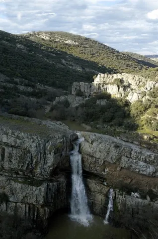
In the central region of Sierra Morena, on a substrate of slate and sandstone, this protected space is located characterized by its accidental relief.

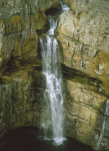
On the south-west side the river Guarrizas appears, creating strong slopes. On the contrary, the declives on the southeast side are softer. The napping of the river forms waterfalls, the most spectacular and beautiful being that of Cimbarra.

The flora is characterized by its heterogeneity. It abounds the mixed forest of oak and alcornoques, with an abundant Mediterranean bush. There is also an area of oak and repopulations of pineapple and black pine. The fauna is also rich and varied.

Among the medium-sized predators the fox and the gin abound, while numerous rapaces fly over the skies of this natural area of 534 hectares of extension, highlighting the royal eagle and the eagle.

Breve descripción

If for anything it is known Aldeaquemada is precisely for La Cimbarra. This spectacular waterfall, about 40 meters high, is located about two kilometres from the village in the south direction and has the category, as a protected natural space, of Natural Park. The access path is in good condition and efforts to improve it have been important in recent years.

Ubicación
Latitud
38.388645
Longitud
-3.414725
Distrito
Municipio
Ubicación en el mapa
POINT (-3.414725 38.388645)
Tipos de punto de interés
Imágenes carrusel
imagen
Image
xDESPE%C3%91APERROS%2C%20LA%20CIMBARRA.jpg
Imagen principal
Desactivado
imagen
Image
main_image_54214.jpeg
Imagen principal
Desactivado
Imágenes cabecera
imagen
Image
Cascada%20de%20la%20Cimbarra%20G%C3%BCido%20Monta%C3%B1%C3%A9s.jpg
Imagen principal
Activado
Loading map
Preparing points of interest and routes...

Natural Area Alto Guadalquivir

Submitted by brandcode_deweloper on
Id
2190557
Descripción
Descripción larga

The whole area of this artificial wet area - with an increasingly important water vegetation belt - is surrounded by crops.

The palustre vegetation of these swamps is basically made up of eneas and canes, accompanied by beets and tarays and on their shores are mainly developed the alms.

While, as far as fauna is concerned, an abundant and varied community of aquatic birds is concentrated in these reservoirs of Alto Guadalquivir, highlighting the colony of squid (species catalogued as threatened at community level), royal ducks and spoons, as well as imperial porrones and garzas.

The total area of this natural area, whose reference locations are Ubeda and Jódar, is 663 hectares.

Breve descripción

To the south of the famous hills of Ubeda, the Guadalquivir River was repressed in the 1950s in a succession of three small reservoirs: Doña Aldonza (301 hectares), Pedro Marín (240 hectares) and Puente de la Cerrada (122 hectares).

Ubicación
Latitud
37.779600
Longitud
-3.784910
Municipio
Ubicación en el mapa
POINT (-3.78491 37.7796)
Tipos de punto de interés
Imágenes carrusel
imagen
Image
Natu178.jpg
Imagen principal
Desactivado
imagen
Image
Natu179.jpg
Imagen principal
Desactivado
imagen
Image
Natu237.jpg
Imagen principal
Desactivado
Imágenes cabecera
imagen
Image
Natu049%20%281%29.jpg
Imagen principal
Activado
Loading map
Preparing points of interest and routes...

River Area of Cuadros

Submitted by brandcode_deweloper on
Id
2980270
Descripción
Descripción larga

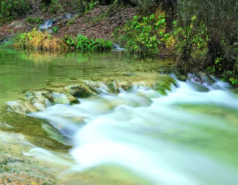
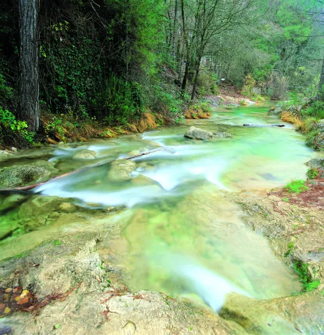
Also known as "Senda de los Adelfares," it is a forest in a gallery made up of adelfas that develops along the birth of the Cuadros River, in the Natural Park of Sierra Magina. It is the most extensive formation in southern Spain with a high degree of conservation.

Breve descripción

Next to the shrine of the Virgin of Cuadros, south of the city centre, about 4 km. of Bedmar; access directly by the road JV-3.222.

Telecomunicaciones
Sitio web
www.bedmargarciez.es
Teléfono de contacto
953 760 002 / 953 760 043
Correo electrónico
alcaldía@bedmargarciez.es
Ubicación
Código Postal
23537
Latitud
37.787590
Longitud
-3.408670
Dirección
Carretera JA-4111
Distrito
Municipio
Ubicación en el mapa
POINT (-3.40867 37.78759)
Tipos de punto de interés
Imágenes carrusel
imagen
Image
nacimiento-rio-cuadros-1-jpg
Imagen principal
Desactivado
imagen
Image
nacimiento-rio-cuadros-jpg
Imagen principal
Desactivado
Imágenes cabecera
imagen
Image
%C3%81rea%20recreativa%20de%20Cuadros.jpg
Imagen principal
Activado
Microsite al que pertenece
Loading map
Preparing points of interest and routes...

Caño del Aguadero Natural Site

Submitted by brandcode_deweloper on
Id
1891235
Descripción
Descripción larga

Area of pastures traditionally dedicated to pasture, so the fountains, pilares- abrevadero and huts or pastor's cabins abound. The altitude of the saw allows the presence of birds that nedify above 1,500 meters, such as the Red Roquer, the Grey Collalba and the Royal Eagle.

Access by land lane from the nearby town of Bedmar.

13 Km tour, then walk routes.

Breve descripción

Water birth at 1,800 meters of altitude in a high mountain environment.

Ubicación
Latitud
37.791993
Longitud
-3.467877
Dirección
Caño del Aguadero
Distrito
Ubicación en el mapa
POINT (-3.467877 37.791993)
Tipos de punto de interés
Imágenes carrusel
imagen
Image
725_SS_03.jpg
Imagen principal
Desactivado
Imágenes cabecera
imagen
Image
725_SS_05.jpg
Imagen principal
Activado
Microsite al que pertenece
Loading map
Preparing points of interest and routes...

Area of Jesús del Monte

Submitted by brandcode_deweloper on
Id
4585369
Descripción
Breve descripción

The Cañada de la Madera has access to this natural setting, with good views of the park and a well-equipped road with drinking water and a hermitage. In this same place stands the Fuente del Avellano.

Ubicación
Código Postal
23338
Latitud
38.157030
Longitud
-3.032730
Municipio
Ubicación en el mapa
POINT (-3.03273 38.15703)
Tipos de punto de interés
Imágenes carrusel
imagen
Image
iznatoraf_jesus.jpg
Imagen principal
Desactivado
Imágenes cabecera
imagen
Image
3609997Master.jpg
Imagen principal
Activado
Loading map
Preparing points of interest and routes...
Giribaile Reservoir

Submitted by brandcode_deweloper on
Id
4554856
Descripción
Breve descripción

It affects the municipal terms of Ibros, Vilches, Rus, Canena, Ubeda, Navas de San Juan and Sabiote, in the skirts of theNatural area La Lambrain Rus. It is of the compaction type (80% of land).
The swamp collects the waters of the Guadalimar River, which belongs to the Guadalquivir watershed.

Ubicación
Código Postal
23430
Latitud
38.113562
Longitud
-3.461869
Municipio
Ubicación en el mapa
POINT (-3.461869 38.113562)
Imágenes carrusel
imagen
Image
Embalse%20de%20Giribaile.jpg
Imagen principal
Desactivado
Microsite al que pertenece
Loading map
Preparing points of interest and routes...