Saltar al contenido principal
icon-intereses-cultura-del-toro

Plains of Palomares-Cárcheles

Submitted by brandcode_deweloper on
Id
5849330
Descripción
Breve descripción

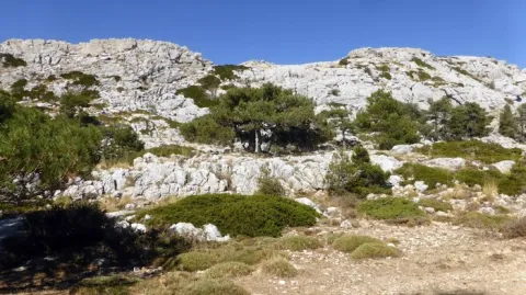
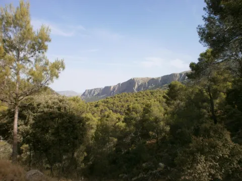
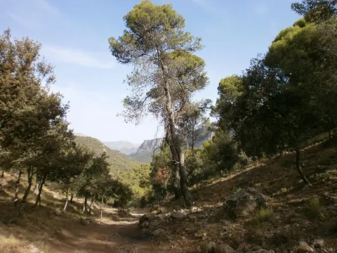
Altiplanicie in height, surrounded by mountains. Border space between the municipal terms of Los Cárcheles and Jaén. It is ideal for all-terrain bike and hiking and is accessible, by unasphalted slopes, from the Monte de la Sierra peri-urban park (Jaén) and from Carchelejo (Cárcheles).

Ubicación
Latitud
37.636740
Longitud
-3.639830
Distrito
Municipio
Ubicación en el mapa
POINT (-3.63983 37.63674)
Tipos de punto de interés
Imágenes carrusel
imagen
Image
Llanos%20de%20Palomares-C%C3%A1rcheles.jpg
Imagen principal
Desactivado
Imágenes cabecera
imagen
Image
Llanos%20de%20Palomares-C%C3%A1rcheles1.jpg
Imagen principal
Activado
Microsite al que pertenece
Loading map
Preparing points of interest and routes...
Alharilla Plain

Submitted by brandcode_deweloper on
Id
4861638
Descripción
Breve descripción

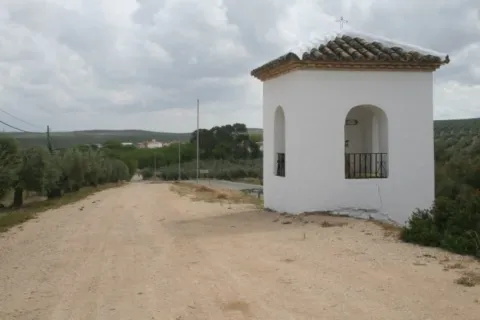
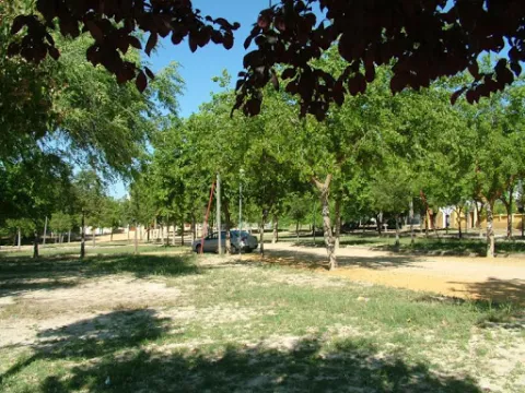
A place that has a large tree and is ideal for a day of field, as it has a magnificent road. There is the hermitage of the Virgin of Alharilla, in whose honor a rosemary is organized every year.

Ubicación
Código Postal
23790
Latitud
37.870860
Longitud
-4.183340
Distrito
Municipio
Ubicación en el mapa
POINT (-4.18334 37.87086)
Tipos de punto de interés
Imágenes carrusel
imagen
Image
Alharilla-humilladero28720180501-696x464.jpg
Imagen principal
Desactivado
Imágenes cabecera
imagen
Image
llano.jpg
Imagen principal
Activado
Microsite al que pertenece
Loading map
Preparing points of interest and routes...
Iberian Lynx

Submitted by brandcode_deweloper on
Id
1914733
Descripción
Descripción larga

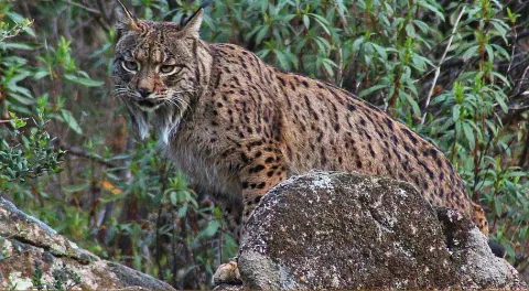
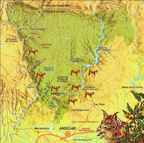
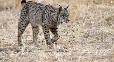
Although Iberian lince has been a protected species since 1966, this wonderful feline is in danger of extinction. At present, only two populations are viable and consolidated for the development and proliferation of this species: the one in Doñana and the one in the natural spaces Sierra de Cardeña and Montoro Natural Park and Sierra de Andújar Natural Park, where the most important population of the nail cat is located.

To see a lince in Andújar

To try to locate and observe an Iberian lince we must look for a good observatory from which we see a lot of saw, many slopes, rosquets, bushes and above all, many clear pasture. Among the best areas for an observation day are:

Road of the boat on its last stretch.

Road and recreational area of the Encinarejo.

Embalse of the Encinarejo from the north bank.

All the viewpoints in the south of the park.

Jabali Path.

Recreative area of the line in New Place.

Located at the observatory, it is essential to be always very attentive and silent, so, even in plain sight, we can distinguish a lineage moving if it is not too far away. We will also start a sweep of the area by means of binoculars. With them we will be looking at the clear and the exits of the land; so we can discover some cat placed on a rock. The telescope should be left for the last search, to go looking further and to go looking very slowly or even to look at the animal once we have discovered it.?

As with almost all predators, the corvids are also very aggressive with the Iberian lince (perhaps this is the animal with which they are most rattled), so we have to be very long-awaited of the movements and demands of the urracas. 50% of the success of observing a lince can come from being able to interpret the corvids.

For the sake of the species and the future visitors who seek to see the great cat, we must respect all the rules of public use, be respectful of the environment, always remain silent and do not in any way disturb animals. Nor should we enter privately owned farms without authorization or deviate from established paths.

Breve descripción

The largest number of the nail cat population

Ubicación
Latitud
38.039236
Longitud
-4.050560
Distrito
Municipio
Ubicación en el mapa
POINT (-4.05056 38.039236)
Imágenes carrusel
imagen
Image
Anotaci%C3%B3n%202020-04-16%20083233.jpg
Imagen principal
Desactivado
imagen
Image
Anotaci%C3%B3n%202020-04-16%20083330.jpg
Imagen principal
Desactivado
Imágenes cabecera
imagen
Image
Anotaci%C3%B3n%202020-04-16%20083259.jpg
Imagen principal
Activado
Microsite al que pertenece
Loading map
Preparing points of interest and routes...
Las Cimbras

Submitted by brandcode_deweloper on
Id
5846924
Descripción
Breve descripción

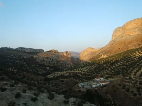
Great beauty rocky scarves that are attached in the urban case of Torres, next to the municipal pool. For its accessibility, climbing routes have been installed, for which it is necessary to be a federated sportsman or to hire the services of an authorized service company.

Ubicación
Latitud
37.689185
Longitud
-3.821449
Distrito
Municipio
Ubicación en el mapa
POINT (-3.821449 37.689185)
Tipos de punto de interés
Imágenes carrusel
imagen
Image
4781171%20%282%29.jpg
Imagen principal
Desactivado
Imágenes cabecera
imagen
Image
1934914Master%20%282%29.jpg
Imagen principal
Activado
Microsite al que pertenece
Loading map
Preparing points of interest and routes...
Las Cabritas

Submitted by brandcode_deweloper on
Id
5845992
Descripción
Breve descripción

Area of old gardens and mills belonging to the municipality of Huelma. Until well into the 20th century it was one of the most fruitful gardens in the province of Jaén. It cultivated multiple varieties of fruit and vegetables. Some of these varieties were inherited from ancient crops of the Middle Ages.

Ubicación
Latitud
37.695120
Longitud
-3.432440
Distrito
Municipio
Ubicación en el mapa
POINT (-3.43244 37.69512)
Tipos de punto de interés
Imágenes carrusel
imagen
Image
Las_Cabritas_%28Huelma%29.jpg
Imagen principal
Desactivado
Imágenes cabecera
imagen
Image
Las_Cabritas.jpg
Imagen principal
Activado
Microsite al que pertenece
Loading map
Preparing points of interest and routes...
Lapiaz of Torcal Llano

Submitted by brandcode_deweloper on
Id
876760
Descripción
Descripción larga

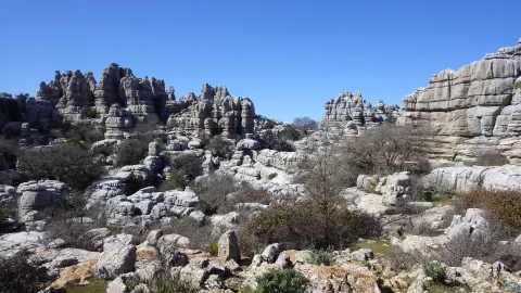
It is a very developed lapiaz with very good exposure, carved on limestone of the upper Jurassic. Stratification has a small dipping, and topography in this sector adapts to the stratification surface, generating a landscape of great beauty.

Source: Inventory of Georresources of Andalusia. Environmental Council. Junta de Andalusia.

Breve descripción

Lapiaz del Torcal Llano

Ubicación
Latitud
37.842982
Longitud
-3.066921
Municipio
Ubicación en el mapa
POINT (-3.066921 37.842982)
Tipos de punto de interés
Imágenes carrusel
imagen
Image
9310925.jpg
Imagen principal
Desactivado
Imágenes cabecera
imagen
Image
0d8a2ca0342a33999d22197e6c2b21c2o.jpg
Imagen principal
Activado
Loading map
Preparing points of interest and routes...

Lagoon Grande

Submitted by brandcode_deweloper on
Id
7010098
Descripción
Descripción larga

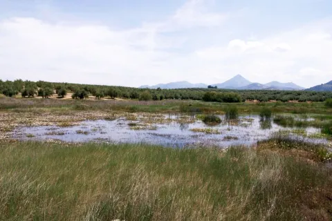
It covers an area of about 206 ha., including the lagoon itself and a protection perimeter of 500 metres.

The vegetation it presents is typical of a wetland, with the presence of eneas (typha domingensis) and carrizos (phagmites australis). As for tree species, the white acacia (populus alba), taray (African tamarix) and strawberry (fraximus angustifolia), even in isolation, is highlighted. The rest of the area is dominated by olive groves.

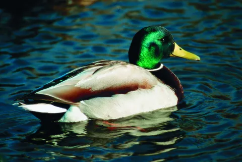
As for the present fauna, there is a particular interest in the presence of typical wetland birds: common fences (as it grows), spoon duck (as clypeata), common porron (aythya ferina), small zumpullin (tachybaptus rufilollis), cold anade (as strepera), real anade (as platyrhynchos). In spring, many of these species move to their nesting area, remaining only those that do so in this area: storks (himantopus himantopus), the chorlitero chico (charandrius dubius) and the water cock (gallinula chloropus).

There are also the presence of non-aquatic birds, such as the common charcoal (parus major), the common pineapple (coelebs fridge), the capirotated curling (silvia atricapilla), the black head curling (silvia melanocephala), the common myrtle (turdus merula), the common cernícalo (falco tinnunculus), the common mouse (butyo buteo), the calcada eagle and the lagoon (circuls aeruginosus).

The mammals are minor, although the gineta (genetta genetta) and the badger (meles meles) stand out. As for amphibians, the gallipato (pleurodeles waltl), the southern ranite (hyla meridionalis), the San Antón ranite (hyla arborea), the common frog (rana ridibunda) and the common toad (bufo bufo) stand out.

Breve descripción

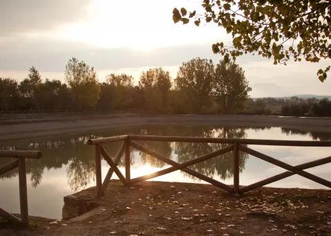
It is a wetland near Baeza, about 2 Km. the Guadalquivir River, but about 80 meters above its level. This is an easy-to-contend space in which man has acted deeply: in fact, his origin is in agricultural activity, since his waters are used for irrigation and feed on a system of waterfalls, with a relatively high salinity. At present, it has no agricultural use, although it continues to be used as a water warehouse.

Ubicación
Latitud
37.932130
Longitud
-3.559140
Municipio
Ubicación en el mapa
POINT (-3.55914 37.93213)
Tipos de punto de interés
Imágenes carrusel
imagen
Image
lagunagrande1.jpeg
Imagen principal
Desactivado
Imágenes cabecera
imagen
Image
lagunagrande.jpeg
Imagen principal
Activado
Microsite al que pertenece
Loading map
Preparing points of interest and routes...
Lagoon of the Chinche

Submitted by brandcode_deweloper on
Id
2190731
Descripción
Descripción larga

Its importance is increased, as in the case of Laguna Honda, due to the shortage of wet areas in the province. Natural vegetation has been transformed and only remains of perilagunar vegetation remain. The most common species are carrizo, swordsman and tarage. The fauna of this nature reserve of 6.5 hectares of extension, as such, and 39 hectares of protection area, is related to that of the neighbouring Laguna del Conde or Salobral in the province of Córdoba.

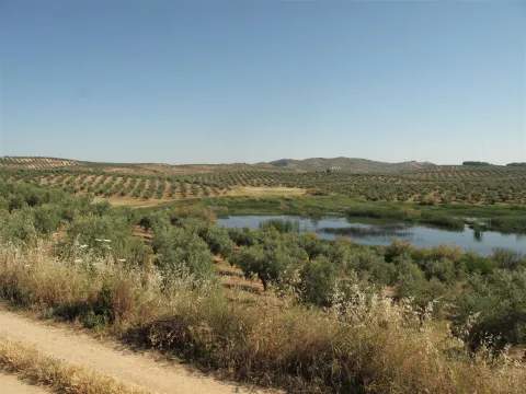
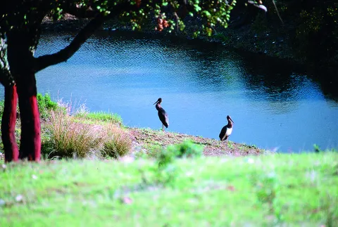
Surrounded by olive groves, it has a small natural vegetation of spadaws, reeds and carrizos. Among the aquatic birds, the occasional presence of pink flamingos, storks, royal anades and whistles and red ducks and spoon stands out. As for the terrestrial fauna, the rabbit and the red partridge abound in the area.

Breve descripción

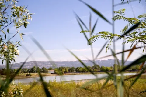
On a relief of soft profiles is raised this lagoon of endorreic nature fed by the surface runoff. The wetland, located in the south-west Jiennense, is surrounded by agricultural land and olive groves.

Ubicación
Latitud
37.614040
Longitud
-4.152960
Distrito
Municipio
Ubicación en el mapa
POINT (-4.15296 37.61404)
Tipos de punto de interés
Imágenes carrusel
imagen
Image
20_RN_01%20%282%29.jpg
Imagen principal
Desactivado
imagen
Image
laguna-chinche%20%282%29.jpeg
Imagen principal
Desactivado
imagen
Image
Natu045.jpg
Imagen principal
Desactivado
Imágenes cabecera
imagen
Image
Natu043.jpg
Imagen principal
Activado
Microsite al que pertenece
Loading map
Preparing points of interest and routes...
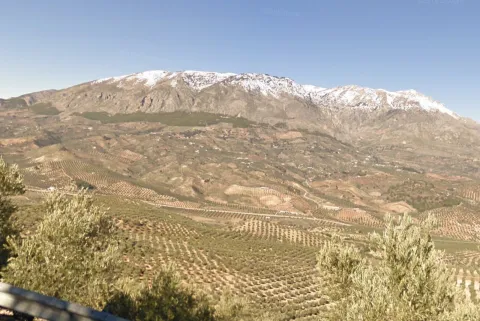
Lagoon of las Casillas y laguna de las Navas

Submitted by brandcode_deweloper on
Id
4885202
Descripción
Breve descripción

They are seasonal lagoons located in the western part of the municipality. Since 2007 they have been registered in the inventory of wetlands in Andalusia. These two lagoons are ideal for the observation of aquatic and amphibian birds at some times of the year.

Ubicación
Código Postal
23650
Latitud
37.761010
Longitud
-3.951102
Distrito
Municipio
Ubicación en el mapa
POINT (-3.951102 37.76101)
Imágenes carrusel
imagen
Image
lagunanavas.png
Imagen principal
Desactivado
Imágenes cabecera
imagen
Image
4%20%283%29.jpg
Imagen principal
Activado
Microsite al que pertenece
Loading map
Preparing points of interest and routes...
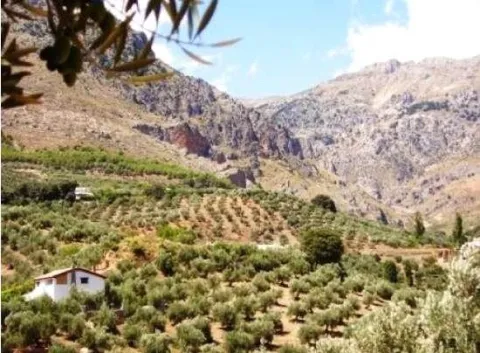
La Toba

Submitted by brandcode_deweloper on
Id
659826
Descripción
Descripción larga

Through the Toba passes the path GR 147, so we can travel some sections either in the direction of Santiago de la Espada, or in the direction of the Casicas del Río Segura. You can also gain unforgettable views over the Segura Valley if you go up the forest track of Awake-up.

Breve descripción

The water catches the senses in the village of Toba. Its spread in some of its streets, freshness, its surrounding sound are guaranteed if you visit this delicious village. You can't miss the birth of the Toba, right next to the village, with a cave you can access inside if you're not afraid of cold water.

Ubicación
Latitud
38.118220
Longitud
-2.670100
Ubicación en el mapa
POINT (-2.6701 38.11822)
Tipos de punto de interés
Imágenes carrusel
imagen
Image
600_image_2.jpg
Imagen principal
Desactivado
imagen
Image
600_image_3.jpg
Imagen principal
Desactivado
Imágenes cabecera
imagen
Image
La_Toba-Fuentetoba-03.jpg
Imagen principal
Activado
Loading map
Preparing points of interest and routes...