Saltar al contenido principal

Jabalí Recreational Area

Submitted by brandcode_deweloper on
Id
2981139
Descripción
Descripción larga

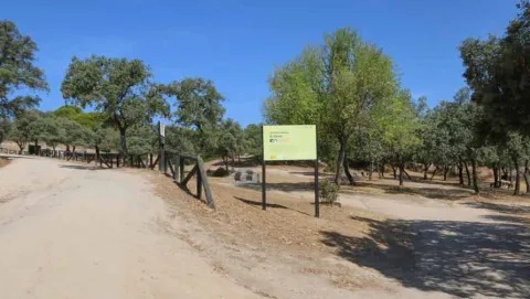
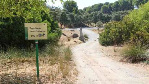
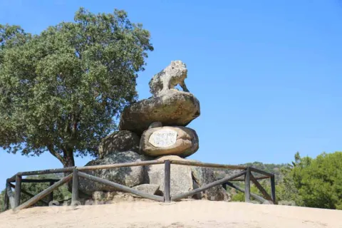
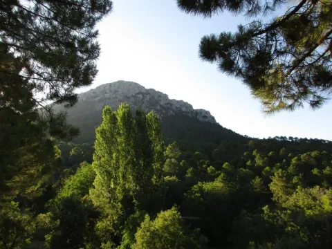
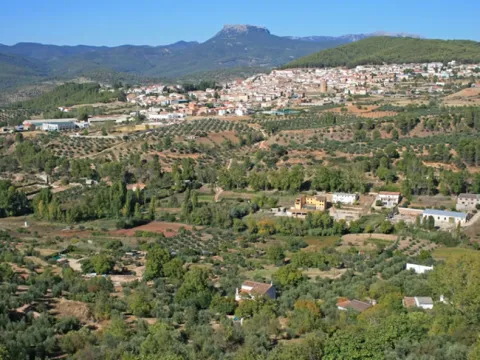
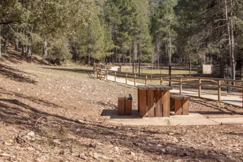
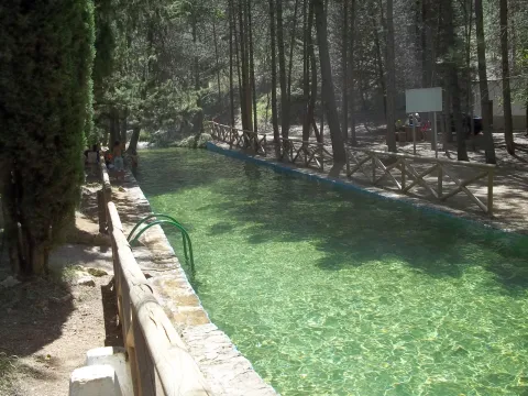
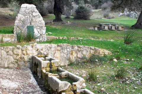
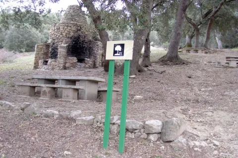
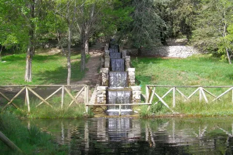
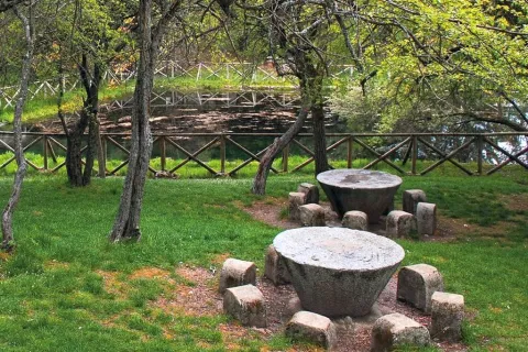
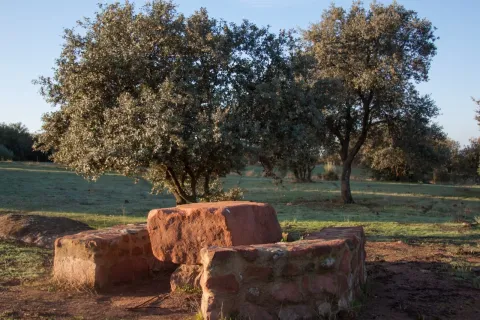
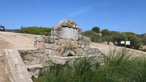
The recreational area of the Jabali is distinguished by the abundance of oak trees surrounded by pine trees, very characteristic of the Sierras de Andújar Natural Park, to which it belongs. It is perfectly equipped to celebrate a family picnic, with tables, banks, barbecues, containers, and even a fountain. His name is given by the remarkable stone sculpture of the lone boar who presides over the space, the work of local artist Luis Aldehuela. The enclave links with the path that connects El Jabali with the Encinarejo.

Breve descripción

It is accessed by the road J-5010, from Andújar to the Sanctuary Virgen de la Cabeza, diverting about 5 km. before reaching the Basilica, right on one of the road's margins. The vehicles can be parked in the same recreational area.
Telecomunicaciones
Sitio web
www.turismodeandujar.com
Teléfono de contacto
953 508 200
Correo electrónico
turismodeandujar@andujar.es
Ubicación
Código Postal
23740
Latitud
38.183160
Longitud
-4.015840
Dirección
Carretera A-6178
Distrito
Municipio
Ubicación en el mapa
POINT (-4.01584 38.18316)
Tipos de punto de interés
Imágenes carrusel
imagen
Image
sierra-de-andujar-42.jpg
Imagen principal
Desactivado
imagen
Image
sierra-de-andujar-38.jpg
Imagen principal
Desactivado
imagen
Image
sierra-de-andujar-40.jpg
Imagen principal
Desactivado
imagen
Image
sierra-de-andujar-39.jpg
Imagen principal
Desactivado
Imágenes cabecera
imagen
Image
sierra-de-andujar-43.jpg
Imagen principal
Activado
Microsite al que pertenece
Loading map
Preparing points of interest and routes...

Recreational Area Dehesa del Oso

Submitted by brandcode_deweloper on
Id
3964833
Descripción
Descripción larga

There are two ways to access the Bear Dehesa:

  • From the village of Onsares, you have to leave on the road to Villarrodrigo and, within 3 km, we take the forest track that leaves on our right. We follow her without taking any of the detours that go back to Onsares to the right. At 6, 5 km from the time we took this lead, we got to the recreational area.
  • From the A-310 road between Siles and La Puerta de Segura, at point 17, we take a forest track passing through the village of La Pendolera. After 14.8 km, without being separated by any detour, we reached the Dehesa del Oso. The initial section of this track passes through the area where the works of the Siles dam are currently being carried out.

If we access from Siles, it is appropriate to stop for a while in the small village of La Cañada the Lord.

The whole area is covered by an impressive black pine pineapple with oaks, complaints and dense Mediterranean bush.

From the Dehesa del Oso you can go by forest track to the village of El Bellotar, 5 km, already located in the province of Albacete. To do this, we have to follow the Cambrón route and, in which we will see at the end of 0.7 km (collado de Las Lagunillas), follow the front rather than turn right towards El Cambrón. From El Bellotar you can get off by asphalt road to the charming village of Villaverde del Guadalimar and close a circuit back to Siles.

Breve descripción

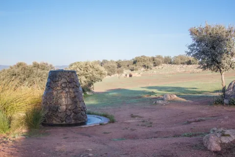
This small recreational area, next to an old forest house, is located at the foot of the Cambrón, a pétrea mole whose walls rise almost vertical on a pine sea, at the northern end of the Natural Park. The name of the place evokes the presence of the bear in these saws until the mid-18th century. There is a fountain with abundant flow, tables to eat, small meadows and beautiful walnuts. It is the starting point for climbing the Cambrón along the signposted route PR-A 173.

Telecomunicaciones
Sitio web
www.lasierradesegura.org/parajes-naturales/dehesa-del-oso/
Correo electrónico
villarrodrigo@promojaen.es
Ubicación
Código Postal
23393
Latitud
38.462640
Longitud
-2.580450
Distrito
Municipio
Ubicación en el mapa
POINT (-2.58045 38.46264)
Tipos de punto de interés
Imágenes carrusel
imagen
Image
2%20%281%29.jpg
Imagen principal
Desactivado
Imágenes cabecera
imagen
Image
image_175589.jpeg
Imagen principal
Activado
Horario
24 h.
Loading map
Preparing points of interest and routes...

Recreational Area of Linarejos

Submitted by brandcode_deweloper on
Id
881739
Descripción
Descripción larga

Here's what it takes to spend a quiet day in the middle of nature. You have a large parking area, meringeros with chairs and wooden tables, a fountain, a kiosk-bar (open only in summer) and a charming piscina-dam very busy in the months of hottest.

The presence of water attached to the lush and closed forest around this area allows, when there is little human activity, the mammals of the saw to move freely around. The bouquet, boar or even muflon have been seen a few meters from the recreation area.

But the minuscule life is the queen of the area: invertebrates like the dragonfly, and a very delicate crustacean like the native river crab are raised in the remnants of the stream of Linarejos. Your visit must, by obligation, be respectful of the inhabitants of the mountain, avoiding unnecessary noises and removing any waste from the place.

We suggest:

  • Take a walk to the canyon that the Guadalquivir River has tasted in the Cerrada del Utrero. It's about following the track that comes out next to the kiosk of the recreational area and turning left to go next to the stream. Do it with caution because in the end you arrive at the spectacular jump of Linarejos, where you don't have to look too much.

In Cazorla take the Sierra road (A-319) until the crossing known as the Empalme del Valle. Turn right on the JF-7092 road and after passing the bridge over the Guadalquivir River (4 km from the Empalme) follow the left track (JF-7091). 2 km from this bridge we turn left by a track that arrives, after a kilometre to the recreational area.
Breve descripción

Through the Arroyo de Linarejos and wrapped in a lush vegetation, this recreational area is one of the most accessible and popular in the Sierra de Cazorla. The site is a sample of the most important that encloses the saw: crystal streams surrounded by a green mantle, lush riverside vegetation, freshness, pine and wild animals around. Here we can start and finish some simple routes that will allow us to know the surroundings.

Ubicación
Latitud
37.922990
Longitud
-2.911570
Dirección
Camino de la Huelga
Municipio
Ubicación en el mapa
POINT (-2.91157 37.92299)
Tipos de punto de interés
Imágenes carrusel
imagen
Image
Natu223.jpg
Imagen principal
Desactivado
imagen
Image
2.jpg
Imagen principal
Desactivado
Imágenes cabecera
imagen
Image
3%20%281%29.jpg
Imagen principal
Activado
Loading map
Preparing points of interest and routes...

Recreational Area of Gibralberca

Submitted by brandcode_deweloper on
Id
2981114
Descripción
Breve descripción

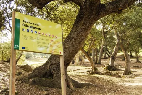
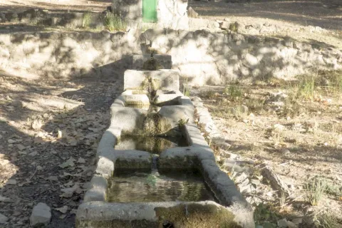
The recreational area of Gibralbca, at 1,200 metres of altitude, is a fuente- abrevadero whose waters come from the stream of the same name. Located between alamos, centenary oak and thorns, in the middle of a meadow, from this point we have impressive views of Mount Almadén (1,883 m), in the natural park of Sierra Magina. In addition, many forest birds, riverbanks and, above all, red squirrels can be observed in the moms that preside over it.

Telecomunicaciones
Sitio web
www.cambil-arbuniel.es
Teléfono de contacto
953 300 427
Ubicación
Código Postal
23560
Latitud
37.674840
Longitud
-3.498170
Dirección
Carretera A-324
Distrito
Municipio
Ubicación en el mapa
POINT (-3.49817 37.67484)
Tipos de punto de interés
Imágenes carrusel
imagen
Image
717_AR_02.jpg
Imagen principal
Desactivado
imagen
Image
717_AR_01.jpg
Imagen principal
Desactivado
imagen
Image
717_AR_04.jpg
Imagen principal
Desactivado
imagen
Image
722_SS_01.jpg
Imagen principal
Desactivado
Imágenes cabecera
imagen
Image
717_AR_03.jpg
Imagen principal
Activado
Microsite al que pertenece
Loading map
Preparing points of interest and routes...

Recreational Area of Fuenmayor

Submitted by brandcode_deweloper on
Id
2980282
Descripción
Descripción larga

Fuenmayor in a camping area and a road, located in the middle of a large mass of trees, with plenty of water, as there is a spring there. The recreation area extends along the Fresnos de Fuenmayor stream, with a source of water jumps and a pond, as well as stationery, banks and picnic tables. The Fuenmayor is surrounded by long chopos between which you can see and hear some birds of forest and riverside like the listed reyezuelo, the common agateador or the cascade lavender.

Breve descripción

To the south of the town, in the Natural Park of Sierra Mágina, right on the slopes of the Almadén peak, about 7 km. Torres. The recreational area is accessed through an asphalt road that leaves the village and leads directly to Fuenmayor.

Telecomunicaciones
Sitio web
www.juntadeandalucia.es
Teléfono de contacto
954 544 438
Ubicación
Código Postal
23540
Latitud
37.750750
Longitud
-3.516820
Dirección
Carretera de Mancha Real
Distrito
Municipio
Ubicación en el mapa
POINT (-3.51682 37.75075)
Tipos de punto de interés
Imágenes carrusel
imagen
Image
ar%20Fuenmayor.jpg
Imagen principal
Desactivado
imagen
Image
ar%20Fuenmayor%202.jpg
Imagen principal
Desactivado
imagen
Image
ar%20Fuenmayor%203.jpg
Imagen principal
Desactivado
Imágenes cabecera
imagen
Image
18.jpg
Imagen principal
Activado
Microsite al que pertenece
Loading map
Preparing points of interest and routes...

Recreational Area Burguillos

Submitted by brandcode_deweloper on
Id
6615992
Descripción
Descripción larga

Mount Burguillos is one of the most significant elevations of the border area between Sierra Morena and the countryside.

The recreational area of Burguillos is equipped with tables, banks and barbecues, as well as sources, an artificial lagoon, parking area, a bar-restaurant and a Nature Hall.

The area is frequented by people who want to share a field meal with their friends or family, take a walk in the middle of nature or simply contemplate the rich biodiversity that Burguillos has.

The area of the Dehesa de Burguillos, also known as the Villa, is home to a Mediterranean forest of oak trees, alcornoques and complaints, a bucolic livestock area and a beautiful closed area through which the Rumblar River passes after leaving the dam. In addition, the land is splattered with spectacular rounded blocks of granite called "bowling" and of cavalry stones, as well as carrocal features of this area of Sierra Morena.

From the recreational area there are numerous hiking routes, all signposted and of medium-low difficulty, being able to intertwine with each other, highlighting one that goes into the mountain under adhesado to the Rumblar River and another that runs through the so-called Cerro de las Trinches, where trenches used in the Civil War are located.

Breve descripción

The Burguillos recreational area is located 5 kilometres north of the town of Bailén, within the area known as the Dehesa de Burguillos, a city-owned public mountain.

Ubicación
Latitud
38.138960
Longitud
-3.811280
Distrito
Municipio
Ubicación en el mapa
POINT (-3.81128 38.13896)
Tipos de punto de interés
Imágenes carrusel
imagen
Image
natural28_223.jpg
Imagen principal
Desactivado
imagen
Image
natural28.jpg
Imagen principal
Desactivado
imagen
Image
natural28_224.jpg
Imagen principal
Desactivado
Imágenes cabecera
imagen
Image
natural28_227.jpg
Imagen principal
Activado
Microsite al que pertenece
Loading map
Preparing points of interest and routes...

Los Negros Camping Area

Submitted by brandcode_deweloper on
Id
5928053
Descripción
Breve descripción

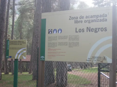
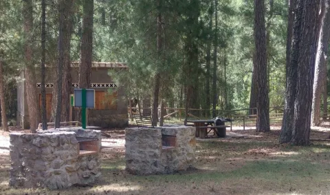
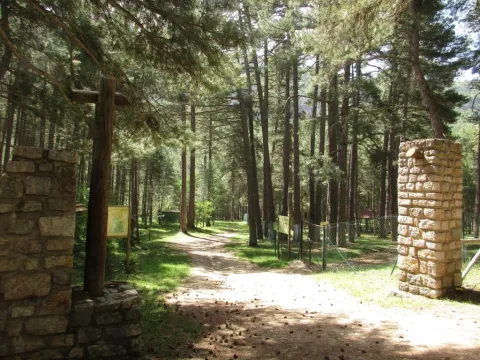
This ZALO is located in the valley of Rio Madera, a few kilometres after its birth, next to the road in the Canyon of Poyo Torres and very close to the river line. It is located in an area where the larix pine forest predominates, with a sotoforest of ferns, which denotes the moist nature of the environment.

Ubicación
Latitud
38.317340
Longitud
-2.575560
Distrito
Municipio
Ubicación en el mapa
POINT (-2.57556 38.31734)
Tipos de punto de interés
Imágenes carrusel
imagen
Image
Los%20Negros%203.jpg
Imagen principal
Desactivado
imagen
Image
Los%20Negros.jpg
Imagen principal
Desactivado
Imágenes cabecera
imagen
Image
3%20%281%29.jpg
Imagen principal
Activado
Loading map
Preparing points of interest and routes...

Venison with quince paste

Submitted by brandcode_deweloper on
349180
Distrito
Municipio
imagen
Image
venado-membrillo.jpg
Imagen principal
Activado
Medium

We peel and cut the membrane, add the sugar and water and reduce it to slow heat; then we pass it and reserve it.

We put all the ingredients in a pot and reduce them to slow heat; then we reserve it.

For the trusted figs, all four units are trusted in syrup.

We took the back, splattered it, and fried it with strong fire on both sides. We booked it and split it into eight steaks, two per ration. We mount the dish: 2 fillets with a little salsa covering half filet, a tablespoon of mashed mast and, above all, a trusted fig.

Desactivado

800 gr, thickle sauce, mashed mast, 4 units of confide figs, oil, salt and pepper.

For mashed mast: 200 gr of mast, 200 gr of sugar, 500 cl. of water.

For the carob sauce: meat juice, vinegar, caramel, 1 cup of port.

Pickled trout (Escabeche)

Submitted by brandcode_deweloper on
381982
Distrito
Municipio
imagen
Image
trucha.png
Imagen principal
Activado
Medium

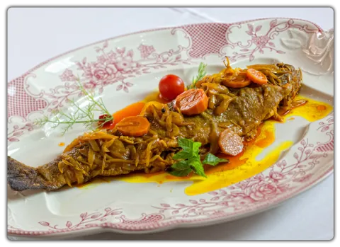
The salt trout is seasoned, the salt trout is flattened and cold in strong oil and we reserve. In the remaining oil we cast the onion cut in juliana, the laminated carrot, the garlic, the laurel, the pepper, the thyme branch, rosemary, nail and stew over slow heat.

We add sweet pepper and a glass of white wine, let us reduce, and we incorporate water, let us cook for 10 or 15 minutes and recite salt. We put the vinegar to taste, let it cook 5 minutes and sprinkle the scrubbing into the trout, covering them and letting it macerate before consuming them not less than 24 hours.

Desactivado

4 trout, 2 medium onions, garlic teeth, laurel, 1 thyme and rosemary, pepper grains, 1 nail, sweet pepper, salt, white wine, vinegar and extra virgin olive oil.

José Lorente Polaina

Wild boar loin medallions

Submitted by brandcode_deweloper on
382233
Municipio
imagen
Image
tronquitos.png
Imagen principal
Activado
Easy

To make good all the ingredients in the mortar. Add later the pepper, wine, oil and vinegar.

The loin is seasoned and covered with the adobo, are macerated 48 hours and finally, is fried in extra virgin olive oil.

Present accompanied by asparagus and potatoes.

Desactivado

1 kg of boar's back, 6 garlic teeth, 1 parsley tart, 2 laurel leaves, 1 thyme tart, 10 grs of pepper, a pinch of oregano, a pinch of cumin, 1 teaspoon of pimenton, 1 dl. of white wine, ½ dl. of extra virgin olive oil, 1 chorreon of vinegar.

José Lorente Polaina