Saltar al contenido principal
icon-intereses-senior

Tower of the Lucero

Submitted by brandcode_deweloper on
Id
7984365
Descripción
Descripción larga

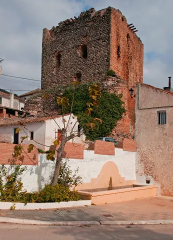
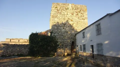
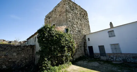
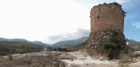
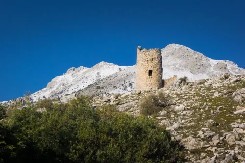
According to the description of several authors, 3? 4? 5? more than a watchtower would be a chastisement. Built in well-trimmed masonry, its plant is cylindrical with a semicircular wall that protects the entrance. It is located in height (about 2 meters above the ground level) and still retains remains of wood lintel from the door and its cap. There must have been a second floor, as inside the tower remains of beams from the wooden roof that separated both floors. It has two overlapping interior rooms and a terrace. The bottom of the tower is solid. The plants were covered with semi-spherical vaults, communicating with a 1.18 meters wide terraced staircase.

In general it is kept in good condition, although a great crack threatens to break it down

Breve descripción

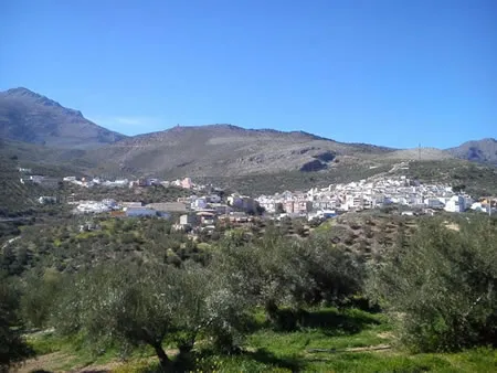
The Torre del Lucero is an important atalaya located at the highest point of the hill of the same name, at 1275 meters high. The hill rises to the northwest of the present town of Bélmez de la Moraleda, Jaén province, Spain, dominating it. 2
Telecomunicaciones
Sitio web
www.belmezdelamoraleda.es/el-municipio/patrimonio-historico.html
Ubicación
Código Postal
23568
Latitud
37.731800
Longitud
-3.394850
Distrito
Ubicación en el mapa
POINT (-3.39485 37.7318)
Tipos de punto de interés
Imágenes carrusel
imagen
Image
Torre-del-lucero-belmez-de-la-moraleda%202.jpg
Imagen principal
Desactivado
Imágenes cabecera
imagen
Image
Torre-del-lucero-belmez-de-la-moraleda.jpg
Imagen principal
Activado
Microsite al que pertenece
Loading map
Preparing points of interest and routes...

Tower of the Homenaje

Submitted by brandcode_deweloper on
Id
1908944
Descripción
Descripción larga

The Tower of Tribute is built with irregular stone armchairs except for corners, which are embellished and reinforced by regular armchairs. The basement, which was used as an aljibe, is only accessible through a trap on the ground floor. To collect the rainwater from the roof it had a conduction of ceramic tubes, and so they were stored in the aljibe.

Access to the ground floor is made from the outside. This plant is covered by an ojival vault. The first floor is accessed from the inside by a narrow staircase led on the ground floor; this floor is the main stay of the Tower and is covered by a dome made from a brick row approach, supported by pechines, also brick. Finally, when you reach the roof you get a great visibility and control of the city. This Tower was restored and is currently a visitor reception centre.

Breve descripción

The Tribute Tower is an important place in the Marteña architecture and in the panoramic image of Martos. To this day he has lost the raison d'être of defending the city but helps us to understand what it was one day: the capital of the Calatrava Endowment. It is the most significant element of the defensive architecture of the lower fortress of Martos. It is a milestone in its location as it is visible from the different accesses to Martos: roads of Alcaudete, Jaén, Monte Lope Alvarez and Santiago de Calatrava.

The Tower was built by the demand of the Order of Calatrava in the 14th century, serving at the same time as a watchtower and a headquarters of government. It has a square floor, 10 x 10 m. and consists of a basement, ground floor, first floor and roof. It is 25 m high from the basement and 22 m above the street level.

Ubicación
Latitud
37.723755
Longitud
-3.966906
Dirección
C/ Primero de Mayo, s/n
Distrito
Municipio
Ubicación en el mapa
POINT (-3.966906 37.723755)
Tipos de punto de interés
Imágenes carrusel
imagen
Image
castillo_de_la_villa2-jpg
Imagen principal
Desactivado
imagen
Image
_mg_5748-jpg
Imagen principal
Desactivado
imagen
Image
_mg_5753-jpg
Imagen principal
Desactivado
Imágenes cabecera
imagen
Image
martos-170-jpg
Imagen principal
Activado
Microsite al que pertenece
Loading map
Preparing points of interest and routes...

Tower of the Homenaje

Submitted by brandcode_deweloper on
Id
4979142
Descripción
Breve descripción

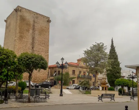
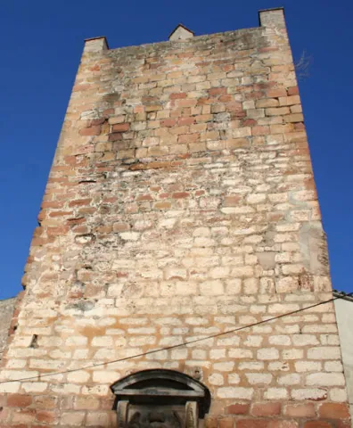
This important tower is located in the centre of the village next to the church and the city hall, and dates back to the 14th century. It is square and is built in scarlet masonry in small yarn and with corners reinforced by sillery pieces arranged to rope and sawn.The outer enclosureIt is composed of wall and four solid cubes that protect the corners.InsideIts stone is more well-kept and is structured on three floors: in the lower one there is an aljibe, and the superiors are divided, by a central wall, into two halves, covered by canyon vaults pointed and very low. It rises to the floors through an inner staircase that goes up around the tower. This tower of the homage of the old Castle was declared Good of Cultural Interest in 1985.

Telecomunicaciones
Sitio web
www.torresdealbanchez.es/
Correo electrónico
torresalbanchez@yahoo.es
Ubicación
Código Postal
23391
Latitud
38.415368
Longitud
-2.676730
Distrito
Ubicación en el mapa
POINT (-2.67673 38.415368)
Tipos de punto de interés
Imágenes carrusel
imagen
Image
torre%20homenaje.%20t.%20albachez.jpg
Imagen principal
Desactivado
Imágenes cabecera
imagen
Image
torre-1080x675.jpg
Imagen principal
Activado
Microsite al que pertenece
Loading map
Preparing points of interest and routes...

Tower of Mengíbar

Submitted by brandcode_deweloper on
Id
4617898
Descripción
Descripción larga

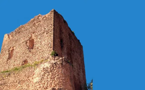
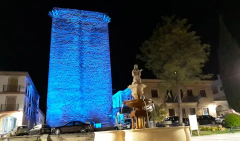
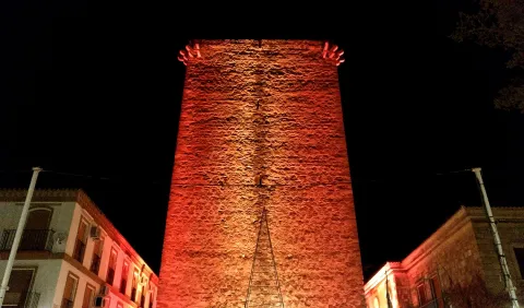
This tower is the only thing left standing in the medieval defensive system. It is about 25 meters high to the parapet of the terrace and is a square base. The entrance is east and is located at 1.90 meters high. For it you can access a square room covered with brick vault. A little bit diverted from the center on the ground, a circular pebble is preserved, excavated in the rock.

The first floor is accessed by a staircase built on the north and west walls, which has a square room of 7.45 metres on its side. It is covered with a slightly pointed brick vault supported by two pointed arches of stone and brick. These stand on the north and south walls. The light is received from open saetas in the center of each wall. The staircase on the south wall is on the second floor. It is identical to the first, although the arches are based on the east and west walls. On the east wall there is a balcony, previously amattacanado, that was looking out for the entrance of the tower that is left in its vertical. This balcony was accessed by two straits. From the second floor you can access the terrace by a staircase on the west wall.

On the floor of the first floor, near the corners, built on the floor, there are four large ceramic silos and with 1.20 meters deep. They are inserted into the thickness of the underlying vault, which is the ground floor cover. On the second floor there are four other smaller ones. They all served to store grains or liquids. On the corners of the terrace of the tower there are still canes that were holding amattacan balconies.

The Tower is Well of Cultural Interest.

Breve descripción

The Mengibar Tower is the memorial tower of the old Mengibar castle, the only thing that has been preserved from that castle. It is located in the old town of the town. It was restored in 1982.

Telecomunicaciones
Sitio web
www.mengibarturismo.com/
Teléfono de contacto
677 222 285
Correo electrónico
turismo@aytomengibar.com
Ubicación
Código Postal
23620
Latitud
37.968280
Longitud
-3.808840
Dirección
Plaza de la Constitución, 1
Distrito
Municipio
Ubicación en el mapa
POINT (-3.80884 37.96828)
Tipos de punto de interés
Imágenes carrusel
imagen
Image
torre-de-mengibar-iluminada-azul-dia-concienciacion-autismo-1140.jpg
Imagen principal
Desactivado
imagen
Image
main_image_97201.jpeg
Imagen principal
Desactivado
imagen
Image
mengibar-torre-del-homenaje-con-la-bandera-espanola-por-el-dia-de-la-constitucion.jpg
Imagen principal
Desactivado
Microsite al que pertenece
Loading map
Preparing points of interest and routes...

Tower of the Tercia

Submitted by brandcode_deweloper on
Id
4539204
Descripción
Descripción larga

Historical data

The data relating to the medieval Génave are scarce, but it must have been one of the many foothills that populated the Sierra de Segura. A fortification or tower was probably built between the 11th and 13th centuries in the face of the advance of Christian armies.

After the Christian conquest, between 1235 and 1239, Géave and the whole Sierra de Segura were controlled by the Order of Santiago's Order and they had to endure the raison and attacks of intimidation of Saracena troops, so this and other torreons acted as a parapet in these war skirmishes and as a shelter for the population.

The chronicles written at the end of the Middle Ages, such as those of Don Francisco de León in 1468 or the Relations of Philip II of 1575, speak of the tower without any reference to a castle or enclosure of important dimensions, so it had to replace the ancient Islamic fortress.

Until 1551 Génave was the village of Segura de la Sierra, from that year on he received the privilege of Villa de orden de Felipe II.

In 1575 Génave is included in the Chancellery district of Granada, it depends on the archbishopric of Toledo and the Kingdom of Murcia before the Cortes, although it is directly under the governorate of Segura de la Sierra.

Description

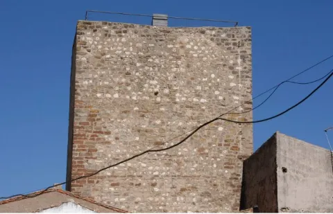
This tower, surrounded by buildings that cover its bottom, is built in irregular masonry.

It has a square floor of 10.50 m on its side, and in its interior two overlapping rooms are kept covered with half-canyon vaults. To access each of them, as well as the roof, there is a staircase embedded in the thickness of the walls covered with the same type of vault.

The access is now made through a building that houses the Adult Center of the town and which was previously the seat of the City Council.

The tower was declared in 1985 Good of Cultural Interest.

Breve descripción

Génave is located on a hillside, near the wide valley in which the foothills of Sierra Morena and Sierra de Segura converge, on the road to Levante, a natural step that goes back to the Guadalimar River, connecting the Guadalquivir with the Peninsular Levant.

The only rest of the missing Génave castle is the so-called Torreon de la Tercia built by Christians at the end of the 13th century. It has an impressive cubic structure and is located in the center of the population.

Ubicación
Latitud
38.430300
Longitud
-2.733180
Dirección
C/ Tercia, 17
Distrito
Municipio
Ubicación en el mapa
POINT (-2.73318 38.4303)
Tipos de punto de interés
Imágenes carrusel
imagen
Image
11.jpg
Imagen principal
Desactivado
Imágenes cabecera
imagen
Image
12.jpg
Imagen principal
Activado
Loading map
Preparing points of interest and routes...

Tower of the Muña

Submitted by brandcode_deweloper on
Id
4873576
Descripción
Breve descripción

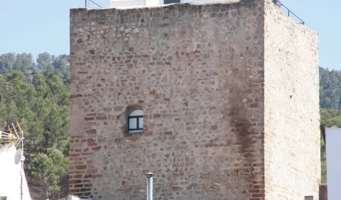
Located at the top of a small ameseado, it is defined as a fortification under medieval (XIV-XV century), several wall canvases and a magnificent square-floor tower, built in masonry and structured in two rooms covered with pointed vaults.

Telecomunicaciones
Sitio web
www.torredelcampo.es/index.php?option=com_content&task=view&id=134&Itemid=135
Teléfono de contacto
953 568 649
Ubicación
Nombre
Cortijo de la Muña
Código Postal
23640
Latitud
37.831870
Longitud
-3.942100
Distrito
Municipio
Ubicación en el mapa
POINT (-3.9421 37.83187)
Tipos de punto de interés
Imágenes carrusel
imagen
Image
t.%20de%20la%20mu%C3%B1a%202.jpg
Imagen principal
Desactivado
Imágenes cabecera
imagen
Image
unnamed.jpg
Imagen principal
Activado
Microsite al que pertenece
Loading map
Preparing points of interest and routes...

Tower of the Fuente Sorda

Submitted by brandcode_deweloper on
Id
6232212
Descripción
Breve descripción

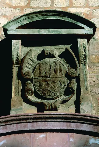
Old deaf, tower of the Almohad wall, which in the 15th century was lined with silery. The shield of the city that decorates the central front is from the 16th century. It is made of stone, on cut and timbrated hides. Above it is a curved fronton held by two mencapsules as a baking. The source below must be of later chronology.

Telecomunicaciones
Sitio web
www.turismodeandujar.com
Teléfono de contacto
953 504 959 / 953 508 200
Correo electrónico
turismodeandujar@andujar.es
Ubicación
Código Postal
23740
Latitud
38.036330
Longitud
-4.057340
Dirección
C/ Alcázar, 5D
Distrito
Municipio
Ubicación en el mapa
POINT (-4.05734 38.03633)
Tipos de punto de interés
Imágenes carrusel
imagen
Image
Mon488.jpg
Imagen principal
Desactivado
imagen
Image
Mon491.jpg
Imagen principal
Desactivado
Imágenes cabecera
imagen
Image
10325717824_6a02e248a0_z.jpg
Imagen principal
Activado
Horario
24 h.
Microsite al que pertenece
Loading map
Preparing points of interest and routes...

Tower of the Cabeza

Submitted by brandcode_deweloper on
Id
4658496
Descripción
Breve descripción

It is a cylindrical masonry turret with a monitoring and communication function. It was built in its current state by the Constable Miguel Lucas de Iranzo between 1462 and 1470, although it is likely to rise on the ruins of another previous one. In fact, this tower is part of a set of them that crossed the province in the North-South direction. At this one, there were two more towers today in meltdown.

Telecomunicaciones
Sitio web
www.ayto-pegalajar.org
Teléfono de contacto
953 360 003
Correo electrónico
pegalajar@promojaen.es
Ubicación
Código Postal
23110
Latitud
37.712700
Longitud
-3.641780
Distrito
Municipio
Ubicación en el mapa
POINT (-3.64178 37.7127)
Tipos de punto de interés
Imágenes carrusel
imagen
Image
torre-de-la-cabeza-2.jpg
Imagen principal
Desactivado
Imágenes cabecera
imagen
Image
torre-de-la-cabeza.jpg
Imagen principal
Activado
Microsite al que pertenece
Loading map
Preparing points of interest and routes...

Tower of Calígula

Submitted by brandcode_deweloper on
Id
4444587
Descripción
Descripción larga

This castle reached the second-rank level at the time of the Constable Iranzo, played an important role in taking sides, like Andújar, on the realistic side when in 1465 the king's enemies placed Jaén, and became famous when, six years later, the warden Diego Frías stopped and ordered a rival of the Constable, Don Fernando de Acuña, son of the Count of Buendía and no less than nephew of the Archbishop of Toledo, to be locked in his tower.
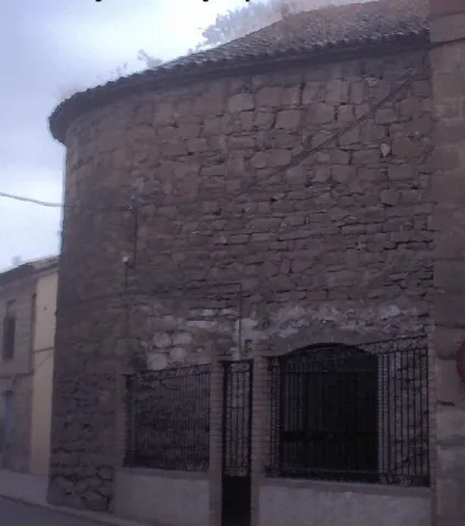
In fact, the castle, of small dimensions, was formed by a cylindrical tower with an almond parapet, as Martin drew it from Ximena Jurado. A stone from the upper tower seems to have an inscription, probably Arabic. There is no trace of this tower in the village. However, the head of the church presents a lock that could correspond to the remains of the castle. This solid semicircular wall of masonry could be reused from a large round tower, sister of those of the Rus and El Marmol castles, in the lands of Baeza.
This turret was declared Good of Cultural Interest in 1985.

Breve descripción

The so-called Torre de Caligula, a semicircular turret of the old castle, is preserved in the parish church.

Telecomunicaciones
Sitio web
www.cazalilla.es
Teléfono de contacto
953 537 131
Correo electrónico
castalla@cazalilla.es
Ubicación
Nombre
Torre de Calígula
Código Postal
23628
Latitud
37.984160
Longitud
-3.881890
Distrito
Municipio
Ubicación en el mapa
POINT (-3.88189 37.98416)
Tipos de punto de interés
Imágenes carrusel
imagen
Image
torre%20caligula.jpg
Imagen principal
Desactivado
Microsite al que pertenece
Loading map
Preparing points of interest and routes...

El Lagartijo Bullfighting Tavern and Museum

Submitted by brandcode_deweloper on
Id
2279189
Descripción
Descripción larga

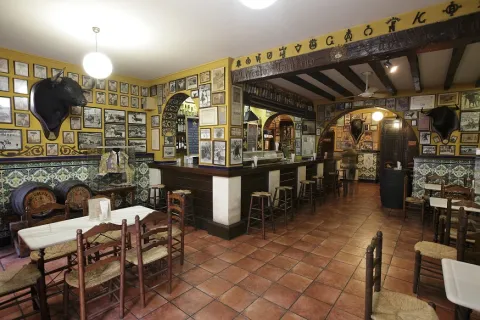
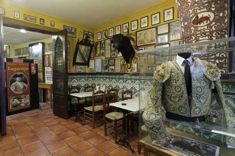
La Taberna Museo Restaurante Lagartijo, is a charming tavern dedicated to the tauromaquia and opened in March 1980. In it you can taste an excellent traditional cuisine in a tourist-cultural atmosphere decorated with billboards, photographs and taurine objects. In it, culture, tourism and gastronomy are hand in hand in a typical Andalusian environment.

The property consists of two areas. The Taberna, dedicated to tasting tapas and rations, can be found just after entering. In this atmosphere, you can enjoy a typical tavern kitchen, surrounded by many objects dedicated to the tauromaquia, such as photographs, posters and light suits.

In the interior is the Museum and Restaurant Room, which has a select menu of kitchen recipes, with typical and traditional dishes, where the meats, peas, and especially the confected and baked ones stand out.

Breve descripción

Monographic Museum of the Tauromacia linarense. It is named after Rafael Molina Lagartijo, a 19th-century Cordobe bullfighter. It is located in a building dating back to 1795. The property retains the original well and courtyard of the time. La Taberna has an exhibition of topics related to the Tairian world. The collection highlights a series of memories of Manolete's mortal catch in Linares bullring in August 1947.

Telecomunicaciones
Teléfono de contacto
697 924 993
Correo electrónico
juanpradamoreno77@gmail.com
Ubicación
Código Postal
23700
Latitud
38.094570
Longitud
-3.633440
Dirección
C/ Pérez Galdós, 27
Distrito
Municipio
Ubicación en el mapa
POINT (-3.63344 38.09457)
Imágenes carrusel
imagen
Image
_MG_5812.JPG
Imagen principal
Desactivado
imagen
Image
Museo%20Taurino%20Taberna%20Lagartijo.jpg
Imagen principal
Desactivado
Imágenes cabecera
imagen
Image
FOTOS_LINARES_074.jpg
Imagen principal
Activado
Horario
Open on tavern hours. Groups: arrange a visit.
Microsite al que pertenece
Loading map
Preparing points of interest and routes...