Saltar al contenido principal
icon-intereses-senior

Ruins of the Church of Santo Domingo de Silos

Submitted by brandcode_deweloper on
Id
913023
Descripción
Descripción larga

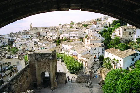
Se produce entonces el primer ensanche urbano de la población, que rompe longitudinalmente hacia el Suroeste con su antigua estructura amurallada. A lo largo de este eje se levantan el Pósito, sede del Ayuntamiento, y la iglesia de Ntra. Sra. de la Concepción, parroquia en pie hasta 1955, año en el que sobre ella se construyó la actual, perdiendo la población una de las dos parroquias históricas que tuvo en el pasado.

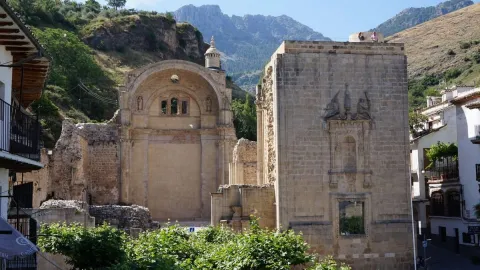
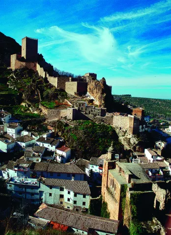
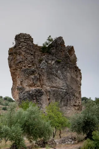
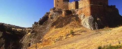
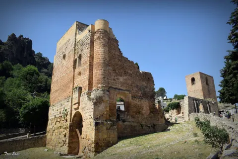
La otra parroquia se alza ruinosa dentro del recinto bajo de la fortaleza, configurando con ella y la espléndida naturaleza de la Sierra que la enmarca uno de los lugares más bellos de la provincia de Jaén. Este segundo templo, dedicado a Santo Domingo, es fruto del empeño de uno de los hombres más influyentes en la España de Carlos I, el famoso y prepotente secretario Francisco de los Cobos, que consiguió hacerse con el señorío del Adelantamiento en 1534, permaneciendo bajo la administración y control de sus descendientes, los Marqueses de Camarasa, hasta el año 1606, fecha en la que es recuperado por el Arzobispado de Toledo, propietario del amplio señorío desde el siglo XIII. Durante este período se construiría la que Rus Puerta califica como Iglesia Mayor.

Pero este monumental templo presentaba cierto abandono y ruina en el siglo XVIII. En el Catastro del Marqués de la Ensenada, de 1751, se relata así el estado en que se encontraba: “(...) lo que causa mayor dolor es ver la fábrica de la parroquial mayor de Santo Domingo de Silos por acabar, siendo esta bastante decente, y por los muchos hostigos y tejados con los que hoy se halla, por no estar perfeccionada padece el continuo detrimento de tan continuos gastos para poder conservarse (...)”.

La Guerra de la Independencia provocó su total ruina, pues fue incendiada, como Santa María, de Cazorla, el 4 de julio de 1810 por las tropas francesas. Posteriormente fue usado como Cementerio hasta mediados del siglo XX, quedando aún visibles los restos de esta ocupación. Paseando por las ruinas de Santo Domingo de Silos podemos acercarnos a uno de los episodios de la historia de estas sierras menos conocido. Poco sabemos sobre lo sucedido entre 1808 y 1812 en unas zonas muy alejadas de las ciudades ocupadas por los franceses. ¿Por qué incendiarían los franceses un edificio como la iglesia de Santo Domingo de Silos? Está claro que en una zona tan inaccesible, la presencia de los invasores franceses era bastante puntual.

Al mismo tiempo se ha constatado que aprovechando la geografía del terreno muchos guerrilleros se escondieron de los invasores en esta zona. Sabemos que ningún pueblo acogió de buena gana el gobierno de José I. Por el contrario, se organizaron juntas de defensas en las capitales de partido para hacer frente a los franceses.

En muchos pueblos se hicieron algunas obras de fortificación y quizá esta fue la última vez en la que se volvió a utilizar el castillo de Segura de la Sierra con fines militares. La respuesta francesa fue siempre la misma y consistió en el saqueo y destrucción de todos los elementos del poder en los pueblos. Normalmente se incendiaba el ayuntamiento con el objetivo de destruir toda la documentación del archivo y paralizar administrativamente el gobierno local. Otro objetivo eran las iglesias para destruir libros de bautismos y de defunciones, aunque la destrucción de las iglesias tenía también un componente psicológico pues se destruía un refugio para la población y al mismo tiempo el último recurso que los vecinos tenían en una situación de este tipo, el acudir a la iglesia a rezar para implorar la ayuda divina.

Por otra parte, según Vicente Salvatierra parece muy posible que la primitiva iglesia pudo estar en el mismo emplazamiento que la de Santo Domingo, al pie del castillo. En opinión de Luis Magaña, Rodrigo de Gibaja, maestro cantero ligado al Arzobispado de Toledo y responsable de las fábricas de la Colegial de Baeza y de la iglesia de Puebla de Don Fabrique, en tierras granadinas, tuvo a su cargo las obras de las iglesias de Santa María, en Quesada, y de Santo Domingo de La Iruela. También se ha documentado la participación del cantero cazorleño Gabriel de Tauste. No hay constancia documental de la intervención de Andrés de Vandelvira, pero es muy probable que diera las trazas a instancias de Francisco de los Cobos en torno al año 1534, encargándose de la ejecución Gibaja y Tauste, entre otros maestros canteros.

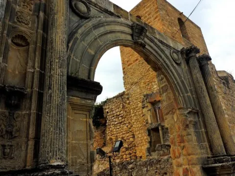
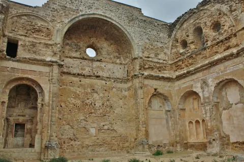
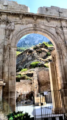
Chueca Goitia, comparando los restos de las iglesias de Santa María, de Cazorla, con la de La Iruela, estima que esta “Es de arte más pobre y tosco, como realizado por maestros locales siguiendo, seguramente, inspiraciones vandelvirescas”. En cualquier caso, ambas fábricas se están levantando paralelamente, dilatándose más en el tiempo la de Cazorla. De aquel monumental templo solo restan parte de los muros perimetrales, las portadas de acceso, la escalera de caracol para acceder a la torre de campanas, las capillas mayor y colaterales y una monumental portada en el lado del Evangelio con un relieve en el que se representa el milagro de la imposición de la casulla a San Ildefonso. La planta era de tres naves y la cabecera plana y destacada.

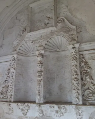
Determinados rasgos decorativos, la traza de las portadas de acceso y, sobre todo, la composición del alzado de los muros del crucero o primer gran tramo, articulado por un gran arco de medio punto en la parte alta y dos capillas en la baja separadas entre sí por una pilastra con una hornacina avenerada, son claramente vandelvirianos. En la catedral de Jaén o en San Isidoro de Úbeda, Andrés de Vandelvira incorporó monumentalmente esta composición, ejecutada con mayor sencillez en el caso de La Iruela.

Breve descripción

Monument included in the Historical-Artistic Set. Uncooked 01 / 04 / 85. The 16th century was a time of great economic development for the people of Alto Guadalquivir, which led to important urban and architectural interventions. In the villa of La Iruela, as in Cazorla, head of the advance, certain works were planned and carried out throughout that centuria that enhanced and modified its powerful medieval image, determined by its imposing strength.

Telecomunicaciones
Sitio web
www.lairuela.es/el-municipio/patrimonio-historico.html
Teléfono de contacto
953 720 712
Ubicación
Código Postal
23476
Latitud
37.920330
Longitud
-2.990450
Dirección
Cuesta Santo Domingo, s/n
Municipio
Ubicación en el mapa
POINT (-2.99045 37.92033)
Tipos de punto de interés
Imágenes carrusel
imagen
Image
Iglesia%20Santo%20Domingo%20de%20Silos%202%20%282%29.jpg
Imagen principal
Desactivado
imagen
Image
Iglesia Santo Domingo de Silos
Imagen principal
Desactivado
imagen
Image
Iglesia Santo Domingo de Silos
Imagen principal
Desactivado
imagen
Image
Iglesia Santo Domingo de Silos
Imagen principal
Desactivado
Imágenes cabecera
imagen
Image
Iglesia%20Santo%20Domingo%20de%20Silos-ok.jpg
Imagen principal
Activado
Modelo 3D
Loading map
Preparing points of interest and routes...

Ruins of the Church of Santa María

Submitted by brandcode_deweloper on
Id
912868
Descripción
Descripción larga

It cost him the effort, but in the end, and despite Toledo's resistance, in 1534 he obtained the title, but his descendants could not keep it, as he was reintegrated to his former owners after a sound lawsuit in 1634. Cobos would soon complete his dream of becoming a great lord with the purchase of the jiennese villas of Sabiote, Canena, Torres and Velliza (Valladolid); his wife, Maria de Mendoza, rounded this great state with the acquisition of Jimena, whose purchase process was already initiated by her husband.

In all these enclaves, more in his hometown and in that of his wife (Ubeda and Valladolid, respectively), Francisco de los Cobos planned great building programs of marked artistic and propaganda significance. This double intention is perfectly reflected in the project of the church of Santa Maria, which was in all probability carried out by his trusted man, the deán Ortega, who in turn would entrust the works and direction in Andrés de Vandelvira, the master of the house's quarry, especially from the works in El Salvador de Ubeda.

The new church would rise on the way of the River Cerezuelo, but for this it was necessary to abovednot only the space dedicated to the church, but also the rest of the same located in front of it. Thus the temple closes and presides over the square, which also had the City Hall building (now hidden) and a beautiful pilar-abrevadero, which Chueca Goitia attributes to the hand of Andrés de Vandelvira, although the date 1606 carved in its large central billboard indicates otherwise. We must not forget that the advance to Toledo was returned the traces of Cobos and his descendants, the Marquis of Camarasa, had to be erased in all those goods where they were present.

This temple, located in a unique natural setting, suffered a catastrophic raid at the end of the 17th century, taking with it almost all its movable property. The fire by the Napoleonic troops in the War of Independence left the factory ruined, remaining standing the header, part of the perimeter walls, one of the two foot towers, with various remains, and a cover on the side of the Epistle. The destruction and the limited documentation found so far about its constructive process makes it difficult to set the stages and the teachers responsible for its factory. In any case, the difference in style between the header and the rest seems clear. Andrés de Vandelvira is present in the head and chapel of San Isicio, leaving out of his language the part of the feet and the side cover, which, according to José María Crespo, was able to run to a large extent by Alonso Barba.

The canyon vault of the presbyterium, the serlian vanity of the tester, the angular pillars that would form the cruise, with half Corinthian columns and fantastic heads, and the snail staircase topped into a cylindrical body are certainly elements used by Vandelvira around the 1540's. The vault of the chapel of San Isicio, for its part, is closely related to the one located under the tower-bell tower of El Salvador de Ubeda. The plant, made up of a ship and cruise to cover (at least in the initial project) with boned vaults, would approach the type of La Guardia, a conventual church in which Vandelvira also left the best of its art in the major chapel and cruise.

The ruins of Santa María, currently in the process of restoration in accordance with the project of the architect Mr Pedro Salmerón, still show today the proud architecture with which it was conceived by one of the most influential men of the 16th century in Spain, Don Francisco de los Cobos, who was also lucky to have at his service Andrés de Vandelvira, one of the most outstanding singers of the Spanish Renaissance.

Breve descripción

Monument of the Historical-Artistic Set. Declared 13 / 07 / 1972. The advance of Cazorla remained under the jurisdiction of the Archbishop of Toledo from the 13th to the 16th century. The large territory provided important benefits and the position of Advantado gave prestige to the one who held them. Both reasons must have weighed enough for Don Francisco de los Cobos, the prepowerful secretary of the Emperor Charles V, to come up with all the means at his disposal to obtain the rule and charge of such wide-ranging dominion for himself and his descendants.

Telecomunicaciones
Sitio web
www.cazorla.es/turismo/ruinas-de-santa-maria/
Teléfono de contacto
953 710 102
Ubicación
Código Postal
23470
Latitud
37.908550
Longitud
-2.999930
Dirección
C/ Hoz, 6
Municipio
Ubicación en el mapa
POINT (-2.99993 37.90855)
Tipos de punto de interés
Imágenes carrusel
imagen
Image
2%20%282%29.jpg
Imagen principal
Desactivado
imagen
Image
3%20%282%29.jpg
Imagen principal
Desactivado
imagen
Image
Mon165.jpg
Imagen principal
Desactivado
imagen
Image
Mon244.jpg
Imagen principal
Desactivado
Imágenes cabecera
imagen
Image
iglesia-santa-maria-de-cazorla-830x623.jpg
Imagen principal
Activado
Microsite al que pertenece
Loading map
Preparing points of interest and routes...

Castillejo Ruins

Submitted by brandcode_deweloper on
Id
4405889
Descripción
Breve descripción

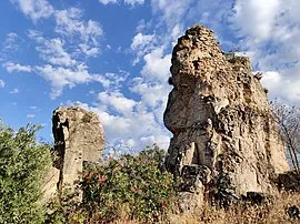
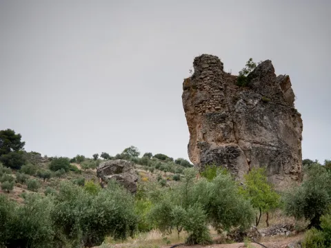
The Castlejo de Cárchel is of Muslim origin and in the surrounding areas there have been many fragments of Spanish-Muslim ceramic glazed and unglazed, and among all the archaeological remains found in the area, stands the head of a clay figure, found in 1997 by the child José M. Ruiz. It is possibly a survival of Iberian exvotes in Muslim times.

Telecomunicaciones
Sitio web
www.carcheles.es/el-municipio/patrimonio-historico.html
Teléfono de contacto
953 302 291 / 953 302 003
Correo electrónico
Webmaster@carcheles.es
Ubicación
Código Postal
23192
Latitud
37.634510
Longitud
-3.640960
Distrito
Municipio
Ubicación en el mapa
POINT (-3.64096 37.63451)
Tipos de punto de interés
Imágenes carrusel
imagen
Image
270px-Castillo_de_C%C3%A1rchel_24J_14.jpg
Imagen principal
Desactivado
imagen
Image
castillejo.jpg
Imagen principal
Desactivado
Imágenes cabecera
imagen
Image
castillejlo.jpg
Imagen principal
Activado
Microsite al que pertenece
Loading map
Preparing points of interest and routes...

Pillories and Jurisdiction Columns

Submitted by brandcode_deweloper on
Id
13581021
Descripción
Descripción larga

The title, granted by Philip II, allowed him to have full jurisdiction, made symbolized by the presence of rolls and picotas. While the former reflect the new administrative and legal status, picotta is the place where the prisoners were punished.

The rolls marked the jurisdictional limit and were commemorative monuments of the award of the title of Villa. The picotas were stone columns, more or less ornamented, where punishments and public scarings were applied. At present, the three conserved in the municipality are crouched and topped by crosses.

Breve descripción

Located in the historical set of Mengibar, the rolls and the picotas are evidence of their formation as a people with its own jurisdiction. The origin of the rolls is on the date of 1574, when the city of Jaén was emancipated and the title of Villa was acquired.

Telecomunicaciones
Sitio web
https://mengibarturismo.com/
Teléfono de contacto
677 222 285
Correo electrónico
turismo@aytomengibar.com
Ubicación
Código Postal
23620
Latitud
37.968050
Longitud
-3.808780
Dirección
C/ Santos Galindo, 1
Distrito
Municipio
Ubicación en el mapa
POINT (-3.80878 37.96805)
Imágenes cabecera
imagen
Image
cruz-del-rollo-jpg
Imagen principal
Activado
Loading map
Preparing points of interest and routes...

Jandulilla River

Submitted by brandcode_deweloper on
Id
8114425
Descripción
Descripción larga

Former Xandulilla. Influent on the left bank of the Guadalquivir River. Collect the waters from the northeastern face of the Sierra Magina massif. The associated valley is given the same name. Unwind in the Guadalquivir River, in the area of Ubeda the old one. The Arab geographer Al-Zuhrí, mentions him by the name of Wadi-l-Ard, or Rio de la Tierra.

He named the former population of Xandulilla, of which there are many archaeological remains of great importance spread throughout the area. In the 17th century it was known as "Villa de Felix" with its own jurisdiction. It is a river with a normally low and variable flow rate and without regulatory structures. It is born under the Port of the Gallardos, also known in its first stretch as Rio Huelma, its main tributaries, both on the left are the Gualijar River and the Garganton River that are born in the main massif of Magina and after a very short journey they result in the Jandulilla, apart from numerous intermittent rags and ramps.

Breve descripción

The Jandulilla River is a short river in the south of Spain, tributary to the left bank of the Guadalquivir River that runs through the province of Jaén and collects the waters of the northeastern face of the Sierra Magina massif. The associated valley is given the same name. Unwind in the Guadalquivir River, in the area of Ubeda la Vieja.

Telecomunicaciones
Teléfono de contacto
953 390 210
Ubicación
Código Postal
23560
Latitud
37.650300
Longitud
-3.459550
Distrito
Municipio
Ubicación en el mapa
POINT (-3.45955 37.6503)
Imágenes carrusel
imagen
Image
r%C3%ADo%20Jandulilla%202%20%281%29.jpg
Imagen principal
Desactivado
Imágenes cabecera
imagen
Image
r%C3%ADo%20Jandulilla.jpg
Imagen principal
Activado
Microsite al que pertenece
Loading map
Preparing points of interest and routes...

Remains of the Ancient ermita de San Ildefonso

Submitted by brandcode_deweloper on
Id
4747699
Descripción
Breve descripción

With an external appearance similar to that of other rural cortijos, it now retains remains of what was an ancient hermitage, called the hermitage of San Ildefonso.

As in most rural areas of Jaén, these ancient cortijos of the 18th and 19th centuries are owned by large families and have over the years served as a residence for farm workers and olive collectors.

Ubicación
Nombre
Cortijo de San Ildefonso
Latitud
38.342440
Longitud
-3.103540
Distrito
Municipio
Ubicación en el mapa
POINT (-3.10354 38.34244)
Tipos de punto de interés
Imágenes carrusel
imagen
Image
ermita%20de%20San%20Ildefonso%20en%20montizon2.jpg
Imagen principal
Desactivado
imagen
Image
ermita%20de%20San%20Ildefonso%20en%20montizon.jpg
Imagen principal
Desactivado
Imágenes cabecera
imagen
Image
18.jpg
Imagen principal
Activado
Microsite al que pertenece
Loading map
Preparing points of interest and routes...

Almazaras Oleo Turísticas Regional Network

Submitted by brandcode_deweloper on
Id
777503
Descripción
Descripción larga

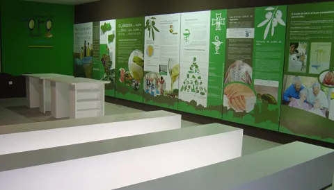
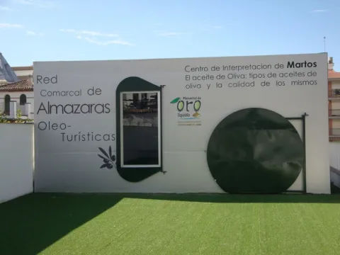
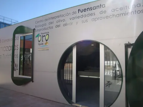
The Network is made up of nine Interpretation Centres in Almazaras Oileteras in the Sierra Sur de Jaén for the promotion of olive cultivation. Each Centre has a different theme on various aspects related to olive oil, such as olive oil production systems and evolution throughout history, olive oil qualities and uses, olive oil cultivation systems, olive oil analysis and olive oil marketing system, olive biology, olive varieties, olive by-products, olive oil and its uses, olive heritage, traditions, olive oil types and olive oil quality and history.

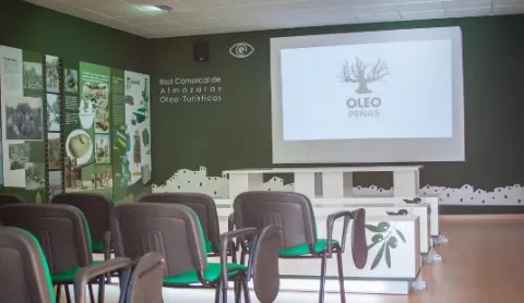
The Interpreting Centres have a space of about 85 square meters arranged for interpretation, teaching and tourism use, equipped with latest technology such as touch screen, and multitactile, to enjoy games and multimedia application, interpretative panels or 3D projection canyon.

It is intended to take advantage of olive oil and olive oil, very abundant resources in the region, such as tourism resources, to value the idle resources (facilities, machinery, documentation etc.) of the almazaras, for as long as they are not in the full process of collecting and producing oil, to promote knowledge about the different uses of the olive and olive oil, to promote knowledge of the culture, traditions and related customs, and to diversify the comarcal tourist offer by taking advantage of the resources available such as the almazaras, olive and olive oil.

Oilticulture will be promoted and disseminated in a didactic, dynamic and attractive way for a wide range of audiences, from thematic staff, professionals from the olive sector, people from school or training ages, to tourists or local audiences. Visitors will be able to connect intellectually and emotionally, through the Network's interpretative script, to the fascinating world of cultural and ethnographic heritage that olive oil and olive oil form around them.

The Comarcal Network of Almazaras Ole- touristic can be visited through the tourist route that connects the nine Interpretation Centres with the main tourist attractions of the municipalities of the Sierra Sur de Jaén: Alcalá la Real, Alcaudete, Castillo de Locubín, Friiles, Fuensana, Jamilena, Martos, Torredelcampo, Valdepeñas de Jaén and Los Villares can be traveled under the enigmas of liquid gold and the sea of olive trees that shape the orography of this territory. On the other hand, the visit to the Centres will be completed with an internal route through the facilities of the milling plants that make up the Network, adapted to the resources, and particular characteristics of each of them and of the visiting public.

The project is funded by the European Agricultural Fund for Rural Development (EAFRD) at 40% in the framework of the Global Action Plan, of the Council for Agriculture, Fisheries and the Environment, and by 60% from the Sustainable Tourism Initiative - Lands of Romance and Legend, of the Council for Tourism and Trade.

Breve descripción

TheComarcal Network of Almazaras Ole- touristis a project promoted by the Association for Rural Development of the South Sierra de Jaén (ADSUR). It is a commitment to economic diversification by taking advantage of the tourist potential that the mills offer as a factor of sustainable development and as an element of territorial identity.

Telecomunicaciones
Sitio web
http://www.redalmazarassierrasurjaen.es/
Correo electrónico
adsur@adsur.es
Ubicación
Latitud
37.770588
Longitud
-3.899727
Distrito
Municipio
Ubicación en el mapa
POINT (-3.899727 37.770588)
Tipos de punto de interés
Imágenes carrusel
imagen
Image
torredelcampoDSC04828.jpg
Imagen principal
Desactivado
imagen
Image
9962afd4d7801adbe96e49a2f2eab69f_8_XL.jpg
Imagen principal
Desactivado
imagen
Image
9962afd4d7801adbe96e49a2f2eab69f_6_XL.jpg
Imagen principal
Desactivado
imagen
Image
museo3.jpg
Imagen principal
Desactivado
Imágenes cabecera
imagen
Image
thb_g_1.jpeg
Imagen principal
Activado
Microsite al que pertenece
Loading map
Preparing points of interest and routes...

Bridge Viejo sobre el Cañamares

Submitted by brandcode_deweloper on
Id
8088389
Descripción
Descripción larga

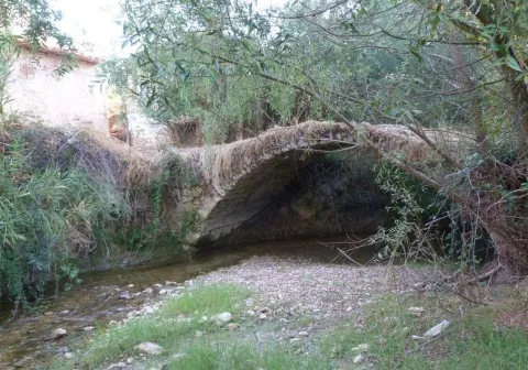
It is a one-eye bridge made up of a half-point arch, quite robust and with pillars and paraments that make a curve to the Cañamares River. The shillery is well worked and is quite regular in size.

Breve descripción

It has traditionally been given as a certain chronology for this construction the first centuries of the Christian era coinciding with the Roman presence on our lands, and the proximity of the Almansas, where there was an important settlement at the time.

Telecomunicaciones
Sitio web
http://www.chilluevar.es/
Teléfono de contacto
953 717 300 / 953 717 225
Ubicación
Código Postal
23477
Latitud
38.001450
Longitud
-3.030960
Dirección
Av. Andalucía, 6
Municipio
Ubicación en el mapa
POINT (-3.03096 38.00145)
Tipos de punto de interés
Imágenes cabecera
imagen
Image
Puente%20Viejo%20sobre%20el%20Ca%C3%B1amares2.jpg
Imagen principal
Activado
Loading map
Preparing points of interest and routes...

Bridge Romano

Submitted by brandcode_deweloper on
Id
4706810
Descripción
Breve descripción

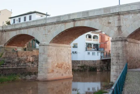
In Puente de Génave we find the Old Bridge or Roman Bridge, on the river Guadalimar, of stone, reduced arch and one eye, in which the masonry is alternated with the silery. They highlight the environment and configuration of the village, being a forming element of the settlement of the village around the river and an essential step to know the riverside and its implementation in the territory.

Telecomunicaciones
Sitio web
www.puentedegenave.es/el-municipio/patrimonio-historico.html
Correo electrónico
pgenave@puentedegenave.es
Ubicación
Código Postal
23350
Latitud
38.355380
Longitud
-2.803190
Distrito
Municipio
Ubicación en el mapa
POINT (-2.80319 38.35538)
Tipos de punto de interés
Imágenes carrusel
imagen
Image
Mon501.jpg
Imagen principal
Desactivado
Imágenes cabecera
imagen
Image
puente-romano.jpg
Imagen principal
Activado
Loading map
Preparing points of interest and routes...

Bridge Renaissance

Submitted by brandcode_deweloper on
Id
4276894
Descripción
Breve descripción

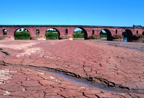
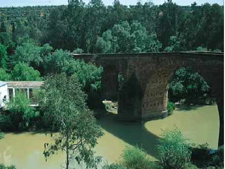
It is one of the most important historical and artistic milestones of Marmolejo, along with the Parish Church of Our Lady of Peace and the spa of medicinal waters that spring up next to the same channel of the Guadalquivir River. Precisely bridge and spa linked their existence since the discovery of the therapeutic utility of the waters of these springs at the end of the 18th century (whose first news appears in theTreaty on the main medicinal sources of AndalusiaJohn of God Help, 1794) and the first facilities began to be built. But before thousands of swimmers turned this quiet place into bustling, there was already an architectural element in the environment: the San Bartolomé Bridge, possibly called for opening the day of the onomastics of this Holy, on August 24.

Telecomunicaciones
Sitio web
www.villademarmolejo.es/urbanismo-y-monumentos/monumentos/puente-de-san-bartolome/
Ubicación
Código Postal
23770
Latitud
38.054040
Longitud
-4.193410
Distrito
Municipio
Ubicación en el mapa
POINT (-4.19341 38.05404)
Tipos de punto de interés
Imágenes carrusel
imagen
Image
puente%20renacentista-1.png
Imagen principal
Desactivado
Imágenes cabecera
imagen
Image
puente%20renacentista_marmolejo-1.png
Imagen principal
Activado
Microsite al que pertenece
Loading map
Preparing points of interest and routes...