Saltar al contenido principal
icon-intereses-senior

Parque de las Eras

Submitted by brandcode_deweloper on
Id
8113062
Descripción
Breve descripción
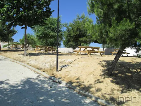
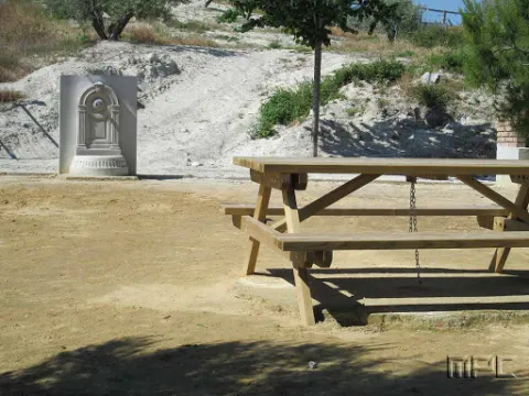
Located in the upper part of the town. It has wooden benches, a fountain and large shaded areas for relaxing and enjoying a wonderful day outdoors.
Telecomunicaciones
Teléfono de contacto
953 37 60 11 / 953 37 61 17
Correo electrónico
ayuntamiento@fuertedelrey.es
Ubicación
Código Postal
23180
Latitud
37.87327
Longitud
-3.88616
Dirección
C/ las Eras.  Fuerte del Rey
Distrito
Municipio
Ubicación en el mapa
POINT (-3.88616 37.87327)
Imágenes carrusel
imagen
Image
Parque%20de%20las%20Eras%2C2.jpg
Imagen principal
Desactivado
Imágenes cabecera
imagen
Image
Parque%20de%20las%20Eras%2C.jpg
Imagen principal
Activado
Loading map
Preparing points of interest and routes...

Iglesia Parroquial de la Natividad de Nuestra Señora

Submitted by brandcode_deweloper on
Id
4517663
Descripción
Descripción larga
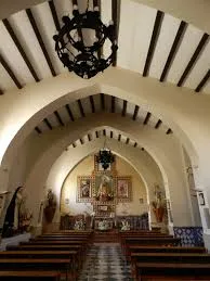
This is the most notable building in Fuerte del Rey. Its construction was completed in 1796. It has a single floor with whitewashed pointed arches. The choir is set on a raised level facing the altar. The façade is built in ashlar stone, reinforced with strong buttresses. The most interesting feature is the bell gable at the foot of the church. It is arranged in three sections separated by moulding, with a window in the second section framed by ashlar surrounds. The final section, the bell gable proper, is not built in stone, and features two stylised bell openings covered with semicircular arches. It ends in a pediment shaped like a truncated pyramid, decorated at its base with graceful scrollwork.
Telecomunicaciones
Sitio web
www.fuertedelrey.es/el-municipio/patrimonio-historico.html
Teléfono de contacto
953 37 60 11
Ubicación
Código Postal
23180
Latitud
37.87433
Longitud
-3.88463
Dirección
Plaza de la Constitución, 3, Fuerte del Rey
Distrito
Municipio
Ubicación en el mapa
POINT (-3.88463 37.87433)
Tipos de punto de interés
Imágenes carrusel
imagen
Image
Iglesia%20Parroquial%20de%20la%20Natividad%203.jpg
Imagen principal
Desactivado
Imágenes cabecera
imagen
Image
iglfuerte.jpg
Imagen principal
Activado
Loading map
Preparing points of interest and routes...
Vieja fábrica de harina

Submitted by brandcode_deweloper on
Id
4517777
Descripción
Descripción larga
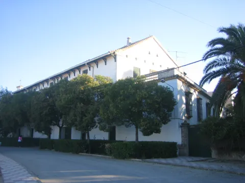
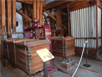
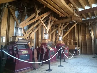
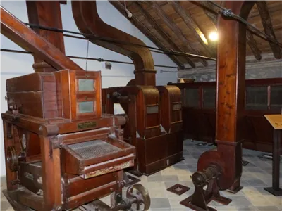
Dating from the first half of the 20th century, it is one of the oldest flour mills in the province. It was a key facility for the municipality's economy during the post-war years. In 2004, it was listed in the General Catalogue of Andalusian Historical Heritage as a site of ethnological interest.
Telecomunicaciones
Sitio web
www.fuertedelrey.es
Teléfono de contacto
953 37 60 11 - 953 37 61 17
Ubicación
Código Postal
23180
Latitud
37.87464
Longitud
-3.88427
Dirección
Av. de Jaén, 68
Distrito
Municipio
Ubicación en el mapa
POINT (-3.88427 37.87464)
Imágenes carrusel
imagen
Image
thb_g_P1300402.jpg
Imagen principal
Desactivado
imagen
Image
Fabrica%20Harinas%20Nuestra%20Se%C3%B1ora%20del%20Rosario%20Fuerte%20del%20Rey%20%28Ja%C3%A9n%29%20fachada.jpg
Imagen principal
Desactivado
imagen
Image
thb_g_IMG_20190827_103314228.jpg
Imagen principal
Desactivado
imagen
Image
thb_g_P1300413.jpg
Imagen principal
Desactivado
imagen
Image
thb_g_P1300420.jpg
Imagen principal
Desactivado
Imágenes cabecera
imagen
Image
thb_g_P1300371.jpg
Imagen principal
Activado
Loading map
Preparing points of interest and routes...
Iglesia Santa Catalina

Submitted by brandcode_deweloper on
Id
4523752
Descripción
Descripción larga
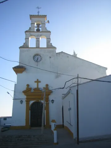
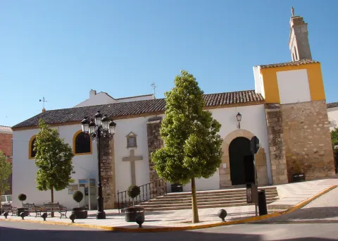
The small parish church, built on the site of the old Oratory of Santa Catalina and reached by a gentle flight of steps, was inaugurated in 1954. Its narrow, tall whitewashed façade features a simple lintelled doorway framing a semicircular-arched entrance with a broken pediment holding a cross, topped by a bell gable with three bell openings arranged in the shape of a truncated pyramid.
Telecomunicaciones
Sitio web
www.applicajaen.com/?load=applica&guia&punto=670_iglesia-santa-catalina-espeluy
Teléfono de contacto
953 537 161
Ubicación
Código Postal
23628
Latitud
38.03272
Longitud
-3.86193
Dirección
Plaza Constitucion, 2A
Distrito
Municipio
Ubicación en el mapa
POINT (-3.86193 38.03272)
Tipos de punto de interés
Imágenes carrusel
imagen
Image
Iglesia%20Santa%20Catalina.JPG
Imagen principal
Desactivado
imagen
Image
Iglesia%20Santa%20Catalina2.JPG
Imagen principal
Desactivado
Imágenes cabecera
imagen
Image
santacatalina.jpg
Imagen principal
Activado
Loading map
Preparing points of interest and routes...
Iglesia Inmaculada Concepción

Submitted by brandcode_deweloper on
Id
4524144
Descripción
Descripción larga
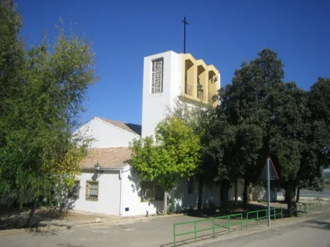
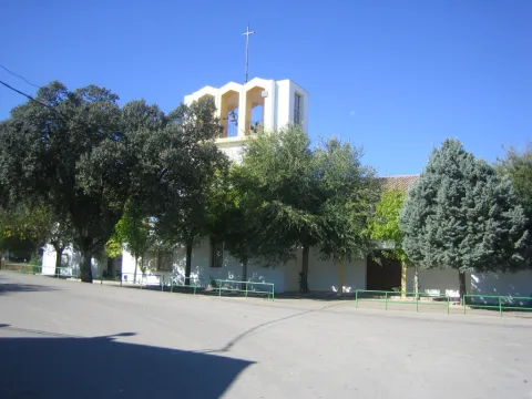
Located in the Barriada Santa Ana, it was built in 1968. It houses images of San Miguel, San José and the Immaculate Conception.
Telecomunicaciones
Sitio web
www.espeluy.es/el-municipio/patrimonio-historico.html
Teléfono de contacto
953 537 161
Ubicación
Código Postal
23628
Latitud
38.03274
Longitud
-3.86195
Dirección
C/ Constitución, 1
Distrito
Municipio
Ubicación en el mapa
POINT (-3.86195 38.03274)
Tipos de punto de interés
Imágenes carrusel
imagen
Image
Iglesia%20Inmaculada%20Concepci%C3%B3n_Espeluy.jpg
Imagen principal
Desactivado
Imágenes cabecera
imagen
Image
inmaculadac.jpg
Imagen principal
Activado
Loading map
Preparing points of interest and routes...

Castillo de Espelúy

Submitted by brandcode_deweloper on
Id
4522991
Descripción
Descripción larga
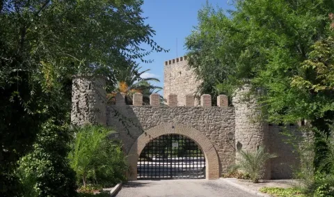
The castle played an important role at one of the key strategic points controlling the Guadalquivir and Guadalimar rivers. Its origins probably date back to the Caliphate period, although it was destroyed by Ferdinand III in the first third of the 13th century. Once under Christian rule, the castle was rebuilt between the end of that century and the beginning of the next. Its most authentic feature is its magnificent keep, square in plan, which houses two superimposed rooms inside, covered by barrel vaults. It was declared a Site of Cultural Interest in 1985.
Telecomunicaciones
Sitio web
www.espeluy.es/el-municipio/patrimonio-historico.html
Teléfono de contacto
953 537 161
Correo electrónico
espeluy@promojaen.es
Ubicación
Código Postal
23628
Latitud
38.03362
Longitud
-3.86188
Dirección
23628 Espelúy
Distrito
Municipio
Ubicación en el mapa
POINT (-3.86188 38.03362)
Tipos de punto de interés
Imágenes carrusel
imagen
Image
Castillo%20de%20Espel%C3%BAy%202.jpg
Imagen principal
Desactivado
Imágenes cabecera
imagen
Image
castillo_de_espeluy_03_cde.jpg
Imagen principal
Activado
Loading map
Preparing points of interest and routes...
Hacienda del Pilar

Submitted by brandcode_deweloper on
Id
4523531
Descripción
Descripción larga
The Hacienda del Pilar, which takes its name from the image of the Virgin under this title placed on its façade, was built from 1904 onwards as a working farm estate and later remodelled into a private noble residence for receiving dignitaries. Owned by José del Prado y Palacio, former Minister of Public Instruction and Marquis of Rincón de San Ildefonso, it hosted Alfonso XIII during his visit to Jaén in 1916. It was approached through carefully tended English-style gardens with a monumental fountain at their centre and another, in Seville style, to one side. The façade, with two columned galleries — one of them glazed — featured wooden columns and finely worked ironwork, all in a markedly eclectic style. Inside, this eclecticism continued with an element of special interest: a Renaissance courtyard belonging to a palace in Andújar, demolished in the second decade of the century and acquired and transferred to El Pilar by its owner. Nine slender columns, eight arches with cushioned coffering, spandrels, medallions and noble coats of arms were removed from their original building and brought here, along with a fountain with a wide basin, four shells and two bowls, decorated with caryatids. The building also had spacious rooms, a small theatre and a hall with fine furnishings.
Breve descripción
Closed and very difficult to visit. Built from 1904 onwards as a working farm estate and later remodelled into a private noble residence for receiving dignitaries. Its owner was the Marquis of Rincón de San Ildefonso, Don José del Prado y Palacio, Minister of Public Instruction under King Alfonso XIII and one of the great landowners of the area. It is approached through English-style gardens with fountains. It incorporates a Renaissance courtyard taken from a demolished palace in Andújar — that of the Marquis of Puente de la Virgen, formerly located in Andújar's Plaza de España, today Plaza de la Constitución. The building included a small theatre and a hall furnished with walnut furniture.
Telecomunicaciones
Sitio web
www.espeluy.es/el-municipio/patrimonio-historico.html
Correo electrónico
espeluy@promojaen.es
Ubicación
Código Postal
23628
Latitud
38.03192
Longitud
-3.86257
Distrito
Municipio
Ubicación en el mapa
POINT (-3.86257 38.03192)
Imágenes carrusel
imagen
Image
hacienda%20del%20pilar.jpg
Imagen principal
Desactivado
Imágenes cabecera
imagen
Image
hacienda_El_pilar%20%281%29.jpg
Imagen principal
Activado
Loading map
Preparing points of interest and routes...
Restaurante Tropezón

Submitted by brandcode_deweloper on
Id
6771659
Redes sociales
Facebook
https://www.facebook.com/Restaurante-Tropezon-171697546354700/?ref=page_internal
Descripción
Descripción larga
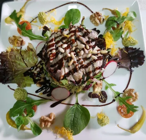
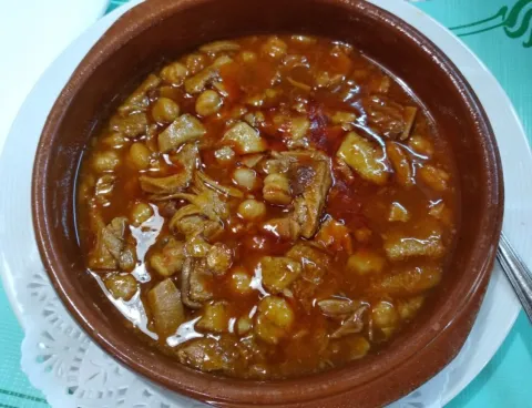
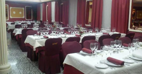
Restaurante Tropezón is a traditional-cuisine restaurant that, alongside its outstanding quality, offers very good value for money. Excellent raw ingredients guarantee the quality of Restaurante Tropezón, where you'll find good meat, fish and seafood. It also offers a home-delivery menu, featuring starters, fish, meat and roasts to enjoy. Its spacious premises also make it the perfect place for celebrations and events.
Información de contacto
Sitio web
https://www.jaenparaisointerior.es/es/restaurante-tropezon-villacarrillo
Teléfono de contacto
953377032
Ubicación
Código Postal
37.93926
Latitud
-3.73042
Longitud
23630
Dirección
Plaza de la Constitucion, 8
Municipio
Ubicación en el mapa
POINT (-3.730355 37.939302)
Tipo de restaurante
Imágenes
imagen
Image
15288546_550446815146436_8582017086427663448_o.jpg
Imagen principal
Activado
imagen
Image
120751785_1476720375852404_1835087933561251692_o%20%281%29.jpg
Imagen principal
Desactivado
imagen
Image
121200881_1481906548667120_6480809203470358403_n.jpg
Imagen principal
Desactivado
Tipo de cocina
Microsite al que pertenece
Loading map
Preparing points of interest and routes...
Restaurante-Asador El Recreo

Submitted by brandcode_deweloper on
Id
2182115
Descripción
Descripción larga
This blend of traditional, artisan Andalusian cuisine with touches of creative, avant-garde cooking creates the perfect mix to delight and surprise even the most demanding, gourmet palates. Thanks to the outstanding quality of the ingredients, their skill at the stove, and the warm, family-style treatment of guests, they ensure that when you sit down at their table, you'll remember the excellence of good cooking and the quality of their dishes with gratitude. Restaurante Asador "El Recreo" was founded by Miguel Ramírez Navarro in 1934. His sons, Pedro and Manolo Ramírez, carried on the hospitality business, and today it is the grandchildren and great-grandchildren who continue this saga of restaurateurs. Today, this third and fourth generation have given the establishment the dynamic, innovative touch that characterises it today.
Información de contacto
Sitio web
www.restauranteasadorelrecreo.es
Teléfono de contacto
953377072
Correo electrónico
contacto@restauranteasadorelrecreo.es
Ubicación
Código Postal
23630
Latitud
37.94008
Longitud
-3.72933
Dirección
Plaza de la Constitución, 53
Municipio
Ubicación en el mapa
POINT (-3.72933 37.94008)
Tipo de restaurante
Imágenes
imagen
Image
6.jpg
Imagen principal
Activado
imagen
Image
7.jpg
Imagen principal
Desactivado
imagen
Image
7%20%281%29.jpg
Imagen principal
Desactivado
imagen
Image
6%20%281%29.jpg
Imagen principal
Desactivado
Capacidad
80
Número de tenedores
1
Tipo de cocina
Horario
• Monday: 11: 00-1: 30 • Tuesday: 11: 00-1: 30 • Wednesday: 11: 00-1: 30 • Thursday: 11: 00-1: 30 • Friday: 11: 00-1: 30 • Saturday: 11: 00-2: 30 • Sunday: 11: 00-2: 30
Microsite al que pertenece
Loading map
Preparing points of interest and routes...
El Añadío

Submitted by brandcode_deweloper on
6870559
Facebook
https://www.facebook.com/Amigos-de-El-A%C3%B1adio-161845803872243/
Twitter
https://twitter.com/elanadio_sc?lang=es
Instagram
https://www.instagram.com/elanadio/?hl=es
Descripción larga

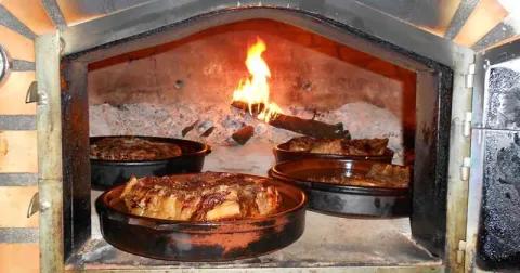
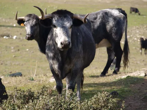
A dehesa of more than 350 Ha. where, since the mid-19th century, successive generations of the same family, have dedicated themselves to their great passion, the breeding of the bravo bull.

Teléfono
953 066 031
Sitio web
https://elanadio.es/
Correo electrónico
gerencia@elanadio.es
Latitud
38.250240
Longitud
-2.86921
Dirección
Dehesa El Añadío. Carretera A-301 La Carolina-Úbeda, Km. 11,9
Distrito
Municipio
Ubicación en el mapa
POINT (-2.86921 38.25024)
Curiosidades

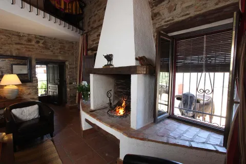
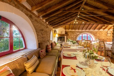
It is a breeding of ligia that invites the tourist to contemplate and engage in their work: to feed and review the cattle, to cling calves, to lock up cattle, to separate, to participate in horseshoes, to witness tentaderos, even to learn to torar, both in the living room and in practical way. It has top-class rural accommodation, swimming pool and restaurant for accommodation and early external reservations.

imagen
Image
Vista%20aerea.jpg
Imagen principal
Activado
imagen
Image
el-anadio-2.jpg
Imagen principal
Desactivado
imagen
Image
El%20A%2B%C2%A6ad%2B%C2%A1o%20Vistas%20.jpg
Imagen principal
Desactivado
imagen
Image
vilches-jaen-casa-habitaciones-galeria-14.jpg
Imagen principal
Desactivado
imagen
Image
El%20A%2B%C2%A6ad%2B%C2%A1o%20Comedor.jpg
Imagen principal
Desactivado
imagen
Image
El%20A%2B%C2%A6ad%2B%C2%A1o%20Dormitorio.jpg
Imagen principal
Desactivado
imagen
Image
El%20A%2B%C2%A6ad%2B%C2%A1o%20Salon%20de%20los%20toros.jpg
Imagen principal
Desactivado
Desactivado
Loading map
Preparing points of interest and routes...