Mata Bejid Farmhouse
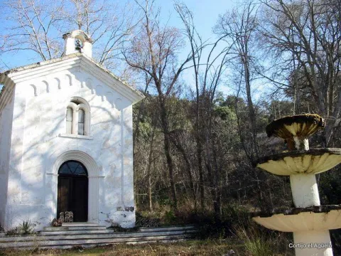
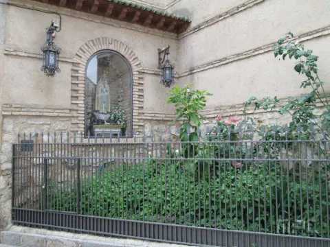
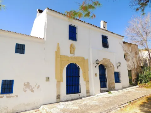
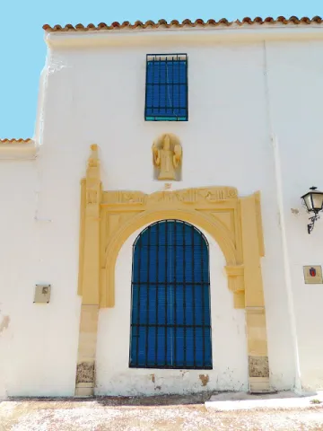
In this private estate the spirit of the belle époque with rural dyes is still revived. It is a private property with an interesting chapel, gardens, house of the gentlemen and even a regional style garage.
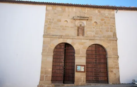
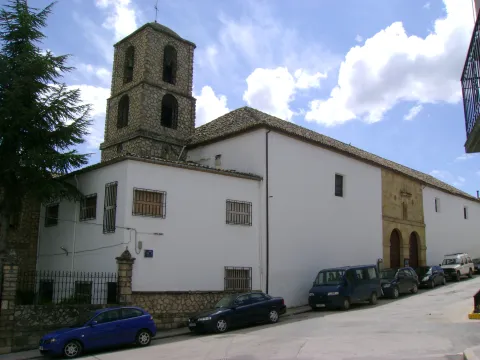
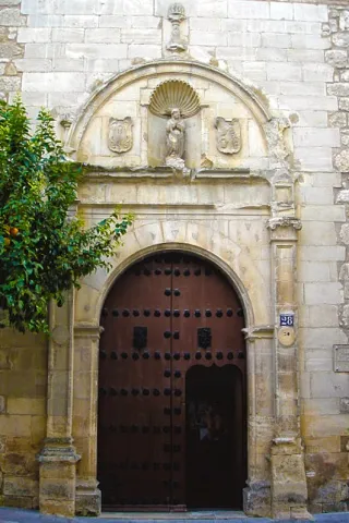
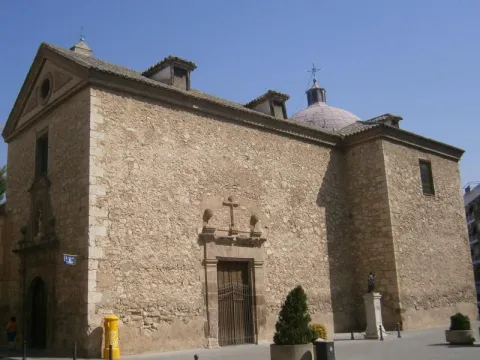
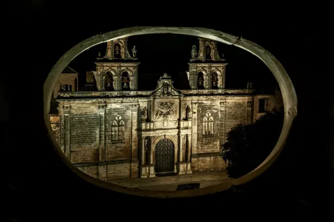
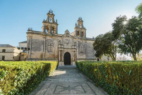
The Santa Ana Sunday convent was built in 1540 at the request of Fray Domingo de Baltanás, Dominican, theologian and writer. The cover of the church is made of silery stone, with a hornacina where the figure of the Santo Domingo de Guzmán, founder of the Dominican order, is represented. The interior of the church is made up of a single ship. In the convent, a magnificent 16th century cloister, with fourteen columns that support part of the dependencies, is removed. Around the courtyard is the refectory with a remarkable mural of 1584.
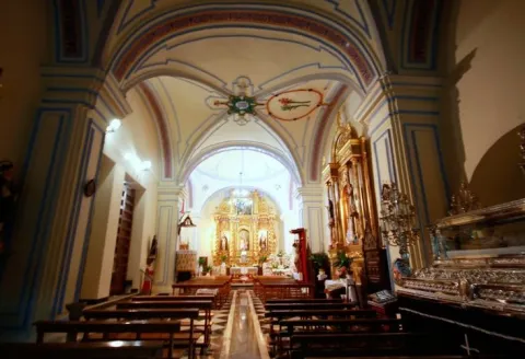
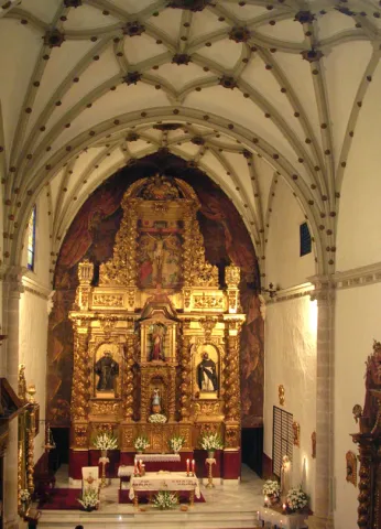
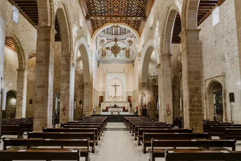
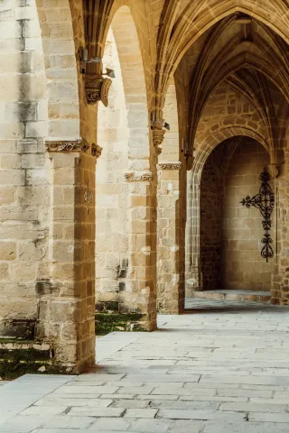
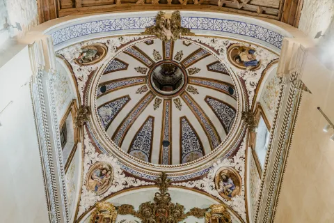
Founded by Don Jerónimo de Padilla and Pacheco around the year 1540, belonging to theOrder of Santiagoand with a triple function:house a convent of Dominican nuns, be a family pantheon for the founders and serve as a school for home maidens. The church presentsone shipdivided into three sections, with side chapels embedded in the wall. It hasdouble choruson the feet and on the side of the presbytery. The altarpiece is baroque from 1728. The ship is divided into three sections with star Gothic vaults and separated by half-point arches, columns and capitals. The profusion of santiaguine shells and the general composition of late and Renaissance Gothic elements are a decorative element. In the interior of the convent you can highlight the double floor cloister, you cannot visit it as a closing convent.
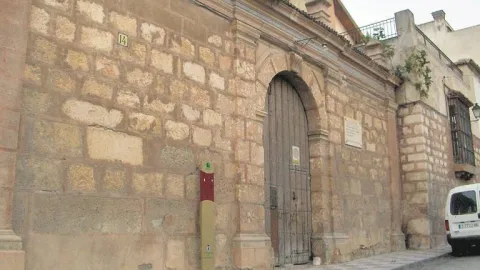
It was founded by San Juan de la Cruz when it was in Baeza on 12 October 1586, putting it under the patronage of the Immaculate Conception, as we can see in the commemorative plaque of the façade. It is accessed through a cover with a half-point arch flanked by pilasters. The set is removed by a cornice that supports four pinacles.
This convent is very linked to Our Lady of Hope, as we can see below. Often, when we hear about Our Lady of Hope, we automatically associate her with Seville and her Holy Week. However, one thing that many people are not aware of is that its origin is located in the province of Jaén, specifically in the region of Sierra Magina, according to some studies and the finding of a document, image of the left, of great importance on this subject. With the transcription that is presented we intend to see how in the toponymy of the convent of Cazalla a reference to the Virgin Macarena appears, in the year 1749, coinciding with the epoch of the highest splendor of the Order of the Basilios, as well as the Cadastre of the Marquis of the Ensenada. This report, which refers to a guide to the transport of cattle, is the only document found in the municipal archive, so far, where it is confirmed something that supports previous studies, such as that published by Rafael Ortega and Sagrista, "The Monastery of Our Lady of Hope, in the cazalla, belonging to the order of San Basilio Magno," where the origin of such a Marian advocation, the famous Virgin Esperanza Macarena of Seville, is determined in these places. What seems to be fully observed is that the diffuse center of the Basil monks in Andalusia comes from the region of Sierra Mágina, in particular Mata-Begid and the said Cazalla Convent, as Vicente Oya shows, to see the website www.camorl.iesata.es, or the book by Hilario Arenas González "La Macarena de Sevilla."
With this small review, we are only trying to make known an interesting line of research that we are now in the process of developing.
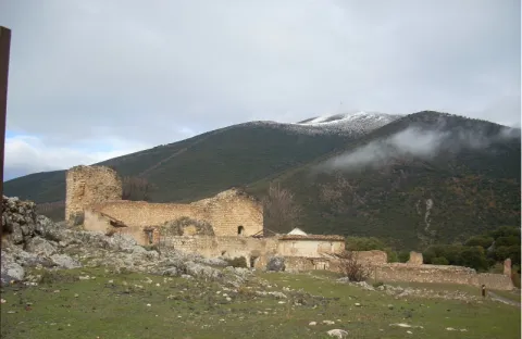
Since the 15th century there was a monastery of agustines in the place of Cazalla, which in 1578 became of the order of S. Basilio Magno. From that convent, it reached its highest splendor in the 18th century, reaching to have 13 monks, 3 leagues, 8 servants to own more than 200 flocks of cultivation (approximately 130 Hectareas) as known to the remains currently existing, only one cover remains, with a half-point bow blinded that gave access to the temple and, above it, the statue of S. Basilio Great, on a stacked hornadine up to half. It is a cast size of small proportions, which only lets see the head of the holy headline, with a luenga beard and a mitre. The size has been recently restored.
The Archaeological Set of Catulo and its monographic museum in Linares are the ideal sites to know the cultural diversity of Andalusia. The Ibero-Roman city is located on the right bank of the Guadalimar River, it is one of the capital centers of the peninsular noon during the antiquity, both for the extension of its walled enclosure (70 hectares), and for its strategic position in the Alto Guadalquivir and its mining holdings of silver, lead and copper. The "oppidum"- or fortified city - of Cattulo, first, was the most important nucleus of the population of the Iberian Oretania and, later, was formed as a Roman municipality, becoming episcopal headquarters in the lower-imperial era.
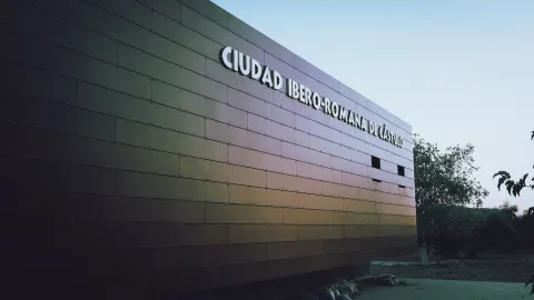
Catulus, Ibero-Roman city
The archaeological area of Catulo comprises a vast surface where multiple evidence is overlapping which are expression of other forms of occupation. There are necropolis, factories, public infrastructure and other suburban facilities related to the Ibero-Roman city, but also other settlements from Prehistory to the low Middle Ages, which complete the historical value of this archaeological area. This complex stratigraphic and temporal sequence, which has reached our time in exceptional conditions of conservation and integrity, is a significant segment of the entire history of Andalusia.
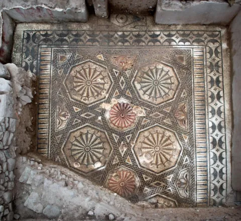
The tour begins with the reception center, where the visitor will find all the keys to understand the historical development of the site. In the walls you can make a stop in the highest part of the city and visit the Gate of the Lions of the Republican period, where the famous León de Catulo, the best preserved of the entire Iberian peninsula, was discovered. In the central area of the plateau do not forget to make a tour of the different archaeological areas and to contemplate the spectacular "Mosaic of the Amores," considered one of the ten greatest discoveries of 2012 by the magazine National Geographic. Also in the same area you can see an important religious building within which the "Patena de Cristo" was discovered, a fourth-century glass dish with one of the best preserved images of Christ which is currently exposed in the Museum of Linares. At the most eastern end of the settlement, you can see the Castle of Santa Eufemia, a fortification that dates from the Arab period and is also part of the cultural itinerary Route of the Castles and the Battle.
This museum cannot be understood in its integrity without reference to the Archaeological Set of Cattulo, as they are intimately related. In fact, an important impetus in the development of the Museum occurs when the expropriation of the lands of the former Cattulo is carried out, a process that began in 1968 and concluded in 1972, thus facilitating the research work that has been carried out in these areas since 1958 and from where the most important and numerous part of the collection comes from.
The tour is arranged on several floors, a covered courtyard and the basement. Its rooms treasure the most important findings of Catulus, including the Ibero-Roman Lion dating back to the 1st century BC and the Patena of Christ dating back to the 4th century AD.

The archaeological set of Catulo and its monographic museum in Linares are the ideal sites to know the cultural diversity of Andalusia. The Ibero-Roman city is located on the right bank of the Guadalimar River, it is one of the capital centers of the peninsular noon during the antiquity, both for the extension of its walled enclosure (70 hectares), and for its strategic position in the Alto Guadalquivir and its mining holdings of silver, lead and copper. The "oppidum"- or fortified city - of Cattulo, first, was the most important nucleus of the population of the Iberian Oretania and, later, was formed as a Roman municipality, becoming episcopal headquarters in the lower-imperial era.
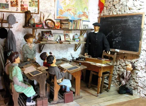
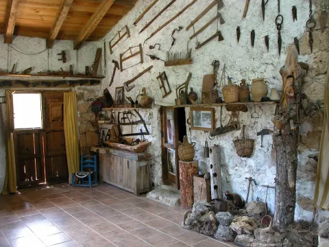
The museum offers us a tour of different aspects of traditional life, such as the stays of the serrana house, the rural school, the barbershop, the old inn, the stable and the trades related to the forest. There is also a small shop for crafts and food.
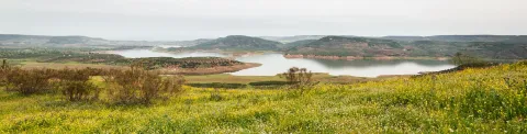
The small and isolated valley of Los Anchos, surrounded by mountains, is of an overwhelming beauty, especially in the autumn, when the wings of the stream become yellow.
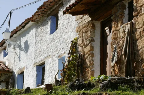
The village of Los Anchos is one of the best preserved in the Natural Park. Very close to it there are two others around which you have to take a walk, which are those of Prado Maguillo and La Cañada del Saucar. From this last part a senderist route marked PR-A 196, which goes up to the Calar del Cobo, specifically to the Puntal of the Mass, one of the best viewpoints of the Natural Park. In Prado Maguillo there are also signposted trails.
This museum, despite its small space, houses a large collection of ancient objects of daily use to the traditional serrana life, and is in an absolutely surprising place, where it is not expected to find something like this. It is shortly before the village of Los Anchos and transmits authenticity, not only for the pieces it exposes, but also for the traditional cortijo it occupies and for the extraordinary landscape of which it is part.
Price of entry: 3 €with tasting included (children and retirees, free entry).
You can visit the Interpretation Centre in Vilches (currently closed by reforms) and learn about the historical evolution of this important site, but there is a fence that closes the passage to the fortified city, so it is necessary to telephone the City Hall in advance, on working hours from 8: 00 to 14: 00, to make an appointment.
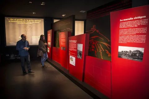
In the archaeological enclave you can visit a prehistoric sanctuary, an Iberian village, a cenobium or eemite paleocristian or visigode and a Almohad castle, all surrounded by beautiful landscapes between olive and saw. Landscape, culture, heritage, history, nature, hiking... are intermingled in Giribola, where it is possible to appreciate the footprint left by different peoples and cultures over the centuries.
Thus, along with the vestiges of the castle, the traveller will also be able to see the remains that are still preserved from the great wall surrounding the Iberian oppidum, an important city that occupied a strategic place on the road of connection between Catulo and the Levant and that was abandoned after being swept away by the Romans. Similarly, the numerous caves that are distributed on the slopes of the hill, the so-called Cuevas de Espeluca, are also interesting.
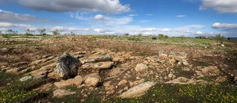
Giribola is located in the confluence of the Guadalimar and Guadalén rivers, in the municipal term of Vilches. The archaeological area occupies a prominent position at the end of a plateau interrupted by a barrier-type fortification that serves as a limit and, at the same time, a main access to the Iberian city. It can be considered, with its 18 hectares, one of the largest Iberian villages in the province of Jaén.
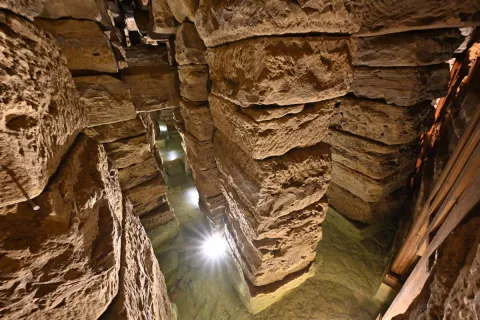
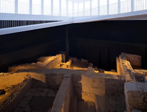
Declared Good of Cultural Interest in 2014, the La Calderona tank in Porcra (Jaén) is a water tank in the Roman city of Obulco, which is presumed to be linked to a water infrastructure of themunicipum,Maybe public hot springs. In the time of the Roman Empire, the growth of the large walled city led to the area being covered with large stone pillars on which new constructions were settled, thus starting what became its final burial.
In the Spanish civil war the tank served as an anti-aircraft shelter. In a fortuitous way, there was a finding that put the experts on the track of the original infrastructure: as they went down to the ground to protect themselves from the bombing, the neighbors observed that the wells they had in their homes were part of a more complex structure.
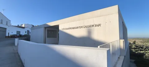
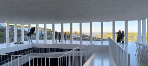
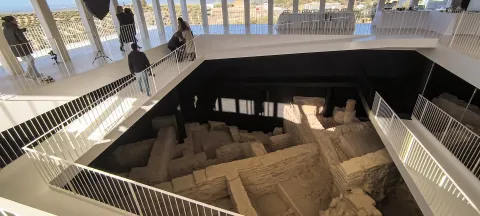
After a long and complex restoration, the tank currently in operation has been opened to the public. In order to access the level of the deposit, the intervention required, first, to build a new building, to serve as a reception centre for visitors and to integrate in turn the helicoidal ramp of down with 100 meters suspended, that do not touch the archaeological remains. In order to locate the new construction, an empty area was taken advantage of, located on one of the margins of the nearest road, so that the houses located on the Roman complex were not affected. In this way, the search for access to the tank ended up generating as added in addition to the new construction, a bridge that crosses San Marcos street and a tunnel that passes below the houses.
The project, led by the architect Pablo Millán, is based on the interrelationship of opposite realities and that, in the face of complexity, proposes a discourse based on the simplicity of a clean, geometrically precise architecture that does not conflict with the heritage architecture, present both in the Roman tank and in all the domestic buildings that appear during the archaeological intervention. In front of the space under the railing, hidden, in which the light does not enter, there is a new clear and deafan space through which the visitor travels, establishing a dialogue between the archaeological heritage and contemporary architecture.
It is an underground hydraulic complex more than two millennia old, located in the municipality of Porcra. Accidentally rediscovered by one of the inhabitants of the contemporary houses above him and used during the civil war as an anti-air shelter, it was originally a large public water tank with several years of rainwater collection and three catchment wells. Its construction, by means of walls and built-in pillars of cyclopean armchairs that support the architrabada deck with huge slabs of local calcarenita, makes it unique and unique at all levels.