Saltar al contenido principal
icon-intereses-senior

El torreón de Lupión

Submitted by brandcode_deweloper on
Id
8088950
Descripción
Descripción larga
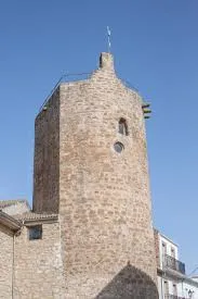
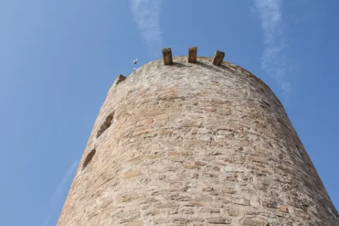
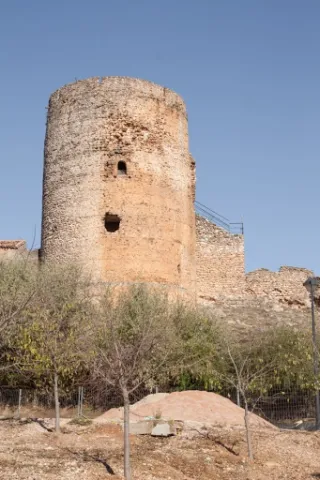
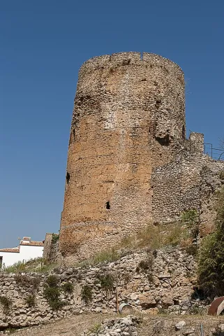
The tower of Lupión belonged to an old medieval castle datable to the 13th century, built of masonry in regular courses, with roughly hewn stone facings. Its floor plan is square on the inner side, the older part, adjoining the parade ground, while the outer side, facing the street, is round — perhaps because it was later remodelled to reduce the destructive effects of artillery. Internally, its two floors are covered with brick domed vaults. The terrace preserves its crenellated structure with corbels, as well as the brackets of a now-vanished defensive machicolation. It was declared a Site of Cultural Interest in 1985.
Breve descripción
Lupión is a small municipality located two kilometres from Begíjar and very close to Baeza. When it was an Ibero-Roman oppidum, it had rich pastureland and abundant wolves, which gave rise to its name.
Telecomunicaciones
Sitio web
www.lupion.es/el-municipio/patrimonio-historico.html
Ubicación
Código Postal
23528
Latitud
37.99674
Longitud
-3.54664
Dirección
La Loma, Jaén
Municipio
Ubicación en el mapa
POINT (-3.54664 37.99674)
Tipos de punto de interés
Imágenes carrusel
imagen
Image
torreon%20lupion2%20%281%29.jpg
Imagen principal
Desactivado
Imágenes cabecera
imagen
Image
torreon%20lupion.jpg
Imagen principal
Activado
Loading map
Preparing points of interest and routes...
El cubo

Submitted by brandcode_deweloper on
Id
4868835
Descripción
Descripción larga

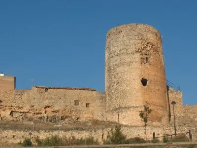
Within the Cube we can consider up to four spatial and functional levels: At the lower level or ground floor, we find ourselves in front of a circular floor room of approximately 8 m in diameter with a half-orange vault with a height of approximately 10 m.

Due to this considerable height it could have been divided into several levels with structures and wooden entwels. The site available in these defence towers was so valuable that it took advantage of the smallest space for the storage of food, utensils and the shelter of people that the Order of Santiago kept under its protection.

The intermediate level or first floor is a circular room of smaller size because it contains the staircase access to the roof. It has a vault pointed on nerves where its intermediate cloth is also made of stone.

From the roof, we can see the plain where the Kurah was framed in the time of Al-Ándalus, this allowed the control of the four cardinal points against the fronts of advance.

Breve descripción

The tower has a height of 21.5 m and is made of masonry with lime mortar. The average diameter is 8.5 m and the thickness of the walls is more than 2.75 m.

Ubicación
Código Postal
23380
Latitud
38.386690
Longitud
-2.582460
Distrito
Municipio
Ubicación en el mapa
POINT (-2.58246 38.38669)
Tipos de punto de interés
Imágenes carrusel
imagen
Image
8.jpg
Imagen principal
Desactivado
imagen
Image
9.jpg
Imagen principal
Desactivado
Imágenes cabecera
imagen
Image
5%20%285%29.jpg
Imagen principal
Activado
Loading map
Preparing points of interest and routes...
El Cerro de Castellón

Submitted by brandcode_deweloper on
Id
8088833
Descripción
Descripción larga

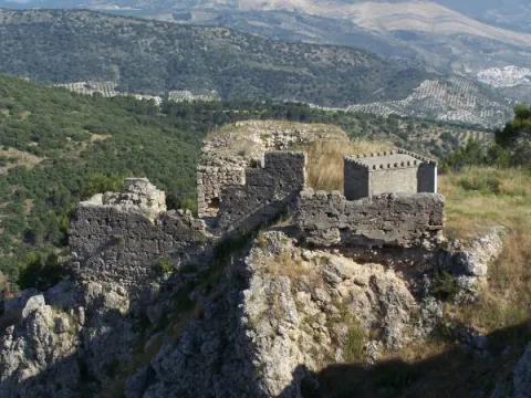
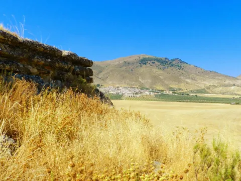
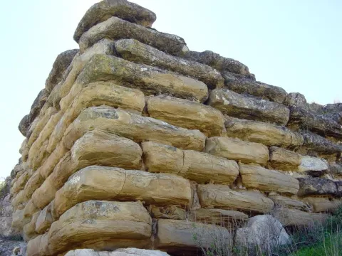
It has a rectangular plant facing from northeast to southeast and a walled enclosure. The best preserved wall is the northeast, 18.70 meters long and 4 meters high in its highest corner. It consists of several rows of large-scale stones, on which a wall of tapial, now missing, would be raised. In its interior it retains a seam of regular armchairs, smaller than those of the outer wall, of 6.30 meters in length and 2 meters in width.

Although it dates from Iberian chronology, both ceramic decorated with Iberian ceramic bands andterra sigillataRoman, so you can deduce a continued occupation of the land; as well as medieval ceramics.

Its mission was to monitor and control the communication routes, as it is closely linked to the corridor of the Guadiana Minor River, which communicates the upper valley of Guadalquivir with the highlands of Guadix and Baza.

In 1985 it was declared Good of Cultural Interest.

Breve descripción

On the hill of Castellón are preserved the remains of an Iberian cyclopian fortress between the II and I BC centuries It is a walled enclosure, with a quadrangular structure and an aljibe inside it, built with limestone armchairs that reach a meter and a half in length.

Telecomunicaciones
Sitio web
www.larva.es/el-municipio/patrimonio-historico.html
Correo electrónico
ayuntamiento@larva.es
Ubicación
Código Postal
23591
Latitud
37.770410
Longitud
-3.192560
Distrito
Municipio
Ubicación en el mapa
POINT (-3.19256 37.77041)
Tipos de punto de interés
Imágenes carrusel
imagen
Image
El%20Cerro%20de%20Castell%C3%B3n2.JPG
Imagen principal
Desactivado
imagen
Image
El%20Cerro%20de%20Castellon3%20%282%29.jpg
Imagen principal
Desactivado
Imágenes cabecera
imagen
Image
El%20Cerro%20de%20Castell%C3%B3n.jpg
Imagen principal
Activado
Microsite al que pertenece
Loading map
Preparing points of interest and routes...
Alma Serrana Ethnological Eco-Museum

Submitted by brandcode_deweloper on
Id
2335206
Descripción
Descripción larga

It highlights its website where we find the various activities that can be developed and the publications of its cultural association.

Breve descripción

The eco museum is a cultural center where you can travel in time to understand the history of the following people. There you can know and learn the customs and traditions, ancient techniques of the trades, the relationship of man to the territory, the exploitation of natural resources, as they dressed, ate, lived, etc.

Telecomunicaciones
Teléfono de contacto
608 695 623
Correo electrónico
concienciados@gmail.com; almaserrana@tecnosegura.com
Ubicación
Nombre
Eco - Museo Etnológico Alma Serrana
Código Postal
23294
Latitud
38.221410
Longitud
-2.584580
Distrito
Municipio
Ubicación en el mapa
POINT (-2.58458 38.22141)
Imágenes carrusel
imagen
Image
descarga%20%2817%29.jpeg
Imagen principal
Desactivado
imagen
Image
aldea-de-los-anchos-sierra-de-segura-69466-sm.jpg
Imagen principal
Desactivado
Imágenes cabecera
imagen
Image
unnamed%20%2822%29.jpg
Imagen principal
Activado
Horario
Monday to Sunday: 10: 00 - 18: 00.
Loading map
Preparing points of interest and routes...
Gorge of Puerta Arenas

Submitted by brandcode_deweloper on
Id
7991049
Descripción
Descripción larga

Location: On the highway of Granada, just at the limit of the municipal terms of Campillo, Cárcheles and Cambil.

Distance: 7 km.

Medium: Tourism vehicle.

Access: Directly via the Granada Highway (A-44)

Breve descripción

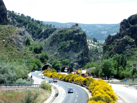
The river erosion, which has a limestone wall of about 400 meters high, is the result of the river erosion. There is a teaching path dedicated to local botany.

Telecomunicaciones
Sitio web
www.campillodearenas.es/el-municipio/patrimonio-natural.html
Teléfono de contacto
953 309 004
Correo electrónico
general@campillodearenas.es
Ubicación
Nombre
Hierro
Código Postal
28340
Latitud
37.555820
Longitud
-3.635560
Dirección
Campillo de Arenas
Distrito
Municipio
Ubicación en el mapa
POINT (-3.63556 37.55582)
Tipos de punto de interés
Imágenes carrusel
imagen
Image
Desfiladero%20de%20Puerta%20Arenas.jpg
Imagen principal
Desactivado
imagen
Image
Desfiladero%20de%20Puerta%20Arenas2.jpg
Imagen principal
Desactivado
Imágenes cabecera
imagen
Image
Desfiladero%20de%20Puerta%20Arenas3.jpeg
Imagen principal
Activado
Microsite al que pertenece
Loading map
Preparing points of interest and routes...
Caves Refugio

Submitted by brandcode_deweloper on
Id
8124859
Descripción
Descripción larga

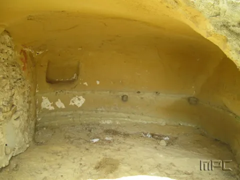
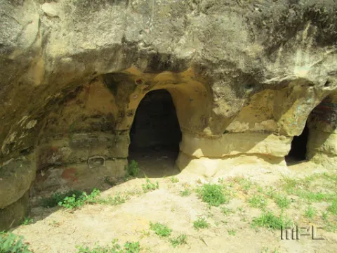
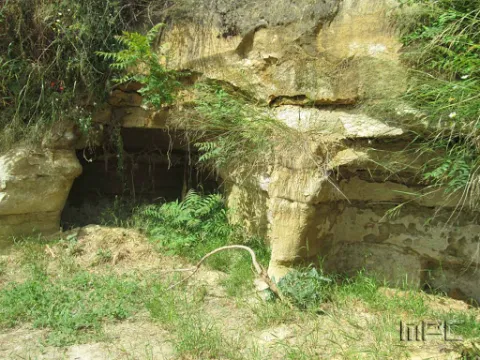
When Franco passed through Lopera in the 1950s he ordered that new houses be demolished and built for his tenants in the Pradillo Guijoso neighborhood, the front of the first body was finally only demolished. Some are currently abandoned and others have been occupied by Lopera's neighbours by keeping firewood or coal inside.

Breve descripción

The 11 caves at the entrance were used as shelters during the Civil War. They date back to 1828 and had several bodies.

Telecomunicaciones
Teléfono de contacto
953 516 250
Ubicación
Código Postal
23780
Latitud
37.941620
Longitud
-4.209160
Dirección
Carretera de Porcuna
Distrito
Municipio
Ubicación en el mapa
POINT (-4.20916 37.94162)
Tipos de punto de interés
Imágenes carrusel
imagen
Image
Cuevas%20refugio%202.jpg
Imagen principal
Desactivado
imagen
Image
Cuevas%20refugio.jpg
Imagen principal
Desactivado
Imágenes cabecera
imagen
Image
Cuevas%20refugio%203.jpg
Imagen principal
Activado
Loading map
Preparing points of interest and routes...

Cave of the Puerto de las Palomas

Submitted by brandcode_deweloper on
Id
8084183
Descripción
Descripción larga

The predominant indigenous vegetation is the oaks and moans, low mountain of rosemary, lentisco and sabina. Some well-known routes are the Carchelejo-Cazall- Convent, Carchel to Carchelejo by the Barrio de la Grilla or the ascension to the Cueva del Puerto de las Palomas. On the urban periphery of the two cores there are several recreational areas, such as the Parque de la Fuente, the Haza de la Widow and the sports facilities of Carchelejo and Cárchel.

Breve descripción

Cárcheles has a wide variety of natural sites such as the Monastery Barrio, the Cueva del Puerto de las Palomas, Cazalla and the Convent, etc., where to make excursions, using all kinds of means of transport: on foot, by cavalry, bike, bike or car, etc.

Telecomunicaciones
Teléfono de contacto
953 302 291 / 953 302 003
Correo electrónico
Webmaster@carcheles.es
Ubicación
Código Postal
23192
Latitud
37.612010
Longitud
-3.661260
Distrito
Municipio
Ubicación en el mapa
POINT (-3.66126 37.61201)
Tipos de punto de interés
Imágenes carrusel
imagen
Image
la%20Cueva%20del%20Puerto%20de%20las%20Palomas%20%281%29.jpg
Imagen principal
Desactivado
imagen
Image
la%20Cueva%20del%20Puerto%20de%20las%20Palomas3%20%281%29.jpg
Imagen principal
Desactivado
Imágenes cabecera
imagen
Image
la%20Cueva%20del%20Puerto%20de%20las%20Palomas2%20%281%29.jpg
Imagen principal
Activado
Microsite al que pertenece
Loading map
Preparing points of interest and routes...
Cave of the Morrón

Submitted by brandcode_deweloper on
Id
4872240
Descripción
Breve descripción

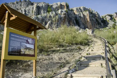
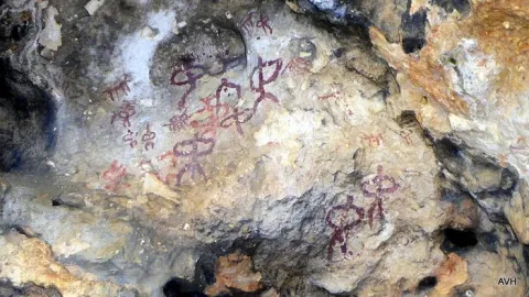
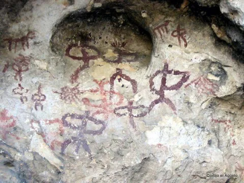
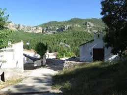
It is one of the greatPaleolithic-era rock sanctuariesthey are located in the Alto Guadalquivir. The paintings are in a small room in the Cave. These are two different chromatism caprics, one red and one black. It is very likely that we are facing a sanctuary in which the paintings have a magical propitiatory purpose for hunting, which was the main means of life of the surrounding populations. These rock paintings have been declaredGood for Cultural Interest.On the outskirts is"The Beast"which is as popularly known the bridge thatAndrés Vandelvira built in 1565,on behalf of Maria de Mendoza.

Ubicación
Código Postal
23540
Latitud
37.784650
Longitud
-3.508180
Distrito
Municipio
Ubicación en el mapa
POINT (-3.50818 37.78465)
Tipos de punto de interés
Imágenes carrusel
imagen
Image
cueva%20morron.jpg
Imagen principal
Desactivado
Imágenes cabecera
imagen
Image
100_7655.jpg
Imagen principal
Activado
Microsite al que pertenece
Loading map
Preparing points of interest and routes...
Graja Cave

Submitted by brandcode_deweloper on
Id
5692889
Descripción
Descripción larga

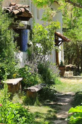
The great presence of limestone and the karmic effects make our province abundant the caves and coats that served as a home for those who lived these lands thousands of years ago. The Cueva de la Graja is an example of this; this rocky coat located at the north end of the Aznaitín at 750 meters high houses rock art manifestations with an age of 2000 to 5000 years before our age. The cave can be visited by requesting it previously in the City of Jimena.

Breve descripción

At the north end of the Aznaitin massif, in the area known as "the Cimbra," is the Cueva de la Graja. It is really a 6-meter-deep coat by 6-wide, which in its highest part reaches 5 meters. In addition to offering wonderful views from its 750 meters of altitude, this coat houses rock art manifestations that were made between 2000 and 5000 years before our era. Made with pigments obtained through the mixture of iron oxide, clays and animal fats; the paintings represent rites and grazing work. Declared an Artistic Historical Monument in 1924, the cave can be visited on request in the City of Jimena.

Telecomunicaciones
Sitio web
www.lugaresmiticosdejaen.com/es/articulos/lugares/cueva-de-la-graja
Correo electrónico
ayuntamientodejimena@gmail.com
Ubicación
Código Postal
23530
Latitud
37.833960
Longitud
-3.473090
Distrito
Municipio
Ubicación en el mapa
POINT (-3.47309 37.83396)
Tipos de punto de interés
Imágenes carrusel
imagen
Image
12.jpg
Imagen principal
Desactivado
imagen
Image
13.jpg
Imagen principal
Desactivado
Imágenes cabecera
imagen
Image
11.jpg
Imagen principal
Activado
Microsite al que pertenece
Loading map
Preparing points of interest and routes...
Cosmolarium Castle of Hornos. Interpretation Centre of Astronomía y Planetario

Submitted by brandcode_deweloper on
Id
2343310
Descripción
Descripción larga

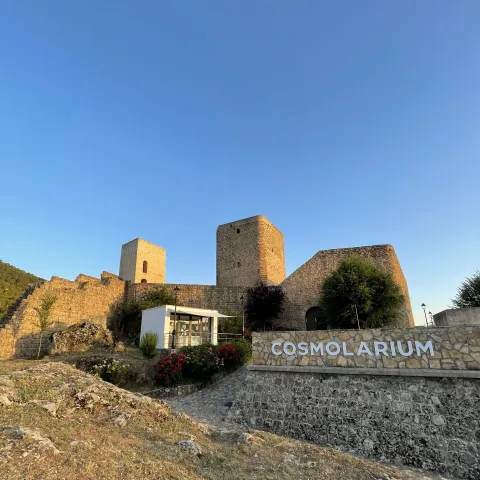
While other castles can focus mainly on their medieval history, Cosmolarium offers a completely different experience for two reasons:

  1. It offers an experience focused on astronomy and the universe
  2. It values the incredible sky of the Sierra de Segura, Cazorla and the Villas, non-light pollution.

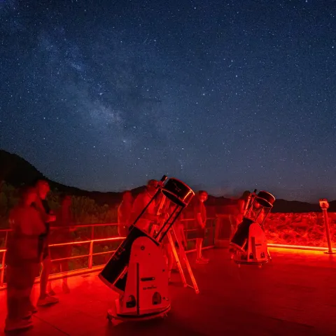
In short, its universe museum, planetary sessions, guided tours and night sky observation activities make it unique in the region.

Breve descripción

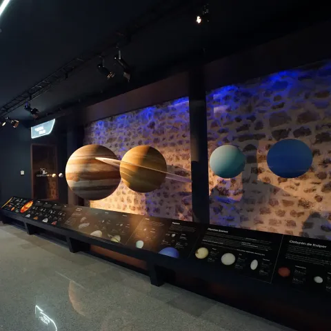
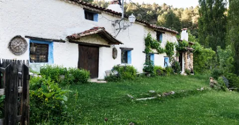
It is a centre for the interpretation of astronomy that consists of a digital planetarium, with a dome of 8 meters in diameter that shows enveloping audiovisual productions, complete exhibition rooms on the Universe, spaces for workshops and educational games, as well as a terrace for astronomical observations.

Telecomunicaciones
Sitio web
https://www.cosmolariumdehornos.com
Teléfono de contacto
664 175 596
Correo electrónico
info@cosmolariumdehornos.com
Ubicación
Nombre
Castillo de Hornos
Código Postal
23292
Latitud
38.216480
Longitud
-2.718430
Distrito
Municipio
Ubicación en el mapa
POINT (-2.71843 38.21648)
Tipos de punto de interés
Imágenes carrusel
imagen
Image
cosmolarium-interior-jpg
Imagen principal
Desactivado
imagen
Image
observacion-nocturna-jpg
Imagen principal
Desactivado
Imágenes cabecera
imagen
Image
cosmolarium-exterior-jpg
Imagen principal
Activado
Horario
Wednesday to Sunday: 10: 30 - 14: 00. Late by season (see web).
Loading map
Preparing points of interest and routes...