Flavors and adventure: Route and gourmet tasting at Paraíso de Bardazoso
Day 1.
Arrived at the accommodation.
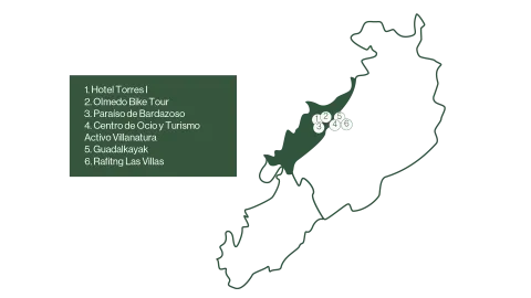
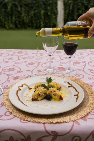
Defeat the liquid gold of Jaén from the hand of the Hotel Torres I.
Duration of experience: Minimum stay of 1 night.
Price: 125 €/ adult.
Day 2.
Discover the Sierra de Las Villas by bike or by taking a route.
Option A.
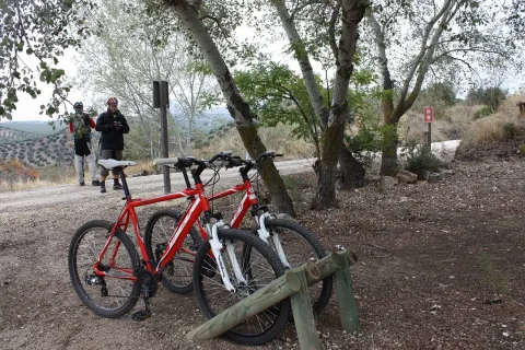
Explore the Natural Park of the saws of Cazorla, Segura and Las Villas by bicycle with Olmedo Bike Tour.
Duration of experience: 6 to 7 hours.
Price: 50 €/ group.
Option B.
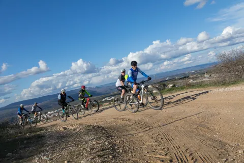
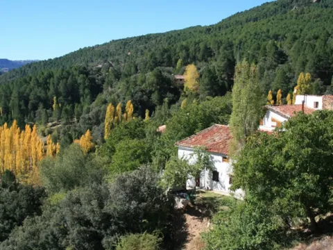
Taste and adventure: Route and tasting gourmet in Paradise of Bardazoso.
Duration of experience: 5 hours.
Price: 50 €/ person.
Option C.
Change of accommodation.
Rural House and Active Tourism and Leisure Center Villanatura. Enjoy a day in a mountain olive grove.
Duration of experience: 5 hours.
Minimum stay of 1 night.
Price: 50 €/ person.
Day 3.
Adventure activities.
Option A.
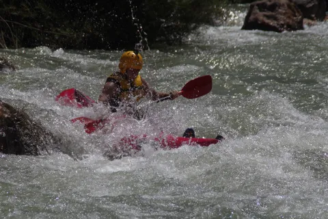
Rafting by the Guadalquivir River with Guadalkayak.
Duration of experience: 1 hour.
Price: adult 40 €/ person and children (under 14 years): 30 €/ person.
Option B.
Kayak waters by the Guadalquivir River with Guadalkayak.
Duration of experience: 3 hours.
Price: 50 €/ person.
Day 4
Initiation to the Via Ferrata El Rayo with Rafting Las Villas.
Duration of experience: 2 and a half hours.
Price: 35 €/ person.
(*) Prices may be subject to change.
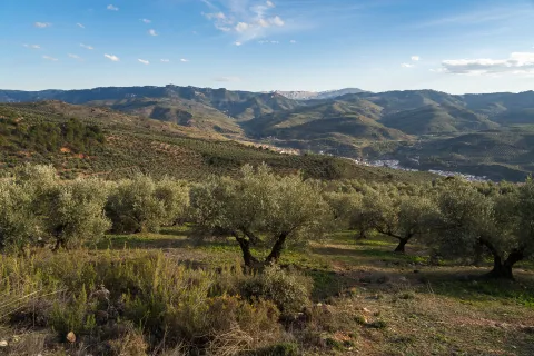
A circuit designed for those who want to immerse themselves in the natural and cultural beauty of the Sierra de Las Villas. Various experiences of oleoturism are offered, where travelers will discover the process of making extra virgin olive oil, a real local treasure. On many occasions you can combine it with the rich gastronomy of the area, which offers local and quality products, highlighting its authentic flavors.
For nature and sport lovers, you can make bike routes or explore the river by practicing kayak or rafting, ideal for enjoying the landscapes of the saw from different perspectives.
A circuit that combines culture, sport and the pleasure of gastronomy, allowing to discover the Sierra de Las Villas in a unique and sustainable way.
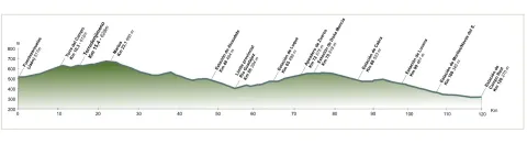
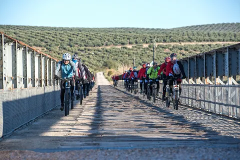
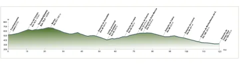
The tour begins at the edge of the city centre of Jaén, next to the municipal sports complex Las Fuentezuelas. The first 2 km, used by hiking and cycling, have several rest areas. From here on, we will cross, on a service road, the north-west circumvalation of Jaén to resume the trail to the town of Torredelcamp. After passing through a new alternative road that saves the A-316 motorway, we arrive at the Torredelcampo station (km. 11,100) located in this urban nucleus.
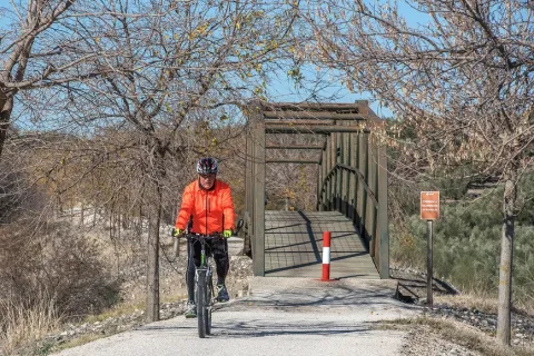
After two tunnels (the first lit 333 meters long), two viaducts and the rest area of the Quebradas, we will reach the nearby town of Torredonjimeno. From Torredonjimeno Station (Km. 1,600) we will continue in the direction of Martos, for which we will have to cross two long metal walkways that allow the crossing with the road A-316. La Via Verde crosses the city centre of Martos and offers the possibility to make interesting visits to the city.
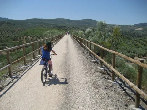
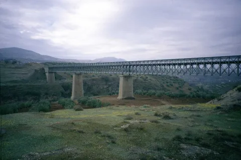
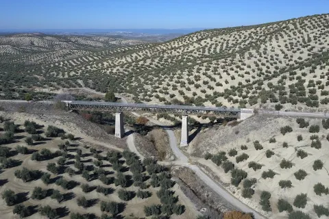
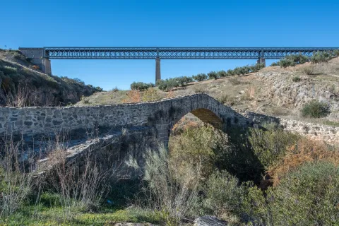
We left Martos, in a southwestern direction, towards the border with the province of Córdoba. New intersections with the national road are resolved by installing a lower step and a new gateway. In Km. 33, coinciding with the proximity of the Salado stream, the landscape changes and becomes more abrupt and serrano, already in the foothills of the Sierra Sur massif. The railway crosses rivers and streams in the middle of impressive ravines, through metal viaducts with lengths between 70 m and 224 m. These complex engineering works, which were designed by the French Alessandre and Delapierre, date back to the end of the 19th century, magnificent examples of oblonted architecture, and which constitute extraordinary views on the rural landscapes of the province of Jaén.
The rest area of the isolated station of Vado-Jaén is located at km 37. The old railway platform continues its course in the direction of the Alcaudete Station, passing the impressive viaduct on the Víboras River (224 m long and 80 m high), the remains of an abandoned balast quarry, called La Muela, and some sections of lush Mediterranean vegetation in which they stand out oak, retama and majajelos, as well as old almonds.
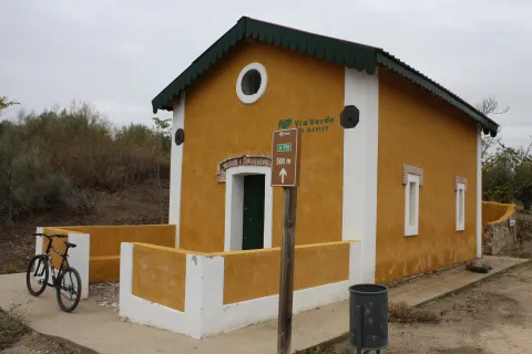
Leaving the Alcaudete station behind, at 48,400 km, we will reach a crossing with the A-316 road, saved by a high gateway.
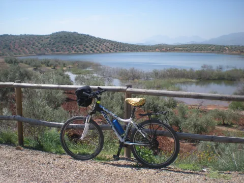
After passing through the building for the railway houses, the Green Way of Oil connects with the Biking Routes of Sierra Sur de Jaén (signposted), which enter the cycloturist in the heart of the massif of the same name, and runs right next to the Laguna Honda Natural Reserve (Km. 50,500); at this point you can see the abundant and rich avifauna that dwells in this 65 Has. wetland of extension: evil, real anade, squid or small zampullin.
On the right bank of the Green Way, a road leads to another natural space protected from the environment: the Natural Reserve of Laguna del Chinche, of 6.5 Has. of extension and with an interesting perilagunar vegetation. The last miles pass through a very eroded site where deep ravines are frequent, in whose slopes the thyme and the spartum occupy a land, not suitable for the olive tree, which sometimes offer excellent panoramic views of the Vadomojón reservoir. The jiennese part of the Green Way of Oil concludes on the great iron bridge over the Guadaljoz River, right in the tail of the reservoir, 199 m long.
From this point the green track connects with that of the Cordobese Subbetic.
6, from Jaén (The Fuentezuelas' polysports complex) and from each of the five stations.
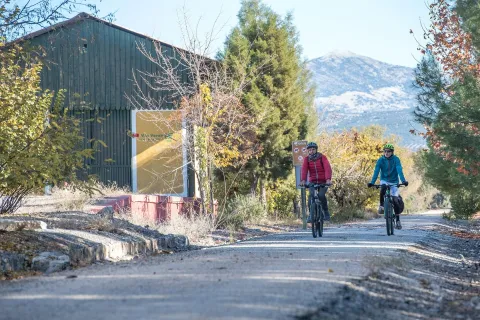
Users: cyclists, walkers and wheelchair people.
Regardless of the way you decide to travel this route, it is recommended to use comfortable clothes and footwear and adapted to the time of the year. Although it is not convenient to do so in the middle of summer due to the heat. You must not forget to wear enough water and, if you go on a bike, it is always recommended to wear a helmet.
For more information visit:http: / / www.viasverdes.com
Cultural heritage: Monumental set of Jaén. The medieval castle of Alcaudete. Medieval Bridge of the Vipers. Archaeological route of the Torreones. Urban assemblies of Luque, Zuheros, Doña Mencía, Cabra and Lucena. Cueva de los Murcielagos en Zuheros.
Ramal a Baena: Urban complex of Luque and Baena, archaeological park of Torreparedones, the Historical and Archaeological Museum of Baena, church of the ancient Convent of the Agustinos Descalzo in Luque.
The starting point is located in the village of Vadillo-Castril. The latter is followed by the A-319 road that links the towns of Peal de Becerro and Hornos de Segura. We must take the detour located at the kilometer 31.7 and continue for 5 km by the JF-7091 until the entrance detour to Vadillo-Castril and the Training and Forest Experiment Centre.
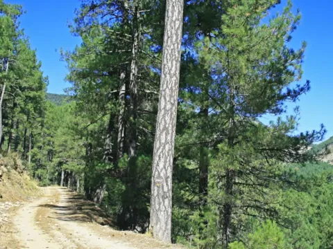
The route has been broken down in stages, assuming that it will be of interest to cycloturists, although it could be carried out by car as it travels on roads open to traffic.
Coordinates 38.39197, -2,58255
Siles is a village of 2200 inhabitants located on the north end of the Natural Park. There is an old artificial pineapple sequero, which has been musealized and transformed into the current Centre for Interpretation and Reception of Visitors of the Sierra de Segura. It is located in the street Carretera de Hellín no. 21, and has several exhibition spaces that report on the natural values of the Sierra de Segura, the history of the human population in the territory, the serrano trades and, in an outstanding way, on the sequero itself, from which the original machinery is preserved.
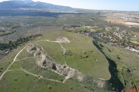
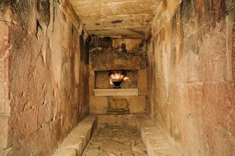
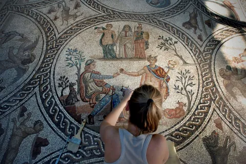
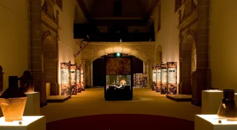
The archaeological heritage that left the culture of the Iberos in Jaén is unique in the world, both for its uniqueness and for its variety. The development of this culture between the 6th century BC and the 1st century BC, has left in the province more than 545 invented sites, among which are the most important
fortified cities of Catulo and Puente Tablas, funeral chambers such as Toya, and ethnic shrines such as the Cave of the Dolls or the Lobera.
The archaeological heritage that left the culture of the Iberos in Jaén is unique in the world, both for its uniqueness and for its variety.
The great journey we propose to the time of the Iberos is a great project of the Diputación de Jaén coordinated with the various municipalities, and is currently in full development. The visitor can contemplate one of the largest sculptural assemblies of the Ibera Statuary in stone: that of Cerillo Blanco de Porcra and that of the Heroic Sanctuary of the Pajarillo of Huelma, exposed at the Provincial Museum of Jaén. In the Archaeological Museum of Linares we can visit the history of Catulo, one of the most important cities of ancient times, and in the Museum of Castellar an impressive collection of Iberian exvotes is presented. All this together with the new projects that are currently being implemented and have new
museum spaces and the value of archaeological sites such as the White Crow in Porcilla.
Shortly after the fifth bridge, it is recommended to continue to the left, where it is already incorporated into a wider road, right next to a rural house called "Nace el Río." If you go ahead, there are two ways to return, or on a road to the left that goes down to the same point of departure, or you can follow the right by a road called "Paseo del Solar," which when you reach the village allows you to go down to the Plaza de Santa María again.
The first option would be about an hour, the second option would be half an hour more, but it is worth the beautiful views we have from the viewpoints. Both routes are very simple so they are perfect for those trails who want to go for a walk or families with children. But they are also ideal to discover the most beautiful corners of the area without making an intense effort, being able to enjoy the road to the maximum.
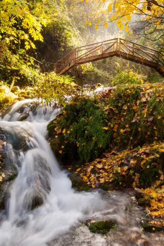
In the direction of the Castle of the Yedra we run into a small square where to the right it is moving towards the Castle, and to the left it is already marked the beginning of this circular route, which will enter into a space closed by large chopos that, in combination with the crystal waters of the river forming pozas, will make our journey an unparalleled environment to enjoy nature. Using the various wooden bridges, you can cross the river to continue this magnificent expedition.
Wear adequate clothing and footwear.
About 200 m behind the ruins of Santa Maria.
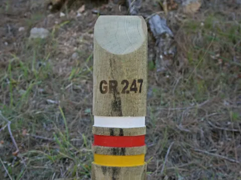
This first stage of the GR 247.1 Variant unites two of the most emblematic small inhabited nuclei of the deep interior of the Natural Park, in the Sierra de Segura. The first is the village of Los Anchos and Prado Maguillo, and the second is the village of Arroyo Canales and Rio Madera.
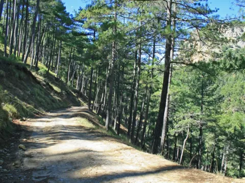
They are isolated, lonely and surrounded by a very beautiful environment. The first, at the highest altitude, draw attention to the good conservation of popular architecture, of great simplicity and with an aesthetics fully integrated into the landscape. The Recreative Area of La Morringa, which is a very pleasant and shaded space with fountain and tables next to the River Madera, whose waters run manly between the riverside vegetation, stands out.
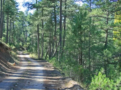
Most of the route runs through the forest track that runs through the Valley of Arroyo de las Tres Aguas, linking the valleys of Los Anchos and Río Madera through thick forests of pine laricio or salgareño. The Stage is short, and it is possible to chain it in the same day with one of the other steps of the Southern Forest Path with which it links, or with a stretch of them, but we recommend to do so without haste and to remain at any of the two ends of it, because they have left-over attractions for it.
On the path: No
Near the path: Segura de la Sierra
GR-147, PR-A 199
In the beginning: Refugio Casa Forestal El Bodegón (1.4 km from the beginning of Etapa).
In the end: there is no.
The serrano cortijo, a combination between the practical and the simple
The Valley of Los Anchos, from which this route is part, is perhaps the area where what is left of the popular architecture of these mountains is best preserved. Joaquín Gómez Mena, an excellent connoisseur of the Natural Park, sums up its main features.
The serrana house, as a general rule, is rectangular and has thick walls ranging from 50 to 70 centimeters, made of stones and toves attached with argamase, which serves as protection against summer heat and the cold of winter. The surface of this rectangle ranges from 25-35 meters wide by 30-40 meters long.
On the lower floor there are usually three rooms that are aligned. The first is a kitchen-dining room, where there is the access door to the house and it has one or two windows not very large. In this kitchen-dining room is the home or fireplace, which has the double function of heating the room in winter and serving to cook the food and heat the water.
In most of the houses, on both sides of the fireplace are two fitted cupboards on the wall, where the cooking tools are kept. Sometimes in one of these holes the quarries were placed with the water that was brought from the source.
The other two rooms are single bedrooms, one for marriage and one for children. They have small ventilation windows and are very austere, for in them there is only one bed and a harpoon to keep the clothes. From one of the bedrooms leaves the staircase that gives access to the upper floor, where the camera is located.
The roof of this plant is of descending height, or as we say today, overstretched, because the roof becomes inclined, usually to a water, to run the rainwater. This camera has one or two small windows to air the stay, where the products of the killing are cured and stored. The roof of the camera is unglued, with the wooden rolls that make of beams and the wooden boards placed above them. Finally, a clay layer and tiles are available on the boards.
Next to the human stays, but separated by a wall and with independent entrances, the blocks for the cattle are located, which have freckles for mules and donkeys. In some corijos these blocks are separated from the house, in front of it or on one side of it. Other buildings of the cortijo separated from the family house are the corrals and aprines for the goats and sheep, the cochineas and the hens.
There are also other common-use infrastructure for different families in a corijada. Among them are the ages to pull the grain, which are usually on high and well ventilated grounds to take advantage of the effect of the air, are almost always circular and its soil is made with rolling edges, perfectly placed as if of a mosaic. Many of these ages are currently abandoned and it is regrettable that they end up being lost in the near future, because they are part of the cultural heritage of the natural park.
Another element of common use is the bread oven, built of stone and mud and in a vaulted form. It can be found standing out of the walls of the house to which it is located or, more often, as an independent construction among other buildings of the cortijo. The plant of these furnaces is usually circular or square, and is covered with Arab tile.
Also the fountains and lavatories, which were essential elements in the daily life of the village, are another heritage that in many places is being lost and that, even if the installation of running water in the houses makes them barely used, should be kept perfectly preserved.
Prado Maguillo and Refugio Casa Forestal El Bodegón
Wood River
Nuestra ruta comienza en Prado Maguillo, una pequeña aldea de montaña muy cerca de Los Anchos. Ambas están en un entorno de extraordinaria belleza y conservan bastante bien la arquitectura popular. Salimos entre huertas, la mayoría ya abandonadas, y a los 500 metros, a la izquierda hay un pequeño cerro al que es imprescindible subir (son muy pocos metros) para recrearse en las maravillosas vistas que se contemplan desde él: el valle de Los Anchos en primer plano y, al fondo, las crestas de El Calarico, Poyo Gavilán y Poyo Alto.
A la izquierda sale un camino que, al cabo 650 metros, nos lleva a la Casa Forestal El Bodegón, una de cuyas construcciones auxiliares ha sido rehabilitada como refugio. La Casa y el almacén –al que se llamaba barraca- ya están en ruinas, pero el paraje, que es un amplio claro en pleno bosque, es encantador.
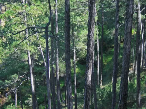
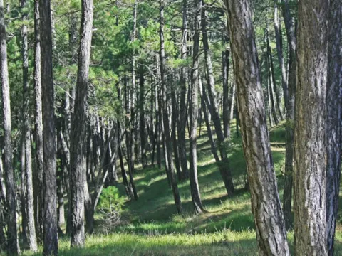
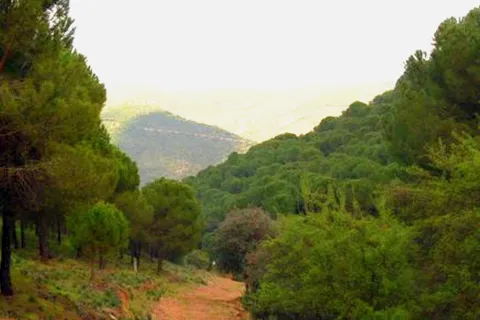
Volviendo a nuestra ruta, continuamos bajando por la solitaria pista forestal en medio de un gran bosque de pino laricio o salgareño con sotobosque de encina, un paisaje cautivador que nos acompañará hasta el final de la Etapa. Vamos entre la Loma del Mirandante y el Calar de Peña Rubia, por el encajado valle del Arroyo del Prado de los Fresnos.
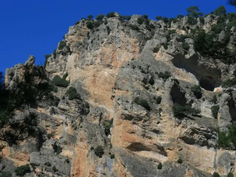
Pronto oiremos el rumor de sus aguas, mezclado con el canto de la abundante avifauna forestal. A la derecha, al otro lado del valle, aparece la inconfundible silueta de Peña Rubia, con sus paredones verticales que, haciendo honor a su nombre, tienen un llamativo color dorado y sepia que se acentúa con las últimas luces de la tarde.
A la altura del kilómetro 3, aproximadamente, en el fondo del valle confluyen las aguas del Arroyo del Prado de los Fresnos con las de los Arroyos de La Cerecera y La Cuesta del Majano. Por eso, a partir de ese punto, el cauce que resulta tiene el bello nombre de Arroyo de las Tres Aguas.
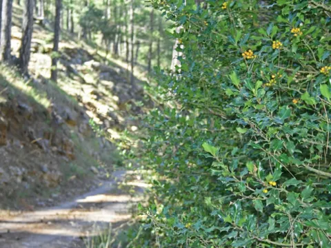
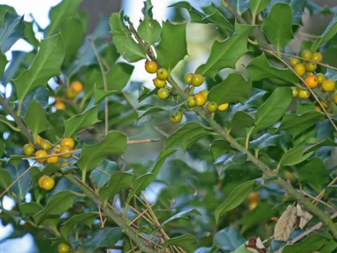
El ambiente fresco y umbrío del valle propicia la existencia de acebos aislados, pudiendo admirar un pequeño grupo de ellos en el kilómterom 3,8. Un poco más adelante vemos abajo las ruinas del Molino de Peña Rubia y su antigua conducción de agua, que nos hablan de un pasado en el que se trabajaba para sobrevivir, pero donde el agua era mucho más abundante, porque la que circula en la actualidad apenas podría mover la rueda de un molino con la necesaria continuidad.
En el kilómetro 4,4 hay un manantial de agua que sale a través de una conducción por el lado derecho de la pista forestal.
La ruta llega al fondo del valle y cruzamos sobre este río, que poco después afluye al Río Madera. Es un lugar refrescante con abundancia de mimbreras y juncos, al igual que el cruce sobre el Río Madera por un vado unos 400 metros más adelante. La lámina de agua que tenemos que atravesar suele ser muy delgada, pero si ha llovido mucho puede tener alguna dificultad. También hay que tener prudencia en invierno, época en la que puede tener una capa de hielo. A partir del vado, y ya por el Valle del Río Madera, caminamos otros 400 metros con el río a nuestra derecha. En este tramo apreciamos que la vegetación es abundante, pero además hay que saber que las condiciones de frescor y humedad convierten a la zona en un enclave con una relevante importancia botánica. Hay, por ejemplo, una población de un equiseto (similar a la cola de caballo) denominado Equisetum palustre, planta propia del norte cuyas escasas poblaciones andaluzas sólo están en este Parque Natural. También se puede ver la centaurea (Centaurea nevadensis), exclusiva de las sierras calizas del este y sureste de España, y la ajonjera de Cazorla (Carlina baetica), una planta de distribución restringida al Parque Natural y sierras cercanas.
Este Área es un buen lugar para descansar e incluso para echarse una siesta, tal vez por eso los serranos le pusieron este nombre, que en el habla local es sinónimo de soñarrera. Es un espacio muy agradable y sombreado que dispone de fuente y mesas junto al Río Madera, cuyas aguas discurren mansamente entre la vegetación de ribera. Después salimos a la carretera del valle de Río Madera y caminamos por ella apenas 200 metros para tomar un camino que sale a nuestra izquierda. Se trata de un jorro (vía de saca de madera) con algunos repechos que al poco se convierte en senda. En el kilómetro 7, 4 llegamos a un collado donde se abren vistas hacia el pequeño Valle de Arroyo Canales, donde vemos la aldea del mismo nombre en la que finalizará nuestra Etapa. En este mismo collado cruzamos una pista forestal que, hacia la izquierda, nos llevaría a los cortijos de Los Jarales y Los Asperones.
La Etapa termina en la pequeña aldea de Arroyo Canales, unos metros después de atravesar el arroyo del mismo nombre y las huertas que riega. Por la carreterita que pasa por la aldea, a la derecha, llegaríamos en unos minutos a la aldea de Río Madera, que tiene menos casas, pero que con su ermita, su venta, su plazuela y su antigua casa forestal ha sido siempre y sigue siendo el lugar de referencia del frondoso y seductor valle de Río Madera. Si en vez de bajar a la aldea de Río Madera queremos continuar por la Etapa 2 de la Variante GR 247.1, solo hay que cruzar Arroyo Canales, y al llegar a la carretera seguir por el camino que arranca enfrente.
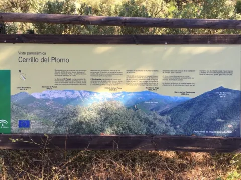
The Cerrillo del Plomo was one of the most productive mines during the Roman period, being one of the most important deposits in Spain for the extraction of galena, both for its production and for the quality of the mineral extracted. The galena is a mineral of the group of sulphides from which lead and silver are extracted.
Under the rule of the Roman Empire, this silver was sent to Rome, while lead was used to make coins, vessels and cover pipes and roofs. In the mid-20th century, the miners called sacageneros removed the bowels of this hill in search of the remains of lead that the Romans did not extract.
Thank you for your cooperation!
On the A-4 E-5 Highway, at the height of La Carolina we will take Exit 270, to follow the JA-6100 road, which will lead us to El Centenillo. At the entrance of the village there is a track on the right that descends to the beginning of the path.
The Andalusian Legate keeps two routes open in this province. The Nazaris and the Caliphate represent unique opportunities to decipher the keys of our past. Both itineraries run in twenty-three Jiennese municipalities. The route of the Caliphate - smaller - crosses the south of the province of Jaén, kissing three cities full of art, culture and history: Alcaudete, Castillo de Locubín and Alcalá la Real. The route of the Nazaris - the most extensive - cuts the province in two, from Sierra Morena to Sierra Mágina, passing through the districts of La Campiña and La Loma. The route crosses twenty municipalities, including the capital of the province. Up to four hundred castles, fortresses, torreons, strong houses and watchmen spatter the way. The monumental heritage, landscapes, popular customs, handicrafts and gastronomy that Jaén today possesses are largely due to that refined civilization that made al-Ándalus a paradise in the middle of the Middle Ages.
Source: Council of Culture and Heritage. Junta de Andalusia.
The Andalusian legacy is a Public Foundation of the Junta de Andalucía attached to the Council of Culture and Historical Heritage which has the support of the Council of Europe and the collaboration of many public and private institutions. The activities of the Foundation are linked to the dissemination and preservation of the cultural and artistic heritage of Al@-@ Ándalus, and the role that Andalusia and Spain have played throughout history as both a cultural bridge between East and West and in relations with the countries of the Arab, Mediterranean and Ibero-American world. The routes of the Andalusian Legacy are therefore aimed at the value and dissemination of our cultural heritage with special reference to the Spanish-Muslim period, with emphasis on the mutual and fertile influences of the Mediterranean environment over the centuries. On the basis of this concept, the Foundation launched a network of national and international cultural routes and Itineraries (11 in total).