Saltar al contenido principal
icon-intereses-familia

Trail Balcón de Despeñaperros

Submitted by brandcode_deweloper on
Id
7396151
Descripción larga

If taken in the sense of the clockwise from the point of start, the path enters
quickly in a pine pine pineapple pineapple pineapple with some
Pines resineros, cypresses and oaks. The first 350 meters of path run through an area
trees with abundant shadows and free of shrubs, as it constitutes the safety zone against
camping fires. This makes this section an ideal site for mushroom search in the autumn.
The path continues another 170 meters through a more intricate area of Mediterranean vegetation in the
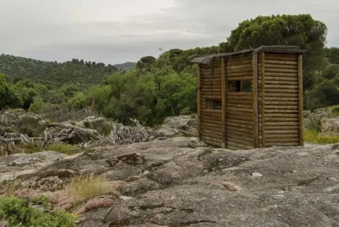
that abounds the rosemary and the jars under the tree, which leads us to a spectacular lookout
Panoramic suspended on the old road N-IV. From the viewpoint you have an unparalleled vision
of the Natural Park, as the path is located on the South end. The panoramic view of 180
degrees allows to see the whole mountain of Despeñacos from the Collado de la Estrella, the Port of the King, he
Salto del Fraile, Navavacas, the Castle of Castro Ferral and following the line of the Collado de la
Star to the East, you can see the Paso de Despeñacolos and to its right the Collado de los
Gardens from where the park looks at Aldeaquemada.

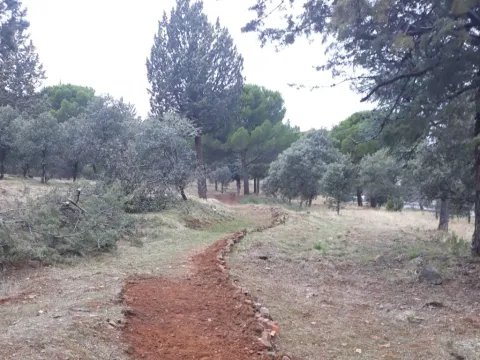
Leaving the lookout behind, the path runs 900 meters through an old wooden draw track
completely flat through a lush mixed forest of pine, cypress, oak and cork,
where again the noble bush of the Mediterranean mountain gives a touch of naturality to the visitor
which loses the notion of distance to the people, but which, let us not forget, is just over 1 km from
distance.


Arrived at the end of the track, the path turns abruptly to the right to return to St. Helena
using a wider forest path, which also runs under a canopy of pineapple pine
Great. It is from that point where the only difficulty of the path is found, for during
400 meters is raised by a light cost with a slope about 5% to reach the
limit of the park where again it becomes completely flat. The final section runs through an area of
transition between forest and agricultural space, bordering just the southern perimeter of the campsite
Cracking dogs, passing through their access door and ending right where it started.

The path shows as main attractions its closeness to the people of St. Helena, its affability,
the abundance of shadows for hot days, the great botanical biodiversity and, above
all, the privileged views from the viewpoint that invites to let the imagination fly contemplating
this unparalleled landscape and, why not, to reflect on the countless travelers of so many cultures
who have used this natural passage between the plateau and Andalusia.

Breve descripción

This new path has a length of almost 4 km. and being circular can be performed in both
senses. It starts in the corner that gives access to the Camping Despeñacolos, next to the old section of
the N-IV, on the outskirts of the town of St. Helena.

Latitud
38.4003
Longitud
-3.5201
Distrito
Municipio
Ubicación en el mapa
POINT (-3.5201 38.4003)
imagen
Image
Sendero%20Balc%C3%B3n%20de%20Despe%C3%B1aperros.jpg
Imagen principal
Activado
imagen
Image
Sendero%20Balc%C3%B3n%20de%20Despe%C3%B1aperros1.jpg
Imagen principal
Desactivado
1 h

Nature

icon-intereses-naturaleza

Friends

icon-intereses-amigos

Adventure

icon-intereses-aventura

Culture

icon-intereses-cultura

Sport

icon-intereses-deporte

Eco-friendly

icon-intereses-eco-friendly

For couples

icon-intereses-en-pareja

Family

icon-intereses-familia

Gastronomy

icon-intereses-gastronomia

Municipality

icon-intereses-municipio

Low-cost tourism

icon-intereses-turismo-low-cost

Solo travel

icon-intereses-viajar-solo
Baja
Sendero Balcón de Despeñaperros
3,8 km
On foot
All year round
Desactivado
  • In front of COVID19, keep the safety distance and carry a mask, avoid agglomerations and contact with surfaces, wash your hands frequently, use hydroalcoholic gel and consult the available digital materials. Take care of your health and others.
  • It works to prevent fires. Do not throw cigarettes or any other object that produces combustion.
  • By consuming local products and having companies in the area you will contribute to rural development.
  • He lives with the local people and other users. It respects private property and property.
  • Unwind in a sustainable way: public transport, bike, walk, shared vehicle...
  • Noise is another form of pollution. In silence you will enjoy your experience more.
  • It facilitates the use of people with special needs.
  • The trash doesn't come back alone. Take her with you to the nearest container. Reduce, reuse, recycle.
  • Don't leave a mark on your way through nature.
  • It practices a responsible and committed tourism with the environment. Be a real ecotourist!
  • Respect the facilities at your disposal. We all pay for your maintenance.
  • Check the weather forecast before starting your activity.
  • Avoid going out alone. If you do, it communicates tour and time of return to other people.
  • Extreme caution under adverse conditions and with the occasional presence of animals or motor vehicles.
  • Please provide prior information on the possible existence of cynegetic activity.
  • It has water, sun protection, proper clothes and shoes.
  • It carries a mobile with enough battery in case of emergency (112), but remember that there is not always coverage.
  • Don't even bother animals. You would negatively alter his behavior.
  • For your safety and the safety of the environment, don't get out of the signposted road or take shortcuts.
  • Remember that the capture of animals, light fire, fish and collect plants or minerals is prohibited.
  • If you bring a dog, take him with his strap and make sure he doesn't bother other animals or people.
  • Your safety is our concern, but it's your responsibility.

Thank you for your cooperation!

It starts in the urban centre of Santa Elena, next to the campsite Despeñacolos (C / Infanta Elena
s / n).

Tramo de asfalto o cemento
 
Tramo de pista o camino forestal
 
Tramo de vía pecuaria
 
Tramo de senda
 

Route Santuario-Jabalí

Submitted by brandcode_deweloper on
Id
7394904
Descripción larga

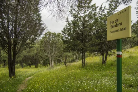
At the beginning of this path is a view of the Sanctuary of the Virgin of the Head, continuing to the East on a forest track. We immediately take a right turn, entering between jars, rosemary and lentils.

The path passes through an ancient herd of cattle, to then cross the forest track of the Membrellejo, used for the access of reels from Andújar and Marmolejo to the Sanctuary during the celebration of the annual Romeria.

It continues between the vegetation of the Mediterranean Mount, it can be seen the Pantano del Encinarejo, and the road that unites the populations of Andújar and Puertollano, beginning a slight down to reach the recreational area of El Jabali, where this path ends

Breve descripción

It is a small walk that will lead us from the surroundings of the Cerro del Cabezo to the Jabali Recreative Area.

Latitud
37.9201
Longitud
-3.0102
Distrito
Municipio
Ubicación en el mapa
POINT (-3.0102 37.9201)
imagen
Image
Ruta%20Santuario-Jabal%C3%AD1.jpg
Imagen principal
Activado
imagen
Image
Ruta%20Santuario-Jabal%C3%AD.jpg
Imagen principal
Desactivado
30 min (solo ida)

Nature

icon-intereses-naturaleza

Friends

icon-intereses-amigos

Adventure

icon-intereses-aventura

Culture

icon-intereses-cultura

Sport

icon-intereses-deporte

Eco-friendly

icon-intereses-eco-friendly

For couples

icon-intereses-en-pareja

Family

icon-intereses-familia

Gastronomy

icon-intereses-gastronomia

Municipality

icon-intereses-municipio

Low-cost tourism

icon-intereses-turismo-low-cost

Solo travel

icon-intereses-viajar-solo
Baja
Ruta Santuario-Jabalí
2 km (solo ida)
All year round
Desactivado
  • In front of COVID19, keep the safety distance and carry a mask, avoid agglomerations and contact with surfaces, wash your hands frequently, use hydroalcoholic gel and consult the available digital materials. Take care of your health and others.
  • It works to prevent fires. Do not throw cigarettes or any other object that produces combustion.
  • By consuming local products and having companies in the area you will contribute to rural development.
  • He lives with the local people and other users. It respects private property and property.
  • Unwind in a sustainable way: public transport, bike, walk, shared vehicle...
  • Noise is another form of pollution. In silence you will enjoy your experience more.
  • It facilitates the use of people with special needs.
  • The trash doesn't come back alone. Take her with you to the nearest container. Reduce, reuse, recycle.
  • Don't leave a mark on your way through nature.
  • It practices a responsible and committed tourism with the environment. Be a real ecotourist!
  • Respect the facilities at your disposal. We all pay for your maintenance.
  • Check the weather forecast before starting your activity.
  • Avoid going out alone. If you do, it communicates tour and time of return to other people.
  • Extreme caution under adverse conditions and with the occasional presence of animals or motor vehicles.
  • Please provide prior information on the possible existence of cynegetic activity.
  • It has water, sun protection, proper clothes and shoes.
  • It carries a mobile with enough battery in case of emergency (112), but remember that there is not always coverage.
  • Don't even bother animals. You would negatively alter his behavior.
  • For your safety and the safety of the environment, don't get out of the signposted road or take shortcuts.
  • Remember that the capture of animals, light fire, fish and collect plants or minerals is prohibited.
  • If you bring a dog, take him with his strap and make sure he doesn't bother other animals or people.
  • Your safety is our concern, but it's your responsibility.

Thank you for your cooperation!

Tramo de asfalto o cemento
 
Tramo de pista o camino forestal
 
Tramo de vía pecuaria
 
Tramo de senda
 

Renaissance of the South

Submitted by brandcode_deweloper on
Id
6739302
Breve descripción

The province of Jaén has the most important Renaissance legacy in Spain, thanks to the work of the master of works Andrés de Vandelvira. Its Renaissance is unique; it comes from Muslim inspiration. Discover an unforgettable route, full of rich monuments, customs, legendary legends, cathedrals that rise between olive trees, palaces full of history, fortresses, urbanism, etc. In short, everything that the traveller needs to discover an indelible footprint of centuries of history.

South Renaissance

Municipio
imagen
Image
Cabecera-renacimiento%20sur.jpeg
Imagen principal
Activado
imagen
Image
a9db8a3328ff7a4f7ae308c2d6a95a5a.jpg
Imagen principal
Desactivado

Friends

icon-intereses-amigos

Adventure

icon-intereses-aventura

Sport

icon-intereses-deporte

Eco-friendly

icon-intereses-eco-friendly

For couples

icon-intereses-en-pareja

Family

icon-intereses-familia

Gastronomy

icon-intereses-gastronomia

Nature

icon-intereses-naturaleza

Low-cost tourism

icon-intereses-turismo-low-cost

Solo travel

icon-intereses-viajar-solo
Desactivado

Greenwaand (Vía Verde) del Aceite

Submitted by brandcode_deweloper on
Id
6622232
Descripción larga

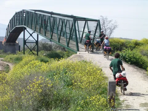
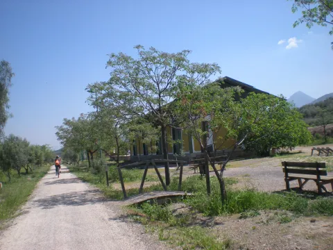
The tour begins at the edge of the city centre of Jaén, next to the municipal sports complex Las Fuentezuelas. The first 2 km, used by hiking and cycling, have several rest areas. From here on, we will cross, on a service road, the north-west circumvalation of Jaén to resume the trail to the town of Torredelcamp. After passing through a new alternative road that saves the A-316 motorway, we arrive at the Torredelcampo station (km. 11,100) located in this urban nucleus.

After two tunnels (the first lit 333 meters long), two viaducts and the rest area of the Quebradas, we will reach the nearby town of Torredonjimeno. From Torredonjimeno Station (Km. 1,600) we will continue in the direction of Martos, for which we will have to cross two long metal walkways that allow the crossing with the road A-316. La Via Verde crosses the city centre of Martos and offers the possibility to make interesting visits to the city.

We left Martos, in a southwestern direction, towards the border with the province of Córdoba. New intersections with the national road are resolved by installing a lower step and a new gateway. In Km. 33, coinciding with the proximity of the Salado stream, the landscape changes and becomes more abrupt and serrano, already in the foothills of the Sierra Sur massif. The railway crosses rivers and streams in the middle of impressive ravines, through metal viaducts with lengths between 70 m and 224 m. These complex engineering works, which were designed by the French Alessandre and Delapierre, date back to the end of the 19th century, magnificent examples of oblonted architecture, and which constitute extraordinary views on the rural landscapes of the province of Jaén.

The rest area of the isolated station of Vado-Jaén is located at km 37. The old railway platform continues its course in the direction of the Alcaudete Station, passing the impressive viaduct on the Víboras River (224 m long and 80 m high), the remains of an abandoned balast quarry, called La Muela, and some sections of lush Mediterranean vegetation in which they stand out oak, retama and majajelos, as well as old almonds.

Leaving the Alcaudete station behind, at 48,400 km, we will reach a crossing with the A-316 road, saved by a high gateway.

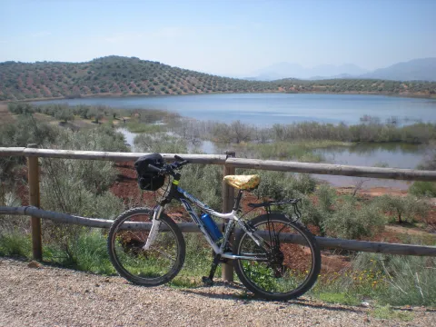
After passing through the building for the railway houses, the Green Way of Oil connects with the Biking Routes of Sierra Sur de Jaén (signposted), which enter the cycloturist in the heart of the massif of the same name, and runs right next to the Laguna Honda Natural Reserve (Km. 50,500); at this point you can see the abundant and rich avifauna that dwells in this 65 Has. wetland of extension: evil, real anade, squid or small zampullin.

On the right bank of the Green Way, a road leads to another natural space protected from the environment: the Natural Reserve of Laguna del Chinche, of 6.5 Has. of extension and with an interesting perilagunar vegetation. The last miles pass through a very eroded site where deep ravines are frequent, in whose slopes the thyme and the spartum occupy a land, not suitable for the olive tree, which sometimes offer excellent panoramic views of the Vadomojón reservoir. The jiennese part of the Green Way of Oil concludes on the great iron bridge over the Guadaljoz River, right in the tail of the reservoir, 199 m long.

From this point the green track connects with that of the Cordobese Subbetic.

Breve descripción

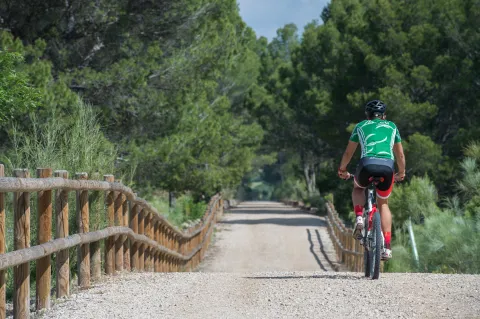
The Green Way of Oil is presented as a new and attractive offer of interior tourism based on the development and recovery of the infrastructure of the old abandoned railway Jaén-Campo Real (Córdoba) as a green corridor, for the practice of cycling, hiking and other sports in direct contact with nature.

Built between 1882 and 1893, this railway belonged to the line Linares- Puente Genil, which was dedicated throughout much of the 20th century to the transport of different metals from the linarian mines and, especially, from the abundant olive oil to the port of Málaga and the markets of the southern Peninsula, so it was popularly called the Oil Train. Technical and commercial reasons motivated their abandonment in 1971, and the transport of passengers and goods was finally closed on 1 January 1985.

All of its layout, from Jaén to the provincial limit, runs by sepentating olive-countryside grounds that make up a landscape of authentic olive-sea splattered by typical Andalusian cortijos. The presence of the Serras de Jabalcuz, la Grana, la Caracolera and del Achillos, located very close to the South and the East of the Via Verde, provide diversity to the relief and the landscape.

Latitud
37.7206
Longitud
-3.9726
Distrito
Municipio
Ubicación en el mapa
POINT (-3.9726 37.7206)
imagen
Image
Foto%204_R%C3%B1CC_2540.jpg
Imagen principal
Activado
imagen
Image
VVA.jpg
Imagen principal
Desactivado
imagen
Image
Patricia%20Aybar%20en%20V%C3%ADa%20Verde.JPG
Imagen principal
Desactivado
imagen
Image
VVA%20%281%29.jpg
Imagen principal
Desactivado
imagen
Image
VVA%20%282%29.jpg
Imagen principal
Desactivado
imagen
Image
VVA%20%283%29.jpg
Imagen principal
Desactivado
imagen
Image
VVA%20%284%29.jpg
Imagen principal
Desactivado
imagen
Image
VVA%20%285%29.jpg
Imagen principal
Desactivado
imagen
Image
VVA%20%286%29.jpg
Imagen principal
Desactivado
imagen
Image
74422248_140452477303677_4407740479924338688_o.jpg
Imagen principal
Desactivado
imagen
Image
VVA%20%287%29.jpg
Imagen principal
Desactivado
imagen
Image
VVA%20%288%29.jpg
Imagen principal
Desactivado
imagen
Image
Aceite08.jpg
Imagen principal
Desactivado
imagen
Image
Aceite10.jpg
Imagen principal
Desactivado
imagen
Image
Aceite13.jpg
Imagen principal
Desactivado
imagen
Image
RCC_2082%20%281%29.jpg
Imagen principal
Desactivado
imagen
Image
cantera-de-la-muela-1-jpg
Imagen principal
Desactivado
5 h

Friends

icon-intereses-amigos

Nature

icon-intereses-naturaleza

Solo travel

icon-intereses-viajar-solo

Gastronomy

icon-intereses-gastronomia

For couples

icon-intereses-en-pareja

Family

icon-intereses-familia

Adventure

icon-intereses-aventura

Culture

icon-intereses-cultura

Sport

icon-intereses-deporte

Municipality

icon-intereses-municipio

Low-cost tourism

icon-intereses-turismo-low-cost

Eco-friendly

icon-intereses-eco-friendly
Baja
Document
Image
fc880c76-e19a-7c1e-4cfb-785b4441a694?t=1604415740731
Vía Verde del Aceite
55 km
250m
Suitable and practical with some sections with inclination, more information at: www.viasverdisaccesibles.es
All year round
Desactivado
Image
e89bb8eb-4c68-4c94-c1c4-16b8446ab220?t=1607013766463
2
9
3
5
3
1

6, from Jaén (The Fuentezuelas' polysports complex) and from each of the five stations.

Users: cyclists, walkers and wheelchair people.

Regardless of the way you decide to travel this route, it is recommended to use comfortable clothes and footwear and adapted to the time of the year. Although it is not convenient to do so in the middle of summer due to the heat. You must not forget to wear enough water and, if you go on a bike, it is always recommended to wear a helmet.

For more information visit:http: / / www.viasverdes.com

Cultural heritage: Monumental set of Jaén. The medieval castle of Alcaudete. Medieval Bridge of the Vipers. Archaeological route of the Torreones. Urban assemblies of Luque, Zuheros, Doña Mencía, Cabra and Lucena. Cueva de los Murcielagos en Zuheros.
Ramal a Baena: Urban complex of Luque and Baena, archaeological park of Torreparedones, the Historical and Archaeological Museum of Baena, church of the ancient Convent of the Agustinos Descalzo in Luque.

Greenwaand (Vía Verde) de Segura

Submitted by brandcode_deweloper on
Id
6591286
Descripción larga

Km 114.5

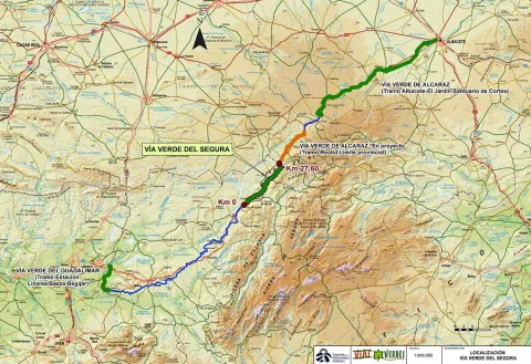
The Segura Natural Trail–Greenway, promoted by the Provincial Council of Jaén and developed by the Ministry of Agriculture, Fisheries and Food in 2015, is a truly unspoilt route surrounded by nature and landscapes. Visitors should be aware that the nearby towns, and therefore opportunities to obtain supplies, are located some distance from the route. It begins beside the kilometre 217 marker on the Bailén–Albacete national road (N-322), two kilometres from Arroyo del Ojanco and one kilometre from its abandoned railway station. There is no designated car park on the left-hand side of the road when travelling towards Albacete, although there is sufficient space to park several vehicles. Information panels and signs indicate the starting point.

The first kilometre descends towards the Guadalimar River viaduct, a monumental concrete structure with a 175-metre-long deck supported by five wide arches. The viaduct also provides an exceptional viewpoint overlooking the river’s gallery forest. The Guadalimar River is the lowest point on the route.

After crossing the Guadalimar River, the route of the former railway has been occupied for 1.5 km by the access road to a biogas plant. The alternative is a parallel path which, in order to negotiate the overpasses, includes several ascending and descending slopes.

When the asphalt road branches away at km 118, the route once again takes over the former railway platform. The Segura Greenway regains the advantages of the original railway route and begins a long journey through a landscape of rolling hills, dominated by orderly rows of olive trees and alternating areas of uncultivated land covered with Spanish broom, dotted with isolated trees and small patches of pine forest. In the distance, high mountains rise on both sides, their olive groves extending upwards until they meet the dense pine forests crowning the summits.

Across such difficult terrain, the railway was able to maintain long straight sections thanks to its most characteristic engineering structures. High embankments built over stream valleys alternate with cuttings through raised terrain and cut-and-cover tunnels in places where the earthy walls of the cuttings were too unstable.

From km 122 onwards, it becomes easier to see a deep gorge opening in the mountain range that closes off the southern horizon on the right. The Guadalimar River has carved a passage through the Sierra de Segura, where the town of La Puerta de Segura occupies a strategic location. In the distance, beyond the gorge and perched on a hill, the castle and village of Segura de la Sierra can be seen overlooking the boundaries of the Sierras de Cazorla, Segura y Las Villas Natural Park.

Within sight of the hamlet of La Agracea, at km 124.5, there is another important point on the route. A shooting range stands to one side, and its bar is the only place near the greenway where visitors can obtain supplies. 

Km 125

At km 125, the original route of the Baeza–Utiel railway has been severed by the N-322 road. The gravel path ends at the intersecting JV-7001 road. As the former railway alignment has disappeared, the alternative is to share the lightly trafficked road with other vehicles. Turning right, the road rises over an overpass and crosses above the N-322 in the direction of La Puerta de Segura, located 6 km from the greenway. This interruption, which is clearly signposted, is marked by an old steamroller raised on an unusual pedestal: a former railway track overpass.
Around 200 metres further on, a gravel track on the left descends to rejoin the original railway alignment and allows vehicles to reach the car park provided beside the first station on the route.
 
The former Puente de Génave station, at km 125.3, follows the same architectural design as the other stations. It consists of a main passenger building and a goods warehouse, each with its respective platform. Here, however, there is also a livestock loading platform, which is not present at the other stations, alongside which a rest area has been provided.
 
It is worth mentioning that there is a new 5 km cycle lane between the town of Puente de Génave and La Puerta de Segura. This provides an excellent opportunity to reach this beautiful town and the heart of the Natural Park safely.
 
Beyond the station, the railway route winds around the courses of the Gavilán and Moral streams. The alignment curves around deep valleys with steep slopes. In this unspoilt environment, pine forest begins to spread towards the route, first reaching it through the intermittent ravines crossed by high embankments and eventually becoming the dominant feature. The pine trees enhance the route between the hamlet of Bonache, at km 126.7, shortly before crossing into the Natural Park, and the cutting at km 129. This section includes a rest area at km 128.2, an idyllic place to stop, where the greenery and shade of the pine trees create an oasis.

As the route crosses the Sierras de Cazorla, Segura y Las Villas Natural Park, the dominant landscape of olive groves and uncultivated land returns. The vegetation changes, but the surrounding stream valleys continue to shape the route. The Segura Greenway then enters a large cutting with high rocky walls that curves to the left, rises over two high embankments providing views across the deep valley and finally passes underground. The Génave Tunnel, at km 132, is the longest on the route and consists of a straight, 277-metre gallery in excellent condition. However, it has no lighting, so visitors are advised to bring a torch or bicycle lights.

Km 133.5

A long straight section through uncultivated land leads to Génave station, at km 133.5, where there is a rest area, a car park and access from the Génave road, the JV-7053.

Beyond Génave station, the rolling landscape returns. The former railway platform once again follows long straight sections between olive groves and uncultivated fields. The surroundings are similar, although the panoramic views are different. On the left-hand side, towards the north, Sierra Morena gradually descends and the landscape opens up. The view extends across the boundaries of the province of Jaén and may even reach the Campos de Montiel region in Ciudad Real. 

Km 137

The section through the Natural Park comes to an end beside an overpass near the Santa María farmhouse. The ruined buildings and rugged surroundings create a strong sense of isolation. From this farmhouse onwards, the landscape changes radically. Olive groves are no longer ever-present. They continue to dominate the distant mountains, but along the edges of the route they alternate with fields of herbaceous crops and uncultivated land covered with Spanish broom and holm oaks. The latter even form a small woodland extending for around one hundred metres.
 
Villarrodrigo station, at km 140, has a rest area and an access point. Beyond the station lies the final section of the route: a gentle 1.5 km descent through flat cereal fields. The Segura Greenway ends at the provincial boundary with Albacete, at km 141.5. However, the journey can continue for another 19.5 km along the Sierra de Alcaraz Greenway, or even as far as the city of Albacete, although a further 16 km section beyond Reolid station and towards the town of Alcaraz has not yet been restored. 

Facilities
Information and evacuation panels, direction signs, railings, bollards and replanted vegetation along the edges of the route. Rest areas with tables, benches, litter bins and bicycle parking facilities. Access points at the stations.
 
The beginning of the Segura Greenway is marked as km 114.5 with a view to its future integration with other already signposted sections in both Jaén and Albacete. At km 131.5, there is an original series of railway markers bearing the initials B-U, standing for Baeza–Utiel. These belonged to the former Baeza–Utiel railway, whose starting point, km 0, was located in Linares. 

Breve descripción

The route of the old Baeza railway - Use its steps in the province of Jaén in the region of the Sierra de Segura. On the way to the province of Albacete, it unfolds between a landscape of lomas and hills dominated by the olive grove. And one of its sections goes through the Natural Park Sierras de Cazorla, Segura and Las Villas.

This Natural Road - Via Verde has been implemented under the Natural Walking Programme of the Ministry of Agriculture, Food and the Environment.

Latitud
37.7796
Longitud
-3.7849
Distrito
Municipio
Ubicación en el mapa
POINT (-3.7849 37.7796)
imagen
Image
PA200236%20-%20copia.jpg
Imagen principal
Activado
imagen
Image
PA200223%20-%20copia.jpg
Imagen principal
Desactivado
imagen
Image
Foto%201_RAF1305.jpg
Imagen principal
Desactivado
imagen
Image
Foto%202_RAF1230.jpg
Imagen principal
Desactivado
imagen
Image
Foto%203_RAF1232.jpg
Imagen principal
Desactivado
imagen
Image
Foto%204-203237.png
Imagen principal
Desactivado
imagen
Image
Foto%205_RAF1295.jpg
Imagen principal
Desactivado
imagen
Image
Foto%207_RAF1315.jpg
Imagen principal
Desactivado
imagen
Image
PA200215%20-%20copia.jpg
Imagen principal
Desactivado
imagen
Image
PA200280%20-%20copia.jpg
Imagen principal
Desactivado
imagen
Image
DGJK5601.jpg
Imagen principal
Desactivado
imagen
Image
thumb.png
Imagen principal
Desactivado
imagen
Image
PA200265%20-%20copia.jpg
Imagen principal
Desactivado

Friends

icon-intereses-amigos

Nature

icon-intereses-naturaleza

Solo travel

icon-intereses-viajar-solo

Gastronomy

icon-intereses-gastronomia

For couples

icon-intereses-en-pareja

Family

icon-intereses-familia

Adventure

icon-intereses-aventura

Culture

icon-intereses-cultura

Sport

icon-intereses-deporte

Municipality

icon-intereses-municipio

Low-cost tourism

icon-intereses-turismo-low-cost

Eco-friendly

icon-intereses-eco-friendly
Medium
Image
d3c1c77a-e613-630f-1a91-091aa05883f1?t=1604419293738
Vía Verde de Segura
27 km
Suitable though difficult between the km. 116.2 and 117.7.
All year round
Desactivado
Image
1bce61fa-87f2-0deb-4b00-f9ee11d10e13?t=1607013708900

Between the km 217 of the N-322 road (municipal term of Arroyo del Ojanco) and the provincial limit Jaén-Albacete (T.M. de Villarrodrigo).

Tramo de asfalto o cemento
 
Tramo de pista o camino forestal
 
Tramo de vía pecuaria
 
Tramo de senda
 

Greenwaand (Vía Verde) de Vadollano

Submitted by brandcode_deweloper on
Id
6585625
Descripción larga

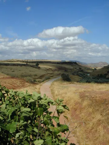
This Green Way has 2 protected natural spaces located within a radius of less than 5 km: ZIC of the Guadalimar River (Red Natura 2000) and the El Pibat Natural Monument. In addition, it is possible to learn more about these natural spaces protected by the Laguna Grande Information Point.
ZIC of the Guadalimar River:In this natural space, red clays and sands are common. This area is part of the medium mountain serranies of the Sierras de Cazorla and Segura, predominating the landscape of mountain-standing countryside (Cuenca del Guadalimar). The final section is characterized by the landscape of the Vega del Guadalquivir. The river is important for species such as calandino, the Boga del Tajo and the Boga del Guadiana.

The Pat Natural Monument:This Natural Monument, located in the area of contact between the countryside and the foothills of Sierra Morena, houses a stretch of the river Guarrizas of extraordinary landscape and natural value. In the higher areas the landscape is rough and the river is attached to the huge granite blocks. The channel has to save a number of levels by producing two small waterfalls. Below, the arms of the river are reunited in a deep remnant. The riverside vegetation is in good condition of conservation, highlight species like the strawberry, with examples of a remarkable size. Among the fauna are the birds, among which is the black millano.

Breve descripción

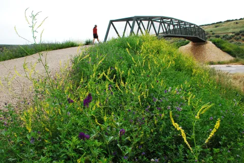
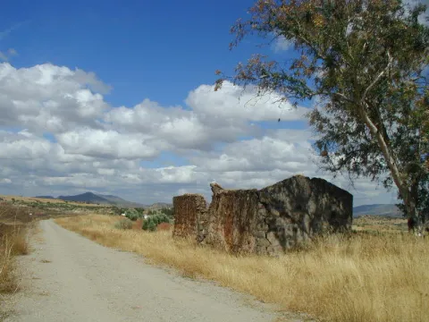
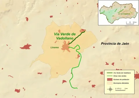
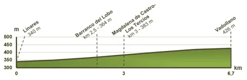
The Vadollano Green Way runs through the old route of the Linares- Vadollano railway road, from the old Santana factory to the access doors of the Army Station Headquarters in Vadollano, from which rail and naughty remains can be observed, which over the years have been covered with vegetation and are virtually unpassable.

Latitud
37.7796
Longitud
-3.7849
Distrito
Municipio
Ubicación en el mapa
POINT (-3.7849 37.7796)
imagen
Image
Vadollano00.jpg
Imagen principal
Activado
imagen
Image
Vadollano04.jpg
Imagen principal
Desactivado
imagen
Image
Vadollano01.jpg
Imagen principal
Desactivado
imagen
Image
Vadollano03.jpg
Imagen principal
Desactivado
imagen
Image
Vadollano05.jpg
Imagen principal
Desactivado
imagen
Image
Vadollano02.jpg
Imagen principal
Desactivado

Nature

icon-intereses-naturaleza

Friends

icon-intereses-amigos

Adventure

icon-intereses-aventura

Culture

icon-intereses-cultura

Sport

icon-intereses-deporte

Eco-friendly

icon-intereses-eco-friendly

For couples

icon-intereses-en-pareja

Family

icon-intereses-familia

Gastronomy

icon-intereses-gastronomia

Municipality

icon-intereses-municipio

Low-cost tourism

icon-intereses-turismo-low-cost

Solo travel

icon-intereses-viajar-solo
Medium
Image
cf9c3d89-f6e2-4cbc-ef01-e6d4338688df?t=1604420899217
Vía Verde de Vadollano
6,7 km
Can be taken by foot, mountain bike and horse
All year round
Desactivado
Image
76052e72-0bfc-a949-04c2-bb067efc28ba?t=1607013534423
1

1 rest area

Regardless of the way you decide to travel this route, it is recommended to use comfortable clothes and footwear and adapted to the time of the year. Although it is not convenient to do so in the middle of summer due to the heat. You must not forget to wear enough water and, if you go on a bike, it is always recommended to wear a helmet.

For more information visit:http: / / www.viasverdes.com

Monumental set of Linares, mining and industrial heritage, ruins of the Ibero-Roman city of Catulo and centres of interpretation of the Landscape Minero and Metallurgy.

By car we recommend you access the Via Verde for the following access:

  • Access No 1: Linares, in the vicinity of the Factory of Santa Ana. GPS coordinates (decimal format): 38.105551 °, -3.620675 °.
  • Access No 2: Vadollano area, access from road A-312. GPS coordinates (decimal format): 38.139634 °, -3.570731 °.

By train:

  • Liners: Medium Distance, Madrid-Jaén Line and Long Distance of Renfe

Connections:

  • Jaén: 30 km to Linares.

Trail de la Muralla PR-A126

Submitted by brandcode_deweloper on
Id
6489019
Descripción larga

Without leaving the path, at the front and below we find the path of the Fuente la Zarza, the forest opens and leaves room for the olive tree. Without going down to the lane, to the left, on the hillside, a narrow path diagonally ascends towards the right flank of the pine near the olive grove. Here begins a progressive, and pleasant promotion. This path connects with an access lane to an olive grove. At this point and without separating from the pine tree we go up to the left, for a short and steep stretch that softens and leads us first on a path and then on a track to the Neveral Hospital.

Due to the constant works in the vicinity of the Hospital and the lack of continuity of the original route of the path that previously surrounded the center through the back area, it is easier to continue straight by the asphalt, so we enter the hospital compound Dr. Sagaz, El Neveral and we cross it to its exit. At the entrance already on the road and to avoid moving on it, to the right, we take advantage of the trails of the recreational area of the Neveral that will take us away from the road traffic. We take a narrow road to the left, on a basketball field and cross the forest track, (common section with the PR-A127: Pinares del Neveral) the road marked, continues close to the vaguada, and the cross later to connect with the road again, about 50 meters from the Caño Quebrado Center. Caño Quebrado is the only source we find throughout the course. (End of common section with the PR-A127 Neveral Pines).

In Caño Quebrado they connect the road to Jaén, the road of the Castle of Santa Catalina and Parador Nacional, with the road to the Neveral Hospital, where we have passed before. In front of the Caño Quebrado Fountain. Just to the left of the road that goes up to the Castle of Santa Catalina and the Parador. Take a lane that descends next to some old chalet, below and to the right continue on a very good road that opens way between the pines and that will return us back to the crossing that is next to the Wall, which we cross again, this time in the opposite direction, to return to the beginning of the Path.

Breve descripción

This circular path, has its beginning in the city centre of Jaén, specifically begins on the bypass road, opposite No. 126. In front of this point a road in good condition, next to an electric transformer ascends on the north side of the hill of the Castle of Santa Catalina. The track with a strong slope, then turns right and softens, rushing through the castle wall. Once we cross the wall, we find an olive tree and the road forks. At this point we will return to the descent, as from here it begins circular section of the path. We take the right road, right through the olive line. From this flat section, you can see the San Vicente de Paul (below), the Magdalena Quarter, and the San Juan Quarter on the right. As we reach the pine tree, we continue on a path descending a few meters and then slightly ascending, opening the way between the pine trees. At about 150 m there is a crossing that we must continue on the right. Later on it passes through a (open) gate of one fenced, the path crosses this fencing, and it leaves it coming out later by a similar gate. Both cancels are generally open.

Latitud
37.768825
Longitud
-3.795409
Ubicación en el mapa
POINT (-3.795409 37.768825)
imagen
Image
sendero%20de%20la%20muralla1.jpg
Imagen principal
Activado
imagen
Image
sendero%20de%20la%20muralla.jpg
Imagen principal
Desactivado
2 h 30 min

Nature

icon-intereses-naturaleza

Friends

icon-intereses-amigos

Adventure

icon-intereses-aventura

Culture

icon-intereses-cultura

Sport

icon-intereses-deporte

Eco-friendly

icon-intereses-eco-friendly

For couples

icon-intereses-en-pareja

Family

icon-intereses-familia

Gastronomy

icon-intereses-gastronomia

Municipality

icon-intereses-municipio

Low-cost tourism

icon-intereses-turismo-low-cost

Solo travel

icon-intereses-viajar-solo
Medium
645 m
Muralla PR-A126
5,95 km
195m
195m
On foot
All year round
Desactivado

Good conservation status, but signs have disappeared in some areas.

Coordenadas / Huso 30S
UTM coordinates: x = 429946 and = 4180464
Tramo de asfalto o cemento
8.4%
Tramo de pista o camino forestal
47.9%
Tramo de vía pecuaria
0
Tramo de senda
43.7%

Trail Cruz de la Chimba

Submitted by brandcode_deweloper on
Id
6488877
Descripción larga

The path begins at the same source of the Cañada de las Azadillas, before a small round where the asphalt road ends. To the right of the fountain and to the empty, we go up perpendicularly from the road about 80 m. We make a turn of something more than 90 ° to the left where a horseshoe path is born that passes on the hillside of the fountain. Once on the road there is no loss as it is very marked, only some fallen trees cross the road, but these do not have difficulty avoiding them.

This first stretch is a constant rise and the good route of the path facilitates progression. As you gain height, the cups of the bushes adjacent to the path partially occupy some areas of the path, but in no case makes the footprint difficult or hidden. Already at the top the slope is softer and soon in a clear area we find the remains of a low-marked lane that lead to an explanade where forest cars turn, and start of the track. This point is the place of access and to which we must return, if we want to visit the forest shed Cruz de la Chimba at about 200 meters, hidden by the thickness of the pines. There is no path marked as such, so it is easy to get confused even though the distance is short. The best option is to walk on the track about 20 m from where the vehicle pass begins and is marked, perpendicularly to the lane and to the right of the track (west direction, direction 247th) we enter the pine in an area of path little defined, but with traces of the passage of the people, and that goes slightly up to reach a meadow where the shed is.

The Chimba Cross. It's the star point of the excursion. It has one of the best panoramic views of the Sierra de Jaén. Behind the shed is La Pandera, below the valley of the Quiebrajano River, and towards the north, the Castle of Otiñar and to the bottom of Jaén. It is in a semi-exclusive state thanks to the respectful care of its visitors. Caution should be exercised if we are accompanied by children or have vertigo, as the shed is in the vicinity of a steep area without any protection.

For return to the track the same route is used in the one way. Again on the forest track you have to continue to the right, the land is flat. This area is known as the Llanos de Navalopos. The track has no confusion. At its step and on the left it passes close to a plain and later borders a second plain up to a hill. At this point, the track goes down continuously until it returns to the Azadillas Canyon. But first we will find a chain that cuts the way to the cars and just beyond there is a crossing with the track that links the Azadillas Canyon with the Llanos de Palomares and the Pueblo de Carchelejo. We continue on the left descending, direction to the Cañada de las Azadillas. At the entrance to the Hall of Nature we will have finished the tour.

Breve descripción

It is located in the area of the Cañada de las Azadillas, inside the Jaén Periurban Park, at 18.5 Km. Its forest and abrupt orography are of a great beauty and landscape wealth that deserves to visit it. Their isolation because it is not a place of passage, has helped to remain practically intact. There is a recreational area, known and visited by the Jiennenses and people of neighbouring villages on weekends to make picnic hiking, etc. There is also a Nature Hall dedicated to environmental education. The previous approach is made from Jaén, from the Alcantarilla district, by regional road JA-3210 to the Sierra Bridge. From there, follow to the right, the road towards the Quebrajano Pantano, Otinar and Cañada de las Azadillas. In the Km 14 of the road, under the Castle of Otiñar, we take the left road across the bridge and about 3 km away we will reach the Cañada.

Latitud
37.654095
Longitud
-3.728805
Ubicación en el mapa
POINT (-3.728805 37.654095)
imagen
Image
1226012Master.jpg
Imagen principal
Activado
imagen
Image
Sendero%20Cruz%20de%20la%20Chimba%20%282%29.jpg
Imagen principal
Desactivado
2 h

Nature

icon-intereses-naturaleza

Friends

icon-intereses-amigos

Adventure

icon-intereses-aventura

Culture

icon-intereses-cultura

Sport

icon-intereses-deporte

Eco-friendly

icon-intereses-eco-friendly

For couples

icon-intereses-en-pareja

Family

icon-intereses-familia

Gastronomy

icon-intereses-gastronomia

Municipality

icon-intereses-municipio

Low-cost tourism

icon-intereses-turismo-low-cost

Solo travel

icon-intereses-viajar-solo
Medium
1114 m
Sendero Cruz de la Chimba
6,9 km
283m
283m
On foot
All year round
Desactivado

Recreational area of the Cañada de las Azadillas
Source of the Cañada de las Azadillas (non-drinking water) at the beginning of the path

It is located at 18.5 km. of the city of Jaén, in the area of the Cañada de las Azadillas well known for the recreational area of the same name. A vehicle is currently needed to access the start of the path quickly. Take the JA-3210 communal road leading to the Sierra Bridge. From there, we take to the right the road towards the Quebrajano Pantano, Otinar and Cañada de las Azadillas.

In the Km. 14 of the road, under the castle of Otiñar, we take the left road crossing the bridge over the river until we reach the canyon. The path begins at the source of the Cañada de las Azadillas, before a small round don ends the asphalt road.

Coordenadas / Huso 30S
UTM coordinates: x = 435713 and = 4167687

GR-7

Submitted by brandcode_deweloper on
Id
6485714
Descripción larga

The explanations offered here are very brief, and do not go from being a presentation of this great itinerary, with the aim of locating its different stages as it passes through our province. The most important localities and reference steps are mentioned, but the explanation does not stop to inform about each and every detail of the road, actually formed by different types of roads, landscapes and conditions.
The entire route in the province of Jaén will take a week to ten days of long walks, with the most recommended support of one or two vehicles for the transport of material. Its passage through villages makes its division possible and allows it to make stages of less journey, depending on the interest of the group of hiking people. The GR-7 was marked and beheaded by the Andalusian Mountain Federation and the Tourism, Trade and Sport Council. Years later, some of the milestones have been lost, but by using traditional roads, their realization remains possible.
The path crosses the provincial border Cordoba-Jaén in Pilas de Fuente Soto, reaches Alcalá la Real and continues, in the direction of the village of Santa Ana, coinciding with a Royal Canyon adorned with stone crosses that crosses a moor with the Castle of La Mota on the horizon. It passes through Santa Ana, takes us to Fries and then to Los Rosales, from where it follows a paved road and then to rural roads.
It traverses several ports among which is that of Los Alamillos, goes down to the river Valdearazo and comes up again by seeping the Stone of the Palo, between Camillo de Arenas and Carchelejo, giving view to the Embalse of Quiebrajano. The road continues to ascend to a few plains before the town of Carchelejo, which is accessed by a steep road, by the upper part of the town, by the deposits.
The road leaves the Sierra Sur and leaves Carchelejo following a path that descends in search of the old road N-323, passing through a rock needle to which they refer by "The Old Tooth." In the N-323 it continues to the highway, the cross below and goes back the river line between orchards and choperas to access Cambil next to the debugger of the population. From here we go in the direction of the Corrijada of Matabejid, in the direction of Huelma, to enter the Natural Park of Sierra Magina, with the highest summits of the province of Jaén. We pass through Matabejid and follow a track towards the Port of La Mata, passing through the area of the Castillejo, a magnificent landscape characterized by the ruins of a castle of the ancient medieval border. This mountain of oaks and complaints is kept by one of the most emblematic mountains of the province, La Peña de Jaén. This landscape has the particularity of being the dehesa of complaints on a limestone mountain, higher in Spain. Crossing the Port the road runs between pine trees in the direction of Torres, where we can refresh with the water of the Fuenmayor, and already in the village in the Pila Pellenda, at the entrance to the village, before continuing to Albánchez de Magina by means of pecuaria roads, used as pedestrian roads between populations, accompanied by almonds and cherry trees characteristic of this area, which offers an image of whitened valley during its flowering.
Once again, we pass through Fuente de la Fresneda and through the recreational area of Cuadros until we reach Bedmar, from where we will suddenly go up to El Portillo by one of the most pronounced ramps of the GR to go down to Jódar through the Serrezuela. We left Jódar for the Jódara-Quesada railway station, we crossed the Minor Guadiana looking for Peal Furnaces, then Toya, and continued on the Vega to Quesada.
We are already in the Natural Park of the Serras de Cazorla, Segura and the Villas. As we leave Quesada we will pass under the site known as El Chorro, in search of the Monastery of Monte Zion, and from here to the hermitage of San Isicio, near Cazorla. We will leave Cazorla on one of the most beautiful roads of the whole route, we will see the hermitage of the Virgin of the Cabeza, on a road between pine trees we will pass by the Fountain of the Bear in search of the village of Vadillo Castril, then the village of Loma de Mª Ángeles, later on, through the Natural Park of the Sierra de Cazorla, Segura and Las Villas, Catorrios, and through the avenue of the Guadalquivir, passing near the Aguamulas River, we will go to the Fountain to Segura to reach Pontones. From Pontones we continue to Poyotello, we go down next to the channel of the young Rio Zumeta to the village of the Ruices, Santiago de la Espada, and finally we cross the provincial limit towards the Puebla de D. Fadrique, in Granada.

Breve descripción

The path GR-7 is just over 300 km. of the province of Jaéngoing throughthree of the most important Sierras in the province:Sierra Sur, Sierra Magina and Sierras de Cazorla, Segura and Las Villas. This is a stretch of this great road that runs through the European continent. It begins in Tarifa (Cadiz, Spain) and through Brussels (Belgium), it ends in Athens (Greece). As you pass through the province of Jaén, you will find a network of local, no less interesting, small tour trails.

Latitud
37.4614
Longitud
-3.9222
Distrito
Municipio
Ubicación en el mapa
POINT (-3.9222 37.4614)
imagen
Image
gr7malaga1.jpeg
Imagen principal
Activado
imagen
Image
gr7malaga1-1-jpeg
Imagen principal
Desactivado
Unas 100 h de andadura a una media de 3 km/h

Friends

icon-intereses-amigos

Nature

icon-intereses-naturaleza

Solo travel

icon-intereses-viajar-solo

Gastronomy

icon-intereses-gastronomia

For couples

icon-intereses-en-pareja

Family

icon-intereses-familia

Adventure

icon-intereses-aventura

Culture

icon-intereses-cultura

Sport

icon-intereses-deporte

Municipality

icon-intereses-municipio

Low-cost tourism

icon-intereses-turismo-low-cost

Eco-friendly

icon-intereses-eco-friendly
GR-7
150 km
11000m
11000m
Desactivado
Tramo de asfalto o cemento
 
Tramo de pista o camino forestal
 
Tramo de vía pecuaria
 
Tramo de senda
 

Signposted Trail - El Encinarejo

Submitted by brandcode_deweloper on
Id
6474525
Breve descripción

It is a path designed around the Jandula River. Through a pleasant walk, you can enjoy the contrast between the riverside ecosystems and those of a typical dehesa of the Sierra de Andújar Natural Park.

It starts at the Iron Bridge that crosses the Jandula River and is also the main entrance to the natural park. A recreational area with barbecues and tables continues in parallel to the right bank of the river. In this section of the path we can observe the characteristic vegetation of the park's riverside forests: strawberries, alyses, sardines, tarayes, etc., which serve as a refuge to the representative fauna of this humid area: royal herons, zampullin, water cocks and if we are lucky you can see some otter. It is interesting, too, the presence of small sides of rabies or mohyes that often approach visitors waiting for food.

On this same stretch and on our left, in what constitutes the Solana del Coscojar, we can see, on the hillside, that the vegetation changes markedly, with the appearance of oak, pine pines, lentils and grasses.

Following the river bank we arrive at the foot of the dam of the Encinarejo swamp. It is a small swamp, more like a lake, and the purpose of which is the use of electrical energy. Under the dam and through a bridge you cross the other shore, after a small climb you reach the village of Encinarejo, built to house the employees who built the dam.

The rabbit is of great importance inside the park. In addition to traditional cynegetic use in the area, it provides support for species of great interest such as the lince, the imperial eagle or the meloncillo. The deer is the species of major hunting par excellence in the natural park, the traditional form of hunting is the montaria, its tradition in this

Latitud
38.0704
Longitud
-4.0303
Distrito
Municipio
Ubicación en el mapa
POINT (-4.0303 38.0704)
imagen
Image
1190_SS_02%20%281%29.jpg
Imagen principal
Activado
imagen
Image
Sendero%20se%C3%B1alizado%20-%20El%20Encinarejo.jpg
Imagen principal
Desactivado
1 h

Nature

icon-intereses-naturaleza

Friends

icon-intereses-amigos

Adventure

icon-intereses-aventura

Culture

icon-intereses-cultura

Sport

icon-intereses-deporte

Eco-friendly

icon-intereses-eco-friendly

For couples

icon-intereses-en-pareja

Family

icon-intereses-familia

Gastronomy

icon-intereses-gastronomia

Municipality

icon-intereses-municipio

Low-cost tourism

icon-intereses-turismo-low-cost

Solo travel

icon-intereses-viajar-solo
Baja
Sendero señaliado - El Encinarejo
2,7 km
On foot
All year round
Desactivado
  • In front of COVID19, keep the safety distance and carry a mask, avoid agglomerations and contact with surfaces, wash your hands frequently, use hydroalcoholic gel and consult the available digital materials. Take care of your health and others.
  • It works to prevent fires. Do not throw cigarettes or any other object that produces combustion.
  • By consuming local products and having companies in the area you will contribute to rural development.
  • He lives with the local people and other users. It respects private property and property.
  • Unwind in a sustainable way: public transport, bike, walk, shared vehicle...
  • Noise is another form of pollution. In silence you will enjoy your experience more.
  • It facilitates the use of people with special needs.
  • The trash doesn't come back alone. Take her with you to the nearest container. Reduce, reuse, recycle.
  • Don't leave a mark on your way through nature.
  • It practices a responsible and committed tourism with the environment. Be a real ecotourist!
  • Respect the facilities at your disposal. We all pay for your maintenance.
  • Check the weather forecast before starting your activity.
  • Avoid going out alone. If you do, it communicates tour and time of return to other people.
  • Extreme caution under adverse conditions and with the occasional presence of animals or motor vehicles.
  • Please provide prior information on the possible existence of cynegetic activity.
  • It has water, sun protection, proper clothes and shoes.
  • It carries a mobile with enough battery in case of emergency (112), but remember that there is not always coverage.
  • Don't even bother animals. You would negatively alter his behavior.
  • For your safety and the safety of the environment, don't get out of the signposted road or take shortcuts.
  • Remember that the capture of animals, light fire, fish and collect plants or minerals is prohibited.
  • If you bring a dog, take him with his strap and make sure he doesn't bother other animals or people.
  • Your safety is our concern, but it's your responsibility.
  • Thank you for your cooperation!
Tramo de asfalto o cemento
 
Tramo de pista o camino forestal
 
Tramo de vía pecuaria
 
Tramo de senda