Saltar al contenido principal
icon-intereses-amigos

Hiking Route Cañada del Saucar - Puntal de la Misa

Submitted by brandcode_deweloper on
Id
5725679
Descripción larga


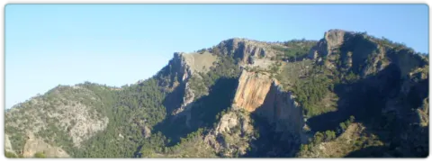
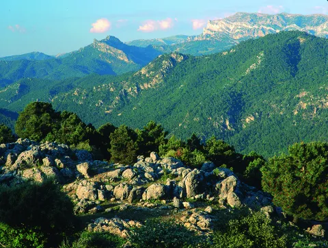
This is one of the most impressive hiking routes in the Segura saw. As we gain height, vegetation is scarce to a piornal austere. Once on the top of the calar, we discover the great and overwhelming atmosphere of the high mountain of Segureña: a huge karmic platform, 5 km long, with meadows where the flocks of Segureña sheep are pasted, broken by dolinas (sodas called "sorbeores" in the region), vaguadillas and sharp rocky.
The remains of stone walls of ancient agricultural terraces remain on the ground, witnesses to the hardness of the old rural life, in which the serrans went up from the nearby villages to sow cereals, taking advantage of the moisture that the soil conserves in a few pits. It is now unthinkable to make such hard daily displacements to start such scarce yields.

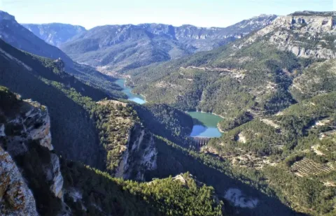
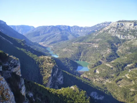
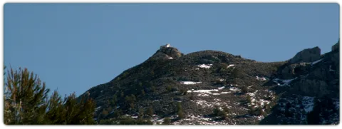
From the forest surveillance site of the Puntal de la Misa, and along the east side of the calar, we will dominate unforgettable panoramic over an infinite succession of mountain curtain across the deep valley of the Segura River.

The calar is frequented by flocks of mountain goats and overtaken by the lion vulture. In the cut there are also pilgrims hawks. The whole area is full of boar. It is easy to see the piquiroja chova and the alpine accentor.

Breve descripción

This is one of the most impressive hiking routes in the Segura saw. As we gain height, vegetation is scarce to a piornal austere. Once on the top of the calar, we discover the great and overwhelming atmosphere of the high mountain of Segureña: a huge karmic platform, 5 km long, with meadows where the flocks of Segureña sheep are pasted, broken by dolinas (sodas called "sorbeores" in the region), vaguadillas and sharp rocky.

Latitud
38.22008
Longitud
-2.546613
Distrito
Municipio
Ubicación en el mapa
POINT (-2.546613 38.22008)
imagen
Image
676_img.png
Imagen principal
Activado
imagen
Image
shutterstock_1060474277.jpg
Imagen principal
Desactivado
3 h 22 min (ida y vuelta)

Family

icon-intereses-familia

Friends

icon-intereses-amigos

Nature

icon-intereses-naturaleza

Adventure

icon-intereses-aventura

Solo travel

icon-intereses-viajar-solo

Culture

icon-intereses-cultura

Gastronomy

icon-intereses-gastronomia

Sport

icon-intereses-deporte

Municipality

icon-intereses-municipio

Low-cost tourism

icon-intereses-turismo-low-cost

Eco-friendly

icon-intereses-eco-friendly

For couples

icon-intereses-en-pareja
Baja
1796
Image
9a64b259-acb7-36ab-9b6b-027116101491?t=1607090586469
Image
c9129abf-a978-ef5c-8f27-4f1eaf341694?t=1607090580344
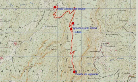
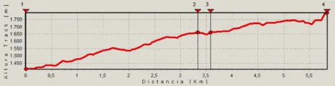
Cañada del Saucar-Cumbre del Puntal de la Misa
5,9 km (solo ida)
466m
93m
1
1
1
3
Horse, on foot, bike or 4x4
All year round
Desactivado
Image
854c582e-25de-5750-3804-c341e13f63dc?t=1607090573673

The tour is marked PR-A 1196
Water at the source of the Cañada del Saucar, at the beginning of the route.

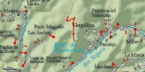
On the road between Rio Madera and La Toba (JF-7038), take the detour that leads to the villages of Los Anchos and Prado Maguillo, to continue on a good forest track to the cortijos of La Cañada del Saucar, where the beginning is located.

1410

Plot of Surveillance Summit of the Puntal of the Mass
1796
Coordenadas / Huso 30S
30S x = 539687 and = 4230331
Tramo de asfalto o cemento
0
Tramo de pista o camino forestal
0.01
Tramo de vía pecuaria
0
Tramo de senda
0

Hiking Route Campo del Espino a Banderillas

Submitted by brandcode_deweloper on
Id
5725559
Breve descripción

The route begins in the heart of the Fields of Henán Perea, altiplanicie located between the 1600- 1700 m altitude, almost devoid of trees, very rocky and with infinity of formations as a funnel (dolines and simas) that indicate, the difficult winter conditions and the nature of its composition. We are in the largest "sponge" in the park, the limestone absorbs the water, dissolving over the years and forming this landscape so characteristic that many resemble a lunar landscape. Although on certain occasions of the year it may even seem like a desert and dry land, nothing further than reality, under us is the largest underground aquifer of the park.

Latitud
38.01445
Longitud
-2.785396
Distrito
Municipio
Ubicación en el mapa
POINT (-2.785396 38.01445)
imagen
Image
Natu348.jpg
Imagen principal
Activado
imagen
Image
shutterstock_1060474277.jpg
Imagen principal
Desactivado
4 h (ida y vuelta)

Family

icon-intereses-familia

Friends

icon-intereses-amigos

Nature

icon-intereses-naturaleza

Adventure

icon-intereses-aventura

Solo travel

icon-intereses-viajar-solo

Culture

icon-intereses-cultura

Gastronomy

icon-intereses-gastronomia

Sport

icon-intereses-deporte

Municipality

icon-intereses-municipio

Low-cost tourism

icon-intereses-turismo-low-cost

Eco-friendly

icon-intereses-eco-friendly

For couples

icon-intereses-en-pareja
Medium
1985
Image
64b81a4f-9ae6-512e-0b09-b84a0abf5ed5?t=1607089127003
Document
Image
1fcd7c3f-8ff6-aadf-a915-6bdef12934fc?t=1607089134181
CAMPO DEL ESPINO A CUMBRE DEL BANDERILLAS
7,63 km (solo ida)
347m
70m
2
1
2
3
Horse, on foot
All year round
Desactivado
Image
d1090215-2463-6d8e-aa20-982d31281c8b?t=1607089119774

Safe Source

The route begins in the heart of the Fields of Henán Perea, altiplanicie located between the 1600- 1700 m altitude, almost devoid of trees, very rocky and with infinity of formations as a funnel (dolines and simas) that indicate, the difficult winter conditions and the nature of its composition. We are in the largest "sponge" in the park, the limestone absorbs the water, dissolving over the years and forming this landscape so characteristic that many resemble a lunar landscape. Although on certain occasions of the year it may even seem like a desert and dry land, nothing further than reality, under us is the largest underground aquifer of the park.
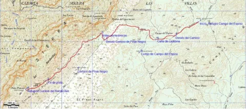
The area with the most abundant fresh pastures in the hottest months and therefore thousands of "segureña" sheep run through this altiplanicie during the period. Our tour has its beginning in a pastoralist shelter that is located in the countryside of Espino, from there we see the Banderillas, the final objective of it. We started in a southwestern direction on the existing forest track, which at first appears a certain linearity. This track is the most passed, especially by the pastors in their movements with the herds.
At 900 m from the start we take a turn to the right, leaving the main track to the left, in this area there are innumerable tracks of vehicles that pass through the canyon, due to the difficult conditions of passage in winter with snow, and in the melting period, Although we find several options of the pull, there is no need to worry because in the end almost all, they lead to the same place. We must maintain the direction now more towards the West. We cross the Carabina Canyon and at 1.7 km from the beginning we leave to our left some ruins, which correspond to the Cortijo del Campo del Espino, to the left of it, usually pastors put salt stones to the sheep flocks (as a food supplement) so it is very common to observe wild fauna (deer, gores, muflons or mountain goats) in that area.
We leave the ruins about 500 m away, to our left, and right ahead there is a larix pine forest, to the right a peeled hill stands out in the landscape, is the Majal de la Carrasca (1812 m), the track passes between the pine and the base of the hill, maintaining the west direction.
At 3.9 km we arrive at a fork, at the front of the road of Pinar Negro, more transited, we continue to the right by a track that is smooth between hills without trees. A few 250 m away we reach a natural balcony over the Aguamulas valley, the Guadalquivir and many other places in the Park. Our route is dimensioned in space and altitude, although from the beginning we were at more than 1700 m, is now when we acquired the feeling of height. And right now, the ascension to the Banderillas (roof of the Segura Region) begins. We continue our track, no options for the desist, now back in the south-west direction.
We soon entered the slopes of the Banderillas, to which are grasped centenary larix pine trees that withstand extreme weather conditions and a predominant bush the boj. Again we are in a very suitable area for wildlife observation, especially if it is sunrise or sunset. In addition, it is very common to meet with a lion's vulture on top of the hillsides, or to overtake us.
Spectacular views, accompany us to the left, altiplano of the Campos de Hernán Perea, Sierra Nevada, La Sagra etc. At 8.8 km from the start, the track ends to continue on a narrow path, which continues to ascend, there are no other options, in just over 800 m will take us to the summit of the Banderillas, where we will find two fire surveillance hubs and probably one of the wider panorama of the Natural Park, as we have to bear in mind that it is the highest altitude we find over the Guadalquivir Valley.

The Campo del Espino is reached by track from Pontones and from Ramblaseca.

1702

Banderillas Summit monitoring houses

1985
Coordenadas / Huso 30S
30S x = 518838 and = 4207440
Tramo de asfalto o cemento
0
Tramo de pista o camino forestal
89.16%
Tramo de vía pecuaria
0
Tramo de senda
10.84%

Hiking Route El Cambrón

Submitted by brandcode_deweloper on
Id
5725500
Descripción larga

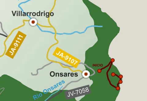
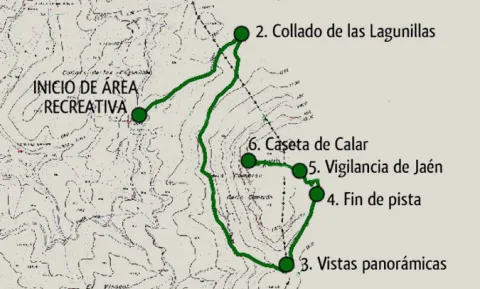
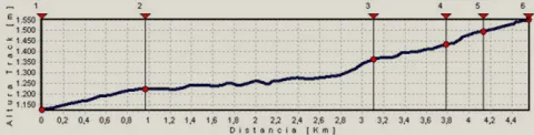
This route links the Recreative Area of the Dehesa del Bear with the Cambrón summit, a pétrea mole whose walls rise almost vertical on a pine sea. In the Dehesa del Bear we have a fountain with abundant flow, stone tables, small meadows and beautiful walnuts.

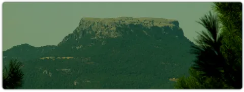
The road gently ascends along a narrow forest track, in the middle of a closed black pine forest with abundant oak and some complaints, from which you enjoy views that go from the valley of the Onsares to Calar del Mundo, valley of the head of the Guadalimar and saw of Alcaraz, in Albacete. In the end it climbs through a path of pastors that opens way between the rocks, to reach the impressive stone platform of the calar, typical carstic landscape of lapiaz with some hills, in which only few isolated black pine trees dare grow.

From the fire surveillance shed there is a superb panoramic from the manchegan plains of Ciudad Real and Albacete to Sierra Nevada. Crossing to the other end of the calar is another house belonging to Castilla-La Mancha. In the area there is plenty of the rocky plane and the piquirred chova, and we can see the flight of the lion vulture and the pilgrim hawk. You can also see flocks of muflons.

In the Collado de Las Lagunillas, we would continue to the village of El Bellotar, in the province of Albacete. Instead, we turn the track to the right. From here, the track remains without possible loss until it ends at the foot of the calar, which will have to go up a sidewalk.

At the end of the track, we take a path of shepherds to the left that goes up in zig@-@ zag. As we enter the plateau platform, the path loses some definition. We must follow the marks that we will find in stone milestones, pine trees and plates that mark the limits of the Natural Park.

We finally arrived at the Jaén fire site. It is highly recommended to cross the calar to the place in its eastern part, belonging to Castilla-La Mancha, where it will take about 15 'to arrive.

Breve descripción

This route links the Recreative Area of the Dehesa del Bear with the Cambrón summit, a pétrea mole whose walls rise almost vertical on a pine sea. In the Dehesa del Bear we have a fountain with abundant flow, stone tables, small meadows and beautiful walnuts. The road gently ascends along a narrow forest track, in the middle of a closed black pine forest with abundant oak and some complaints, from which you enjoy views that go from the valley of the Onsares to Calar del Mundo, valley of the head of the Guadalimar and saw of Alcaraz, in Albacete.

Latitud
38.461192
Longitud
-2.564754
Distrito
Municipio
Ubicación en el mapa
POINT (-2.564754 38.461192)
imagen
Image
516_img.png
Imagen principal
Activado
imagen
Image
shutterstock_1678062892.jpg
Imagen principal
Desactivado
2 h 45 min

Nature

icon-intereses-naturaleza

Friends

icon-intereses-amigos

Adventure

icon-intereses-aventura

Culture

icon-intereses-cultura

Sport

icon-intereses-deporte

Eco-friendly

icon-intereses-eco-friendly

For couples

icon-intereses-en-pareja

Family

icon-intereses-familia

Gastronomy

icon-intereses-gastronomia

Municipality

icon-intereses-municipio

Low-cost tourism

icon-intereses-turismo-low-cost

Solo travel

icon-intereses-viajar-solo
Medium
1520
Document
Image
1453ec1c-3022-4909-b80c-8abef5f907da?t=1607011772793
Document
Image
a0b0f0b6-e4e7-0990-c254-a53e98f68a96?t=1607011890602
PR-A 173 Cumbre del Cambrón
4,6 km (solo ida)
439m
12m
2
1
2
2
Horse, on foot and bike
All year round
Desactivado
Image
f2ad2904-4380-bff2-9e23-ce2d7ebe8746?t=1607011787369

Dehesa del Bear

The forest track of access to the Dehesa del Bear coincides with part of the PR-A 151 Siles- Villarrodrigo route.

Recreative area of the Bear Dehesa. Your access via the road A-310, from La Puerta de Segura to Siles, direction Siles, past km 12 we take to the left a well-established lane that passes through the village of La Pendolera. After 14.8 km, without being separated by any detour, we reached the Dehesa del Oso.

1125

Navalperal Summit Surveillance Hat

1552
Coordenadas / Huso 30S
30S x = 537973 and = 4257077
Tramo de asfalto o cemento
0
Tramo de pista o camino forestal
82.61%
Tramo de vía pecuaria
0
Tramo de senda
17.39%

Hiking Route Aguascebas de Gil Cobo and subida al Blanquillo

Submitted by brandcode_deweloper on
Id
5714794
Descripción larga

Forest track that starts at km 28 of the JH-1755 (Transversal de las Villas) road, to the right, right next to the river Aguascebas de Gil Cobo, very close to Recreative Area of the same name.

Breve descripción

The wide road enters the San Ginés closed, parallel to the stream. The channel has been capriciously modeled by the action of water, giving rise to unique jumps and small water pods. Some sections are flanked by abrupt rocky brown. On its shores we find an exceptional vegetation with various endemic species, as well as tides, stalks and even some birches, a purely northern and very scarce tree in the Natural Park.

We continue as far as the track forks and follow our left, accompanied by magnificent pinars. The sinuous route of the road allows us a smooth rise to the Collado del Perenoso, where we have a spectacular view of this whole environment. This is the starting place towards the peak of the Blanquillo or Pedro Miguel.

The tour here has plenty of attractive to do, but if we want stronger emotions, we can ascend to this extraordinary summit. We take to our right a narrow path that runs through a soft hill between salgarean pines in its first stretch.

We continue along this path, through a small ledge that diagonally crosses a rocky wall, and with great caution we pass some sections that have some difficulty. We follow the path, passing a stream that descends from the summit, and we reach a small plain, which is named "La Carrasquilla," from where we see the dominant limestone mole, the modesty vegetation of the high mountain and the shaded pine trees that indicate the extreme weather conditions of this place.

From here we see the final section of this route. We will head towards a small hill and from there we follow the rope, where the arrival to the top is more serene. Once at the summit we have before us all the immensity and beauty of these unusual places.

Latitud
38.2201
Longitud
-2.6703
Municipio
Ubicación en el mapa
POINT (-2.6703 38.2201)
imagen
Image
684_SS_07.jpg
Imagen principal
Activado
imagen
Image
667_image_1.jpg
Imagen principal
Desactivado
imagen
Image
Natu017.jpg
Imagen principal
Desactivado

Family

icon-intereses-familia

Friends

icon-intereses-amigos

Nature

icon-intereses-naturaleza

Adventure

icon-intereses-aventura

Solo travel

icon-intereses-viajar-solo

Culture

icon-intereses-cultura

Gastronomy

icon-intereses-gastronomia

Sport

icon-intereses-deporte

Municipality

icon-intereses-municipio

Low-cost tourism

icon-intereses-turismo-low-cost

Eco-friendly

icon-intereses-eco-friendly

For couples

icon-intereses-en-pareja
Ruta de senderismo Aguascebas de Gil Cobo y subida al Blanquillo
On foot
All year round
Desactivado

Once at the top, approach the pinar that is observed to the north, known as Black Pinar. It is a forest made up of centenary and unique examples of salgarean or laritian pine trees (Pinus nigra ssp. salzmanii), in which there is a small fountain with its wooden tornachs, which the mountain-flocks use as a watershed.

The possibility to make the descent through the rope in a southwestern direction towards the hill of White Water and descent through the vaguada, towards the main track of the Cerrada San Gines.

Tramo de asfalto o cemento
 
Tramo de pista o camino forestal
 
Tramo de vía pecuaria
 
Tramo de senda
 

Hiking Route el Aguardentero (La Osera)

Submitted by brandcode_deweloper on
Id
5714747
Descripción larga

The most recommended option is to make the path down. From the reservoir of Aguascebas, the walk is 4.5 km, from the km 18.8 of the road JH-7155 (Transversal de las Villas). At this point, to our left are the houses of the reservoir and, right behind you, we can observe an old quarry, where you walk the path.

Breve descripción

This path will allow you to discover one of the most charming environments in the Las Villas mountains. It runs along the natural channel of the river Aguascebas Chico, where we will discover unusual and unexpected corners. Following him, on our right, we found fenced land of ancient crops and a small cortijo half-melting. This place is known as "Las Ramblillas." In the deep valley you can see the river Aguascebas Chico.

We deviate from the road, in order to see, upstream, a spectacular leap of water, with a large poza in its base, whose waters look an emerald green by the reflection of the lush vegetation surrounding it. Let us take our way back, to reach a small hill, with a very particular silhouette. It is the Paso del Aguartedo, place of impressive views towards the countryside.

The path is conditioned and low, with a serpentating route, on a steep and rocky slope. On our left we found a striking oquity - an ashtray - where the shepherds used to keep their cattle. Below we reach a small lookout, where the path is fork. We follow the one on the right, until we get back to the channel to contemplate the majestic cascade of the Osera, perhaps one of the highest and beautiful waterfalls of Andalusia.

We continue along the path marked, by the narrow and steep ravine, enjoying the multiple pozas of the channel, to a walkway that crosses the river and back the path to the Odera lookout. If at this point we continue along the road that goes parallel to the channel, we will reach the explanade of La Osera, place where the vehicles are left when it is accessed from Mogón.

For these wonderful places it is very easy to observe the flight of the leonate vulture. The real eagle is also present and, if we look well, we can even see the little perdicular eagle.

Latitud
38.1904
Longitud
-2.6902
Municipio
Ubicación en el mapa
POINT (-2.6902 38.1904)
imagen
Image
668_img.png
Imagen principal
Activado
imagen
Image
shutterstock_1060474277.jpg
Imagen principal
Desactivado

Nature

icon-intereses-naturaleza

Friends

icon-intereses-amigos

Adventure

icon-intereses-aventura

Culture

icon-intereses-cultura

Sport

icon-intereses-deporte

Eco-friendly

icon-intereses-eco-friendly

For couples

icon-intereses-en-pareja

Family

icon-intereses-familia

Gastronomy

icon-intereses-gastronomia

Municipality

icon-intereses-municipio

Low-cost tourism

icon-intereses-turismo-low-cost

Solo travel

icon-intereses-viajar-solo
Baja
Ruta de senderismo el Aguardentero (La Osera)
Spring
Desactivado

The path can also be done in the ascending sense, starting from Mogon.

Hiking Route Acebeas - Navalperal

Submitted by brandcode_deweloper on
Id
5714710
Descripción larga

This route allows you to admire one of the most unique botanical enclaves of the Iberian Peninsula and enjoy wonderful panoramic views. A particularly humid and fresh microclimate is given in the area of Las Abeas. Thanks to him, under the canopy of pine larice grows an amazing hazelnut - the southernmost of Spain - with plenty of large stalks. There are many climbing plants such as ivy and clematide, and there are very few species in Andalusia, such as wild strawberry and noble liver. The set transmits a sense of freshness and plant abundance that is typical of the northern forests.

As we ascend, there are oaks, maples and oaks mixed with the pines, and finally the clare vegetation giving way to the piornal and to the lastoning. The route ends in the surveillance shed, promontory air from which very wide views are dominated. Before you go down, you recommend a walk through the Calar de Navalperal to enjoy its praises and its typical karmic landscape.

The exceptional nature of the hazelnut and acebos forest in southern Spain, together with the presence of many endemic or endangered plant species, has made this area a reserve area of Las Acebeas- Nava del Espino. It therefore enjoys the highest level of protection within the Natural Park.

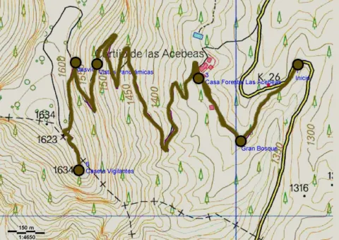
At 600 m from the beginning we find the Forest House of the Azebeas This is two beautiful houses, the first for use by environmental agents and the second, recently restored, was formerly at the service of forest engineers. There are several strands planted. At this point the forest track is narrow and turn left.

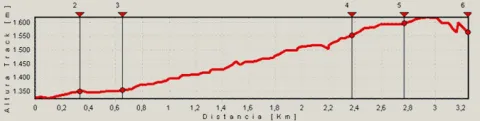
At 2700 m we left the forest track and turned left on a well-marked path. (If we prefer, we can also follow the track, which makes a wide and soft loop by rodeo the central area of the calar, to join again with the path). The path passes through a navel and is headed towards a few stone mojones.

And finally in the km 3.2 we arrived at the fire surveillance shed. Impressive panoramic areas of the provinces of Jaén, Ciudad Real, Albacete and Granada. To the north you can see the manchegan plains, the mountains of the Alcaraz saw and the Calar del Mundo. To the west, the cliffs of Segura La Vieja, the high valley of Trujala, Orcera and the memorial tower of the castle of Segura de la Sierra. To the South we see the Yelmo and to the bottom the Banderillas, the great mole of La Sagra and the saw of Cazorla. And to the east we contemplate the Cerrico de Las Mentiras and the nearby calares of Navalespino and Morillas.

Breve descripción

This route allows you to admire one of the most unique botanical enclaves of the Iberian Peninsula and enjoy wonderful panoramic views. A particularly humid and fresh microclimate is given in the area of Las Abeas. Thanks to him, under the canopy of pine larice grows an amazing hazelnut - the southernmost of Spain - with plenty of large stalks. There are many climbing plants such as ivy and clematide, and there are very few species in Andalusia, such as wild strawberry and noble liver. The set transmits a sense of freshness and plant abundance that is typical of the northern forests.

Latitud
38.318183
Longitud
-2.583833
Distrito
Municipio
Ubicación en el mapa
POINT (-2.583833 38.318183)
imagen
Image
etapas-bosques.jpg
Imagen principal
Activado
imagen
Image
481_image_1%20%281%29.jpg
Imagen principal
Desactivado
imagen
Image
481_image_2.jpg
Imagen principal
Desactivado
imagen
Image
481_image_3.jpg
Imagen principal
Desactivado
1 h 55 min ida y vuelta

Family

icon-intereses-familia

Friends

icon-intereses-amigos

Nature

icon-intereses-naturaleza

Adventure

icon-intereses-aventura

Solo travel

icon-intereses-viajar-solo

Culture

icon-intereses-cultura

Gastronomy

icon-intereses-gastronomia

Sport

icon-intereses-deporte

Municipality

icon-intereses-municipio

Low-cost tourism

icon-intereses-turismo-low-cost

Eco-friendly

icon-intereses-eco-friendly

For couples

icon-intereses-en-pareja
Medium
1646
Document
Image
4be93b88-5a5b-e7ea-a724-b873575af519?t=1607007107860
Document
Image
e710d6bb-b2bb-c0b5-de10-1729b99478c8?t=1607006093359
PR-A 176 Acebeas-Cumbre de Navalperal
3,25 km (solo ida)
343m
24m
2
1
2
2
Horse, on foot and bike
All year round
Desactivado
Image
08debf2c-ac71-9b88-724f-6331c660c1af?t=1607005930188

Las Azebeas, La Peña del Olivar, Los Negros

The ideal time to visit from October to the end of April. Set up for 4 hours minimum.

The entire route runs along the edge of one of the Park Reserve areas, an area with maximum protection level (Grade A) due to the ecological values it houses. Path marked PR.

From Siles: In the km 12 of the said road we find a forest track to the right, to the counter, with a barrier that prevents the passage of vehicles (on the road JF-7012, marked "Camino de Las Acebeas").
From Segura de la Sierra: at 8.4 km from the aforementioned road, turn left towards Siles. The forest track is about 1.5 km to the left (on the JF-7032 road to the saw).

1350

Navalperal Summit Surveillance Hat

1646
Coordenadas / Huso 30S
30S x = 536380 and = 4241201
Tramo de asfalto o cemento
0
Tramo de pista o camino forestal
83.08%
Tramo de vía pecuaria
0
Tramo de senda
16.92%

Scenic Drive Siles - Las Acebeas

Submitted by brandcode_deweloper on
Id
5714026
Descripción larga

We suggest the following possibilities:

Km 2.Peña del Olivar Recreative Area. It has an unusual Botanical Collection with natural park species and a natural pool. It is also the starting point for various walks.

Km 2.2.Start to the left of the road to the Fountain Recreative Area of the Almoteja. You can go by car, but we recommend to enjoy on foot this walk 1.5 km next to the river vegetation of the Arroyo del Barranco de los Tejos. The recreational area has a fountain where we can see the catacamosque (Pinguicola vallisneriifolia), small carnivora plant endemic to the Park. There begins a signposted path of 1 '5 km.

Km 5.2. The site of La Fresnedilla, with small scattered cortijos, where we can walk two signposted paths.

Km 6.3.Start to the right of the La Canalica forest track. We recommend that you drive through it, as we can walk through several signposted trails and approach the well of the Snow, sturdy and hidden stone construction where the snow was previously stored for use during the summer. Next to him is a source.

Km 7.3.Mirador de La Fresneilla, with beautiful views.

Km 7.8.Free Time Siles residence. It is in a very careful environment from which comes a wide road that allows very pleasant walks. It ends, after almost 6 km, on the forest track that leaves Siles towards the Puntal de la Ajedrea.

Km 10.4.Start to the left of a long forest track that crosses private farms and runs, in its last sections, by the Tu River.

Km 11.Start to the right of the same forest track we saw in the km 6.3, which makes loop with the road. From here is closer the Snow well. From here we enter the Reserve Area of Acebeas- Nava del Espino, an area especially protected by its high ecological value. We can see that at this point the forest becomes greener and greener.

Km 11.6.Area of Azebeas Controlled Squad. Magnificent place under large larity pines where you can rest when you are not occupied by some camp.

Km 12.5.Place of Las Abeas. On the left a delicious walk to an old forest house starts. This place, with its hazelnuts and its large hives in the shadow of the larice pines, is one of the most emblematic of the Natural Park. In less than an hour you can climb an exceptional path from the forest house to the Calar de Navalperal, from where you enjoy great views.

Km 14.1.Cross with the JF-7016 road. Here our route ends, although it is a very strategic place to start many others. You will see abundant signs that indicate different possibilities, such as Segura de la Sierra, Río Madera or Pontones.

Breve descripción

This route runs along the narrow mountain road next to Siles in the direction of the high areas of the saw. It is always raised between pineapples and allows access to different recreational areas, looking and very attractive walking routes. It ends in the area of Las Azebeas, where the forest acquires an amazing northern environment.

Latitud
38.388517
Longitud
-2.581781
Distrito
Municipio
Ubicación en el mapa
POINT (-2.581781 38.388517)
imagen
Image
478_img.png
Imagen principal
Activado
imagen
Image
Ruta%20en%20coche%20Siles%20-%20Las%20Acebeas.jpg
Imagen principal
Desactivado
imagen
Image
shutterstock_57991261.jpg
Imagen principal
Desactivado

Nature

icon-intereses-naturaleza

Friends

icon-intereses-amigos

Adventure

icon-intereses-aventura

Culture

icon-intereses-cultura

Sport

icon-intereses-deporte

Eco-friendly

icon-intereses-eco-friendly

For couples

icon-intereses-en-pareja

Family

icon-intereses-familia

Gastronomy

icon-intereses-gastronomia

Municipality

icon-intereses-municipio

Low-cost tourism

icon-intereses-turismo-low-cost

Solo travel

icon-intereses-viajar-solo
Ruta en coche Siles - Las Acebeas
14 km (solo ida)
By car, on foot
All year round
Desactivado

A-310. It's pointed out as the Way of the Azeas.

Scenic Drive Santiago de La Espada-Juntas de Miller

Submitted by brandcode_deweloper on
Id
5713957
Descripción larga

Among the options we propose to you:

Km 0.Santiago de la Sword. Located at 1350 m of altitude, its main economic activity is extensive livestock. It has the parish church of Santiago Apostle (16th century), built on an earlier hermitage dedicated to the same saint and which has a beautiful major altarpiece of Baroque style. In the square of the City Hall we find an old 16th century inn with a vistose wooden balconade.

Km 10.Mirador del Salto de la Nova or del Zumeta; 10 km from Santiago we find on the right hand side this mirador from which we see the limit of the Park and the province of Jaén. Watch out for hats, they can fly a long way.

Km 12.Tobos village. Compulsory stop to buy good bread and delicious cakes. Next to the road there is a simple laundry room that circulates the Tobos stream, with fresh and clean waters.

Km 13.Vites village. To get to the village of Vites you have to turn left and drive 2 km. In this village are raised magnificent white grapes, large and sweet, from which a powerful spirit is distilled. Ask the local neighbors.

Prado Moro.At the end of the village of Vites a left road ascends to Prado Moro. Here a centenary oak resists at the time that gives us a vision of the vegetation that in the past existed in the area.

Km 16.Embalse de la Vieja. A prominent peak called the Morrison announces the beginning of the Old Age reservoir. After the village of Morrión, a lane - not marked - goes down on the left to the reservoir.

Km 18.The Vadico. Two km from the reservoir there are houses on the right side of the road with a wall in front. Right across the street we found a way up to the Vadico. It's a nice walk, by a real vergel, which deserves to be made on foot. On the way there are sources to be able to refresh and collect water.

Km 18.5.Entrance to the villages of La Muela, Marchena and Marchenica. The Muela is 5.4 km from this point. In its vicinity is Hoya Somera, an important archaeological site of the bronze age. Later on there are Marchena and Marchenica. In its surroundings, there were Roman remains and an Arab necropolis.

Km 22.Miller's together. At this point the Zumeta River has come with us all the way and the Segura. A natural stone tunnel announces the arrival at this meeting place.

Miller village.From Las Juntas there is another road that reaches this historic village with more than 20 water births. It is a starting point for several routes that will make us known beautiful areas of the Sierra de Segura. When you pass the stone tunnel you have to follow the indication "Central and Miller."

Breve descripción

The Zumeta Valley, through which this route runs, is a true journey in time. By the river there have been settlements from the Neolithic to today. We will find archaeological sites, rock paintings, small castles and villages that are authentic ethnic museums in the open air. In them it is still easy to see their inhabitants doing work of other times.

The morphology of the land also tells us of the thousands of years in which water has been the artisan hand that has built the landscape. As we go down this road, the oak and pine trees make way for lush riverside forests.

Latitud
38.0764
Longitud
-2.5222
Distrito
Municipio
Ubicación en el mapa
POINT (-2.5222 38.0764)
imagen
Image
Ruta%20en%20coche%20Santiago%20de%20La%20Espada%20-%20Juntas%20de%20Miller%20%281%29.jpg
Imagen principal
Activado
imagen
Image
Ruta%20en%20coche%20Santiago%20de%20La%20Espada%20-%20Juntas%20de%20Miller.jpg
Imagen principal
Desactivado
imagen
Image
Ruta%20en%20coche%20Santiago%20de%20La%20Espada%20-%20Juntas%20de%20Miller2.jpg
Imagen principal
Desactivado
1 día

Nature

icon-intereses-naturaleza

Friends

icon-intereses-amigos

Adventure

icon-intereses-aventura

Culture

icon-intereses-cultura

Sport

icon-intereses-deporte

Eco-friendly

icon-intereses-eco-friendly

For couples

icon-intereses-en-pareja

Family

icon-intereses-familia

Gastronomy

icon-intereses-gastronomia

Municipality

icon-intereses-municipio

Low-cost tourism

icon-intereses-turismo-low-cost

Solo travel

icon-intereses-viajar-solo
Baja
Ruta en coche Santiago de La Espada-Juntas de Miller
By car, on foot
All year round
Desactivado

Santiago de la Espada village

Tramo de asfalto o cemento
 
Tramo de pista o camino forestal
 
Tramo de vía pecuaria
 
Tramo de senda
 

Scenic Drive: Piscifactoría de Borosa - Hornos de Segura

Submitted by brandcode_deweloper on
Id
5713838
Descripción larga
  • Km 0 - Piscifactory and River Borosa River Interpreting Center. In this Centre we will know the importance of water and river ecosystems in the Natural Park, in which emblematic species such as the common trout and the otter stand out.

  • Km 1,7 - Vinagre Tower. This area is one of the most crowded in the Park and is located in a geographically privileged area for its centrality. Here it is essential to know the Park Visitors Center, which has been recently modernized and has various interactive resources. It has a Natural Park Store, toilets, cafe, rest room and children's play area on the outside. Very close to this center is the Botanical Garden, a pleasant place with a wide and careful selection of natural park plants, from small herbaceas to large trees. It is a perfect place to observe and learn to distinguish them or simply to take a pleasant walk between lush vegetation.

  • Km 6.5 - Coto Ríos. This village, on the banks of the Guadalquivir, was built in the 1960s of last century to house families living in scattered villages and cortijos and whose houses were expropriated to create the National Cazorla-Segura Hunting Coto (now the Andaluza de Caza Reserve). It has medical assistance, shops and other services, in addition to several campsites.

  • Km 13.3 - Wild Fauna Park Collado del Almond. In their enclosure they pasture in semi-freedom deer, mountain goats, wos and muflons. You can see them and photograph them by walking a pleasant itinerary with fountains, banks and several viewpoints with splendid views of the Tranco reservoir and the ruins of the castle of Bujaraiza.

  • Km 14 - FRF look. It is one of the milestones of the Route of the same name, dedicated to the mythical naturalist Felix Rodríguez de la Fuente, who from this point of view filmed the famous scenes of the berrea of the deer in the 1970s. In front of it is Mount Bujaraiza, which sometimes, when the reservoir is very full, becomes an island, and is crowned by the ruins of an Arab turret.

  • Km 17.6 - Old-garden controlled area. This place is very nice to eat and rest, except on the dates you are occupied by some camp.

  • Km 19.2 - House of Crafts Los Casares. It is an old Forest House converted into a shop of crafts and products from the Park.

  • Km 26 - Old Control Recreative Area. It is a large and recently built area with magnificent views over the northern part of the Tranco reservoir. It has banks, tables to eat and fountain.

  • Km 28.4 Tranco Dam - This impressive dam, whose height on the Guadalquivir channel is 82 meters, is one of the largest in Spain. In its surroundings there are several restaurants, terraces and water sports facilities, as well as the village that was raised for the workers who built the dam.

  • Km 31.5 - The Parral Recreative Area. It is in the middle of the carrasco pine pinar and has a look-out with good views over the waters of the Tranco reservoir.

  • Km 35.7 - Cñada Morales. When it reaches this village the landscape is opened and no longer exclusively forest, to give way to large humanized areas with olive groves, orchards and scattered cortijos.

  • Km 44.6 - Safe Furnaces. This small town, built on the top of a peñasco, is in the center of the Natural Park. Its monuments, views and irregular alleys of the Arab past, served him the declaration of Artistic Historical Set.

Breve descripción

It is one of the most busy and popular routes of the Natural Reserve, which combines an attractive landscape dominated by the Tranco water reservoir and the opportunity to visit interesting facilities where visitors can enjoy discovering and observing the natural heritage of this protected space. Most of the route follows the winding road A-319.

Do not forget to drive with caution, especially in high season, when there is a greater influx of tourists. You will discover many viewpoints and recreational areas that are good places to stop, but we especially recommend the stops and visits described below. You will find more information about most of these places on this website.

Latitud
37.9502
Longitud
-2.8601
Distrito
Municipio
Ubicación en el mapa
POINT (-2.8601 37.9502)
imagen
Image
piscifactoria%20borosa.jpg
Imagen principal
Activado
imagen
Image
Piscifactoria%20Borosa%2C%20Hornos%20del%20Segura.jpg
Imagen principal
Desactivado
imagen
Image
Piscifactoria%20Borosa%2C%20Hornos%20del%20Segura2.jpg
Imagen principal
Desactivado
Se recomienda al menos 1 día completo.

Nature

icon-intereses-naturaleza

Friends

icon-intereses-amigos

Adventure

icon-intereses-aventura

Culture

icon-intereses-cultura

Sport

icon-intereses-deporte

Eco-friendly

icon-intereses-eco-friendly

For couples

icon-intereses-en-pareja

Family

icon-intereses-familia

Gastronomy

icon-intereses-gastronomia

Municipality

icon-intereses-municipio

Low-cost tourism

icon-intereses-turismo-low-cost

Solo travel

icon-intereses-viajar-solo
Ruta en coche: Piscifactoría de Borosa - Hornos de Segura
45 km
By car, on foot
All year round
Desactivado

Piscifactory del Borosa

Safe Furnaces.

Scenic Drive Mogón Charco del Aceite

Submitted by brandcode_deweloper on
Id
5713657
Descripción larga


1.    Km 0. Mogón. This beautiful village, which belongs to the municipality of Villacarrillo, lies in the Guadalquivir Valley. Its olive groves and fertile river plains are also watered by the Aguascebas River, as both waterways converge at this point. It has a large, well-equipped bathing area in the “El Molinillo” beauty spot.
2.    Km 9.9. La Osera and Cerro Vilorto Viewpoints. On our left are these two viewpoints, offering magnificent panoramic views of La Osera, one of the most iconic natural areas in these mountains.
3.    Km 14. Curva del Tambor. Its name comes from its pronounced circular layout. From here, looking eastwards, there are extensive views over the Cañamares River Valley, the waterfall and the vulture nesting site at Peña Palomera, as well as the villages of Cazorla, La Iruela and Burunchel.
4.    Km 18.5. Chorrogil Waterfall. Approximately 500 metres before reaching the Aguascebas Reservoir, a dirt track begins on the right-hand side and leads us close to this spectacular horsetail-shaped waterfall. Among the lush vegetation are several birch trees, a northern species whose presence at this latitude is truly exceptional. Its multicoloured rock face makes the area even more attractive.
5.    Km 19. Aguascebas Reservoir. This charming artificial lake supplies drinking water to the villages throughout La Loma. It is also a high-mountain rainbow trout fishing reserve. Bathing is not permitted.
6.    Km 22. La Fresnedilla. This is the main hub of this part of the Sierra de las Villas. It is a small village equipped with a primary school and a municipal hostel. Around 700 metres from this point, several tracks branch off to the left, providing access to charming places that are well worth exploring on foot, such as Arroyo del Torno, Nava del Milano and the summit of Navazalto.
7.    Km 24. Collado del Lobo, Nava del Rico and Collado del Pocico. A particularly distinctive type of vegetation catches our attention here: the juniper woodland. Magnificent specimens of Phoenician juniper occupy the limited soil between the limestone rocks at Lancha del Sabinar. On our right, a track provides access to beautiful places such as Cruz de Juan Núñez, Cortijo de la Cruz, Las Castañetas and Prado de los Chopos.
8.    Km 28. Cerrada de San Ginés. On our right begins the track that provides access to the highest areas of this remarkable mountain range and brings us closer to this natural site. The waters of the small Aguascebas de Gil Cobo River flow through the canyon, alternating between distinctive waterfalls and refreshing pools. The first section of this area is well worth exploring on foot, both for its undeniable beauty and for its extraordinary botanical wealth, which includes numerous endemic species and specimens of yew, holly and birch. The Gil Cobo Recreational Area is located just a few metres from the beginning of this forest track.
9.    Km 34.5. Cueva del Peinero. A recreational area located in a setting of majestic beauty beside the Aguascebas Grande River, whose waters flow through lush riverside vegetation and between large stone blocks.
10.    Km 40. Collado del Ojuelo. This location is a crossroads. To the left, the forest track leads to places such as Collado de la Tobilla, La Muela and Cañada de la Madera. To the right, the Tableros track, which is closed to vehicles by a barrier, provides access to lesser-known locations such as Prado de los Chortales, Cañada Somera, Collado de los Hermanillos and Caballo de Torraso.
11.    Km 47. Agua de los Perros. This spectacular site is dominated by the enormous dome known as Iglesia de los Perros. Its centre is pierced by an opening resembling a skylight, through which the stream that flows into it falls like fine raindrops. At Piedra del Agujero there is an enormous opening carved into the rock by erosion, as well as a natural bridge shaped in the rock by the stream. Visitors can cool down at its spring of cold, crystal-clear water.
12.    Km 48. Collado del Agua de los Perros. At an altitude of 1,200 metres, this location is well worth a stop to admire the views, the pine forests and the beautiful specimens of Spanish juniper.
13.    Km 50. Mirador del Tapadero. An essential stop at this viewpoint overlooking the abyss. Below, the narrow and turbulent course of the Chillar Stream can be seen.
14.    Km 55.4. Fuente de los Cerezos Regulated Campsite. Beside the road stands a beautiful fountain with two spouts. Near this location, approximately 300 metres to the right, beside the first stream, we can see one of the few surviving tar kilns, traditionally used to extract juniper tar, that remains fully intact within the Natural Park. It is a silent reminder of how people once made use of the natural resources of these mountains.
15.    Km 58.2. Puente de los Agustines – Charco del Aceite. After crossing the bridge over the Guadalquivir River, a short turning on our right leads to a delightful bathing area. The Charco del Aceite Recreational Area is a natural setting where the Guadalquivir forms a large pool of clean, refreshing water.

Breve descripción

The winding and winding route of this road, which is perfectly framed in this beautiful environment, will discover a part of this unexplored and almost unknown paradise and will show us many landscapes of a prodigious beauty, where water is often the protagonist.

We will find numerous cortijos, some standing and others in ruins, faithful examples of popular architecture. As we advance our journey, we are shown forests of majestic pine trees, authentic sabinars, dense riverside forests in the streams and centuries-old examples of oak trees and complaints.

Latitud
38.2803
Longitud
-2.7204
Municipio
Ubicación en el mapa
POINT (-2.7204 38.2803)
imagen
Image
Ruta%20en%20coche%20Mog%C3%B3n%20Charco%20del%20Aceite%205.jpg
Imagen principal
Activado
imagen
Image
Ruta%20en%20coche%20Mog%C3%B3n%20Charco%20del%20Aceite2.jpg
Imagen principal
Desactivado
imagen
Image
Ruta%20en%20coche%20Mog%C3%B3n%20Charco%20del%20Aceite3.jpg
Imagen principal
Desactivado

Nature

icon-intereses-naturaleza

Friends

icon-intereses-amigos

Adventure

icon-intereses-aventura

Culture

icon-intereses-cultura

Sport

icon-intereses-deporte

Eco-friendly

icon-intereses-eco-friendly

For couples

icon-intereses-en-pareja

Family

icon-intereses-familia

Gastronomy

icon-intereses-gastronomia

Municipality

icon-intereses-municipio

Low-cost tourism

icon-intereses-turismo-low-cost

Solo travel

icon-intereses-viajar-solo
Image
64f15156-b2a3-d91a-f05f-b2bbb7f0c86a?t=1606928077396
Ruta en coche Mogón Charco del Aceite
60 km
By car, on foot
All year round
Desactivado

The use of all-terrain vehicle is recommended if we move away from the road.

Tramo de asfalto o cemento
 
Tramo de pista o camino forestal
 
Tramo de vía pecuaria
 
Tramo de senda