Saltar al contenido principal

Torres - Hondacabras - Fuenmaandor - Puerto de Torres - Castillejos - Mata Bejid - Centro de visitantes del Natural Park

Submitted by brandcode_deweloper on
Id
2639034
Descripción larga

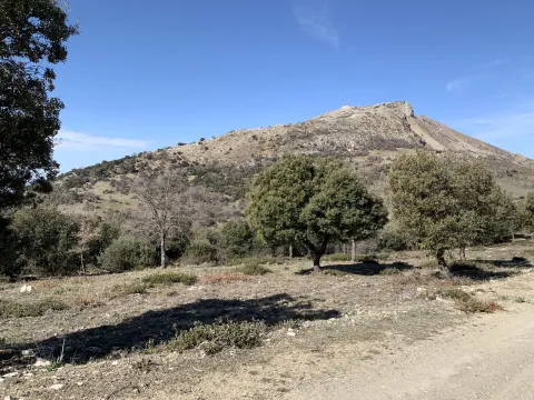
From Torres, and through the Pila Pellenda parquet, a mountain road is started towards Albanchez de Magina. A few four kilometres away we find a right turn, which gives access to the youth camp area Hondacabras. These sites were cattle's rest on the freckles that passed through these mountains. In this place begins a forest track between pine trees that gradually ascends for 4 Km, something beyond the Nita Fountain. When we get to the crossing we will change direction to make the promotion to the Port of the Mata. The floor of the track is firm, but we will find some outstanding ramps that the less experienced can invite them to take off their bikes. In 3.5 km the port is reached, a step between mountains - some above 2,000 meters. The landscape is a gift for the view: all the southern side of the Natural Park, mountains more than 2,000 meters of altitude (Almadén, 2.036 m., Ponce, 2.006 m and Cerro Cárceles, 2.061 m.), and dehesas in height of complaints, flocks of sheep..., and on the horizon the province of Granada. The rest of the way is down. Five and a half kilometres from the port we arrived at the Castlejo de Mata Bejid, a beautiful place that housed a garrison, which watched this passage on the Middle Ages border, and that until the first half of the 20th century it housed several families of settlers who cultivated the dehesas along the way. This castle was donated to the city of Jaén by the Catholic Kings in 1494, in reward for the services provided in the conquest of Cambil and Alhabar. Two kilometers of olive trees take us to the Cambil-Huelma road. At this point it is worth looking at the corrijada of Mata Bejid, where the spirit of the belle époque with rural dyes is still revived. It is a private property that has an interesting chapel, gardens, house of the gentlemen and even a garage of regionalist style. From here we can choose to go down to the town of Cambil, by the course of the Oviedo River (5 Km.), or better to get close to the new Visitors Center of the Natural Park just three km away. In addition to information from all over the Park, the centre has a shop, meringers, children's games, fountain, services and a walk area for people with reduced mobility.

Breve descripción

This route crosses the Sierra Magina massif by immediate areas to the high mountain. The tour begins and ends at the limits of the Natural Park, from south to north, through it completely.
Latitud
37.7917
Longitud
-3.5447
Distrito
Municipio
Ubicación en el mapa
POINT (-3.5447 37.7917)
imagen
Image
22394163Master.jpg
Imagen principal
Activado
imagen
Image
camping0.jpg
Imagen principal
Desactivado
imagen
Image
13277673.jpg
Imagen principal
Desactivado
imagen
Image
parque-natutal.jpeg
Imagen principal
Desactivado

Nature

icon-intereses-naturaleza

Friends

icon-intereses-amigos

Adventure

icon-intereses-aventura

Culture

icon-intereses-cultura

Sport

icon-intereses-deporte

Eco-friendly

icon-intereses-eco-friendly

For couples

icon-intereses-en-pareja

Family

icon-intereses-familia

Gastronomy

icon-intereses-gastronomia

Municipality

icon-intereses-municipio

Low-cost tourism

icon-intereses-turismo-low-cost

Solo travel

icon-intereses-viajar-solo
Torres - Hondacabras - Fuenmayor - Puerto de Torres - Castillejos - Mata Bejid - Centro de visitantes del Parque Natural
Desactivado

Mancha Real - Summit of Almadén - Torres

Submitted by brandcode_deweloper on
Id
2638904
Descripción larga

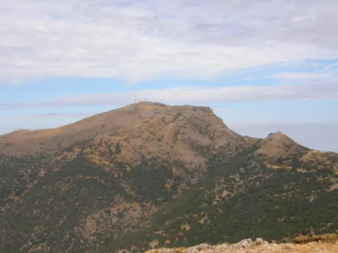
The tour begins in Mancha Real and ends in the neighboring town of Torres; therefore a route that makes it easier to leave a car in each village to organize the return after the route. If you are going to complete the tour you will need water, some food to replenish strength and a coat for the high mountain area. In Mancha Real you will only have to ask about the rise to the Almadén peak or the TV repeater - the summit is located a set of telephone and telecommunications antennas. Any neighbor will know you have to go south of the village, next to the Pila Fountain and the municipal pool. There, and on permanent rise by repopulation pineers, the lane rises from the repeater by which you will pedal for 10 km of climb next to the Sierra de la Peña del Eagle. The ascent will take you from the 850 m from Mancha Real to the plains of Bercho and Peña Blanca at 1,400 m. on the Jiennense countryside, where the landscape of mountain plains is appreciated, an area that was described in the Middle Ages, in the Chronicle of the Constable and the Book of the Alphony X Mountain, as... "an important place of major hunting, rich in boars, wolves, deer, bears and a closed vegetation." Two kilometers of plain and we are on the detour for the big climb, the step towards the high mountain: the Almadén summit pedaling by track. It's six and a half miles of ramps and sweat, but the effort is worth it. The summit, if the day is clear, is a privileged viewpoint in Andalusia. To the north is the entire great depression of Guadalquivir, closed by the horizon of Sierra Morena. The east shows you the other peaks of more than 2,000 meters from the Sierra Magina massif. To the south you will see the Sierra Nevada Natural Park horizon in Granada. The drop of the same 6.5 Km. (watch out for curves and speed!) leads us back to the previous crossing. From here a new stretch of 4 Km. by cherry plantations accompanies us to Navaparís, one of the most cuddly sources in the area. 2.5 kilometers more and you are on the local road - asphalt - that will take you in permanent descent (another 2.5 km more) between orchards, cherry fields and small cords to the Torres River, and the town of the same name.

Breve descripción

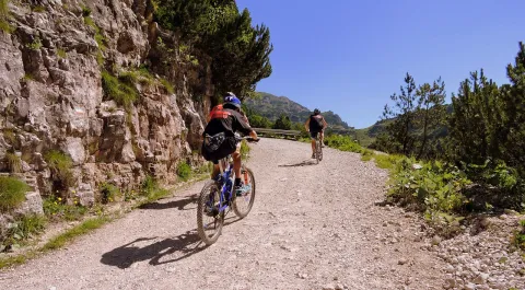
For mountain bike lovers in pure state. Large levels, long ascends, roads of changing floors, with several hours of pedal and with little water. The first ten kilometres are outside the Sierra Magina Natural Park. The rest of the journey goes through the protected natural space.

Latitud
37.7856
Longitud
-3.6156
Distrito
Municipio
Ubicación en el mapa
POINT (-3.6156 37.7856)
imagen
Image
cycling-1527260_1280.jpg
Imagen principal
Activado
imagen
Image
8613_0py6f5ox1mdut7an.jpg
Imagen principal
Desactivado
imagen
Image
40143113.jpg
Imagen principal
Desactivado
imagen
Image
Campos_de_cerezos_y_Torres_al_fondo.jpg
Imagen principal
Desactivado

Nature

icon-intereses-naturaleza

Friends

icon-intereses-amigos

Adventure

icon-intereses-aventura

Culture

icon-intereses-cultura

Sport

icon-intereses-deporte

Eco-friendly

icon-intereses-eco-friendly

For couples

icon-intereses-en-pareja

Family

icon-intereses-familia

Gastronomy

icon-intereses-gastronomia

Municipality

icon-intereses-municipio

Low-cost tourism

icon-intereses-turismo-low-cost

Solo travel

icon-intereses-viajar-solo
Mancha Real - Cumbre de Almadén - Torres
Desactivado

34 km of lanes and mountain slopes, in addition to the end by a local road paved with occasional traffic.

Tramo de asfalto o cemento
 
Tramo de pista o camino forestal
 
Tramo de vía pecuaria
 
Tramo de senda
 

Route Cabra del Santo Cristo

Submitted by brandcode_deweloper on
Id
2638783
Descripción larga

If you prefer to save your promotion to Cabra, you can start your pedal in this town, but the beginning and end of the route will be very disconnected.

From here there are almost 20 km of solitary plains (including the detour and the visit to the Cabra Station), along the secondary road of the altiplano. The tour is very quiet because of the few slopes - except some ramps - and because of the near absence of road traffic. The road has a sufficiently cyclable floor, passing through repopulation pines, olive groves and high cerealist fields. The area consists of a succession of rural areas, with large panoramic to the south, with the permanent image of the summits of the Sierra Nevada Natural Park (province of Granada). To the north the summits of the Natural Park of Sierra Magina rise.

The last stretch is a continuous descent from the pedanean town of Solera to the valley of the Jandulilla River. Solera is a small town with a tiny old town set up around the ruins of a rocky castle that was watching the medieval border. This 15 km stretch ends in Huelma, where you can eat in one of its restaurants, and visit the Vandelvirian Church and its castle, both monuments of the Andalusian Renaissance.

Breve descripción

Unpublished route, near the Natural Park of Sierra Magina. The tour is divided into three sections: The first kilometers - just over 10 - represent a rise from the valley of the Jandulilla River to the high plane of Cabra of Holy Christ. This stretch stands out for the subdesert landscapes, a little known beauty of unique shapes and colors. From here there are still 7 Km. without slope to the town of Cabra of Holy Christ. In this town, one of the historic places of the espartera industry in southern Spain, you must visit its interesting church or eat at Casa Herminia restaurant.

Latitud
37.727883
Longitud
-3.377833
Distrito
Ubicación en el mapa
POINT (-3.377833 37.727883)
imagen
Image
31692175.jpg
Imagen principal
Activado
imagen
Image
Ruta%20Cabra%20del%20Santo%20Cristo.JPG
Imagen principal
Desactivado

Nature

icon-intereses-naturaleza

Friends

icon-intereses-amigos

Adventure

icon-intereses-aventura

Culture

icon-intereses-cultura

Sport

icon-intereses-deporte

Eco-friendly

icon-intereses-eco-friendly

For couples

icon-intereses-en-pareja

Family

icon-intereses-familia

Gastronomy

icon-intereses-gastronomia

Municipality

icon-intereses-municipio

Low-cost tourism

icon-intereses-turismo-low-cost

Solo travel

icon-intereses-viajar-solo
Ruta Cabra del Santo Cristo
All year round
Desactivado

53 km of asphalt roads with occasional traffic.

Coordenadas / Huso 30S
30S x = 466705 and = 4175691

Las Cimbras

Submitted by brandcode_deweloper on
Id
1909009
Descripción larga

Where to sleep. -There are not many places nearby to camp. We must seek life in the nearby villages or live.

Where to drink. -There are three sources of drinking water.

Notes and warnings. -In summer you can climb from dawn to 12.30 p.m.; in the afternoon from 18 a.m.; and in winter during the hours of the sun.

How to get there. -The school is located a few kilometers from Jaén, leaving in the direction of Mancha Real. Once there you have to go to Torres by the JV-3242. No parking problem. The area is in the same village, by the road.

Breve descripción

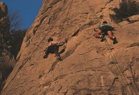
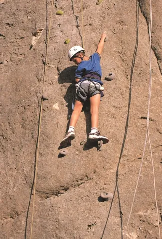
It is a small area integrated into the urban centre. It is located in front of the municipal pool. Comfortable and undergraduate. The average height is 8 meters. The maximum height is 12 meters. It is equipped and very good for initiation.

Latitud
37.785244
Longitud
-3.509375
Distrito
Municipio
Ubicación en el mapa
POINT (-3.509375 37.785244)
imagen
Image
shutterstock_1048500664.jpg
Imagen principal
Activado
imagen
Image
shutterstock_279617825.jpg
Imagen principal
Desactivado

Friends

icon-intereses-amigos

Nature

icon-intereses-naturaleza

Adventure

icon-intereses-aventura

Solo travel

icon-intereses-viajar-solo

Gastronomy

icon-intereses-gastronomia

Sport

icon-intereses-deporte

Municipality

icon-intereses-municipio

For couples

icon-intereses-en-pareja
Las Cimbras
Desactivado
Coordenadas / Huso 30S
30S x = 455148 and = 4182110

Cerro Golondrina

Submitted by brandcode_deweloper on
Id
1908278
Descripción larga

For water, food and accommodation.- Water should be brought, as the nearest water is in Bedmar or Jodar. The accommodation and restaurants of the immediate villages are ideal for finding supply.

How to get there.- The area is 60 kilometres from Jaén capital. From this city you have to go to Bedmar (C-328). After that municipality we turn right through the crossing with the C-325. We arrived shortly after the area. The walls have no loss. They get up in the middle of the hill. There's enough space to park on both sides of the road.

Breve descripción

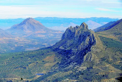
It is a very bright wall, which is integrated into an interesting relief formation and surrounded by a landscape with magnificent views. It is located at the limits of the Natural Park of Sierra Magina. Although it is a school of local interest, it may be of interest for a short visit. His inclination is quite vertical. The insurance system allows sports climbing with a certain technical character. The limestone walls reach 25 meters of level, with an average height of 15 meters.

Latitud
37.813578
Longitud
-3.340539
Distrito
Municipio
Ubicación en el mapa
POINT (-3.340539 37.813578)
imagen
Image
Natu010.jpg
Imagen principal
Activado
imagen
Image
2.jpg
Imagen principal
Desactivado
imagen
Image
1.jpg
Imagen principal
Desactivado

Friends

icon-intereses-amigos

Nature

icon-intereses-naturaleza

Adventure

icon-intereses-aventura

Solo travel

icon-intereses-viajar-solo

Gastronomy

icon-intereses-gastronomia

Sport

icon-intereses-deporte

Municipality

icon-intereses-municipio

For couples

icon-intereses-en-pareja
Cerro Golondrina
Desactivado

Number of routes:16

You're up to V:60%

Votes from V + to 6c +:40%

Vies from 7a to 7c +:0%

Eight-way:0%

Best time:spring and autumn

Coordenadas / Huso 30S
30S x = 470026 and = 4185186
Tramo de asfalto o cemento
 
Tramo de pista o camino forestal
 
Tramo de vía pecuaria
 
Tramo de senda
 

Route del Legado Andalusí

Submitted by brandcode_deweloper on
Id
7397834
Descripción larga

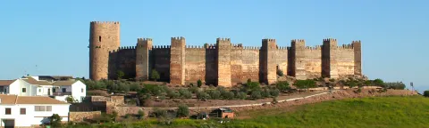
The Andalusian Legate keeps two routes open in this province. The Nazaris and the Caliphate represent unique opportunities to decipher the keys of our past. Both itineraries run in twenty-three Jiennese municipalities. The route of the Caliphate - smaller - crosses the south of the province of Jaén, kissing three cities full of art, culture and history: Alcaudete, Castillo de Locubín and Alcalá la Real. The route of the Nazaris - the most extensive - cuts the province in two, from Sierra Morena to Sierra Mágina, passing through the districts of La Campiña and La Loma. The route crosses twenty municipalities, including the capital of the province. Up to four hundred castles, fortresses, torreons, strong houses and watchmen spatter the way. The monumental heritage, landscapes, popular customs, handicrafts and gastronomy that Jaén today possesses are largely due to that refined civilization that made al-Ándalus a paradise in the middle of the Middle Ages.

Source: Council of Culture and Heritage. Junta de Andalusia.

Breve descripción

The Andalusian legacy is a Public Foundation of the Junta de Andalucía attached to the Council of Culture and Historical Heritage which has the support of the Council of Europe and the collaboration of many public and private institutions. The activities of the Foundation are linked to the dissemination and preservation of the cultural and artistic heritage of Al@-@ Ándalus, and the role that Andalusia and Spain have played throughout history as both a cultural bridge between East and West and in relations with the countries of the Arab, Mediterranean and Ibero-American world. The routes of the Andalusian Legacy are therefore aimed at the value and dissemination of our cultural heritage with special reference to the Spanish-Muslim period, with emphasis on the mutual and fertile influences of the Mediterranean environment over the centuries. On the basis of this concept, the Foundation launched a network of national and international cultural routes and Itineraries (11 in total).

Latitud
37.7796
Longitud
-3.7849
Distrito
Municipio
Ubicación en el mapa
POINT (-3.7849 37.7796)
imagen
Image
Cabecera-legado%20andalusi.jpeg
Imagen principal
Activado
imagen
Image
01-el-legado-andalusi-jaen.jpg
Imagen principal
Desactivado
imagen
Image
Andalusi_870x489%20%282%29.jpg
Imagen principal
Desactivado
imagen
Image
EYhPj9YWAAEFhBX.jpg
Imagen principal
Desactivado

Friends

icon-intereses-amigos

Nature

icon-intereses-naturaleza

Solo travel

icon-intereses-viajar-solo

Gastronomy

icon-intereses-gastronomia

For couples

icon-intereses-en-pareja

Business

icon-intereses-negocios

Family

icon-intereses-familia

Culture

icon-intereses-cultura

Adventure

icon-intereses-aventura

Municipality

icon-intereses-municipio

Low-cost tourism

icon-intereses-turismo-low-cost

Eco-friendly

icon-intereses-eco-friendly
Ruta del Legado Andalusí
All year round
Desactivado

Route: Cambil-Mata Bejid-Centro Visitantes Natural Park-Huelma-Arbuniel-Cambil

Submitted by brandcode_deweloper on
Id
7395615
Descripción larga

In the first section we go through three points of interest: the corrijada of Mata Bejid, set of regional-style constructions, the Centre of Visitors of the Natural Park and the bosquet with meringeros area of the Sanctuary of the Fuensanta. In addition in this first part of the route we will find conveniently marked the beginning of the most interesting trails of the massif: Torres Ports and Ascension to the Magic Pico. To the Ctra. A-324 will circulate for 17 km to Huelma. We advise to stop at the Mata Bejid Visitors Center, which in addition to an interesting presentation on the environmental and cultural values of the Natural Park and an audiovisual, has a small shop and meringero area adapted for people with reduced mobility. The Visitors' Centre is open from Thursday to Sunday (check time per season).

You will continue to Huelma, where you can visit two Renaissance monuments that perfectly explain the grandiosity of this population, of these mountains in the 16th century: the Church of the Immaculate Conception, the work of Andrés de Vandelvira, and the castle that watches the people from above.

The second section of the route runs on horseback in the provinces of Granada and Jaén. From Huelma we'll take the Ctra. JA-4204 for four kms. We'll continue for 4 km. More for the Ctra. GR-3100. These are the landscapes of the mountain cereal, increasingly reduced in extension due to its low profitability, but that in times not so far away were the sustenance of the families of the area. The feeling that is perceived in the contemplation of these moors is of remoteness, of isolation, a rural world that is extinguishing.

Attention because you have to turn right on the Ctra. JA-3205, by which you will go down a steep slope towards Arbuniel. To this point you take 35 kms. since you left Cambil. Arbuniel is known for its water spring that feeds the irrigations of the area, through a system of waterfalls that remains active, and that passes through this small population belonging to the municipality of Cambil. The spring is surrounded by a little park, a magnificent place to rest.

From Arbuniel, and in only 8 km. from a road that passes through olive landscapes, we will reach Cambil by the Ctra. JA-3204. Cambil has sufficient restoration services. Do not stop walking through its urban town and be surprised with some Baroque facades, such as the Hospital (18th century).

Breve descripción

A route to know endangered landscapes, this route crosses some of the most interesting forest masses of Sierra Magina, but also the mountain cerealist landscapes that remain hidden in this corner of Andalusia. It is a circular route that begins and ends in Cambil, so it can be done in both ways.

Latitud
37.6681
Longitud
-3.5742
Distrito
Municipio
Ubicación en el mapa
POINT (-3.5742 37.6681)
imagen
Image
Castillo_de_Alhabar01.jpg
Imagen principal
Desactivado
imagen
Image
cambil%20%281%29.jpg
Imagen principal
Desactivado
1 h (sin incluir paradas)

Nature

icon-intereses-naturaleza

Culture

icon-intereses-cultura
Medium
Ruta: Cambil-Mata Bejid-Centro Visitantes Parque Natural-Huelma-Arbuniel-Cambil
44 km
All year round
Desactivado

Start in Cambil direction Huelma.

It ends in Cambil.

Route de los Nazaríes

Submitted by brandcode_deweloper on
Id
7363314
Descripción larga

The starting point of this route is located in the Navas de Tolosa, where the decisive departure that made it possible to open Andalusia to Christianity was won. The route is built through vigorous landscapes in the town of La Carolina and in ancient fortified villas like Baños de la Encina, with its califal-era castle, in historic crossroads of roads like Bailén or Mengibar and in large cities like Andújar, surrounded by the nature of its natural park.

The itinerary is held in the municipalities of the western countryside of Jaén: Arjona, Porcilla, Torredonjimeno, Martos, Torredelcampo, synonyms of border squares, monumental enclosures and industrial villas with oil as protagonist. Then the route goes back to the course of the high Guadalquivir, approaching Linares, to follow the region of La Loma. Here are two unique jewels: Baeza and Ubeda. Two Renaissance sets, unparalleled tops of the history and art of Andalusia.

From here on, the Sierra Magina road through Jódar and its fortress, Jimena and Mancha Real, until entering Jaén, head of Holy Kingdom, crowned by the castle of Santa Catalina and the Cathedral. This route then runs through La Guardia de Jaén, through mountains and ports in the direction of Cambil and Huelma, before entering the province of Granada by Guadahortuna, Píñar and Iznalloz. Only the mountains of Sierra Nevada separate us from the one that was cut from the Nazari sultans. In the meantime, the houses of Deifontes, Albolote, Maracena, as predecessors of the destination of the route, stand out: Granada, which is covered by living traditions in which the indelible heritage of the Andalusian civilization is reflected.

+ INFO

Breve descripción

The historical, monumental and landscape heritage is united in this path, which is marked by the endless succession of the castles and atalayas that constituted the impressive defensive system that both Muslims and Christians built, as these lands continued to pass from one hand to another during the 13th to 15th centuries. Part of the Navas de Tolosa and runs through the lands from which Nasar House, founders of the Nazi dynasty, originated.

https: / / www.andalucia.org / es / rutas-ruta-de-the-nazaries

Latitud
37.9143
Longitud
-3.0072
Distrito
Municipio
Ubicación en el mapa
POINT (-3.0072 37.9143)
imagen
Image
banos-encina.png
Imagen principal
Activado
imagen
Image
image_149804.jpeg
Imagen principal
Desactivado
imagen
Image
image_149797.jpeg
Imagen principal
Desactivado
imagen
Image
image_149800.jpeg
Imagen principal
Desactivado
imagen
Image
image_149791%20%281%29.jpeg
Imagen principal
Desactivado

Culture

icon-intereses-cultura
Ruta de los Nazaríes
All year round
Desactivado
Tramo de asfalto o cemento
 
Tramo de pista o camino forestal
 
Tramo de vía pecuaria
 
Tramo de senda
 

GR-7

Submitted by brandcode_deweloper on
Id
6485714
Descripción larga

The explanations offered here are very brief, and do not go from being a presentation of this great itinerary, with the aim of locating its different stages as it passes through our province. The most important localities and reference steps are mentioned, but the explanation does not stop to inform about each and every detail of the road, actually formed by different types of roads, landscapes and conditions.
The entire route in the province of Jaén will take a week to ten days of long walks, with the most recommended support of one or two vehicles for the transport of material. Its passage through villages makes its division possible and allows it to make stages of less journey, depending on the interest of the group of hiking people. The GR-7 was marked and beheaded by the Andalusian Mountain Federation and the Tourism, Trade and Sport Council. Years later, some of the milestones have been lost, but by using traditional roads, their realization remains possible.
The path crosses the provincial border Cordoba-Jaén in Pilas de Fuente Soto, reaches Alcalá la Real and continues, in the direction of the village of Santa Ana, coinciding with a Royal Canyon adorned with stone crosses that crosses a moor with the Castle of La Mota on the horizon. It passes through Santa Ana, takes us to Fries and then to Los Rosales, from where it follows a paved road and then to rural roads.
It traverses several ports among which is that of Los Alamillos, goes down to the river Valdearazo and comes up again by seeping the Stone of the Palo, between Camillo de Arenas and Carchelejo, giving view to the Embalse of Quiebrajano. The road continues to ascend to a few plains before the town of Carchelejo, which is accessed by a steep road, by the upper part of the town, by the deposits.
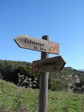
The road leaves the Sierra Sur and leaves Carchelejo following a path that descends in search of the old road N-323, passing through a rock needle to which they refer by "The Old Tooth." In the N-323 it continues to the highway, the cross below and goes back the river line between orchards and choperas to access Cambil next to the debugger of the population. From here we go in the direction of the Corrijada of Matabejid, in the direction of Huelma, to enter the Natural Park of Sierra Magina, with the highest summits of the province of Jaén. We pass through Matabejid and follow a track towards the Port of La Mata, passing through the area of the Castillejo, a magnificent landscape characterized by the ruins of a castle of the ancient medieval border. This mountain of oaks and complaints is kept by one of the most emblematic mountains of the province, La Peña de Jaén. This landscape has the particularity of being the dehesa of complaints on a limestone mountain, higher in Spain. Crossing the Port the road runs between pine trees in the direction of Torres, where we can refresh with the water of the Fuenmayor, and already in the village in the Pila Pellenda, at the entrance to the village, before continuing to Albánchez de Magina by means of pecuaria roads, used as pedestrian roads between populations, accompanied by almonds and cherry trees characteristic of this area, which offers an image of whitened valley during its flowering.
Once again, we pass through Fuente de la Fresneda and through the recreational area of Cuadros until we reach Bedmar, from where we will suddenly go up to El Portillo by one of the most pronounced ramps of the GR to go down to Jódar through the Serrezuela. We left Jódar for the Jódara-Quesada railway station, we crossed the Minor Guadiana looking for Peal Furnaces, then Toya, and continued on the Vega to Quesada.
We are already in the Natural Park of the Serras de Cazorla, Segura and the Villas. As we leave Quesada we will pass under the site known as El Chorro, in search of the Monastery of Monte Zion, and from here to the hermitage of San Isicio, near Cazorla. We will leave Cazorla on one of the most beautiful roads of the whole route, we will see the hermitage of the Virgin of the Cabeza, on a road between pine trees we will pass by the Fountain of the Bear in search of the village of Vadillo Castril, then the village of Loma de Mª Ángeles, later on, through the Natural Park of the Sierra de Cazorla, Segura and Las Villas, Catorrios, and through the avenue of the Guadalquivir, passing near the Aguamulas River, we will go to the Fountain to Segura to reach Pontones. From Pontones we continue to Poyotello, we go down next to the channel of the young Rio Zumeta to the village of the Ruices, Santiago de la Espada, and finally we cross the provincial limit towards the Puebla de D. Fadrique, in Granada.

Breve descripción

The path GR-7 is just over 300 km. of the province of Jaéngoing throughthree of the most important Sierras in the province:Sierra Sur, Sierra Magina and Sierras de Cazorla, Segura and Las Villas. This is a stretch of this great road that runs through the European continent. It begins in Tarifa (Cadiz, Spain) and through Brussels (Belgium), it ends in Athens (Greece). As you pass through the province of Jaén, you will find a network of local, no less interesting, small tour trails.

Latitud
37.4614
Longitud
-3.9222
Distrito
Municipio
Ubicación en el mapa
POINT (-3.9222 37.4614)
imagen
Image
gr7malaga1.jpeg
Imagen principal
Activado
imagen
Image
gr7malaga1-1-jpeg
Imagen principal
Desactivado
Unas 100 h de andadura a una media de 3 km/h

Friends

icon-intereses-amigos

Nature

icon-intereses-naturaleza

Solo travel

icon-intereses-viajar-solo

Gastronomy

icon-intereses-gastronomia

For couples

icon-intereses-en-pareja

Family

icon-intereses-familia

Adventure

icon-intereses-aventura

Culture

icon-intereses-cultura

Sport

icon-intereses-deporte

Municipality

icon-intereses-municipio

Low-cost tourism

icon-intereses-turismo-low-cost

Eco-friendly

icon-intereses-eco-friendly
GR-7
150 km
11000m
11000m
Desactivado
Tramo de asfalto o cemento
 
Tramo de pista o camino forestal
 
Tramo de vía pecuaria
 
Tramo de senda
 

Trail Veredón-Mojón Blanco

Submitted by brandcode_deweloper on
Id
4982563
Descripción larga

The path from the Veredón to Mojón Blanco runs along the Pecuaria route Colada Fuente de la Teja, in Pegalajar. It allows us to climb to the peak in which the municipal terms of Pegalajar, Mancha Real and Torres are joined, and from which are seen spectacular views of the Bercho umbria, one of the most steep and wild areas of the municipal term Pegalajar. We can also enjoy amazing views of the Sierra de Jaén.

It is a relatively short path that we can complete with a visit to the beautiful village of Pegalajar and its famous pond, which in the years of abundant rains appears as a huge pond within the urban centre.

This path can be linked to those who come from the Royal Mancha, as well as other pecuary ways, or even, to the Pico Almadén.

Breve descripción

The path from the Veredón to Mojón Blanco runs along the Pecuaria route Colada Fuente de la Teja, in Pegalajar. It allows us to climb to the peak in which the municipal terms of Pegalajar, Mancha Real and Torres are joined, and from which are seen spectacular views of the Bercho umbria, one of the most steep and wild areas of the municipal term Pegalajar. We can also enjoy amazing views of the Sierra de Jaén.

It is a relatively short path that we can complete with a visit to the beautiful village of Pegalajar and its famous pond, which in the years of abundant rains appears as a huge pond within the urban centre.

This path can be linked to those who come from the Royal Mancha, as well as other pecuary ways, or even, to the Pico Almadén.

Latitud
37.7861
Longitud
-3.6286
Distrito
Municipio
Ubicación en el mapa
POINT (-3.6286 37.7861)
imagen
Image
1561_SS_05.jpg
Imagen principal
Activado
imagen
Image
Sendero%20Vered%C3%B3n-Moj%C3%B3n%20Blanco.jpg
Imagen principal
Desactivado
imagen
Image
1561_SS_04.jpg
Imagen principal
Desactivado
imagen
Image
1561_SS_02.jpg
Imagen principal
Desactivado
1 h 30 min

Nature

icon-intereses-naturaleza

Friends

icon-intereses-amigos

Adventure

icon-intereses-aventura

Culture

icon-intereses-cultura

Sport

icon-intereses-deporte

Eco-friendly

icon-intereses-eco-friendly

For couples

icon-intereses-en-pareja

Family

icon-intereses-familia

Gastronomy

icon-intereses-gastronomia

Municipality

icon-intereses-municipio

Low-cost tourism

icon-intereses-turismo-low-cost

Solo travel

icon-intereses-viajar-solo
Medium
Sendero Veredón-Mojón Blanco
2,9 km
On foot
All year round
Desactivado
  • In front of COVID19, keep the safety distance and carry a mask, avoid agglomerations and contact with surfaces, wash your hands frequently, use hydroalcoholic gel and consult the available digital materials. Take care of your health and others.
  • It works to prevent fires. Do not throw cigarettes or any other object that produces combustion.
  • By consuming local products and having companies in the area you will contribute to rural development.
  • He lives with the local people and other users. It respects private property and property.
  • Unwind in a sustainable way: public transport, bike, walk, shared vehicle...
  • Noise is another form of pollution. In silence you will enjoy your experience more.
  • It facilitates the use of people with special needs.
  • The trash doesn't come back alone. Take her with you to the nearest container. Reduce, reuse, recycle.
  • Don't leave a mark on your way through nature.
  • It practices a responsible and committed tourism with the environment. Be a real ecotourist!
  • Respect the facilities at your disposal. We all pay for your maintenance.
  • Check the weather forecast before starting your activity.
  • Avoid going out alone. If you do, it communicates tour and time of return to other people.
  • Extreme caution under adverse conditions and with the occasional presence of animals or motor vehicles.
  • Please provide prior information on the possible existence of cynegetic activity.
  • It has water, sun protection, proper clothes and shoes.
  • It carries a mobile with enough battery in case of emergency (112), but remember that there is not always coverage.
  • Don't even bother animals. You would negatively alter his behavior.
  • For your safety and the safety of the environment, don't get out of the signposted road or take shortcuts.
  • Remember that the capture of animals, light fire, fish and collect plants or minerals is prohibited.
  • If you bring a dog, take him with his strap and make sure he doesn't bother other animals or people.
  • Your safety is our concern, but it's your responsibility.

Thank you for your cooperation!

From the city centre of Pegalajar itself, go along the Vereda Real Ubeda-Granada, along the track leading to Mount Bercho. The path begins about 5 km from the village.

Tramo de asfalto o cemento
 
Tramo de pista o camino forestal
 
Tramo de vía pecuaria
 
Tramo de senda